


Pilot’s Handbook |
As Real As It Gets |

Information in this document is subject to change without notice. The names of companies, products, people, characters, and/or data mentioned herein are fictitious, and are in no way intended to represent any real individual, company, product, or event, unless otherwise noted. No part of this document may be reproduced or transmitted in any form or by any means, electronic or mechanical, for any purpose, without the express written permission of Microsoft Corporation. Microsoft may have patents or pending patent applications, trademarks, copyrights, or other intellectual property except as expressly provided in any written license agreement from Microsoft.
© 1983-1997 Microsoft Corporation. All rights reserved.
Microsoft, MS-DOS, SideWinder 3D Pro, Windows, and the Windows logo are either registered trademarks or trademarks of Microsoft Corporation in the United States and/or other countries.
Microsoft Flight Simulator scenery designed for Microsoft Corporation by MicroScene, Inc. under contract, and produced by the Microsoft Corporation.
Airport charts were reproduced with permission of Jeppesen Sanderson, Inc. © 1991, 1992, 1993, 1994, 1995, 1997 Jeppesen Sanderson, Inc.
FlightSafety International is a registered trademark of FlightSafety International, Inc.
This product is for entertainment purposes only and shall not be used for training purposes. It is not part of an approved training program under the standards of the FAA or any other regulatory authority.
Document No. 000-61938

Contents
Welcome to Microsoft Flight Simulator 98 .................................... |
1 |
Installing Flight Simulator ...................................................... |
1 |
Starting Flight Simulator ........................................................ |
2 |
What’s New in Flight Simulator............................................. |
2 |
Area Charts, Airport Diagrams, and Approach Charts................. |
6 |
Atlanta .................................................................................... |
8 |
Charlotte ............................................................................... |
10 |
Chicago................................................................................. |
12 |
Cleveland .............................................................................. |
15 |
Dallas .................................................................................... |
17 |
Denver .................................................................................. |
19 |
Detroit................................................................................... |
21 |
Hawaii................................................................................... |
23 |
Houston................................................................................. |
28 |
Los Angeles .......................................................................... |
30 |
Miami.................................................................................... |
34 |
New Orleans ......................................................................... |
36 |
New York ............................................................................. |
38 |
San Diego ............................................................................. |
41 |
San Francisco........................................................................ |
43 |
Seattle ................................................................................... |
45 |
Caribbean.............................................................................. |
48 |
London.................................................................................. |
57 |
Munich.................................................................................. |
59 |
Paris ...................................................................................... |
61 |
Japan ..................................................................................... |
63 |


Welcome to
Microsoft Flight Simulator 98
Welcome to Microsoft® Flight Simulator 98. Follow these simple installation and starting instructions, and you’ll be ready for takeoff before you know it.
Installing Flight Simulator
1.Turn on your computer and start Microsoft Windows 95 or Windows NT Workstation 4.0.
2.Place the Flight Simulator CD-ROM in the disc holder (if required), and insert it in your CD-ROM drive.
3.Follow the instructions when the installation screen appears.
NOTE If your CD-ROM drive does not support automatic installation, follow these steps:
4.Click Start.
5.Point to Settings, and then click Control Panel.
6.Double-click Add/Remove Programs.
7.Windows 95 or NT Workstation 4.0 displays the Add/Remove Programs Properties dialog box.
8.On the Install/Uninstall tab, click Install.
Follow the instructions on your screen.
During Setup, you can select a Typical or Custom installation. If you need to conserve hard disk space, choose the Typical setup option. To optimize flying performance, choose Custom. If you are an advanced user and want to select and configure components yourself, choose Custom.
If you experience any performance problems once you’re up in the air (for example, slow response time or jerky screen displays), check the “Using Flight Simulator” section of Help for suggestions on fine-tuning Flight Simulator.
Microsoft Flight Simulator 98 — Pilot’s Guide |
1 |
Welcome to Microsoft Flight Simulator 98
Starting Flight Simulator
∙To start Flight Simulator automatically, place the Flight Simulator CD-ROM in the disc holder (if required), and insert it in your CD-ROM drive.
-or-
∙If you created a shortcut to Flight Simulator on your desktop, double-click the icon.
-or-
∙Click the Start button, point to Programs, point to Microsoft Games, point to Flight Simulator, and then click
Flight Simulator 98.
What’s New in Flight Simulator 98
The best gets better with Flight Simulator 98. Here are some of the exciting features and technological improvements you’ll find in Flight Simulator 98.
Three New Aircraft
Your hangar of eight aircraft now includes a challenging Bell 206B JetRanger III helicopter, the latest Cessna Skylane 182S, and the Learjet 45. You’ll also find improved versions of Flight Simulator veterans, including a Cessna Skylane RG, an Extra 300S, a Boeing 737-400, a Schweizer 2-32 sailplane, and a Sopwith Camel. The flight models for these aircraft have been validated by experts, including Cessna, Learjet, FlightSafety International, and Patty Wagstaff. To find detailed information about each aircraft, click
Aircraft Handbooks on the Help menu.
Improved Instrument Panels
New photorealistic panels put you in the pilot’s seat. Developed from photographs of the actual cockpits, the new panels are easier to read and feature more sophisticated avionics, autopilots, and other systems. The panels scale automatically to match your screen resolution, and on many panels you can display radios, detailed engine controls, and other items in separate windows as you fly. When you master the basic instruments in the Cessna Skylane 182S, try to keep up with the latest electronic displays in the Learjet 45. If you feel a bit overwhelmed, just point to an instrument or control to see a pop-up label, or click an item to learn more about how it works.
2 Microsoft Flight Simulator 98 — Pilot’s Guide
Welcome to Microsoft Flight Simulator 98
Feel the Force
If you have a force-feedback joystick like the Microsoft SideWinder® Force Feedback Pro joystick, you can experience a new level of realism in Microsoft Flight Simulator 98. You’ll feel your wheels rolling down the runway and the stick shake in a stall, sense trim forces as you change speeds and power settings, and encounter other effects that make pulling Gs more than a game. To set options for a force-feedback joystick, click Custom Controls on the Options menu and then click the Forces tab.
New Sights and Sounds
3-D acceleration using DirectX and other advanced graphics technology make scenery pop to life. Flight Simulator supports the latest graphics hardware to show you more detail and improved performance. Even if you don’t have 3-D hardware, new mipmapping and image-smoothing techniques improve the out-the- window view. Of course, what you see is just part of the picture. New digitized sounds—from wind noise and tire squeals to whining jet turbines and electronic warnings—immerse you in a realistic flying environment. To set sound options, click Preferences on the Options menu and then click the Display & Sound tab.
Multiplayer
Multiplayer capability puts you in crowded skies via the Internet Gaming Zone (http://www.zone.com), a network, or a direct connection between two computers. Challenge other pilots to an aerobatic competition on the Internet Gaming Zone. Join a fly-in on a network. Chase other aircraft through an urban obstacle course. Practice formation aerobatics for an airshow. Enter the traffic pattern at a busy airport. Or put yourself in the control tower and try to keep everyone else organized. To join or host a multiplayer session, click Multiplayer on the Flights menu and follow the instructions on your screen.
More Airports and Scenery
Flight Simulator 98 gives you the globe. You can take off from more than 3,000 airports worldwide—10 times more than in previous versions. You’ll also find detailed scenery, including atlas data (roads, rivers, lakes) for the U.S. and Europe and over 45 new metropolitan areas, including more than 20 new U.S. cities and new photorealistic scenery of Hong Kong. And if you like to fly low,
Microsoft Flight Simulator 98 — Pilot’s Guide |
3 |
Welcome to Microsoft Flight Simulator 98
watch out for thousands of new buildings, towers, antennas, and other obstacles. To set scenery options, click Scenery Complexity on the World menu. You can also control dynamic scenery—air and ground traffic. Click Dynamic Scenery on the World menu.
New Adventures
Try a cross-Channel hop from Paris to London or take command of an airline flight from LAX to JFK. A logbook full of new adventures will have you taking off on realistic flights with air traffic control instructions, emergencies, and other surprises that test your skills. To make sure you’re prepared before each flight, review the Preflight Briefings. To see these topics, click Preflight Briefings on the Help menu. To fly an adventure, click Adventures on the Flights menu.
Flight School
Whether you’re a novice or seasoned Flight Simulator pilot, you’ll find more lessons to hone your flying skills. You can try introductory flights to learn the basics of flying a specific aircraft, or take advanced lessons on such skills as ILS approaches and holding patterns. To review background information about aerodynamics, aircraft systems, navigation, and other subjects, click Pilot Training on the Help menu. Before you take off, make sure you review the Preflight Briefings that prepare you for each lesson. To see these topics, click Preflight Briefings on the Help menu. To fly a lesson, click Lessons on the Flights menu.
An Online Aviation Library
The updated online Help includes topics on subjects from aerodynamics and advanced flying techniques to aircraft instruments and systems, weather, navigation, regulations, and human factors. Videos and animations bring key concepts to life, while more than 200,000 words of text take you deep into the real-world details of flying. To explore Help, click Pilot Training on the Help menu. If you need information about a specific aircraft, the Aircraft Handbooks section of Help includes checklists, operating procedures, and performance statistics. To see these handbooks, click Aircraft Handbooks on the Help menu.
4 Microsoft Flight Simulator 98 — Pilot’s Guide

Welcome to Microsoft Flight Simulator 98
Globe Trotting
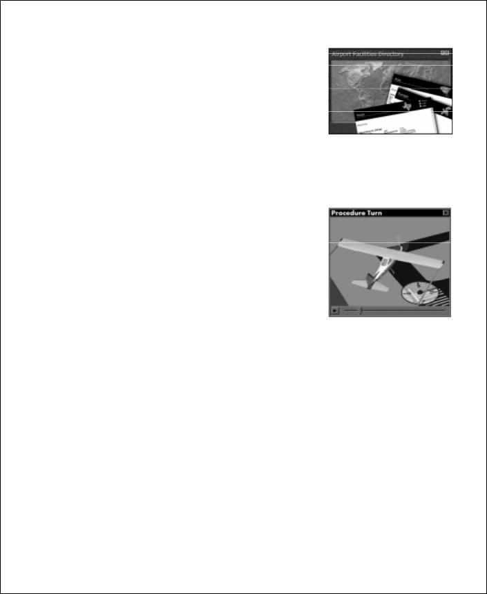
The improved Airport/Facility Directory (A/FD) and Go To features help you enjoy the world of airports and scenery in Flight Simulator 98. The powerful search features in the A/FD make it easy to find detailed information about the airports and navigation aids in the Flight Simulator database. To use the A/FD, click Airport/Facility Directory on the World menu.
You can also start a flight quickly at any airport or at a specific location and altitude. Just click Go To on the World menu and fill in the appropriate information.
Web Links
The latest information about Flight Simulator is just a mouse click away. Links from the Help menu take you directly to the official Microsoft Flight Simulator Web site at http://www.microsoft.com/games/fsim. You’ll find articles about flying and Flight Simulator, technical support, links to other sites devoted to Flight Simulator, and more. To see these links, point to
Microsoft On The Web on the Help menu.
Get Help Fast
Help includes tips, hints, and detailed procedures to help you get the most out of Flight Simulator. Click Using Flight Simulator on the Help menu, or click Index to locate specific information about customizing Flight Simulator, improving performance, changing the weather, flying lessons and adventures, keyboard shortcuts, and so forth. And don’t forget to check the back cover of this book for a list of basic keyboard shortcuts.
Flight Simulator in the Classroom
Flight Simulator is a terrific tool to introduce students to aviation, math, geography, physics, and related subjects. The Teacher’s Activity Guide available on the Flight Simulator Web site has lesson plans, student worksheets, and links to resources that educators can use in the classroom. You can find the Teacher’s Activity Guide for Flight Simulator at: http://www.microsoft.com/games/fsim/tag/tagintro.htm.
Microsoft Flight Simulator 98 — Pilot’s Guide |
5 |

Welcome to Microsoft Flight Simulator 98
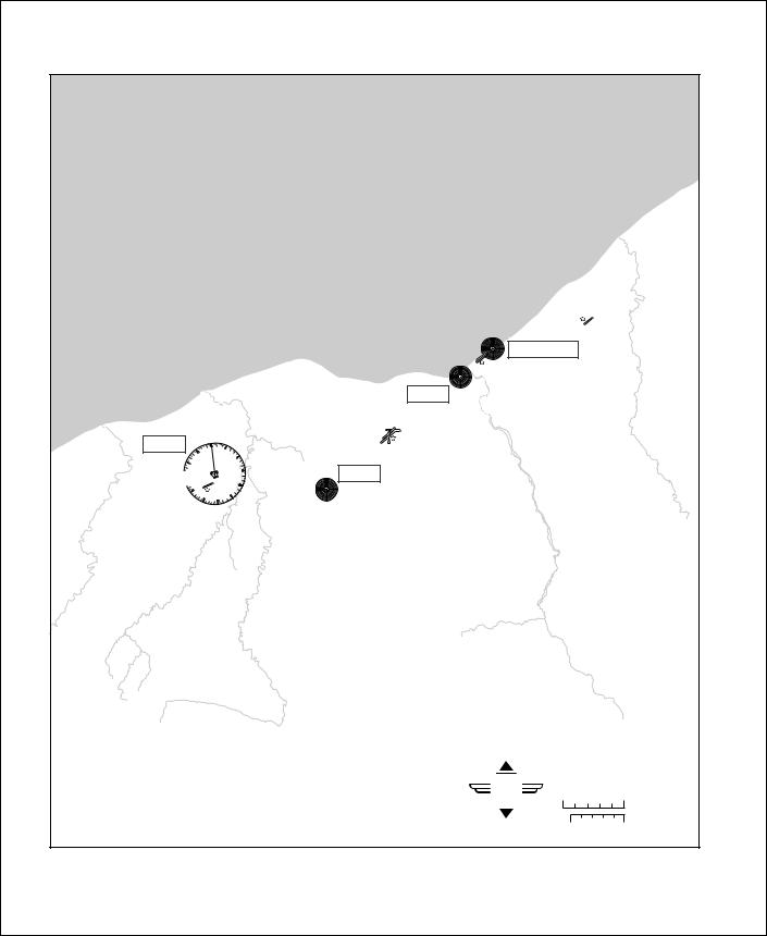
Area Charts, Airport Diagrams,
and Approach Charts
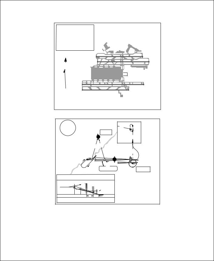
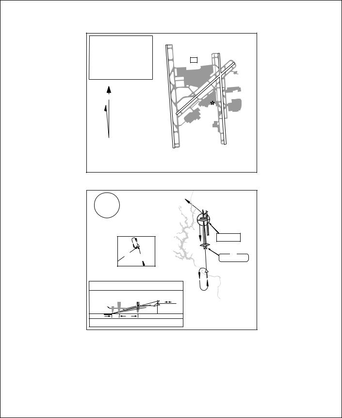
This Pilot’s Handbook includes charts for some of the most interesting areas you can visit in Flight Simulator 98. On the pages that follow, you’ll find area charts to help you navigate around major cities and geographic areas, plus a selection of airport diagrams and instrument approach charts to help you find your way to specific runways.
Airport/Facility Directory
Flight Simulator 98 includes an improved Airport/Facility Directory (A/FD) with powerful search features to help you find information about the airports and navigation aids in the Flight Simulator database. For example, you can look up airports by their official identifiers or names, or by searching global regions, countries, states or provinces, or cities. For each airport you can find the field elevation, latitude/longitude, runway numbers and lengths, and information about instrument approaches. You can also look up the location, frequency, and other information about each VOR and NDB in the database.
To use the A/FD, click Airport/Facility Directory on the World menu. For more information about using the Airport/Facility Directory, see the topic “Using the Airport/Facility Directory” in online Help.
6 Microsoft Flight Simulator 98 — Pilot’s Guide
Welcome to Microsoft Flight Simulator 98
Chart Legend
The following charts are simplified versions of real navigation charts. They include basic information to help you find airports, navigation aids, and some visual checkpoints. The legend explains the symbols on the charts.
You can quickly move your aircraft to any airport or to a specific location defined by latitude and longitude. To do so, click the Go To command on the World menu and fill in the appropriate information.
For detailed information about all the airports and navigation aids in the Flight Simulator database, check the Airport/Facility Directory (A/FD). To use the A/FD, click Airport/Facility Directory on the World menu. For more information about using the Airport/Facility Directory, see the topic “Using the Airport/Facility Directory” in Help.
R
NAME CT 124.4 206
NAME ATIS 118.0
NFCT
JOLIET 112.3
VOR (T)
KANKAKEE 111.6
KEDZI 248
Legend
Civil-Public use airport
Restricted/Private-Nonpublic use airport, having emergency use or landmark value
Rotating light in operation, sunset to sunrise
Airport name
Control Tower (CT)-Primary frequency Elevation in feet
Airport name
Automatic Terminal Information ServiceCommunication radio frequency
Non-Federal Control Tower
VOR (VHF Omni Range)-Civilian navigation board
VORTAC (VHF Omni Range TACAN)- Civilian and military navigation beacon
VOR-Navigation radio frequency
VOR(T)-Terminal VOR
NDB (Non-directional radio beacon) frequency
Microsoft Flight Simulator 98 — Pilot’s Guide |
7 |
|
|
|
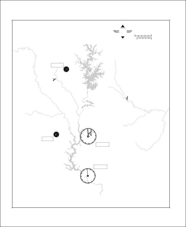
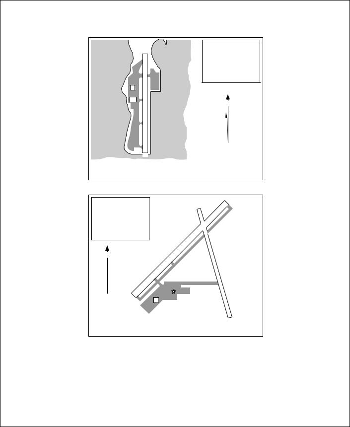
Atlanta |
|
|
|
For use with |
|
|
|
|
Microsoft |
Microsoft Flight Simulator |
|
|
|
|
Flight |
0 |
5 |
|
|
|
Simulator |
|
NAUTICAL |
|
|
|
|
MILES |
|
|
|
|
|
|
STATUTE |
|
|
|
|
|
MILES |
|
|
|
|
0 |
5 |
|
|
|
|
|
FLANC |
|
|
|
|
|
344 |
|
|
|
|
|
|
0 |
HARTSFIELD ATLANTA INTL |
|
|
|
|
ATIS 119.65 |
|
|
|
|
|
33 |
|
|
|
|
|
1026 |
|
|
|
|
|
|
|
|
|
|
|
30 |
|
|
|
|
|
27 |
9 |
REDAN |
|
|
|
|
||
|
|
|
|
|
266 |
|
|
|
24 |
12 |
|
|
|
VORTAC |
21 |
15 |
|
|
|
ATLANTA |
|
||
|
|
18 |
|
|
|
|
|
|
|
|
|
|
|
116.9 |
|
|
|
|
|
PEACHTREE-FALCON |
|
|
|
|
|
808 |
|
|
|
|
|
|
PECAT |
|
|
|
|
|
316 |
|
|
8 Microsoft Flight Simulator 98 — Pilot’s Guide |
|
|
|
||
Atlanta
Elevation |
1026 |
Coordinates |
33°38.4'N |
|
84°25.6'W |
ATIS |
119.65 |
N
VAR |
|
|
3° |
9L |
|
W |
||
|
||
|
9R |
|
|
AIRPORT CHART
For use with
Microsoft Flight Simulator
8L
8R
9000 x 150
9000 x 150 |
26R |
|
|
|
|
10000 x 150 |
26L |
|
|
|
|

 CT
CT
11889 x 150 |
27R |
|
|
27L |
|
Atlanta, Georgia
The Hartsfield Atlanta International
3100'
MSA
AT LOM
018°
FLANC 344
346°
RMG |
360° |
180° |
115° |
||
115.4 |
D38.1 |
TROYS |
|
|
D15 |
MISSED |
360° |
|
APCH FIX |
|
|
|
|
360° |
047°
|
|
BAHRR |
CATTA |
MM |
IM |
092° |
|
|
REIFF |
|
|
|
|
|
|
||
|
|
|
|
|
|
|
227° |
|
272° |
|
|
|
|
ILS |
|
|
|
|
|
|
|
ATLANTA |
|
|
|
092° 109.3 IHFW |
|
||
|
|
|
|
|
116.9 |
APPROACH MINIMUMS:
Straight in approach decision height (DH) 200'
|
LOM |
|
|
|
|
BAHRR |
|
|
|
|
272° |
MM |
|
|
5000' |
REIFF |
|
|
|
|
|
|
||
|
092° |
IM |
|
|
|
3700' |
|
M |
TCH 59' |
|
2800' |
|
|
TDZE 8L 1015' |
|
|
|
|
TDZE 8R 1024' |
|
4.8 |
0.4 |
|
APT. 1026' |
|
|
|
MISSED APPROACH: Climb to 1500', then climbing LEFT turn to 3500' outbound via ATL VOR R-360 to TROYS INT/D15.0 ATL and hold.
ILS Rwy 8L
Hartsfield
Atlanta International
Microsoft Flight Simulator 98 — Pilot’s Guide |
9 |
|
|
Charlotte |
|
|
||
|
|
|
|
|
For use with |
|
|
|
|
|
Microsoft |
Microsoft Flight Simulator |
|
|
|
|
|
Flight |
0 |
5 |
|
|
|
|
Simulator |
|
NAUTICAL |
|
|
|
|
|
MILES |
|
|
|
|
|
|
|
STATUTE |
|
|
|
|
|
|
MILES |
|
|
|
|
|
0 |
5 |
LINCOLNTON |
|
|
|
|
|
|
432 |
|
|
|
|
|
|
LINCOLN CO |
|
|
|
|
|
|
875 |
|
|
|
|
|
|
|
|
|
|
CONCORD REGIONAL |
|
|
|
|
|
|
690 |
|
|
|
|
|
|
CHARLOTTE/DOUGLAS INTL |
|
|
|
|
0 |
3 |
ATIS 121.15 |
|
|
|
|
|
749 |
|
|
|
GASTONIA |
33 |
|
|
|
|
|
|
|
|
6 |
|
|
|
797 |
30 |
|
|
|
|
|
|
|
|
|
|
|
|
|
|
|
|
9 |
|
|
STONIA |
27 |
|
|
|
|
|
|
|
|
|
|
|
|
293 |
24 |
|
|
12 |
|
|
|
|
|
|
|
|
|
|
21 |
|
15 |
CHARLOTTE |
|
|
|
|
18 |
115.0 |
|
|
|
|
|
|
|
|
||
|
|
|
|
FORT MILL |
|
|
|
|
0 |
3 |
112.4 |
|
|
|
|
|
|
|
|
|
|
33 |
|
|
|
|
|
|
|
|
6 |
|
|
|
|
30 |
|
|
|
|
|
|
|
|
|
9 |
|
|
|
27 |
|
|
|
|
|
|
24 |
|
|
12 |
|
|
|
21 |
|
15 |
|
|
|
|
|
18 |
|
|
|
|
|
|
|
|
|
|
|
10 Microsoft Flight Simulator 98 — Pilot’s Guide |
|
|
|
|
|
|
|
|
Charlotte |
|
|
||
Elevation |
749 |
18R |
|
|
|
|
|
|
|
|
|
||
|
|
|
|
|
|
18L |
Coordinates |
35°12.9'N |
|
|
|
|
|
|
80°56.6'W |
|
|
|
CT |
23 |
|
|
|
|
|
||
ATIS |
121.15 |
|
|
|
|
|
N |
|
10000 |
|
|
|
|
|
x |
|
|
150 |
|
|
|
|
150 |
|
x |
|
|
|
|
7501 |
|
|
|
|
|
|
|
|
|
|
|
VAR |
|
|
5 |
|
|
|
|
|
|
|
|
|
|
5° |
|
|
|
|
|
8845 |
W |
|
|
|
|
|
|
|
|
|
|
|
x |
|
|
|
|
|
|
|
150 |
|
|
|
|
|
|
36R |
|
|
|
36L |
|
|
|
AIRPORT CHART |
|
|
|
Charlotte, North Carolina |
||
For use with |
|
|
|
|
||
|
|
Charlotte/Douglas International |
||||
Microsoft Flight Simulator |
|
|||||
3800' |
|
|
|
|
314° |
hdg |
|
MSA |
|
|
|
|
|
|
|
|
|
|
|
|
CLT VOR |
|
|
|
|
IM |
|
|
|
|
|
|
|
MM |
347° |
167° STANN |
||
|
D29 |
||
|
|
||
|
|
|
. |
SPA |
|
|
5 |
|
|
3F |
|
.7 |
|
1 |
|
059° |
|
14M |
|
115 |
|
2 L |
|
|
.7° |
||
MISSED |
4 |
||
|
|
||
APCH FIX |
|
|
|
APPROACH MINIMUMS:
Straight in approach decision height (DH) 200'
to |
|
MARJO |
|
181° |
CHARLOTTE |
|
|
|
115.0 |
GLASI |
|
|
ILS |
|
001° 111.7 IDQG |
|
MARJO |
181° |
|
|
001° |
|
MM |
GLASI |
MARJO |
|
|
|
|
||
|
IM |
|
181° |
001° |
|
|
|
001° |
4600' |
|
|
|
2900' |
|
TCH 55' |
|
|
|
|
TDZE 708' |
|
|
|
|
APT. 749' |
0.4 |
5.9 |
|
|
|
|
|
MISSED APPROACH: Climb to 1200' then climbing LEFT turn to 3600' via 314° heading and outbound FML VOR R-347 to STANN INT and hold.
ILS Rwy 36L
Charlotte/
Douglas International
Microsoft Flight Simulator 98 — Pilot’s Guide |
11 |
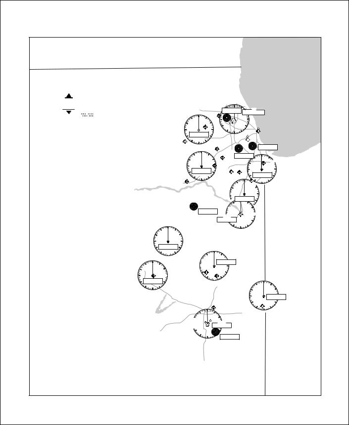
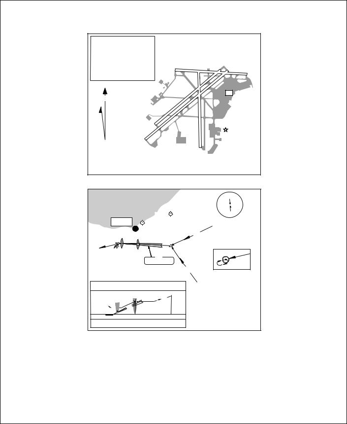
Chicago
For use with
Microsoft Flight Simulator
Microsoft
 Flight
Simulator
0 |
|
5 |
|
10 |
NAUTICAL |
|
|
|
|
|
MILES |
|
|
|
|
|
STATUTE |
0 |
5 |
10 |
MILES |
||
NOTAM
Notice to Airmen
For details, see Chicago Sectional Aeronautical Chart.
If no ATIS is available, tune in the control-tower frequency (CT) for information.
WISCONSIN
ILLINOIS
Lake Michigan
|
|
|
|
|
0 |
|
|
|
|
|
|
33 |
|
3 |
|
|
|
|
SCHAUMBERG |
|
DEANA |
VOR |
|
|
|
|
797 |
|
350 |
CHICAGO-O'HARE |
|
|
|
0 |
|
113.9 |
|||
|
|
|
|
|
|||
|
33 |
|
3 |
|
|
|
CHICAGO-O'HARE INT'L |
|
|
|
27 |
|
|
9 |
ATIS 135.4 |
|
|
DUPAGE |
|
|
|
||
30 |
|
6 |
|
|
|
668 |
|
|
|
758 |
|
|
|
|
|
|
27 |
|
|
|
|
|
DU PAGE |
|
24 |
|
108.4 |
AURORA |
21 |
|
|
707 |
|
15 |
|
|
|
|
18 |
|
|
|
0 |
|
|
33 |
3 |
|
30 |
|
|
27 |
|
|
JOLIET |
24 |
112.3 |
MORRIS |
21 |
|
584 |
15 |
|
|
|
18 |
|
24 |
|
12 |
|
|
|
9 |
|
|
|
|
MEIGS |
|
|
|
21 |
|
|
ATIS 127.35 |
|
|
|
15 |
|
593 |
|
|
|
|
18 |
|
|
||
12 |
|
|
CHIGAGO-MIDWAY |
|
||
|
|
|
ATIS 132.75 |
|
||
|
|
|
|
619 |
|
|
|
CLOW INT'L |
|
|
KEDZI |
|
|
|
|
|
248 |
|
||
|
670 |
|
|
|
|
|
|
|
|
|
|
|
|
|
|
|
ERMIN |
|
0 |
|
|
|
LEWIS |
33 |
3 |
|
|
|
|
332 |
|
|
||
6 |
|
|
|
|
||
|
|
668 |
|
|
LANSING |
|
|
|
|
30 |
|
||
|
JOLIET |
|
616 |
|
||
|
582 |
FRANKFORT |
|
|
|
|
|
|
778 |
27 |
|
|
9 |
12 |
NEW LENOX- |
|
CHICAGO HGTS |
|
||
|
24 |
|
114.2 |
12 |
||
|
HOWELL |
0 |
|
|||
|
|
|
||||
|
753 |
33 |
|
|
|
|
|
|
|
SANGER |
15 |
|
|
|
|
30 |
790 |
6 |
18 |
|
DWIGHT 632
DWIGHT 344
|
|
0 |
|
33 |
3 |
30 |
|
6 |
27 |
|
|
9 |
|
|
|
|
|
PONTIAC |
|
|
24 |
109.6 |
12 |
0 |
|
|
27
33 30 
27  VOR (T)
KANKAKEE
111.6 24
21
|
|
9 |
|
PEOTONE0 |
|
|
|
113.2 |
3 |
12 |
|
|
|
|
|
|
|
6 |
|
GREATER 9KANKAKEE |
|||
629 |
|
|
|
|
|
12 |
|
18 |
15 |
|
|
|
|
|
|
|
|
ILLINOIS |
INDIANA |
|
21 |
|
0 |
33 |
3 |
30 |
|
27 |
|
|
BLOOMINGTON |
24 |
108.2 |
21 |
15 |
|
18 |
 15 18
15 18
6
 9
9
12 BLOOMINGTON-
NORMAL 875
33 30  27
27 
24 |
|
GIBSON CITY |
|
758 |
21 |
|
3
6 |
ROBERTS |
116.8 |
9 |
12
 15 18 PAXTON
779
0
33
30
3
6
27 |
DANVILLE |
|
111.0 |
|
|
|
24 |
12 |
|
0 |
FRASCA |
|
|
|
735 |
21 |
|
|
|
3 |
15 |
||
33 |
|
|||
|
|
VERMILLION CO. 18 |
|
|
|
|
|
|
|
30 |
|
|
696 |
|
|
6 |
|
|
|
UNIV OF ILLINOIS |
|
|
|
|
WILLARD |
|
VORTAC |
|
|
(CHAMP27 AIGN) |
CHAMPAIGN |
|
|
|
ATIS 124.85 |
|
110.0 |
|
|
754 |
|
12 |
|
|
24 |
|
|
|
|
21 |
|
VEALS |
|
|
15 |
407 |
|
|
|
|
18 |
|
|
|
12 Microsoft Flight Simulator 98 — Pilot’s Guide

Chicago
MISSED APPROACH |
LOM |
|
Remain |
|
Climb to 1200, then climbing |
|
within 10 NM |
||
left, turn to 2700 via CMI |
|
|
|
|
R-297 to Lodge Int and hold. |
|
136° |
|
|
|
|
2573 |
|
|
|
|
|
|
|
MM |
|
|
316° |
2600 |
|
|
|
GS 3.00° |
|
|
|
|
2600 |
|
|
|
|
TCH 52 |
|
|
|
|
|
|
0.5 |
5 NM |
|
|
|
|
|
|
(IAF) |
|
C |
26 |
0 |
0 |
|
|
|
|
|
|
|
|
|
|
||||
|
|
|
|
|
|
M |
|
|
N |
|
|
|
|
|
|
|
||||||
|
|
|
|
|
|
|
|
|
|
|
|
|
|
|
|
|||||||
|
|
|
|
|
|
|
I |
1 |
|
|
|
|
|
|
|
|
|
|||||
|
|
|
|
|
|
|
|
|
|
|
|
o |
|
|
|
OCTOE |
|
|
|
|||
|
|
|
|
006 |
|
|
|
|
|
2 |
D |
P |
|
2600 |
|
|
|
|||||
|
|
|
|
|
|
|
|
|
|
|
|
T |
|
|
|
|
||||||
|
|
|
|
R |
|
|
|
|
|
|
|
|
|
M |
|
|
|
|
|
|
||
|
|
|
|
|
|
|
|
|
|
|
|
|
|
E |
|
213°.5) |
|
|
|
|||
|
297° |
|
|
- |
|
|
|
|
|
|
|
|
|
|
|
|
|
|
|
|
|
|
|
|
LODGE |
|
LOCALIZER 109.10 |
|
(11 |
|
|
|
|
||||||||||||
|
117° |
CMI 13 DME |
|
|
|
|
|
|
|
|||||||||||||
|
R- |
1146 |
|
I-CMI |
|
---------- |
|
|
|
|
|
|
|
|||||||||
|
|
297 |
|
|
|
|
|
|
(IAF) |
|
|
|
|
|
|
|
||||||
|
|
|
2600 to |
|
MM |
|
|
|
|
|
|
|
|
CM |
|
|||||||
|
|
|
|
|
|
|
LOM |
|
|
|
|
|
|
2 |
||||||||
|
|
|
LOM |
|
|
|
|
|
VEALS |
|
|
|
|
A |
|
|||||||
|
|
130° (6) |
|
|
|
407 CM --------- |
|
|
S |
|
5 |
|||||||||||
|
|
|
|
|
|
|
EMTEE |
M |
|
|
||||||||||||
|
|
|
-234 |
|
+ |
|
|
|
|
|
|
|
|
|
|
|
|
3000 |
|
|||
|
|
|
850 |
|
|
|
|
|
|
|
|
|
|
2600 |
|
|
|
|||||
|
|
|
R |
|
- |
|
|
|
|
|
LR- |
|
|
251° |
|
|
|
|
||||
|
|
|
|
|
|
|
|
|
|
|
|
|
(8 |
|
|
|
|
|||||
|
|
|
CHAMPAIGN |
|
|
|
|
|
|
|
|
123 |
|
|
.5) |
|
|
|
|
|||
(IAF) |
2600 |
|
|
LR316° |
|
|
|
|
|
|
|
|||||||||||
|
077° |
|
110.0 CMI |
--------- |
|
|
|
|
|
2600 NoPT to |
|
|
|
|||||||||
|
(14.7) |
Chan 37 |
|
|
|
|
- |
|
|
|
|
|
|
|
|
|
|
|
||||
BEMEN |
|
|
|
142 |
|
|
|
|
|
|
CMI LOM |
|
|
|
||||||||
|
|
|
|
|
|
|
|
|
|
|
|
|
|
|
|
|
088° |
270° heading |
|
|
|
|
|
|
|
|
|
|
|
|
|
|
|
|
|
|
|
|
|
|
|
|
|
||
|
|
|
|
|
0 |
|
|
|
|
|
|
|
|
|
|
|
268° (5.2) and LOC (8.8) |
|
|
|
||
|
|
|
|
|
|
|
|
|
|
|
|
|
|
|
|
136° |
(IAF) |
|
|
|
||
|
|
2600 |
26 |
0 |
|
|
|
|
|
|
|
|
|
|
|
|
|
|
|
|
||
|
|
CMI 12 |
|
|
|
|
|
|
|
|
|
|
|
NEWMY |
|
|
|
|||||
|
|
044° |
10N |
|
|
|
|
|
|
|
||||||||||||
|
CLEPT |
|
(11) |
|
|
|
|
|
|
|
|
|
|
M |
|
|
|
|
|
|
|
|
|
|
|
|
|
|
|
|
|
|
|
|
|
|
|
|
|
|
|
|
|
||
|
|
|
E |
|
|
|
|
|
|
|
|
|
|
|
|
|
|
S |
|
|
|
|
|
|
|
NR |
|
|
|
|
|
|
|
|
|
|
|
|
IE |
|
|
|
|
||
|
|
|
|
|
|
|
|
|
|
|
|
|
IT |
|
|
|
|
|||||
|
|
|
|
|
|
|
|
|
|
|
|
|
IL |
|
|
|
|
|
|
|||
|
|
|
|
|
OUTE FAC |
|
|
|
|
|
|
|
||||||||||
ILS Rwy 32
University of Illinois-Willard (CMI)
14R |
18 |
|
|
|
|
Elevation |
754 |
|
|
|
|
|
|
|
|
|
|
|
|
|
22R |
Coordinates |
40°02'N |
|
|
|
|
|
|
88°17'W |
|
|
|
|
|
|
|
|
|
|
|
|
|
|
|
ATIS |
124.85 |
|
|
|
|
|
F |
|
|
|
150 |
|
|
|
|
CT |
|
|
X |
|
|
150 |
|
N |
|
|
5299 |
|
|
|
|
||
|
|
X |
|
|
|
||
|
6500 |
|
|
|
|
||
|
|
|
8100 |
|
VAR |
|
|
|
|
|
|
X |
|
|
|
|
|
|
|
150 |
|
|
|
|
|
|
|
|
|
1° |
|
|
|
|
|
|
|
W |
|
4L |
36 |
|
|
|
|
|
|
AIRPORT CHART |
|
|
|
|
32L |
|
|
|
|
|
|
Champaign-Urbana, Illinois |
|||
For use with |
|
|
|
|
|
||
|
|
|
|
University of Illinois-Willard (CMI) |
|||
Microsoft Flight Simulator |
|
|
|
||||
|
|
|
|
|
|
|
|
|
|
|
|
|
|
|
|
|
|
|
|
Elevation |
619 |
|
|
L |
13 |
|
|
|
|
|
|
|
|
|
|
|
R |
|
|
|
Coordinates |
41°47'N |
|
C |
|
|
|
|
|
|
|
|
|
|
|
|
|
|
|
|
|||||
13 |
|
|
|
|
|
|
|
|
|
|
|
22 |
|
|
|
|
|||||
|
|
|
|
|
|
|
|
|
|
|
|
|
|
|
|
||||||
|
|
|
|
|
|
|
|
|
|
|
|
|
|
|
|
|
L |
|
87°45'W |
||
|
|
|
|
|
|
|
|
|
|
|
|
|
|
|
|
|
|
|
|||
|
|
|
|
|
|
|
|
|
|
|
|
|
|
|
|
|
22 |
|
|
||
|
|
|
|
|
|
|
|
|
|
|
|
|
|
|
|
|
|
|
|
||
|
|
|
|
|
|
|
|
|
|
|
|
|
|
|
|
|
|
|
|
ATIS |
132.75 |
|
R |
13 |
|
|
|
|
|
150 |
|
|
|
|
|
|
|
|
|
|
|
|
|
|
|
3859 |
|
|
|
X |
|
|
|
|
|
|
|
|
|
|
|
|
|||
|
|
|
5509 |
|
|
|
|
|
|
|
|
|
|
|
|
|
|
|
|||
|
|
|
|
|
|
|
|
|
|
|
|
|
|
|
|
|
|
|
|||
|
|
|
|
|
|
|
|
|
150 |
|
|
|
|
|
|
|
|
|
|||
|
|
|
X |
|
|
|
|
|
|
|
|
F |
|
|
|
|
|
||||
|
|
|
|
60 |
|
|
|
|
X |
|
|
|
|
|
|
|
|
||||
|
|
|
|
|
|
|
|
|
|
|
|
|
|
|
|
|
|||||
|
|
|
|
|
|
|
|
|
6446 |
|
|
|
|
|
|
|
|
|
|
|
|
|
|
|
|
|
|
|
|
|
|
|
5141 |
|
|
CT |
|
|
N |
|
|||
|
|
|
|
|
|
|
|
|
|
|
|
|
|
|
|
|
|
|
|
||
|
|
|
|
|
|
|
|
|
6521 |
|
X |
|
|
|
|
|
|
|
|||
|
|
|
|
|
|
|
|
|
|
|
150 |
|
|
|
VAR |
|
|||||
|
|
|
|
|
|
|
|
|
|
|
X |
|
|
|
|
|
|
|
|
||
|
|
|
|
|
|
|
|
|
|
|
|
150 |
|
|
|
|
|
|
|
||
4 |
|
|
|
|
|
|
|
|
|
|
|
|
|
|
|
31 |
|
1° |
|
||
L |
|
|
|
|
|
|
|
|
|
|
|
31 |
|
|
|
|
R |
W |
|
||
|
|
|
|
|
|
|
|
|
|
|
|
|
|
|
|
|
|
|
|
||
|
|
|
|
|
|
|
|
|
|
|
|
L |
|
|
|
|
|
|
|
|
|
|
|
|
|
|
|
|
|
|
|
|
|
|
|
|
|
|
|
|
|
|
|
|
4 |
|
|
|
|
|
|
|
|
|
|
|
|
|
|
|
31 |
|
|
|
|
|
R |
|
|
|
|
|
|
|
|
|
|
|
|
|
|
|
C |
|
|
|
|
|
|
|
|
|
|
|
|
|
|
|
|
|
|
|
|
|
|
|
|
||
|
|
|
|
|
|
|
|
|
|
|
|
|
|
|
|
|
|
|
|
|
|
AIRPORT CHART |
|
|
|
|
|
|
|
|
|
|
|
|
|
|
|
Chicago, Illinois |
|||||
For use with |
|
|
|
|
|
|
|
|
|
|
|
|
|
|
|
|
|
|
|||
|
|
|
|
|
|
|
|
|
|
|
|
|
|
|
|
|
|
Chicago-Midway (MDW) |
|||
Microsoft Flight Simulator |
|
|
|
|
|
|
|
|
|
|
|
|
|
|
|
||||||
|
|
|
|
L |
|
|
|
|
|
|
|
|
|
|
|
|
|
|
|
|
|
|
|
|
|
14 |
|
|
|
|
|
|
|
|
|
|
|
|
|
|
|
Elevation |
668 |
|
|
|
|
|
|
|
|
|
|
|
|
|
|
|
|
|
|
|
|
||
|
|
|
|
|
|
|
|
|
18 |
|
R |
|
|
|
|
|
|
|
|
||
|
|
|
|
|
|
|
|
|
22 |
|
|
|
|
|
|
Coordinates |
41°59'N |
||||
|
|
|
|
|
10003 |
|
|
|
|
|
|
|
|
|
|
||||||
|
|
|
|
|
|
|
|
|
|
|
|
|
|
|
|
|
|||||
|
|
|
|
|
|
X |
|
|
X150 |
|
|
|
|
|
|
|
|
|
|
87°54'W |
|
|
|
|
|
|
|
|
150 |
|
|
|
|
|
|
|
|
|
|
||||
|
|
|
|
|
|
|
|
|
|
|
|
|
|
|
|
|
|
||||
R |
|
|
|
|
|
|
|
|
|
|
|
|
|
|
|
|
|
|
|
|
|
14 |
|
|
|
|
|
|
150 |
|
5341 |
|
|
|
|
|
|
|
|
|
ATIS |
135.4 |
|
|
|
|
|
|
|
X |
|
|
|
|
|
|
|
|
|
|
|||||
|
|
|
|
|
7500 |
|
|
|
|
|
|
|
|
|
|
|
|
|
|
|
|
|
|
|
|
|
|
|
|
|
|
|
|
|
|
|
|
|
|
|
|
|
|
|
|
|
L 9 |
7967 X 150 |
|
|
|
|
|
|
27 |
R |
|
|
|
|
|||||
|
|
|
|
|
|
|
|
|
|
|
|
|
|
|
|||||||
|
|
13000 |
4 |
|
|
|
|
36 |
|
|
|
|
|
|
|
|
|
|
|||
|
|
L |
F |
|
|
|
|
|
32 |
|
|
|
|
|
|
||||||
|
|
|
X |
|
|
|
|
|
|
|
|
|
|
|
|
|
|
|
|||
|
|
|
200 |
|
|
|
|
CT |
|
|
|
|
|
R |
|
|
|
|
N |
||
|
|
|
|
|
|
|
|
|
|
|
|
|
|
|
|
|
|
|
|
||
|
|
|
|
|
|
|
|
|
|
|
|
|
|
|
|
|
|
|
L |
|
VAR |
|
|
9 R |
|
|
|
|
|
10141 X 150 |
|
|
|
|
|
22 |
|
||||||
|
|
|
|
|
|
|
|
|
|
|
|
|
|
||||||||
|
|
|
|
|
|
|
|
|
|
|
|
|
|
|
|
|
|
|
|
|
1° |
|
|
|
|
|
|
|
|
|
|
|
|
|
|
|
|
|
|
|
|
|
W |
|
|
|
|
|
|
|
|
|
32 |
|
|
|
|
X |
150 |
|
|
|
|
|
|
|
|
|
|
|
|
|
|
|
|
|
|
8071 |
|
|
|
|
|
|
|||
|
|
|
|
|
|
|
|
|
|
|
|
|
|
|
|
|
|
|
|||
|
|
|
|
|
|
|
|
|
|
L |
|
|
|
|
|
|
|
|
|
|
|
|
|
|
|
|
|
|
|
|
|
|
|
|
|
|
|
|
|
|
|
|
|
AIRPORT CHART
For use with |
4 |
Chicago, Illinois |
|
R |
Chicago-O'Hare International Airport (ORD) |
||
Microsoft Flight Simulator |
|
||
Microsoft Flight Simulator 98 — Pilot’s Guide |
13 |
Chicago
18
F |
X 150 |
|
CT |
||
3899 |
||
|
Lake Michigan
36
AIRPORT CHART
For use with
Microsoft Flight Simulator
Elevation 593
Coordinates 41°52'N
87°36'W
ATIS 127.35
N
VAR 2°
W
Chicago, Illinois
Merrill C. Meigs (CGX)
Elevation |
629 |
|
|
|
22 |
|
|
|
16 |
||
|
|
|
|
|
|
Coordinates |
41°04'N |
|
|
|
|
|
87°51'W |
|
|
|
|
No ATIS or CT |
|
|
|
|
|
N |
|
|
|
100 |
4400 |
|
|
X |
X |
||
|
|
5985 |
|
75 |
|
|
|
|
|
||
|
|
|
|
|
|
0°VAR |
|
|
|
|
|
|
4 |
F |
|
|
|
|
|
|
|
|
|
|
|
|
|
|
34 |
AIRPORT CHART |
|
|
|
|
Kankakee, Illinois |
For use with |
|
|
|
|
|
|
|
|
|
Greater Kankakee (IKK) |
|
Microsoft Flight Simulator |
|
|
|
||
14 Microsoft Flight Simulator 98 — Pilot’s Guide
|
|
|
|
Cleveland |
|
|
|
|
|
|
|
Lake Erie |
|
|
|
|
|
|
|
|
CUYAHOGA CO |
|
|
|
|
|
|
|
879 |
|
|
|
|
|
|
BURKE-LAKEFRONT |
|
|
|
|
|
|
|
|
416 |
|
|
|
|
|
|
BURKE-LAKEFRONT |
|
|
|
|
|
|
|
ATIS 125.25 |
|
|
|
|
|
|
|
584 |
|
|
|
|
|
|
|
ENGEL |
|
|
|
|
|
|
|
226 |
|
|
|
|
|
|
|
CLEVELAND-HOPKINS INTL |
|
|
|
|
|
|
|
ATIS 127.85 |
|
|
|
DRYER |
|
|
|
792 |
|
|
|
|
0 |
3 |
|
|
|
|
|
113.6 |
33 |
|
|
|
|
|
|
|
|
|
6 |
|
|
|
|
30 |
|
|
|
|
|
|
|
|
|
|
9 |
HARRI |
|
|
|
27 |
|
|
|
334 |
|
|
|
LORAIN CO REGIONAL |
|
|
|
|
|
|
|
794 |
|
|
12 |
|
|
|
|
|
|
|
|
|
|
|
|
|
24 |
|
|
|
|
|
|
|
21 |
|
15 |
|
|
|
|
|
|
18 |
|
|
|
|
|
|
|
|
|
|
For use with |
|
|
|
|
|
|
Microsoft |
Microsoft Flight Simulator |
|
|
|
|
|
|
Flight |
0 |
5 |
|
|
|
|
|
Simulator |
|
NAUTICAL |
|
|
|
|
|
|
MILES |
|
|
|
|
|
|
|
|
STATUTE |
|
|
|
|
|
|
|
MILES |
|
|
|
|
|
|
0 |
5 |
|
|
|
|
|
Microsoft Flight Simulator 98 — Pilot’s Guide |
15 |
||
|
|
|
Cleveland |
|
|
|
||||
Elevation |
792 |
|
|
|
|
|
|
|
|
|
Coordinates |
41°24.7'N |
|
|
|
|
|
|
|
|
|
|
81°51.0'W |
|
|
|
|
|
|
|
R |
|
|
|
|
|
|
|
|
|
23 |
|
|
|
|
|
|
|
|
|
|
|
|
|
|
|
|
|
|
|
|
6015 x 150 |
18 |
L |
|
|
|
|
|
|
10 |
23 |
|
|||
|
|
|
|
|
|
|
||||
ATIS |
127.85 |
|
|
|
|
|
|
28 |
||
|
|
|
|
|
|
|
|
|||
N |
|
|
|
|
|
|
|
|
CT |
|
|
|
|
|
|
|
|
|
|
|
|
|
|
|
|
|
|
x |
150 |
|
|
|
|
|
|
7096 |
|
|
|
|
|
||
VAR |
|
|
|
x |
150 |
|
|
|
||
|
5L |
8999 |
|
|
|
150 |
|
|
||
7° |
|
|
|
|
|
|
|
|||
|
|
|
|
|
|
|
|
|||
W |
|
|
|
|
|
|
|
x |
|
|
|
|
|
|
|
|
|
6410 |
|
|
|
|
5R |
|
|
|
|
|
|
|
|
|
|
|
|
|
|
|
|
|
|
|
|
|
|
|
|
|
|
|
|
36 |
|
|
AIRPORT CHART |
|
|
|
|
|
|
|
Cleveland, Ohio |
||
For use with |
|
|
|
|
|
|
|
|
||
|
|
|
|
|
|
Cleveland-Hopkins International |
||||
Microsoft Flight Simulator |
|
|
|
|
|
|||||
|
|
|
|
|
|
|
|
|
180° |
|
Lake Erie |
|
|
|
|
|
|
|
3100' |
|
|
|
|
|
|
|
|
|
|
|
2600' |
|
|
|
|
|
|
|
|
CUYAHOGA CO |
360° |
MSA |
|
|
|
|
|
|
|
|
|
|
DJB VOR |
|
|
|
|
|
|
|
|
|
|
|
|
ENGEL |
|
|
|
|
|
|
|
|
|
|
226 |
BURKE LAKEFRONT |
|
|
|
||||||
|
|
|
|
|||||||
MM PARMA
OPTOO
247°
ILS
280° 110.7 IPXP
DRYER |
|
113.6 |
|
077° |
|
257° |
MISSED |
APCH FIX |
|
330° |
|
APPROACH MINIMUMS:
Straight in approach decision height (DH) 250'
|
PARMA |
|
OPTOO |
|
|
6000' |
|
|
|
|
|
MM |
|
2700' |
280° |
|
|
TCH 42' |
M |
280° |
TDZE 792'
APT. 792' 
 0.6
0.6 
 5.0
5.0 

MISSED APPROACH: Climb to 1400' then climbing LEFT turn to 3000' direct DJB VOR and hold.
ILS Rwy 28
Cleveland-
Hopkins International
16 Microsoft Flight Simulator 98 — Pilot’s Guide
Dallas
NAS FT WORTH/ CARSWELL ATIS 271.6
650
BOURLAND
 870
870
FT WORTH ALLIANCE ATIS 126.925
722
MUFIN 365
DENTON 642 
DALLAS-FT WORTH INTL ATIS 123.775 
603 |
30 |
|
For use with |
|
|
|||
Microsoft |
Microsoft Flight Simulator |
|||||
Flight |
0 |
|
|
5 |
||
Simulator |
|
|
|
|
|
MILES |
|
|
|
|
|
|
NAUTICAL |
|
|
|
|
|
|
STATUTE |
|
|
|
|
|
|
MILES |
|
0 |
5 |
||||
MC KINNEY 586
ADDISON ATIS 133.4 644
0
3
6
FT WORTH MEACHAM  ATIS 120.7
710
LUCK  725
725
FT WORTH SPINKS  700
700
27 

 9 DALLAS-FT WORTH
24 |
|
117.0 |
|
21 |
12 |
|
|
18 |
15 |
|
NAS DALLAS HENSLEY ATIS 278.0 
491
ARLINGTON 631 
DALLAS LOVE ATIS 120.15 487
MESQUITE 248
MESQUITE 446 
REDBIRD ATIS 126.35 660
REDBIRD 287
LANCASTER 239
JECCA 388
Microsoft Flight Simulator 98 — Pilot’s Guide |
17 |
|
|
|
|
|
Dallas |
|
|
|
|
|
|
Elevation |
603 |
|
|
|
|
|
|
|
|
||
Coordinates |
32°53.8'N |
|
|
|
|
|
|
N |
|||
|
|
|
|
|
|
|
|||||
|
|
097°02.5'W |
|
|
|
|
|
|
|
||
ATIS |
123.775 |
|
|
|
200 |
|
|
|
E |
||
|
|
|
|
|
|
17R |
|
|
|
6° |
|
|
|
|
|
|
|
|
x |
|
13L |
VAR |
|
|
|
|
|
18L18R |
|
13400 |
|
||||
|
13R |
|
|
|
17C |
|
|||||
|
|
|
|
|
|
|
|
|
|
||
|
|
|
|
|
|
|
|
|
|
|
|
|
|
|
CT |
|
|
|
|
|
|
|
9000 |
|
|
|
|
|
|
|
|
|
|
x |
|
|
|
|
|
|
|
|
|
|
|
|
|
|
9300 |
|
|
|
|
|
|
|
|
|
200 |
|
|
|
|
|
|
|
|
|
|
|
|
|
x |
|
|
|
|
|
|
|
|
|
|
|
150 |
|
|
|
|
|
|
|
|
|
CT |
|
|
|
|
|
|
|
|
|
|
|
|
|
|
|
|
|
|
|
|
|
|
|
31R |
|
|
|
31L |
|
|
|
|
11388x150 |
|
|
|
|
|
|
|
x150 |
200 |
|
|
|
|
|
|
|
|
|
36L |
11338 |
36R |
35L 35C |
|
|
|||
|
|
|
|
|
|
||||||
AIRPORT CHART |
|
11387x |
|
|
|
|
Dallas-Fort Worth,Texas |
||||
|
|
|
|
|
|
|
|||||
For use with |
|
|
|
|
|
|
|
|
|||
|
|
|
|
Dallas/Fort Worth International |
|||||||
Microsoft Flight Simulator |
|
|
|
||||||||
|
2600' |
|
|
|
093° |
YOHAN |
|
|
|
245° |
|
090° |
|
|
|
|
|
|
|
||||
270° |
|
|
|
|
|
|
|
|
|
|
|
|
|
|
|
|
|
|
|
|
|
|
|
|
3400' |
MSA |
|
|
174° |
|
|
|
|
|
|
|
DFW VOR |
|
|
|
|
|
|
ILS DME |
|||
|
|
|
|
|
|
|
|
||||
|
|
|
|
|
|
LEGRE |
|
|
|
|
|
|
|
|
|
|
|
|
|
|
074° 111.9 IVYN |
||
|
|
|
|
|
|
|
|
|
|
||
|
|
|
|
|
|
HASTY |
|
|
|
||
|
|
|
|
|
|
|
|
|
|
|
ADDISON |
|
|
|
|
|
|
|
D2.0 |
|
|
||
|
MISSED |
DFW 178° |
0 |
|
|
MM |
|
|
|
|
|
|
APCH FIX |
|
|
|
|
|
|
|
|||
|
. |
|
|
|
|
|
|
|
|||
|
117 |
|
|
|
IM |
|
|
|
|||
|
|
|
|
|
|
|
|
||||
|
|
|
|
|
|
|
|
|
|
||
|
|
D15 |
BLITZ |
|
|
|
|
|
|
|
|
|
|
178° |
|
|
|
|
|
|
|
|
|
|
AQN |
358° |
|
|
|
|
|
|
|
DALLAS-LOVE |
|
|
063° |
|
|
|
|
|
|
|
|||
|
.6 |
|
|
|
|
|
|
|
|
|
|
|
110 |
|
|
|
|
|
|
|
|
|
|
|
|
|
|
|
|
|
178° |
|
|
|
DALLAS-FT WORTH |
|
|
|
|
|
|
|
|
|
|
|
|
|
|
|
|
|
|
|
|
|
|
|
117.0 |
APPROACH MINIMUMS:
Straight in approach decision height (DH) 200'
MM |
LEGRE |
YOHAN |
||
IM |
HASTY |
174° |
3000' |
|
|
||||
D2.0 |
174° |
|||
|
|
|||
TCH 55' |
2300' |
|
|
|
TDZE 18R 603' M |
|
|
||
|
|
|
||
TDZE 18L 596' |
|
|
|
|
0.5 |
4.6 |
|
|
|
MISSED APPROACH: Climb to 3300' outbound via DFW VOR R-178 to BLITZ INT and hold.
ILS Rwy 18R
Dallas/Fort Worth
International
18 Microsoft Flight Simulator 98 — Pilot’s Guide
|
|
|
|
Denver |
|
|
|
|
|
|
|
33 |
0 |
|
|
JEFFCO |
|
|
|
|
|
|
|
|
|
|
|
|
|
|
|
|
|
||
30 |
|
|
3 |
115.4 |
|
|
|
|
|
|
|
|
|
|
|
|
|
|
|
|
|
||
|
|
|
|
|
0 |
|
MILE HIGH |
|
|
||
|
|
|
|
6 |
33 |
|
|
|
|||
|
|
|
|
|
|
|
|
||||
27 |
|
|
|
JEFFCO |
30 |
|
3 |
114.7 |
|
|
|
|
|
|
|
|
|
|
|
||||
|
|
|
|
|
|
|
|
|
|||
|
|
|
|
|
|
|
|
|
|
||
|
|
|
|
ATIS 126.25 |
|
|
6 |
|
|
|
|
24 |
|
|
|
5670 |
27 |
|
|
|
|
|
|
|
|
|
|
|
|
|
|
|
|
|
|
21 |
|
|
|
|
|
|
9 |
|
|
|
|
|
|
|
DENVER INTL |
|
|
|
|
|
|
|
|
18 |
|
15 |
|
|
|
|
|
|
|
|
|
|
|
ATIS 125.6 |
|
|
12 |
|
|
|
|
||
|
|
|
|
5431 |
|
|
|
|
|
|
|
|
|
|
|
|
|
15 |
|
|
|
|
|
|
|
|
|
STAPLETON INTL |
DENVER |
|
|
|
SKIPI |
|
|
|
|
|
|
|
|
|
321 |
|
|||
|
|
|
|
(CLOSED) |
|
|
|
|
|||
|
|
|
|
|
117.9 |
|
|
|
|
|
|
|
|
|
|
|
|
|
|
|
|
|
|
|
|
|
|
|
|
|
FRONT RANGE |
|
|
||
|
|
|
|
|
|
|
5500 |
|
|
|
|
|
|
|
|
AURORA |
33 |
0 |
|
FALCON |
|
|
|
|
|
|
|
5680 |
30 |
|
3 |
116.3 |
|
|
|
|
|
|
|
|
|
|
|
|
|||
|
|
|
|
|
|
|
|
|
|
|
|
|
|
|
|
|
|
|
6 |
|
|
|
|
|
|
|
|
BUCKLEY ANGB |
27 |
|
|
|
|
|
|
|
|
|
|
|
|
|
|
|
|
|
|
|
|
|
|
5663 |
|
|
9 |
|
|
|
|
|
|
|
|
|
24 |
|
|
|
|
|
|
|
|
|
|
|
21 |
|
12 |
|
|
|
|
|
|
|
|
|
18 |
15 |
|
|
|
|
|
|
|
|
|
CENTENNIAL |
|
|
|
|
|
|
|
|
|
|
|
ATIS 120.3 |
|
|
|
|
|
|
|
|
|
|
|
5883 |
|
|
|
|
|
|
|
|
|
|
|
CASSE |
|
|
|
|
|
|
|
|
|
|
|
260 |
|
|
|
|
|
|
|
|
|
|
|
|
|
|
|
|
For use with |
|
|
|
|
|
|
|
|
Microsoft |
Microsoft Flight Simulator |
|
|||
|
|
|
|
|
|
Flight |
|
0 |
5 |
|
|
|
|
|
|
|
|
Simulator |
|
NAUTICAL |
|
||
|
|
|
|
|
|
|
MILES |
|
|||
|
|
|
|
|
|
|
|
|
|
STATUTE |
|
|
|
|
|
|
|
|
|
|
|
MILES |
|
|
|
|
|
|
|
|
|
|
0 |
5 |
|
|
|
|
|
|
Microsoft Flight Simulator 98 — Pilot’s Guide |
19 |
|||||
 Loading...