


Owner’s Manual
StreetPilot® C550™
navigation and communication

© 2006 Garmin Ltd. or its subsidiaries |
|
|
Garmin International, Inc. |
Garmin (Europe) Ltd. |
Garmin Corporation |
1200 East 151st Street, |
Unit 5, The Quadrangle, |
No. 68, Jangshu 2nd Road, |
Olathe, Kansas 66062, U.S.A. |
Abbey Park Industrial Estate, |
Shijr, Taipei County, Taiwan |
Tel. 913/397.8200 or |
Romsey, SO51 9DL, U.K. |
Tel. 886/2.2642.9199 |
800/800.1020 |
Tel. 44/0870.8501241 |
Fax 886/2.2642.9099 |
Fax 913/397.8282 |
Fax 44/0870.8501251 |
|
All rights reserved. Except as expressly provided herein, no part of this manual may be reproduced, copied, transmitted, disseminated, downloaded or stored in any storage medium, for any purpose without the express prior written consent of Garmin. Garmin hereby grants permission to download a single copy of this manual onto a hard drive or other electronic storage medium to be viewed and to print one copy of this manual or of any revision hereto, provided that such electronic or printed copy of this manual must contain the complete text of this copyright notice and provided further that any unauthorized commercial distribution of this manual or any revision hereto is strictly prohibited.
Information in this document is subject to change without notice. Garmin reserves the right to change or improve its products and to make changes in the content without obligation to notify any person or organization of such changes or improvements. Visit the Garmin Web site (www.garmin.com) for
current updates and supplemental information concerning the use and operation of this and other Garmin products.
Garmin®, MapSource®, and StreetPilot® are registered trademarks and c550™ and Garmin Lock™ are trademarks of Garmin Ltd. or its subsidiaries and may not be used without the express permission of Garmin.
SiRF, SiRFstar and the SiRF logo are registered trademarks of SiRF Technology, Inc. SiRFstarIII and SiRF Powered are trademarks of SiRF Technology, Inc.
The Bluetooth® word mark and logos are owned by the Bluetooth SIG, Inc. and any use of such marks by Garmin is under license. Other trademarks and trade names are those of their respective owners.
Windows® is a registered trademark of Microsoft Corporation in the United States and/or other countries.
April 2006 |
Part Number 190-00642-00 Rev.A |
Printed in Taiwan |

PREFACE
Thank you for purchasing the Garmin® StreetPilot® c550™.
Manual Conventions
When you are instructed to “touch” something, use your finger to touch an item on the screen.
You will see small arrows (>) used in the text. They indicate that you should touch a series of items. For example, if you see “touch Where to? > Favorites” you should touch the Where to? button, and then touch Favorites.
c550 Tips and Shortcuts
•To quickly return to the Menu page, touch and hold Back.
•Touch  and
and  to see more choices.
PREFACE
Tell us how you like this manual! Fill out the Product Documentation Survey. Go to www.garmin.com/ contactUs/, and click Product Documentation Survey.
Quick Links
•Finding an address: page 7
•Viewing the Map page: page 12
•Using hands-free cellular phone features: page 14
•Using the Garmin Lock™ antitheft feature: page 6
•Listening to MP3 files: page 24
•Transferring files to your c550: pages 22–23
•Adjusting the volume: page 6
•Adjusting the brightness: page 6
•Cleaning and storing your unit: page 31
c550 Owner’s Manual |
i |

PREFACE |
|
Preface ............................................ |
i |
Manual Conventions.......................... |
i |
c550 Tips and Shortcuts.................... |
i |
Quick Links........................................ |
i |
Warning........................................... |
iv |
Caution............................................. |
v |
Important Information....................... |
v |
Product Registration........................ |
vi |
Contact Garmin............................... |
vi |
Software License Agreement .......... |
vi |
Getting Started............................... |
1 |
What’s in the Box? ........................... |
1 |
Looking at Your c550........................ |
1 |
Step 1: Mounting the c550 ............... |
2 |
Step 2: Configuring the c550............ |
3 |
Step 3: Acquiring Satellites............... |
3 |
Step 4: Using the c550..................... |
3 |
Finding Your Destination .................. |
4 |
Following Your Route ....................... |
5 |
Adding a Stop to Your Route............ |
5 |
Adding a Detour ............................... |
6 |
Stopping the Route........................... |
6 |
Taking a Better Route....................... |
6 |
Adjusting the Volume........................ |
6 |
Adjusting the Brightness................... |
6 |
Locking Your c550............................ |
6 |
Where To?...................................... |
7 |
Finding an Address........................... |
7 |
Go! Page Options............................. |
7 |
Go Home.......................................... |
8 |
Finding Points of Interest.................. |
8 |
Finding Recently Found Places........ |
9 |
Favorites......................................... |
10 |
Finding a Place Using the Map ...... |
11 |
Expanding Your Search.................. |
11 |
Using the Main Pages ................. |
12 |
Map Page....................................... |
12 |
Trip Information Page..................... |
13 |
Turn List Page................................ |
13 |
Next Turn Page .............................. |
13 |
Using Hands-free Features......... |
14 |
Understanding Bluetooth |
|
Technology................................ |
14 |
Pairing Your Phone......................... |
14 |
Getting a Call.................................. |
15 |
In a Call.......................................... |
16 |
Phone Menu................................... |
17 |
ii |
c550 Owner’s Manual |

Using FM Traffic........................... |
20 |
Viewing Traffic Incidents................. |
20 |
Avoiding Traffic............................... |
21 |
Purchasing an Additional Traffic |
|
Subscription............................... |
21 |
Managing Files on Your c550..... |
22 |
Supported File Types ..................... |
22 |
Step 1: Insert an SD Card |
|
(Optional)................................... |
22 |
Step 2: Connect the USB Cable..... |
22 |
Step 3: Transfer Files to |
|
Your c550.................................. |
23 |
Step 4: Eject and Unplug the USB |
|
Cable......................................... |
23 |
Deleting Files from Your c550 ........ |
23 |
Listening to MP3 files ................. |
24 |
Customizing the c550 ................. |
25 |
Changing the Map Settings............ |
25 |
Changing the System Settings....... |
26 |
Localizing Your c550 ...................... |
26 |
Customizing the Display................. |
27 |
Changing the Navigation Settings.. |
28 |
Bluetooth Technology Settings....... |
28 |
Restoring All Settings..................... |
29 |
Clearing User Data......................... |
29 |
PREFACE |
|
Appendix...................................... |
30 |
Resetting Your c550....................... |
30 |
Caring for Your c550 ...................... |
31 |
Changing the Fuse......................... |
32 |
Charging the c550.......................... |
32 |
Calibrating the Screen ................... |
32 |
Using a Remote Antenna ............... |
32 |
Updating the c550 Software........... |
33 |
Purchasing and Loading Additional |
|
MapSource Maps...................... |
33 |
Loading MapSource Waypoints on |
|
Your c550.................................. |
34 |
Using the Garmin Travel Guide™ ...34 |
|
Custom POIs (Points of Interest).... |
35 |
Battery Information ........................ |
36 |
About Satellite Signals ................... |
36 |
Technical Specifications................. |
37 |
Troubleshooting.............................. |
38 |
FCC Compliance............................ |
40 |
Declaration of Conformity............... |
40 |
Index............................................. |
41 |
c550 Owner’s Manual |
iii |

PREFACE
 Warning
Failure to avoid the following potentially hazardous situations could result in an accident or collision resulting in death or serious injury.
When installing the unit in a vehicle, place the unit securely so that it does not interfere with vehicle operating controls or obstruct the driver’s view of the road (see diagram).
Do not mount |
Do not place |
where driver’s |
unsecured on |
field of vision |
the vehicle |
is blocked. |
dash. |
Do not mount in front of an airbag field of deployment.
When navigating, carefully compare information displayed on the unit to all available navigation sources, including information from street signs, visual sightings, and maps. For safety, always resolve any discrepancies or questions before continuing navigation.
Always operate the vehicle in a safe manner. Do not become distracted by the unit while driving, and always be fully aware of all driving conditions. Minimize the amount of time spent viewing the screen of the unit while driving and use voice prompts when possible. Do not input destinations, change settings, or access any functions requiring prolonged use of the unit’s controls while driving. Pull over in a safe and legal manner before attempting such operations.
The unit contains a non-user-replaceable, rechargeable lithium-ion battery. The battery may present a risk of fire or chemical burn if mistreated.
•Do not remove from the unit, heat unit above 140°F (60°C), or incinerate.
•Dispose of unit properly. Contact your local waste disposal department for information on properly disposing of lithium-ion batteries.
WARNING: This product, its packaging, and its components contain chemicals known to the State of California to cause cancer, birth defects, or reproductive harm. This Notice is being provided in accordance with California’s Proposition 65. If you have any questions or would like additional information, please refer to our Web site at http://www.garmin.com/prop65.
iv |
c550 Owner’s Manual |

|
PREFACE |
|
Caution |
|
|
|
|
|
Failure to avoid the following potentially |
not be used to determine ground proximity for |
|
hazardous situations may result in injury or |
aircraft navigation. |
|
property damage. |
The Global Positioning System (GPS) is |
|
The unit is designed to provide you with route |
||
operated by the United States government, |
||
suggestions. It does not reflect road closures |
which is solely responsible for its accuracy |
|
or road conditions, traffic congestion, weather |
and maintenance. The government’s system |
|
conditions, or other factors that may affect safety |
is subject to changes which could affect the |
|
or timing while driving. |
accuracy and performance of all GPS equipment, |
|
Use the unit only as a navigational aid. Do not |
including the unit.Although the unit is a |
|
precision navigation device, any navigation |
||
attempt to use the unit for any purpose requiring |
||
device can be misused or misinterpreted and, |
||
precise measurement of direction, distance, |
||
therefore, become unsafe. |
||
location, or topography. This product should |
||
|
||
|
|
|
Important Information |
|
MAPDATAINFORMATION: One of the goals of Garmin is to provide customers with the most complete and accurate cartography that is available to us at a reasonable cost. We use a combination of governmental and private data sources, which we identify in product literature and copyright messages displayed to the consumer. Virtually all data sources contain inaccurate or incomplete data to some degree. This is particularly true outside the United States, where complete and accurate digital data is either not available or prohibitively expensive.
NOTICE TO DRIVERS IN CALIFORNIAAND MINNESOTA: State law prohibits drivers in California and Minnesota from using suction mounts on their windshields while operating motor vehicles. Other Garmin dashboard or friction mounting options should be used. For available accessories, refer to the Garmin Web site at www.garmin.com.Also, refer to the Owner’s Manual for instructions on using the included mounting disk with the suction cup mount. Garmin does not take any responsibility for any fines, penalties, or damages that may be incurred as a result of disregarding this notice. (See California Vehicle Code Section 26708(a); Minnesota Statutes 2005, Section 169.71)
NOTICE: This Category II radiocommunication device complies with Industry Canada Standard RSS-310.
c550 Owner’s Manual |
v |

PREFACE
Product Registration
Help us better support you by completing our online registration today! Connect to our Web site at www.garmin
.com/registration/.
Use this area to record the serial number (8-digit number located on the back
of the c550) in case your c550 needs service. Keep the original sales receipt, or a photocopy, in a safe place.
Serial Number: ____ ____ ____ ____
____ ____ ____ ____
Contact Garmin
Contact Garmin if you have any questions while using your c550. In the U.S.A. contact Garmin Product Support by phone: 913/397.8200 or 800/800.1020, Monday–Friday,
8AM–5 PM Central Time; or go to www.garmin.com/support/, and click
Product Support.
In Europe, contact Garmin (Europe) Ltd. at 44/0870.8501241.
Software License Agreement
BY USING THE c550, YOUAGREE TO BE BOUND BYTHE TERMSAND CONDITIONS OF THE FOLLOWING SOFTWARE LICENSE AGREEMENT. PLEASE READ THIS AGREEMENT CAREFULLY.
Garmin grants you a limited license to use the software embedded in this device (the “Software”) in binary executable form in the
normal operation of the product. Title, ownership rights, and intellectual property rights in and to the Software remain in Garmin.
You acknowledge that the Software is the property of Garmin and is protected under the United States ofAmerica copyright laws and international copyright treaties. You further acknowledge that the structure, organization, and code of the Software are valuable trade secrets of Garmin and that the Software in source code form remains a valuable trade secret of Garmin. You agree not to decompile, disassemble, modify, reverse assemble, reverse engineer, or reduce to human readable form the Software or any part thereof or create any derivative works based on the Software. You agree not to export or re-export the Software to any country in violation of
the export control laws of the United States of America.
vi |
c550 Owner’s Manual |

GETTING STARTED
GETTING STARTED
What’s in the Box?
c550 unit and vehicle suction cup mount.
FM TMC traffic receiver/12-Volt adapter to provide external power and traffic information.
USB cable to connect the c550 to your computer. Your c550 connects to your computer as a Mass Storage Device (see page 22).
Dashboard Disk to mount the suction cup mount on your dashboard (see page 30).
Yellow Sheet that contains your unit’s serial number, registration number for registering on Garmin’s Web site, and unlock code for future reference.
Looking at Your c550 |
Volume knob |
Speaker |
|
Ball socket (for attaching |
|
the suction mount |
|
Internal SD card slot microphone
MCX connector under rubber cap (for an optional external antenna)
Power |
Audio out |
|
connector |
(for optional |
Mic in (for an |
|
headphones or line |
optional external |
|
out to stereo input) |
microphone) |
Power
button
c550 Owner’s Manual |
1 |

GETTING STARTED
Step 1: Mounting the c550
Select a suitable location to mount the c550 on your windshield. Clean and dry the selected area of your windshield.
 Windshield
1.Plug the power cable into the back of the c550.
2.Place the suction cup on the windshield. Flip the lever back, toward the windshield.
3.Snap the socket on the back of the c550 onto the ball on the end of the suction cup mount.
4.Plug the power cable into a power receptacle in your vehicle. Your unit should turn on automatically if it is plugged in and your vehicle is running.
To remove the c550 from the mount, turn the c550 as far as you can to the right or left. Apply pressure in that direction until the c550 snaps off the mount.
To remove the suction cup from the windshield, flip the lever toward you. Pull the tab on the suction cup toward you.
2 |
c550 Owner’s Manual |
GETTING STARTED
Step 2: Configuring the c550
To turn on your c550, press and hold the Power button on the side of the unit. Follow the on-screen instructions to configure your c550.
Step 3: Acquiring Satellites
Go outdoors to an open area, away from tall buildings and trees. Turn on the c550. Acquiring satellite signals may take 30–60 seconds.
The  bars in the upper-left corner indicate satellite strength. When the bars are green, your c550 has acquired satellite signals; you can find your destination and go to it.
Step 4: Using the c550
A Touch to find a destination. B Touch to view the map.
C Touch to make a call (when connected
to a cellular phone with Bluetooth® A wireless technology).
D Touch to view traffic incidents, when an |
|
|
B |
|
|
FM traffic receiver is connected. |
|
|
|
|
|
|
|
|
|
|
|
E Touch to listen to MP3 files loaded on |
|
|
|
|
|
the SD card or “Garmin” drive. |
C |
D |
E |
F |
G |
F Touch to adjust the c550’s settings.
G Touch to adjust the brightness of the screen.
c550 Owner’s Manual |
3 |

GETTING STARTED
Finding Your Destination
The Where to? menu provides several different categories for you to use when you search for locations.
|
|
|
|
|
Touch Where to?. |
Select a category. |
Select a sub-category. |
||
|
|
|
|
|
|
|
|
|
Select a destination. |
|
Touch Go!. |
|
|
Enjoy the route! |
|||
Touch the arrows to see |
|
|
|
|
|
|
|
|
more places. |
|
|
|
|
|
|
|
|
|
TIP: Touch |
and |
to see more choices. |
|
||||
|
|
|
|
|
|
|
|
|
4 |
c550 Owner’s Manual |
GETTING STARTED
Following Your Route
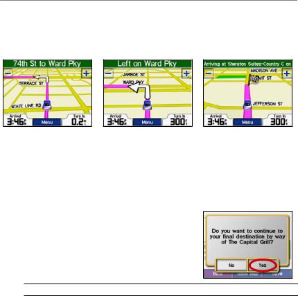
As you travel, your c550 guides you to your destination with voice prompts, arrows on the map, and directions at the top of the Map page. If you depart from the original route, your c550 recalculates the route and provides new directions.
Your route is marked with a |
Follow the arrows as you |
A checkered flag marks your |
magenta line. |
take turns. |
destination. |
Adding a Stop to Your Route
You can add a stop to your route.The c550 gives you directions to the stop and then to your final destination.
1.With a route active, touch Menu on the Map page, and touch  Where to?.
2.Search for the extra stop.
3.Touch Go!.
4.Touch Yes to add this stop before your destination. Or, touch No to make this your new final destination.
 NOTE: You can add only one stop to your route.
c550 Owner’s Manual |
5 |

GETTING STARTED
Adding a Detour
If a road on your route is closed, you can take a detour.
1.With a route active, touch Menu.
2.Touch Detour.
Stopping the Route
1.With a route active, touch Menu.
2.Touch Stop.
Taking a Better Route
As you approach your destination, the c550 evaluates road options, which may result in a better route. When the c550 finds a better route,  or
or  is displayed in the right corner of the map. Touch
  or
or  to take the better route.
Adjusting the Volume
Turn the volume knob on the right side of the unit to adjust the volume.
Adjusting the Brightness
On the Menu page, touch |
|
|
|
. Touch |
|
|
to lower the brightness and |
|
|
|
to raise |
it. Touch OK when you are done.
Locking Your c550
1.On the Menu page, touch  >
>
 System.
2.Touch the button next to Garmin Lock. Touch OK.
3.Enter a 4-digit PIN. Touch Yes to accept the PIN.
4.Touch OK. Drive to a security location, and touch Set.
Each time you turn on the c550, enter the 4-digit PIN or drive to the security location.
What is a Security Location?
You can select any location, such as your home or office, for your security location. If you are at your security location, you do not need to enter a PIN. If you forget your PIN, drive to your security location to unlock the c550.
NOTE: To unlock your c550 at your security location, the c550 must have acquired satellite signals.
6 |
c550 Owner’s Manual |

 WHERE TO?
The Where to? menu provides several different categories you can use to search for locations. To learn how to perform a simple search, see page 4.
Finding an Address
1.From the Menu page, touch
 Where to? >
  Address.
2.Select a state and city, if necessary.
3.Type the address number. Touch
Done.
4.Type the street name until a list of streets appears, or touch Done.
5.Select the street.
6.Select a city, if necessary.
7.Select the address, if necessary. The Go! page opens.
8.Touch Go! to create a route to this address.
TIP: You can search for a postal code. Enter the postal code instead of the city name. (Not all map data provides postal code searching.)
WHERE TO?
TIP: Finding an intersection is very similar to finding an address. Touch Intersection, and enter the two
street names.
Go! Page Options
Touch an item in the search results list to view the Go! page.
Touch Go! to create a turn-by-turn route to this location.
Touch Show Map to view this location on the map. If the GPS is off, touch Set Loc. to select this place as your current location.
Touch Save to save this location as one of your Favorites. See page 10.
If a cellular phone with Bluetooth wireless technology is connected, touch
 to call this location.
|
|
|
c550 Owner’s Manual |
7 |
|

WHERE TO?
Go Home
You can set a home location for the place you return to most often.
1.From the Menu page, touch
 Where to? >
  Go Home.
2.Select an option.
Going Home
After you set your home location, you can route to it at any time by touching
 Where to? >
  Go Home.
Changing Your Home Location
To change your home location, you must first delete it from Favorites:
1.From the Menu page, touch
Where to? >  Favorites.
2.Touch HOME > Edit > Delete > Yes.
After you delete your home location, reset it by following the steps in the “Go Home” section above.
Finding Points of Interest
1.From the Menu page, touch
 Where to? >
  Food, Hotels….
2.Select a category and a sub-category, if necessary. (Touch the arrows to see more categories.)
3.Select a destination.
4.Touch Go!.
Finding a Place by Spelling the Name
If you know the name of the location you are looking for, you can spell it using the on-screen keyboard. You can also enter letters contained in the name to narrow the search.
1.From the Menu page, touch
 Where to? >
  Food, Hotels….
2.Touch Spell Name.
3.Using the on-screen keyboard, enter letters in the name. Touch Done.
4.Touch the place you are looking for, and touch Go!.
8 |
c550 Owner’s Manual |
 Loading...