


Triton 1500
Table of contents
 Loading...
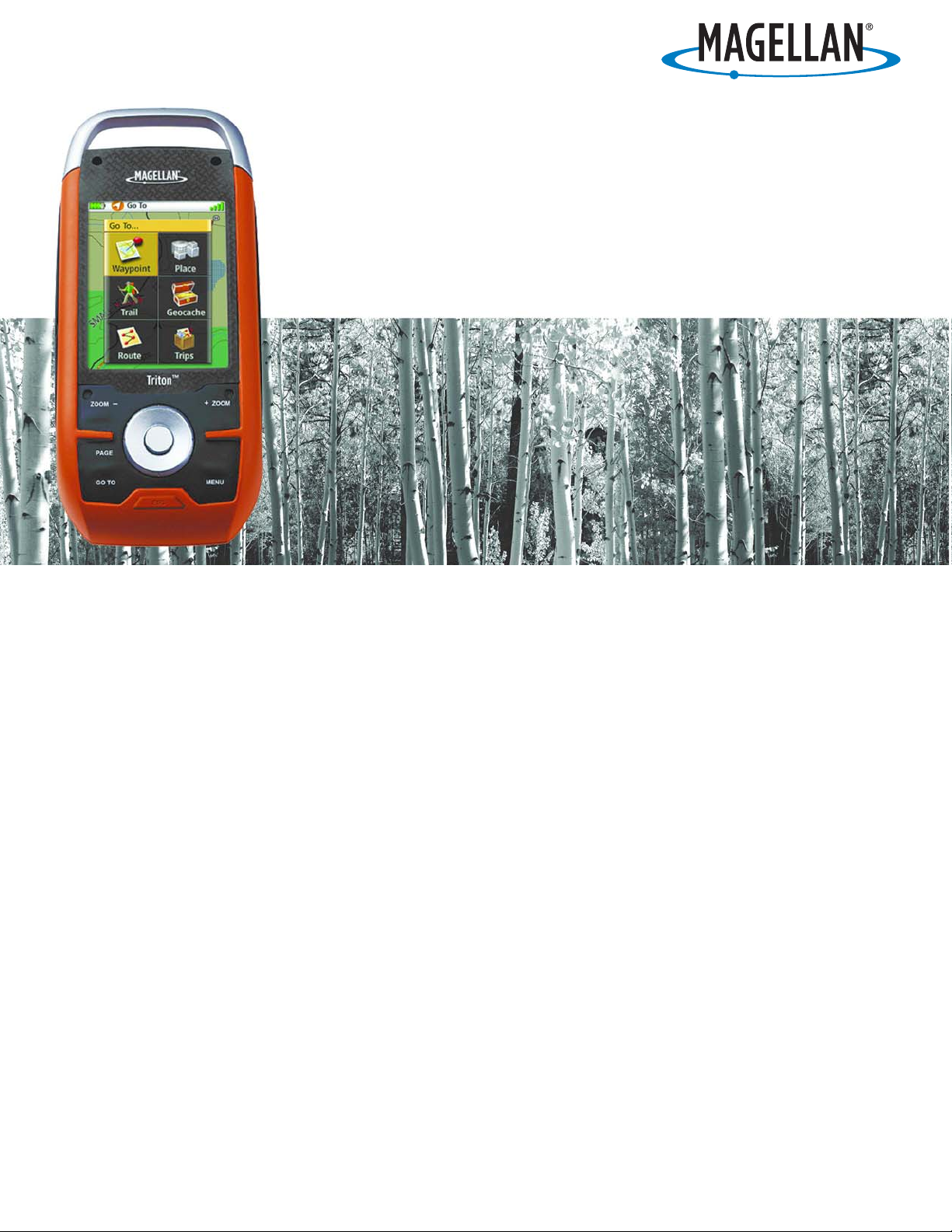
Magellan Navigation, Inc. 960 Overland Court, San Dimas, CA 91773
Magellan
®
Triton™ 1500
User Manual

i
The Magellan Triton is a navigation aid designed to assist you in arriving at your selected destination.
When using the Magellan Triton, these safety rules must be followed to prevent accidents that can
result in injury or death to yourself or others:
IN THE INTERESTS OF SAFETY, DO NOT USE THIS NAVIGATION DEVICE WHILE
DRIVING A VEHICLE.
Please do not try and change any settings on the Magellan Triton while driving. Come to a
complete stop or ask a passenger make any changes. Taking your eyes off the road is dangerous
and can result in an accident in which you or others could be injured.
USE GOOD JUDGEMENT
This product is an excellent navigation aid, but does not replace the need for careful
orienteering and good judgement. Never rely solely on one device for navigating.
USE CARE
The Global Positioning System (GPS) is operated by the U.S. Government, which is solely
responsible for the accuracy and maintenance of the GPS network. The accuracy of position
fixes can be affected by the periodic adjustments to GPS satellites made by the U.S.
government and is subject to change in accordance with the Department of Defence civil GPS
user policy and the Federal Radionavigation Plan. Accuracy can also be affected by poor
satellite geometry and obstructions, like buildings and large trees.
USE PROPER ACCESSORIES
Use only Magellan cables and antennas; the use of non-Magellan cables and antennas may
severely degrade performance or damage the receiver, and will void the warranty.
LICENSE AGREEMENT
Magellan Navigation Inc. grants you, the purchaser, the right to use the software supplied in
and with Magellan Navigation GPS products (the “SOFTWARE”) in the normal operation of the
equipment.
The SOFTWARE is the property of Magellan Navigation and/or its suppliers and is protected by
United States copyright laws and international treaty provisions; therefore, you must treat this
SOFTWARE like any other copyright material.
You may not use, copy, modify, reverse engineer or transfer this SOFTWARE except as expressly
provided in this license. All rights not expressly granted are reserved by Magellan Navigation
and/or its suppliers.
Operation is subject to the following two conditions: (1) this device may not cause interference,
and (2) this device must accept any interference, including interference that may cause
undesired operation of this device.
No part of this guide may be reproduced or transmitted in any form or by any means, electronic
or mechanical, including photocopying and recording, for any purpose other than the
purchaser’s personal use without the prior written permission of Magellan Navigation Inc.
IMPORTANT SAFETY WARNINGS

IMPORTANT SAFETY WARNINGS
ii
Federal Communication Commission Interference Statement
This equipment has been tested and found to comply with the limits for a Class B digital device, pursuant to Part 15 of the
FCC Rules. These limits are designed to provide reasonable protection against harmful interference in a residential
installation. This equipment generates, uses and can radiate radio frequency energy and, if not installed and used in
accordance with the instructions, may cause harmful interference to radio communications. However, there is no guarantee
that interference will not occur in a particular installation. If this equipment does cause harmful interference to radio or
television reception, which can be determined by turning the equipment off and on, the user is encouraged to try to correct
the interference by one of the following measures:
• Reorient or relocate the receiving antenna.
• Increase the separation between the equipment and receiver.
• Connect the equipment into an outlet on a circuit different from that to which the receiver is connected.
• Consult the dealer or an experienced radio/TV technician for help.
This device complies with Part 15 of the FCC Rules. Operation is subject to the following two conditions: (1) This device
may not cause harmful interference, and (2) this device must accept any interference received, including interference that
may cause undesired operation.
FCC Caution: Any changes or modifications not expressly approved by the party responsible for compliance could void the
user’s authority to operate this equipment.
IMPORTANT NOTE:
FCC Radiation Exposure Statement:
This equipment complies with FCC radiation exposure limits set forth for an uncontrolled environment. End users must
follow the specific operating instructions for satisfying RF exposure compliance.
This transmitter must not be co-located or operating in conjunction with any other aerial or transmitter.
In order to maintain compliance with FCC regulations, shielded cables must be used with this equipment. Operation with
non-approved equipment or unshielded cables is likely to result in interference to radio and TV reception. The user is
cautioned that changes and modifications made to the equipment without the approval of manufacturer could void the user’s
authority to operate this equipment.
The Magellan Triton must be installed and operated at a distance no closer then 8 inches (20 cm) from the user.
This Class B digital device meets all requirements of the Canadian Interference-Causing Equipment Regulations.

IMPORTANT SAFETY WARNINGS
iii
IC statement
Operation is subject to the following two conditions:
1. This device may not cause interference.
2. This device must accept any interference, including interference that may cause undesired operation of the
device.
IMPORTANT NOTE:
IC Radiation Exposure Statement:
This equipment complies with IC radiation exposure limits set forth for an uncontrolled environment. End users must follow
the specific operating instructions for satisfying RF exposure compliance.
This transmitter must not be co-located or operating in conjunction with any other antenna or transmitter.
The information provided in this document is subject to change without notice. Improvements and enhancements to the
product may occur without any formal notification. Check the Magellan website (www.magellanGPS.com) for product
updates and additional information.
Underwriters Laboratories Inc. (“UL”) has not tested the performance or reliability of the Global Positioning System (“GPS”)
hardware, operating software or other aspects of this product. UL has only tested for fire, shock or casualties as outlined in
UL’s Standard(s) for Safety for Information Technology Equipment, UL60950-1. UL Certification does not cover the
performance or reliability of the GPS hardware and GPS operating software. UL MAKES NO REPRESENTATIONS,
WARRANTIES OR CERTIFICATIONS WHATSOEVER REGARDING THE PERFORMANCE OR RELIABILITY OF ANY GPS
RELATED FUNCTIONS OF THIS PRODUCT.
Maximum normal use temperature is 66°C.
© 2008 Magellan Navigation, Inc. All rights reserved. The Magellan Logo, Magellan, and Magellan Triton are trademarks of
Magellan Navigation, Inc. No part of this user manual may be reproduced or transmitted in any form or by any means,
electronic or mechanical, including photocopying and recording, for any purpose other than the purchaser’s personal use,
without the prior written permission of Magellan Navigation, Inc.
604-0006-001 A

Table of Contents Magellan Triton i
Table of Contents
Overview .................................................................................................................................1
Features of the Magellan Triton 1500 ...................................................................... 1
Specifications ........................................................................................................ 3
Fundamentals ..........................................................................................................................4
Turning the Triton on ......................................................................................... 4
Turning the Triton off ......................................................................................... 4
Setting the display backlight intensity ................................................................. 4
Setting the Time Zone ........................................................................................ 4
Changing Languages .......................................................................................... 5
Sleep Mode (Backlight Timer) ................................................................................. 5
Waking up the Triton from Sleep Mode ................................................................ 5
Setting the Backlight Timer ................................................................................ 5
Automatic Power Off ............................................................................................... 6
Setting the Power Off Timer interval. ................................................................... 6
Hold Switch ........................................................................................................... 6
Setting the Hold Switch ..................................................................................... 6
Flashlight .............................................................................................................. 7
Turning the flashlight on or off. ........................................................................... 7
Menus ................................................................................................................... 7
Accessing the Main Menu ................................................................................... 7
Navigation Screens ................................................................................................. 8
Accessing the Map Screen Options Menu ............................................................. 8
Accessing the Speedometer Options Menu ........................................................... 8
Data Fields ............................................................................................................ 9
Accessing the Data Fields on the Map Screen ...................................................... 9
Customizing the Data Field ................................................................................. 9
Selecting Maps ...................................................................................................... 9
Battery Life ......................................................................................................... 10
Navigation Screens ...............................................................................................................12
Selecting Navigation Screens ............................................................................ 12
Map Screen ......................................................................................................... 12
Changing the Map Scale ................................................................................... 12
Displaying the Map Screen Data Fields .............................................................. 12
Customizing the Data Fields ............................................................................. 13
Accessing the Main Menu ................................................................................. 13
Accessing the Options Menu ............................................................................. 13
Map Cursors ........................................................................................................13

Table of Contents Magellan Triton ii
Cancelling Pan ................................................................................................ 13
Viewing Best Fish and Hunt Times .................................................................... 14
Viewing Sun and Moon Rise and Set Times ........................................................ 14
Current Location Screen ....................................................................................... 14
Large Data Screen ................................................................................................ 15
Customizing the Data Fields for the Large Data Screen ........................................ 15
Speedometer Screen ............................................................................................ 15
Resetting the Odometer .................................................................................... 15
Resetting the Trip Odometer .............................................................................15
Resetting Maximum Speed ............................................................................... 15
The Compass Screen ............................................................................................ 16
Customizing the Data Fields for the Compass Screen .......................................... 16
The Satellite Status Screen ................................................................................... 16
Customizing the Data Fields for the Satellite Status Screen ................................. 16
Explanation of Data Field Types ............................................................................. 17
Using the Keyboard ...............................................................................................................19
Date Entry ........................................................................................................... 22
Text Size Limitations ............................................................................................ 22
Settings ................................................................................................................................23
Customizing Navigation Settings ....................................................................... 23
Setting Volume and Brightness ......................................................................... 23
View Memory Usage ......................................................................................... 24
Clearing Memory ............................................................................................. 24
Restoring Factory Settings ................................................................................ 24
Setting Connectivity ......................................................................................... 24
Getting Software Version Information ................................................................. 25
Viewing Copyright Information .......................................................................... 25
Personalizing Magellan Triton ........................................................................... 25
Performing Diagnostic Checks ........................................................................... 25
Profiles .................................................................................................................................27
Activating a Profile .......................................................................................... 27
Customizing a Profile ....................................................................................... 27
Display Page ................................................................................................... 27
Map Page ....................................................................................................... 28
Alerts Page ..................................................................................................... 28
Waypoints .............................................................................................................................30
Waypoint Detail Screen Overview ........................................................................... 30

Table of Contents Magellan Triton iii
Creating Waypoints ............................................................................................... 31
Creating a Current Location Waypoint from the Map Screen .................................31
Creating a Current Location Waypoint Using the Triton Menu ............................... 31
Creating a Waypoint Using the Pan Cursor ......................................................... 31
Creating a Waypoint from a Point on the Map Using the Triton Menu .................... 32
Creating a Custom Waypoint from the Map Screen .............................................. 32
Creating a Custom Waypoint Using the Triton Menu ............................................ 32
Viewing Waypoints ................................................................................................ 33
Viewing a Saved Waypoint ................................................................................ 33
Editing Waypoints ................................................................................................34
Editing a Saved Waypoint ................................................................................. 34
Deleting a Saved Waypoint ............................................................................... 34
Deleting a Saved Waypoint (Alternate Method) ................................................... 34
Duplicating a Saved Waypoint ........................................................................... 35
Geocache Waypoints .............................................................................................................36
Creating a Geocache Waypoint .......................................................................... 36
Editing a Saved Geocache Waypoint .................................................................. 36
Deleting a Saved Geocache Waypoint ................................................................ 37
Deleting a Saved Geocache Waypoint (Alternate Method) ..................................... 37
Duplicating a Saved Geocache Waypoint ............................................................ 38
Routes ..................................................................................................................................39
Go To Routes ....................................................................................................... 39
Creating a Go To Route Using the Pan Cursor ..................................................... 39
Creating a Go To Route to a Saved User-Created Waypoint. .................................. 39
Creating a Go To Route to a Place Waypoint ....................................................... 40
Creating a Go To Route to a Geocache Waypoint ................................................. 41
Creating a Multileg Route ................................................................................. 41
Activating a Multileg Route ............................................................................... 42
Deleting a Multileg Route ................................................................................. 43
Duplicating a Multileg Route ............................................................................ 43
Viewing a Route’s Vertical Profile ...................................................................... 43
Cancelling a Route .......................................................................................... 44
Trails ....................................................................................................................................45
Creating a Trail ................................................................................................ 45
Creating a Trail (Alternate method) .................................................................... 45
Activating a Trail ............................................................................................. 45
Deleting a Trail ................................................................................................ 46
Deleting a Trail (Alternate Method) .................................................................... 46

Table of Contents Magellan Triton iv
Duplicating a Trail ........................................................................................... 47
Reversing a Trail .............................................................................................. 47
Hiding/Showing a Trail ..................................................................................... 48
Activating a Backtrack Route ............................................................................ 48
Places ..................................................................................................................................49
Searching for a Place Waypoint (base map) ........................................................ 49
Searching for a Place Waypoint (Detail Map) ...................................................... 49
Turning On/Off the Waypoint Proximity Alarm for a Place Waypoint ...................... 50
Viewing Best Fish and Hunt Times for a Place Waypoint ...................................... 51
Viewing Sun and Moon Rise and Set Times for a Place Waypoint .......................... 51
Media ...................................................................................................................................53
Taking a Photograph ........................................................................................ 53
Making a Movie ............................................................................................... 54
Making an Audio Recording .............................................................................. 54
Browsing Photographs and Videos ..................................................................... 55
Playing Stored Music Files ............................................................................... 56
Changing Music File Settings ............................................................................ 56
Playing Stored Audio Files ................................................................................ 57

Overview 1
Overview
Thank you for your purchase of the Magellan Triton GPS receiver. The Magellan Triton was designed
for the outdoor enthusiast with all the features needed to make your outdoor adventures safe and
enjoyable.
Be sure to register your Magellan Triton at www.magellangps.com
to be kept informed of possible
software updates and new features as they become available. Also visit the Magellan Triton support
page at www.magellangps.com/support/
and select your Magellan Triton model for additional
information and tips on the use of your Triton.
Features of the Magellan Triton 1500
2.7” color touch screen – The brilliant colors and touchscreen controls provide an easy-to-read
display that makes selecting functions as easy as touching the screen.
Ease-of-use – Simple menus and an intuitive interface makes using the Magellan Triton easy for
first time GPS receiver users while still keeping all the functions experienced users expect to see.
Routes and tracks – Create a single leg Go To route, a route with multiple destinations or just use
the backtrack function to follow your footsteps back to your point of origin.
3-meter accuracy – The SiRFstarIII™ GPS chipset and an integrated multidirectional antenna
offer superior GPS accuracy. The Magellan Triton is also WAAS and EGNOS-capable, taking
advantage of the Wide Area Augmentation System for improved accuracy.
Built-in map – A built-in base map of the continental United States and Canada display major
highways, city centers, bodies of water and much more.
Ability to add detailed maps – Access optional detail maps for marine cartography, topographic
maps, as well as feature-packed National Geographic maps from an SD card that can be installed
in the Magellan Triton.
SD-card expansion - Use an optional SD memory card to upload detailed maps and store media.
Flashlight - Light your way with a powerful LED flashlight. Low power consumption helps
maximize battery life.
Voice recorder - Microphone and speaker enable you to record audio notes and attach them to
waypoints, share with friends and family or easily find your way back next time.
Digital music player - Upload your digital music to an optional SD card and enjoy a customized
soundtrack as you explore. Plug in any standard headphones (optional accessory) for clear private
listening.
External antenna connector - Simply plug in an external antenna (optional accessory) in your boat
or off-road vehicle for enhanced GPS signal reception.
Audio jack - Plug in any standard 1/8" headphones (optional accessory) to enjoy clear private
listening of your digital music, voice notes and other recordings.
Overview 2
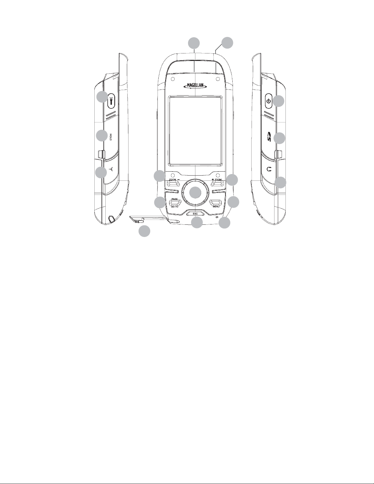
Magellan Triton 1500
A
B
C
D
E
F
G
I
J
K
H
L
M
N
P
O
A
Backlight and Flashlight Button
B
Hold Switch (under protective rubber cover)
C
External Antenna Connector (under protective rubber cover)
D
Data Connector (Back)
E
Stylus
F
Zoom - (Zoom out) Button
G
Page / Go To Button
H
Esc (Escape) Button
I
Zoom + (Zoom in) Button
J
Menu Button
K
Enter Button / Cursor Control
L
Microphone
M
Power Button
N
SD Card Slot (under protective rubber cover)
O
Headphone Jack (under protective rubber cover)
P
Reset

Overview 3
Specifications
PHYSICAL
PERFORMANCE
POWER
Case Rubber armored impact-resistant plastic, water-resistant seal, IPX-7
Base Map Built-in base map of the continental United States and Canada.
Size 5.75" x 2.5" x 1.13" (14.6 x 6.35 x 2.87 cm)
Weight 8.0 oz (227 g) - w/ battery
Display
2.7" (6.86 cm) diagonal, QVGA (240X320) resolution and touch screen
(LED backlit)
Data Storage Secure Digital (SD) Card (optional accessory)
Antenna Built-in multidirectional patch (or optional external antenna)
Keypad Nine direct-access keys
Operating Range 14° to 140°F (-10° to 60°C)
Receiver SiRF Star III™ 20 channels, WAAS/EGNOS
Acquisition Time Hot: 20 seconds, Cold: 60 seconds, Initial: 2 minutes
Update Rate Once per second
Accuracy
3 to 5 meters (10 - 16 feet) - WAAS/EGNOS, < 7 meters (15 feet) - GPS
only
Languages
English, French, German, Dutch, Danish, Swedish, Spanish, Italian,
Portuguese, Finnish, Norwegian
Coordinate Systems
Latitude/Longitude, UTM, OSGB, Irish, Swish, Swedish, Finnish, German,
French, USNG, MGRS, Indian, Nederlands
Source Two AA Batteries (included)
Battery Life Up to 10 hours
Fundamentals 4
Fundamentals
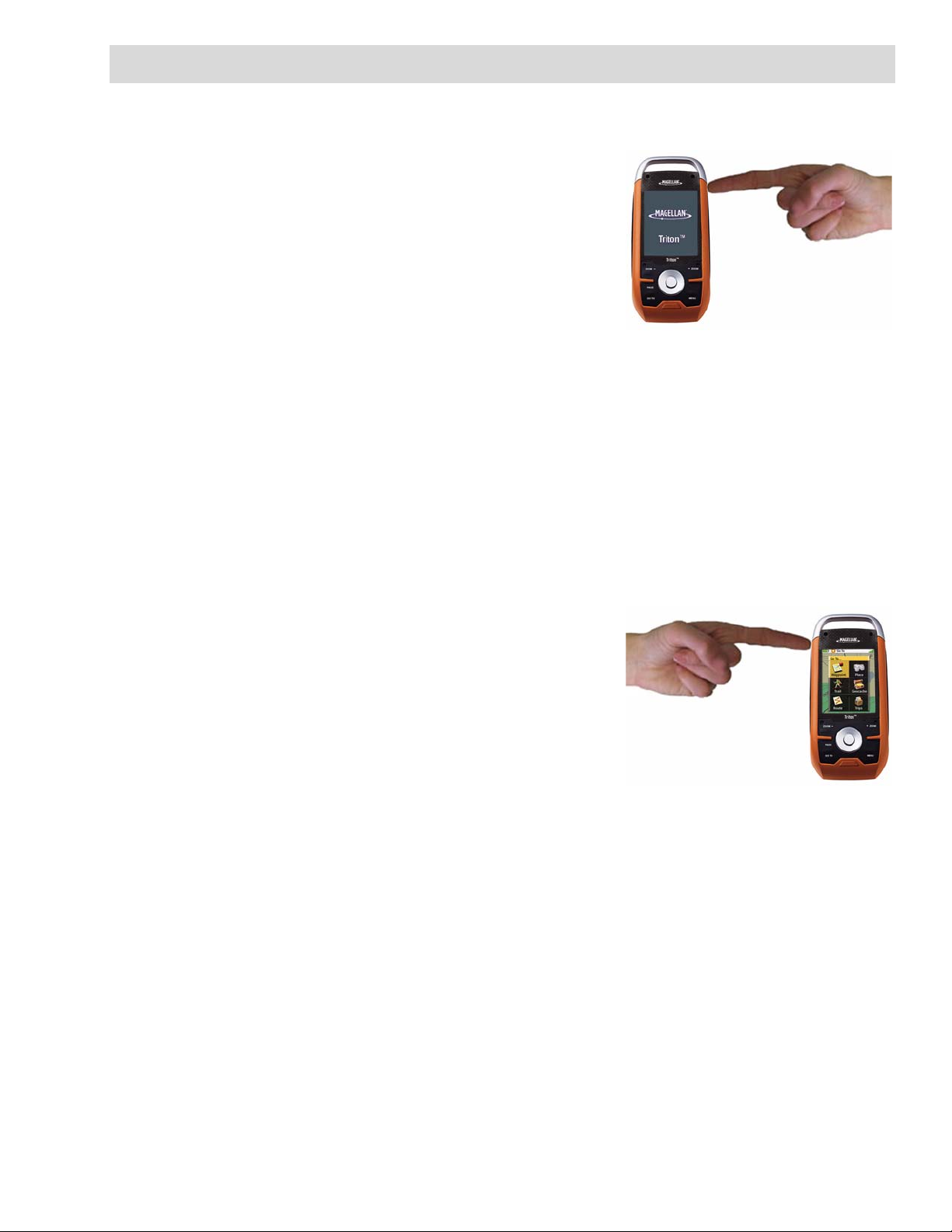
Turning the Triton on
1. Press and hold the power button until the Triton
splash screen is displayed.
Turning the Triton off
When turning off the Triton you can select to have it
shutdown or go into suspend mode.
1. Press the Power button and the Triton will begin the
shutdown sequence.
2. To place the Triton in suspend mode, press Enter
before the shutdown sequence is complete.
3. To cancel the shutdown sequence and return to the last viewed screen, press any key or tap
the screen.
4. If after 5 seconds no key has been pressed, the Triton will shutdown.
Setting the display backlight intensity
Depending upon the lighting conditions you are in you may need to change the backlight settings for
the display. There are five levels of backlight intensity, press the backlight button momentarily to
step through each level of backlight intensity.
1. Press the backlight button momentarily. The
backlight intensity will increase 20% until it reaches
the maximum intensity. Pressing the backlight
button again will turn off the display backlight.
Please note that reducing the backlight setting will increase
the battery life for the Triton. Refer to the section in this
chapter on Battery Life for other tips on extending the
Triton’s battery life. Also note that the backlight and the
flashlight use the same button on the Magellan Triton. Press
the button momentarily to control the backlight setting, press
and hold the button to turn the flashlight on and off.
Setting the Time Zone
The time and date information will be computed from information from the GPS satellites so there is
no requirement for you to input any time or date information. However, to make the time accurate
for your location you must select the correct time zone.
1. From the Map screen press MENU.
2. Select View.
3. Select Profiles.
4. Select the profile you want to use. (See the chapter on Profiles for more information.)
5. Press the PAGE / GO TO button to change the page to the Display page.
Press button
momentarily

Fundamentals 5
6. Scroll down the page and select the Tim e Zo ne field.
7. From the drop-down menu, select your current time zone. (Time zones are not changed
automatically when travelling. If you travel to an area with a different time zone, you will
need to change it here for accurate time information.)
8. Repeat the process for the Daylight Savings field.
9. Press the PAGE / GO TO button until the Info page is displayed.
10. Select Activate Profile.
Changing Languages
1. From the Map screen press MENU.
2. Select View.
3. Select Profiles.
4. Select the profile you want to use. (See the chapter on Profiles for more information.)
5. Press the PAGE / GO TO button to change the page to the Display page.
6. Scroll down the page and select the Language field.
7. From the drop-down menu, select the desired language.
8. Press the PAGE / GO TO button until the Info page is displayed.
9. Select Activate Profile.
Sleep Mode (Backlight Timer)
To conserve battery life the Triton will go into Sleep Mode at a preset interval when no keys have been
pressed.
Waking up the Triton from Sleep Mode
1. Press any key and the Triton will wake up, turning the backlight on to the previous setting.
Setting the Backlight Timer
1. From the Map screen, press MENU.
2. Select View.
3. Select Profiles.
4. Select the profile desired.
5. Select the Display Options icon at the top of the
display. Select Backlight Timer.
6. Choose the interval that the backlight will turn off
with no keys pressed. You can also select Off if you want the backlight to remain on as long
as the Triton is turned on.
Display Options Icon

Fundamentals 6
Automatic Power Off
The Triton can be set to automatically go into suspend mode when no keys have been pressed. This
saves battery life if you forget to turn off the Triton.
Setting the Power Off Timer interval.
1. From the Map screen, press MENU.
2. Select View.
3. Select Profiles.
4. Select the profile desired.
5. Select the Display Options icon at the top of the display.
6. Select Power Off Timer.
7. Choose the interval that the Triton will turn off with no keys pressed. You can also select Off
if you want the Triton to not turn off automatically.
Hold Switch
Sometimes you may find that you want the Triton to keep computing your position but you are keeping
it in your backpack or some other area where the keys might be pressed accidently. To prevent
accidental key presses, the Triton has a Hold Switch that disables the keys and the touchscreen but
the Magellan Triton will continue to compute position information.
Setting the Hold Switch
1. Lift the protective cover from the Hold Switch.
2. Slide the Hold Switch down to turn off the keys and touchscreen,
up for normal operation.
Fundamentals 7
Flashlight
The Triton has a three LED flashlight located at the top of the receiver. This can be used in
emergency situations when you need quick access to a flashlight. To conserve battery life it is
recommended that you use the flashlight only when needed.
Turning the flashlight on or off.
1. Press and hold the Flashlight button for at least 4
seconds to turn the flashlight on.
2. Press and hold the Flashlight button for 4 seconds
again to turn the flashlight off.
Note that the backlight and the flashlight use the same
button on the Magellan Triton. Press the button momentarily
to control the backlight setting, press and hold the button to
turn the flashlight on and off.
Menus
Accessing the features of the Magellan Triton is done through the Main Menu. The Main Menu has
three options; Go To, Create and View. Selecting one of these menu options brings up the menu for
the corresponding function.
Accessing the Main Menu
1. From the Map Screen, press MENU.
The Go To Menu has six options; Waypoint, Place, Trail, Geocache, Route, and Trips.
The Waypoint option provides a way to create a Go To route to a waypoint that has been saved
to the Magellan Triton.
The Place option is used to select a destination waypoint that has been either preloaded into
the Magellan Triton as part of the internal base map or a destination waypoint found on a
detailed map that have been loaded on an optional SD card.
The Trail option displays trails that you have saved previously. You can select the trail that you
would like to follow from the list.
The Geocache option allows you to select a saved geocache waypoint and use it as the
destination waypoint for a Go To route.
The Route option displays routes that you have created previously that you can select from to
activate.
The Trips option will be available in a future update. Check the Magellan website at
www.magellangps.com for information on updates to your Magellan Triton.
The Create Menu has the same options as the Go To Menu but these are used to create waypoints
and multileg routes that can be saved by the Magellan Triton.
Use the Waypoint option to create a waypoint from your present location, by selecting a point
on the map or by entering the coordinates for a known waypoint.
The Trail option provides a way for you to save your current track (a record of your travels since
the last time track was cleared) as a route that you can use again to follow your current
journey.
Press and hold
for 4 seconds.

Fundamentals 8
The Geocache option allows you to add new geocache locations from your present position, by
selecting a point on the map or by entering the coordinates of a known geocache.
The Route option is used to create a route with multiple legs. These routes generally begin at
your current location and go to a series of waypoints that could have been created and saved
in the Magellan Triton from earlier trips or waypoints that are available from the base map or
an optional detailed map.
The Trips option will be available in a future update. Check the Magellan website at
www.magellangps.com for information on updates to your Magellan Triton.
The View Menu has options for many of the support functions and tools found in the Magellan Triton.
The Local Info option provides access to information about the best hunting and fishing times
as well as solar and lunar rise and set times for the location of your cursor.
The Profiles option is used to customize the settings of the Magellan Triton for a particular
activity; hiking, marine use or geocaching.
The Maps option displays a list of the base maps and available detail maps, that can be used.
The Media option contains the functions for taking and viewing photographs and movie clips.
Other functions of the Media option are creating audio clips and playing MP3 music files.
Use Settings to access navigation settings, adjust volume and brightness, select connectivity,
view memory details, as well as perform diagnostics.
Navigation Screens
The Triton has six navigation screens and a Satellite Status screen that can be accessed by pressing
the PAGE / GO TO or ESC button The Navigation Screens will be discussed in detail in the Navigation
Screen chapter of this manual.
Navigation Screen options menus
The Map and Speedometer navigation screens have options menus that are associated with them
providing access to additional functions.
Accessing the Map Screen Options Menu
1. While viewing the Map screen, press ENTER.
2. Press ESC to close the options menu.
Accessing the Speedometer Options Menu
1. While viewing the Speedometer screen, press MENU.
For Speedometer you can: Reset Odometer, Reset Trip Odometer, Reset Speed.
2. Press ESC to close the options menu.
Fundamentals 9
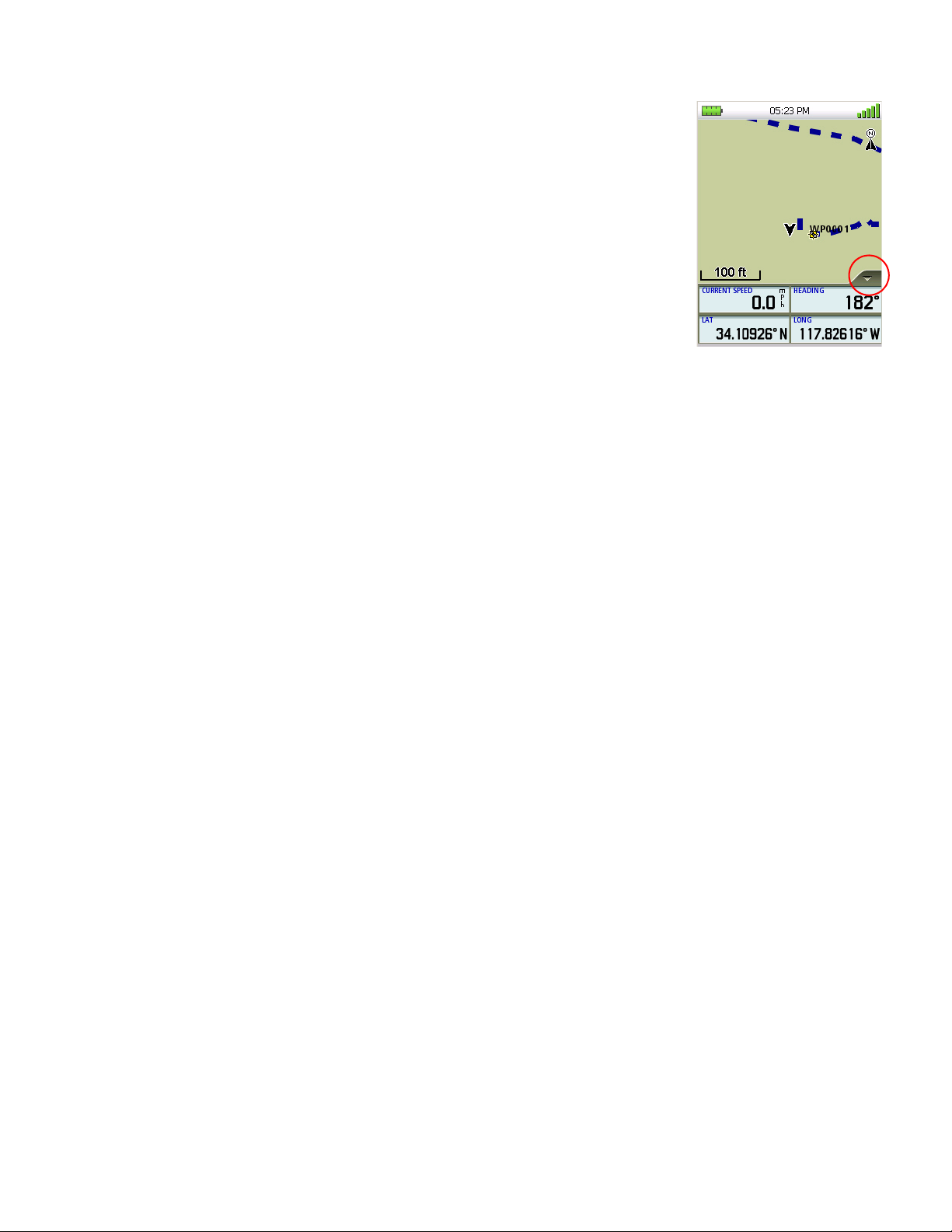
Data Fields
The Map screen, the Large Data screen, the Compass, and the Satellite
Status screen have data field that can be customized to display
navigation information. You can change what information is being
displayed from 20 different data type options.
Accessing the Data Fields on the Map Screen
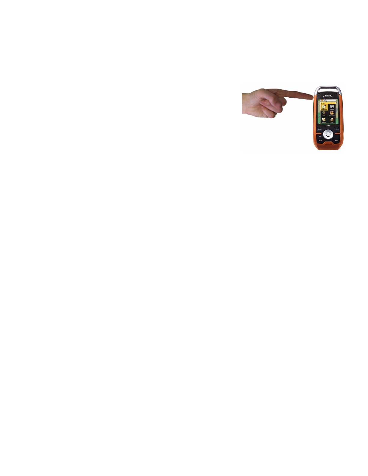
1. While viewing the Map screen, tap on the arrow (circled in
red) in the lower right corner.
2. Two data fields will appear. Tap on it again and two more
data fields appear. A total of four can be displayed.
Customizing the Data Field
1. While viewing a screen that has customizable data fields, press ENTER. The first data field
will be displayed in pale orange.
2. Select the field you want to change and with it highlighted, press ENTER.
3. Select the data type desired from the list shown and press ENTER.
4. The Triton will return to the original screen with the data field customized to display the
information selected.
Selecting Maps
Detailed maps, including National Geographic maps, can be purchased and downloaded from the
Magellan Store and loaded automatically into your Magellan Triton from an SD card. You will need
to select the detailed map you want to use to activate it.
1. From the Map screen, press MENU.
2. Select View.
3. Select Maps.
4. Select the detailed map from the list that you want to activate and press ENTER.
5. The font for the detailed map will turn blue when it is active.
6. Select the green checkmark.

Fundamentals 10
Battery Life
The following are things you can do to conserve the battery life in your Magellan Triton.
Turn off backlight during daytime use.
1. Press the Backlight button (top left side of the receiver) to cycle through the backlight
intensities.
(Alternate method)
1. Press MENU.
2. Select View.
3. Select Profiles.
4. Select a profile.
5. Press PAGE / GO TO to select the Display page.
6. Select Backlight Level.
Select a low backlight level during nighttime use.
1. Press the Backlight button (top left side of the receiver) to cycle through the backlight
intensities.
(Alternate method)
1. Press MENU.
2. Select View.
3. Select Profiles.
4. Select a profile.
5. Press PAGE / GO TO to select the Display page.
6. Select Backlight Level.
Select a short backlight timer setting during nighttime use.
1. Press MENU.
2. Select View.
3. Select Profiles.
4. Select a profile.
5. Press PAGE / GO TO to select the Display page.
6. Select Backlight Level.

Fundamentals 11
Connect to PC using USB cable (if possible).
1. Connect the Magellan Triton to a computer using the USB cable supplied with the Magellan
Tri t on.
2. Select POWER ONLY from the options menu that is displayed.
Connect to Vehicle Power Adapter (optional accessory).
1. Connect the Magellan Triton to the optional vehicle power adapter.
2. Select POWER ONLY from the options menu that is displayed.
For optimal performance, use only brand name AA alkaline or lithium batteries.
Rechargeable AA batteries are not recommended.
Loading...