

Page 1

®
Integrated Flight Deck
G1000
Pilot’s Guide
Diamond DA40/40F
Page 2
SYSTEM OVERVIEW
FLIGHT INSTRUMENTS
EIS
AUDIO PANEL & CNS
FLIGHT MANAGEMENT
HAZARD AVOIDANCE
AFCS
ADDITIONAL FEATURES
APPENDICES
INDEX
Page 3

Copyright © 2006-2008 Garmin Ltd. or its subsidiaries. All rights reserved.
This manual reflects the operation of System Software version 0321.18 or later for the Diamond DA40 or DA40F. Some differences in
operation may be observed when comparing the information in this manual to earlier or later software versions.
Garmin International, Inc., 1200 East 151st Street, Olathe, Kansas 66062, U.S.A.
Tel: 913/397.8200 Fax: 913/397.8282
Garmin AT, Inc., 2345 Turner Road SE, Salem, OR 97302, U.S.A.
Tel: 503/391.3411 Fax: 503/364.2138
Garmin (Europe) Ltd., Liberty House, Bulls Copse Road, Hounsdown Business Park, Southampton, SO40 9RB, U.K
Tel: 44/0870.8501241 Fax: 44/0870.8501251
Garmin Corporation, No. 68, Jangshu 2nd Road, Shijr, Taipei County, Taiwan
Tel: 886/02.2642.9199 Fax: 886/02.2642.9099
Website Address: www.garmin.com
Except as expressly provided herein, no part of this manual may be reproduced, copied, transmitted, disseminated, downloaded or stored
in any storage medium, for any purpose without the express written permission of Garmin. Garmin hereby grants permission to download
a single copy of this manual and of any revision to this manual onto a hard drive or other electronic storage medium to be viewed for
personal use, provided that such electronic or printed copy of this manual or revision must contain the complete text of this copyright notice
and provided further that any unauthorized commercial distribution of this manual or any revision hereto is strictly prohibited.
Garmin® and G1000® are registered trademarks of Garmin Ltd. or its subsidiaries. FliteCharts®, and SafeTaxi® are trademarks of Garmin
Ltd. or its subsidiaries. These trademarks may not be used without the express permission of Garmin.
Bendix/King® and Honeywell® are registered trademarks of Honeywell International, Inc.; Becker® is a registered trademark of Becker
Flugfunkwerk GmbH; NavData® is a registered trademark of Jeppesen, Inc.; XM® is a registered trademark of XM Satellite Radio, Inc.; and
Stormscope® is a registered trademark of L-3 Communications.
March 2008 Printed in the U.S.A.
Garmin G1000 Pilot’s Guide for the Diamond DA40/40F
190-00592-05 Rev. A
Page 4

LIMITED WARRANTY
LIMITED WARRANTY
This Garmin product is warranted to be free from defects in materials or workmanship for two years from the date of purchase. Within this
period, Garmin will, at its sole option, repair or replace any components that fail in normal use. Such repairs or replacement will be made
at no charge to the customer for parts and labor, provided that the customer shall be responsible for any transportation cost. This warranty
does not cover failures due to abuse, misuse, accident, or unauthorized alterations or repairs.
THE WARRANTIES AND REMEDIES CONTAINED HEREIN ARE EXCLUSIVE AND IN LIEU OF ALL OTHER WARRANTIES EXPRESS OR IMPLIED
OR STATUTORY, INCLUDING ANY LIABILITY ARISING UNDER ANY WARRANTY OF MERCHANTABILITY OR FITNESS FOR A PARTICULAR
PURPOSE, STATUTORY OR OTHERWISE. THIS WARRANTY GIVES YOU SPECIFIC LEGAL RIGHTS, WHICH MAY VARY FROM STATE TO
STATE.
IN NO EVENT SHALL GARMIN BE LIABLE FOR ANY INCIDENTAL, SPECIAL, INDIRECT OR CONSEQUENTIAL DAMAGES, WHETHER
RESULTING FROM THE USE, MISUSE, OR INABILITY TO USE THIS PRODUCT OR FROM DEFECTS IN THE PRODUCT. Some states do not
allow the exclusion of incidental or consequential damages, so the above limitations may not apply to you.
Garmin retains the exclusive right to repair or replace the unit or software, or to offer a full refund of the purchase price, at its sole
discretion. SUCH REMEDY SHALL BE YOUR SOLE AND EXCLUSIVE REMEDY FOR ANY BREACH OF WARRANTY.
To obtain warranty service, contact your local Garmin Authorized Service Center. For assistance in locating a Service Center near you, visit
the Garmin Website at “http://www.garmin.com” or contact Garmin Customer Service at 800-800-1020.
190-00592-05 Rev. A
Garmin G1000 Pilot’s Guide for the Diamond DA40/40F
i
Page 5
WARNINGS, CAUTIONS, AND NOTES
WARNING:
To reduce the risk of unsafe operation, carefully review and understand all aspects of the
G1000 Pilot’s Guide documentation. Thoroughly practice basic operation prior to actual use. During flight
operations, carefully compare indications from the G1000 to all available navigation sources, including
the information from other NAVAIDs, visual sightings, charts, etc. For safety purposes, always resolve any
discrepancies before continuing navigation.
WARNING:
The Garmin G1000 has a very high degree of functional integrity. However, the pilot must
recognize that providing monitoring and/or self-test capability for all conceivable system failures is not
practical. Although unlikely, it may be possible for erroneous operation to occur without a fault indication
shown by the G1000. It is thus the responsibility of the pilot to detect such an occurrence by means of
cross-checking with all redundant or correlated information available in the cockpit.
WARNING:
WARNING:
For safety reasons, G1000 operational procedures must be learned on the ground.
The United States government operates the Global Positioning System and is solely responsible
for its accuracy and maintenance. The GPS system is subject to changes which could affect the accuracy
and performance of all GPS equipment. Portions of the Garmin G1000 utilize GPS as a precision electronic
NAVigation AID (NAVAID). Therefore, as with all NAVAIDs, information presented by the G1000 can be
misused or misinterpreted and, therefore, become unsafe.
WARNING:
The altitude calculated by G1000 GPS receivers is geometric height above Mean Sea Level and
could vary significantly from the altitude displayed by pressure altimeters, such as the GDC 74A Air Data
Computer, or other altimeters in aircraft. GPS altitude should never be used for vertical navigation. Always
use pressure altitude displayed by the G1000 PFD or other pressure altimeters in aircraft.
WARNING:
The displayed minimum safe altitudes (MSAs) are only advisory in nature and should not be
relied upon as the sole source of obstacle and terrain avoidance information. Always refer to current
aeronautical charts for appropriate minimum clearance altitudes.
WARNING:
Navigation and terrain separation must NOT be predicated upon the use of the terrain function.
The G1000 Terrain Proximity feature is NOT intended to be used as a primary reference for terrain avoidance
and does not relieve the pilot from the responsibility of being aware of surroundings during flight. The
Terrain Proximity feature is only to be used as an aid for terrain avoidance and is not certified for use
in applications requiring a certified terrain awareness system. Terrain data is obtained from third party
sources. Garmin is not able to independently verify the accuracy of the terrain data.
WARNING:
Do not use outdated database information. Databases used in the G1000 System must be updated
regularly in order to ensure that the information remains current. Pilots using any outdated database do so
entirely at their own risk.
Garmin G1000 Pilot’s Guide for the Diamond DA40/40F
190-00592-05 Rev. Aii
Page 6
WARNINGS, CAUTIONS, AND NOTES
WARNING:
Do not use basemap (land and water data) information for primary navigation. Basemap data is
intended only to supplement other approved navigation data sources and should be considered as an aid to
enhance situational awareness.
WARNING:
Traffic information shown on the G1000 Multi Function Display is provided as an aid in visually
acquiring traffic. The aircraft should be maneuvered based only upon ATC guidance or positive visual
acquisition of conflicting traffic.
WARNING:
XM Weather should not be used for hazardous weather penetration. Weather information
provided by the GDL 69/69A is approved only for weather avoidance, not penetration.
WARNING:
NEXRAD weather data is to be used for long-range planning purposes only. Due to inherent
delays in data transmission and the relative age of the data, NEXRAD weather data should not be used for
short-range weather avoidance.
WARNING:
Use of the Stormscope is not intended for hazardous weather penetration (thunderstorm
penetration). Stormscope information, as displayed on the G1000 MFD, is to be used only for weather
avoidance, not penetration.
WARNING
:
The illustrations in this guide are only examples. Never use the G1000 to attempt to penetrate
a thunderstorm. Both the FAA Advisory Circular, Subject: Thunderstorms, and the Aeronautical Information
Manual (AIM) recommend avoiding “by at least 20 miles any thunderstorm identifi ed as severe or giving
an intense radar echo.”
WARNING:
Because of anomalies in the earth’s magnetic field, operating the G1000 within the following
areas could result in loss of reliable attitude and heading indications. North of 70° North latitude and south
of 70° South latitude. An area north of 65° North latitude between longitude 75º West and 120º West. An
area south of 55° South latitude between longitude 120º East and 165º East.
CAUTION:
The Garmin G1000 does not contain any user-serviceable parts. Repairs should only be made by
an authorized Garmin service center. Unauthorized repairs or modifications could void both the warranty
and the pilot’s authority to operate this device under FAA/FCC regulations.
CAUTION:
The PFD and MFD displays use a lens coated with a special anti-reflective coating that is very
sensitive to skin oils, waxes, and abrasive cleaners. CLEANERS CONTAINING AMMONIA WILL HARM THE
ANTI-REFLECTIVE COATING. It is very important to clean the lens using a clean, lint-free cloth and an
eyeglass lens cleaner that is specified as safe for anti-reflective coatings.
190-00592-05 Rev. A
Garmin G1000 Pilot’s Guide for the Diamond DA40/40F
iii
Page 7
WARNINGS, CAUTIONS, AND NOTES
NOTE:
When using Stormscope, there are several atmospheric phenomena in addition to nearby thunderstorms
that can cause isolated discharge points in the strike display mode. However, clusters of two or more
discharge points in the strike display mode do indicate thunderstorm activity if these points reappear after
the screen has been cleared.
NOTE:
All visual depictions contained within this document, including screen images of the G1000 panel
and displays, are for example only, are subject to change, and may not reflect the most current G1000
System. Depictions of equipment may differ slightly from the actual equipment.
NOTE:
The GDU 1040/1042/1044 PFD/MFD may require a warm-up time of up to 30 minutes when exposed
to -40˚C for an extended period. A warm-up time of up to 15 minutes may be required when exposed to
-30˚C for an extended period.
NOTE:
This device complies with part 15 of the FCC Rules. Operation is subject to the following two conditions:
(1) this device may not cause harmful interference, and (2) this device must accept any interference received,
including interference that may cause undesired operation.
NOTE
:
This product, its packaging, and its components contain chemicals known to the State of California
to cause cancer, birth defects, or reproductive harm. This notice is being provided in accordance with
California’s Proposition 65. For additional information, refer to the website at www.garmin.com/prop65.
NOTE:
Interference from GPS repeaters operating inside nearby hangars can cause an intermittent loss of
attitude and heading displays while the aircraft is on the ground. Moving the aircraft more than 100 feet
away from the source of the interference should alleviate the condition.
NOTE: Use of polarized eyewear may cause the flight displays to appear dim or blank.
Garmin G1000 Pilot’s Guide for the Diamond DA40/40F
190-00592-05 Rev. Aiv
Page 8
Record of Revisions
REVISION INFORMATION
Part Number
190-00592-00 A 11/10/05 i – I-6 Optional fuel pressure gauge information added
190-00592-01 A 6/16/06 i – I-4 GFC 700 information added
190-00592-02 A 7/20/06 i – I-4 TAWS information added
190-00592-03 A 4/20/07 i – I-6 EIS updated
190-00592-04 A 12/04/07 i – I-6 KAP 140 Autopilot annunciations added
190-00592-05 A 03/31/08 i – I-6 Synthetic Vision System information added
Revision Date Page Range Description
GDL 69A crew muting information added
Airways information added
WAAS information added
VNV information added
Charts information added
Stormscope information added
TAS600 information added
190-00592-05 Rev. A
Garmin G1000 Pilot’s Guide for the Diamond DA40/40F
v
Page 9

TABLE OF CONTENTS
SECTION 1 SYSTEM OVERVIEW
1.1 Line Replaceable Units ......................................... 10
1.2 Secure Digital (SD) Cards ..................................... 15
1.3 System Power-up ................................................... 16
1.4 System Operation .................................................. 17
Display Operation ....................................................... 17
G1000 System Annunciations ...................................... 18
System Status ............................................................. 19
AHRS Operation .........................................................21
GPS Receiver Operation ..............................................22
1.5 G1000
Controls ...................................................... 26
PFD/MFD Controls ...................................................... 26
Softkey Function ......................................................... 28
1.6 Accessing G1000 Functionality ........................... 35
Menus ....................................................................... 35
Data Entry ................................................................. 35
Page Groups .............................................................. 37
System Settings .......................................................... 41
Timers ....................................................................... 46
1.7 Display Backlighting ............................................. 49
SECTION 2 FLIGHT INSTRUMENTS
2.1 Flight Instruments ................................................. 54
Airspeed Indicator ......................................................54
Attitude Indicator ....................................................... 56
Altimeter ................................................................... 57
Vertical Speed Indicator (VSI) ....................................... 59
Vertical Deviation ....................................................... 60
Horizontal Situation Indicator (HSI) ..............................61
Course Deviation Indicator (CDI) .................................. 66
2.2 Supplemental Flight Data ....................................73
Outside Air Temperature ..............................................73
Wind Data .................................................................75
Vertical Navigation (VNV) Indications ...........................76
2.3 PFD Annunciations and Alerting Functions ........
System Alerting .......................................................... 77
Marker Beacon Annunciations ..................................... 78
Traffic Annunciation ....................................................78
TAWS Annunciations ................................................... 79
Altitude Alerting .........................................................80
Low Altitude Annunciation .......................................... 80
Minimum Descent Altitude/Decision Height Alerting ...... 81
77
2.4 Abnormal Operations ...........................................82
Abnormal GPS Conditions ...........................................82
Unusual Attitudes .......................................................83
SECTION 3 ENGINE INDICATION SYSTEM
3.1 EIS Display .............................................................. 86
3.2 Engine Page ........................................................... 88
Fuel Calculations ........................................................ 90
3.3 Leaning Assist Mode .............................................91
3.4 EIS Display in Reversionary Mode ....................... 92
Lean Display .............................................................. 94
System Display ........................................................... 96
SECTION 4 AUDIO PANEL AND CNS
4.1 Overview ................................................................ 99
MFD/PFD Controls and Frequency Display ................... 100
Audio Panel Controls ................................................ 102
4.2 COM Operation .................................................... 104
COM Transceiver Selection and Activation ................... 104
COM Transceiver Manual Tuning ................................ 105
Quick-Tuning and Activating 121.500 MHz .................. 106
Auto-Tuning the COM Frequency ................................ 107
Frequency Spacing ....................................................111
Automatic Squelch .................................................... 112
Volume .................................................................... 112
4.3 NAV Operation .....................................................113
NAV Radio Selection and Activation ........................... 113
NAV Receiver Manual Tuning .....................................114
Auto-Tuning a NAV Frequency from the MFD .............. 116
Marker Beacon Receiver ............................................ 121
ADF/DME Tuning ...................................................... 122
4.4 GTX 33 Mode S Transponder .............................. 126
Transponder Controls ................................................ 126
Transponder Mode Selection ...................................... 127
Entering a Transponder Code ..................................... 130
IDENT Function ........................................................131
4.5 Additional Audio Panel Functions .....................132
Power-Up ................................................................. 132
Mono/Stereo Headsets .............................................. 132
Speaker ................................................................... 132
Intercom .................................................................. 133
Passenger Address (PA) System .................................. 135
Clearance Recorder and Player ................................... 135
Garmin G1000 Pilot’s Guide for the Diamond DA40/40F
190-00592-05 Rev. Avi
Page 10

TABLE OF CONTENTS
Entertainment Inputs ................................................ 136
4.6 Audio Panel Preflight Procedure ....................... 137
4.7 Abnormal Operation ........................................... 138
Stuck Microphone ..................................................... 138
COM Tuning Failure ................................................... 138
Audio Panel Fail-Safe Operation ................................. 138
Reversionary Mode ................................................... 138
SECTION 5 FLIGHT MANAGEMENT
5.1 Introduction ......................................................... 139
Navigation Status Box ............................................... 141
5.2 Using Map Displays ............................................. 142
Map Orientation ....................................................... 142
Map Range .............................................................. 144
Map Panning ............................................................ 146
Measuring Bearing and Distance ................................ 151
Topography .............................................................. 152
Map Symbols ........................................................... 155
Airways ................................................................... 161
Track Vector .............................................................163
Wind Vector ............................................................. 164
Nav Range Ring ....................................................... 165
Fuel Range Ring ....................................................... 166
Field of View (SVS) .................................................... 167
5.3 Waypoints .............................................................168
Airports ................................................................... 169
Intersections ............................................................175
NDBs ....................................................................... 177
VORs ....................................................................... 179
User Waypoints ........................................................ 181
5.4 Airspaces ..............................................................
186
5.5 Direct-to-Navigation .......................................... 190
5.6 Flight Planning ..................................................... 197
Flight Plan Creation .................................................. 198
Adding Waypoints to an Existing Flight Plan ................ 201
Adding Airways to a Flight Plan .................................203
Adding Procedures to a Stored Flight Plan ..................206
Flight Plan Storage ...................................................213
Flight Plan Editing ....................................................215
Along Track Offsets ................................................... 218
Parallel Track ............................................................ 220
Activating a Flight Plan Leg ....................................... 223
Inverting a Flight Plan ............................................... 224
Flight Plan Views ...................................................... 225
Closest Point of FPL .................................................. 227
5.7 Vertical Navigation .............................................
Altitude Constraints .................................................. 230
228
5.8 Procedures ...........................................................234
Departures ............................................................... 234
Arrivals ................................................................... 237
Approaches ............................................................. 239
5.9 Trip Planning ........................................................
Trip Planning ............................................................ 245
245
5.10 RAIM Prediction .................................................. 249
5.11 Navigating a Flight Plan ..................................... 253
5.12 Abnormal Operation ........................................... 281
SECTION 6 HAZARD AVOIDANCE
6.1 XM Satellite Weather .......................................... 283
Activating Services .................................................... 284
Using XM Satellite Weather Products .......................... 285
6.2 WX-500
Setting Up Stormscope on the Navigation Map ...........308
Selecting the Stormscope Page .................................. 312
Stormscope ...........................................308
6.3 Terrain Proximity ................................................. 313
Displaying Terrain Proximity Data ............................... 314
Terrain Proximity Page ...............................................316
6.4 Terrain-SVS ........................................................... 318
TERRAIN-SVS Page ................................................... 322
TERRAIN-SVS Alerts .................................................. 324
System Status ........................................................... 326
6.5 Terrain Awareness & Warning System (TAWS) .328
Displaying TAWS Data ............................................... 329
TAWS Page .............................................................. 331
TAWS Alerts .............................................................333
System Status ........................................................... 339
6.6 Traffic Information Service (
Displaying TRAFFIC Data ........................................... 341
Traffic Map Page ....................................................... 343
TIS Alerts ................................................................. 344
System Status ........................................................... 346
TIS) ........................ 340
6.7 Traffic Advisory System ......................................349
TAS Symbology ......................................................... 349
Displaying Traffic Data .............................................. 350
Altitude Display ........................................................ 351
190-00592-05 Rev. A
Garmin G1000 Pilot’s Guide for the Diamond DA40/40F
vii
Page 11

TABLE OF CONTENTS
Traffic Map Page Display Range ................................. 352
TAS Alerts ................................................................354
TAS Voice Alerts ........................................................ 354
System Status ........................................................... 355
SECTION 7 AUTOMATIC FLIGHT CONTROL SYSTEM
7.1 AFCS Controls ...................................................... 358
7.2 Flight Director Operation ................................... 360
Activating the Flight Director ..................................... 360
AFCS Status Box ....................................................... 361
Command Bars ......................................................... 362
Flight Director Modes ................................................ 362
7.3 Vertical Modes ..................................................... 363
Pitch Hold Mode (PIT) ............................................... 364
Selected Altitude Capture Mode (ALTS) ....................... 365
Altitude Hold Mode (ALT) .......................................... 366
Vertical Speed Mode (VS) .......................................... 367
Flight Level Change Mode (FLC) ................................. 368
Vertical Navigation Modes (VPTH, ALTV) ..................... 370
Glidepath Mode (GP) (WAAS only) ............................. 375
Glideslope Mode (GS) ............................................... 377
Go Around Mode (GA) .............................................. 378
7.4 Lateral Modes ...................................................... 379
Roll Hold Mode (ROL) ...............................................380
Heading Select Mode (HDG) ...................................... 381
Navigation Modes (GPS, VOR, LOC, BC) ...................... 382
Approach Modes (GPS, VAPP, LOC) ............................. 384
7.5 Autopilot Operation ............................................ 386
Engaging the Autopilot ............................................. 386
Control Wheel Steering ............................................. 387
Disengaging the Autopilot ......................................... 387
7.6 Example Flight Plan ............................................388
Departure ................................................................389
Intercepting a VOR Radial .......................................... 391
Flying a Flight Plan/GPS Course ................................. 392
Descent ................................................................... 393
Approach ................................................................. 397
Go Around/Missed Approach ..................................... 399
7.7 AFCS Annunciations and Alerts ......................... 401
AFCS Status Alerts .................................................... 401
Overspeed Protection ................................................ 402
Annunciations for KAP 140 Autopilot System .............. 402
SECTION 8 ADDITIONAL FEATURES
8.1 Synthetic Vision System (SVS) ...........................404
SVS Operation .......................................................... 405
SVS Features ............................................................ 406
Field of View ............................................................ 411
Reversionary Mode ................................................... 412
Unusual Attitudes ..................................................... 413
8.2 SafeTaxi ................................................................ 414
SafeTaxi Cycle Number and Revision ..........................417
8.3 ChartView ............................................................. 420
ChartView Softkeys ................................................... 420
Terminal Procedures Charts .......................................421
Chart Options ........................................................... 431
Day/Night View ........................................................437
ChartView Cycle Number and Expiration Date ............. 439
8.4 FliteCharts ............................................................ 443
FliteCharts Softkeys .................................................. 443
Terminal Procedures Charts .......................................444
Chart Options ........................................................... 452
Day/Night View ........................................................456
FliteCharts Cycle Number and Expiration Date ............. 458
8.5 XM Radio Entertainment (Optional) ................. 462
Activating XM Satellite Radio Services ........................ 462
Using XM Radio .......................................................464
Automatic Audio Muting ........................................... 468
8.6 Scheduler .............................................................. 469
8.7 Electronic Checklists ........................................... 471
8.8 Abnormal Operation ........................................... 474
SVS Troubleshooting .................................................475
APPENDICES
Annunciations and Alerts ............................................. 477
SVS Terrain Alerts ...................................................... 494
SVS Terrain Status Annunciations ............................... 494
SD Card Use and Databases .........................................
497
Glossary .......................................................................... 501
Frequently Asked Questions ........................................ 507
General TIS Information ............................................... 511
Map Symbols ................................................................. 513
INDEX
Index ................................................................................ I-1
Garmin G1000 Pilot’s Guide for the Diamond DA40/40F
190-00592-05 Rev. Aviii
Page 12
SECTION 1 SYSTEM OVERVIEW
SYSTEM OVERVIEW
OVERVIEW
SYSTEM
NOTE:
Refer to the Automatic Flight Control System (AFCS) Section for details on the GFC 700 AFCS.
The G1000 Integrated Flight Deck System presents flight instrumentation, position, navigation, communication,
and identification information using flat-panel color displays. The system is distributed across the following Line
Replaceable Units (LRUs):
•
GDU 1040
•
GDU 1040/1042/1044
(MFD)
•
GMA 1347
Beacon Receiver
•
GIA 63/63W
•
GDC 74A
•
GEA 71
Primary Flight Display (PFD)
Multi Function Display
Audio Panel with Integrated Marker
Integrated Avionics Units (IAU)
Air Data Computer (ADC)
Engine/Airframe Unit
•
GTX 33
•
GRS 77
Mode S Transponder
Attitude and Heading Reference System
(AHRS)
•
GMU 44
•
GDL 69/69A
•
GSA 81
•
GSM 85
Magnetometer
AFCS Servos
Servo Mounts
Data Link Receiver
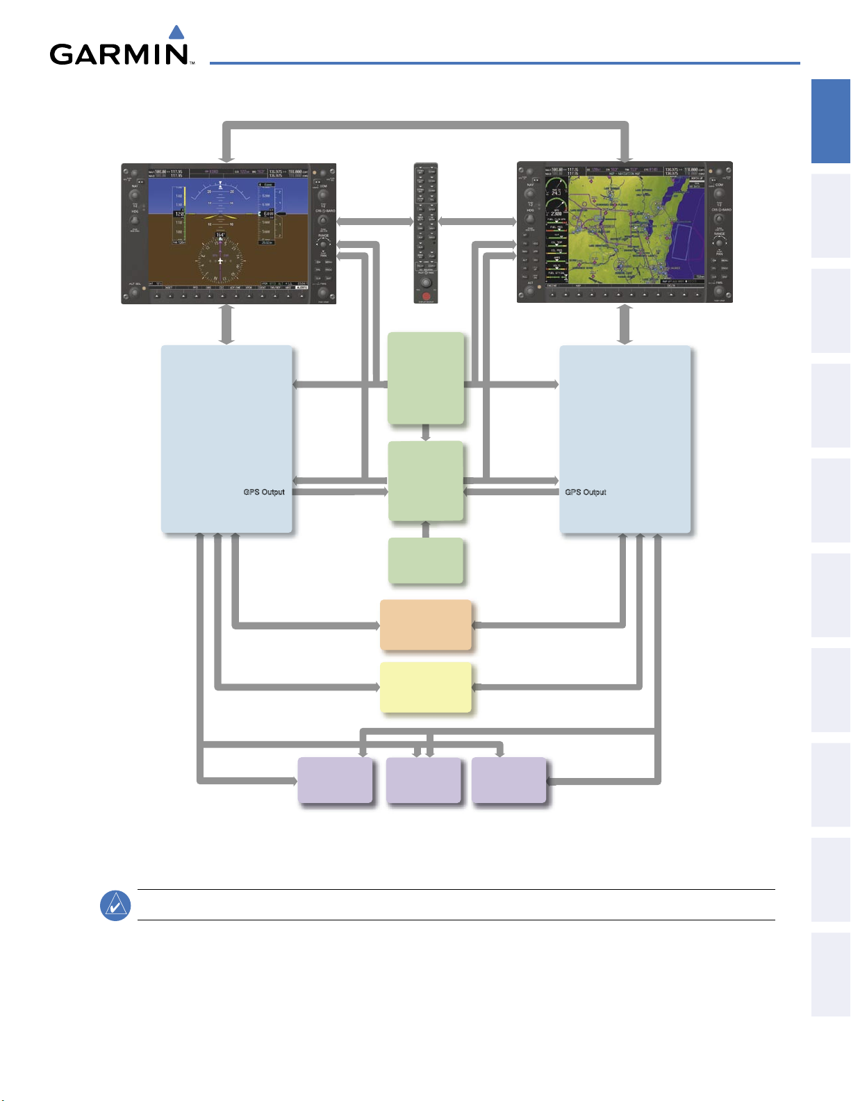
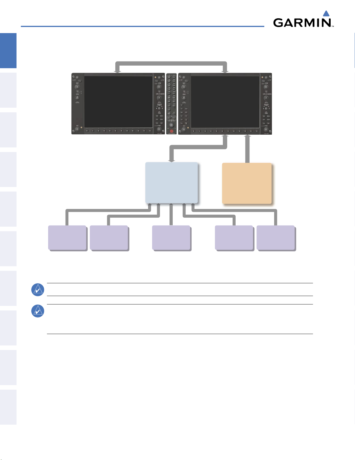
Figure 1-1 shows interactions between the LRUs. Additional/optional equipment are shown in Figure 1-2.
The Diamond DA40/40F may be optionally equipped with a GFC 700 Automated Flight Control System (AFCS),
providing flight director (FD), autopilot (AP), and manual electric trim (MET) functions of the G1000 System.
INSTRUMENTS
FLIGHT
EIS
AUDIO PANEL
& CNS
MANAGEMENT
FLIGHT
AVOIDANCE
HAZARD
190-00592-05 Rev. A
Garmin G1000 Pilot’s Guide for the Diamond DA40/40F
9
AFCS
ADDITIONAL
FEATURES
APPENDICES INDEX
Page 13
SYSTEM OVERVIEW
1.1 LINE REPLACEABLE UNITS
SYSTEM
OVERVIEW
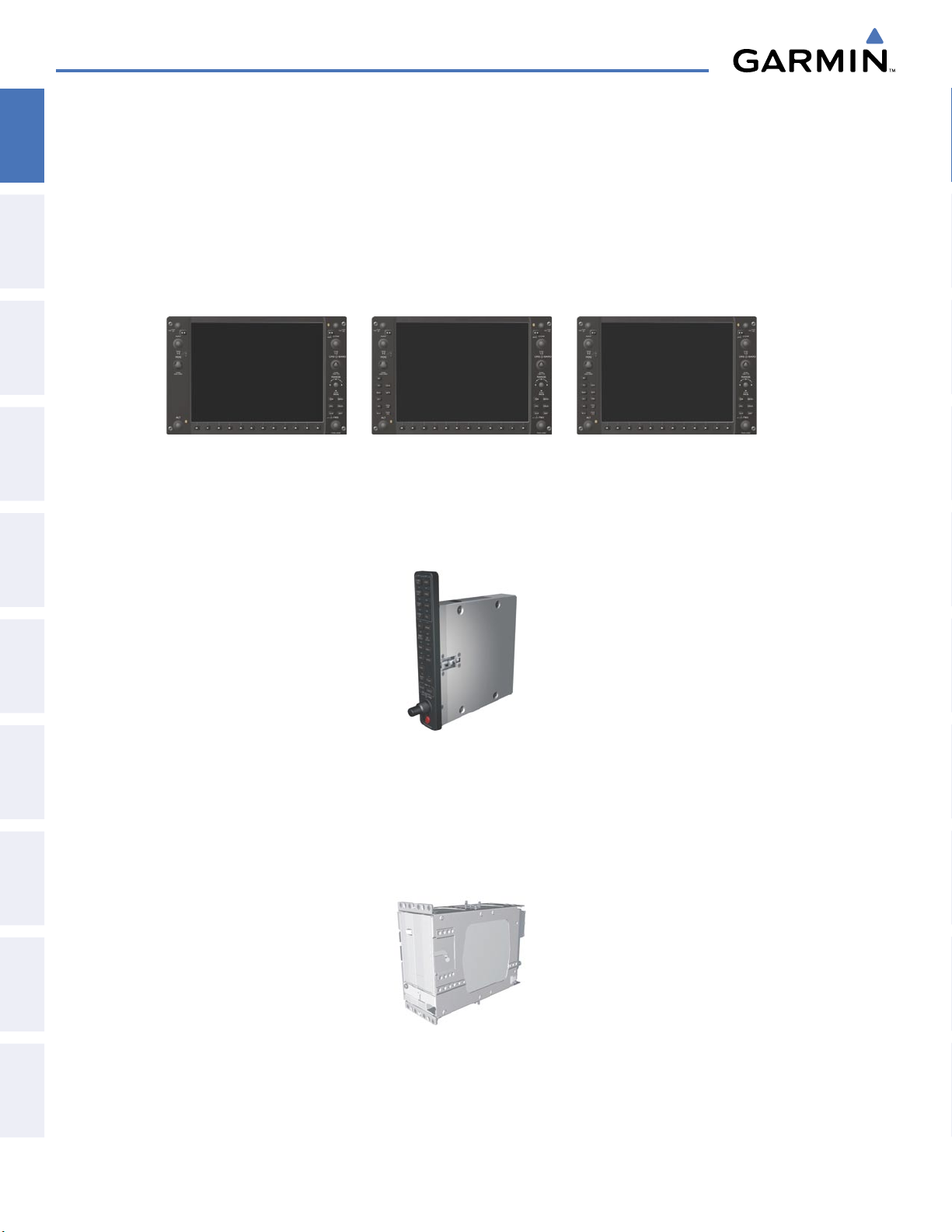
• GDU 1040/1042/1044 (2) – A GDU 1040 is configured as the Primary Flight Display (PFD) and a GDU 1040,
1042 or 1044 (1042/1044 for airframes equipped with the GFC 700) as a Multi Function Display (MFD). Both
displays feature 10.4-inch LCD screens with 1024 x 768 resolution. The displays communicate with each other
through a High-speed Data Bus (HSDB) Ethernet connection. Each display is also paired with an Ethernet
FLIGHT
INSTRUMENTS
EIS
& CNS
AUDIO PANEL
connection to an IAU.
•
GMA 1347
and marker beacon controls, and is installed between the displays. This unit also provides manual control of
display Reversionary Mode (red
with both IAUs using an RS-232 digital interface.
GDU 1040
GDU 1042
GDU 1044
– The Audio Panel integrates navigation/communication radio (NAV/COM) digital audio, intercom,
DISPLAY BACKUP
button; see Section 1.4, System Operation) and communicates
FLIGHT
MANAGEMENT
HAZARD
AVOIDANCE
AFCS
ADDITIONAL
APPENDICESINDEX
•
FEATURES
GIA 63/63W
(2) – The Integrated Avionics Units (IAU) function as the main communications hub, linking
all LRUs with the PFD. Each IAU contains a GPS receiver, a very high frequency (VHF) communication/
navigation/glideslope (COM/NAV/GS) receiver, and system integration microprocessors, and is paired with
the on-side display via an HSDB connection. The GIA 63W contains a GPS WAAS receiver. The IAUs are not
paired together and do not communicate with each other directly.
Garmin G1000 Pilot’s Guide for the Diamond DA40/40F
190-00592-05 Rev. A10
Page 14
SYSTEM OVERVIEW
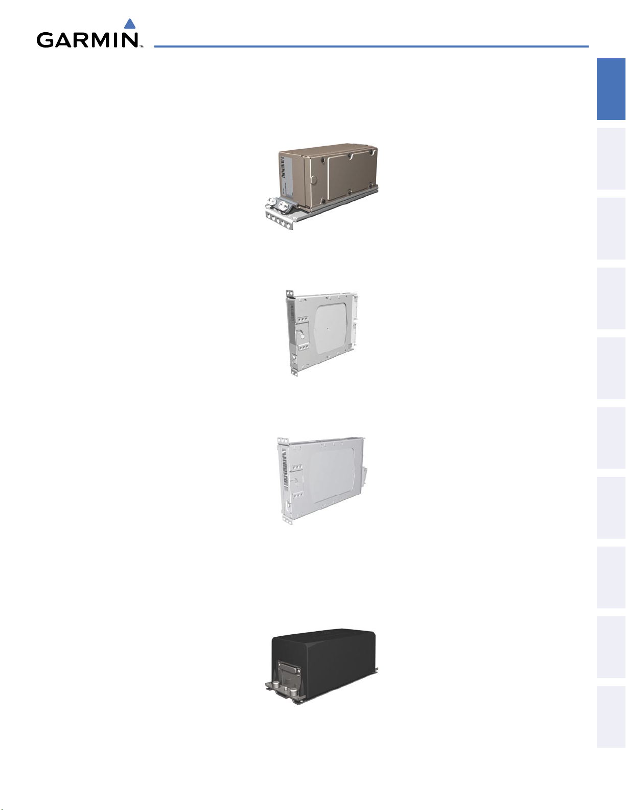
GDC 74A
(OAT) sensor. The ADC provides pressure altitude, airspeed, vertical speed, and OAT information to the
G1000 System, and it communicates with the primary IAU, displays, and AHRS using an ARINC 429 digital
interface.
•
GEA 71
unit communicates with both IAUs using an RS-485 digital interface.
– The Air Data Computer (ADC) processes data from the pitot/static system and outside air temperature
– The Engine Airframe Unit receives and processes signals from the engine and airframe sensors. This
OVERVIEW
SYSTEM
INSTRUMENTS
FLIGHT
EIS
AUDIO PANEL
& CNS
MANAGEMENT
FLIGHT
•
GTX 33
– The solid-state Transponder provides Modes A, C, and S capability and communicates with both IAUs
through an RS-232 digital interface.
•
GRS 77
(2) – The Attitude and Heading Reference System (AHRS) provides aircraft attitude and heading
information via ARINC 429 to both the PFD and the primary IAU. The AHRS contains advanced sensors
(including accelerometers and rate sensors) and interfaces with the Magnetometer to obtain magnetic field
information, with the ADC to obtain air data, and with both IAUs to obtain GPS information. AHRS operation
is discussed in Section 1.4, System Operation.
AVOIDANCE
HAZARD
AFCS
ADDITIONAL
FEATURES
APPENDICES INDEX
190-00592-05 Rev. A
Garmin G1000 Pilot’s Guide for the Diamond DA40/40F
11
Page 15
SYSTEM OVERVIEW
•
SYSTEM
OVERVIEW
FLIGHT
INSTRUMENTS
•
EIS
& CNS
AUDIO PANEL
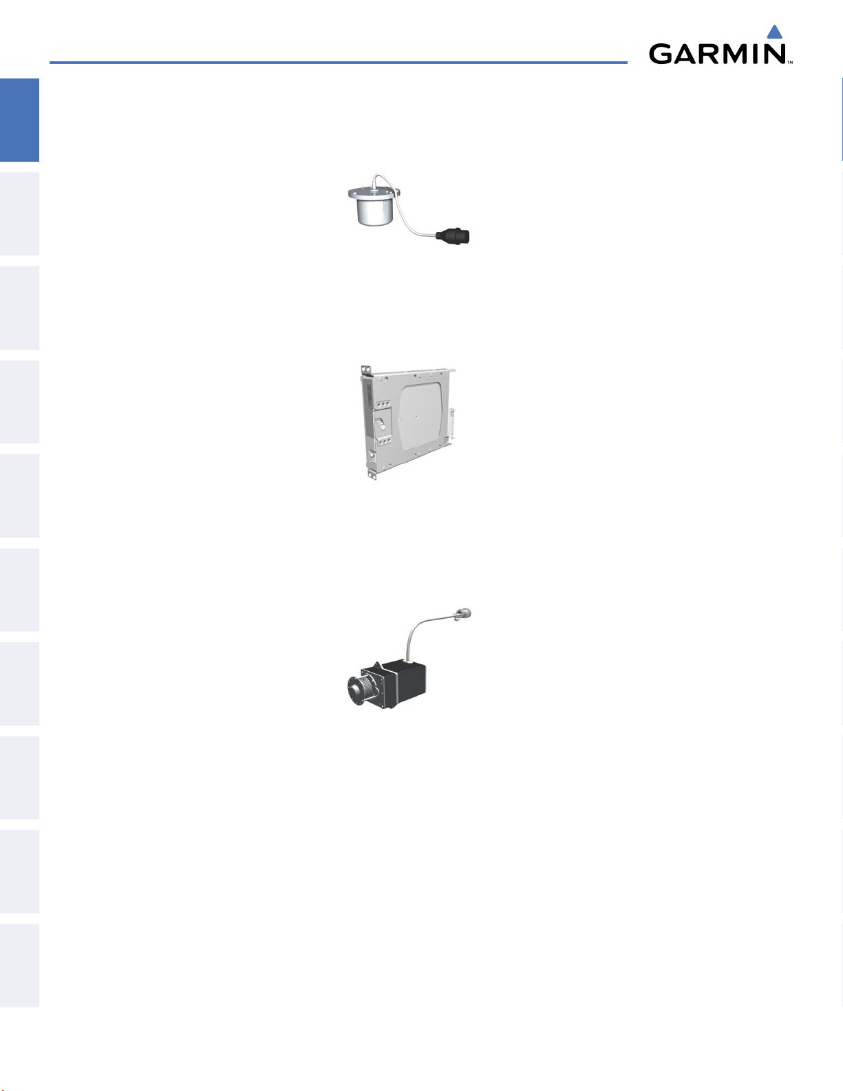
GMU 44
determine aircraft magnetic heading. This unit receives power directly from the AHRS and communicates with
it via an RS-485 digital interface.
GDL 69/69A
and the PFD Inset Map. The GDL 69A model is also capable of providing digital audio entertainment. The
Data Link Receiver communicates with the MFD via an HSDB connection. A subscription to XM Satellite Radio
Service is required to enable Data Link Receiver capability.
– The Magnetometer measures local magnetic field and sends data to the AHRS for processing to
– The Data Link Satellite Radio Receiver provides real-time weather information to MFD maps
FLIGHT
•
MANAGEMENT
The GSM 85 servo mounts are responsible for transferring the output torque of the servo actuators to the
HAZARD
AVOIDANCE
AFCS
FEATURES
ADDITIONAL
APPENDICESINDEX
GSA 81
and
GSM 85
– The GSA 81 servos are used for automatic control of pitch, pitch trim, and roll. These
units interface with each IAU.
mechanical flight-control surface linkages.
Garmin G1000 Pilot’s Guide for the Diamond DA40/40F
190-00592-05 Rev. A12
Page 16
GSA 81
Roll Servo
Autopilot Calculations
(optional)
GSA 81
Pitch Servo
Autopilot Calculations
(optional)
GSA 81
Pitch Trim Servo
Autopilot Calculations
(optional)
No. 1 GIA 63/63W
Integrated Avionics Unit
System Inegration Processors
I/O Processors
VHF COM
VHF NAV/LOC
GPS/WAAS
Glideslope
Flight Director (with GFC 700 option)
No. 2 GIA 63/63W
Integrated Avionics Unit
System Integration Processors
I/O Processors
VHF COM
VHF NAV/LOC
GPS/WAAS
Glideslope
GTX 33
Transponder
High-Speed Data Bus (Ethernet)
Reversionary
Control
GEA 71
Engine/Airframe
Unit
GDC 74A
Air Data
Computer
OAT
Airspeed
Altitude
Ve
rtical Speed
GRS 77
AHRS
Attitude
Rate of Turn
Slip/Skid
GMU 44
Magnetometer
Heading
GPS Output
GPS Output
Reversionary
Control
GMA 1347
Audio Panel
GDU 1040 (PFD)
GDU 1040/1044 (MFD)
SYSTEM OVERVIEW
OVERVIEW
SYSTEM
INSTRUMENTS
FLIGHT
EIS
AUDIO PANEL
& CNS
Figure 1-1 G1000 System Block Diagram
MANAGEMENT
FLIGHT
AVOIDANCE
HAZARD
AFCS
ADDITIONAL
FEATURES
APPENDICES INDEX
NOTE:
190-00592-05 Rev. A
The GDU 1044 is available in systems using the Garmin GFC 700 Automatic Flight Control System.
Garmin G1000 Pilot’s Guide for the Diamond DA40/40F
13
Page 17
SYSTEM OVERVIEW
High-Speed Data Bus (Ethernet)
No. 2 GIA 63/63W
Integrated A
vionics Unit
System Integration Processors
I/O Processors
VHF COM
VHF NAV/LOC
GPS/WAAS
Glideslope
GDL 69/69A
Data Link Receiver
Real-time Weather and
Digital Audio Entertainment
(subscription-based service)
Avidyne
TAS600-series
Traffic Information
(optional)
L3
Stormscope
Lightning Strike and
Thunderstorm Detection
(optional)
Becker
RA 3502-(1)
ADF Receiver
(optional)
Honeywell
KN 63
DME
(optional)
Honeywell
KAP 140
Autopilot
(optional)
SYSTEM
OVERVIEW
FLIGHT
INSTRUMENTS
EIS
& CNS
AUDIO PANEL
FLIGHT
MANAGEMENT
HAZARD
AVOIDANCE
AFCS
FEATURES
ADDITIONAL
APPENDICESINDEX
Figure 1-2 G1000 With Optional/Additional Interfaces
NOTE:
NOTE:
The GDU 1040 is available in systems using the Honeywell KAP 140 Autopilot.
For information on additional equipment shown in Figure 1-2, consult the applicable optional interface
user’s guide. This document assumes that the reader is already familiar with the operation of this additional
equipment.
Garmin G1000 Pilot’s Guide for the Diamond DA40/40F
190-00592-05 Rev. A14
Page 18
SYSTEM OVERVIEW
1.2 SECURE DIGITAL (SD) CARDS
NOTE:
Ensure the G1000 System is powered off before inserting an SD card.
NOTE:
Refer to Appendix B for instructions on updating databases.
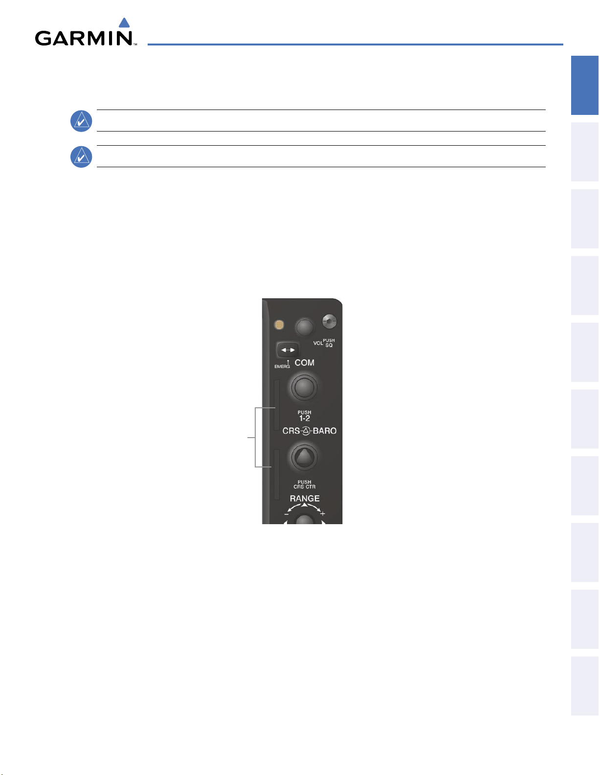
The PFD and MFD data card slots use Secure Digital (SD) cards and are located on the upper right side of the
display bezels. Each display bezel is equipped with two SD card slots. SD cards are used for aviation database
and system software updates as well as terrain database storage.
Installing an SD card:
1) Insert the SD card in the SD card slot, pushing the card in until the spring latch engages. The front of the card
should remain flush with the face of the display bezel.
2) To eject the card, gently press on the SD card to release the spring latch.
OVERVIEW
SYSTEM
INSTRUMENTS
FLIGHT
EIS
AUDIO PANEL
& CNS
MANAGEMENT
FLIGHT
SD Card Slots
Figure 1-3 Display Bezel SD Card Slots
AVOIDANCE
HAZARD
AFCS
ADDITIONAL
FEATURES
APPENDICES INDEX
190-00592-05 Rev. A
Garmin G1000 Pilot’s Guide for the Diamond DA40/40F
15
Page 19
SYSTEM OVERVIEW
1.3 SYSTEM POWER-UP
SYSTEM
OVERVIEW
FLIGHT
INSTRUMENTS
busses. The PFD, MFD, and supporting sub-systems include both power-on and continuous built-in test features
EIS
that exercise the processor, RAM, ROM, external inputs, and outputs to provide safe operation.
should disappear typically within the first minute of power-up. Upon power-up, key annunciator lights also
become momentarily illuminated on the Audio Panel and the display bezels.
& CNS
AUDIO PANEL
display valid attitude and heading fields typically within the first minute of power-up. The AHRS can align itself
both while taxiing and during level flight.
FLIGHT
• System version
• Copyright
MANAGEMENT
• Land database name and version
NOTE:
See the Aircraft Flight Manual (AFM) for specific procedures concerning avionics power application
and emergency power supply operation.
NOTE:
Refer to Appendix A for system-specific annunciations and alerts.
The G1000 System is integrated with the aircraft electrical system and receives power directly from electrical
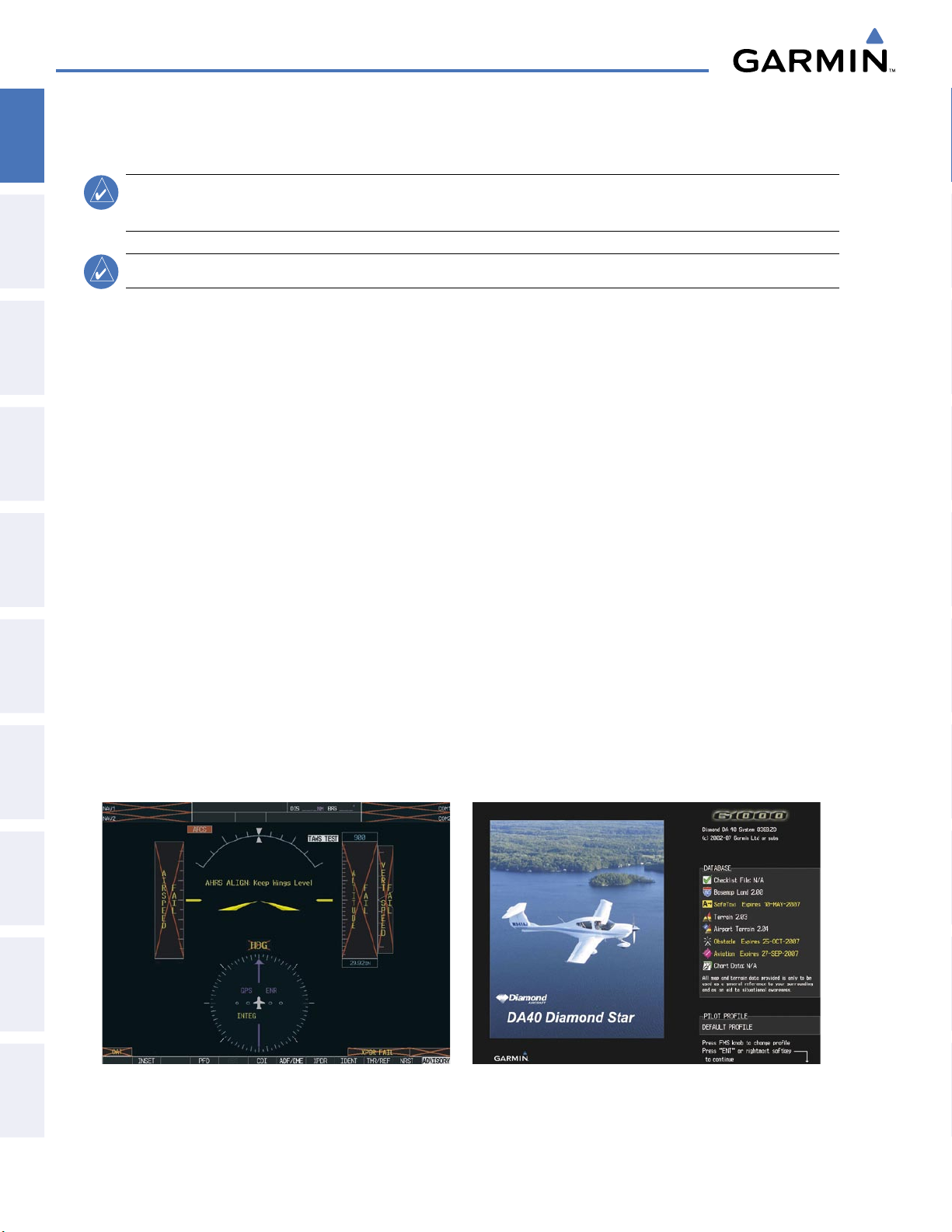
During system initialization, test annunciations are displayed, as shown in Figure 1-4. All system annunciations
On the PFD, the AHRS begins to initialize and displays “AHRS ALIGN: Keep Wings Level”. The AHRS should
When the MFD powers up, the splash screen (Figure 1-5) displays the following information:
• Obstacle database name and version
• Terrain database name and version
• Aviation database name, version, and effective dates
HAZARD
information has been reviewed for currency (to ensure that no databases have expired), the pilot is prompted to
AVOIDANCE
continue.
displayed upon pressing the key a second time. When the system has acquired a sufficient number of satellites to
AFCS
ADDITIONAL
APPENDICESINDEX
determine a position, the aircraft’s current position is shown on the Navigation Map Page.
FEATURES
Current database information includes valid operating dates, cycle number, and database type. When this
Pressing the
ENT Key (or right-most softkey) acknowledges this information, and the Navigation Map Page is
Figure 1-4 PFD Initialization Figure 1-5 Example (DA40) MFD Power-up Splash Screen
Garmin G1000 Pilot’s Guide for the Diamond DA40/40F
190-00592-05 Rev. A16
Page 20
1.4 SYSTEM OPERATION
SYSTEM OVERVIEW
OVERVIEW
SYSTEM
NOTE:
Refer to Appendix A for detailed descriptions of all alerts and annunciations. Refer to the Aircraft
Flight Manual (AFM) for additional information regarding pilot responses to these annunciations.
The displays are connected together via a single Ethernet bus for high-speed communication. As shown in
Figure 1-1, each IAU is connected to the on-side display. This allows the units to share information, enabling true
system integration
DISPLAY OPERATION
NOTE:
In normal operating mode, backlighting can only be adjusted from the PFD. In Reversionary Mode, it
can be adjusted from the remaining display.
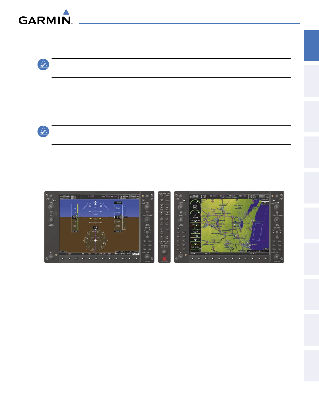
In normal operating mode, the PFD presents graphical flight instrumentation (attitude, heading, airspeed,
altitude, vertical speed), replacing the traditional flight instrument cluster (see the Flight Instruments Section
for more information). The MFD normally displays a full-color moving map with navigation information (see
the Flight Management Section), while the left portion of the MFD is dedicated to the Engine Indication System
(EIS; see the EIS Section). Both displays offer control for COM and NAV frequency selection.
INSTRUMENTS
FLIGHT
EIS
AUDIO PANEL
& CNS
MANAGEMENT
FLIGHT
AVOIDANCE
HAZARD
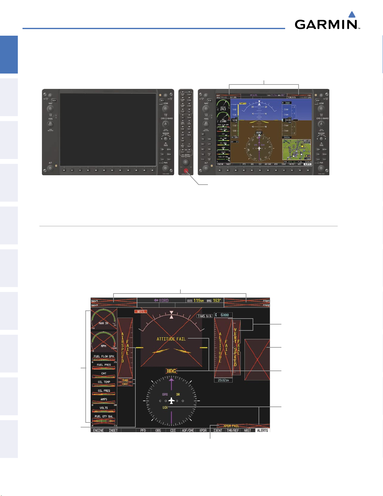
In the event of a display failure, the G1000 System automatically switches to reversionary (backup) mode. In
Reversionary Mode, all important flight information from the PFD is presented on the remaining display in the
same format as in normal operating mode, with the addition of the EIS. EIS operation while in Reversionary
Mode is discussed in the EIS Section. As when the PFD is operating normally, windows for flight planning,
nearest airports, and procedures are available. The Inset Map is moved to the right side of the display.
If a display fails, the appropriate IAU-display Ethernet interface is cut off. Thus, the IAU can no longer
communicate with the remaining display (refer to Figure 1-1), and the NAV and COM functions provided to
the failed display by the IAU are flagged as invalid on the remaining display. The system reverts to backup
paths for the AHRS, ADC, Engine/Airframe Unit, and Transponder, as required. The change to backup paths is
completely automated for all LRUs and no pilot action is required.
190-00592-05 Rev. A
Figure 1-6 G1000 Normal Operation
Garmin G1000 Pilot’s Guide for the Diamond DA40/40F
17
AFCS
ADDITIONAL
FEATURES
APPENDICES INDEX
Page 21
SYSTEM OVERVIEW
If the system fails to detect a display problem, Reversionary Mode may be manually activated by pressing the
SYSTEM
OVERVIEW
FLIGHT
INSTRUMENTS
EIS
Audio Panel’s red
DISPLAY BACKUP
Button. Pressing this button again deactivates Reversionary Mode.
NAV1 and COM1 (provided by the
failed PFD) Flagged Invalid
& CNS
AUDIO PANEL
FLIGHT
MANAGEMENT
HAZARD
AVOIDANCE
AFCS
FEATURES
ADDITIONAL
DISPLAY BACKUP
Deactivates Reversionary Mode on Both Displays
Figure 1-7 G1000 Reversionary Mode (Failed PFD)
Button Manually Activates/
G1000 SYSTEM ANNUNCIATIONS
When an LRU or an LRU function fails, a large red ‘X’ is typically displayed over the instrument experiencing
failed data (Figure 1-8 displays all possible flags and responsible LRUs). The G1000 System alerts the pilot
when backup paths are utilized by the LRUs. Upon G1000 power-up, certain instruments remain invalid as
equipment begins to initialize. All instruments should be operational within one minute of power-up. If any
instrument remains flagged, the G1000 should be serviced by a Garmin-authorized repair facility.
GIA 63/63W Integrated Avionics Units
GDC 74A
Air Data
Computer
Database
GEA 71
Engine
Airframe Unit
OR
GIA 63/63W
Integrated
Avionics Unit
Mismatch in the
PFD and MFD
GRS 77 AHRS
OR GMU 44
Magnetometer
APPENDICESINDEX
GDC 74A
Air Data
Computer
GTX 33 Transponder OR GIA 63/63W
Integrated Avionics Units
Figure 1-8 G1000 System Failure Annunciations
Garmin G1000 Pilot’s Guide for the Diamond DA40/40F
GIA 63/63W
Integrated
Avionics Units
190-00592-05 Rev. A18
Page 22
SYSTEM OVERVIEW
SYSTEM STATUS
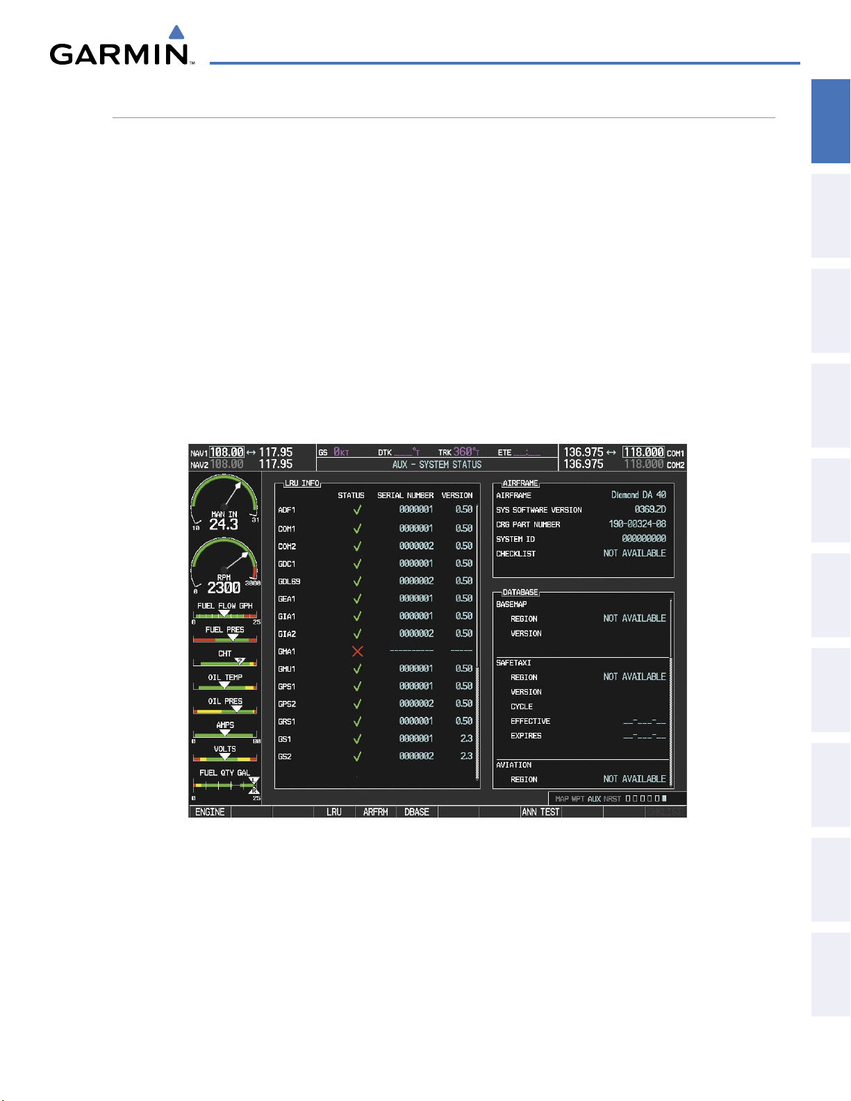
The System Status Page displays the statuses, serial numbers, and software version numbers for all detected
system LRUs. Active LRUs are indicated by green check marks; failed, by red ‘X’s. Failed LRUs should be noted
and a service center or Garmin-authorized dealer informed.
Viewing LRU information:
1) Use the FMS Knob to select the AUX - System Status Page.
2) To place the cursor in the ‘LRU Info’ Box,
OVERVIEW
SYSTEM
INSTRUMENTS
FLIGHT
a) Press the LRU Softkey.
Or:
a) Press the MENU Key.
b) With ‘Select LRU Window’ highlighted, press the ENT Key.
3) Use the FMS Knob to scroll through the box to view LRU status information.
EIS
AUDIO PANEL
& CNS
MANAGEMENT
FLIGHT
AVOIDANCE
HAZARD
AFCS
190-00592-05 Rev. A
Figure 1-9 Example System Status Page
Garmin G1000 Pilot’s Guide for the Diamond DA40/40F
19
ADDITIONAL
FEATURES
APPENDICES INDEX
Page 23
SYSTEM OVERVIEW
Pertinent information on all system databases is also displayed on this page. Refer to the Appendices and
SYSTEM
OVERVIEW
Additional Features sections for more information about databases.
Viewing database information:
1) Use the FMS Knob to select the AUX - System Status Page.
FLIGHT
INSTRUMENTS
EIS
& CNS
AUDIO PANEL
FLIGHT
MANAGEMENT
HAZARD
AVOIDANCE
2) To place the cursor in the ‘Database’ Box,
a) Press the DBASE Softkey.
Or:
a) Press the MENU Key.
b) Highlight ‘Select Dbase Window’ and press the ENT Key.
3) Use the FMS Knob to scroll through the box to view database status information.
The G1000 uses aural tones to convey the priority of airframe-specific alerts. The alerting system’s annunciation
tone may be tested from the System Status Page. Refer to the Appendices for airframe-specific alerts.
Testing the system annunciation tone:
1) Use the FMS Knob to select the AUX - System Status Page.
2) Press the ANN TEST Softkey.
Or:
a) Press the MENU Key.
b) Highlight ‘Enable Annunciator Test Mode’ and press the ENT Key.
AFCS
FEATURES
ADDITIONAL
APPENDICESINDEX
Garmin G1000 Pilot’s Guide for the Diamond DA40/40F
190-00592-05 Rev. A20
Page 24
AHRS OPERATION
Attitude/Heading Invalid
AHRS
no-GP
S
Mode
AHRS Normal
Operation
AHRS no-
Mag Mode
AHRS no-Mag/
no-Air Mode
Heading Invalid
available
available
unavailable
una
vailab
le
available
unavailable
unavailable
available
Air Data
Magnetometer Data
unavailable
available
GPS Data
Magnetometer Data
Air Data
SYSTEM OVERVIEW
OVERVIEW
SYSTEM
NOTE:
Aggressive maneuvering while AHRS is not operating normally may degrade AHRS accuracy.
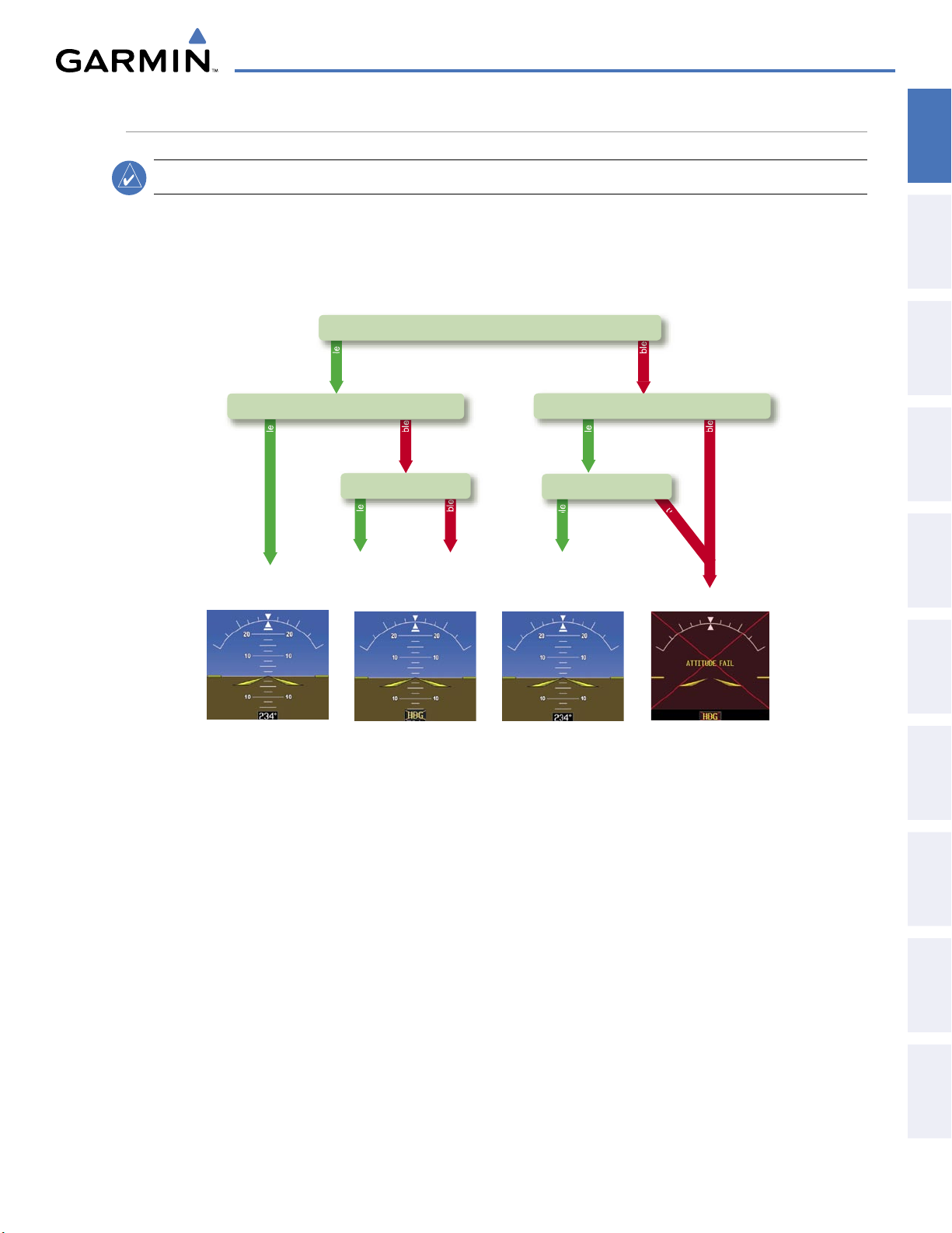
The Attitude and Heading Reference System (AHRS) performs attitude, heading, and vertical acceleration
calculations for the G1000 System, utilizing GPS, magnetometer, and air data in addition to information
from its internal sensors. Attitude and heading information are updated on the PFD while the AHRS receives
appropriate combinations of information from the external sensor inputs.
INSTRUMENTS
FLIGHT
EIS
AUDIO PANEL
& CNS
MANAGEMENT
FLIGHT
AVOIDANCE
HAZARD
Loss of GPS, magnetometer, or air data inputs is communicated to the pilot by message advisory alerts (refer
to Appendix A for specific AHRS alert information). Any failure of the internal AHRS inertial sensors results in
loss of attitude and heading information (indicated by red ‘X’ flags over the corresponding flight instruments).
Two GPS inputs are provided to the AHRS. If GPS information from one of the inputs fails, the AHRS uses
the remaining GPS input and an alert message is issued to inform the pilot. If both GPS inputs fail, the AHRS
can continue to provide attitude and heading information to the PFD as long as magnetometer and airspeed
data are available and valid.
If the magnetometer input fails, the AHRS continues to output valid attitude information; however, the
heading output on the PFD is flagged as invalid with a red ‘X’.
Failure of the air data input has no effect on the AHRS output while AHRS is receiving valid GPS information.
Invalid/unavailable airspeed data in addition to GPS failure results in loss of all attitude and heading
information.
Figure 1-10 AHRS Operation
AFCS
ADDITIONAL
FEATURES
APPENDICES INDEX
190-00592-05 Rev. A
Garmin G1000 Pilot’s Guide for the Diamond DA40/40F
21
Page 25
SYSTEM OVERVIEW
GPS RECEIVER OPERATION
SYSTEM
OVERVIEW
FLIGHT
INSTRUMENTS
EIS
& CNS
AUDIO PANEL
FLIGHT
MANAGEMENT
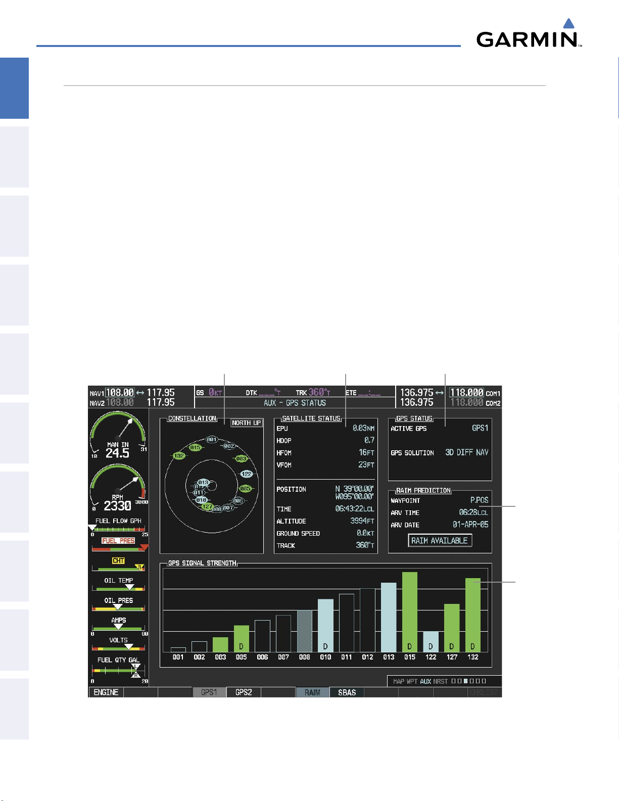
Each Integrated Avionics Unit (IAU) contains a GPS receiver. Internal system checking is performed to
ensure both GPS receivers are providing accurate data to the PFD. When both GPS receivers are providing
accurate data, the GPS receiver producing the better solution is used by the system. Information collected by
the specified receiver (GPS1 for the #1 IAU or GPS2 for the #2 IAU) may be viewed on the AUX - GPS Status
Page.
Viewing GPS receiver status information:
1) Use the large FMS Knob on the MFD to select the Auxiliary Page Group (see Section 1.6 for information on
navigating MFD page groups).
2) Use the small FMS Knob to select GPS Status Page (third page in the AUX Page Group).
3) To change the selected GPS receiver:
Press the desired
GPS
Softkey.
Or:
a) Press the MENU Key.
b) Use the FMS Knob to highlight the receiver which is not selected and press the ENT Key.
Satellite Constellation
Diagram
Satellite Signal
Information
GPS Receiver
Status
HAZARD
AVOIDANCE
AFCS
FEATURES
ADDITIONAL
APPENDICESINDEX
RAIM
Availability
Prediction
Satellite
Signal
Strength
Bars
Figure 1-11 GPS Status Page
Garmin G1000 Pilot’s Guide for the Diamond DA40/40F
190-00592-05 Rev. A22
Page 26
SYSTEM OVERVIEW
For WAAS-enabled systems, GPS sensor annunciations are most often seen after system power-up when one
GPS receiver has acquired satellites before the other or one of the GPS receivers has not yet acquired a WAAS
signal. While the aircraft is on the ground, the WAAS signal may be blocked by obstructions causing one GPS
receiver to have difficulty acquiring a good signal. Also, while airborne, turning the aircraft may result in one of
the GPS receivers temporarily losing the WAAS signal. If no failure message exists, check the GPS Status Page
and compare the information for GPS1 and GPS2. Discrepancies may indicate a problem.
GPS RECEIVER STATUS
The GPS solution type (ACQUIRING, 2D NAV, 2D DIFF NAV, 3D NAV, 3D DIFF NAV) for the active
GPS receiver (GPS1 or GPS2) is shown in the upper right of the GPS Status Page. When the receiver is
in the process of acquiring enough satellite signals for navigation, the receiver uses satellite orbital data
(collected continuously from the satellites) and last known position to determine the satellites that should be
in view. ACQUIRING is indicated as the solution until a sufficient number of satellites have been acquired
for computing a solution.
When the receiver is in the process of acquiring a 3D navigational GPS solution, 3D NAV is indicated as the
solution until the 3D differential fix has finished acquisition. Satellite-Based Augmentation System (SBAS)
status should be indicated as INACTIVE at this point. When acquisition is complete, the solution status
changes to 3D DIFF NAV and SBAS becomes active.
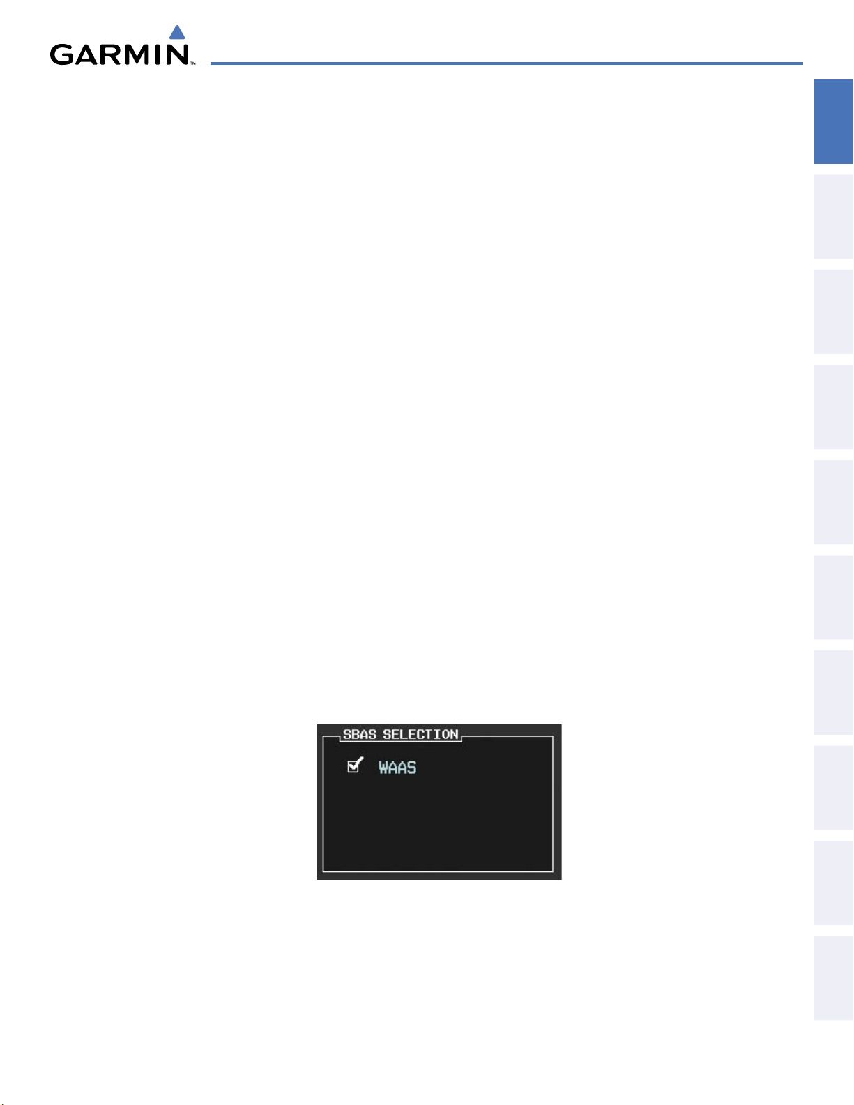
In certain situations, such as when the aircraft is outside or on the fringe of the WAAS coverage area, it may
be desirable to disable WAAS (although it is not recommended). When disabled, the SBAS field in the GPS
Status box indicates DISABLED.
OVERVIEW
SYSTEM
INSTRUMENTS
FLIGHT
EIS
AUDIO PANEL
& CNS
MANAGEMENT
FLIGHT
Disabling WAAS (for WAAS-enabled systems):
1) Select the GPS Status Page.
2) Press the SBAS Softkey. The RAIM PREDICTION box is replaced by SBAS SELECTION.
3) Press the
FMS
Knob
. ‘WAAS’ is highlighted.
4) Press the ENT Key to uncheck the box.
5) Press the FMS Knob to remove the cursor.
Figure 1-12 Enable/Disable WAAS
AVOIDANCE
HAZARD
AFCS
ADDITIONAL
FEATURES
APPENDICES INDEX
190-00592-05 Rev. A
Garmin G1000 Pilot’s Guide for the Diamond DA40/40F
23
Page 27
SYSTEM OVERVIEW
RAIM PREDICTION
SYSTEM
OVERVIEW
FLIGHT
INSTRUMENTS
EIS
& CNS
AUDIO PANEL
FLIGHT
MANAGEMENT
Receiver Autonomous Integrity Monitoring (RAIM) is a GPS receiver function that performs a consistency
check on all tracked satellites. RAIM ensures that the available satellite geometry allows the receiver to
calculate a position within a specified RAIM protection limit (2.0 nautical miles for oceanic and enroute, 1.0
nm for terminal, and 0.3 nm for non-precision approaches). During oceanic, enroute, and terminal phases of
flight, RAIM is available nearly 100% of the time.
The RAIM prediction function also indicates whether RAIM is available at a specified date and time. RAIM
computations predict satellite coverage within ±15 min of the specified arrival date and time. In G1000
systems with WAAS enabled, performing RAIM prediction is not necessary in most cases. However, if the
selected approach is outside the WAAS coverage area, it may be necessary to perform a RAIM prediction for
the intended approach.
Because of the tighter protection limit on approaches, there may be times when RAIM is not available. The
G1000 automatically monitors RAIM and warns with an alert message when it is not available. If RAIM is not
predicted to be available for the final approach course, the approach does not become active, as indicated by
the messages “Approach is not active”. If RAIM is not available when crossing the FAF, the missed approach
procedure must be flown.
Predicting RAIM availability:
1) Select the GPS Status Page.
2) Press the RAIM Softkey.
2) Press the
FMS
Knob
. The ‘WAYPOINT’ field is highlighted.
HAZARD
AVOIDANCE
AFCS
FEATURES
ADDITIONAL
APPENDICESINDEX
3) Turn the small FMS Knob to display the Waypoint Information Window.
4) Enter the desired waypoint and press the ENT Key (refer to Section 1.6 for instructions on data entry).
Or:
a) To use the present position, press the MENU Key.
b) With ‘Set WPT to Present Position’ highlighted, press the ENT Key.
c) Press the ENT Key to accept the waypoint entry.
5) Enter an arrival time and press the ENT Key.
6) Enter an arrival date and press the ENT Key.
7) With the cursor highlighting ‘COMPUTE RAIM?’, press the ENT Key. Once RAIM availability is computed, one
of the following is displayed:
• ‘COMPUTE RAIM?’—RAIM has not been computed for the current waypoint, time, and date combination
• ‘COMPUTING AVAILABILITY’—RAIM calculation in progress
• ‘RAIM AVAILABLE’—RAIM is predicted to be available for the specified waypoint, time, and date
• ‘RAIM NOT AVAILABLE’—RAIM is predicted to be unavailable for the specified waypoint, time, and date
Garmin G1000 Pilot’s Guide for the Diamond DA40/40F
190-00592-05 Rev. A24
Page 28
SYSTEM OVERVIEW
SATELLITE INFORMATION
Satellites currently in view are shown at their respective positions on a satellite constellation diagram.
This sky view is always oriented north-up, with the outer circle representing the horizon, the inner circle
representing 45° above the horizon, and the center point showing the position directly overhead. Each satellite
is represented by an oval containing the Pseudo-random noise (PRN) number (i.e., satellite identification
number). Satellites whose signals are currently being used are represented by solid ovals.
The GPS Status Page can be helpful in troubleshooting weak (or missing) signal levels due to poor satellite
coverage or installation problems. As the GPS receiver locks onto satellites, a signal strength bar is displayed
for each satellite in view, with the appropriate satellite PRN number (01-32 or 120-138 for WAAS) below each
bar. The progress of satellite acquisition is indicated by signal bar appearance:
• No signal strength bar—Receiver is looking for the indicated satellite.
OVERVIEW
SYSTEM
INSTRUMENTS
FLIGHT
EIS
• Hollow signal strength bar—Receiver has found the satellite and is collecting data. Each satellite has a 30-
second data transmission that must be collected (signal strength bar is hollow) before the satellite may be
used for navigation (signal strength bar becomes solid).
• Solid signal strength bar—Receiver has collected the necessary data and the satellite signal can be used.
• Checkered signal strength bar—Receiver has excluded the satellite (Fault Detection and Exclusion; FDE).
• “D” indication on signal strength bar—Satellite is being used for differential computations.
• Green signal strength bar—Satellites that are actually being used in the position calculation.
• Blue signal strength bar—Satellite is locked on but not yet being used in the position calculation.
Using the current satellite signal information, they system calculates the aircraft’s GPS position, time,
altitude, ground speed, and track for the aircraft (displayed below the satellite signal accuracy measurements
for reference). The following quantities denote the accuracy of the aircraft’s GPS fix:
• Estimated Position Uncertainty (EPU)—A statistical error indication; the radius of a circle centered on an
estimated horizontal position in which actual position has 95% probability of lying
• Horizontal Dilution of Precision (HDOP)—Measures satellite geometry quality (i.e., number of satellites
received and where they are relative to each other) on a range from 0.0 to 9.9, with lower numbers denoting
better accuracy
• Horizontal and Vertical Figures of Merit (HFOM and VFOM)—Measures of horizontal and vertical position
uncertainty; the current 95% confidence horizontal and vertical accuracy values reported by the GPS
receiver
AUDIO PANEL
& CNS
MANAGEMENT
FLIGHT
AVOIDANCE
HAZARD
AFCS
ADDITIONAL
FEATURES
190-00592-05 Rev. A
Garmin G1000 Pilot’s Guide for the Diamond DA40/40F
APPENDICES INDEX
25
Page 29
SYSTEM OVERVIEW
1.5 G1000 CONTROLS
SYSTEM
OVERVIEW
FLIGHT
INSTRUMENTS
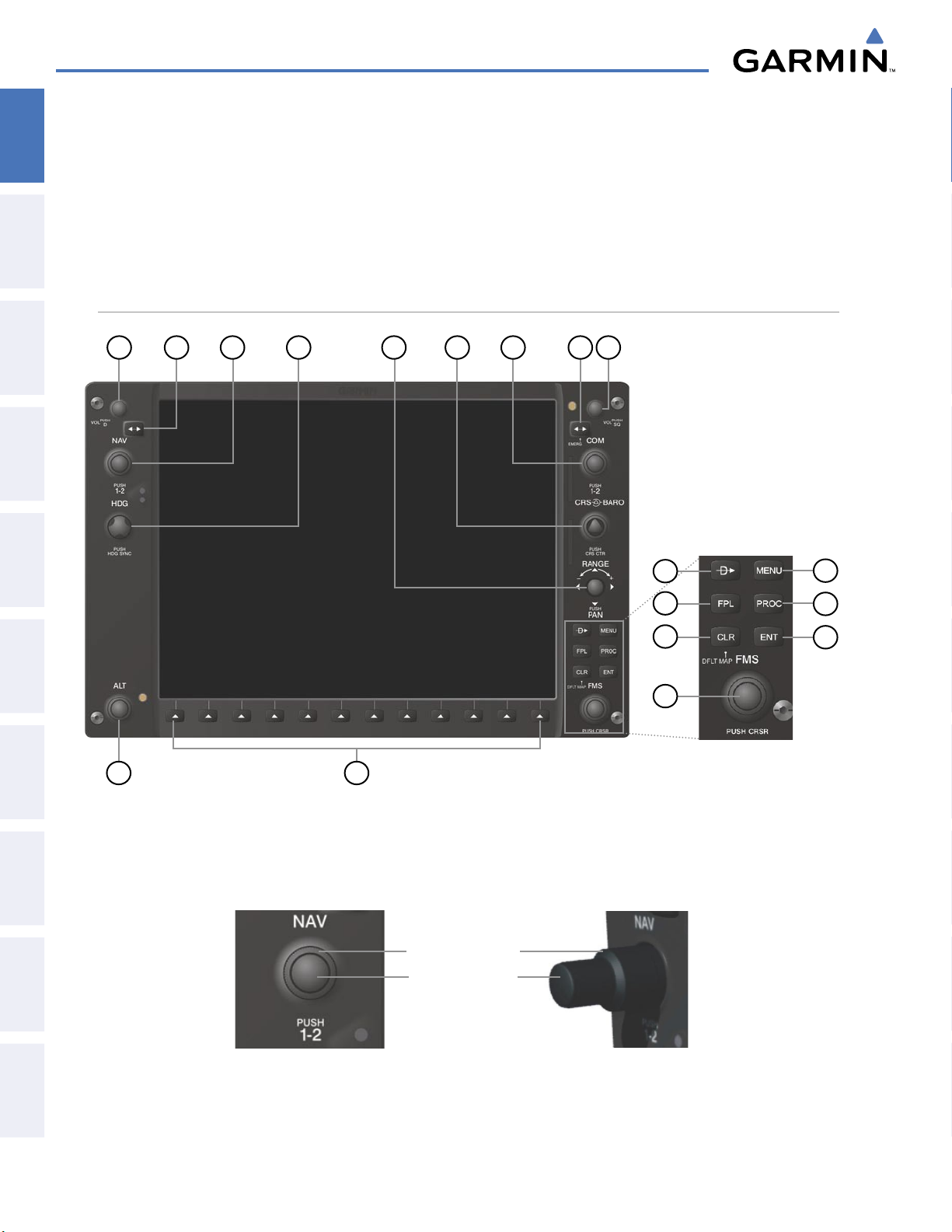
The G1000 controls have been designed to simplify operation of the system and minimize workload and the
time required to access sophisticated functionality. Controls are located on the PFD and MFD bezels and Audio
Panel. PFD and MFD controls and softkeys are discussed in this section. See the Audio Panel and CNS Section
for more information about Audio Panel and NAV/COM controls. AFCS controls (on the bezel of the MFD) are
described in the AFCS section.
PFD/MFD CONTROLS
EIS
& CNS
AUDIO PANEL
FLIGHT
MANAGEMENT
HAZARD
AVOIDANCE
AFCS
18
1
2
3
4
5
17
6
7
9
8
10
11
12
16
13
14
15
FEATURES
ADDITIONAL
APPENDICESINDEX
Figure 1-13 PFD/MFD Controls
The NAV, CRS/BARO, COM, FMS, and ALT knobs are concentric dual knobs, each having small (inner)
and large (outer) control portion. When a portion of the knob is not specified in the text, either may be used.
Large (Outer) Knob
Small (Inner) Knob
Figure 1-14 Dual Concentric Knob
Garmin G1000 Pilot’s Guide for the Diamond DA40/40F
190-00592-05 Rev. A26
Page 30
1
NAV VOL/ID Knob
SYSTEM OVERVIEW
Turn to control NAV audio volume (shown in the NAV Frequency Box as a
percentage)
OVERVIEW
SYSTEM
2
NAV Frequency
Transfer Key
3
NAV Knob
4
Heading Knob
5
Joystick
6
CRS/BARO Knob
7
COM Knob
8
COM Frequency
Transfer Key
(EMERG)
9
COM VOL/SQ Knob
Press to toggle Morse code identifier audio on/off
Transfers the standby and active NAV frequencies
Turn to tune NAV receiver standby frequencies (large knob for MHz; small for kHz)
Press to toggle light blue tuning box between NAV1 and NAV2
Turn to manually select a heading
Press to display a digital heading momentarily to the left of the Horizontal Situation
Indicator (HSI) and synchronize the Selected Heading to the and current heading
Turn to change map range
Press to activate Map Pointer and move in desired direction to pan map
Turn large knob for altimeter barometric pressure setting
Turn small knob to adjust course (only when HSI is in VOR or OBS Mode)
Press to re-center the CDI and return course pointer directly to bearing of active
waypoint/station
Turn to tune COM transceiver standby frequencies (large knob for MHz; small for
kHz)
Press to toggle light blue tuning box between COM1 and COM2
The selected COM (green) is controlled with the
COM MIC Key (Audio Panel).
Transfers the standby and active COM frequencies
Press and hold two seconds to tune the emergency frequency (121.5 MHz)
automatically into the active frequency field
Turn to control COM audio volume level (shown as a percentage in the COM
Frequency Box)
INSTRUMENTS
FLIGHT
EIS
AUDIO PANEL
& CNS
MANAGEMENT
FLIGHT
AVOIDANCE
HAZARD
AFCS
10
Direct-to Key ( )
11
FPL Key
12
CLR Key
(DFLT MAP)
13
MENU Key
14
PROC Key
15
ENT Key
190-00592-05 Rev. A
Press to turn the COM automatic squelch on/off
Activates the direct-to function and allows the user to enter a destination waypoint
and establish a direct course to the selected destination (specified by identifier,
chosen from the active route)
Displays flight plan information
Erases information, cancels entries, or removes menus
Press and hold to display the MFD Navigation Map Page (MFD only).
Displays a context-sensitive list of options for accessing additional features or making
setting changes
Gives access to IFR departure procedures (DPs), arrival procedures (STARs), and
approach procedures (IAPs) for a flight plan or selected airport
Validates/confirms selection or data entry
Garmin G1000 Pilot’s Guide for the Diamond DA40/40F
27
ADDITIONAL
FEATURES
APPENDICES INDEX
Page 31

SYSTEM OVERVIEW
SYSTEM
OVERVIEW
FLIGHT
INSTRUMENTS
EIS
& CNS
AUDIO PANEL
FLIGHT
MANAGEMENT
16
FMS Knob
(Flight Management
System Knob)
Press to turn the selection cursor on/off
Data Entry: With cursor on, turn to enter data in the highlighted field (large
knob moves cursor location; small knob selects character for highlighted cursor
location)
Scrolling: When a list of information is too long for the window/box, a scroll bar
appears, indicating more items to view. With cursor on, turn large knob to scroll
through the list.
Page Selection: Turn knob on MFD to select the page to view (large knob selects a
page group; small knob selects a specific page from the group)
17
Softkey Selection
Press to select softkey shown above the bezel key on the PFD/MFD display
Keys
18
ALT Knob
Sets the Selected Altitude, shown above the Altimeter (the large knob selects the
thousands, the small knob selects the hundreds)
SOFTKEY FUNCTION
The softkeys are located along the bottoms of the displays. The softkeys shown depend on the softkey level
or page being displayed. The bezel keys below the softkeys can be used to select the appropriate softkey. When
a softkey is selected, its color changes to black text on gray background and remains this way until it is turned
off, at which time it reverts to white text on black background. When a softkey function is disabled, the softkey
label is subdued (dimmed).
HAZARD
AVOIDANCE
AFCS
FEATURES
ADDITIONAL
APPENDICESINDEX
Softkeys revert to the previous level after 45 seconds of inactivity.
Bezel-Mounted
Softkeys (Press)
Softkey
On
Figure 1-15 Softkeys (Second-Level PFD Configuration)
Softkey Names
(Displayed)
In the following descriptions, top level softkeys are denoted with bullets.
PFD SOFTKEYS
The
CDI, IDENT, TMR/REF, NRST,
gray background and automatically switch back to white text on black background when selected.
The PFD softkeys provide control over flight management functions, including GPS, NAV, terrain, traffic,
and lightning (optional). Each softkey sublevel has a
previous level. The ALERTS Softkey is visible at all softkey levels (label changes if messages are issued).
and
ALERTS
softkeys undergo a momentary change to black text on
BACK Softkey which can be selected to return to the
Garmin G1000 Pilot’s Guide for the Diamond DA40/40F
190-00592-05 Rev. A28
Page 32
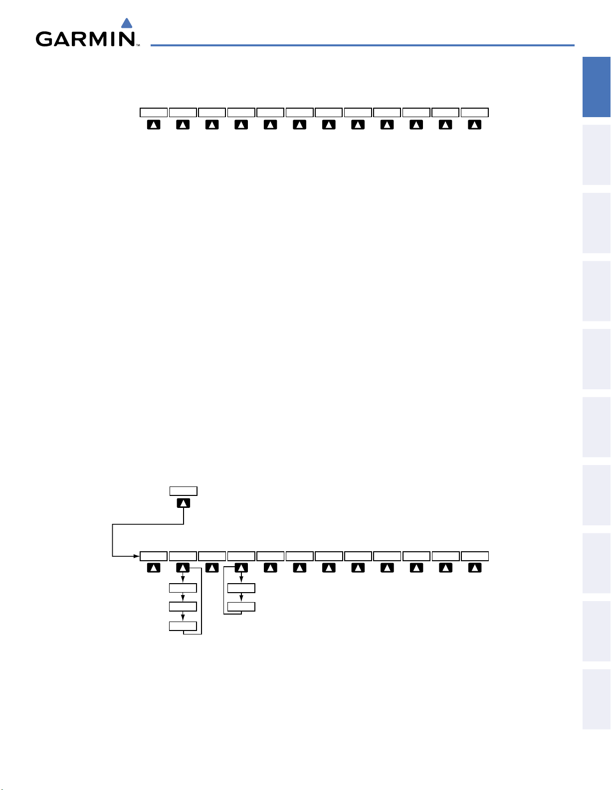
INSET
XPDR
IDENT
TMR/REF
NRST
ALERTS
OBS
PFD
CDI
Press the CDI Softkey to cycle through
navigation sources:
- GPS
- NAV1 (VOR/LOC)
- NAV2 (VOR/LOC)
ADF/DME
(optional)
• INSET
INSET
XPDR
IDENT
TMR/REF
NRST
ALERTS
OBS
PFD
CDI
Press the CDI Softkey to cycle through
navigation sources
:
- GPS
- NAV1 (VOR/LOC)
- NAV2 (VOR/LOC)
ADF/DME
(optional)
BACK
Press the OFF or BACK Softkey
to return to the top-level softkeys.
DCLTR
DCLTR-2
DCLTR-3
DCLTR-1
TOPO
ALERTS
NEXRAD
(optional)
TERRAIN
XM LTNG
(optional)
OFF
TRAFFIC
INSET
STRMSCP
(optional)
TRFC-2
TRFC-1
OFF
DCLTR (3)
TRAFFIC (2)
TOPO
TERRAIN
STRMSCP
NEXRAD
XM LTNG
SYSTEM OVERVIEW
Figure 1-16 Top Level PFD Softkeys
Displays Inset Map in PFD lower left corner
Removes Inset Map
Selects desired amount of map detail; cycles through declutter levels:
DCLTR (No Declutter): All map features visible
DCLTR-1: Removes land data
DCLTR-2: Removes land and SUA data
DCLTR-3: Removes everything except active flight plan
Displays/removes traffic information on Inset Map
TRFC-1: Displays traffic on Inset Map.
TRFC-2: Removes everything except traffic. Inset Map position HDG UP only.
Displays/removes topographical data (e.g., coastlines, terrain, rivers, lakes) on Inset Map
Displays/removes terrain information on Inset Map
Displays/removes Stormscope weather information on Inset Map (
Displays/removes NEXRAD weather and coverage information on Inset Map (
Displays/removes XM lightning information on Inset Map (
optional)
optional)
optional)
OVERVIEW
SYSTEM
INSTRUMENTS
FLIGHT
EIS
AUDIO PANEL
& CNS
MANAGEMENT
FLIGHT
AVOIDANCE
HAZARD
190-00592-05 Rev. A
Garmin G1000 Pilot’s Guide for the Diamond DA40/40F
Figure 1-17 INSET Softkeys
29
AFCS
ADDITIONAL
FEATURES
APPENDICES INDEX
Page 33
SYSTEM OVERVIEW
SYSTEM
OVERVIEW
FLIGHT
INSTRUMENTS
EIS
& CNS
AUDIO PANEL
FLIGHT
MANAGEMENT
HAZARD
AVOIDANCE
AFCS
FEATURES
ADDITIONAL
APPENDICESINDEX
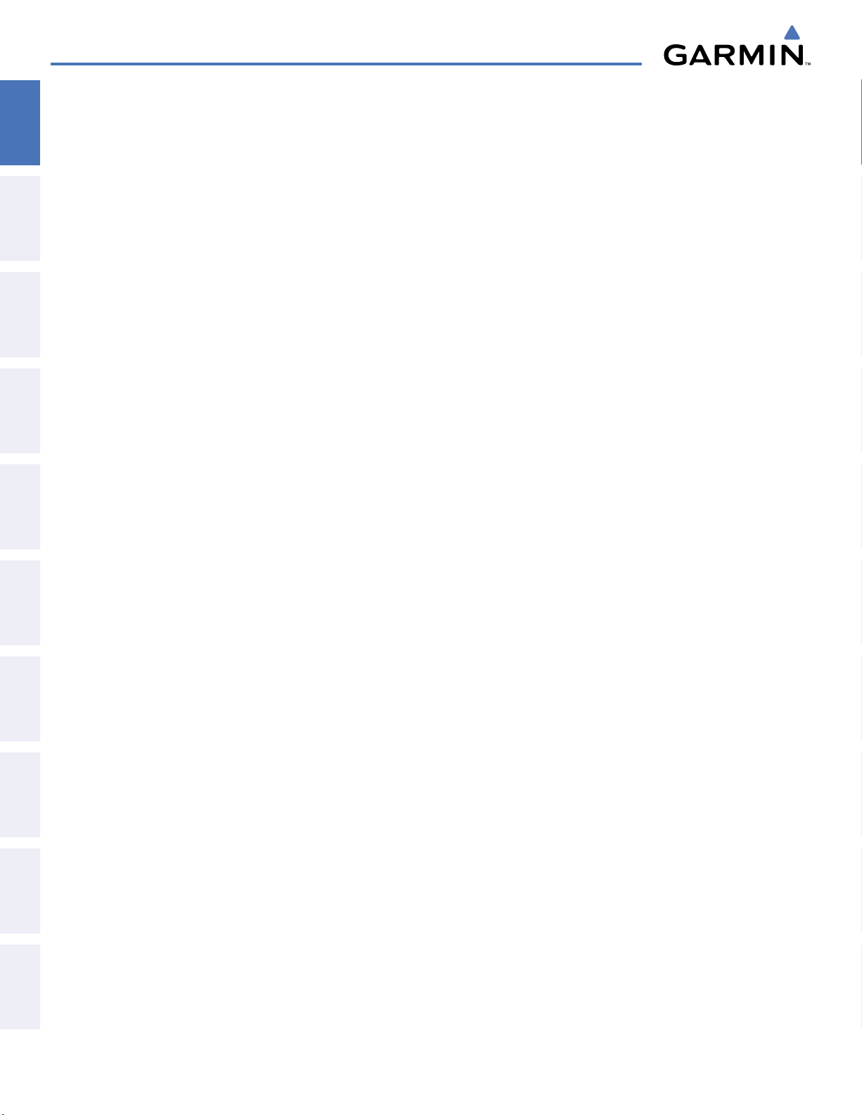
• PFD
SYN VIS
PATHWAY
Displays second-level softkeys for additional PFD configuration
Displays the softkeys for enabling or disabling Synthetic Vision features
Displays rectangular boxes representing the horizontal and vertical flight path
of the active flight plan
SYN TERR
HRZN HDG
APTSIGNS
Enables synthetic terrain depiction
Displays compass heading along the Zero-Pitch line
Displays position markers for airports within approximately 15 nm of the
current aircraft position. Airport identifiers are displayed when the airport is
within approximately 9 nm.
DFLTS
WIND
OPTN1
OPTN2
OPTN3
OFF
DME
BRG1
Resets PFD to default settings, including changing units to standard
Displays softkeys to select and configure wind data
Displays wind data in longitudinal and lateral components
Displays wind data total direction and speed
Displays wind data total direction with head and cross-wind speed components
Removes wind information from display
Displays/removes DME Information Window (
optional)
Cycles the Bearing 1 Information Window through:
NAV1: Waypoint frequency/identifier and DME information
GPS: Waypoint identifier and GPS distance information
ADF: Waypoint frequency
Off: Removes window
HSI FMT
360 HSI
ARC HSI
BRG2
Displays softkeys to select the HSI format
Displays HSI as a 360° compass rose
Displays HSI as a 140° viewable arc (Bearing Information windows unavailable)
Cycles the Bearing 2 Information Window through:
NAV2: Waypoint frequency/identifier and DME information
GPS: Waypoint identifier and GPS distance information
ADF: Waypoint frequency
Off: Removes window
ALT UNIT
Displays softkeys for changing the Altimeter barometric setting and altitude displays to
metric units
METERS
IN
HPA
STD BARO
• OBS
• CDI
Displays the current and Selected altitudes in meters in addition to feet, when selected
Displays the Altimeter barometric setting in inches of mercury (in Hg)
Displays the Altimeter barometric setting in hectopascals (hPa)
Sets barometric pressure to 29.92 in Hg (1013 hPa if metric display is selected)
Selects OBS Mode on the CDI when navigating by GPS (only available with active leg)
Cycles CDI through GPS, NAV1 (VOR/LOC), and NAV2 (VOR/LOC) navigation sources
• ADF/DME Displays/removes ADF/DME Radio Tuning Window (optional; may appear as ADF, DME,
or ADF/DME depending on installation)
Garmin G1000 Pilot’s Guide for the Diamond DA40/40F
190-00592-05 Rev. A30
Page 34
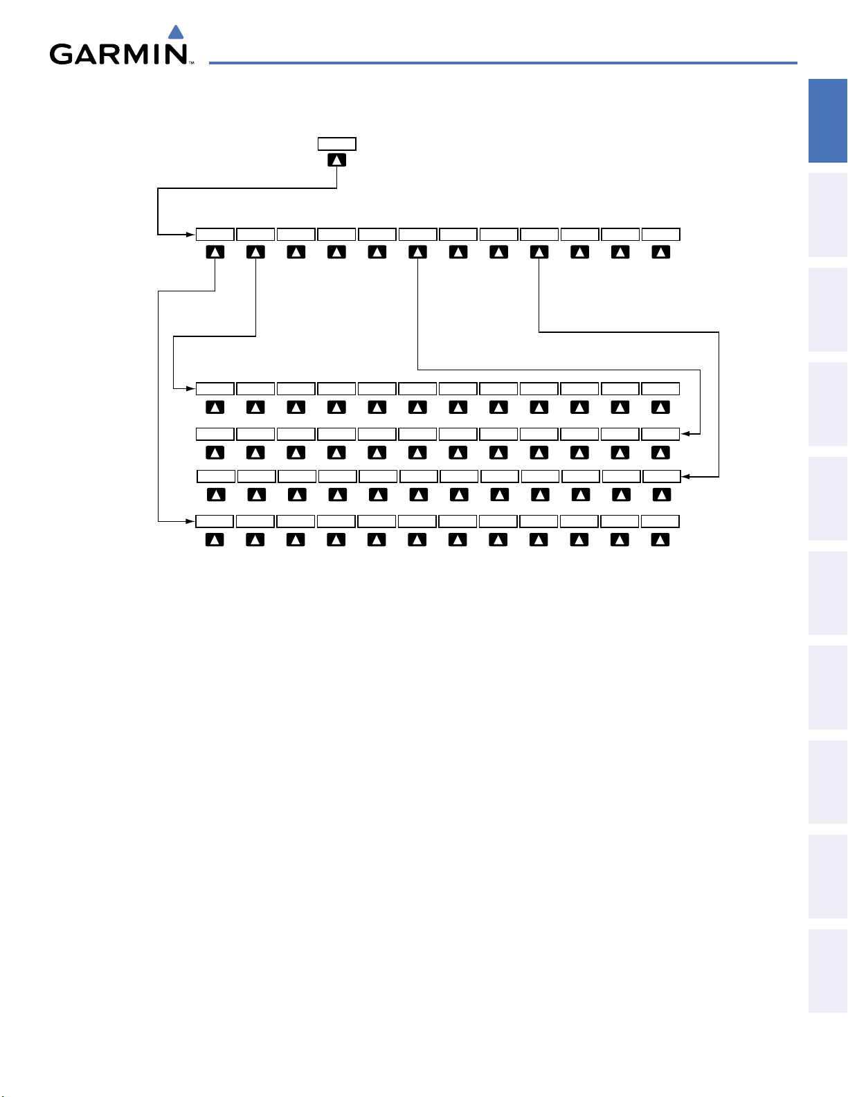
SYSTEM OVERVIEW
STD BARO
BACK
ALERTS
WIND
HSI FMT
PFD
Press the STD BARO or BACK
Softkey to return to the top-level
softkeys
.
ALT UNIT
HPA
BACK
ALERTS
METERS
IN
DFLTS
Press the BRG1/BRG2
softkeys to display/remove
the Bearing Information
windows and cycle through
bearing sources:
- NAV1/NAV2
- GPS
- ADF
BACK
ALERTS
OPTN1 OPTN2 OPTN3
DME
(optional)
BACK
ALERTS
360 HSI
ARC HSI
BRG1
BRG2
OFF
SYN VIS
BACK
ALERTS
PATHWAY
SYN TERR
HRZN HDG
APTSIGNS
OVERVIEW
SYSTEM
INSTRUMENTS
FLIGHT
EIS
AUDIO PANEL
& CNS
MANAGEMENT
FLIGHT
Figure 1-18 PFD Configuration Softkeys
AVOIDANCE
HAZARD
AFCS
ADDITIONAL
FEATURES
APPENDICES INDEX
190-00592-05 Rev. A
Garmin G1000 Pilot’s Guide for the Diamond DA40/40F
31
Page 35
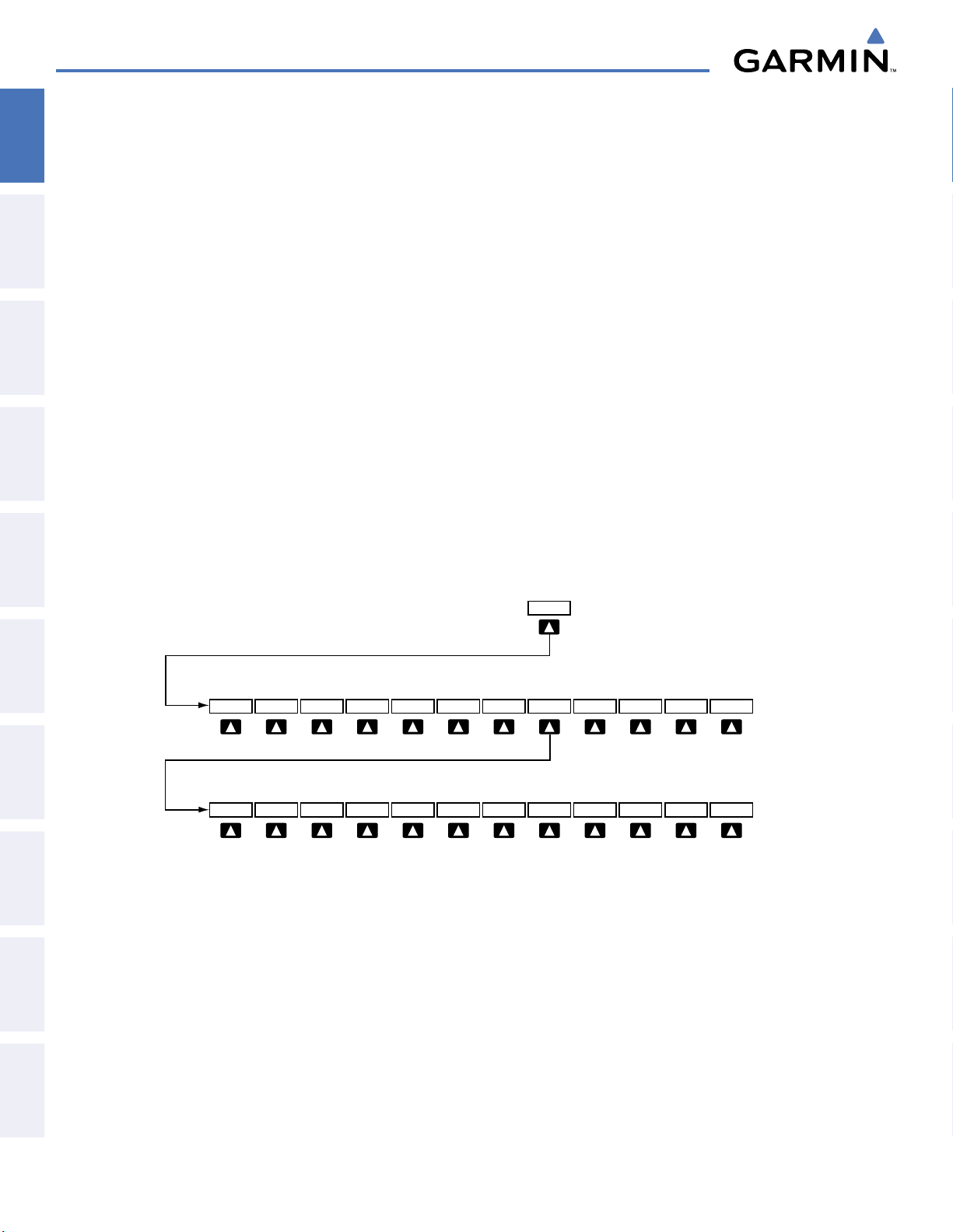
SYSTEM OVERVIEW
INSET
XPDR
IDENT
TMR/REF
NRST
ALERTS
OBS
PFD
CDI
Press the CDI Softkey to cycle through
navigation sources
:
- GPS
- NAV1 (VOR/LOC)
- NAV2 (VOR/LOC)
Press the BACK Softkey to
return to the top-level softkeys
.
Press the IDENT or BACK
Softkey to return to the toplevel softkeys.
XPDR
STBY
ON
ALT
VFR
IDENT
BACK
ALERTS
CODE
IDENT
BACK
ALERTS
0
1
2
3
4
5
6
7
BKSP
GND
ADF/DME
(optional)
BACK
Press the OFF or BACK Softkey
to return to the top-level softkeys.
DCLTR
DCLTR-2
DCLTR-3
DCLTR-1
TOPO
ALERTS
NEXRAD
(optional)
TERRAIN
XM LTNG
(optional)
OFF
TRAFFIC
INSET
STRMSCP
(optional)
TRFC-2
TRFC-1
STD BARO
BACK
ALERTS
WIND
HSI FMT
PFD
Press the STD BARO or BACK
Softkey to return to the top-leve
l
softkeys.
ALT UNIT
HPA
BACK
ALERTS
METERS
IN
DFLTS
Press the BRG1/BRG2
softkeys to display/remove
the Bearing Informatio
n
windows and cycle throug
h
bearing sources:
- NAV1/NAV2
- GPS
- ADF
BACK
ALERTS
OPTN1 OPTN2 OPTN3
DME
(optional)
BACK
ALERTS
360 HSI
ARC HSI
BRG1
BRG2
OFF
• XPDR
SYSTEM
OVERVIEW
FLIGHT
INSTRUMENTS
EIS
& CNS
AUDIO PANEL
STBY
ON
ALT
GND
VFR
CODE
0 — 7
BKSP
• IDENT
• TMR/REF
• NRST
• ALERTS
Displays transponder mode selection softkeys:
Selects standby mode (Transponder does not reply to any interrogations)
Selects Mode A (Transponder replies to interrogations)
Selects Mode C – altitude reporting mode (Transponder replies to identification and altitude
interrogations)
Manually selects Ground Mode (Transponder does not allow Mode A and Mode C
replies, but does permit acquisition squitter and replies to discretely addressed Mode S
interrogations)
Automatically enters the VFR code (1200 in U.S.A. only)
Displays transponder code selection softkeys 0-7
Use numbers to enter code
Removes numbers entered, one at a time
Activates the Special Position Identification (SPI) pulse for 18 seconds, identifying the
transponder return on the ATC screen
Displays/removes Timer/References Window
Displays/removes Nearest Airports Window
Displays/removes Alerts Window
FLIGHT
MANAGEMENT
HAZARD
AVOIDANCE
AFCS
FEATURES
ADDITIONAL
APPENDICESINDEX
Figure 1-19 XPDR Softkeys
Garmin G1000 Pilot’s Guide for the Diamond DA40/40F
190-00592-05 Rev. A32
Page 36

SYSTEM OVERVIEW
CHKLIST
DCLTR
ENGINE
DCLTR-2
DCLTR-3
DCLTR-1
Press the ENGINE Softkey to
return to the top-level softkeys.
INC FUEL
RST FUEL
LEAN
DEC FUEL
ENGINE
MAP
The DONE Softkey label changes to UNDO
when the checklist item is already checked.
EXIT
DONE
ENGINE
EMERGCY
BACK
TOPO
(optional)
NEXRAD
TRAFFIC
TERRAIN
(optional)
XM LTNG
Press the BACK softkey to
return to the top-level softkeys.
AIRWY LO
AIRWY HI
AIRWY ON
AIRWAYS
(optional)
STRMSCP
SHW CHRT
MFD SOFTKEYS
MFD softkeys vary depending on the page selected. EIS and Navigation Map Page (default MFD page)
softkeys are described here.
OVERVIEW
SYSTEM
INSTRUMENTS
FLIGHT
EIS
AUDIO PANEL
& CNS
MANAGEMENT
FLIGHT
• ENGINE
LEAN
DEC FUEL
INC FUEL
RST FUEL
Figure 1-20 EIS and MFD Softkeys
Displays EIS - Engine Page and second-level engine softkeys; press again to exit page (see the
EIS Section for more information)
Accesses engine leaning assist mode
Decreases displayed fuel remaining in 1-gal increments
Increases displayed fuel remaining in 1-gal increments
Resets displayed fuel remaining to maximum fuel capacity for aircraft and fuel used to zero
AVOIDANCE
HAZARD
AFCS
ADDITIONAL
FEATURES
APPENDICES INDEX
190-00592-05 Rev. A
Garmin G1000 Pilot’s Guide for the Diamond DA40/40F
33
Page 37
SYSTEM OVERVIEW
SYSTEM
OVERVIEW
FLIGHT
INSTRUMENTS
EIS
& CNS
AUDIO PANEL
FLIGHT
MANAGEMENT
HAZARD
AVOIDANCE
• MAP
TRAFFIC
TOPO
TERRAIN
AIRWAYS
STRMSCP
NEXRAD
XM LTNG
BACK
• DCLTR (3)
• SHW CHRT
• CHKLIST
DONE
EXIT
EMERGCY
Enables second-level Navigation Map Page softkeys
Displays/removes traffic information on Navigation Map Page
Displays/removes topographical data (e.g., coastlines, terrain, rivers, lakes) on Navigation
Map Page
Displays/removes terrain information on Navigation Map Page
Selects the desired display of Airways; cycles through:
AIRWY ON: All Airways displayed
AIRWY LO: Low Altitude (Victor) Airways displayed
AIRWY HI: High Altitude Airways (Jet Routes) displayed
AIRWAYS: Airways are not displayed
Displays/removes Stormscope weather information on Inset Map (
Displays/removes NEXRAD weather/coverage on Navigation Map Page (
Displays/removes XM lightning information on Navigation Map Page (
optional)
optional)
optional)
Returns to top-level softkeys
Selects desired amount of map detail; cycles through declutter levels:
DCLTR (No Declutter): All map features visible
DCLTR-1: Removes land data
DCLTR-2: Removes land and SUA data
DCLTR-3: Removes everything except the active flight plan
Displays optional Flite Charts or Chart View charts
(optional)
Displays the Checklist Page
Selects the highlighted checklist item
Returns to the top-level softkeys
Immediately accesses the emergency procedures
AFCS
FEATURES
ADDITIONAL
APPENDICESINDEX
Garmin G1000 Pilot’s Guide for the Diamond DA40/40F
190-00592-05 Rev. A34
Page 38
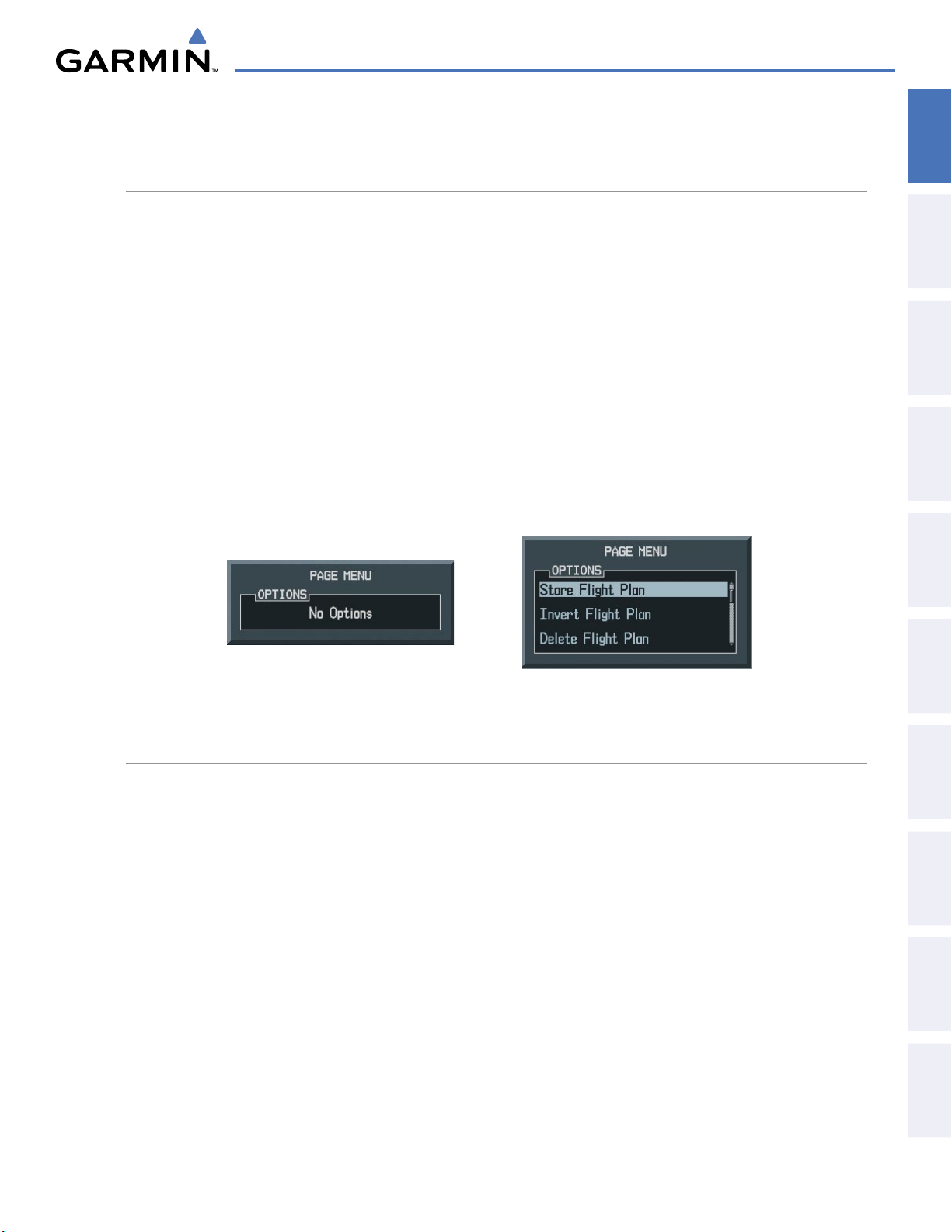
1.6 ACCESSING G1000 FUNCTIONALITY
SYSTEM OVERVIEW
OVERVIEW
SYSTEM
MENUS
The G1000 has a dedicated MENU Key that when pressed displays a context-sensitive list of options. This
options list allows the user to access additional features or make settings changes which specifically relate to
the currently displayed window/page. There is no all-encompassing menu. Some menus provide access to
additional submenus that are used to view, edit, select, and review options. Menus display ‘No Options’ when
there are no additional features or settings for the window/page selected.
Navigating a menu:
1) Press the MENU Key to display the menu.
2) Turn the FMS Knob to scroll through a list of available options (a scroll bar always appears to the right of the
window/box when the option list is longer than the window/box).
3) Press the ENT Key to select the desired option.
4) Press the CLR Key or FMS Knob to remove the menu and cancel the operation.
No Options for
NRST Window
Options for FPL Window
INSTRUMENTS
FLIGHT
EIS
AUDIO PANEL
& CNS
MANAGEMENT
FLIGHT
AVOIDANCE
HAZARD
Figure 1-21 Page Menu Examples
DATA ENTRY
The FMS Knob can be used for directly entering alphanumeric data (e.g., Flight ID, waypoint identifiers,
barometric minimum descent altitude) into the G1000 In some instances, such as when entering an identifier,
the G1000 tries to predict the desired identifier based on the characters being entered. In this case, if the
desired identifier appears, use the ENT Key to confirm the entry without entering the rest of the identifier
manually. This can save the pilot from having to enter all the characters of the identifier.
Besides character-by-character data entry, the system also provides a shortcut for entering waypoint identifiers.
When the cursor is on a field awaiting entry of a waypoint identifier, turning the small
clockwise accesses three different lists of waypoint identifiers for quick selection: flight plan (FPL), nearest
(NRST), and recently-entered (RECENT). The G1000 automatically fills in the identifier, facility, and city fields
with the information for the selected waypoint.
FMS Knob counter-
AFCS
ADDITIONAL
FEATURES
APPENDICES INDEX
190-00592-05 Rev. A
Garmin G1000 Pilot’s Guide for the Diamond DA40/40F
35
Page 39
SYSTEM OVERVIEW
Using the FMS Knob to enter data:
SYSTEM
OVERVIEW
FLIGHT
INSTRUMENTS
EIS
& CNS
AUDIO PANEL
FLIGHT
MANAGEMENT
1) If needed, press the FMS Knob to activate the cursor.
2) Use the large FMS Knob to highlight the desired field.
3) Begin entering data.
a) To quickly enter a waypoint identifier, turn the small FMS Knob counter-clockwise to display a list of waypoints
in the active flight plan (list is titled FPL). If desired, turn the small FMS Knob clockwise to scroll through lists
of nearest waypoints (NRST) and recently-entered waypoints (RECENT).
b) Turn the large FMS Knob to highlight the desired waypoint from the list and press the ENT Key.
Or:
a) Turn the small FMS Knob to select a character for the first placeholder.
Turning the knob clockwise scrolls through the alphabet (where appropriate) toward the letter Z, starting at
K, and the digits zero through nine. Afterwards, turning the knob counter-clockwise scrolls in the opposite
direction.
b) Use the large FMS Knob to move the cursor to the next placeholder in the field.
c) Repeat, using the small FMS Knob to select a character and the large FMS Knob to move the cursor, until the
field is complete.
d) Press the ENT Key to confirm entry.
7) Press the FMS Knob or CLR Key to cancel data entry (the field reverts back to its previous information).
HAZARD
AVOIDANCE
AFCS
FEATURES
ADDITIONAL
APPENDICESINDEX
Garmin G1000 Pilot’s Guide for the Diamond DA40/40F
190-00592-05 Rev. A36
Page 40
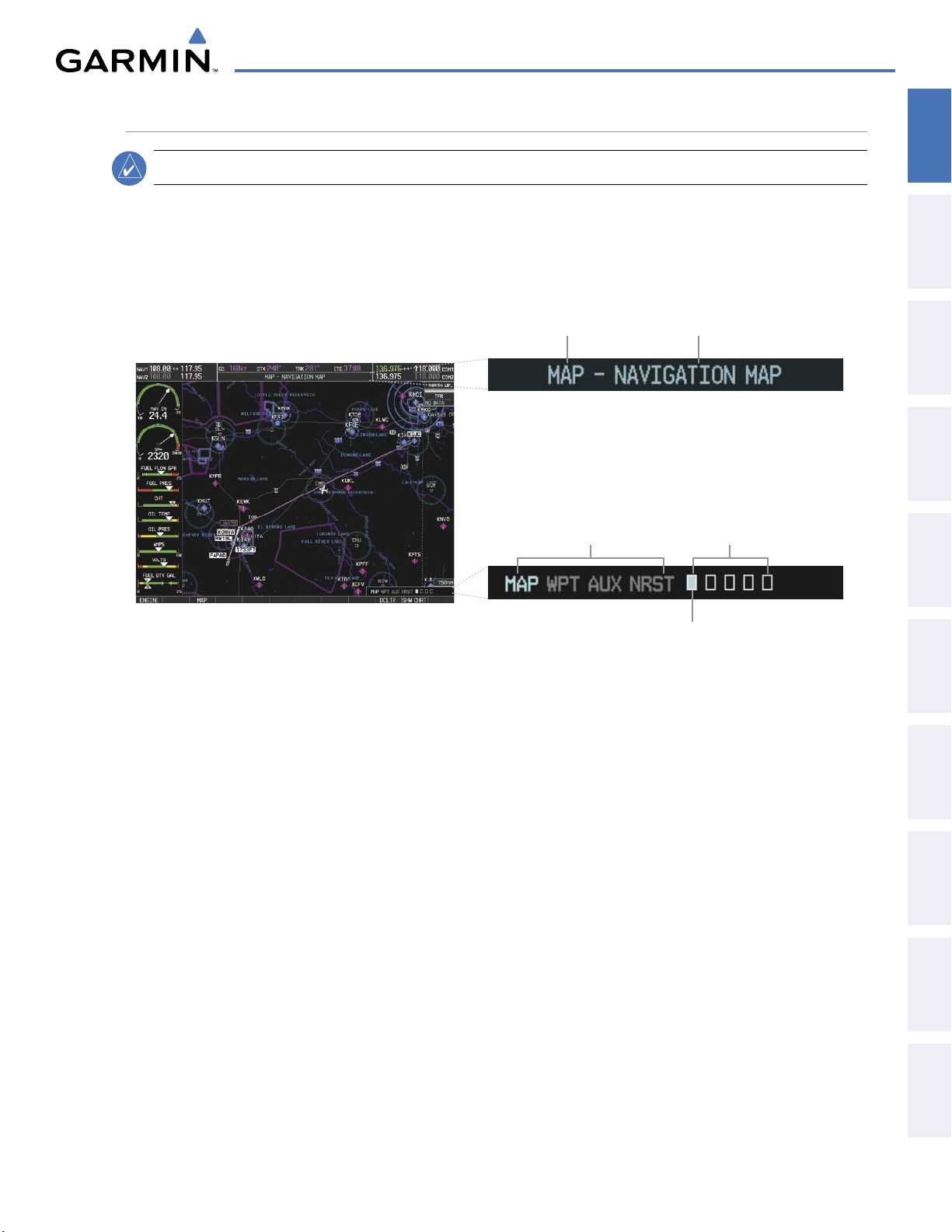
PAGE GROUPS
SYSTEM OVERVIEW
OVERVIEW
SYSTEM
NOTE:
Refer to other supporting sections in this Pilot’s Guide for details on specific pages.
Information on the MFD is presented on pages which are grouped according to function. The page group and
active page title are displayed in the upper center of the screen, below the Navigation Status Box. In the bottom
right corner of the screen, the current page group, number of pages available in the group, and placement of
the current page within the group are indicated by icons. For some of these pages (Airport/Procedures/Weather
Information, XM, Procedure Loading), the title of the page changes while the page icon remains the same.
Page Group Active Page Title
MFD
Page Groups
Pages in Current Group
INSTRUMENTS
FLIGHT
EIS
AUDIO PANEL
& CNS
MANAGEMENT
FLIGHT
Selected Page
Figure 1-22 Page Title and Page Group Icons
There are four main page groups, navigated using the FMS Knob; specific pages within each group can vary
depending on the configuration of optional equipment.
Selecting a page using the FMS Knob:
1) Turn the
2)
Turn
large FMS
the
small FMS
Knob until the desired page group is selected.
Knob until the desired page is selected.
There are also several pages (Airport/Procedures/Weather Information and XM pages) which are selected first
from within a main page group with the
FMS Knob, then with the appropriate softkey at the bottom of the page
(or from the page menu). In this case, the page remains set to the selected page until a different page softkey is
selected, even if a different page group is selected.
AVOIDANCE
HAZARD
AFCS
ADDITIONAL
FEATURES
APPENDICES INDEX
190-00592-05 Rev. A
Garmin G1000 Pilot’s Guide for the Diamond DA40/40F
37
Page 41
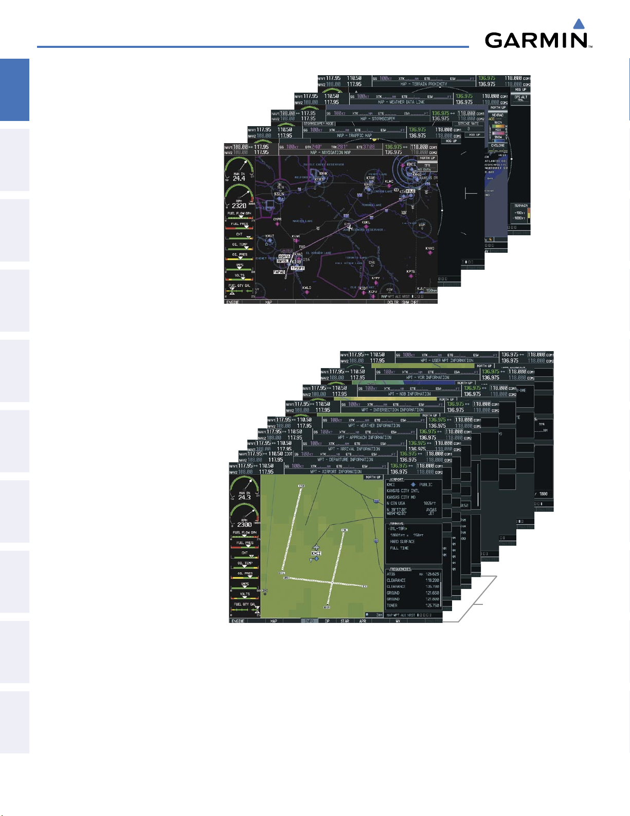
SYSTEM OVERVIEW
• Map Page Group (MAP)
SYSTEM
OVERVIEW
FLIGHT
INSTRUMENTS
EIS
& CNS
AUDIO PANEL
FLIGHT
MANAGEMENT
Navigation Map
Traffic Map
Stormscope (optional)
Weather Data Link (
Terrain Proximity/TAWS
optional)
(TAWS optional)
• Waypoint Page Group (WPT)
Airport/Procedures/Weather Information Pages
- Airport Information
(INFO Softkey)
Figure 1-23 Map Pages
HAZARD
AVOIDANCE
AFCS
FEATURES
ADDITIONAL
APPENDICESINDEX
- Departure Information
(DP Softkey)
- Arrival Information
(STAR Softkey)
- Approach Information
(APR Softkey)
- Weather Information (
optional)
(WX Softkey)
Intersection Information
NDB Information
VOR Information
User Waypoint Information
Airport/
Procedures/
Weather
Information
Pages
Figure 1-24 Waypoint Pages
Garmin G1000 Pilot’s Guide for the Diamond DA40/40F
190-00592-05 Rev. A38
Page 42

• Auxiliary Page Group (AUX)
Trip Planning
SYSTEM OVERVIEW
OVERVIEW
SYSTEM
Utility
GPS Status
System Setup
XM Satellite screens (
- XM Information
optional)
(INFO Softkey)
- XM Radio
(RADIO Softkey)
System Status
• Nearest Page Group (NRST)
Nearest Airports
Nearest Intersections
Nearest NDB
Figure 1-25 Auxiliary Pages
XM
Pages
INSTRUMENTS
FLIGHT
EIS
AUDIO PANEL
& CNS
MANAGEMENT
FLIGHT
AVOIDANCE
HAZARD
Nearest VOR
Nearest User Waypoints
Nearest Frequencies
Nearest Airspaces
Figure 1-26 Nearest Pages
AFCS
ADDITIONAL
FEATURES
APPENDICES INDEX
190-00592-05 Rev. A
Garmin G1000 Pilot’s Guide for the Diamond DA40/40F
39
Page 43
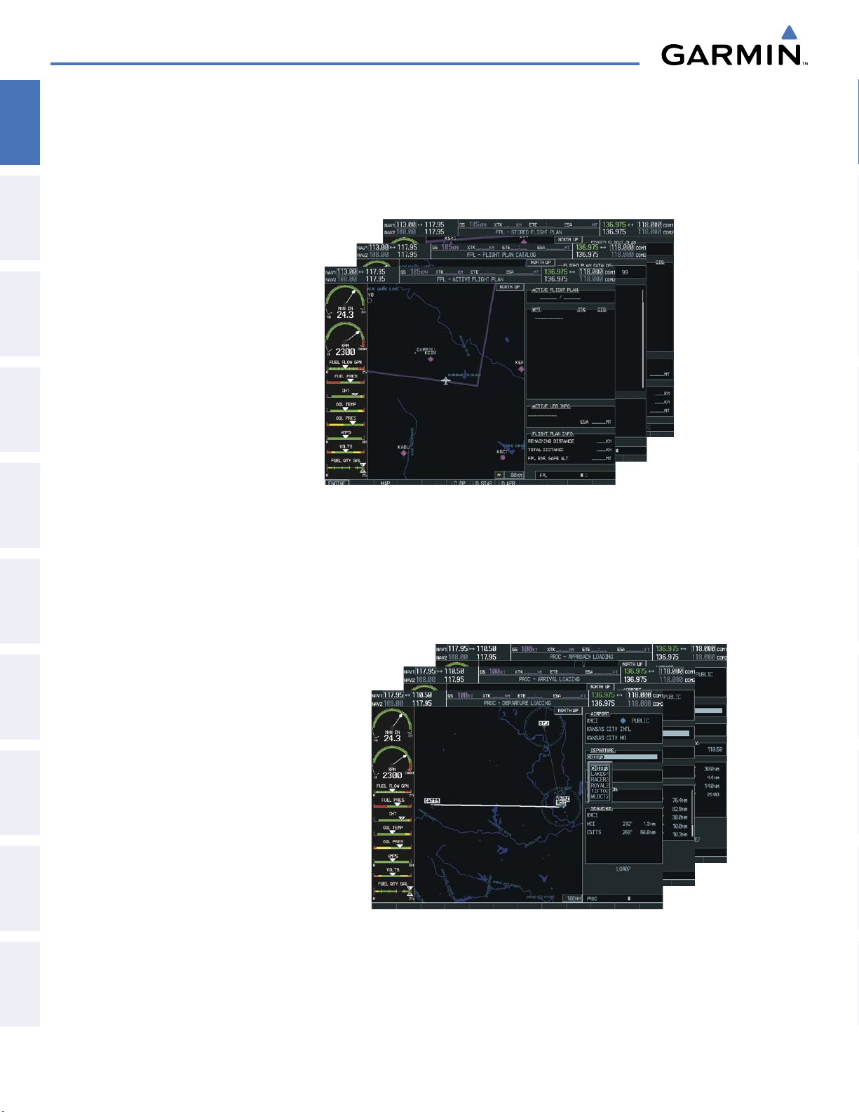
SYSTEM OVERVIEW
In addition to the main page groups accessed exclusively using the FMS Knob, there are pages for flight
SYSTEM
OVERVIEW
planning (FPL) and loading procedures (PROC) which are accessed by key. In some instances, softkeys may be
used to access the Procedure Loading pages.
FLIGHT
INSTRUMENTS
EIS
& CNS
AUDIO PANEL
FLIGHT
MANAGEMENT
HAZARD
AVOIDANCE
The Flight Plan pages are accessed using the
FPL Key on the MFD. Main pages within this group are selected
by turning the small FMS Knob.
• Flight Plan Page Group (FPL)
Active Flight Plan
Flight Plan Catalog
- Stored Flight Plan
(NEW Softkey)
Figure 1-27 Flight Plan Pages
The Procedure Loading pages may be accessed at any time on the MFD by pressing the PROC Key. A menu
is initialized, and when a departure, approach, or arrival is selected, the appropriate Procedure Loading page is
opened. These pages can also be accessed from the Active and Stored Flight Plan pages using the LD softkeys.
Turning the FMS Knob does not scroll through the Procedure Loading pages (note the single page icon in the
lower right corner).
• Procedure Loading Page Group (PROC)
AFCS
FEATURES
ADDITIONAL
APPENDICESINDEX
Departure Loading
Arrival Loading
Approach Loading
Figure 1-28 Procedure Loading Pages
Information on optional electronic checklist pages is offered later in this section. Checklist pages may be
accessed from any page on the MFD using the
Garmin G1000 Pilot’s Guide for the Diamond DA40/40F
CHKLIST Softkey.
190-00592-05 Rev. A40
Page 44
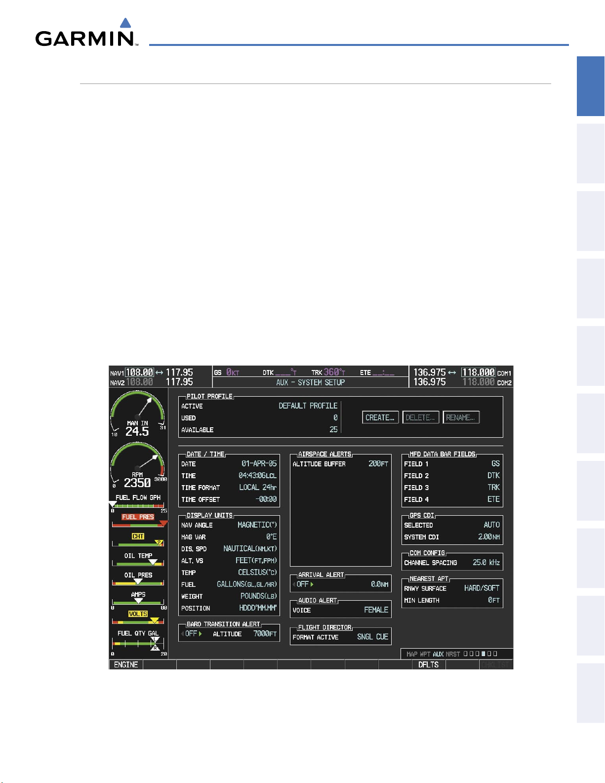
SYSTEM OVERVIEW
SYSTEM SETTINGS
G1000 system settings are managed from the System Setup Page. The following settings can be changed:
OVERVIEW
SYSTEM
• Date/time
• Display Units
(see Flight Instruments Section)
• Airspace alerts (see Flight Management Section)
• Arrival alerts (see Flight Management Section)
• MFD Navigation Status Box fields
(see Flight Management Section)
Restoring system setup defaults:
1) Use the FMS Knob to select the AUX - System Setup Page.
2) Press the DFLTS Softkey.
Or:
a) Press the MENU Key.
b) Highlight ‘Restore Defaults’ and press the ENT Key.
• CDI scaling for GPS navigation source
(see Flight Instruments Section)
• COM channel spacing
(see Audio Panel and CNS Section)
• Criteria for displaying nearest airports
(see Flight Management Section)
• Audio Alerts
INSTRUMENTS
FLIGHT
EIS
AUDIO PANEL
& CNS
MANAGEMENT
FLIGHT
AVOIDANCE
HAZARD
190-00592-05 Rev. A
Figure 1-29 System Setup Page
Garmin G1000 Pilot’s Guide for the Diamond DA40/40F
41
AFCS
ADDITIONAL
FEATURES
APPENDICES INDEX
Page 45

SYSTEM OVERVIEW
DATE/TIME
SYSTEM
OVERVIEW
FLIGHT
INSTRUMENTS
EIS
& CNS
AUDIO PANEL
FLIGHT
MANAGEMENT
The G1000 obtains the current Universal Coordinated Time (UTC) date and time directly from the GPS
satellite signals (shown on the AUX - GPS Status Page, Figure 1-11). System time (displayed in the lower
right corner of the PFD) can be displayed in three formats: local 12-hr, local 24-hr, or UTC. Local time is set
by adding/subtracting an offset (hours:minutes) to/from UTC.
PFD
Figure 1-30 System Time (Local 24-hr Format)
Configuring the system time:
1) Select the AUX - System Setup Page using the FMS Knob.
HAZARD
AVOIDANCE
AFCS
FEATURES
ADDITIONAL
APPENDICESINDEX
2) Press the FMS Knob to activate the cursor.
3) Turn the large FMS Knob to highlight the ‘Time Format’ field.
4) Turn the small FMS Knob to select the desired format and press the ENT Key to confirm selection. The ‘Time
Offset’ field is highlighted.
5) Use the FMS Knob to enter the desired time offset (±HH:MM) and press the ENT Key to confirm selection.
Figure 1-31 Date/Time Settings (AUX - System Setup Page)
Garmin G1000 Pilot’s Guide for the Diamond DA40/40F
190-00592-05 Rev. A42
Page 46
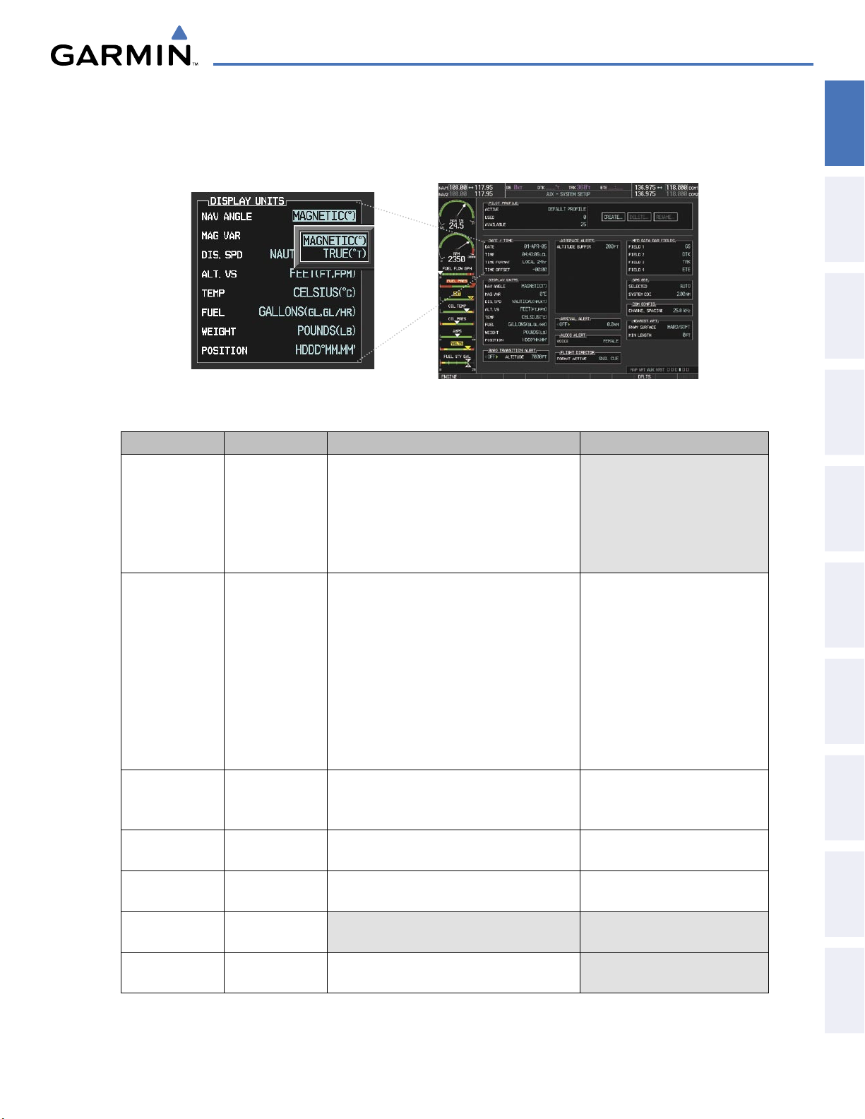
SYSTEM OVERVIEW
DISPLAY UNITS
Units in which various quantities are displayed on the G1000 screens are listed on the System Setup Page.
The Navigation Angle reference can be set from here (refer to the Flight Instruments Section).
Figure 1-32 Display Unit Settings (AUX - System Setup Page)
Category Settings Affected Quantities Exceptions
Navigation Angle
Magnetic (North)
True (North)
Distance and
Nautical Crosstrack error (HSI)
Speed
Altitude and
Feet All altitudes on MFD
Vertical Speed
Temperature Celsius
Fahrenheit
Fuel and
Gallons Fuel parameters (Trip Planning Page) Engine Indication System (EIS)
Fuel Flow
Weight Pounds
Heading
Course
Bearing
Track
Desired Track
Wind direction (Trip Planning Page)
Airspeed Indicator
Bearing distances (information windows)
DME distance (information window)
Flight plan distances
True Airspeed (PFD)
Wind speed vector
Map range (Traffic Page, Terrain
Map ranges
DIS, GS, TAS, XTK fields (Navigation Status Box)
All distances on MFD
CDI scaling (System Setup)
Fuel range calculation (EIS)
Altitude buffer distance (System Setup)
Arrival Alert trigger distance (System Setup)
All speeds on MFD
Altimeter
All elevations on MFD
Vertical Speed Indicator
VNV altitudes (Active Flight Plan)
All temperatures on PFD
Engine Indication System (EIS)
Total Air Temperature (Trip Planning Page)
N/A N/A
Proximity/TAWS Page)
OVERVIEW
SYSTEM
INSTRUMENTS
FLIGHT
EIS
AUDIO PANEL
& CNS
MANAGEMENT
FLIGHT
AVOIDANCE
HAZARD
AFCS
ADDITIONAL
FEATURES
APPENDICES INDEX
Position
190-00592-05 Rev. A
HDDD°MM.MM’
All positions N/A
HDDD°MM’SS.S”
Table 1-1 Display Units Settings (AUX - System Setup Page)
Garmin G1000 Pilot’s Guide for the Diamond DA40/40F
43
Page 47
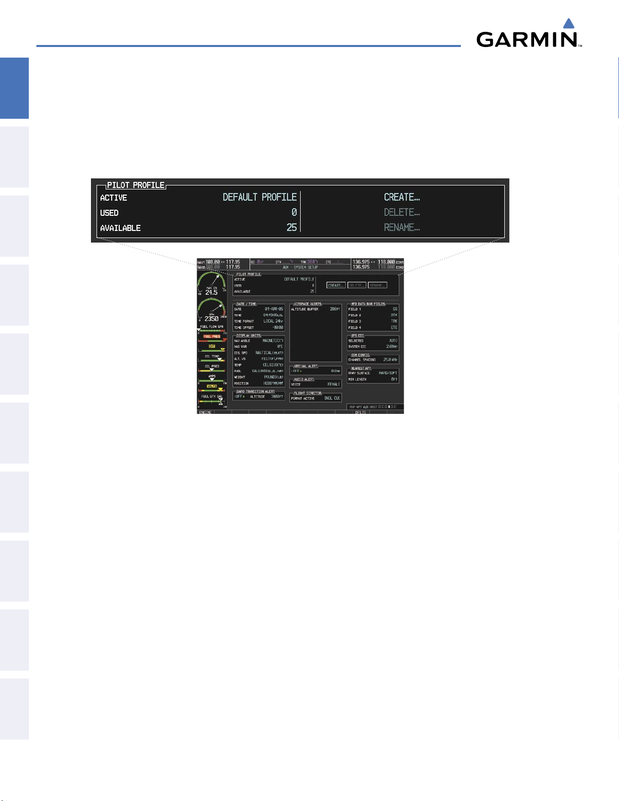
SYSTEM OVERVIEW
PILOT PROFILES
SYSTEM
OVERVIEW
FLIGHT
INSTRUMENTS
EIS
& CNS
AUDIO PANEL
FLIGHT
MANAGEMENT
System settings may be saved under a pilot profile. When the system is powered on, the last selected pilot
profile is shown on the MFD Power-up Splash Screen (Figure 1-5). The G1000 can store up to 25 profiles;
the currently active profile, the amount of memory used, and the amount of memory available are shown at
the top of the System Setup Page in the box labeled ‘Pilot Profile’. From here, pilot profiles may be created,
selected, renamed, or deleted.
HAZARD
AVOIDANCE
AFCS
FEATURES
ADDITIONAL
APPENDICESINDEX
Figure 1-33 Display Unit Settings (AUX - System Setup Page)
Creating a profile:
1) Use the FMS Knob to select the AUX - System Setup Page.
2) Press the FMS Knob momentarily to activate the flashing cursor.
3) Turn the large FMS Knob to highlight ‘CREATE’ in the Pilot Profile Box.
4) Press the ENT Key. A ‘Create Profile’ window is displayed.
5) Use the FMS Knob to enter a profile name up to 16 characters long and press the ENT Key. Pilot profile names
cannot begin with a blank as the first letter.
6) In the next field, use the small FMS Knob to select the desired settings upon which to base the new profile.
Profiles can be created based on Garmin factory defaults, default profile settings (initially based on Garmin
factory defaults unless edited by the pilot), or current system settings.
7) Press the ENT Key.
Garmin G1000 Pilot’s Guide for the Diamond DA40/40F
190-00592-05 Rev. A44
Page 48
8) With ‘CREATE’ highlighted, press the ENT Key to create the profile
Or:
SYSTEM OVERVIEW
OVERVIEW
SYSTEM
Use the large FMS Knob to select ‘CREATE and ACTIVATE’ and press the ENT Key to activate the new profile.
9) To cancel the process, select ‘CANCEL’ with the large FMS Knob and press the ENT Key.
Selecting an active profile:
1) Use the FMS Knob to select the AUX - System Setup Page.
2) Press the FMS Knob momentarily to activate the flashing cursor.
3) Turn the large FMS Knob to highlight the active profile field in the Pilot Profile Box.
4) Turn the small FMS Knob to display the pilot profile list and highlight the desired profile.
5) Press the ENT Key. The G1000 loads and displays the system settings for the selected profile.
Renaming a profile:
1) Use the FMS Knob to select the AUX - System Setup Page.
2) Press the FMS Knob momentarily to activate the flashing cursor.
3) Turn the large FMS Knob to highlight ‘RENAME’ in the Pilot Profile Box.
4) Press the ENT Key.
5) In the ‘Rename Profile’ window, turn the FMS Knob to select the profile to rename.
6) Press the ENT Key.
7) Use the FMS Knob to enter a new profile name up to 16 characters long and press the ENT Key.
INSTRUMENTS
FLIGHT
EIS
AUDIO PANEL
& CNS
MANAGEMENT
FLIGHT
AVOIDANCE
HAZARD
8) With ‘RENAME’ highlighted, press the ENT Key.
9) To cancel the process, use the large FMS Knob to select ‘CANCEL’ and press the ENT Key.
Deleting a profile:
1) Use the FMS Knob to select the AUX - System Setup Page.
2) Press the FMS Knob momentarily to activate the flashing cursor.
3) Turn the large FMS Knob to highlight ‘DELETE’ in the Pilot Profile Box.
4) Press the ENT Key.
5) In the ‘Delete Profile’ window, turn the FMS Knob to select the profile to delete.
6) Press the ENT Key.
7) With ‘DELETE’ highlighted, press the ENT Key.
8) To cancel the process, use the large FMS Knob to select ‘CANCEL’ and press the ENT Key.
AFCS
ADDITIONAL
FEATURES
APPENDICES INDEX
190-00592-05 Rev. A
Garmin G1000 Pilot’s Guide for the Diamond DA40/40F
45
Page 49

SYSTEM OVERVIEW
TIMERS
SYSTEM
OVERVIEW
FLIGHT
INSTRUMENTS
EIS
& CNS
AUDIO PANEL
FLIGHT
MANAGEMENT
The G1000 timers available include:
• Stopwatch-like generic timers (available from the PFD Timer/References Window and on the MFD AUX Utility Page)
• Total-time-in-flight timer (MFD AUX - Utility Page)
• Time since departure (MFD AUX - Utility Page)
The generic timer can be set to count up or down from a specified time (HH:MM:SS). When the countdown
on the timer reaches zero the digits begin to count up from zero. If the timer is reset before reaching zero
on a countdown, the digits are reset to the initial value. If the timer is counting up when reset, the digits are
zeroed.
Setting the generic timer (PFD):
1) Press the
2) Turn the
3) Use the FMS Knob to enter the desired time and press the
4) With the UP/DN field highlighted, turn the
5) Press the
6) With ‘START?’ highlighted, press the
TMR/REF
large FMS
ENT
Key.
Softkey.
Knob to select the timer field (hh/mm/ss).
ENT
small FMS
ENT
Key to start the timer. The field changes to ‘STOP?’.
Knob to select the timer counting direction.
Key.
HAZARD
AVOIDANCE
AFCS
FEATURES
ADDITIONAL
APPENDICESINDEX
7) To stop the timer, press the ENT Key with ‘STOP?’ highlighted. The field changes to ‘RESET?’.
8) To reset the timer, press the ENT Key with ‘RESET?’ highlighted. The field changes back to ‘START?’ and the
digits are reset.
9) To remove the window, press the
PFD
Figure 1-34 Generic Timer (Timer/References Window)
CLR
Key or the
TMR/REF
Softkey.
Garmin G1000 Pilot’s Guide for the Diamond DA40/40F
190-00592-05 Rev. A46
Page 50
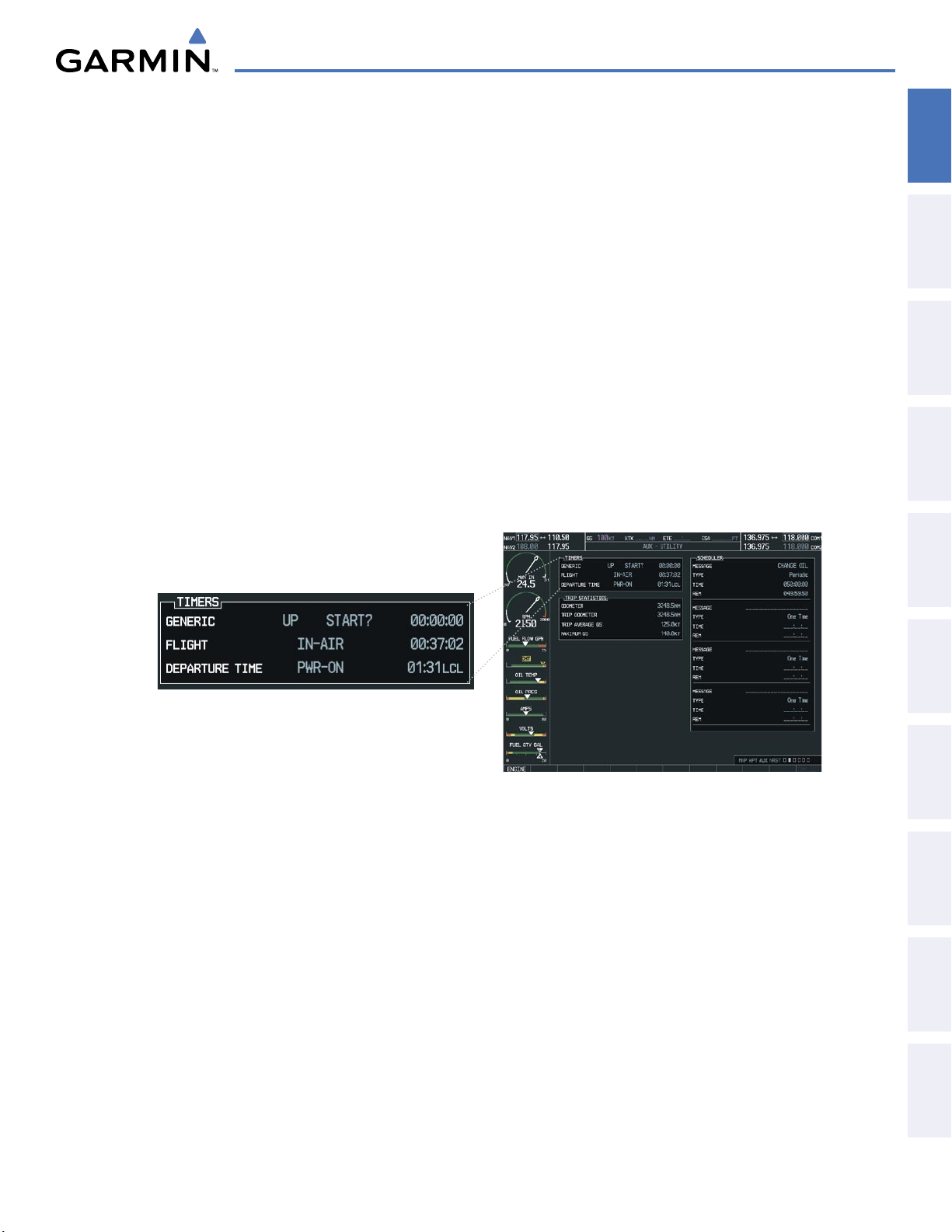
SYSTEM OVERVIEW
The flight timer can be set to count up from zero starting at system power-up or from the time that the
aircraft lifts off; the timer can also be reset to zero at any time.
OVERVIEW
SYSTEM
Setting the generic timer (MFD AUX - Utility Page):
1) Use the FMS Knob to select the AUX - Utility Page.
2) Press the FMS Knob momentarily to activate the flashing cursor.
3) Turn the small FMS Knob to select the timer counting direction (UP/DN) and press the ENT Key.
4) If a specific starting time is desired:
a) Use the large FMS Knob to highlight the HH:MM:SS field.
b) Use the FMS Knob to enter the desired time and press the
5) Turn the
large FMS
Knob to highlight ‘START?’ and press the
ENT
Key.
ENT
Key to start the timer. The field changes to
‘STOP?’.
6) To stop the timer, press the ENT Key with ‘STOP?’ highlighted. The field changes to ‘RESET?’.
7) To reset the timer, press the ENT Key with ‘RESET?’ highlighted. The field changes back to ‘START?’ and the
digits are reset.
INSTRUMENTS
FLIGHT
EIS
AUDIO PANEL
& CNS
MANAGEMENT
FLIGHT
AVOIDANCE
HAZARD
Setting the flight timer starting criterion:
1) Use the FMS Knob to select the AUX - Utility Page.
2) Press the FMS Knob momentarily to activate the flashing cursor.
3) Turn the large FMS Knob to highlight the field next to the flight timer.
4) Turn the
Resetting the flight timer:
1) Use the FMS Knob to select the AUX - Utility Page.
2) Press the
3) With ‘Reset Flight Timer’ highlighted, press the
190-00592-05 Rev. A
small FMS
MENU
Key.
Garmin G1000 Pilot’s Guide for the Diamond DA40/40F
Figure 1-35 Timers (AUX - Utility Page)
Knob to select the starting criterion (PWR-ON or IN-AIR) and press the
ENT
Key.
ENT
Key.
47
AFCS
ADDITIONAL
FEATURES
APPENDICES INDEX
Page 51
SYSTEM OVERVIEW
The G1000 records the time at which departure occurs, depending on whether the pilot prefers the time
SYSTEM
OVERVIEW
to be recorded from system power-up or from aircraft lift off. The displayed departure time can also be reset
to display the current time at the point of reset. The format in which the time is displayed is controlled
from the System Setup Page.
Setting the departure timer starting criterion:
FLIGHT
INSTRUMENTS
EIS
& CNS
AUDIO PANEL
FLIGHT
MANAGEMENT
HAZARD
AVOIDANCE
1) Use the FMS Knob to select the AUX - Utility Page.
2) Press the FMS Knob momentarily to activate the flashing cursor.
3) Turn the large FMS Knob to highlight the field next to the departure time.
4) Turn the
small FMS
Knob to select the starting criterion (PWR-ON or IN-AIR) and press the
Resetting the departure time:
1) Use the FMS Knob to select the AUX - Utility Page.
2) Press the
3) Use the FMS Knob to highlight ‘Reset Departure Time’ and press the
MENU
Key.
ENT
Key.
ENT
Key.
AFCS
FEATURES
ADDITIONAL
APPENDICESINDEX
Garmin G1000 Pilot’s Guide for the Diamond DA40/40F
190-00592-05 Rev. A48
Page 52

SYSTEM OVERVIEW
1.7 DISPLAY BACKLIGHTING
The backlighting of the PFD and MFD displays and bezel and Audio Panel keys can be adjusted automatically or
manually. The default setting (automatic backlighting adjustment) uses photocell technology to automatically adjust
for ambient lighting conditions. Photocell calibration curves are pre-configured to optimize display appearance
through a broad range of cockpit lighting conditions. Manual backlighting adjustment can be accomplished using
the existing instrument panel dimmer bus or the following procedures. In normal operating mode, backlighting
can only be adjusted from the PFD. In Reversionary Mode, it can be adjusted from the remaining display.
OVERVIEW
SYSTEM
INSTRUMENTS
FLIGHT
Adjusting display backlighting:
1) Press the PFD
2) Turn the
3) Press the
4) Use the FMS Knob to enter the desired backlighting then press the
5) Turn the
6) To remove the menu, press the
MENU
Key to display the PFD Setup Menu. ‘AUTO’ is now highlighted next to ‘PFD DSPL’.
small FMS
ENT
large FMS
Knob to select ‘MANUAL’.
Key. The intensity value is now highlighted.
Knob to highlight ‘AUTO’ next to ‘MFD DSPL’ and repeat steps 2-4.
CLR
or
MENU
Key.
ENT
Adjusting key backlighting:
1) Press the PFD
2) Turn the
3) Turn the
4) Turn the
5) Turn the
6) Press the
7) Use the FMS Knob to enter the desired backlighting and press the
MENU
Key to display the PFD Setup Menu. ‘AUTO’ is now highlighted next to ‘PFD DSPL’.
large FMS
small FMS
large FMS
small FMS
ENT
Knob to highlight ‘PFD DSPL’.
Knob in the direction of the green arrowhead to display ‘PFD KEY’.
Knob to highlight ‘AUTO’.
Knob to select ‘MANUAL’.
Key. The intensity value is now highlighted.
ENT
Key.
Key.
EIS
AUDIO PANEL
& CNS
MANAGEMENT
FLIGHT
AVOIDANCE
HAZARD
AFCS
8) Turn the
9) Turn the
10) To remove the menu, press the
190-00592-05 Rev. A
large FMS
small FMS
PFD
Garmin G1000 Pilot’s Guide for the Diamond DA40/40F
Knob to highlight ‘MFD DSPL’.
Knob in the direction of the green arrowhead to display ‘MFD KEY’ and repeat steps 4-7.
CLR
or
MENU
Key.
Figure 1-36 PFD Setup Menu
49
ADDITIONAL
FEATURES
APPENDICES INDEX
Page 53
SYSTEM OVERVIEW
SYSTEM
OVERVIEW
FLIGHT
INSTRUMENTS
EIS
& CNS
AUDIO PANEL
FLIGHT
MANAGEMENT
HAZARD
AVOIDANCE
AFCS
FEATURES
ADDITIONAL
APPENDICESINDEX
BLANK PAGE
Garmin G1000 Pilot’s Guide for the Diamond DA40/40F
190-00592-05 Rev. A50
Page 54
SECTION 2 FLIGHT INSTRUMENTS
FLIGHT INSTRUMENTS
OVERVIEW
SYSTEM
WARNING:
If the airspeed, attitude, altitude, or heading indications become unusable, refer to the backup
instruments.
NOTE:
The Automatic Flight Control System (AFCS) provides additional readouts and bugs on selected flight
instruments. Refer to the AFCS Section for details on these bugs and readouts, as they appear on the display
during certain AFCS modes.
Increased situational awareness is provided by replacing the traditional instruments on the panel with an easyto-scan Primary Flight Display (PFD) that features a large horizon, airspeed, attitude, altitude, vertical speed, and
course deviation information. In addition to the flight instruments, navigation, communication, terrain, traffic,
and weather information are also presented on the PFD and explained in other sections of this Pilot’s Guide.
The following flight instruments and supplemental flight data are displayed on the PFD:
• Airspeed Indicator, showing
– Indicated airspeed
– True airspeed
– Airspeed awareness ranges
– Vspeed reference flags
• Attitude Indicator with slip/skid indication
• Horizontal Situation Indicator, showing
– Turn Rate Indicator
– Bearing pointers and information windows
– Navigation source
– Course Deviation Indicator (CDI)
– Bearing pointers and information windows
INSTRUMENTS
FLIGHT
EIS
AUDIO PANEL
& CNS
MANAGEMENT
FLIGHT
AVOIDANCE
HAZARD
• Altimeter, showing
– Trend vector
– Barometric setting
– Selected altitude
• Vertical Deviation, Glideslope, and Glidepath
Indicators
• Vertical Speed Indicator (VSI)
• Vertical Navigation (VNV) indications
• Outside air temperature (OAT)
The PFD also displays various alerts and annunciations.
– DME Information Window
• Transponder Mode, Code, and Ident/Reply
• Course Deviation Indicator (CDI)
• Timer/References Window, showing
– Generic timer
– Vspeed values
– Barometric minimum descent altitude (MDA)
• Wind data
AFCS
ADDITIONAL
FEATURES
APPENDICES INDEX
190-00592-05 Rev. A
Garmin G1000 Pilot’s Guide for the Diamond DA40/40F
51
Page 55
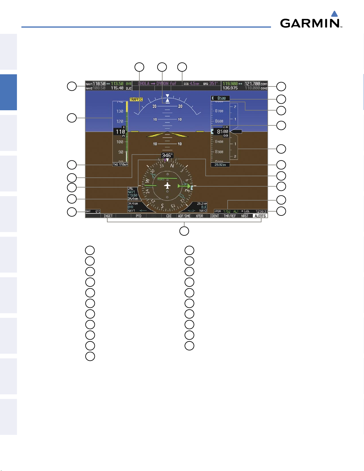
FLIGHT INSTRUMENTS
SYSTEM
OVERVIEW
21
20
19
FLIGHT
INSTRUMENTS
EIS
& CNS
AUDIO PANEL
FLIGHT
MANAGEMENT
1
2
3
4
5
6
7
8
1
NAV Frequency Box
12
Turn Rate Indicator
18
17
16
15
14
13
12
11
10
9
HAZARD
AVOIDANCE
AFCS
FEATURES
ADDITIONAL
APPENDICESINDEX
2
Airspeed Indicator
3
True Airspeed
4
Current Heading
5
Current Track Indicator
6
Horizontal Situation Indicator ( HSI)
7
Outside Air Temperature (OAT)
8
Softkeys
9
System Time
10
Transponder Data Box
11
Heading Bug
Figure 2-1 Primary Flight Display (Default)
13
Barometric Altimeter Setting
14
Vertical Speed Indicator (VSI)
15
Selected Altitude Bug
16
Altimeter
17
Selected Altitude
18
COM Frequency Box
19
Navigation Status Box
20
Slip/Skid Indicator
21
Attitude Indicator
Garmin G1000 Pilot’s Guide for the Diamond DA40/40F
190-00592-05 Rev. A52
Page 56

15
FLIGHT INSTRUMENTS
OVERVIEW
SYSTEM
INSTRUMENTS
FLIGHT
1
2
3
4
5
1
Traffic Annunciation
2
Selected Heading
3
Vspeed Reference
6
7
8
9
Flight Plan Window
10
Annunciation Window
11
Selected Course
14
13
12
11
10
9
EIS
AUDIO PANEL
& CNS
MANAGEMENT
FLIGHT
AVOIDANCE
HAZARD
4
Wind Data
5
Inset Map
6
DME Information Window
7
Bearing Information Windows
8
Minimum Descent Altitude/
Decision Height
Figure 2-2 Additional PFD Information
12
Vertical Speed Required
13
Vertical Deviation Indicator
14
Current VNV Target Altitude
15
AFCS Status Annunciation
AFCS
ADDITIONAL
FEATURES
APPENDICES INDEX
190-00592-05 Rev. A
Garmin G1000 Pilot’s Guide for the Diamond DA40/40F
53
Page 57
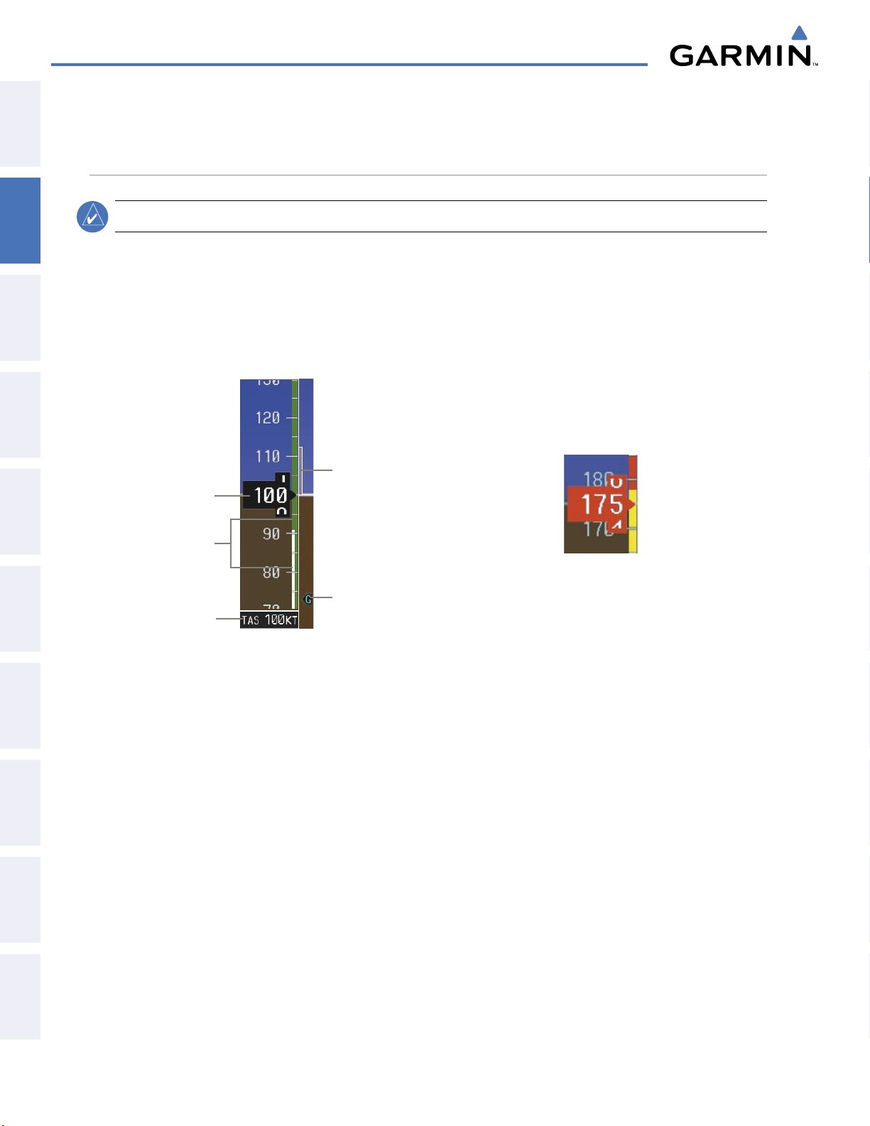
FLIGHT INSTRUMENTS
2.1 FLIGHT INSTRUMENTS
SYSTEM
OVERVIEW
AIRSPEED INDICATOR
FLIGHT
INSTRUMENTS
EIS
& CNS
AUDIO PANEL
FLIGHT
MANAGEMENT
HAZARD
AVOIDANCE
NOTE:
Refer to the Aircraft Flight Manual Supplement (AFMS) for airspeed criteria and Vspeed values.
The Airspeed Indicator displays airspeed on a moving tape rolling number gauge. The true airspeed is
displayed in knots below the Airspeed Indicator. The numeric labels and major tick marks on the moving
tape are marked at intervals of 10 knots. The minor tick marks on the moving tape are marked at intervals of
five knots. Speed indication starts at 20 knots, with 60 knots of airspeed viewable at any time. The indicated
airspeed is displayed inside the black pointer. The pointer remains black until reaching never-exceed speed
(VNE), at which point it turns red.
Airspeed
Indicated
Airspeed
Speed
Ranges
True
Airspeed
Figure 2-3 Airspeed Indicator
Trend
Vector
Vspeed
Reference
Figure 2-4 Red Pointer
Showing Overspeed V
NE
AFCS
FEATURES
ADDITIONAL
APPENDICESINDEX
A color-coded (white, green, yellow, and red) speed range strip is located on the moving tape. The colors
denote flaps operating range, normal operating range, caution range, and never-exceed speed (V
). Red and
NE
yellow ranges are also present for low speed awareness. For EASA-certified aircraft, the yellow low airspeed
awareness band is not shown and the limits on the other lower speed ranges differ (refer to the AFMS for speed
criteria).
The Airspeed Trend Vector is a vertical, magenta line, extending up or down on the airspeed scale, shown
to the right of the color-coded speed range strip. The end of the trend vector corresponds to the predicted
airspeed in 6 seconds if the current rate of acceleration is maintained. If the trend vector crosses V
, the text
NE
of the actual airspeed readout changes to yellow. The trend vector is absent if the speed remains constant or if
any data needed to calculate airspeed is not available due to a system failure.
Garmin G1000 Pilot’s Guide for the Diamond DA40/40F
190-00592-05 Rev. A54
Page 58
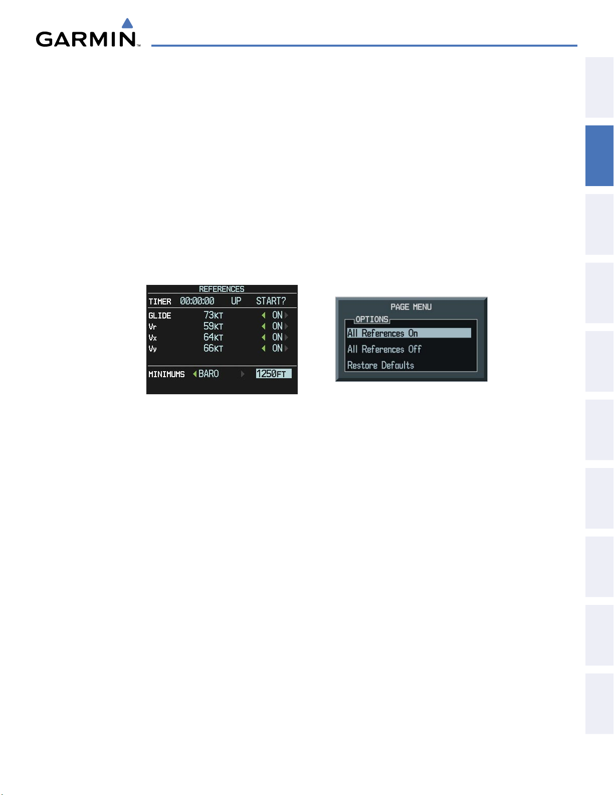
FLIGHT INSTRUMENTS
Vspeeds (Glide, VR, VX, and VY) can be changed and their flags turned on/off from the Timer/References
Window. When active (on), the Vspeeds are displayed at their respective locations to the right of the airspeed
scale. By default, all Vspeed values are reset and all flags turned off when power is cycled.
OVERVIEW
SYSTEM
Changing Vspeeds and turning Vspeed flags on/off:
1) Press the
2) Turn the
TMR/REF
large FMS
Softkey.
Knob to highlight the field of the desired Vspeed to be changed.
3) Use the FMS Knob to enter the desired value. When a speed has been changed from a default value, an asterisk
appears next to the speed.
4) Press the ENT Key or turn the large FMS Knob to highlight the ON/OFF field.
5) Turn the
6) To remove the window, press the
small FMS
Figure 2-5 Timer/References Window
Knob clockwise to ON or counterclockwise to OFF.
CLR
Key or the
TMR/REF
Softkey.
Figure 2-6 Timer/References Menu
INSTRUMENTS
FLIGHT
EIS
AUDIO PANEL
& CNS
MANAGEMENT
FLIGHT
AVOIDANCE
HAZARD
Turning all Vspeed flags on/off:
1) Press the
2) Press the
TMR/REF
MENU
Key.
Softkey.
3) To activate all Vspeed flags, press the ENT Key with All References On highlighted.
4) To remove all Vspeed flags, turn the FMS Knob to highlight All References Off and press the
ENT
Restoring all Vspeed defaults:
1) Press the
2) Press the
3) Turn the
TMR/REF
MENU
FMS
Softkey.
Key.
Knob to highlight Restore Defaults and press the
ENT
Key.
Key.
AFCS
ADDITIONAL
FEATURES
APPENDICES INDEX
190-00592-05 Rev. A
Garmin G1000 Pilot’s Guide for the Diamond DA40/40F
55
Page 59
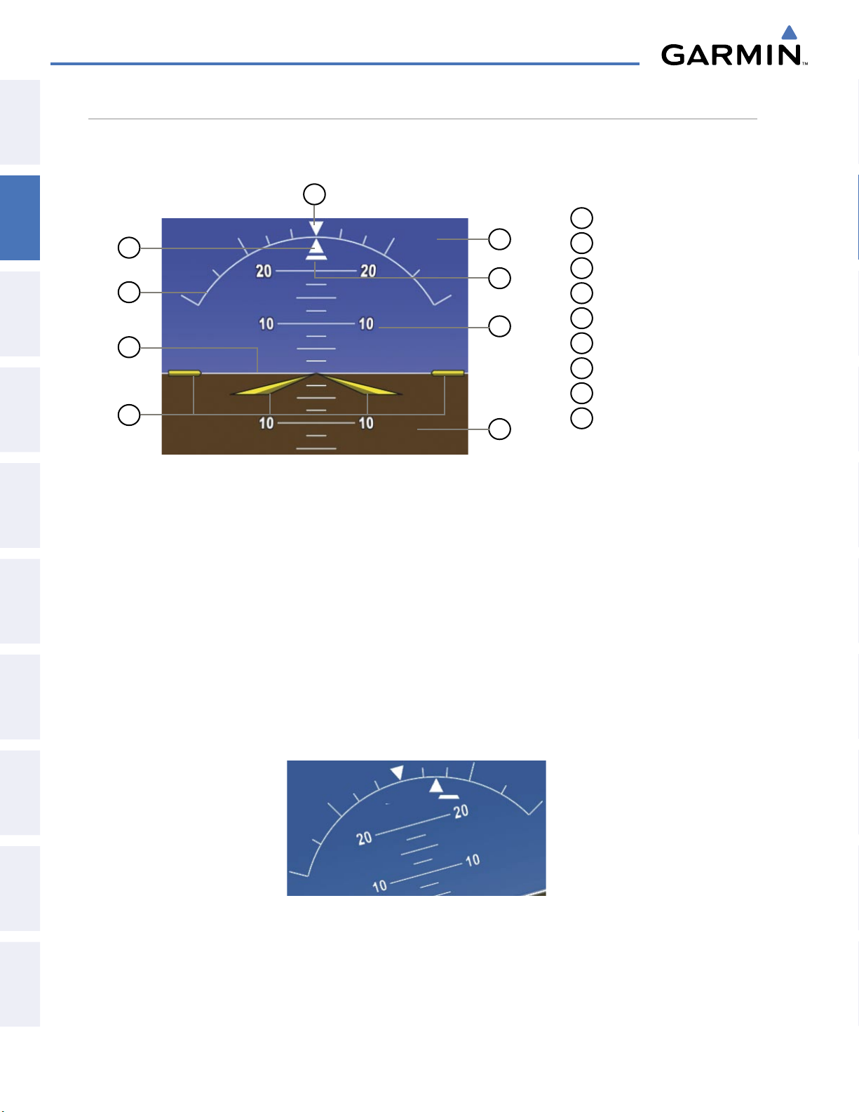
FLIGHT INSTRUMENTS
ATTITUDE INDICATOR
SYSTEM
OVERVIEW
FLIGHT
INSTRUMENTS
EIS
& CNS
AUDIO PANEL
FLIGHT
MANAGEMENT
Attitude information is displayed over a virtual blue sky and brown ground with a white horizon line. The
Attitude Indicator displays the pitch, roll, and slip/skid information.
9
1
Roll Pointer
1
2
3
4
8
7
6
5
2
Roll Scale
3
Horizon Line
4
Aircraft Symbol
5
Land Representation
6
Pitch Scale
7
Slip/Skid Indicator
8
Sky Representation
9
Roll Scale Zero
Figure 2-7 Attitude Indicator
The horizon line is part of the pitch scale. Above and below the horizon line, major pitch marks and numeric
labels are shown for every 10˚, up to 80˚. Minor pitch marks are shown for intervening 5˚ increments, up to
25˚ below and 45˚ above the horizon line. Between 20˚ below to 20˚ above the horizon line, minor pitch marks
occur every 2.5˚.
HAZARD
AVOIDANCE
AFCS
FEATURES
ADDITIONAL
APPENDICESINDEX
The inverted white triangle indicates zero on the roll scale. Major tick marks at 30˚ and 60˚ and minor tick
marks at 10˚, 20˚, and 45˚ are shown to the left and right of the zero. Angle of bank is indicated by the position
of the pointer on the roll scale.
The Slip/Skid Indicator is the bar beneath the roll pointer. The indicator moves with the roll pointer and
moves laterally away from the pointer to indicate lateral acceleration. Slip/skid is indicated by the location of
the bar relative to the pointer. One bar displacement is equal to one ball displacement on a traditional Slip/Skid
Indicator.
Figure 2-8 Slip/Skid Indication
Garmin G1000 Pilot’s Guide for the Diamond DA40/40F
190-00592-05 Rev. A56
Page 60
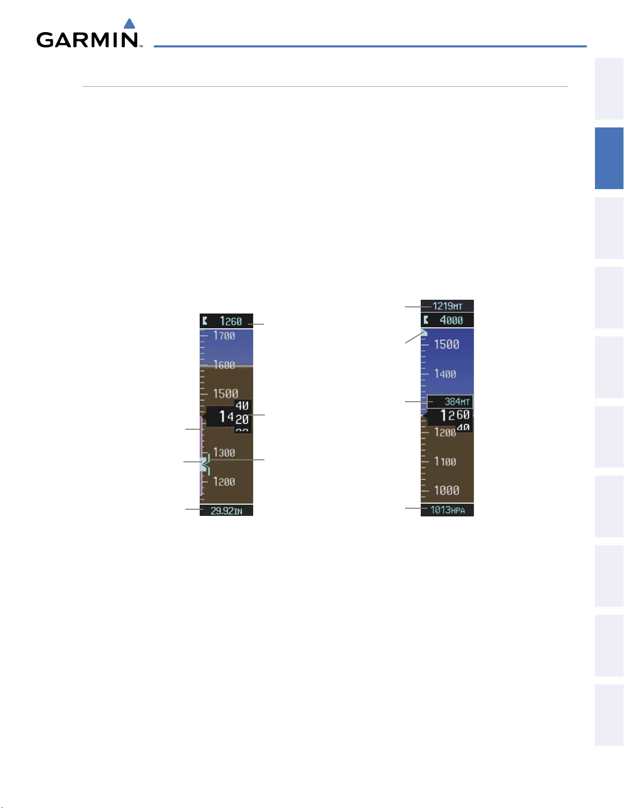
FLIGHT INSTRUMENTS
ALTIMETER
The Altimeter displays 600 feet of barometric altitude values at a time on a moving tape rolling number gauge.
Numeric labels and major tick marks are shown at intervals of 100 feet. Minor tick marks are at intervals of 20
feet. The indicated altitude is displayed inside the black pointer.
The Selected Altitude is displayed above the Altimeter in the box indicated by a selection bug symbol. A bug
corresponding to this altitude is shown on the tape. If the Selected Altitude exceeds the range shown on the
tape, the bug appears at the upper or lower edge of the tape. When the metric value is selected it is displayed
in a separate box above the Selected Altitude.
OVERVIEW
SYSTEM
INSTRUMENTS
FLIGHT
Setting the Selected Altitude:
Turn the
ALT
Knob to set the Selected Altitude (large knob for 1000-ft increments, small knob for 100-ft
increments (increments reduce to 10 feet for approach).
If set, the Minimum Descent Altitude/Decision Height (MDA/DH) value is also available for the Selected Altitude.
Selected
Altitude
(Meters)
Selected
Altitude
Bug
Indicated
Altitude
(Meters)
Barometric
Setting Box
(Hectopascals)
Altitude
Trend
Vector
Selected
Altitude
Bug
Barometric
Setting
Selected
Altitude
Indicated
Altitude
Barometric
Minimums
Bug
EIS
AUDIO PANEL
& CNS
MANAGEMENT
FLIGHT
AVOIDANCE
HAZARD
AFCS
190-00592-05 Rev. A
Altimeter Setting (In HG)
Figure 2-9 Altimeter Settings, In HG and Metric
Altimeter Setting (Metric)
Garmin G1000 Pilot’s Guide for the Diamond DA40/40F
57
ADDITIONAL
FEATURES
APPENDICES INDEX
Page 61
FLIGHT INSTRUMENTS
Altitudes can also be displayed in meters. Note that the altitude tape does not change scale.
SYSTEM
OVERVIEW
FLIGHT
INSTRUMENTS
EIS
& CNS
AUDIO PANEL
FLIGHT
MANAGEMENT
Displaying altitude in meters:
1) Press the PFD Softkey to display the second-level softkeys.
2) Press the ALT UNIT Softkey.
3) Press the METERS Softkey to turn on metric altitude readouts.
4) Press the
BACK
Softkey to return to the top-level softkeys.
A magenta Altitude Trend Vector extends up or down the left of the altitude tape, the end resting at the
approximate altitude to be reached in six seconds at the current vertical speed. The trend vector is not shown
if altitude remains constant or if data needed for calculation is not available due to a system failure.
The barometric pressure setting is displayed below the Altimeter in inches of mercury (in Hg) or hectopascals
(hPa) when metric units are selected. Adjusting the altimeter barometric pressure setting creates discontinuities
in VNV vertical navigation, moving the descent path. For large adjustments, it may take several minutes for the
aircraft to re-establish on the descent patch. If the change is made while nearing a waypoint with a VNV Target
Altitude, the aircraft may not re-establish on the descent path in time to meet the vertical constraint.
Selecting the altimeter barometric pressure setting:
Turn the BARO Knob to select the desired setting.
Selecting standard barometric pressure (29.92 in Hg):
1) Press the PFD Softkey to display the second-level softkeys.
HAZARD
AVOIDANCE
AFCS
FEATURES
ADDITIONAL
APPENDICESINDEX
2) Press the STD BARO Softkey.
Changing altimeter barometric pressure setting units:
1) Press the PFD Softkey to display the second-level softkeys.
2) Press the ALT UNIT Softkey.
3) Press the IN Softkey to display the barometric pressure setting in inches of mercury (in Hg).
Or, press the HPA Softkey to display the barometric pressure setting in hectopascals (hPa).
4) Press the
BACK
Softkey to return to the top-level softkeys.
Garmin G1000 Pilot’s Guide for the Diamond DA40/40F
190-00592-05 Rev. A58
Page 62
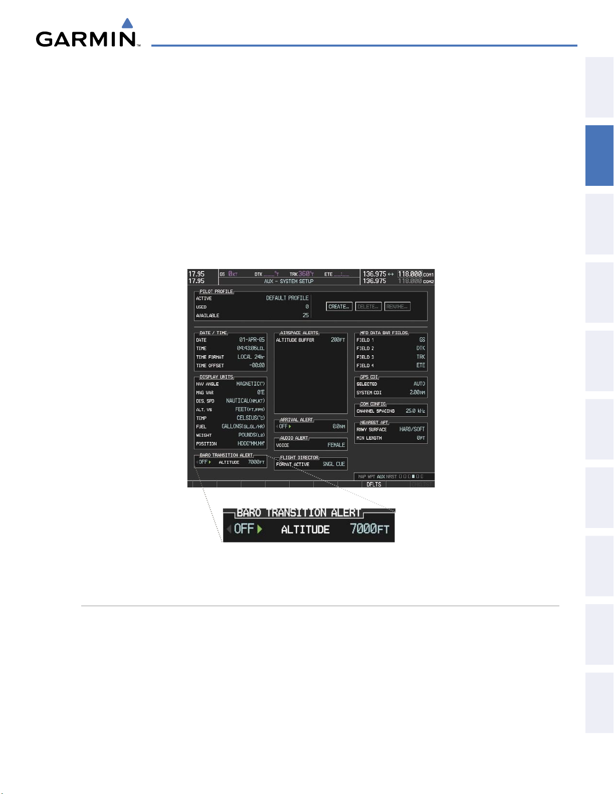
FLIGHT INSTRUMENTS
A Baro Transition Alert is provided to alert the pilot to change the barometric pressure setting when crossing
the transition altitude in either direction. This is displayed by the flashing light blue barometric pressure setting
when crossing the transition altitude.
OVERVIEW
SYSTEM
Setting the Baro Transition Alert:
1) Use the FMS Knob to select the AUX - System Setup Page on the MFD.
2) Press the FMS Knob to activate the cursor.
3) Turn the large FMS Knob to highlight Altitude in the Baro Transition Alert box.
4) Turn the small FMS Knob to turn the alert OFF or ON and press the ENT Key.
5) Turn the small FMS Knob to change the altitude and press the ENT Key.
6) To cancel the selection, press the FMS Knob.
INSTRUMENTS
FLIGHT
EIS
AUDIO PANEL
& CNS
MANAGEMENT
FLIGHT
AVOIDANCE
HAZARD
VERTICAL SPEED INDICATOR (VSI)
The Vertical Speed Indicator (VSI) displays the aircraft vertical speed on a fixed scale with labels at 1000 and
2000 fpm and minor tick marks every 500 fpm. Digits appear in the pointer when the climb or descent rate
is greater than 100 fpm. If the rate of ascent/descent exceeds 2000 fpm, the pointer appears at the edge of the
tape and the rate appears inside the pointer.
190-00592-05 Rev. A
Figure 2-10 Aux - System Setup Page, Baro Transition Alert
Garmin G1000 Pilot’s Guide for the Diamond DA40/40F
59
AFCS
ADDITIONAL
FEATURES
APPENDICES INDEX
Page 63

FLIGHT INSTRUMENTS
VERTICAL DEVIATION
SYSTEM
OVERVIEW
FLIGHT
INSTRUMENTS
EIS
& CNS
AUDIO PANEL
NOTE:
The Vertical Deviation Indicator (VDI) is a magenta chevron indicating the baro-VNV vertical deviation when
Vertical Navigation (VNV) is being used. The VDI appears in conjunction with the “TOD within 1 minute”
alert. The VDI is removed from the display if vertical deviation becomes invalid. See the Flight Management
Section for details on VNV features, and refer to Section 2.2, Supplemental Flight Data, for more information
about VNV indications on the PFD.
The Glideslope Indicator appears to the left of the Altimeter whenever an ILS frequency is tuned in the
active NAV field. A green diamond acts as the Glideslope Indicator, like a glideslope needle on a conventional
indicator. If a localizer frequency is tuned and there is no glideslope, “NO GS” is heard.
The glidepath is analogous to the glideslope for GPS approaches supporting WAAS vertical guidance (LNAV+V,
L/VNAV, LPV). When an approach of this type is loaded into the flight plan and GPS is the selected navigation
source, the Glidepath Indicator appears as a magenta diamond during the approach. If the approach type
downgrades past the final approach fix (FAF), “NO GP” is heard.
The Glidepath Indicator is only shown for aircraft with GIA 63W Integrated Avionics Units when
WAAS is available.
FLIGHT
MANAGEMENT
HAZARD
AVOIDANCE
Deviation
AFCS
FEATURES
ADDITIONAL
Full-scale deflection of two dots is 1000 feet.
VNV Target
Altitude
Vertical
Speed
Indicator
Vertical
Indicator
Figure 2-11 Vertical Speed and
Deviation Indicators (VSI and VDI)
Vertical
Speed
Pointer
Required
Vertical
Speed
Glideslope
Annunciation
Indicator
Figure 2-12 Glideslope Indicator
Marker
Beacon
Glidepath
Indicator
Figure 2-13 Glidepath Indicator
APPENDICESINDEX
Garmin G1000 Pilot’s Guide for the Diamond DA40/40F
190-00592-05 Rev. A60
Page 64
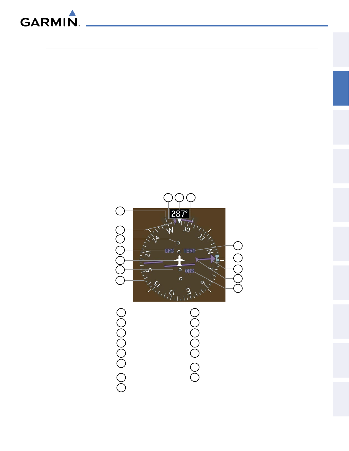
FLIGHT INSTRUMENTS
HORIZONTAL SITUATION INDICATOR (HSI)
The Horizontal Situation Indicator (HSI) displays a rotating compass card in a heading-up orientation. Letters
indicate the cardinal points with numeric labels every 30˚. Major tick marks are at 10˚ intervals and minor tick
marks are at 5˚ intervals. A digital reading of the current heading appears on top of the HSI, and the current
track is represented on the HSI by a magenta diamond. The HSI also presents turn rate, course deviation,
bearing, and navigation source information. The HSI is available in two formats, a 360˚ compass rose and a
140˚ arc.
Changing the HSI display format:
OVERVIEW
SYSTEM
INSTRUMENTS
FLIGHT
1) Press the
PFD
Softkey.
2) Press the HSI FRMT Softkey.
3) Press the
360 HSI
or
ARC HSI
Softkey.
The 360˚ HSI contains a Course Deviation Indicator (CDI), with a Course Pointer, To/From Indicator, and a
sliding deviation bar and scale. The course pointer is a single line arrow (GPS, VOR1, and LOC1) or a double
line arrow (VOR2 and LOC2) which points in the direction of the set course. The To/From arrow rotates with
the course pointer and is displayed when the active NAVAID is received.
14
13
12
11
10
9
8
15
1
2
3
4
5
6
7
EIS
AUDIO PANEL
& CNS
MANAGEMENT
FLIGHT
AVOIDANCE
HAZARD
AFCS
190-00592-05 Rev. A
1
Turn Rate Indicator
2
Current Track Bug
3
Lateral Deviation Scale
4
Navigation Source
5
Aircraft Symbol
6
Course Deviation Indicator
(CDI)
7
Rotating Compass Rose
8
OBS Mode Active
9
To/From Indicator
10
Course Pointer
11
Heading Bug
12
Flight Phase
13
Turn Rate/Heading
Trend Vector
14
Current Heading
15
Lubber Line
Figure 2-14 Horizontal Situation Indicator (HSI)
Garmin G1000 Pilot’s Guide for the Diamond DA40/40F
61
ADDITIONAL
FEATURES
APPENDICES INDEX
Page 65
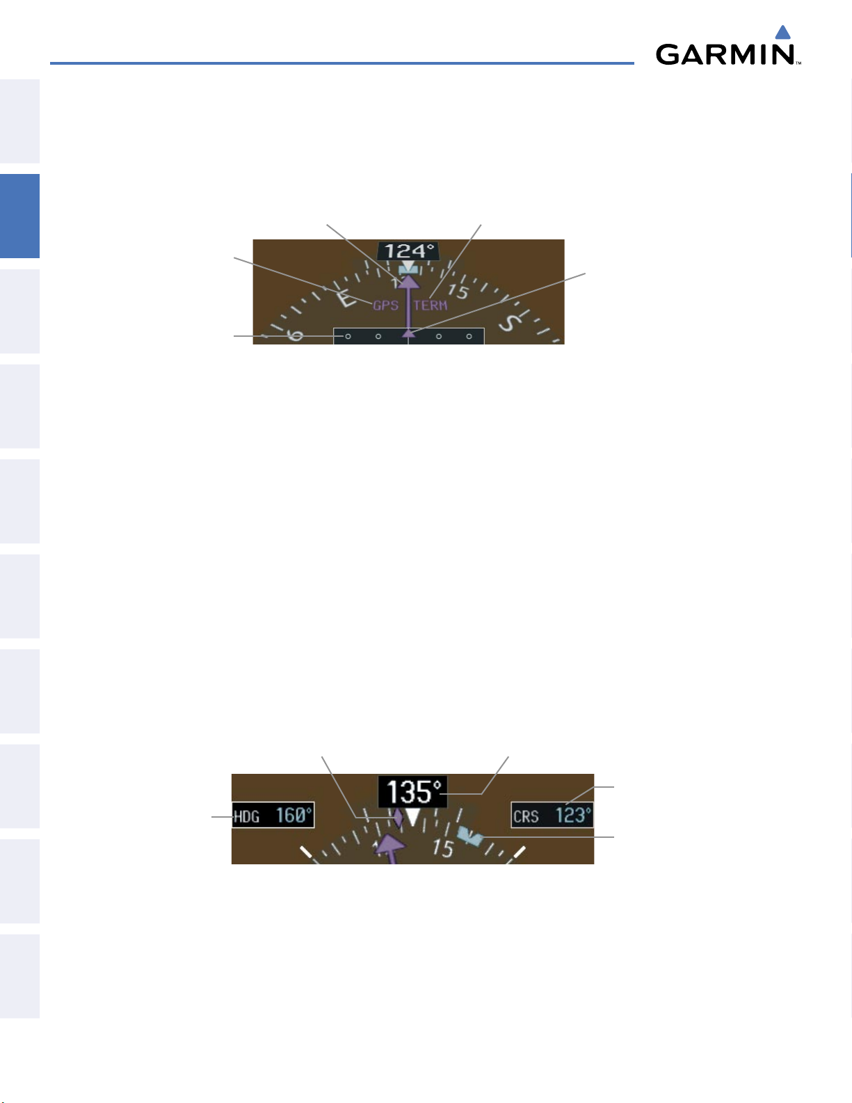
FLIGHT INSTRUMENTS
The Arc HSI is a 140˚ expanded section of the compass rose. The Arc HSI contains a Course Pointer,
SYSTEM
OVERVIEW
combined To/From Indicator and a sliding deviation indicator, and a deviation scale. Upon station passage, the
To/From Indicator flips and points to the tail of the aircraft, just like a conventional To/From flag. Depending
on the navigation source, the CDI on the Arc HSI can appear in two different ways, an arrowhead (GPS, VOR,
OBS) or a diamond (LOC).
FLIGHT
INSTRUMENTS
EIS
& CNS
AUDIO PANEL
FLIGHT
MANAGEMENT
HAZARD
AVOIDANCE
Course Pointer Flight Phase Annunciation
Navigation
Source
Lateral
Deviation
Scale
Figure 2-15 Arc HSI
Course
Deviation
and To/From
Indicator
The selected heading is shown to the upper left of the HSI for 3 seconds after being adjusted. The light blue
heading bug on the compass rose corresponds to the selected heading. While the HSI is displayed as an arc, if
the heading bug is adjusted off the shown portion of the compass rose, the digital reading is displayed.
Adjusting the Selected Heading:
Turn the
HDG
Knob to set the Selected Heading.
Press the HDG Knob to synchronize the bug to the current heading.
The Selected Course is shown to the upper right of the HSI for 3 seconds after being adjusted. While the
HSI is displayed as an arc, the Selected Course is displayed whenever the Course Pointer is not within the 140˚
currently shown.
Adjusting the Selected Course:
AFCS
FEATURES
ADDITIONAL
APPENDICESINDEX
Turn the
CRS
Knob to set the Selected Course.
Press the CRS Knob to re-center the CDI and return the course pointer to the bearing of the active waypoint or
navigation station.
Current HeadingCurrent Track Bug
Selected
Course
Selected
Heading
Figure 2-16 Heading and Course Indications
Garmin G1000 Pilot’s Guide for the Diamond DA40/40F
Selected
Heading
Bug
190-00592-05 Rev. A62
Page 66
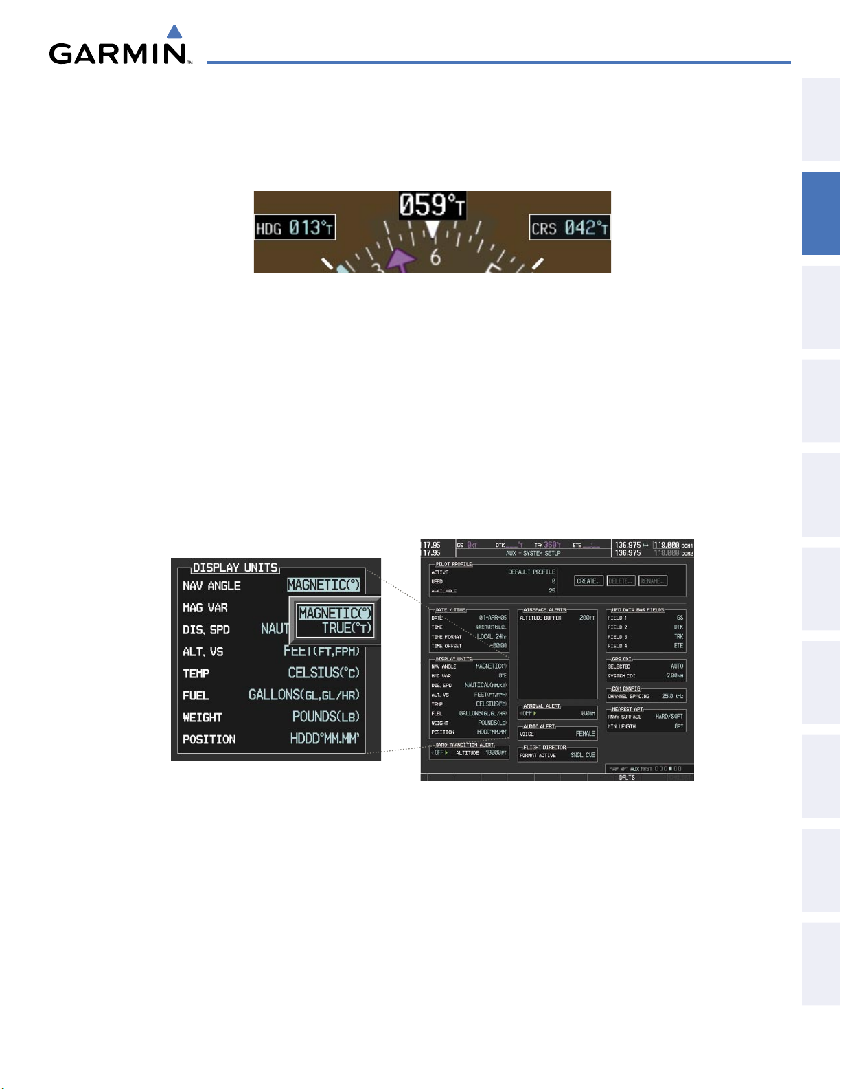
FLIGHT INSTRUMENTS
Navigation angles (track, heading, course, bearing) are corrected to the computed magnetic variation (Mag
Var) or referenced to true north (T), set on the AUX - System Setup Page. When an approach referenced to
true north has been loaded into the flight plan, the system generates a message to change the navigation angle
setting to True at the appropriate time.
OVERVIEW
SYSTEM
INSTRUMENTS
FLIGHT
Figure 2-17 Heading and Course Indications (True)
Changing the navigation angle true/magnetic setting:
1) Use the FMS Knob to select the AUX - System Setup Page on the MFD.
2) Press the FMS Knob to activate the cursor.
3) Turn the
large FMS
Knob to highlight Nav Angle in the Display Units box.
4) Turn the small FMS Knob to highlight the desired setting and press the ENT Key.
• TRUE - References angles to true north (T)
• MAGNETIC - Angles corrected to the computed magnetic variation (Mag Var)
EIS
AUDIO PANEL
& CNS
MANAGEMENT
FLIGHT
AVOIDANCE
HAZARD
AFCS
190-00592-05 Rev. A
Figure 2-18 AUX - System Setup Page, Navigation Angle Settings
Garmin G1000 Pilot’s Guide for the Diamond DA40/40F
63
ADDITIONAL
FEATURES
APPENDICES INDEX
Page 67
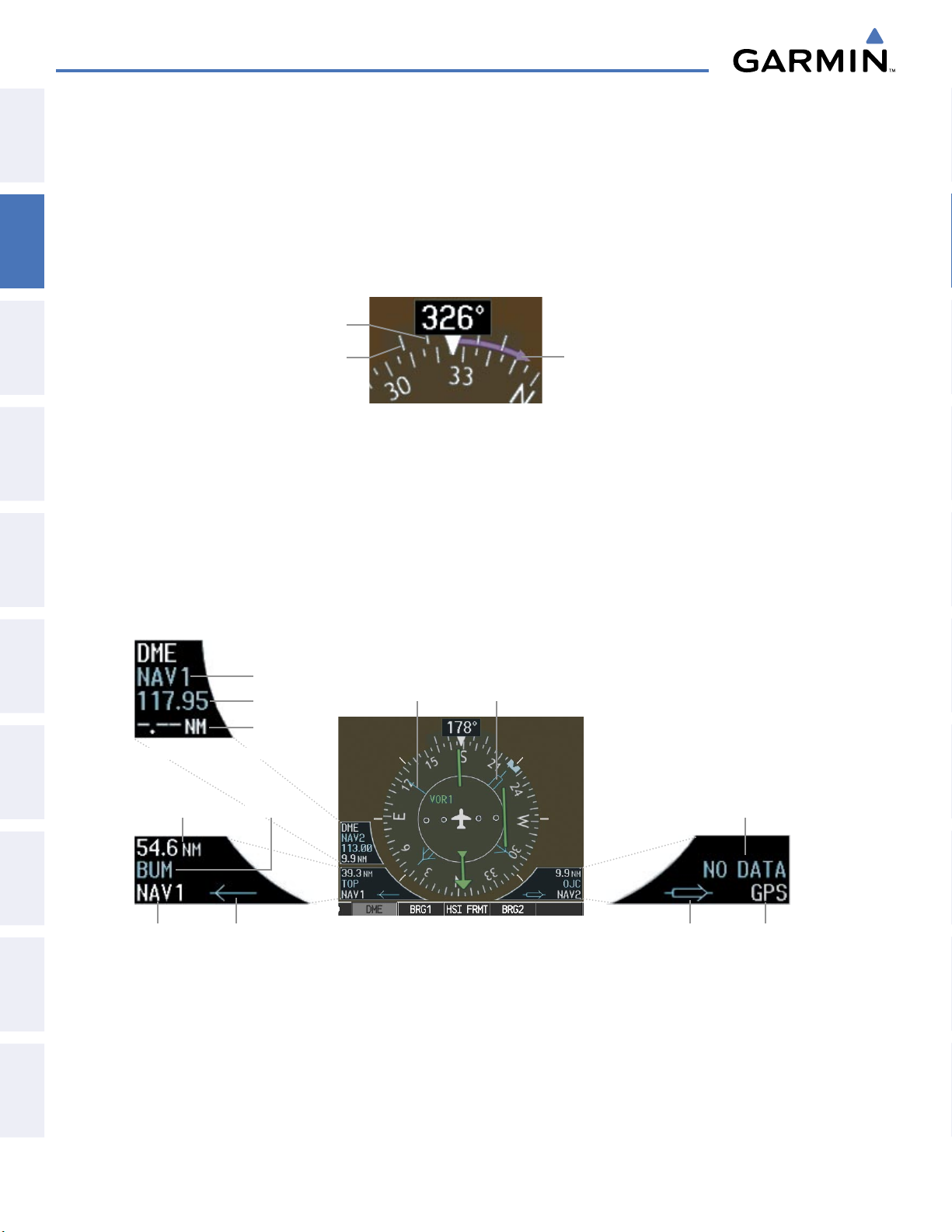
FLIGHT INSTRUMENTS
TURN RATE INDICATOR
SYSTEM
OVERVIEW
FLIGHT
INSTRUMENTS
EIS
& CNS
AUDIO PANEL
FLIGHT
MANAGEMENT
The Turn Rate Indicator is located directly above the rotating compass card. Tick marks to the left and right
of the lubber line denote half-standard and standard turn rates. A magenta Turn Rate Trend Vector shows the
current turn rate. The end of the trend vector gives the heading predicted in 6 seconds, based on the present
turn rate. A standard-rate turn is shown on the indicator by the trend vector stopping at the standard turn
rate tick mark, corresponding to a predicted heading of 18˚ from the current heading. At rates greater than 4
deg/sec, an arrowhead appears at the end of the magenta trend vector and the prediction is no longer valid.
Half-Standard
Turn Rate
Standard
Turn Rate
Figure 2-19 Turn Rate Indicator and Trend Vector
Arrow Shown
for Turn Rate
> 4 deg/sec
BEARING POINTERS AND INFORMATION WINDOWS
Two bearing pointers and associated information can be displayed on the HSI for NAV, GPS, and ADF
sources by pressing the PFD Softkey then a BRG or DME Softkey. The bearing pointers are light blue and are
single-line (BRG1) or double-line (BRG2). A pointer symbol is shown in the information windows to indicate
the navigation source. The bearing pointers never override the CDI and are visually separated from the CDI
by a white ring. Bearing pointers may be selected but not necessarily visible due to data unavailability.
HAZARD
AVOIDANCE
AFCS
FEATURES
ADDITIONAL
APPENDICESINDEX
Tuning Mode
Frequency
Distance
DME Information Window
Distance to
Bearing Source
Bearing
Source
Bearing 1 Information Window
Station
Identifier
Pointer
Icon
Bearing 1
Pointer
Figure 2-20 HSI with Bearing and DME Information
Bearing 2
Pointer
Bearing 2 Information Window
Pointer
Icon
No
Waypoint
Selected
Bearing
Source
Garmin G1000 Pilot’s Guide for the Diamond DA40/40F
190-00592-05 Rev. A64
Page 68
FLIGHT INSTRUMENTS
When a bearing pointer is displayed, the associated information window is also displayed. The Bearing
Information Windows are displayed at the lower sides of the HSI and give the following information:
OVERVIEW
SYSTEM
• Bearing source (NAV, GPS, ADF)
• Pointer icon (BRG1 = single line, BRG2 = double
line)
• Station/waypoint identifier (NAV, GPS)
• GPS-derived great circle distance to
source
bearing
• Frequency (ADF)
When the NAV radio is tuned to an ILS frequency the bearing source and the bearing pointer is removed
from the HSI. When NAV1 or NAV2 is the selected bearing source, the frequency is replaced by the station
identifier when the station is within range. If GPS is the bearing source, the active waypoint identifier is
displayed instead of a frequency.
The bearing pointer is removed from the HSI and NO DATA is displayed in the information window if
the NAV radio is not receiving a VOR station or if GPS is the bearing source and an active waypoint is not
selected.
Selecting bearing display and changing sources:
1) Press the PFD Softkey.
2) Press a BRG Softkey to display the desired bearing pointer and information window with a NAV source.
3) Press the BRG Softkey again to change the bearing source to GPS.
4) To remove the bearing pointer and information window, press the BRG Softkey again.
DME INFORMATION WINDOW
INSTRUMENTS
FLIGHT
EIS
AUDIO PANEL
& CNS
MANAGEMENT
FLIGHT
AVOIDANCE
HAZARD
The DME Information Window is displayed above the BRG1 Information Window on the 360˚ HSI and in
a box above and along side the Arc HSI. It shows the DME label, tuning mode (NAV1, NAV2, or HOLD),
frequency, and distance. When a signal is invalid, the distance is replaced by –.– – NM Refer to the Audio
Panel and CNS Section for information on tuning the DMEs.
Displaying the DME Information Window:
1) Press the PFD Softkey.
2) Press the DME Softkey to display the DME Information Window.
3) To remove the DME Information Window, press the DME Softkey again.
AFCS
ADDITIONAL
FEATURES
APPENDICES INDEX
190-00592-05 Rev. A
Garmin G1000 Pilot’s Guide for the Diamond DA40/40F
65
Page 69

FLIGHT INSTRUMENTS
COURSE DEVIATION INDICATOR (CDI)
SYSTEM
OVERVIEW
FLIGHT
INSTRUMENTS
NOTE:
switches to the opposite side of the deviation scale and displays reverse sensing.
The Course Deviation Indicator (CDI) moves left or right from the course pointer along a lateral deviation
scale to display aircraft position relative to the course. If the course deviation data is not valid, the CDI is not
displayed.
During a heading change of greater than 105˚ with respect to the course, the CDI on the Arc HSI
360º HSI
EIS
& CNS
AUDIO PANEL
FLIGHT
MANAGEMENT
HAZARD
AVOIDANCE
AFCS
Arc HSI
Flight
Phase
CDI
Navigation
Source
CDI
Flight
Phase
Navigation
Source
Scale
Crosstrack
Error
Figure 2-21 Course Deviation Indicator
Crosstrack
Error
CDI Scale
The CDI can display two sources of navigation, GPS or VOR/LOC. The color indicates the current navigation
source, magenta for GPS and green for VOR and LOC. The full scale limits for the CDI are defined by a GPSderived distance when navigating GPS. When navigating using a VOR or localizer (LOC), the CDI uses the
same angular deviation as a mechanical CDI. If the CDI exceeds the maximum deviation on the scale (two dots)
while navigating with GPS, the crosstrack error (XTK) is displayed below the white aircraft symbol.
FEATURES
ADDITIONAL
APPENDICESINDEX
Figure 2-22 Navigation Sources
Garmin G1000 Pilot’s Guide for the Diamond DA40/40F
190-00592-05 Rev. A66
Page 70
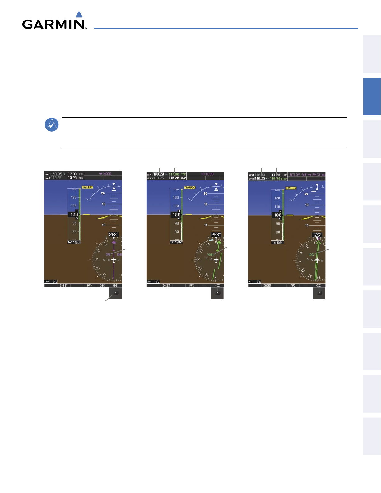
FLIGHT INSTRUMENTS
Changing navigation sources:
1) Press the CDI Softkey to change from GPS to VOR1 or LOC1. This places the light blue tuning box over the
NAV1 standby frequency in the upper left corner of the PFD.
2) Press the CDI Softkey again to change from VOR1 or LOC1 to VOR2 or LOC2. This places the light blue tuning
box over the NAV2 standby frequency.
3) Press the CDI Softkey a third time to return to GPS.
NOTE
:
KAP 140 equipped aircraft only: Each time the CDI Softkey is pressed or the navigation source
changes a message appears (“NAV Source Changed – Select Desired Autopilot Mode”) regardless of
whether or not the autopilot is engaged.
OVERVIEW
SYSTEM
INSTRUMENTS
FLIGHT
EIS
Pressing the
Softkey Cycles through
Navigation Sources
CDI
GPS
Selected
NAV1 Selected for Tuning
and Navigating a VOR
VOR1
Selected
Figure 2-23 Selecting a Navigation Source
NAV2 Selected for Tuning
and Navigating an ILS
LOC2
Selected
The system automatically switches from GPS to LOC navigation source and changes the CDI scaling accordingly
when all of the following occur:
AUDIO PANEL
& CNS
MANAGEMENT
FLIGHT
AVOIDANCE
HAZARD
AFCS
ADDITIONAL
FEATURES
• A localizer or ILS approach has been loaded into the active flight plan
• The final approach fix (FAF) is the active waypoint, the FAF is less than 15 nm away, and the aircraft is moving
toward the FAF
• A valid localizer frequency has been tuned
• The GPS CDI deviation is less than 1.2 times full-scale deflection
GPS steering guidance is still provided after the CDI automatically switches to LOC until LOC capture, up
to the Final Approach Fix (FAF) for an ILS approach, or until GPS information becomes invalid. Activating
a Vector-to-Final (VTF; see the Flight Management Section) also causes the CDI to switch to LOC navigation
source; GPS steering guidance is not provided after this switch.
190-00592-05 Rev. A
Garmin G1000 Pilot’s Guide for the Diamond DA40/40F
APPENDICES INDEX
67
Page 71

FLIGHT INSTRUMENTS
GPS CDI SCALING
SYSTEM
OVERVIEW
FLIGHT
INSTRUMENTS
EIS
& CNS
AUDIO PANEL
FLIGHT
MANAGEMENT
When GPS is the selected navigation source, the flight plan legs are sequenced automatically and
annunciations appear on the HSI for the flight phase. Flight phase annunciations are normally shown in
magenta, but when cautionary conditions exist the color changes to yellow. If the current leg in the flight plan
is a heading leg, HDG LEG is annunciated in magenta beneath the aircraft symbol.
The current GPS CDI scale setting is displayed as System CDI on the AUX - System Setup Page and the fullscale deflection setting may also be changed (2.0 nm, 1.0 nm, 0.3 nm, or Auto) from this page. If the selected
scaling is smaller than the automatic setting for enroute and terminal phases, the CDI is scaled accordingly
and the selected setting is displayed rather than the flight phase annunciation.
Changing the selected GPS CDI setting:
1) Use the FMS Knob to select the AUX - System Setup Page on the MFD.
2) Press the FMS Knob to activate the cursor.
3) Turn the
large FMS
Knob to highlight Selected in the GPS CDI box.
4) Turn the small FMS Knob to highlight the desired setting and press the ENT Key.
5) To cancel the selection, press the FMS Knob or the CLR Key.
HAZARD
AVOIDANCE
AFCS
FEATURES
ADDITIONAL
APPENDICESINDEX
Figure 2-24 AUX - System Setup Page, GPS CDI Settings
When set to Auto (default), the GPS CDI scale automatically adjusts to the desired limits based upon the
current phase of flight (Figure 2-25, Table 2-1).
Garmin G1000 Pilot’s Guide for the Diamond DA40/40F
190-00592-05 Rev. A68
Page 72
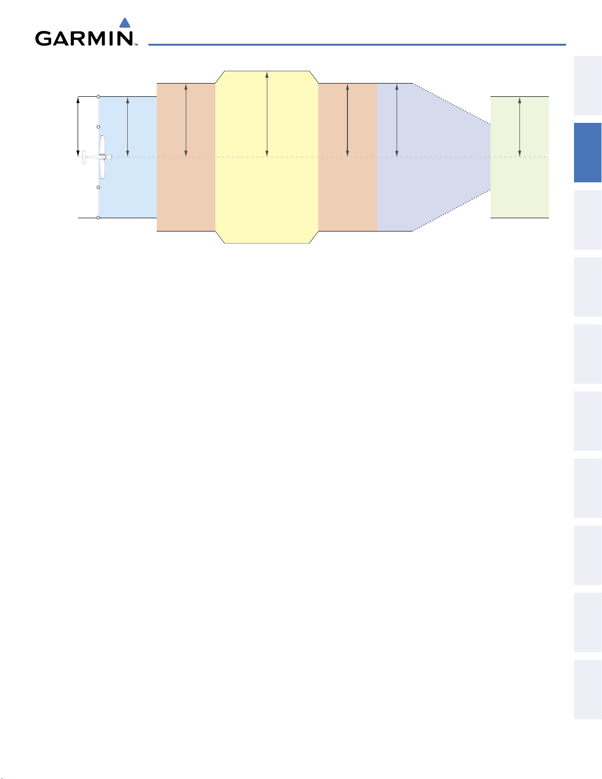
FLIGHT INSTRUMENTS
2.0 nm
Enroute
(Oceanic if >200 nm
from nearest airport)
0.3 nm
Missed
Approach
1.0 nm
Approach
1.0 nm
Terminal
1.0 nm
Terminal
0.3 nm
Departure
CDI Full-scale Deflection
Refer to accompanying
approach CDI scaling figures
OVERVIEW
SYSTEM
INSTRUMENTS
FLIGHT
EIS
Figure 2-25 Automatic CDI Scaling
• Once a departure procedure is activated, the CDI is scaled for departure (0.3 nm).
• The system switches from departure to terminal
CDI scaling (1.0 nm) under the following conditions:
- The next leg in the procedure is not aligned with the departure runway
-
The next leg in the departure procedure is not CA, CD, CF, CI, CR, DF, FA, FC, FD, FM, IF, or TF (see
Glossary for leg type definitions)
- After any leg in the departure procedure that is not CA or FA
• At 30 nm from the departure airport the enroute phase of flight is automatically entered and CDI scaling
changes to 2.0 nm over a distance of 1.0 nm, except under the following conditions:
- When navigating with an active departure procedure, the flight phase and CDI scale does not change
until the aircraft arrives at the last departure waypoint (if more than 30 nm from the departure airport) or
the leg after the last departure waypoint has been activated or a direct-to waypoint is activated.
• If after completing the departure procedure the nearest airport is more than 200 nm away from the aircraft
and the approach procedure has not yet commenced, the CDI is scaled for
oceanic flight (2.0 nm).
• Within 31 nm of the destination airport (terminal area), the CDI scale gradually ramps down from 2.0 nm
to 1.0 nm over a distance of 1.0 nm, except under the following conditions:
AUDIO PANEL
& CNS
MANAGEMENT
FLIGHT
AVOIDANCE
HAZARD
AFCS
ADDITIONAL
FEATURES
190-00592-05 Rev. A
- When navigating with an active arrival route, the flight phase and CDI scale does not change until the
aircraft arrives at the first waypoint in the arrive route (if within 31 nm from the destination airport).
• During approach, the CDI scale ramps down even further (see Figures 2-26 and 2-27). This transition
normally occurs within 2.0 nm of the final approach fix (FAF). The CDI switches to approach scaling
automatically once the approach procedure is activated or if Vector-to-Final (VTF) is selected.
- If the active waypoint is the FAF, the ground track and the bearing to the FAF must be within 45° of the
final approach segment course.
- If the active waypoint is part of the missed approach procedure, the active leg and preceding missed
approach legs must be aligned with the final approach segment course and the aircraft must not have
passed the turn initiation point.
Garmin G1000 Pilot’s Guide for the Diamond DA40/40F
APPENDICES INDEX
69
Page 73
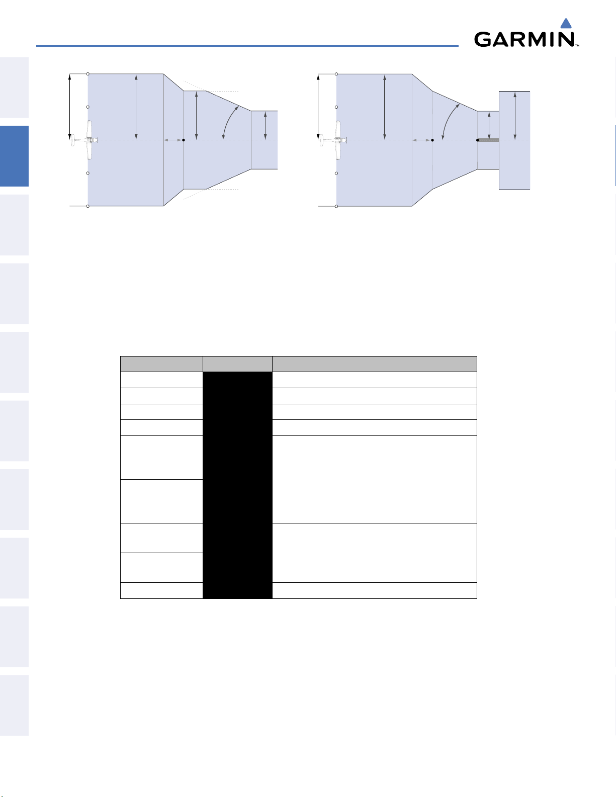
FLIGHT INSTRUMENTS
1.0 nm
2 nm
350 ft
angle set
by system
0.3 nm
FAF
CDI Full-scale Deflection
CDI scale is set to the smaller of 0.3 nm
or an angle set by the syste
m
CDI scale varies if VTF is activated
1.0 nm
2 nm
FAF
0.3 nm
course width
Landing
Threshold
CDI Full-scale Deflection
angle based
on database
information
CDI scale varies if VTF is activated
SYSTEM
OVERVIEW
FLIGHT
INSTRUMENTS
EIS
Figure 2-26 Typical LNAV and LNAV+V Approach CDI Scaling
& CNS
AUDIO PANEL
FLIGHT
MANAGEMENT
HAZARD
AVOIDANCE
AFCS
FEATURES
ADDITIONAL
Figure 2-27 Typical LNAV/VNAV and LPV Approach CDI Scaling
• When a missed approach is activated, the CDI scale changes to 0.3 nm.
• The system automatically switches back to terminal
scaling under the following conditions:
- The next leg in the missed approach procedure is not aligned with the final approach path
-
The next leg in the missed approach procedure is not CA, CD, CF, CI, CR, DF, FA, FC, FD, FM, IF, or TF
- After any leg in the missed approach procedure that is not CA or FA
Flight Phase Annunciation Automatic CDI Full-scale Deflection
Departure DPRT 0.3 nm
Terminal
TERM 1.0 nm
Enroute ENR 2.0 nm
Oceanic OCN 2.0 nm
Approach
(Non-precision)
Approach
(Non-precision with
LNAV
1.0 nm decreasing to 350 feet depending on
variables (see Figure 2-26)
LNAV + V
Vertical Guidance)
Approach
(LNAV/VNAV)
Approach
(LPV)
L/VNAV
LPV
1.0 nm decreasing to a specified course width, then
0.3 nm, depending on variables (see Figure 2-27)
Missed Approach MAPR 0.3 nm
APPENDICESINDEX
Table 2-1 Automatic GPS CDI Scaling
Garmin G1000 Pilot’s Guide for the Diamond DA40/40F
190-00592-05 Rev. A70
Page 74
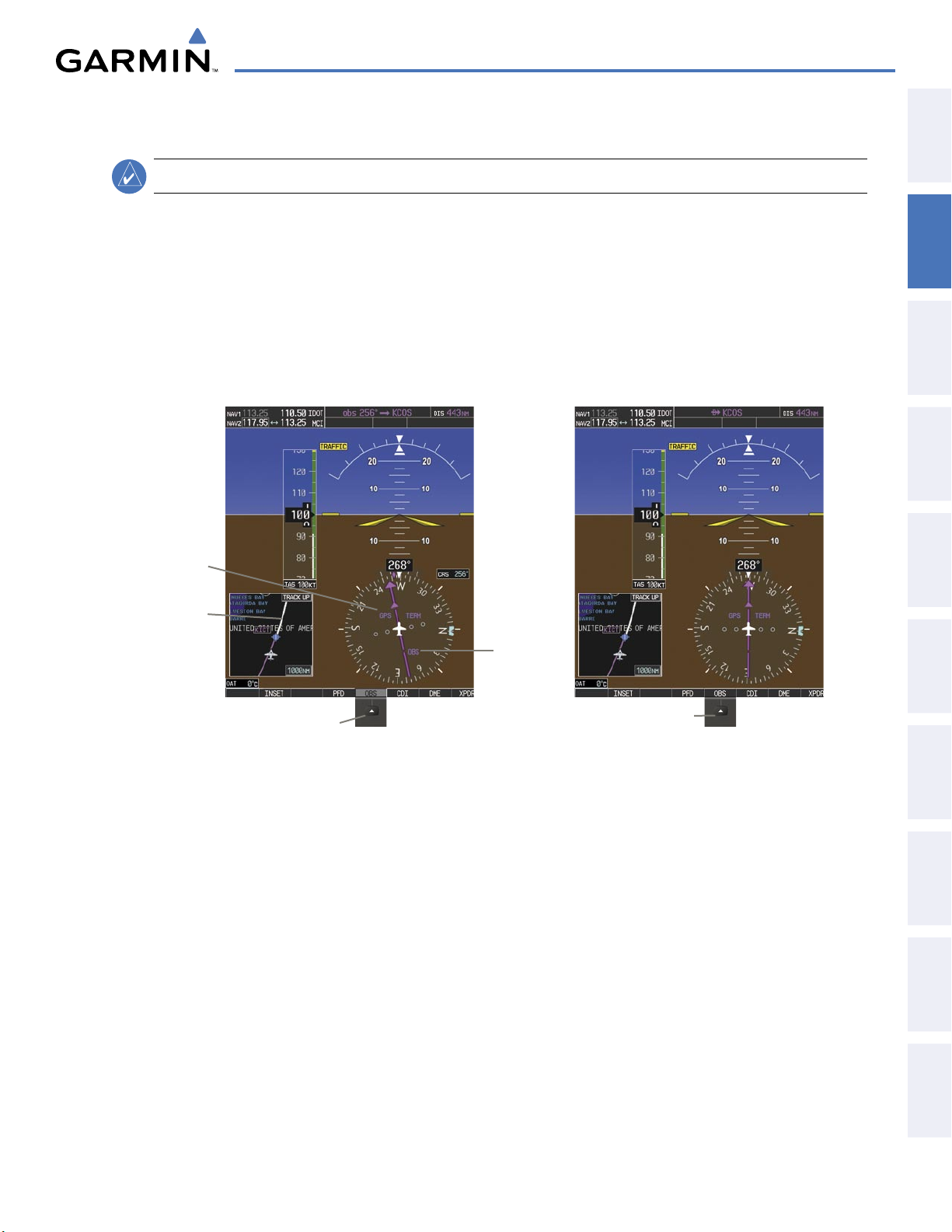
OBS MODE
FLIGHT INSTRUMENTS
OVERVIEW
SYSTEM
NOTE:
VNV is inhibited while automatic waypoint sequencing has been suspended.
Enabling Omni-bearing Selector (OBS) Mode suspends the automatic sequencing of waypoints in a GPS
flight plan (GPS must be the selected navigation source), but retains the current Active-to waypoint as the
navigation reference even after passing the waypoint. OBS is annunciated to the lower right of the aircraft
symbol when OBS Mode is selected.
While OBS is enabled, a course line is drawn through the Active-to waypoint on the moving map. If
desired, the course to/from the waypoint can now be adjusted. When OBS Mode is disabled, the GPS flight
plan returns to normal operation, with automatic sequencing of waypoints, following the course set in OBS
Mode. The flight plan on the moving map retains the modified course line.
GPS
Selected
Extended
Course
Line
OBS
Mode
Enabled
INSTRUMENTS
FLIGHT
EIS
AUDIO PANEL
& CNS
MANAGEMENT
FLIGHT
AVOIDANCE
HAZARD
Pressing the
Softkey Suspends
Waypoint Sequencing
OBS
Figure 2-28 Omni-bearing Selector (OBS) Mode
Pressing the
Softkey Again, Returns
to Normal Operation
OBS
AFCS
ADDITIONAL
FEATURES
APPENDICES INDEX
190-00592-05 Rev. A
Garmin G1000 Pilot’s Guide for the Diamond DA40/40F
71
Page 75

FLIGHT INSTRUMENTS
Enabling/disabling OBS Mode while navigating a GPS flight plan:
SYSTEM
OVERVIEW
FLIGHT
INSTRUMENTS
EIS
& CNS
AUDIO PANEL
FLIGHT
MANAGEMENT
1) Press the OBS Softkey to select OBS Mode.
2) Turn the CRS Knob to select the desired course to/from the waypoint. Press the CRS Knob to synchronize the
Selected Course with the bearing to the next waypoint.
3) Press the OBS Softkey again to return to automatic waypoint sequencing.
As the aircraft crosses the missed approach point (MAP), automatic approach waypoint sequencing is
suspended. SUSP appears on the HSI at the lower right of the aircraft symbol in place of OBS and the
OBS
Softkey label changes to SUSP. Pressing the SUSP Softkey resumes automatic sequencing of approach
waypoints.
SUSP
Annunciation
HAZARD
AVOIDANCE
AFCS
FEATURES
ADDITIONAL
APPENDICESINDEX
SUSP
Softkey Suspends
Waypoint Sequencing
Figure 2-29 Suspending Automatic Waypoint Sequencing
Garmin G1000 Pilot’s Guide for the Diamond DA40/40F
190-00592-05 Rev. A72
Page 76

2.2 SUPPLEMENTAL FLIGHT DATA
FLIGHT INSTRUMENTS
OVERVIEW
SYSTEM
NOTE:
Pressing the DFLTS Softkey turns off metric Altimeter display, the Inset Map and wind data display.
In addition to the flight instruments, the PFD also displays various supplemental information, including
temperatures, wind data, and Vertical Navigation (VNV) indications.
OUTSIDE AIR TEMPERATURE
The Outside Air Temperature (OAT) is displayed in degrees Celsius (°C) or Fahrenheit (°F) as selected by the
pilot, in the lower left of the PFD under normal display conditions. Temperature is displayed below the true
airspeed in reversionary mode.
Normal Display
INSTRUMENTS
FLIGHT
EIS
AUDIO PANEL
& CNS
MANAGEMENT
FLIGHT
AVOIDANCE
HAZARD
190-00592-05 Rev. A
Reversionary Mode
Figure 2-30 Outside Air Temperature
Garmin G1000 Pilot’s Guide for the Diamond DA40/40F
73
AFCS
ADDITIONAL
FEATURES
APPENDICES INDEX
Page 77

FLIGHT INSTRUMENTS
Changing temperature display units:
SYSTEM
OVERVIEW
FLIGHT
INSTRUMENTS
EIS
& CNS
AUDIO PANEL
FLIGHT
MANAGEMENT
1) Select the AUX - System Setup Page on the MFD using the FMS Knob.
2) Press the FMS Knob to activate the cursor.
3) Turn the
large FMS
Knob to highlight the TEMP field in the Display Units box.
4) Turn the small FMS Knob to highlight either CELSIUS or FAHRENHEIT and press the ENT Key to confirm the
selection.
5) To cancel the selection, press the FMS Knob or the CLR Key.
HAZARD
AVOIDANCE
AFCS
FEATURES
ADDITIONAL
APPENDICESINDEX
Figure 2-31 AUX - System Setup Page, Temperature Selection
Garmin G1000 Pilot’s Guide for the Diamond DA40/40F
190-00592-05 Rev. A74
Page 78
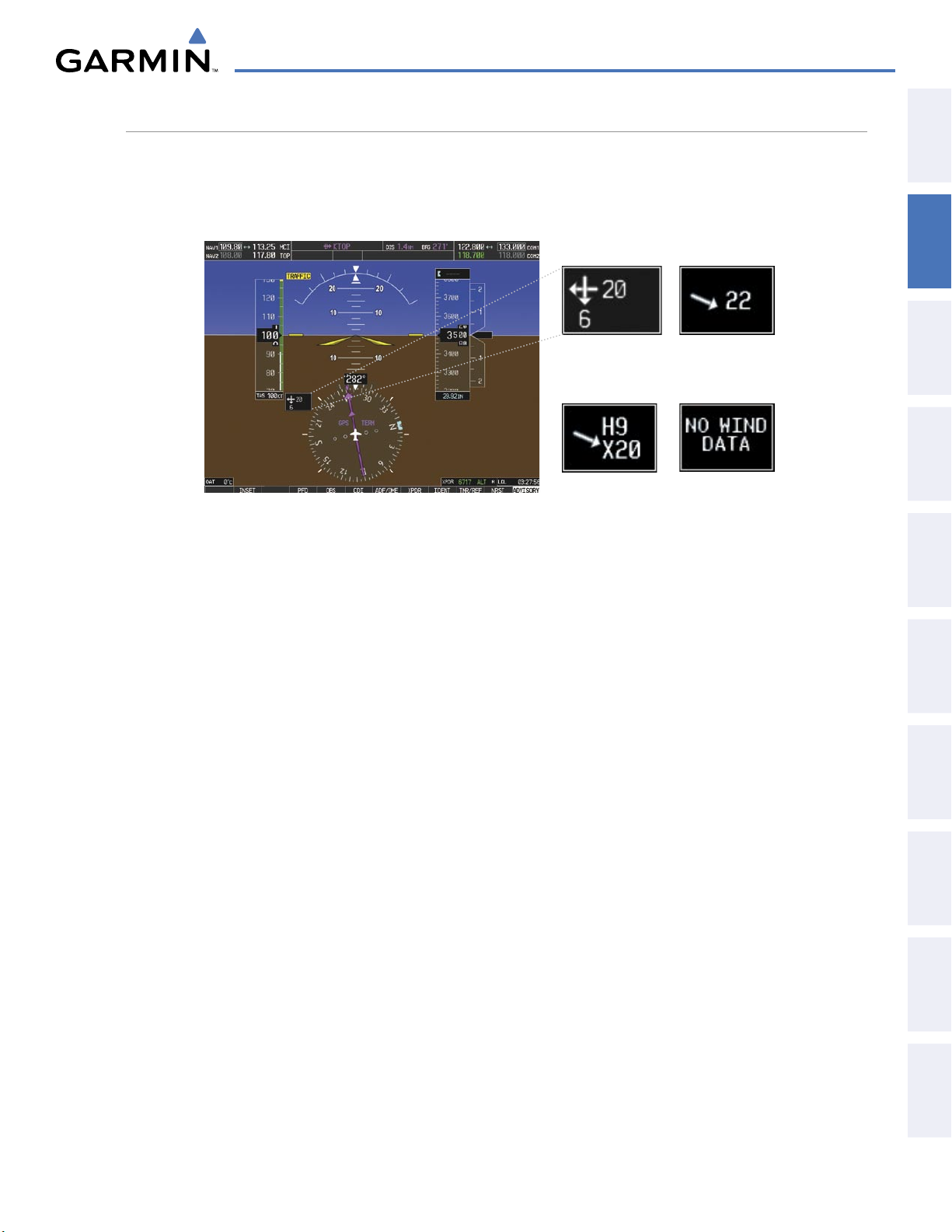
FLIGHT INSTRUMENTS
WIND DATA
Wind direction and speed in knots can be displayed relative to the aircraft in a window to the upper left of
the HSI. When the window is selected for display, but wind information is invalid or unavailable, the window
displays NO WIND DATA. Wind data can be displayed in three different ways.
Option 2Option 1
OVERVIEW
SYSTEM
INSTRUMENTS
FLIGHT
EIS
Option 3
Figure 2-32 Wind Data
No Data
Displaying wind data:
1) Press the PFD Softkey.
2) Press the WIND Softkey to display wind data below the Selected Heading.
3) Press one of the OPTN softkeys to change how wind data is displayed:
• OPTN 1: Headwind and crosswind components
• OPTN 2: Total wind direction and speed
• OPTN 3: Total wind direction with headwind and crosswind speed components
4) To remove the window, press the OFF Softkey.
AUDIO PANEL
& CNS
MANAGEMENT
FLIGHT
AVOIDANCE
HAZARD
AFCS
190-00592-05 Rev. A
Garmin G1000 Pilot’s Guide for the Diamond DA40/40F
75
ADDITIONAL
FEATURES
APPENDICES INDEX
Page 79
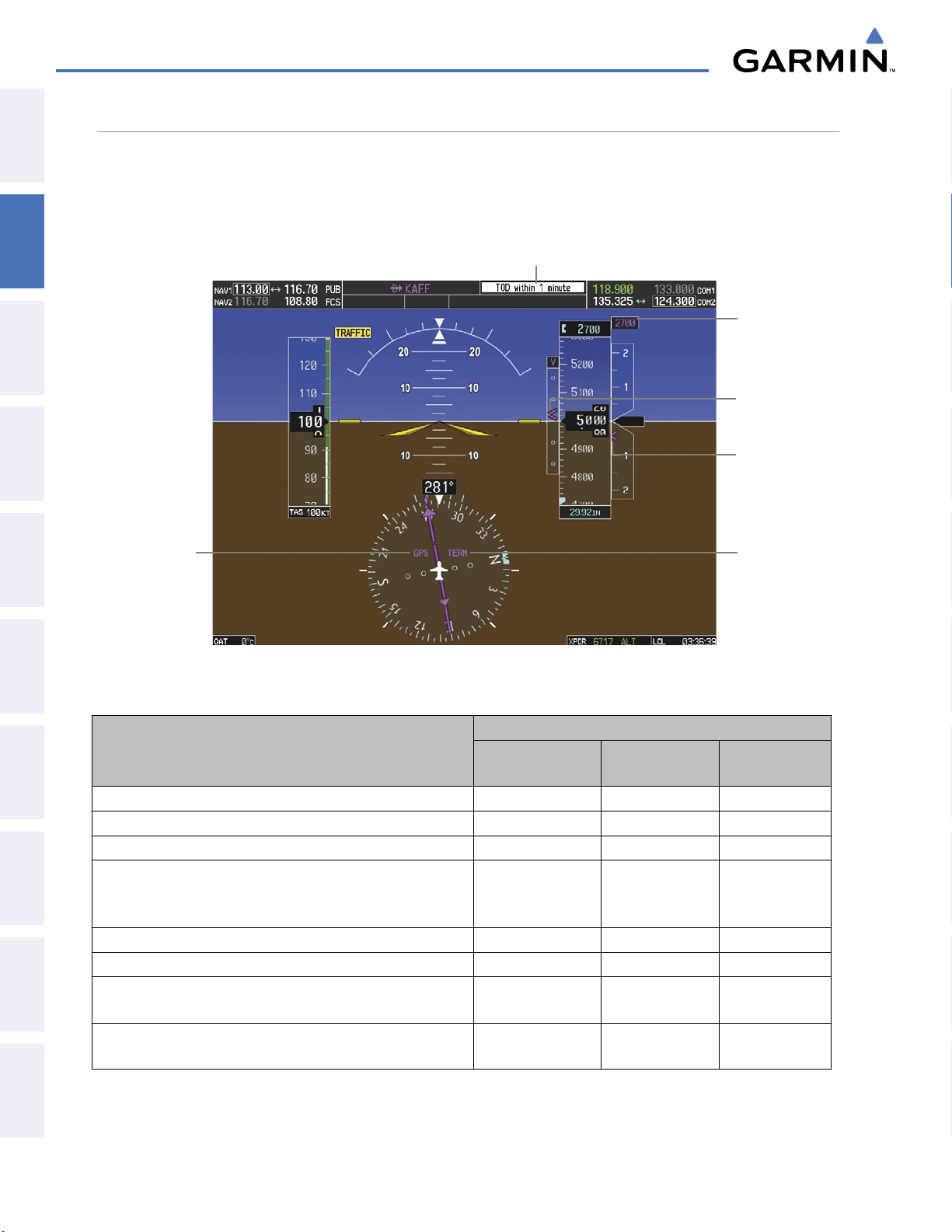
FLIGHT INSTRUMENTS
VERTICAL NAVIGATION (VNV) INDICATIONS
SYSTEM
OVERVIEW
FLIGHT
INSTRUMENTS
EIS
& CNS
AUDIO PANEL
FLIGHT
MANAGEMENT
When a VNV flight plan has been activated, VNV indications (VNV Target Altitude, RVSI, VDI) appear on the
PFD in conjunction with the “TOD within 1 minute” message and “Vertical track” voice alert. See the Flight
Management and AFCS sections for details on VNV features. VNV indications are removed from the PFD
according to the criteria listed in the table.
Top of Descent Message
VNV Target
Altitude
Vertical
Deviation
Indicator
Required
Vertical
Speed Bug
GPS is
Selected
Navigation
Source
Enroute
Phase of
Flight
HAZARD
AVOIDANCE
AFCS
FEATURES
ADDITIONAL
APPENDICESINDEX
Figure 2-33 Vertical Navigation Indications (PFD)
VNV Indication Removed
Criteria
Aircraft > 1 min before the next TOD and not on a descent leg
Aircraft > 1 min before the next TOD due to flight plan change
Required Vertical
Speed (RVSI)
X X X
X X X
Vertical
Deviation (VDI)
VNV Target
Altitude
VNV cancelled (CNCL VNV Softkey selected on MFD) X X X
Distance to active waypoint cannot be computed due to
unsupported flight plan leg type (see Flight Management
X X X
Section)
Aircraft > 250 feet below active VNV Target Altitude
Current crosstrack or track angle error has exceeded limit
Active altitude-constrained waypoint can not be reached within
maximum allowed flight path angle and vertical speed
Last altitude-constrained waypoint in active flight plan reached
Table 2-2 VNV Indication Removal Criteria
X X X
X X X
X X
X
X
(30 sec before)
X
Garmin G1000 Pilot’s Guide for the Diamond DA40/40F
190-00592-05 Rev. A76
Page 80
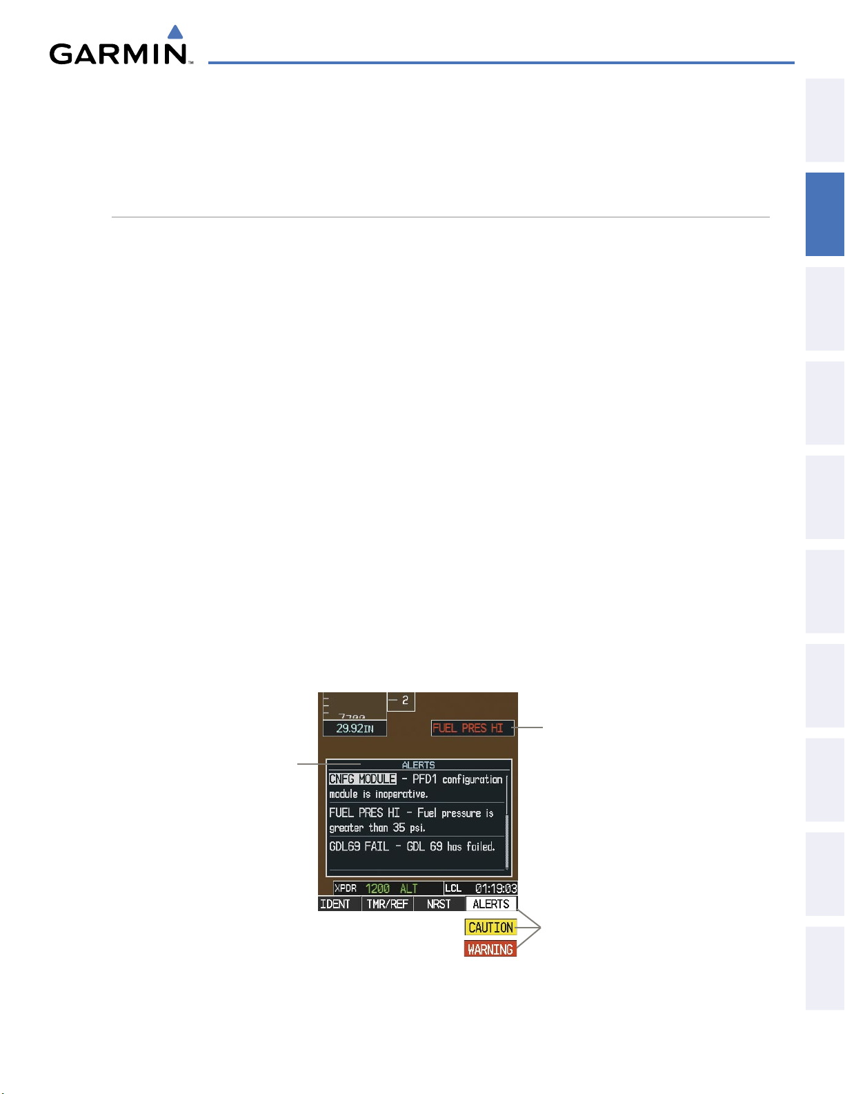
FLIGHT INSTRUMENTS
2.3 PFD ANNUNCIATIONS AND ALERTING FUNCTIONS
The following annunciations and alerting functions are displayed on the PFD. Refer to Appendix A for more
information on alerts and annunciations.
SYSTEM ALERTING
Messages appear in the Alerts Window in the lower right corner of the PFD when a warning, caution, advisory
alert, or G1000 message advisory occurs. System alert messages are provided for awareness of G1000 system
problems or status and may or may not require pilot action. The Alerts Window allows system alerts to be
displayed simultaneously. The FMS Knob is used to scroll through the alert messages. The Alerts Window
is enabled/disabled by pressing the
ALERTS
generated, pressing the ALERTS Softkey to acknowledge the message turns the softkey gray.
Softkey. If the window is already open when a new message is
OVERVIEW
SYSTEM
INSTRUMENTS
FLIGHT
EIS
The ALERTS Softkey label changes to display the appropriate annunciation when an alert is issued. The
annunciation flashes and the appropriate aural alert sounds until acknowledged by pressing the softkey. The
softkey then reverts to the ALERTS label, and when pressed again opens the Alerts Window to display a
descriptive message of the alert.
Caution indicates the existence of abnormal conditions on the aircraft that may require pilot intervention. A
flashing
The flashing CAUTION Softkey annunciation continues to flash until acknowledged by pressing the
CAUTION Softkey annunciation and single aural tone (one chime) indicate the presence of a caution.
CAUTION
Softkey.
Warnings are time-critical and require immediate attention. A flashing WARNING Softkey annunciation and
aural tone (single chime every two seconds) indicate the presence of a warning. The aural tone and flashing
WARNING
Softkey annunciation continue until acknowledged by pressing the
WARNING
Softkey.
The Annunciation Window appears to the right of the Vertical Speed Indicator and displays abbreviated
annunciation text for aircraft alerts. Warnings appear in red, cautions in yellow, advisory alerts in white,
and safe operating annunciations in green. New alerts are displayed at the top of the Annunciation Window,
regardless of priority. Once acknowledged, they are sequenced based on priority.
Annunciation
Window
Alerts
Window
AUDIO PANEL
& CNS
MANAGEMENT
FLIGHT
AVOIDANCE
HAZARD
AFCS
ADDITIONAL
FEATURES
190-00592-05 Rev. A
Softkey
Annunciations
Figure 2-34 G1000 Alerting System
Garmin G1000 Pilot’s Guide for the Diamond DA40/40F
APPENDICES INDEX
77
Page 81
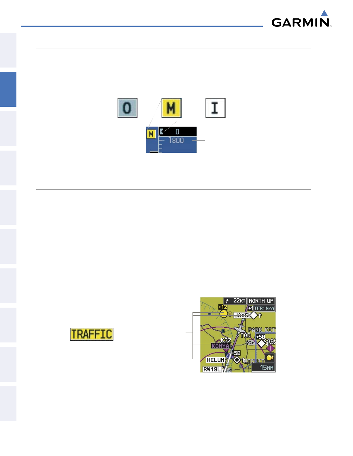
FLIGHT INSTRUMENTS
MARKER BEACON ANNUNCIATIONS
SYSTEM
OVERVIEW
FLIGHT
INSTRUMENTS
EIS
& CNS
AUDIO PANEL
FLIGHT
MANAGEMENT
Marker Beacon Annunciations are displayed on the PFD to the left of the Selected Altitude. Outer marker
reception is indicated in blue, middle in yellow, and inner in white. Refer to the Audio Panel and CNS Section
for more information on Marker Beacon Annunciations.
Inner MarkerMiddle MarkerOuter Marker
Altimeter
Figure 2-35 Marker Beacon Annunciations
TRAFFIC ANNUNCIATION
Traffic is displayed symbolically on the PFD Inset Map, the MFD Navigation Map Page, and various other
MFD page maps. Refer to the Hazard Avoidance Section and Appendix F for more details about the Traffic
Information Service (TIS) and optional Traffic Advisory Systems (TAS). When a traffic advisory (TA) is detected,
the following automatically occur:
HAZARD
AVOIDANCE
AFCS
FEATURES
ADDITIONAL
APPENDICESINDEX
• The PFD Inset Map is enabled and displays traffic
• A flashing black-on-yellow TRAFFIC annunciation appears to the top left of the Attitude Indicator for five
seconds and remains displayed until no TAs are detected in the area
• A single
“TRAFFIC” aural alert is heard, unless an optional Traffic Advisory System (TAS) is installed. Refer
to the applicable TAS documentation for alerts generated by TAS equipment.
If additional TAs appear, new aural and visual alerts are generated.
Traffic
Symbols
PFD Traffic Annunciation
PFD Inset Map with Traffic Displayed
Figure 2-36 Traffic Annunciation and Inset Map with Traffic Displayed
Garmin G1000 Pilot’s Guide for the Diamond DA40/40F
190-00592-05 Rev. A78
Page 82

FLIGHT INSTRUMENTS
TAWS ANNUNCIATIONS
Terrain Awareness and Warning System (TAWS) annunciations appear on the PFD at the top left of the Altimeter.
Refer to the Hazard Avoidance Section and Appendix A for information on TAWS alerts and annunciations.
OVERVIEW
SYSTEM
INSTRUMENTS
FLIGHT
EIS
AUDIO PANEL
& CNS
MANAGEMENT
FLIGHT
Figure 2-37 Traffic and TAWS Annunciations
AVOIDANCE
HAZARD
AFCS
ADDITIONAL
FEATURES
APPENDICES INDEX
190-00592-05 Rev. A
Garmin G1000 Pilot’s Guide for the Diamond DA40/40F
79
Page 83
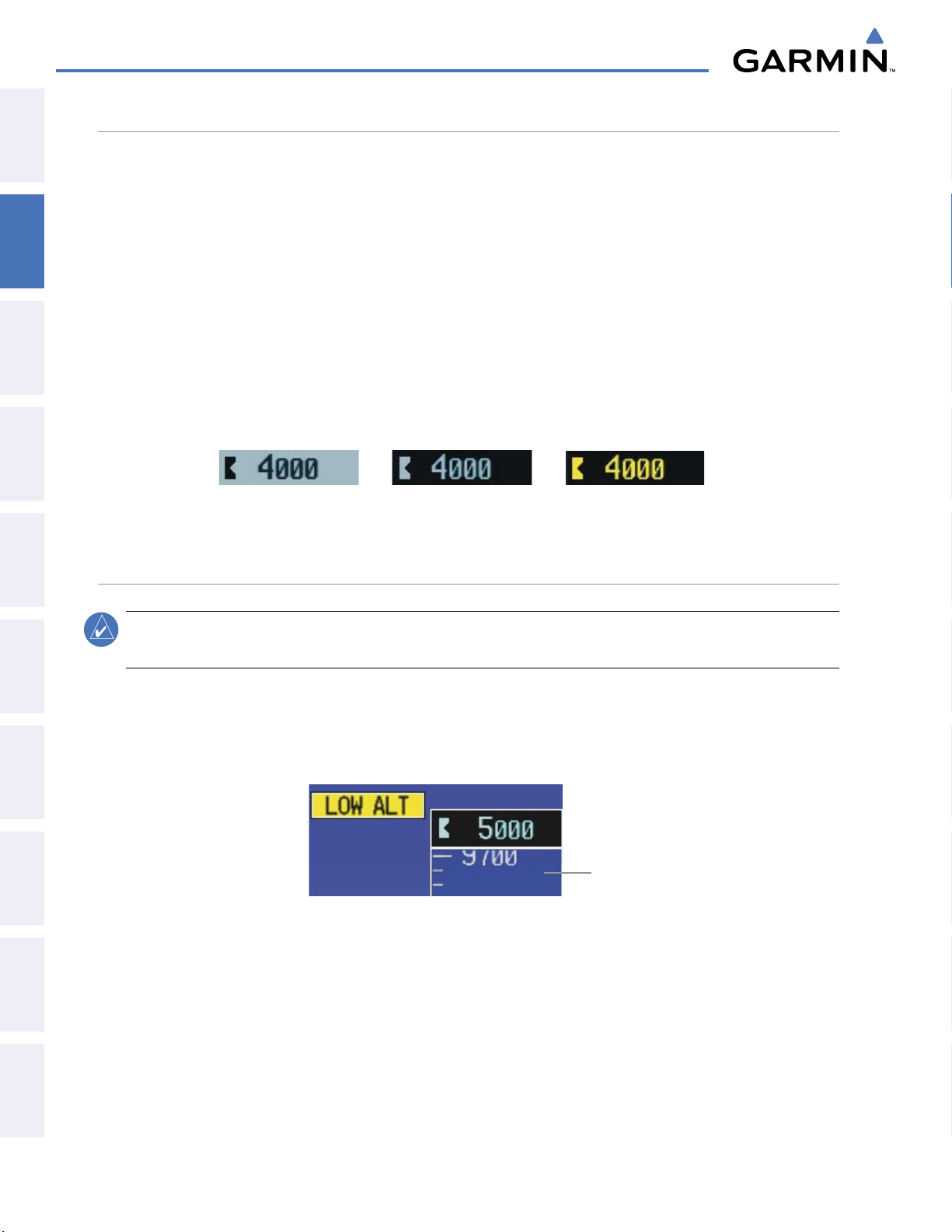
FLIGHT INSTRUMENTS
ALTITUDE ALERTING
SYSTEM
OVERVIEW
FLIGHT
INSTRUMENTS
EIS
& CNS
AUDIO PANEL
FLIGHT
MANAGEMENT
Altitude Alerting provides the pilot with a visual alert when approaching the Selected Altitude. Whenever the
Selected Altitude is changed, the Altitude Alerter is reset. The Altitude Alerter is independent of the GFC 700
AFCS, but alerting tones are heard only when the GFC 700 is installed. The following occur when approaching
the Selected Altitude:
• Upon passing through 1000 feet of the Selected Altitude an aural tone is heard. The Selected Altitude changes
to black text on a light blue background and flashes for 5 seconds.
• When the aircraft passes within 200 feet of the Selected Altitude, the Selected Altitude changes to light blue
text on a black background and flashes for 5 seconds.
• After reaching the Selected Altitude, if the pilot flies outside the deviation band (±200 feet of the Selected
Altitude) an aural tone is heard. The Selected Altitude changes to yellow text on a black background and
flashes for 5 seconds.
Within 1000 ft Within 200 ft Deviation of ±200 ft
Figure 2-38 Altitude Alerting Visual Annunciations
LOW ALTITUDE ANNUNCIATION
HAZARD
AVOIDANCE
AFCS
FEATURES
ADDITIONAL
APPENDICESINDEX
NOTE:
A Low Altitude Annunciation is available only when WAAS is available. This annunciation is not
shown for systems with TAWS, unless TAWS is inhibited.
When the Final Approach Fix (FAF) is the active waypoint in a GPS WAAS approach using vertical guidance,
a Low Altitude Annunciation may appear if the current aircraft altitude is at least 164 feet below the prescribed
altitude at the FAF. A black-on-yellow LOW ALT annunciation appears to the top right of the Altimeter, flashing
for several seconds, then remaining displayed until the condition is resolved.
Altimeter
Figure 2-39 Low Altitude on GPS WAAS Approach
Garmin G1000 Pilot’s Guide for the Diamond DA40/40F
190-00592-05 Rev. A80
Page 84
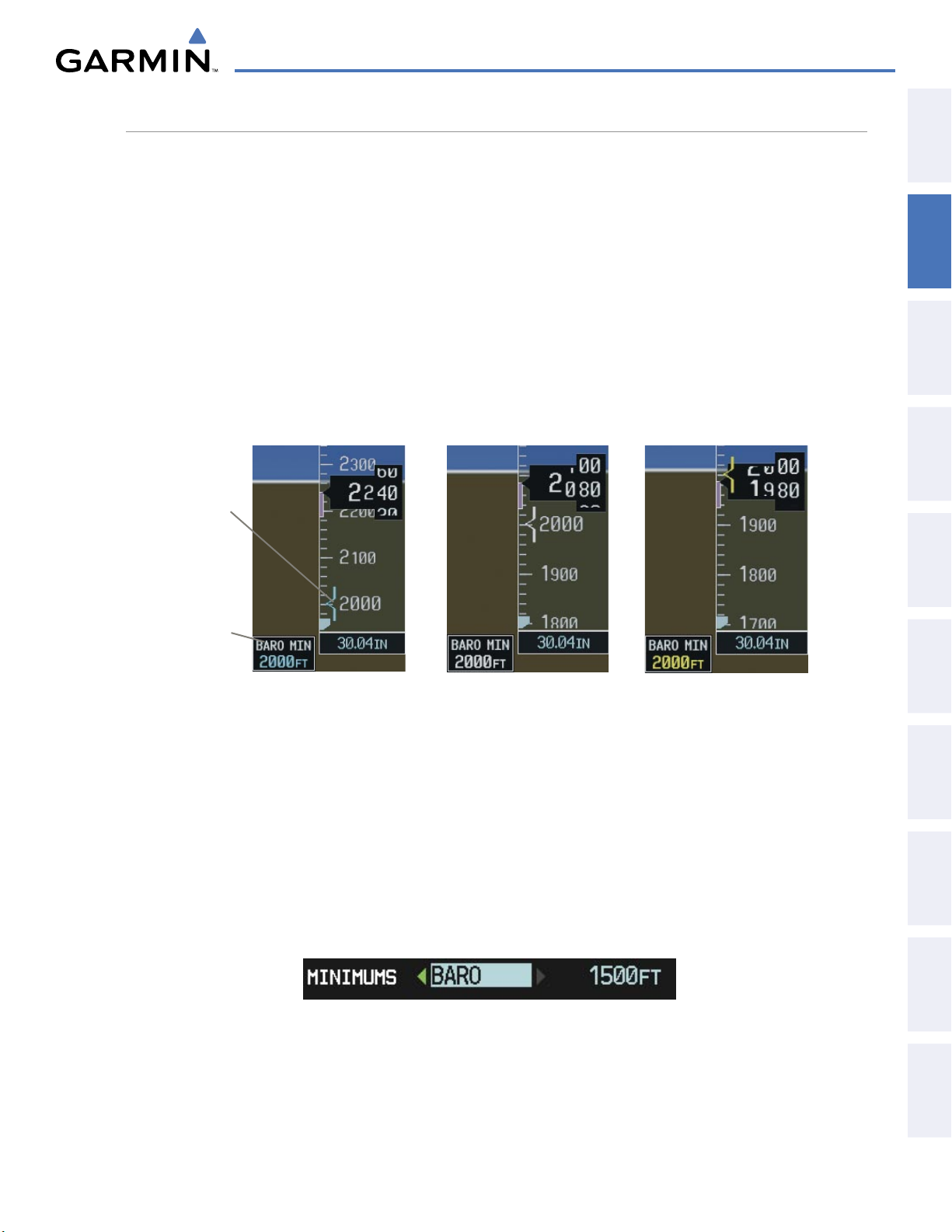
FLIGHT INSTRUMENTS
MINIMUM DESCENT ALTITUDE/DECISION HEIGHT ALERTING
For altitude awareness, a barometric Minimum Descent Altitude (MDA) or Decision Height (DH) can be set
in the Timer/References Window and is reset when the power is cycled. When active, the altitude setting is
displayed to the bottom left of the Altimeter. Once the altitude is within the range of the tape, a bug appears
at the reference altitude on the Altimeter. The following visual annunciations occur when approaching the
MDA/DH:
• When the aircraft altitude descends to within 2500 feet of the MDA/DH setting, the BARO MIN box appears
with the altitude in light blue text. The bug appears on the altitude tape in light blue once in range.
OVERVIEW
SYSTEM
INSTRUMENTS
FLIGHT
• When the aircraft passes through 100 feet of the MDA/DH, the bug and text turn white.
• Once the aircraft reaches MDA/DH, the bug and text turn yellow and the aural alert, “Minimums. Minimums”,
is heard.
Light Blue Within 2500 ft Yellow When Altitude ReachedWhite Within 100 ft
Barometric
Minimum
Bug
Barometric
Minimum
Box
Figure 2-40 Barometric MDA/DH Alerting Visual Annunciations
Setting the barometric Minimum Descent Altitude/Decision Height and bug:
EIS
AUDIO PANEL
& CNS
MANAGEMENT
FLIGHT
AVOIDANCE
HAZARD
AFCS
1) Press the
2) Turn the large FMS Knob to highlight the Minimums field.
3) Turn the small FMS Knob to select BARO. Off is selected by default. Press the ENT Key or turn the large FMS
4) Use the small FMS Knob to enter the desired altitude from zero to 16,000 feet.
5) To remove the window, press the
Alerting is inhibited while the aircraft is on the ground and until the aircraft reaches 150 feet above the MDA.
If the aircraft proceeds to climb after having reached the MDA, once it reaches 50 feet above the MDA, alerting
is disabled.
190-00592-05 Rev. A
TMR/REF
Softkey.
Knob to highlight the next field.
Figure 2-41 Barometric MDA/DH
Garmin G1000 Pilot’s Guide for the Diamond DA40/40F
CLR
Key or the
TMR/REF
Softkey.
81
ADDITIONAL
FEATURES
APPENDICES INDEX
Page 85
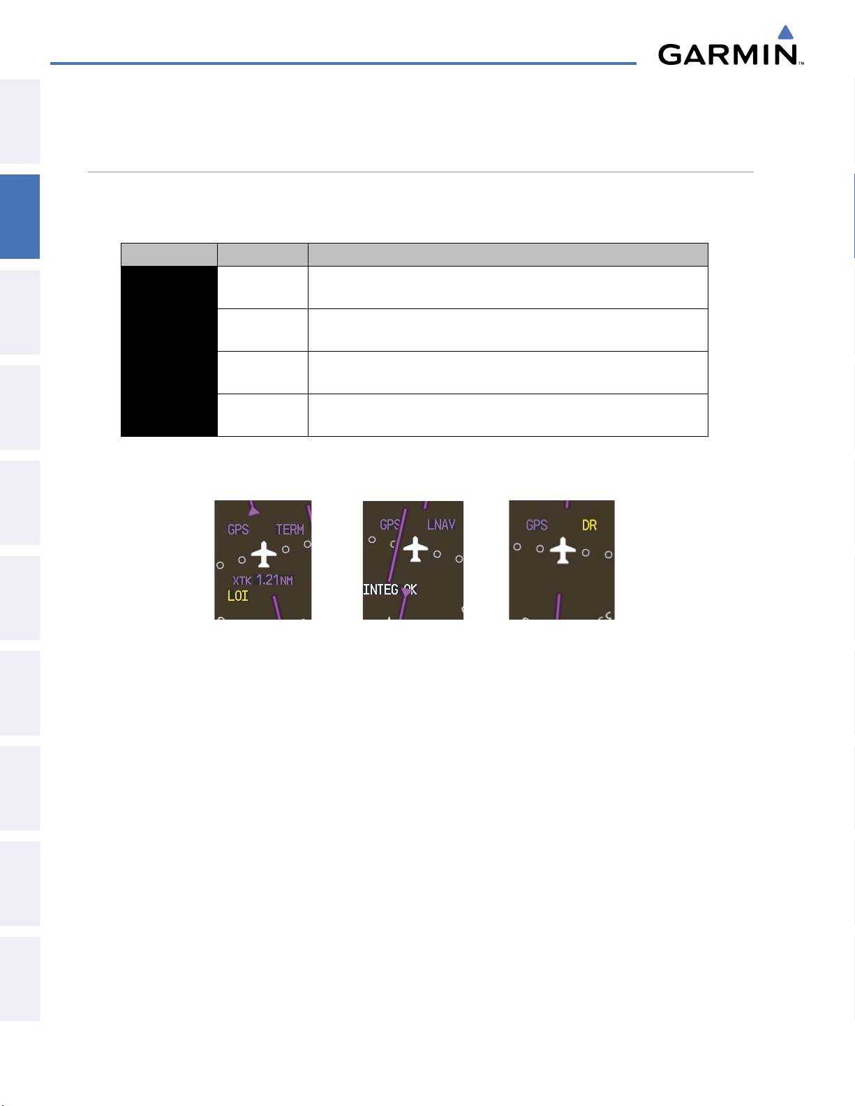
FLIGHT INSTRUMENTS
2.4 ABNORMAL OPERATIONS
SYSTEM
OVERVIEW
ABNORMAL GPS CONDITIONS
The annunciations listed in the table can appear on the HSI when abnormal GPS conditions occur. Refer to
the Flight Management Section for more information on Dead Reckoning Mode.
FLIGHT
INSTRUMENTS
EIS
& CNS
AUDIO PANEL
Annunciation Location Description
LOI
WARN
INTEG OK
DR
Lower left of
aircraft symbol
Lower left of
aircraft symbol
Lower left of
aircraft symbol
Upper right of
aircraft symbol
Loss of Integrity Monitoring–GPS integrity is insufficient for the current
phase of flight
Warning–RAIM function detects excessive GPS position errors
Integrity OK–GPS integrity has been restored to within normal limits
(annunciation displayed for 5 seconds)
Dead Reckoning–System is using projected position rather than GPS position
to compute navigation data and sequence active flight plan waypoints
FLIGHT
MANAGEMENT
HAZARD
AVOIDANCE
AFCS
FEATURES
ADDITIONAL
Table 2-3 Abnormal GPS Conditions Annunciated on HSI
Figure 2-42 Example HSI Annunciations
In Dead Reckoning Mode the CDI is removed from the display when GPS is the selected navigation source.
The following items on the PFD are then shown in yellow:
• Current Track Bug
• Wind Data (calculated based on GPS information)
• Distances in the Bearing Information Windows
• GPS bearing pointers
These items should be verified when operating in Dead Reckoning Mode.
APPENDICESINDEX
Garmin G1000 Pilot’s Guide for the Diamond DA40/40F
190-00592-05 Rev. A82
Page 86
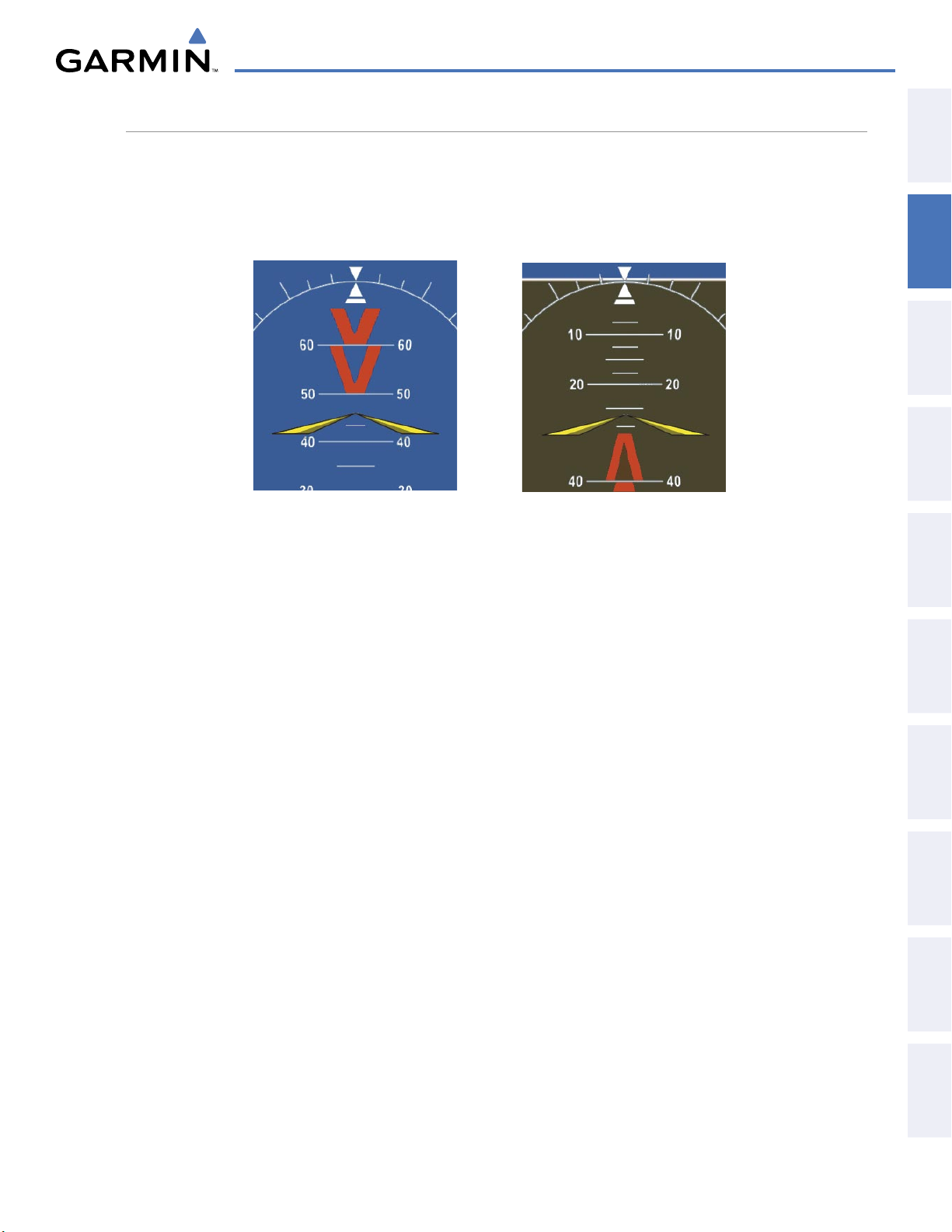
FLIGHT INSTRUMENTS
UNUSUAL ATTITUDES
When the aircraft enters an unusual pitch attitude, red chevrons pointing toward the horizon warn of extreme
pitch. The chevrons are displayed on the Attitude Indicator, starting at 50˚ above and 30˚ below the horizon
line.
Nose High
Figure 2-43 Pitch Attitude Warnings
Nose Low
OVERVIEW
SYSTEM
INSTRUMENTS
FLIGHT
EIS
AUDIO PANEL
& CNS
MANAGEMENT
FLIGHT
If pitch exceeds +30˚/-20˚ or bank exceeds 65˚, some information displayed on the PFD is removed. The
Altimeter and Airspeed, Attitude, Vertical Speed, and Horizontal Situation indicators remain on the display
and the Bearing Information, Alerts, and Annunciation windows can be displayed during such situations. The
following information is removed from the PFD and their softkeys are disabled when the aircraft experiences
unusual attitudes:
• Traffic Annunciations
• AFCS Annunciations
• Flight director Command Bars
• Inset Map
• Outside air temperature (OAT)
• DME Information Window
• Wind data
• Transponder Status Box
• System Time
• PFD Setup Menu
• Windows displayed in the lower
right corner of the PFD:
– Timer/References
– Nearest Airports
– Flight Plan
– Alerts
– Procedures
– ADF/DME Tuning
• Minimum Descent Altitude/
Decision Height readout
• Vertical Deviation, Glideslope,
and Glidepath Indicators
• Altimeter Barometric Setting
• Selected Altitude
• VNV Target Altitude
AVOIDANCE
HAZARD
AFCS
ADDITIONAL
FEATURES
APPENDICES INDEX
190-00592-05 Rev. A
Garmin G1000 Pilot’s Guide for the Diamond DA40/40F
83
Page 87
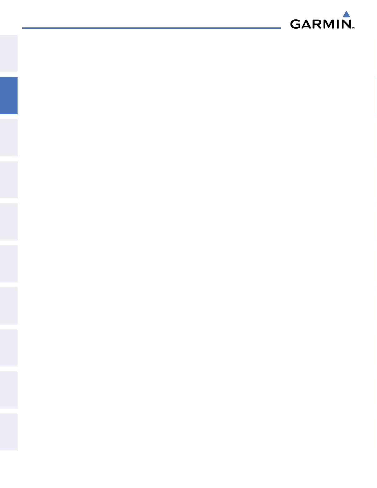
FLIGHT INSTRUMENTS
SYSTEM
OVERVIEW
FLIGHT
INSTRUMENTS
EIS
& CNS
AUDIO PANEL
FLIGHT
MANAGEMENT
HAZARD
AVOIDANCE
AFCS
FEATURES
ADDITIONAL
APPENDICESINDEX
BLANK PAGE
Garmin G1000 Pilot’s Guide for the Diamond DA40/40F
190-00592-05 Rev. A84
Page 88
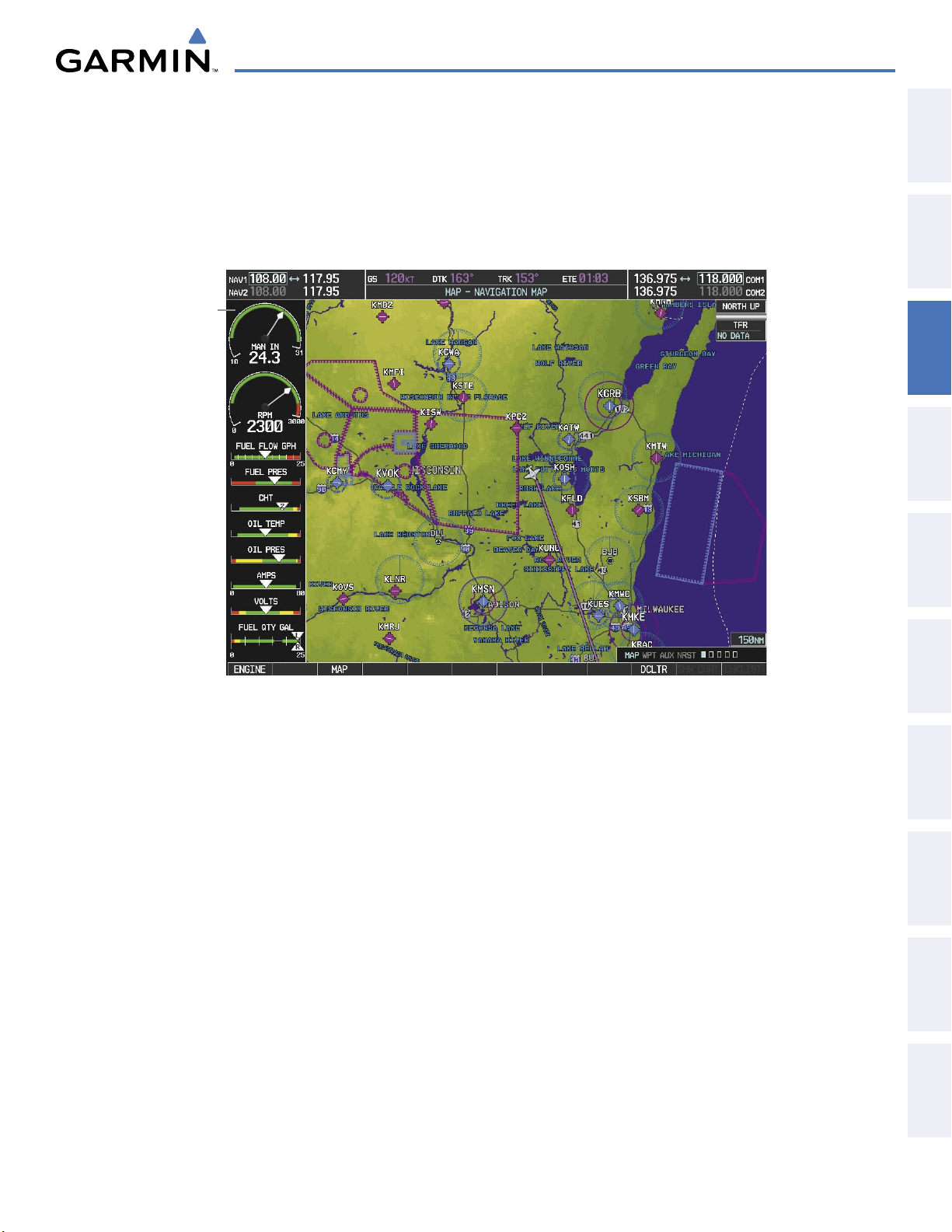
ENGINE INDICATION SYSTEM
SECTION 3 ENGINE INDICATION SYSTEM
The G1000 Engine Indication System (EIS) displays critical engine, electrical, fuel, and other system parameters
on the left side of the Multi Function Display (MFD) during normal operations (Figure 3-1). EIS information can
be fully expanded to an entire page (EIS - Engine Page) using the ENGINE Softkey. In Reversionary Mode, the
displays are re-configured to present Primary Flight Display (PFD) symbology together with the EIS.
EIS Display
OVERVIEW
SYSTEM
INSTRUMENTS
FLIGHT
EIS
AUDIO PANEL
& CNS
Figure 3-1 MFD (DA40)
Green bands on the instruments indicate normal ranges of operation; yellow and red bands indicate caution
and warning, respectively. White or uncolored bands indicate areas outside of normal operation not yet in the
caution or warning ranges. When unsafe operating conditions occur, the corresponding readouts flash to indicate
cautions and warnings. If sensory data to an instrument becomes invalid or unavailable, a red “X” is displayed
across the instrument.
MANAGEMENT
FLIGHT
AVOIDANCE
HAZARD
AFCS
ADDITIONAL
FEATURES
APPENDICES INDEX
190-00592-05 Rev. A
Garmin G1000 Pilot’s Guide for the Diamond DA40/40F
85
Page 89
ENGINE INDICATION SYSTEM
3.1 EIS DISPLAY
SYSTEM
OVERVIEW
1
Engine Manifold Pressure
Gauge (MAN IN HG)
Displays manifold pressure in inches of Mercury (in Hg) to indicate
engine power (DA40 only)
FLIGHT
INSTRUMENTS
EIS
& CNS
AUDIO PANEL
FLIGHT
MANAGEMENT
HAZARD
AVOIDANCE
2
Tachometer (RPM)
3
Fuel Flow Indicator
(FUEL FLOW GPH)
4
Fuel Pressure Indicator
(FUEL PRESS PSI)
5
Cylinder Head Temperature
Indicator (CHT)
6
Oil Temperature Indicator
(OIL TEMP)
7
Oil Pressure Indicator
(OIL PRES)
8
Ammeter (AMPS)
9
Voltmeter (VOLTS)
10
Fuel Quantity Indicator
(FUEL QTY GAL)
Displays propeller speed in revolutions per minute (rpm); the red band
indicates propeller overspeed
Displays current fuel flow in gallons per hour (gph)
Displays the fuel pressure in pounds per square inch (psi) (Option for
EASA certified DA40 aircraft only
)
Displays the head temperature of the hottest cylinder (number is shown
in pointer)
Displays engine oil temperature
Displays pressure of oil supplied to the engine
Displays the alternator load in amperes
Displays the primary bus voltage
Displays the quantity, in gallons (gal), of fuel in the tanks; pointers labeled
L and R indicate the fuel quantity in each tank
Standard Tanks: Indicator ranges from 0 to 20 gal with tick marks every 5
gal; only displays to 17 gal per side when full
Long Range Tanks (optional): Indicator ranges from 0 to 25 gal with tick
marks every 5 gal; only displays to 24 gal per side when full
AFCS
FEATURES
ADDITIONAL
APPENDICESINDEX
Garmin G1000 Pilot’s Guide for the Diamond DA40/40F
190-00592-05 Rev. A86
Page 90
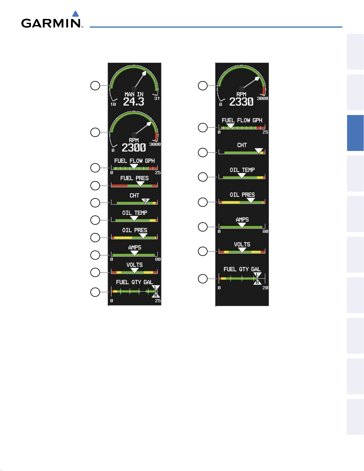
ENGINE INDICATION SYSTEM
OVERVIEW
SYSTEM
INSTRUMENTS
1
2
FLIGHT
2
3
4
5
6
7
8
9
10
3
5
6
7
8
9
10
EIS
AUDIO PANEL
& CNS
MANAGEMENT
FLIGHT
AVOIDANCE
HAZARD
AFCS
190-00592-05 Rev. A
DA40
DA40F
Figure 3-2 EIS Display
Garmin G1000 Pilot’s Guide for the Diamond DA40/40F
87
ADDITIONAL
FEATURES
APPENDICES INDEX
Page 91

ENGINE INDICATION SYSTEM
ENGINE
Press the ENGINE Softkey to
return to the top-level softkeys.
INC FUEL
RST FUEL
LEAN
DEC FUEL
ENGINE
3.2 ENGINE PAGE
SYSTEM
OVERVIEW
FLIGHT
INSTRUMENTS
EIS
Pressing the ENGINE Softkey accesses the EIS - Engine Page, which displays all engine, fuel, fuel calculation,
electrical, and trim information.
Figure 3-3 Engine Page Softkeys
& CNS
AUDIO PANEL
FLIGHT
MANAGEMENT
HAZARD
AVOIDANCE
AFCS
FEATURES
ADDITIONAL
APPENDICESINDEX
ENGINE
LEAN
DEC FUEL
INC FUEL
RST FUEL
1
Engine Manifold Pressure
Displays EIS - Engine Page and second-level engine softkeys; press again to exit page
Accesses Leaning Assist Mode
Decreases displayed fuel remaining in 1-gal increments
Increases displayed fuel remaining in 1-gal increments
Resets displayed fuel remaining to maximum fuel capacity for aircraft and fuel used to zero
Gauge (MAN IN HG)
2
Oil Temperature and
Pressure Gauges
(OIL °F PSI)
3
Fuel Quantity Gauges
(L/R FUEL QTY GAL)
4
Total Time in Service
(TTL TIME IN SVC)
5
Fuel Calculations Group
(FUEL CALCULATOR)
6
Electrical Group
(ELECTRICAL)
Displays manifold pressure in inches of Mercury (in Hg) to indicate engine
power (DA40 only)
Displays oil temperature in degrees Fahrenheit (°F) and pressure in pounds
per square inch (psi)
Display the amount of fuel in gallons (gal) of fuel in the tanks.
Standard Tanks: Indicator ranges from 0 to 20 gal with tick marks every 5
gal; only displays to 17 gal per side when full
Long Range Tanks (optional): Indicator ranges from 0 to 25 gal with tick
marks every 5 gal; only displays to 24 gal per side when full
Displays the total flight hours and is activated when the aircraft becomes
airborne (note that time airborne does not necessarily correspond to
tachometer time)
Displays calculated fuel used, endurance, and range (in nautical miles,
RANGE NM) based on the displayed fuel remaining and the fuel flow
totalizer
Displays the alternator load in amperes and the primary bus voltage
Garmin G1000 Pilot’s Guide for the Diamond DA40/40F
190-00592-05 Rev. A88
Page 92

7
Engine Temperature
Group (TEMPERATURE)
ENGINE INDICATION SYSTEM
Displays exhaust gas (EGT) and head (CHT) temperatures of all cylinders in °F
OVERVIEW
SYSTEM
8
Fuel Flow and Pressure
Gauge (FUEL GPH PSI)
Fuel pressure option EASA
certified DA40 aircraft only
9
Tachometer (RPM)
1
2
Displays fuel flow in gallons per hour (gph) and fuel pressure in pounds
per square inch (psi)
Displays propeller speed in revolutions per minute (rpm); the red band
indicates propeller overspeed
9
8
7
6
INSTRUMENTS
FLIGHT
EIS
AUDIO PANEL
& CNS
MANAGEMENT
FLIGHT
AVOIDANCE
HAZARD
5
3
4
Figure 3-4 Engine Page (DA40)
AFCS
ADDITIONAL
FEATURES
APPENDICES INDEX
190-00592-05 Rev. A
Garmin G1000 Pilot’s Guide for the Diamond DA40/40F
89
Page 93
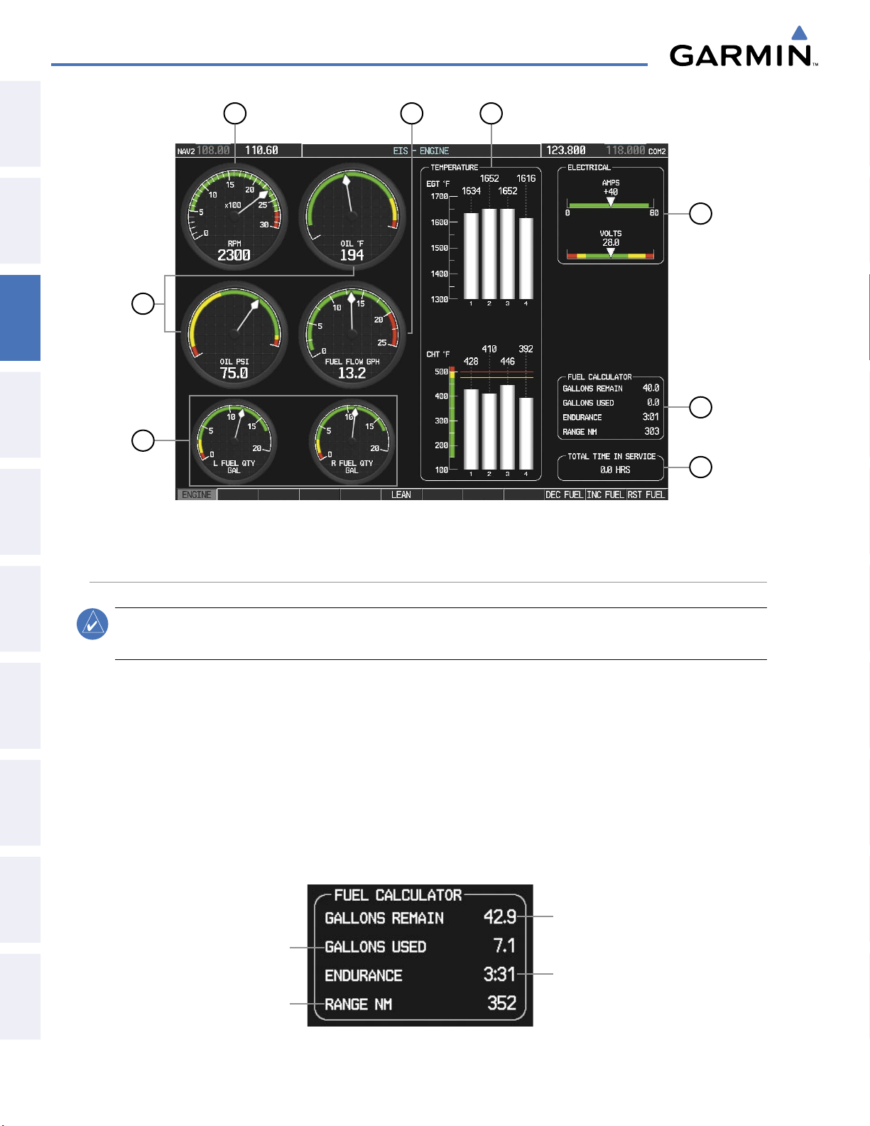
ENGINE INDICATION SYSTEM
SYSTEM
OVERVIEW
FLIGHT
INSTRUMENTS
EIS
& CNS
AUDIO PANEL
FLIGHT
MANAGEMENT
9
2
3
Figure 3-5 Engine Page (DA40F)
8
7
6
5
4
HAZARD
AVOIDANCE
AFCS
FEATURES
ADDITIONAL
APPENDICESINDEX
FUEL CALCULATIONS
NOTE:
Fuel calculations do not use the aircraft fuel quantity indicators and are calculated from the last time
the fuel was reset.
Fuel used (GAL USED), endurance (ENDUR), and range (in nautical miles, RANGE NM) are calculated
based on the displayed fuel remaining (GAL REM) and the fuel flow totalizer. The calculated range also takes
into account the aircraft’s heading and the wind direction and speed. See the Flight Management Section for
information regarding the map feature related to the EIS Fuel Calculations.
Adjusting the fuel totalizer quantity:
On the Engine Page, use the DEC FUEL and INC FUEL softkeys to obtain the desired fuel remaining (GAL REM).
Resetting the fuel totalizer:
On the Engine Page, press the
Calculated
Fuel Used
Calculated
Range
RST FUEL
Softkey; this also resets the fuel remaining (GAL REM) to zero.
Set Fuel
Remaining
Calculated
Endurance
Figure 3-6 Fuel Calculations Group
Garmin G1000 Pilot’s Guide for the Diamond DA40/40F
190-00592-05 Rev. A90
Page 94
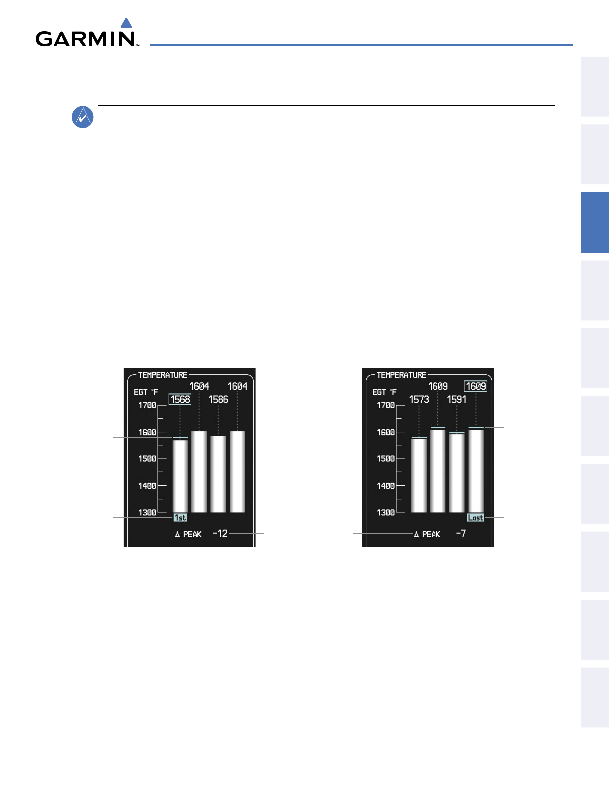
ENGINE INDICATION SYSTEM
3.3 LEANING ASSIST MODE
NOTE
:
The pilot should follow the engine manufacturer’s recommended leaning procedures in the Aircraft
Flight Manual Supplement (AFMS).
A leaning assist function is available on the Engine Page to assist in the leaning process.
Accessing Leaning Assist Mode:
1) Press the ENGINE Softkey to open the Engine Page.
2) Press the LEAN Softkey to identify peaks.
3) Press the LEAN Softkey again to exit Leaning Assist Mode.
OVERVIEW
SYSTEM
INSTRUMENTS
FLIGHT
EIS
When the
LEAN Softkey is pressed, the system initially highlights the number and EGT readout of the cylinder
with the hottest EGT. The ∆ Peak temperature is the difference between the peak temperature and the present
temperature for the peaked cylinder. When the first peak is detected, “1st” is annunciated below that cylinder’s
EGT bar and the temperature is marked in light blue on the graph.
The system continues to detect peak EGTs for each cylinder lean of peak as the fuel flow is decreased, and the
peak of each cylinder’s EGT is indicated by a light blue marker on the graph. Once all cylinders are lean of peak,
the last cylinder to peak is denoted by the “Last” annunciation below its bar on the graph.
Light Blue Bars
Light Blue Bar
Represents Peak
Indicates First
Cylinder to Peak
Current Difference
from Peak Temperature
(Selected Cylinder)
Represent Peaks
Indicates Last
Cylinder to Peak
AUDIO PANEL
& CNS
MANAGEMENT
FLIGHT
AVOIDANCE
HAZARD
AFCS
ADDITIONAL
FEATURES
190-00592-05 Rev. A
Figure 3-7 Leaning Assist Mode
Garmin G1000 Pilot’s Guide for the Diamond DA40/40F
APPENDICES INDEX
91
Page 95

ENGINE INDICATION SYSTEM
3.4 EIS DISPLAY IN REVERSIONARY MODE
SYSTEM
OVERVIEW
FLIGHT
INSTRUMENTS
In reversionary display mode, the remaining display is re-configured to present PFD symbology together with
the EIS Display (refer to the System Overview for information about display Reversionary Mode).
When the G1000 displays enter reversionary mode, the EIS is separated into three displays: Engine (identical to
the normal EIS Display on the MFD), Lean, and System. For a description of the Engine Display, refer to Section
3.1. The Lean Display presents temperature information and assistance for engine leaning. The System Display
shows various system parameters and fuel calculations.
EIS
& CNS
AUDIO PANEL
FLIGHT
MANAGEMENT
HAZARD
AVOIDANCE
AFCS
EIS Display
Figure 3-8 Reversionary Mode (DA40)
FEATURES
ADDITIONAL
APPENDICESINDEX
Garmin G1000 Pilot’s Guide for the Diamond DA40/40F
190-00592-05 Rev. A92
Page 96
ENGINE INDICATION SYSTEM
ENGINE
Press the ENGINE Softkey to
return to the top-level softkeys.
INC FUEL
RST FUEL
LEAN
DEC FUEL
ENGINE
Press the BACK Softkey to
return to the top-level softkeys
.
SYSTEM
ENGINE
LEAN
INC FUEL
RST FUEL
DEC FUEL
BACK
SYSTEM
ENGINE
LEAN
BACK
ASSIST
CYL SLCT
ENGINE
The Engine Display is shown by default. To return to the Engine Display from the Lean or System Display, press
the ENGINE or BACK Softkey.
OVERVIEW
SYSTEM
INSTRUMENTS
FLIGHT
EIS
• ENGINE
• LEAN
CYL SLCT
ASSIST
• SYSTEM
DEC FUEL
INC FUEL
RST FUEL
Figure 3-9 EIS Softkeys (Reversionary Mode)
Displays second-level engine softkeys
Displays the EIS Lean Display
Cycles through the cylinders to obtain information about a particular cylinder, shown in
light blue on the bar graphs
Accesses Leaning Assist Mode
Displays the EIS System Display
Decreases displayed fuel remaining in 1-gal increments
Increases displayed fuel remaining in 1-gal increments
Resets displayed fuel remaining to maximum fuel capacity for aircraft and fuel used to zero
AUDIO PANEL
& CNS
MANAGEMENT
FLIGHT
AVOIDANCE
HAZARD
AFCS
ADDITIONAL
FEATURES
190-00592-05 Rev. A
Garmin G1000 Pilot’s Guide for the Diamond DA40/40F
APPENDICES INDEX
93
Page 97
ENGINE INDICATION SYSTEM
LEAN DISPLAY
SYSTEM
OVERVIEW
FLIGHT
INSTRUMENTS
NOTE
:
The pilot should follow the engine manufacturer’s recommended leaning procedures in the Aircraft
Flight Manual Supplement (AFMS).
The EIS Lean Display provides information and a user interface to perform engine leaning. Exhaust gas
(EGT) and head (CHT) temperatures for each cylinder are displayed in bar graph form with a readout for the
temperature of the selected cylinder shown below each graph.
Accessing the EIS Lean Display:
EIS
& CNS
AUDIO PANEL
FLIGHT
MANAGEMENT
HAZARD
AVOIDANCE
AFCS
1) Press the ENGINE Softkey.
2) Press the LEAN Softkey.
3) To return to the default Engine Display, press the ENGINE or BACK Softkey.
By default, the cylinder with the hottest temperature is selected (number highlighted in light blue) when the
LEAN Softkey is pressed. Bars for cylinders with temperatures in the normal range are shown in white. On the
CHT Bar Graph, caution and warning conditions are indicated in yellow and red, respectively.
Since only one cylinder’s EGT and CHT are displayed at a time, this information can be cycled through for
each cylinder using the CYL SLCT Softkey; the selected cylinder’s number is highlighted in light blue on the
bar graphs. This softkey is disabled when Leaning Assist Mode is selected.
Monitoring the desired cylinder’s temperatures:
From the Lean Display, press the CYL SLCT Softkey to cycle through each cylinder and view its temperature
information. The selected cylinder number is highlighted in light blue.
While in Reversionary Mode, the leaning assist function is available when the
ASSIST Softkey is pressed
from the Lean Display to assist in the leaning process (refer to the section on Leaning Assist Mode for more
information).
1
Engine Manifold Pressure
Gauge (MAN IN HG)
Displays manifold pressure in inches of Mercury (in Hg) to indicate engine
power (DA40 only)
FEATURES
ADDITIONAL
APPENDICESINDEX
2
Tachometer (RPM)
3
Fuel Flow (FFLOW GPH)
4
Exhaust Gas Temperature
Bar Graph (EGT °F)
5
EGT Deviation from Peak
(∆ PEAK)
6
Cylinder Head Temperature
Bar Graph (CHT °F)
Displays propeller speed in revolutions per minute (rpm); the red band
indicates propeller overspeed
Displays current fuel flow in gallons per hour (gph)
Exhaust Gas Temperature (EGT) for each cylinder is represented as a bar;
below the graph, the EGT readout is given for the selected cylinder
(shown in light blue)
A hollow block appears to represent the peak EGT for the selected cylinder
when the ASSIST Softkey is pressed
Displays the current EGT deviation from peak for the selected cylinder in
degrees Fahrenheit (°F) when the
ASSIST Softkey is pressed
Head temperature for each cylinder is represented as a bar; below the
graph, the CHT readout is given for the selected cylinder (shown in
light blue)
Garmin G1000 Pilot’s Guide for the Diamond DA40/40F
190-00592-05 Rev. A94
Page 98
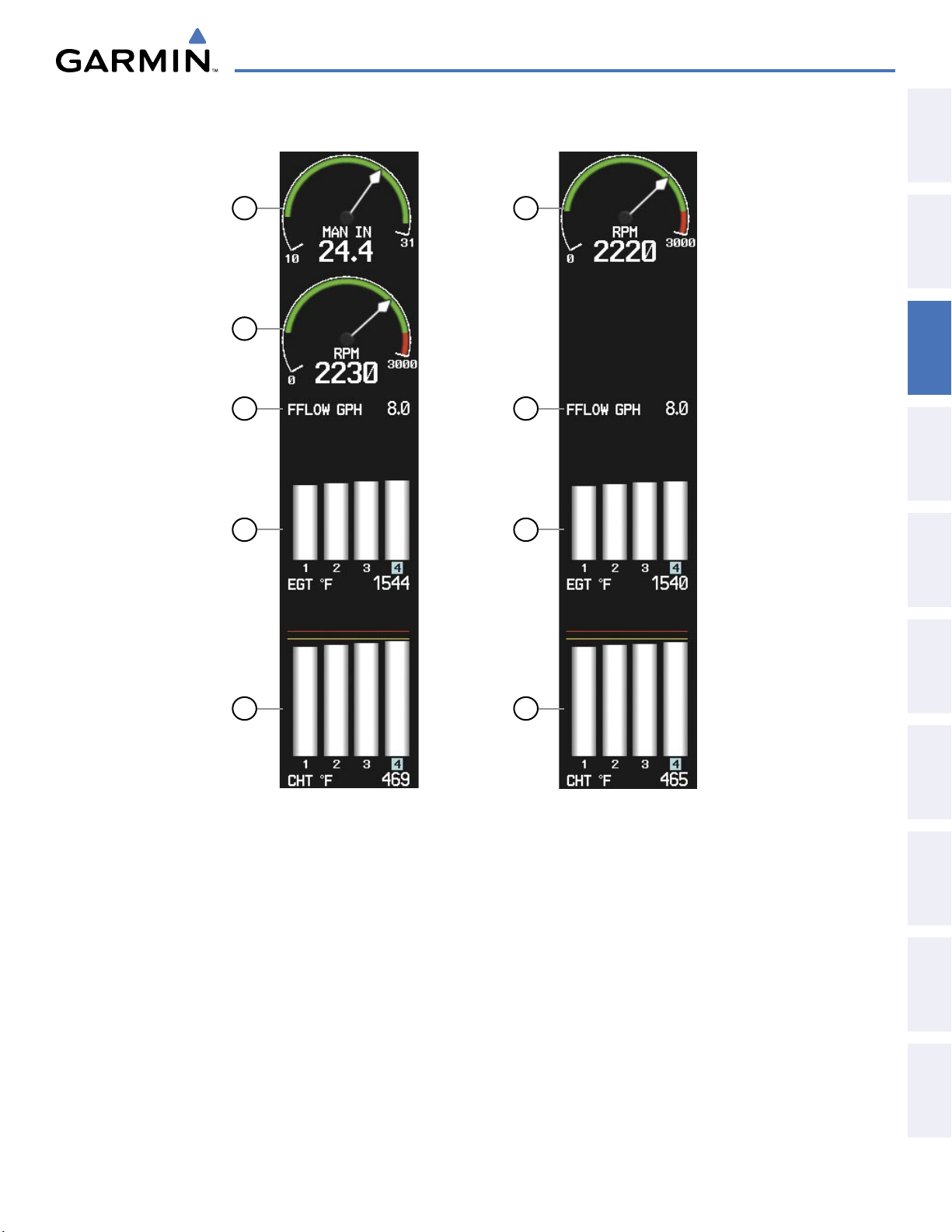
ENGINE INDICATION SYSTEM
OVERVIEW
SYSTEM
1
2
2
3
4
3
4
INSTRUMENTS
FLIGHT
EIS
AUDIO PANEL
& CNS
MANAGEMENT
FLIGHT
AVOIDANCE
HAZARD
5
DA40
Figure 3-10 Lean Display
5
AFCS
DA40F
ADDITIONAL
FEATURES
APPENDICES INDEX
190-00592-05 Rev. A
Garmin G1000 Pilot’s Guide for the Diamond DA40/40F
95
Page 99
ENGINE INDICATION SYSTEM
SYSTEM DISPLAY
SYSTEM
OVERVIEW
FLIGHT
INSTRUMENTS
NOTE:
Fuel calculations do not use the aircraft fuel quantity indicators and are calculated from the last time
the fuel was reset.
NOTE:
Refer to the Aircraft Flight Manual Supplement (AFMS) for limitations.
The EIS System Display shows the dial gauges, various system parameters, and fuel calculations. Fuel
calculations are based on the displayed fuel remaining (GAL REM) and the fuel flow totalizer.
EIS
& CNS
AUDIO PANEL
FLIGHT
MANAGEMENT
HAZARD
AVOIDANCE
AFCS
Accessing the EIS System Display:
1) Press the ENGINE Softkey.
2) Press the SYSTEM Softkey.
3) To return to the default Engine Display, press the ENGINE or BACK Softkey.
Adjusting the fuel totalizer quantity:
From the System Display, press the
DEC FUEL or INC FUEL
Softkey to adjust the fuel remaining (GAL REM).
Resetting the fuel totalizer:
From the System Display, press the
1
Engine Manifold Pressure Gauge
(MAN IN HG)
2
Tachometer (RPM)
RST FUEL
Softkey. This also resets the fuel remaining (GAL REM) to zero.
Displays manifold pressure in inches of Mercury (in Hg) to indicate
engine power (DA40 only)
Shows propeller speed in revolutions per minute (rpm); the red band
indicates propeller overspeed
3
Oil Temperature (OIL °F)
4
Oil Pressure (OIL PSI)
Engine oil temperature is shown in degrees Fahrenheit (°F)
Pressure of oil supplied to the engine is displayed in pounds per square
inch (psi)
5
Voltmeter (VOLTS)
Shows the primary
bus voltage
FEATURES
ADDITIONAL
APPENDICESINDEX
6
Ammeter (AMPS)
7
Fuel Flow (FFLOW GPH)
8
Fuel Pressure (FPRESS PSI)
9
Fuel Remaining (GAL REM)
10
Fuel Used (GAL USED)
11
Endurance (ENDUR)
12
Range (RANGE NM)
13
Total Time in Service (TTL
TIME IN SVC)
Garmin G1000 Pilot’s Guide for the Diamond DA40/40F
Shows the alternator load in amperes
Displays current fuel flow in gallons per hour (gph)
Displays the fuel pressure in pounds per square inch (psi) (Option for
EASA certified DA40 aircraft only
)
Current fuel remaining in gallons as set by the pilot and adjusted for
fuel burn since last set
Quantity of fuel used in gallons
Flight time remaining with fuel onboard (HH:MM when more than an
hour remains)
Aircraft range in nautical miles
Displays the total flight hours and is activated when the aircraft becomes
airborne (note that time airborne does not necessarily correspond to
tachometer time)
190-00592-05 Rev. A96
Page 100
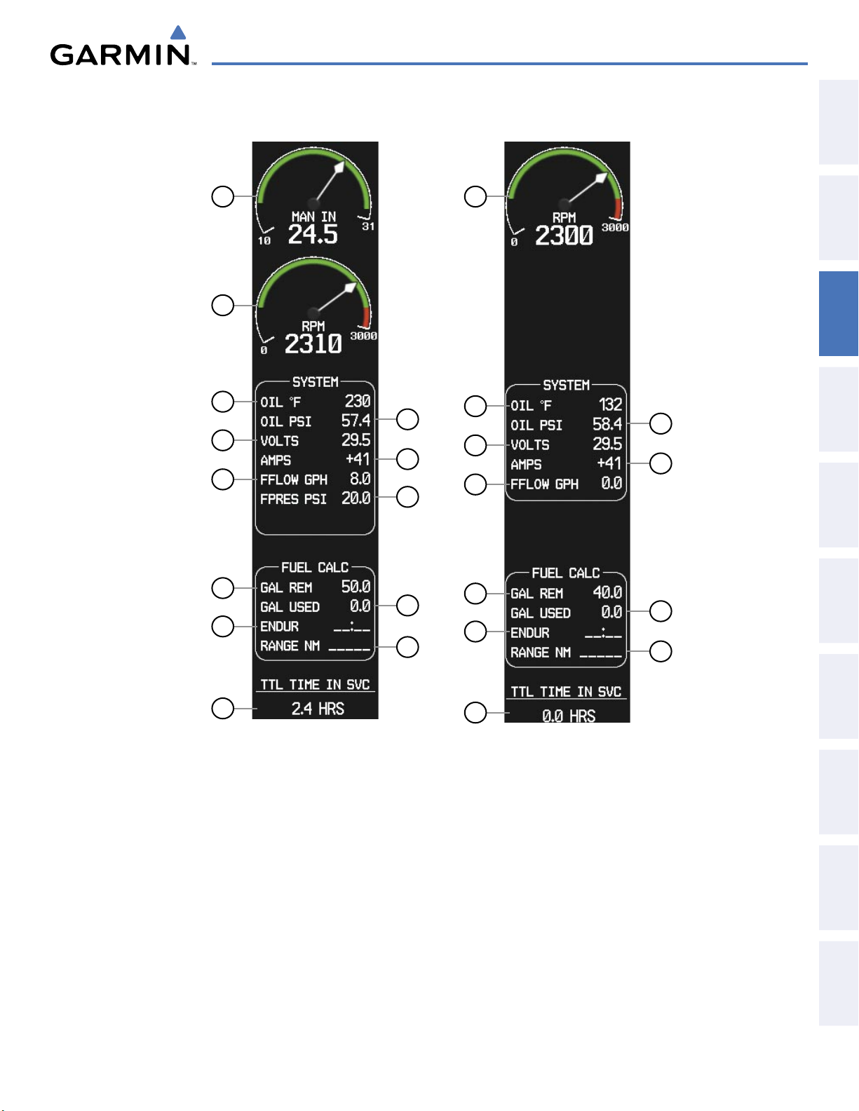
ENGINE INDICATION SYSTEM
OVERVIEW
SYSTEM
INSTRUMENTS
1
2
FLIGHT
11
2
3
4
5
6
7
3
4
5
6
7
EIS
AUDIO PANEL
& CNS
MANAGEMENT
FLIGHT
8
AVOIDANCE
HAZARD
9
10
9
10
11
12
12
AFCS
190-00592-05 Rev. A
13
13
DA40
DA40F
Figure 3-11 System Display
Garmin G1000 Pilot’s Guide for the Diamond DA40/40F
97
ADDITIONAL
FEATURES
APPENDICES INDEX
 Loading...