

Specifications and Main Features
- Device Type: Hand-held GPS receiver
- Model: Magellan GPS 4000 XL
- Antenna: Antenna built in
- Display: LCD display high contrast with illumination
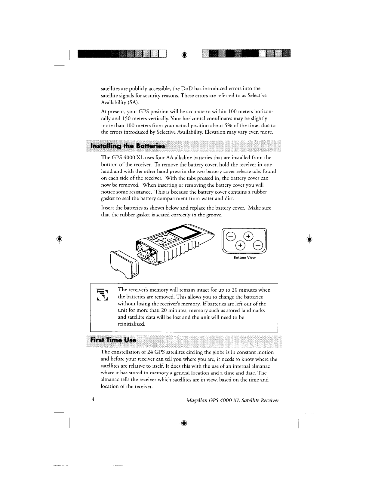
- Battery: Powered by four AA alkaline batteries
- Battery Life: Once fully charged, the system can work for as long as 24 hours
- Accuracy: 25 meters RMS or better for most horizontal and 150 meters vertical, due to Selective Availability, the estimate is generally 100 meters horizontal and 150 meters vertical
- Memory: Has the capability to save 200 landmarks and 5 routes
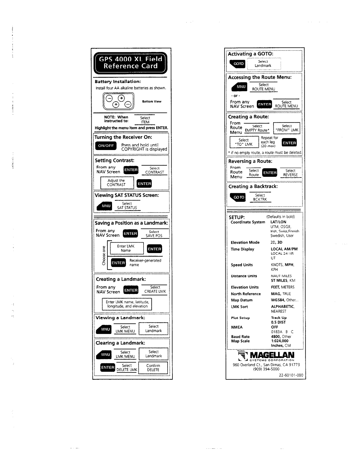
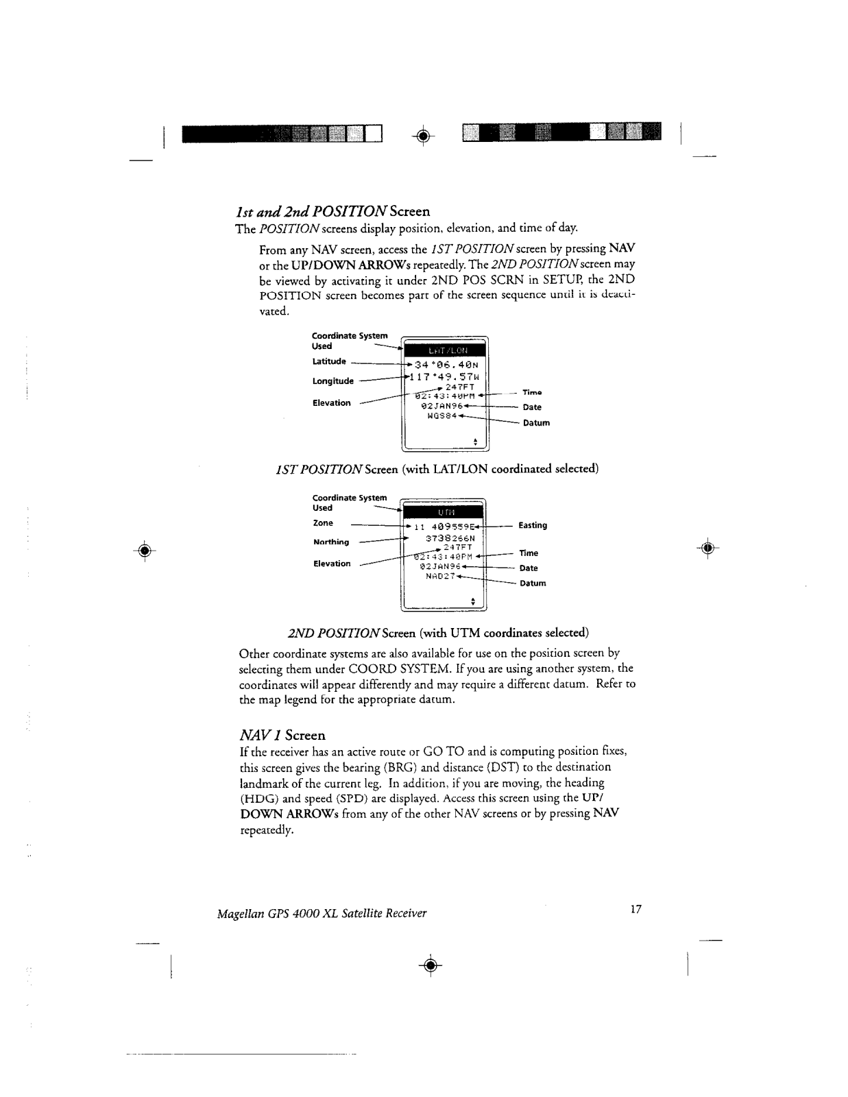
- Coordinate Systems: Lat Lon, UTM, OSGB, Irish, Swiss, Finnish, Swedish and User Grid
- Elevation Modes: 2 D 3D
- Time Display: Western local am pm 12 hour clock, Local time, 24 hour UT
- Speed Units: Nautical mph, kilometers per hour, and knots
- Distance Units: Nautical miles, statute miles, kilometers
- Elevation Units: Foot and Meters
- North Reference: Magnetic True
- Map Datum: WGS84 and others
- Map Scale: 1:024,000
- Communication: Support NMEA format with a Baud Rate of 4800 and others
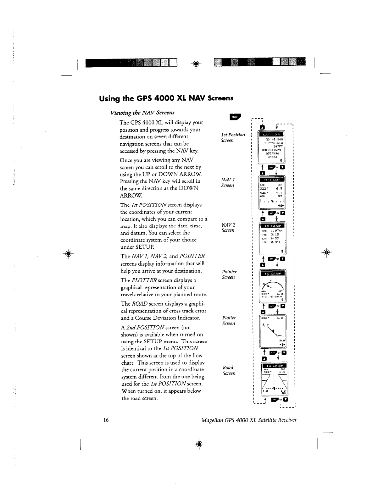
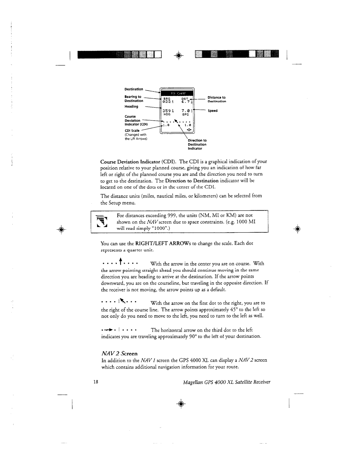
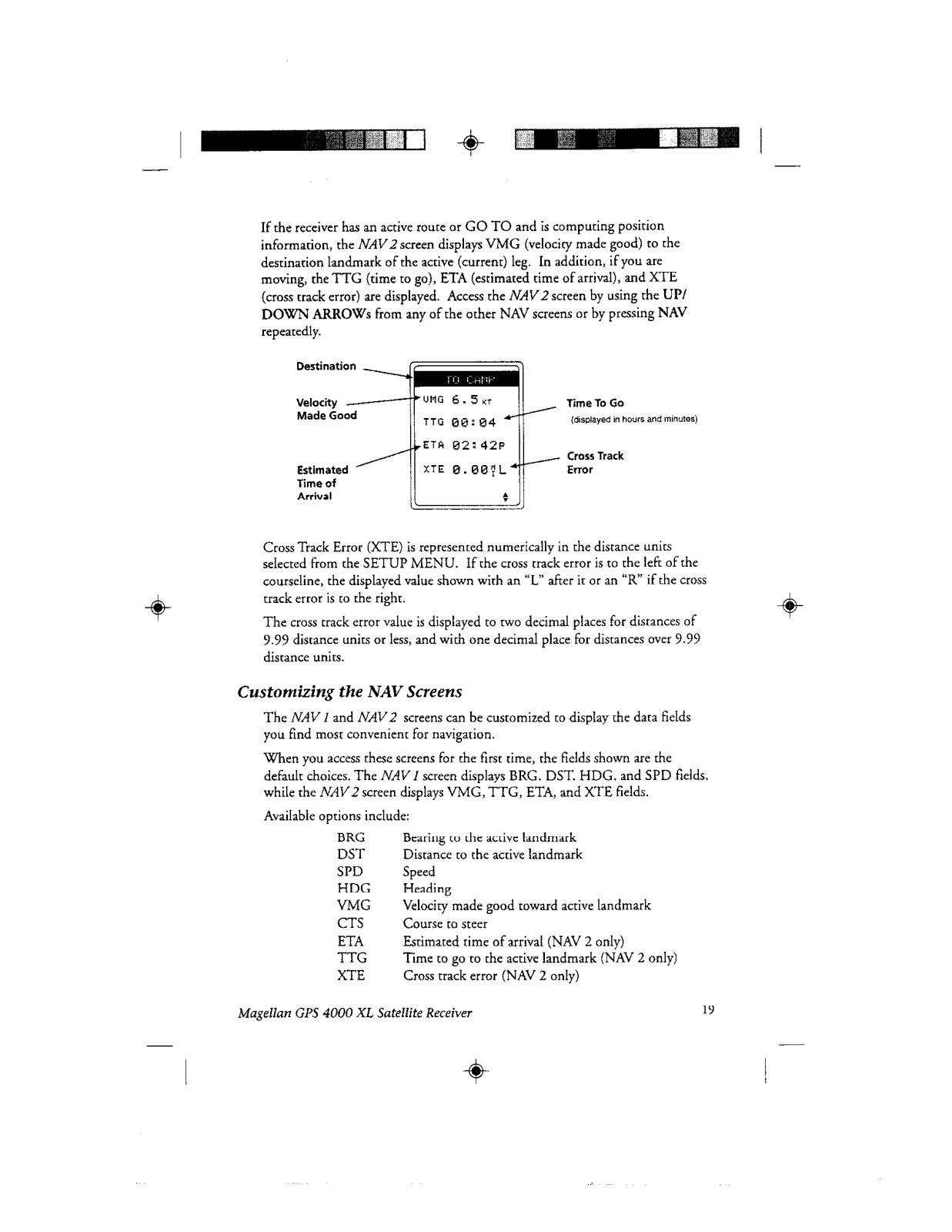
- Navigation Screens: 7 different NAV screens such as Position NAV screen 1, NAV screen 2, Pointer Plotter Road and second position.
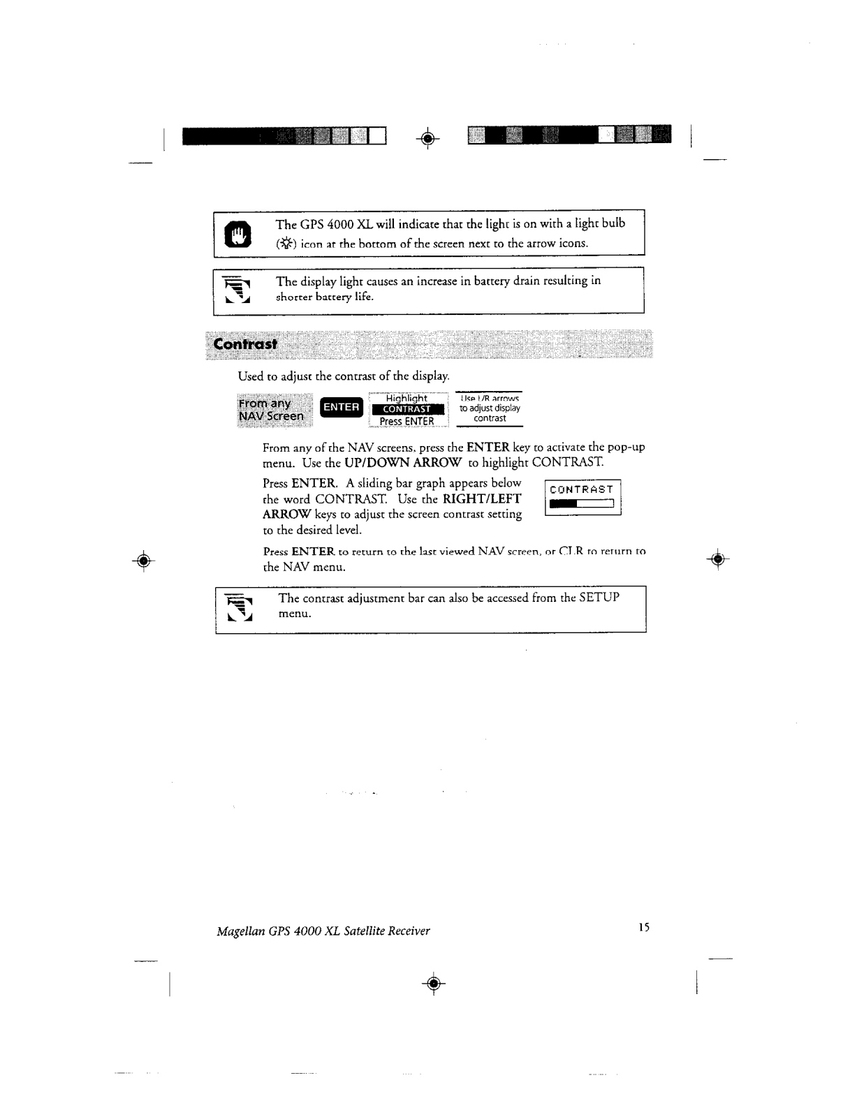
- Customization: Ability to change the level of contrast, the degree of backlight, the screen layout, etc.
Frequently Asked Questions
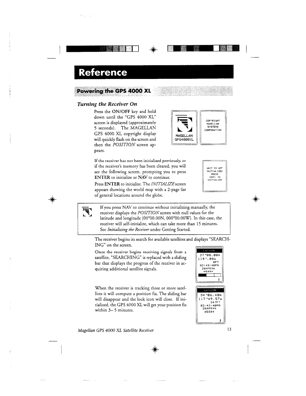
Q: How do I turn on the gps 4000 xl?
A: Hold down the on off button until the copyright menu appears.
Q: In case the device fails to fix the position what must I do?
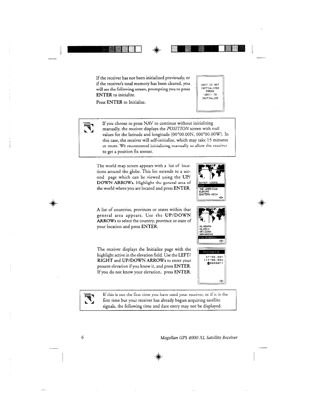
A: Ensure that you have a clear view of the sky and are not standing close to large objects, you might have to re-initialize the receiver once again.
Q: Is it possible to reuse the current location after saving it?
A: Yes, by going to the NAV screen and clicking on the SAVE POS, it will allow you to save the current position as landmark.
Q: Can you help me understand how to edit the routes?
A: First click on the ROUTE MENU, then on any blank route you want to edit. After choosing the blank route, pick a landmark for the ‘FROM’ and ‘TO’ options, and then repeat the process for every segment of the route.
Q: Is there a limit to how many landmarks I am allowed to save?
A: Yes, the mark on GPS 4000 XL does not exceed 200 landmarks concerning memory.
Q: Can I check on how much battery is left?
A: Without a dedicated battery status screen, the device does not show battery level rather it can only estimate battery life by analyzing time and performance.
Q: Am I allowed to revise the edits I made to a landmark I previously saved?
A: Yes, through the LMK MENU, you are permitted to change the name, elevation, or even the coordinates of the previously saved landmark.
Q: A way to modify the existing co-ordinate system?
A: Please note that the device needs to be powered on. To set the co-ordinate system, navigate through to ‘SETUP MENU’ from the device settings.
Q: External power sources are listed as important, can I connect one?
A: As outlined in the preliminary specs, there is a possibility to link an external power source to the GPS 4000 XL.
User Manual


 Loading...