

Page 1
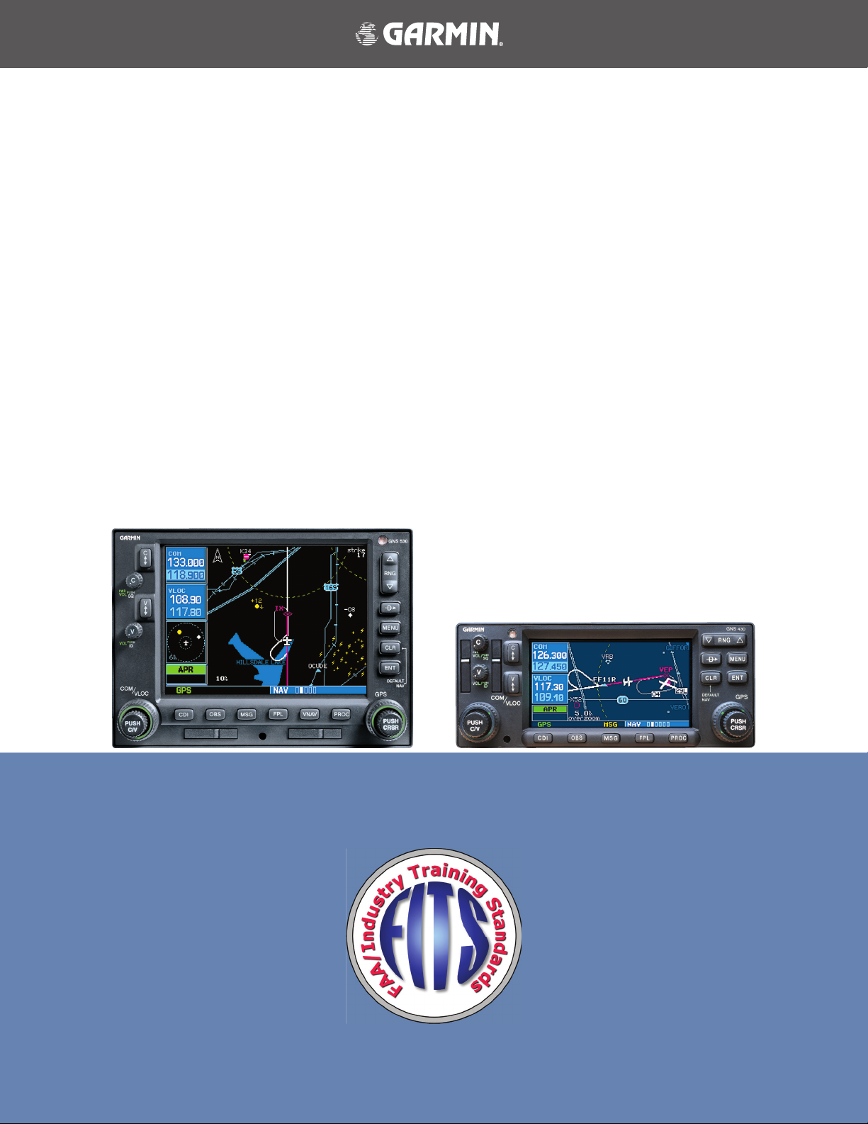
Garmin GNS 530/430
Sample Training Syllabus
and Flight Lessons
for Use by
Flight Schools & Flying Clubs
Page 2

Garmin GNS 530/430 Sample Training Syllabus and Flight Lessons
190-00334-00 Rev. A
Page 3

COPYRIGHT
© 2003 Garmin Ltd. or its subsidiaries. All rights reserved.
Garmin International, Inc., 1200 East 151st Street, Olathe, Kansas 66062, U.S.A.
Tel: 913/397.8200 Fax: 913/397.8282
Garmin AT, Inc., 2345 Turner Road SE, Salem, Oregon 97302, U.S.A.
Tel: 503.391.3411 Fax 503.364.2138
Garmin (Europe) Ltd., Unit 5, The Quadrangle, Abbey Park Industrial Estate, Romsey, Hampshire S051 9DL, U.K.
Tel: 44/1794.519944 Fax: 44/1794.519222
Garmin Corporation, No. 68, Jangshu 2nd Road, Shijr, Taipei County, Taiwan
Tel: 886/02.2642.9199 Fax: 886/02.2642.9099
Web Site Address: www.garmin.com
Except as expressly provided herein, no part of this manual may be reproduced, copied, transmitted, disseminated,
downloaded or stored in any storage medium, for any purpose without the express written permission of Garmin. Garmin
hereby grants permission to download a single copy of this manual and of any revision to this manual onto a hard drive
or other electronic storage medium to be viewed for personal use, provided that such electronic or printed copy of this
manual or revision must contain the complete text of this copyright notice and provided further that any unauthorized
commercial distribution of this manual or any revision hereto is strictly prohibited.
Information in this document is subject to change without notice. Garmin reserves the right to change or improve their
products and to make changes in the content of this material without obligation to notify any person or organization of
such changes or improvements.
Garmin® is a registered trademark of Garmin Ltd. or its subsidiaries and GNS
™
is a trademark of Garmin Ltd. or its subsid-
iaries. These trademarks may not be used without the express permission of Garmin.
September 2003 Printed in the U.S.A.
190-00334-00 Rev. A
Garmin GNS 530/430 Sample Training Syllabus and Flight Lessons
i
Page 4

1
Garmin GNS 530/430 Sample Training Syllabus and Flight Lessons
190-00334-00 Rev. A
TABLE OF CONTENTS
Copyright .......................................................................................................................... i
Table of Contents ............................................................................................................ ii
Introduction ..................................................................................................................... 1
Overview
Home Study Worksheets................................................................................................. 2
GNS 530/430 Home Study 1............................................................................................................3
Worksheet – Use of GPS in lieu of other avionics, regulations
GNS 530/430 Home Study 2............................................................................................................4
Worksheet – Terminology Review
GNS 530/430 Home Study 3............................................................................................................5
Worksheet – COM and VLOC Operation
GNS 530/430 Home Study 4............................................................................................................6
Worksheet – Direct-to and Flight Plan Navigation
GNS 530/430 Home Study 5............................................................................................................7
Worksheet – Arrival, Departure and Approach Procedure Operation
GNS 530/430 Home Study 6............................................................................................................8
Worksheet – GNS 530/430 Series Display Interfaces; TIS
GNS 530/430 Home Study 7............................................................................................................9
Worksheet – GNS 530/430 Series Display Interfaces; GDL 49 Weather
GNS 530/430 Home Study 8..........................................................................................................10
The Role of Avionics in Aeronautical Decision Making and Single-Pilot Resource Management
GNS 530/430 Flight Orientation ................................................................................... 12
Lesson 1: GNS 530/430 Introduction - Cross-Country Flight .....................................................13
Lesson 2: Local Operational Flight Review
.................................................................................14
ii
Lesson 3: GNS 530/430 Dual Installation Introduction
Lesson 4: Dual Installation MFD Operations
Garmin GNS 530/430 Sample Training Syllabus and Flight Lessons
..............................................................................16
..............................................................15
190-00334-00 Rev. A
Page 5

INTRODUCTION
In ight schools, ying clubs and aircraft rental organizations, pilots are often required to learn how to operate the various types and makes of avionics installed in the rental eet. In most cases, no specic training is provided on this equipment other than for rudimentary operation and minimum functions; in some cases no training is provided at all.
In modern aircraft, a number of new navigation techniques and pieces of equipment are available that are designed to
enhance the safety of ight operations in visual and instrument meteorological conditions. Advances in navigation technology can provide the greatest benets in situational awareness and help reduce the cost of ight operations by allowing
more direct routes and simplied approach procedures.
Of all of these advances, none of them alone can bring about a major change in the accident rate of general aviation aircraft. Pilot training and periodic evaluation is the key to realizing the safety benets of new technology and reducing accident rates. The combination of technology and pilot training will help increase safety, lower insurance costs and improve
the public perception of general aviation.
Overview
The enclosed sample syllabi and lesson plans are provided as part of the FAA – Industry Training Standards program
(FITS). This information is designed to be incorporated into existing ight training/aircraft checkout/recurrent qualication programs.
The syllabi and lesson plans are valid for both GNS 530 and GNS 430 series Garmin avionics. There are 3 main training types that this material may be used for: home study, ight checkout and recurrent.
The home study portion is designed to prepare the pilot for use of the avionics and to maximize the ight training segment that follows. This part of the materials is for use with any pilot who plans to y aircraft equipped with GNS 530/430
avionics. It can be incorporated in any stage of pilot training, including private pilot, instrument and commercial as well
as aircraft checkouts and recurrent training, instrument prociency checks (IPCs), and ight reviews.
The ight training segments emphasize scenario-based training. These ights are designed to be cross-country ights
resembling normal ight operations. The en-route segment is ideal for standard air work and provides an opportunity to
train a pilot in both VFR and simulated IFR conditions quickly. It challenges the pilot’s ability to respond to a suddenly
increased workload while testing his or her ability to properly use the avionics systems.
The recurrent training portion uses the same sample enclosed materials for use in conjunction with insurance qualications, IPCs, or ight reviews and is equally well suited for each. The structure remains the same and is based around the
home study review of the avionics in preparation for the ight segment. It encourages use of all system capabilities which,
depending on the pilot’s typical ight operations, may not be used in the normal course of the ight.
These lessons are only sample lesson plans and are designed to be used in conjunction with other programs. Suggestions and recommendations are welcome and will be taken into consideration in future document revisions. Comments/
suggestions can be sent via e-mail to the Garmin FITS Program Manager at: CFI_Tools@garmin.com.
I
190-00334-00 Rev. A
Disclaimer:
These documents are samples only and are provided solely as tools to help Certied Flight Instructors
develop their own training programs. It is also the sole responsibility of the CFI and pilot in training to
ensure that training is completed to an appropriate level of prociency.
Garmin GNS 530/430 Sample Training Syllabus and Flight Lessons
1
Page 6

HOME STUDY
3
Garmin GNS 530/430 Sample Training Syllabus and Flight Lessons
190-00334-00 Rev. A
Home Study Worksheets
Objective:
To develop a basic level of knowledge surrounding the operation of Garmin GNS 530/430 avionics prior to the commencement of actual ight training.
Elements:
• Terminology Review
• Review of requirements for the use of GPS in lieu of other avionics equipment
• Communications radio operation
• VOR/LOC (VLOC) operation
• GPS operation
• Additional interfaces and associated operations
• Avionics use as an aid to the aeronautical decision making process
• PC simulator exercises
Schedule:
Each lesson is designed to take approximately 1 to 2 hours.
Equipment:
• GNS 530/430 Pilot’s Guides and Quick References
• GNS 530/430 Interface Addendum
• GNS 530/430 PC simulator
• Lessons
• Worksheets
Student Actions:
Complete all lessons prior to arriving for training/checkout ight(s).
Completion Standards:
Satisfactory completion of all worksheets/lessons prior to ight training as determined by instructor.
2
Garmin GNS 530/430 Sample Training Syllabus and Flight Lessons
190-00334-00 Rev. A
Page 7

HOME STUDY
GNS 530/430 Home Study 1
Worksheet – Use of GPS in lieu of other avionics, regulations
After reviewing AIM section 1-1-21 f. (Use of GPS for IFR Oceanic, Domestic En Route, and Terminal Area Operations),
answer the following questions:
1. In general, can the GNS 430 or GNS 530 be used for IFR operations in place of ADF and/or DME equipment?
2. Describe the requirements for determining aircraft position over a DME x using GPS.
3. Describe the requirements for ying a DME arc using GPS.
4. Describe the requirements for holding over an NDB/compass locator using GPS.
5. Must the Jeppesen navigation database be current to y approaches under IFR?
6. What does the abbreviation RAIM stand for?
7. For preight preparation, how can you obtain GPS RAIM information?
8. While ying an approach, what should the pilot do if a RAIM warning is received prior to arrival at the Final
Approach Waypoint?
9. Explain the difference between y-over and y-by waypoints and draw a picture of their approach chart symbols.
10. On some approaches, the heading information portrayed on the GPS is slightly different than the heading shown
on the chart; why does this happen?
190-00334-00 Rev. A
Garmin GNS 530/430 Sample Training Syllabus and Flight Lessons
3
Page 8

HOME STUDY
5
HOME STUDY
Garmin GNS 530/430 Sample Training Syllabus and Flight Lessons
190-00334-00 Rev. A
GNS 530/430 Home Study 2
Worksheet – Terminology Review
After reviewing Section 11 of the GNS 430 Pilot’s Guide and Reference Manual (Section 12 of the GNS 530 Pilot’s Guide
and Reference Manual), answer the following questions:
1. VLOC refers to what capability in the GNS 530/430 units?
2. Dene DTK, TRK, XTK and their relationship to each other.
3. Dene CTS.
4. Dene and describe the relationship between VNAV and VSR.
5. What does ESA stand for and what is its purpose?
6. What does the abbreviation FPL stand for?
7. What is the difference between ETA and ETE?
8. What is the difference between HDG and TRK?
9. What is the difference between MSA and ESA?
10. On the satellite status page, the GNS 530/430 units list EPE and DOP. What is the denition of each of these acronyms?
11. What does OBS mean?
12. The term SUA is used as a general reference to what data contained in the Jeppesen aviation database?
13. Dene FDE and explain in what types of operations it is required to be used.
4
Garmin GNS 530/430 Sample Training Syllabus and Flight Lessons
190-00334-00 Rev. A
Page 9

HOME STUDY
GNS 530/430 Home Study 3
Worksheet – COM and VLOC Operation
After reviewing the GNS 430 or GNS 530 Pilot’s Guide, complete the following exercises using the Garmin 400 or 500
series PC simulation device.
Exercise 1
Use the simulation device to manually tune the COM radio to the CTAF of 122.7 and make it the active frequency.
Next, tune the VLOC to the VOR frequency 114.0 and make it the active frequency. Also, set the unit so that the external
CDI is tracking the tuned VOR instead of GPS.
Exercise 2
For this exercise, initialize the simulation device position to KMKC (Wheeler Downtown, Kansas City, MO). After the
position is initialized, use the Nav 3 page (400/500 series trainer) to nd the ATIS frequency for KMKC and automatically
tune the COM radio. Make the ATIS frequency active. Next, tune the Ground frequency in the same manner.
Exercise 3
For this exercise, initialize the simulation device position to KMKC (Wheeler Downtown, Kansas City, MO). After the
position is initialized, locate the Nearest VOR page. From the Nearest VOR page, nd ANX (Napoleon) and automatically
tune the VLOC receiver to it. Make ANX the active frequency and ensure that the external CDI is set to track the VOR.
Exercise 4
Use the simulation device to automatically tune the COM radio to the Tower or CTAF frequency of your home airport,
using the database without using the Nearest page.
190-00334-00 Rev. A
Garmin GNS 530/430 Sample Training Syllabus and Flight Lessons
5
Page 10

HOME STUDY
7
HOME STUDY
Garmin GNS 530/430 Sample Training Syllabus and Flight Lessons
190-00334-00 Rev. A
GNS 530/430 Home Study 4
Worksheet – Direct-to and Flight Plan Navigation
After reviewing the GNS 430 or GNS 530 Pilot’s Guide, complete the following exercises using the Garmin 400 or 500
series PC simulation device.
Exercise 1
Using the simulation device, initialize the simulation device position at KOSH (Oshkosh WI). Once the position is
initialized, enter a Direct-To navigation to KMSN (Madison, WI).
Exercise 2
Using the simulation device, initialize the simulation device position at KOSH (Oshkosh WI). Create a ight plan using
the active ight plan page to go to KALO (Waterloo, IA) via Dells (DLL) VORTAC and the Waukon (UKN) VORTAC.
Exercise 3
Using the simulation device, initialize the simulation device position at KAPA (Centennial Airport, Denver, CO). Create
a ight plan to KGJT (Walker, Grand Junction, CO Airport) via the Red Table (DBL) VOR/DME and the Rie (RIL) VOR/
DME. Once over the Red Table VOR/DME, proceed direct to KGJT by highlighting KGJT in the ight plan and using the
direct-to key.
Exercise 4
Using the simulation device, initialize the simulation device position at KAPA (Centennial Airport, Denver, CO). Create
a ight plan to KGCN (Grand Canyon National Park, AZ) via Blue Mesa (HBU) VORTAC, Farmington (FMN) VORTAC
and the Tuba City (TBC) VORTAC. Once over the Blue Mesa VORTAC, proceed direct to KGCN. While en route to
KGCN, activate and join the leg from the Tuba City VORTAC to KGCN.
6
Garmin GNS 530/430 Sample Training Syllabus and Flight Lessons
190-00334-00 Rev. A
Page 11

HOME STUDY
GNS 530/430 Home Study 5
Worksheet – Arrival, Departure and Approach Procedure Operation
After reviewing the GNS 430 or GNS 530 Pilot’s Guide, complete the following exercises using the Garmin 400 or 500
series PC simulation device.
Exercise 1
Using the simulation device, initialize the simulation device position at KPNC (Ponca City, OK). Create a ight plan
going direct to KICT (Wichita Mid-Continent, Wichita, KS). When 40nm outside of Wichita, load and activate the ILS 1R
approach into KICT via the JAMEY IAF.
Exercise 2
Using the simulation device, initialize the simulation device position at KMCI (Kansas City International, Kansas City,
MO). Create a ight plan to KSTL the Lakes Four Departure via the Columbia transition (LAKES4.COU). Load and activate the RNAV (GPS) RWY 12L approach into St. Louis International using Vectors-To-Final.
Exercise 3
Using the simulation device, initialize the simulation device position at KICT (Wichita Mid-Continent, Wichita, KS).
Create a ight plan going direct to KMKC (Wheeler Downtown, Kansas City, MO) using the Jayhawk Four Arrival, Emporia Transition (EMP.JHAWK4). Load and activate the GPS RWY 3 using Vectors-To-Final.
Exercise 4
Using the simulation device, initialize the simulation device position at KICT (Wichita Mid-Continent, Wichita, KS).
Create a ight plan going to KIXD (New Century Air Center, Olathe, KS) via the Emporia (EMP) VORTAC. As you approach New Century, select the RNAV (GPS) 17 approach via the OGUCO IAF.
F
Note: In these exercises be sure to note the difference in Loading an approach and Activating an
approach. Also, review the missed approach operations with each lesson, noting the pilot actions that
are required to continue on a missed approach procedure.
190-00334-00 Rev. A
Garmin GNS 530/430 Sample Training Syllabus and Flight Lessons
7
Page 12

HOME STUDY
9
HOME STUDY
Garmin GNS 530/430 Sample Training Syllabus and Flight Lessons
190-00334-00 Rev. A
GNS 530/430 Home Study 6
Worksheet – GNS 530/430 Series Display Interfaces; TIS
1. What are the 2 main types of information that may be displayed (when appropriate equipment is installed) on the
GNS 530/430 series units?
2. What does TIS stand for and how does it work?
3. At what ranges (distance and altitude) will TIS display other aircraft?
4. Can TIS data be used as a sole means of trafc avoidance in IMC (instrument meteorological conditions)?
5. Approximately how old is TIS data when displayed?
6. At what distances and altitudes relative to your aircraft will TIS provide a Trafc Advisory?
7. TIS icons on the map page are either open diamonds or solid yellow circles. What is the difference between the
two when deciding which aircraft is a threat?
8. TIS icons have a line protruding from them. What does it stand for?
9. What information is displayed next to the TIS trafc icons?
F
Note: The GNS 530/430 series units will also display L3 (formerly Goodrich) SKY497 Trafc and Ryan
TCAD 9900B and 9900BX Trafc. Please refer to the manufacturer’s documentation for the proper use
and limitations of this additional equipment.
8
Garmin GNS 530/430 Sample Training Syllabus and Flight Lessons
190-00334-00 Rev. A
Page 13

HOME STUDY
GNS 530/430 Home Study 7
Worksheet – GNS 530/430 Series Display Interfaces; GDL 49 Weather
1. What types of weather information can be displayed on a GNS530/430 series units when a GDL 49 data link
receiver is installed?
2. METARs are available in two different formats; what are they?
3. What are the 3 main limitations to using NEXRAD data?
4. There are 2 main views available for NEXRAD data on the dedicated weather page in the Nav page set. What are
they?
5. Can NEXRAD weather be overlaid on the GNS 530 EFIS arc Nav page (Nav 1)?
6. Where can you go in the unit to nd the symbol decoding for graphical METAR information?
F
Note: The GNS 530/430 series units will also display L3 (formerly Goodrich) WX-500 derived lightning
detection. Please refer to the manufacturer’s documentation for proper use of this additional equipment.
190-00334-00 Rev. A
Garmin GNS 530/430 Sample Training Syllabus and Flight Lessons
9
Page 14

HOME STUDY
11
HOME STUDY
Garmin GNS 530/430 Sample Training Syllabus and Flight Lessons
190-00334-00 Rev. A
GNS 530/430 Home Study 8
The Role of Avionics in Aeronautical Decision Making and Single-Pilot
Resource Management
The advent of new avionics technologies has brought signicant gains for pilots in the area of in-ight aeronautical decision-making (ADM). Trafc Information Service (TIS) over the Mode S data link is one example of the relatively low cost
and highly valuable type of data available to the general aviation pilot to help maintain situational awareness in high trafc
environments. Data link weather is another shining example of how technology delivers more information for ight planning and decision making loop at a much lower price of acquisition.
Although such tools offer numerous safety and operational advantages, it should be noted that increased technical capabilities often tempt pilots to operate outside of their personal (or even legal) limits. The availability of GPS and moving
map systems, coupled with trafc and near real-time weather information in the cockpit, may lead pilots to believe they
are protected from the dangers inherent to “scud running,” or otherwise operating in marginal weather conditions. While
advanced cockpit technologies may mitigate certain risks, it is by no means a substitute for sound ADM. The challenge is
this: How should a pilot use this new information in ight to improve the safety of ight operations? The answer to this
question lies in how well the pilot understands the information, its limitations and how best to integrate this data into the
ADM process.
Items such as TIS provide a strong aid to locating trafc in a VFR environment, yet they should not be a substitute for
“see and avoid” technique. A pilot who receives a TIS Trafc Alert should visually identify the other trafc and react accordingly. Waiting until the last minute to use this data then scanning for trafc may very well prove too late depending
on the closure rate. Instead, the pilot should monitor the TIS data continuously in an effort to visually acquire trafc at the
maximum distance.
With readily available data link weather, which provides NEXRAD weather images similar to those found on the Internet, pilots now have greater weather awareness in the cockpit. While data link weather is a powerful new tool, it is not a
direct replacement for airborne weather radar. Data link weather is not real-time information and is not detailed enough
for a pilot to use in an attempt to penetrate a thunderstorm. Instead, we start to pick up a common thread from the above
discussion of TIS: The information is not for last minute use; it should be monitored and it is a planning tool. NEXRAD
weather does allow the pilot to develop an idea of the scope of a storm that is not available from airborne weather radar.
NEXRAD weather data, coupled with the METAR reporting capability of most systems, is best used for in-ight planning and deviation strategy development. By continuously monitoring the weather situation in the cockpit, the pilot can
make better choices about diverting to other airports and/or changing the route of ight. As the pilot becomes more familiar with the system(s) and is able to correlate the data presentation with the actual weather environment more accurately,
NEXRAD will come to enhance his or her decision making process and further the safety of ight.
10
Garmin GNS 530/430 Sample Training Syllabus and Flight Lessons
190-00334-00 Rev. A
Page 15

HOME STUDY
GNS 530/430 Home Study 8 (cont.)
Last but not least, the use of GPS (particularly that of mapping units) opens up new worlds of possibility in maintaining situational awareness and in helping to reduce the navigational workload when deviating from an established ight
plan. Many pilots focus on the need to enter a waypoint rst before they deviate. In reality, pilots should refer to the map
display when possible and commence a turn-away from the dangerous situation (eg. thunderstorm) while notifying ATC
of the change of heading. When the workload decreases and safety of continued ight is ensured, they should then start to
focus on resuming navigation to the destination and entering the needed waypoints. It is also important to note that pilots
should consider having a back-up or secondary means to navigate or communicate in the event of a primary equipment
failure.
As more tools are added to the general aviation cockpit in the form of terrain depictions, TAWS, etc., pilots should learn
the limitations of the tools and then integrate the tools’ strengths into their own ADM process. When evaluating the ADM
process, the key is planning as far ahead as possible to maximize the utility of the information at hand. This ability to “stay
ahead of the airplane” when referring to managing ight performance is of equal value and force in using modern avionics.
As the old saying goes, “follow the six P’s; Proper Prior Planning Prevents Poor Performance.”
190-00334-00 Rev. A
Garmin GNS 530/430 Sample Training Syllabus and Flight Lessons
11
Page 16

FLIGHT ORIENTATION
Garmin GNS 530/430 Sample Training Syllabus and Flight Lessons
190-00334-00 Rev. A
FLIGHT ORIENTATION
13
GNS 530/430 Flight Orientation
The sample lessons are scenario-based and will allow the instructor to maximize the impact of the training with the
student, while combining a number of elements into a single ight. An example of a scenario-based training ight would
start off with an instrument departure then transition to the en-route portion of the ight. During this portion of the
ight, standard air work maneuvers may be completed, such as stalls, slow ight, performance maneuvers, etc. Once the
air work is completed, the student should transition back to instrument ight and complete the remainder of the ight
through the terminal and approach phases, as desired.
Below is a sample syllabus encompassing the avionics for the ight portion:
Objective:
a To develop the student’s ability to condently operate GNS 530/430 equipment while operating in the National
Airspace System (NAS).
Elements:
a Flight Planning
a Communications operation
a Navigation operation
a Flight Plan, Direct-To and Approach operations
a Unit, MFD data eld selection and conguration
a Use of additional data (Weather, Trafc) and the aeronautical decision making process
Schedule:
a Each lesson is designed to take approximately 2-3 hours.
Equipment:
a GNS 530/430 Pilot’s Guides and Quick References
a Lessons
a Notepaper
a View limiting device (Note: For the rst ight or two, the student may or may not want to have the hood on to
help him/her acclimate to the cockpit environment)
a Headset (optional)
a Aircraft (be sure to get it scheduled!)
Student’s Actions:
a Has completed all ground lessons prior to arriving for training/checkout ight(s).
Completion standards:
a Satisfactory completion of all ight training as determined by instructor.
12
Garmin GNS 530/430 Sample Training Syllabus and Flight Lessons
190-00334-00 Rev. A
Page 17

FLIGHT ORIENTATION
Lesson 1: GNS 530/430 Introduction - Cross-Country Flight
Student: Date:
Objective
Elements
Schedule
Equipment
Instructor’s actions
To develop the student’s ability to use the key features in the GNS 530/430 in an
IFR environment.
a Planning and use of ATIS and other airport/weather information
a Unit page/screen navigation
a Communications operation
a Flight plan entry and manipulation
a Approach selection and operation
a Audio panel operation
a Pre-ight brieng and review of student’s preparations – 30 min
a Student practice – duration of ight (approximately 1 hr)
a Post-ight critique – 30 min
a Assignment for further student review – 5 min
a Airplane
a POH/AFM (GNS 530/430 Pilot’s Guide)
a Charts appropriate to ight
a Headset
a Note-taking materials
Preight
a Explain objective
a Assign route of ight
a Describe typical operation ow
a Describe common errors
Student’s actions
Completion standards
Possible errors to watch for
In-ight
a Coach student performance
Post-ight
a Critique
a Ask questions regarding objective, elements and common errors
a Perform operations as directed
a Post-ight – ask pertinent questions
Student should exhibit knowledge of the proper methods for data entry,
communication/navigation frequency selection, ight plan entry, in-ight routing
changes, approach selection and activation, indicator annunciation and ight
data display conguration for the various phases of IFR ight.
a Not using the “enter” button to select stand-by frequencies.
a Failure to use both COM radios (dual installations)
a Loading but not activating an approach
a Improper CDI output selection in GNS 530/430 (GPS when should be
VLOC and vice versa)
a Use of Direct-To navigation when Flight Plan is more appropriate for long
route clearances
190-00334-00 Rev. A
Garmin GNS 530/430 Sample Training Syllabus and Flight Lessons
13
Page 18

Garmin GNS 530/430 Sample Training Syllabus and Flight Lessons
190-00334-00 Rev. A
FLIGHT ORIENTATION
15
FLIGHT ORIENTATION
Lesson 2: Local Operational Flight Review
Student: Date:
Objective
Elements
Schedule
Equipment
Instructor’s actions
To develop the student’s ability to use the key features in the GNS 430 in an IFR
environment.
a Planning and use of ATIS and other airport/weather information
a Unit page/screen navigation
a Communications operation
a Flight plan entry and manipulation
a Approach selection and operation
a Audio panel operation
a Pre-ight brieng and review of student’s preparations – 30 min
a Student practice – 1.5 hrs
a Post-ight critique – 30 min
a Assignment for further student review – 5 min
a Airplane
a POH/AFM (GNS 530/430 Pilot’s Guide)
a Charts appropriate to ight
a Headset
a Note-taking materials
Preight
a Explain objective
a Assign route of ight
a Describe typical operation ow
a Describe common errors
Student’s actions
Completion standards
Possible errors to watch for
In-ight
a Coach student performance
Post-ight
a Critique
a Ask questions regarding objective, elements and common errors
a Perform operations as directed
a Post-ight – ask pertinent questions
Student should exhibit a high degree of knowledge of the proper methods for data
entry, communication/navigation frequency selection, ight plan entry, in-ight
routing changes, approach selection and activation, indicator annunciation and
ight data display conguration for the various phases of IFR ight. The instructor should not have to provide any operational suggestions and the student
should be able to quickly and condently make the correct changes to the GNS
530/430 as required.
a Not using the “enter” button to select stand-by frequencies
a Failure to use both COM radios
a Loading but not activating an approach
a Improper CDI output selection in GNS 430 (GPS when should be VLOC)
a Use of Direct-To navigation when Flight Plan is more appropriate for long
route clearances
14
Garmin GNS 530/430 Sample Training Syllabus and Flight Lessons
190-00334-00 Rev. A
Page 19

FLIGHT ORIENTATION
Lesson 3: GNS 530/430 Dual Installation Introduction
Student: Date:
Objective
Elements
Schedule
Equipment
Instructor’s actions
To develop the student’s ability to properly manage an integrated dual-installation of GNS 530/430 avionics stack in an IFR environment.
a GMA 340 audio panel operations
a GNS 530/430 conguration and operation
a GTX 330 operation and TIS data interpretation
a GDL 49 operation and WX data interpretation and its relation to ight
planning
a Pre-ight brieng and review of student’s preparations – 30 min
a Student practice – 2 hrs
a Post-ight critique – 30 min
a Assignment for further student review – 5 min
a Airplane
a POH/AFM (appropriate Pilot’s Guide)
a Charts appropriate to ight
a Note-taking materials
Preight
a Explain objective
a Assign route of ight
a Assign approach types to be completed
a Assign required operations using TIS and WX data
a Describe typical operation ow
a Describe common errors
Student’s actions
Completion standards
Possible errors to watch for
In-ight
a Coach student performance
Post-ight
a Critique
a Ask questions regarding objective, elements and common errors
a Perform operations as directed
a Post-ight – ask pertinent questions
Student should be able to complete basic tasks using all available avionics tools
to complete the ight and demonstrate function to instructor as requested.
a Not using the “enter” button to select stand-by frequencies
a Failure to use both COM radios
a Loading but not activating an approach
a Improper CDI output selection in GNS 530/430 (GPS when should be
VLOC and vice versa)
a Use of Direct-To navigation when Flight Plan is more appropriate for long
route clearances
a Choosing wrong request type through GDL 49
a Inability to interpret a graphical METAR request
a Not enabling cross-ll function
a Failure to use VNAV/VSR information to help plan descent
a Not setting up displays to maximize the amount of data presented without
overlapping data
190-00334-00 Rev. A
Garmin GNS 530/430 Sample Training Syllabus and Flight Lessons
15
Page 20

FLIGHT ORIENTATION
Lesson 4: Dual Installation MFD Operations
Student: Date:
Objective
Elements
Schedule
Equipment
Instructor’s actions
To develop the student’s ability to properly manage an integrated dual-installation
of GNS 530/430 avionics stack in an IFR environment.
a Operation and conguration of WX interfaces
a Use of WX-500/GDL 49 data as ADM aid
a Operation and conguration of trafc interfaces (SKY 497/TCAD 9900B
series/TIS)
a Use of trafc information as ADM and awareness aid.
a Proper use of TAWS/Terrain data
a Pre-ight brieng and review of student’s preparations – 30 min
a Student practice – 2 hrs
a Post-ight critique – 30 min
a Assignment for further student review – 5 min
a Airplane
a POH/AFM (appropriate Pilot’s Guide)
a Charts appropriate to ight
a Note-taking materials
Preight
a Explain objective
a Assign route of ight
a Assign approach types to be completed
a Describe typical operation ow
a Describe common errors
Student’s actions
Completion standards
Possible errors to watch for
In-ight
a Coach student performance
Post-ight
a Critique
a Ask questions regarding objective, elements and common errors
a Perform operations as directed
a Post-ight – ask pertinent questions
Student should be able to properly congure and interpret the data that is
displayed via the MFD and correctly maneuver the aircraft in response to the
presented information.
a Failure to note the data age for NEXRAD and Stormscope data
a Failure to select the appropriate operating mode for WX-500
a Not using the GDL 49 request options from the Nav 2 page and always
going to the Aux pages for completing requests
a Conguring overlapping data on both MFDs
a Not incorporating MFD in instrument scan
a Delayed reaction to warning messages for terrain and trafc and not taking
correct action to avoid dangerous conditions
a Not verifying successful self-test of remote equipment
16
Garmin GNS 530/430 Sample Training Syllabus and Flight Lessons
190-00334-00 Rev. A
Page 21

190-00334-00 Rev. A
Garmin GNS 530/430 Sample Training Syllabus and Flight Lessons
Page 22

© Copyright 2003 Garmin Ltd. or its subsidiaries
Garmin International, Inc.
1200 East 151st Street, Olathe, Kansas 66062, U.S.A.
Garmin AT, Inc.
2345 Turner Road SE, Salem, Oregon 97302, U.S.A.
Garmin (Europe) Ltd.
Unit 5, The Quadrangle, Abbey Park Industrial Estate, Romsey, SO51 9DL, U.K.
Garmin Corporation
No. 68, Jangshu 2nd Road, Shijr, Taipei County, Taiwan
www.garmin.com
Part Number 190-00334-00 Rev. A
Garmin GNS 530/430 Sample Training Syllabus and Flight Lessons
 Loading...