

Garmin GNC 355, GNX 375, GPS 175 Supplement

GPS 175/GNC 355/GNX 375 Pilot’s Guide Upgrade Supplement
190-02488-02 Rev. A
GPS 175/GNC 355/GNX 375 SW v3.10
UPGRADE SUPPLEMENT
This supplement contains the pages revised in the GPS 175/GNC 355/GNX 375 Pilot’s Guide,
P/N 190-02488-01, Rev. B, regarding the new features of software v3.10. Change bars are
placed adjacent to the revised information corresponding to the revision summary table.
Current documents are available at flyGarmin.com.
Printed copies may be purchased by contacting Garmin Customer Support.
Features and screen images are dependent upon the installed software version and its
configuration. For more information regarding feature availability, refer to the pilot’s
guide.

GPS 175/GNC 355/GNX 375 Pilot’s Guide Upgrade Supplement
190-02488-02 Rev. A
© 2020 Garmin International, Inc., or its subsidiaries. All rights reserved.
Except as expressly provided herein, no part of this manual may be reproduced, copied, transmitted, disseminated,
downloaded or stored in any storage medium, for any purpose without the express prior written consent of Garmin.
Garmin hereby grants permission to download a single copy of this manual and of any revision to this manual onto a
hard drive or other electronic storage medium to be viewed and to print one copy of this manual or of any revision
hereto, provided that such electronic or printed copy of this manual or revision must contain the complete text of
this copyright notice and provided further that any unauthorized commercial distribution of this manual or any
revision hereto is strictly prohibited.
Garmin® and SafeTaxi® are registered trademarks of Garmin International or its subsidiaries. Connext™, Garmin
Pilot™, G3X Touch™, and Smart Airspace™ are trademarks of Garmin International or its subsidiaries. These
trademarks may not be used without the express permission of Garmin.
The Bluetooth® word mark and logos are registered trademarks owned by Bluetooth SIG, Inc. and any use of such
marks by Garmin is under license. Other trademarks and trade names are those of their respective owners.
© 2020 SD® is a registered trademark of SD-3C, LLC. All rights reserved.
The term Wi-Fi® is a registered trademark of the Wi-Fi Alliance®.
All other marks and logos are property of their respective owners. All rights reserved.

Page Description
GPS 175/GNC 355/GNX 375 Pilot’s Guide Upgrade Supplement 190-02488-02 Rev. A
Section 1 - System at a Glance
1-2
Added GNC 355 image with unit dimensions.
Added ADS-B compliance information.
1-3
1-4
1-18
2-2
2-3
2-13
2-14
2-60
Added “Unit Configurations“ subsection.
Added Fastfind Predictive Waypoint Entry to “Apps & Features” table.
Updated list of FIS-B Weather products in “ADS-B In Data” table.
Section 2 - Get Started
Added“Power Up“ section.
Added information about overwriting SD card database files.
Added “Database SYNC“ subsection.
Added note 2 to list of Connext features.
Added “System Status“ subsection.
Added “GPS Status“ subsection.
Section 3 - Navigation
3-5
3-6
3-7
3-20
Added new weather overlays to “Data Drawing Order” table.
Added Lightning to Map menu options.
Added DTK/TRK to list of default user fields.
Added Lightning to list of overlay selections.
Added Lightning to mutually exclusive overlays.
3-21
3-23
Added Lightning overlay subsection.
Added Lightning to overlay status icons.
Added Stale Data icon description.
3-53
5-2
5-7
Added “FastFind Predictive Waypoint Entry“ subsection.
Section 5 - Hazard Awareness
Added new weather products.
Added new product selections to FIS-B weather menu.
5-8
5-9
5-15
Updated list of FIS-B weather products.
Added “Product Legends“ subsection.
Added G-AIRMET filter icons.

Page Description
GPS 175/GNC 355/GNX 375 Pilot’s Guide Upgrade Supplement 190-02488-02 Rev. A
Added “Cloud Top“ subsection.
5-17
Added “Lightning” subsection.
Added “Center Weather Advisory” subsection.
5-18
5-19
6-3
Added “Icing” subsection.
Added “Turbulence” subsection.
Section 6 - Messages
Added new Database Sync message.
LIST OF OMISSIONS
Page Description
Section 3 - Navigation
3-8
5-6
5-8
Removed note 1 from DTK, TRK field type.
Section 5 - Hazard Awareness
Removed “FIS-B Weather Enabled” subsection.
Removed AIRMET from list of weather products.
5-23
Removed FIS-B Enabled function active feature requirement.

System at a Glance
GNC 355 shown as typical.
Overview
GPS 175, GNC 355/355A, and GNX 375 are the first 2” by 6.25” panel mount
navigators to employ full color capacitive touchscreen technology.
GPS 175 is a TSO-C146e compliant GPS/WAAS navigator with en route, terminal,
and precision/non-precision approach capabilities.
GNC 355/355A combines the functionality of the GPS 175 with a TSO-C169a
compliant VHF radio communications transceiver. The GNC 355 supports 25 kHz
channel spacing, while the GNC 355A provides tuning for both
25 kHz and 8.33 khz channels.
Both GPS 175 and GNC 355 can receive ADS-B In weather and traffic when
interfaced to a GTX 345 or GDL 88.
GNX 375 combines the functionality of the GPS 175 with a TSO-C112e
(Level 2els, Class 1) compliant mode S transponder that meets ADS-B Out
requirements. A dual-link ADS-B In receiver provides the display of traffic and
subscription-free weather.
®
Each unit is compatible with Bluetooth
traffic, weather, and position data to an available portable electronic device.
wireless technology, providing flight plan,
1-2 Pilot’s Guide 190-02488-01 Rev. B

Unit Configurations
GPS 175
GPS/MFD
GNX 375
GNC 355
GPS/MFD/XPDR
GPS/MFD/COM
COMPARISON TABLE
System at a Glance
Unit GPS/MFD
GPS 175
GNC 355
GNX 375
COM
Radio
Mode S
XPDR
Dual-link
ADS-B In
•
••
• • • •
1090 ES
ADS-B Out
190-02488-01 Rev. B Pilot’s Guide 1-3

System at a Glance
Apps & Features
GPS 175
NAVIGATOR
• Moving Map
• Terrain
• Flight Plan
• Graphical Flight
Planning
• Waypoint Information
• Nearest
• FastFind Predictive
Waypoint Entry
• FIS-B Weather Display
[1] [2]
• ADS-B In Traffic
[1] [2]
Display
• Terrain Avoidance
• System Advisories
• Scheduled Messages
• Clock
• CDI
• Internal GPS Receiver
• Built-in Bluetooth
Antenna
• Database Concierge
[4]
Access
GNC 355/355A
NAVIGATOR W/VHF
COM TRANSCEIVER
• Moving Map
• Terrain
• Flight Plan
• Graphical Flight
Planning
• Waypoint Information
• Nearest
• FastFind Predictive
Waypoint Entry
• FIS-B Weather Display
[1] [2]
• ADS-B In Traffic
[1] [2]
Display
• VHF Radio Transceiver
• Terrain Avoidance
• System Advisories
• Scheduled Messages
• Clock
• CDI
• Internal GPS Receiver
• Built-in Bluetooth
Antenna
• 8.33 kHz channel
spacing
• Database Concierge
Access
[3]
[4]
GNX 375
NAVIGATOR
W/TRANSPONDER
• Moving Map
• Terrain
• Flight Plan
• Graphical Flight
Planning
• Waypoint Information
• Nearest
• FastFind Predictive
Waypoint Entry
• FIS-B Weather
Receiver & Display
• ADS-B In Traffic
Receiver & Display
• ADS-B Out on 1090
MHz Extended
Squitter
• Terrain Avoidance
• System Advisories
• Scheduled Messages
• Clock
• CDI
• Internal GPS Receiver
• Built-in Bluetooth
Antenna
• Mode S Transponder
• Database Concierge
[4]
Access
[2]
[2]
[1] Requires external ADS-B In product.
[2] ADS-B In via 1090 MHz (traffic) and 978 MHz UAT (traffic and weather).
[3] For use during European operations. Available with GNC 355A only.
[4] Requires Wi-Fi connection via Flight Stream 510.
1-4 Pilot’s Guide 190-02488-01 Rev. B

System at a Glance
Altitude Encoder
LRU DISPLAY FUNCTION
GAE 12
Provides pressure altitude
information to the
transponder.
ADS-B In Data
LRU DISPLAY FUNCTION
GDL 88
GTX 345
Provides datalink traffic
and weather.
GNX Aircraft static pressure
Traffic Services
• ADS-B
• TIS-B
Weather Services
• FIS-B
Weather Products
Map & FIS-B Weather:
• Precip (NEXRAD)
• METARs
• TFRs
GPS
GNC
• Lightning
FIS-B Weather only:
• Center Weather Advisory
• Cloud Tops
• G-AIRMET
• Icing Potential
• PIREP
• SIGMET
• TAF
• Turbulence
• Winds/Temps Aloft
1-18 Pilot’s Guide 190-02488-01 Rev. B
Get Started
WARNING
Review this list to ensure that all
CDI outputs and other displayed
data are correct for the
connected equipment.
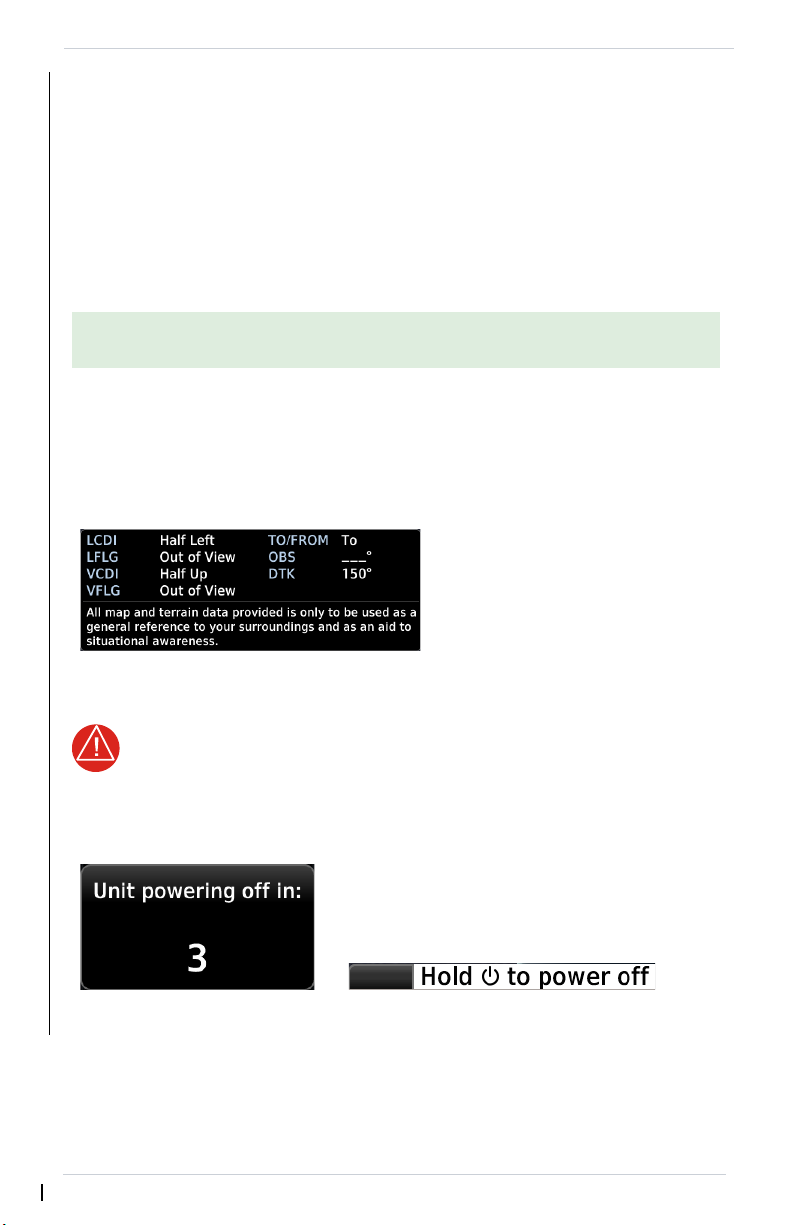
Pushing and holding the Power key for
0.5 seconds initiates the power off sequence.
Shutdown occurs once the timer reaches zero.
Power off annunciation temporarily replaces
the knob function indicator.
Power Up
The unit receives power directly from the aircraft’s electrical system. Upon power-up,
the bezel key backlight momentarily illuminates. System failure annunciations
typically disappear within the first 30 seconds after power-up.
The start-up screen presents the unit software versions, the name and status of all
installed databases, and the Database Updates page access key. These features are
available only at power up.
Tapping Continue advances to the Instrument Test page.
If an instrument remains flagged after one minute, check the status of the
associated LRU, then contact a Garmin dealer for support.
Instrument Test
To ensure safe operation, continuous built-in test features exercise the unit’s
processor, memory, external inputs, and outputs. The Instrument Test page displays
the results of all external equipment checks performed by the unit.
Power Off
Never attempt to power off the unit while airborne unless operational
procedures dictate.
2-2 Pilot’s Guide 190-02488-01 Rev. B

Get Started
NOTE
Overwriting SD card
database files
When database files are loaded
to the SD card, any previously
loaded database files of the
same type residing on the SD
card will be overwritten. This
includes loading a database of a
different coverage area or data
cycle than that currently residing
on the SD card.
For information regarding third party
navigation databases, go to
jeppesen.com
.
Databases
The navigator supports SD cards in the FAT32 format only, with capacities ranging
between 8 GB and 32 GB.
Databases are stored in the unit’s internal memory. To view update cycles, or to
purchase individual databases or database packages, go to flyGarmin.com.
There are two methods for loading and updating databases. Do not attempt either
of these while in flight (on ground only).
• Load databases via SD card. Once loading completes, you may power off
the unit and remove the card.
• Transfer databases from a Flight Stream 510 wireless datacard. This
method requires the Garmin Pilot app on a portable electronic device.
SUPPORTED DATABASES
Basemap
Navigation
Obstacles Obstacle and wire data
SafeTaxi Airport surface diagrams
Terrain Terrain elevation data
Bodies of water, geopolitical boundary, and road
information
Airport, NAVAID, waypoint, and airspace information
(Garmin or Jeppesen)
190-02488-01 Rev. B Pilot’s Guide 2-3
 Loading...