

Page 1
SPECIFICATIONS
Remote Control Unit
RCU-015
RCU-016
1.5 m
5/10 m
250V-TTYCS
250V-TTYCS/
MPYC
MU-201CE/
231CE
10/20/30 m 10/20/30 m
2.5 m
10/20/30 m
LAN Adapter
EC-1010
24 VDC
1.5 m
100-230 VAC
Option Shipyard Supply
Display UnitControl Unit
ECDIS for 2nd station
Processor Unit
EC-1000C
HUB
HUB-100
AIS
Track Pilot *
AMWSS
Route Backup
GPS Navigator
Anemometer
Echo Sounder
Log/Dual Axis Log
Gyrocompass
Engine Control
Water T emp Indicator
Alarms
B Adapter
EC-1020
24 VDC
x8
x2
x8
5 m
Conning Monitor
Gyrocompass (Synchro)
Log (200 p/nm)
Alarms
Analog Sensors
Radar/ARPA*
HUB
HUB-100
INTERCONNECTION DIAGRAM
RCU-018
or
FAR-21x7
series
FAR-28x7
series
Standards IMO Resolution A.817(19), IEC 61174 ed2
Display Unit FEA-2107: MU-201CE, 20.1" color LCD, SXGA (1280 x 1024 pixels)
FEA-2807: MU-231CE, 23.1" color LCD, UXGA (1600 x 1200 pixels)
Operating System Windows XP
Useable Charts IHO/S-57 v.3 vector chart, ARCS raster chart, C-MAP CM93 ed3*
*available in the near future
Presentation Modes True/Relative Motion Noth-up, True/Relative Motion Course-up
Relative Motion Head-up, Relative Motion Route-up
Display of data
Own ship : Position, SOG, COG, Heading
Route : Planned route, Monitoring route
ARPA targets : Range, Bearing, Speed, Course, CPA and TCPA
Others :
EBL, VRM, Parallel index line, Cursor position, Navigation
and pilot data notebook
Route/Waypoint Route: more than 100 routes
Waypoints: 200 waypoints/route
Voyage Calculation The following data can be calculated
Range/Bearing to destination, TTG, ETA, Fuel consumption
Route Navigation Monitoring
Off track, Waypoint, Arrival, Grounding, Depth
Alarms
Off track, Channel limit, Waypoint approach, Depth
Other Functions Night/day presentation colors, ARPA target display, Radar overlay,
User chart function, Position optimization, MOB, Log book,
Pilot data function,
Track control system (TCS)*
* Please contact the local dealers in your area for details.
Interface
Input/output
AIS : IEC 61162-2 (ABM, BBM)
Radar signal : Ethernet 100 Base-TX or RAW Video
Input
Gyrocompass : IEC 61162-1 (HDT) or Synchro
SDME (Speed log) : IEC 61162-1 (VBW) or Pulse type
EPFS : IEC 61162-1 (GLL, GGA, VTG, ZDA, DTM)
Echo Sounder : IEC 61162-1 (DBT, DPT)
Anemometer : IEC 61162-1 (MWV)
Water temp Indicator : IEC 61162-1 (MTW)
Current Indicator : IEC 61162-1 (VDR)
Output
Alarms : Relay output
Printer : Parallel
Power Supply
Display Unit: 100 - 230 VAC, 1 ø, 50/60 Hz
Processor Unit: 100 - 230 VAC, 1 ø, 50/60 Hz
LAN Adapter: 24 VDC
B Adapter: 24 VDC
Environment (IEC 60945 test method)
Temperature
All Units:
-
15˚C to +55˚C
Equipment List
Standard
1.
Display Unit FEA-2107: MU201CE, FEA-2807: MU-231CE
1 unit
2. Control Head RCU-018 or
Trackball Control Unit RCU-015 (Specify when ordering)
1 unit
3. Processor Unit EC-1000C 1 unit
4. LAN Adapter EC-1010 1 unit
5. Power Supply Cable for Processor Unit, 1.5 m 1 pc
6. Power Supply Cable for Display Unit, 1.5 m 1 pc
7.
DVI Cable between Display Unit and Processor Unit, 5 m 1 pc
8.
Cable between Control Unit and Processor Unit, 10 m 1 pc
9. LAN Cable, 2 m
1 pc
10. Standard Spare Parts and Installation Materials 1 set
Option
1. LAN Adapter EC-1010
2. B Adapter EC-1020 for equipment with analog interface
3. Remote Control Unit RCU-016
4. Cable between Control Unit and
Remote Control Unit 03S9610, 1.5/10/20/30 m
5. Hub HUB-100
6.
Radar Overlay Kit for FAR-21x5 series and FAR-28x5 series
7. Video Card for Conning Display Unit
8. Cable between Control Unit and Processor Unit, 20/30 m
9. DVI Cable between Display Unit and Processor Unit, 10 m
10. Armored LAN Cable OP03-186-10/20/30
11. Printer PP-510
12. USB-Parallel Printer Cable for PP-510
13. Hand Grip
14. Bracket
15. Connection Stand
16. Pedestal slim/standard Type
The future today with FURUNO's electronics technology.
9-52 Ashihara-cho, Nishinomiya City, Japan Phone: +81 (0)798 65-2111
Fax: +81 (0)798 65-4200, 66-4622 URL: www.furuno.co.jp
TRADE MARK REGISTERED MARCA REGISTRADA
Catalogue No. L-161b
SPECIFICATIONS SUBJECT TO CHANGE WITHOUT NOTICE
TRADE MARK REGISTERED
MARCA REGISTRADA
05015U Printed in Japan
Ethernet
Ethernet
250V-TTYCS-1T
250V-
TTYCS-1
Serial
554 21.8"
570 22.4"
313 12.3"
471 18.5"
598 23.5"
590 23.2"
Hand Grip
(option)
92 3.6"
398 15.7"
308 12.1"
136 5.4"
180 7.1"
4- 4
54 2.1"
39 1.5"
110 4.3"
4- 4
160 6.3"
136 5.4"
180 7.1"
89 3.5"
50 2.0"
35 1.4"
110 4.3"
4- 4
160 6.3"
136 5.4"
180 7.1"
89 3.5"
50 2.0"
35 1.4"
110 4.3"
5
0
5
1
9
.
9
"
451 17.8"
35
287 11.3"
352 13.9"
Bracket
(option)
534 21.0"
526 20.7"
Hand Grip
(option)
490 19.3"
296 11.7"
420 16.5"
506 19.9"
110 4.3"
4
5
4
1
7
.
9
"
409 16.0"
35
287 11.3"
352 13.9"
Bracket
(option)
440 17.3"
470 18.5"
150
5.9"
150
5.9"
50
2.0"
486 19.0"
395 15.6"
10
0.4"
179 7.1"
6- 8
Display Unit Processor Unit
Control Head
Trackball Control Unit
Remote Control Unit
RCU-015 2.4 kg 5.3 lb
RCU-016 2.4 kg 5.3 lb
EC-1000C 15 kg 33.1 lb
RCU-018 3.7 kg 8.2 lb
MU-201CE 18.3 kg 40.4 lb
MU-231CE 23.5 kg 51.8 lb
20.1" color LCD
23.1" color LCD
*
Up to two LAN
adapters connectable
*Please contact the local dealers in your area for details.
Digitizer
Printer
PP-510
With 8 ports
With 18 ports
*Up to four systems can
be connected
58 669 02 20
FURUNO U.S.A., INC.
Camas, Washington, U.S.A.
Phone: +1 360-834-9300
Fax: +1 360-834-9400
FURUNO (UK) LIMITED
Denmead, Hampshire, U.K.
Phone: +44 2392-230303
Fax: +44 2392-230101
FURUNO FRANCE S.A.
Bordeaux-Mérignac, France
Phone: +33 5 56 13 48 00
Fax: +33 5 56 13 48 01
FURUNO ESPAÑA S.A.
Madrid, Spain
Phone: +34 91-725-90-88
Fax: +34 91-725-98-97
FURUNO DANMARK AS
Hvidovre, Denmark
Phone: +45 36 77 45 00
Fax: +45 36 77 45 01
FURUNO NORGE A/S
Ålesund, Norway
Phone: +47 70 102950
Fax: +47 70 127021
FURUNO SVERIGE AB
Västra Frölunda, Sweden
Phone: +46 31-7098940
Fax: +46 31-497093
FURUNO FINLAND OY
Espoo, Finland
Phone: +358 9 4355 670
Fax: +358 9 4355 6710
FURUNO POLSKA Sp. Z o.o.
Gdynia, Poland
Phone: +48
Fax: +48 58 669 02 21
Page 2
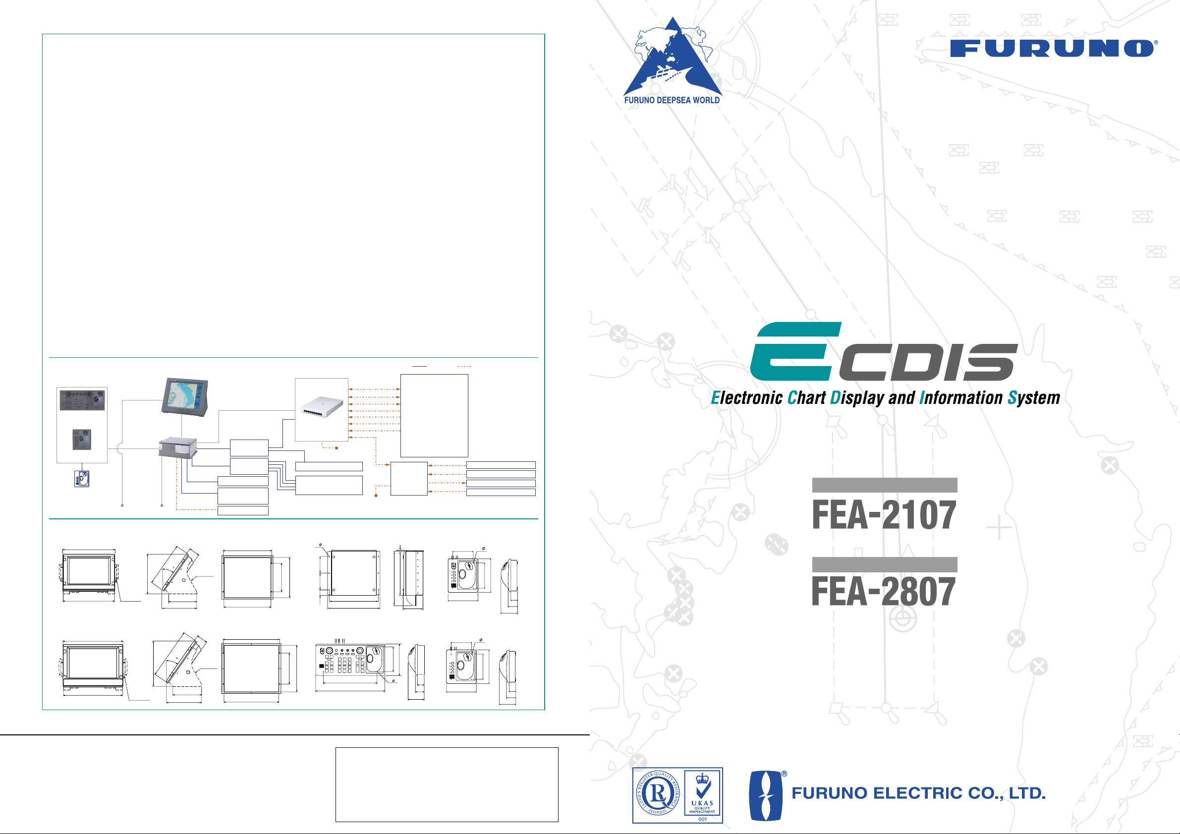
The FEA-2107 and FEA-2807 are FURUNO’s new ECDIS
(Electronic Chart Display and Information System), which
have been designed to fully comply with the latest
standards and resolutions set by IMO, IHO and IEC.
The electronic chart is compatible with ENC (S57 Edition 3)
charts, C-Map CM93 ed3* and ARCS charts (RASTER
CHARTS). Where the ENC chart is not available, the ARCS
chart is used instead. Instant conversion is assured, as both
chart databases are stored on the ECDIS memory.
State-of-the-art technology has been utilized for high-speed
stress-free data processing of chart and navigational data,
which are overlaid on the chart. The navigational data
includes: AIS and ARPA targets as well as a variety of
other navigation information such as position, course, and
speed. In the presentation of chart data, faster chart
drawing and swift switching for presentation on/off of
navigational data can be performed. When planning
the voyage route, this gives quick route profile calculation
and voyage optimization and continuous monitoring of
huge navigational data, user actions and performance of
the system.
The FEA-2107/2807 can be interfaced with up to four sets
of radar/ARPA FAR-21x7/28x7 by using of 100 Base-T
Ethernet network. This allows high-speed data transfer and
data sharing for navigational data within the network, which
simplifies the system integration and the expandability of
the system. The shared data can be accepted in both serial
and analog format.
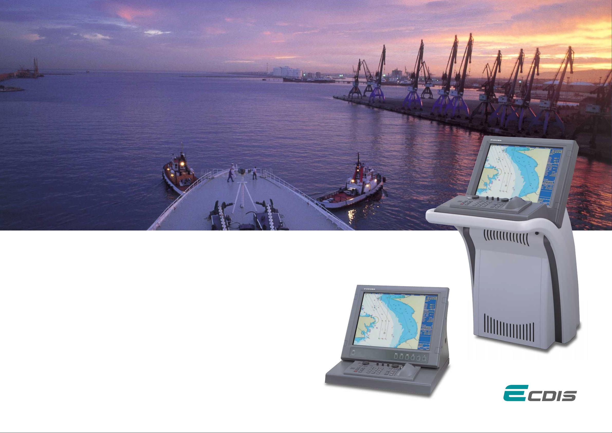
For the display units, the FEA-2107 uses a 20.1" SXGA
LCD and the FEA-2807 uses a 23.1" UXGA LCD. These
high-resolution units provide clear and sharp pictures for
comfortable observation. The presentation colors can be
selectable from five patterns according to the ambient
conditions of the bridge area for optimal viewing around
the clock. The ergonomically designed control panel
consisting of a keyboard, the trackball, thumbwheel and
mouse buttons facilitates intuitive and comfortable operation.
Electronic Chart Display and Information System
FEA-2107: 20.1" LCD
With optional mounting bracket
and connection stand
FEA-2807: 23.1" LCD
Obtain critical navigation information
on a state-of-the-art ECDIS
for safe and efficient travels
With optional pedestal
*available in the near future
Page 3

Ethernet 100 Base-TX
Autopilot
Autopilot
GPS Navigator
GPS Navigator
SDME
SDME
FEATURES of ECDIS
ENC IHO S57 Edition 3
Optional pedestal
sThe electronic chart can be overlaid with a variety of navigation data such as Radar echo
images, ship’s position, heading, speed and others to facilitate safe and efficient navigation.
sComplies with the following IMO and IEC regulations:
• IMO A.817(19) • IMO MSC.64(67) Annex 5
• IMO MSC.86(70) Annex 4 • IMO A.694(17)
• IEC 61174 edition 2 • IEC 60945 edition 4
• IEC 61162-1 edition 2 • IEC 61162-2 edition 1
sCompatible with ENC (S57 Edition 3) charts, ARCS charts and C-MAP CM93 ed3*
*available in the near future
sFlexible expandability allows the ECDIS to be networked with radar/ARPA, positioning
equipment, autopilot and others to consolidate the navigation system
sUser-customizable chart drawing function
sRoute planning applicable to both
Mercator’s sailing and great-circle sailing
sTrack Control System when connected
with autopilot
(Option)
sNavigation data for the past 12 hours
can be recorded
(The data to be recorded includes: time, ship’s position,
GPS correction data, ship’s heading, ship’s speed)
sTrue Motion and Relative Motion modes are
available
sErgonomically designed control panel provides
ease-of-use
The ergonomically designed control panel consists of
a trackball, a thumbwheel and a keyboard. The logically
arranged keyboard provides intuitive operation. Optionally,
the compact control head only with a trackball and
a thumbwheel is available for space-saving installation.
sNavigation data is shared within an Ethernet network
The 100 Base-T Ethernet is utilized to link
this ECDIS with up to four sets of radar/ARPA
FAR-21x7/28x7. This link gives high-speed
navigational data sharing within the system
and allows operators to choose either a single
station system or a total Integrated Navigation
System (INS).
sHigh-resolution color LCD
The use of 20.1"/23.1" high-resolution SXGA/UXGA LCDs
provide crystal clear presentations of navigation
information, such as marks, lines and waypoints.
The LCDs also allows for installation where space is limited.
sDisplays 200 AIS targets
When connected to an optional AIS transponder,
the FEA-2107/2807 can store up to 1,000 AIS
targets information in its storage buffer, and
displays up to 200 AIS targets within the userdefined range on the display. This provides
operators with another solution for observation
of other craft.
sStreamlined design
The color scheme of the optional
pedestal is a stylish pearl white and
gray. The streamline design fits
perfectly in the modern bridge.
A flexible Ethernet network
allows for future expandability
Palm control unit
Sleeping AIS Target
Activated Target Lost Target Dangerous TargetSelected Target
Page 4

PRESENTATIONS of ECDIS
Route planning
The operators can plan and
determine the precise route with
ease, while studying the chart
data on the screen. A route can
be altered in minute detail, and
the changed route can be saved
for later use.
Radar overlay
Radar echo image overlay is optionally available in
the FEA-2107/2807. This function gives the exact match in
scale and presentation of the chart and radar echo image.
This greatly helps the operator’s observation and enhances
their accuracy.
Day/night presentation
Conning display
Typically, information on the conning display is received
from the following sensors:
Data display
When the cursor is placed upon any mark on the electronic
chart, related information about the object such as a buoy,
lighthouse, sunken vessel, etc., will be sho wn in the data
cell. Additionally, other navigational information including
both own ship’s navigational as well as other ship’s
information from ARPA can also be presented.
This function informs the operator beforehand of shallow
coastal water and other sea conditions that could
contribute to the ship going aground.
The information about the sea areas is acquired from
the electronic chart and ship’s draft data is preset in own
ship’s information so that possible strand can be avoided.
Antigrounding
AIS symbol
Heading
Own ship’s information
• Ship’s position
• Heading
• Course over ground (COG)
• Speed over ground (SOG)
UTC
(coordinated universal time)
Cursor information,
Distance and bearing
between own ship
and cursor
Planned route
WTP
(Waypoint)
Buoy
Cursor
Own ship’s marker
Navigate safely and efficiently with
the ECDIS route planning and monitoring
AIS information
• Name
• IMO MMSI number
• Position
• Speed
• Course
• CPA
• TCP A
• Range
sPosition sensors
sWind sensor
sGyro
sRate of turn gyro
sLog/Dual-axis log
sEcho sounder
sRudder
sPropellers
sThrusters
A variety of navigation
information, which is input
from up to sixteen onboard
sensors, can be graphically
displayed on thee screen.
Up to eight sensors provide
the analog data, and the other
eight provide the serial data.
The information is displayed in six predefined place
where the operators can arrange the layout.
Status bar
• Presentation mode
• Vector mode and vector time
• Planned route, chart name
• Name of pilot data
• Source of target data
• Predictor time
Radar overlay dialog box
Operators can have controls for
adjustment of the radar image - gain, sea
clutter, rain clutter, echo trail, interference
rejector, echo stretch and noise rejector.
 Loading...