

Garmin GPS 16A Specifications
WITH WAAS
for even greater accuracy
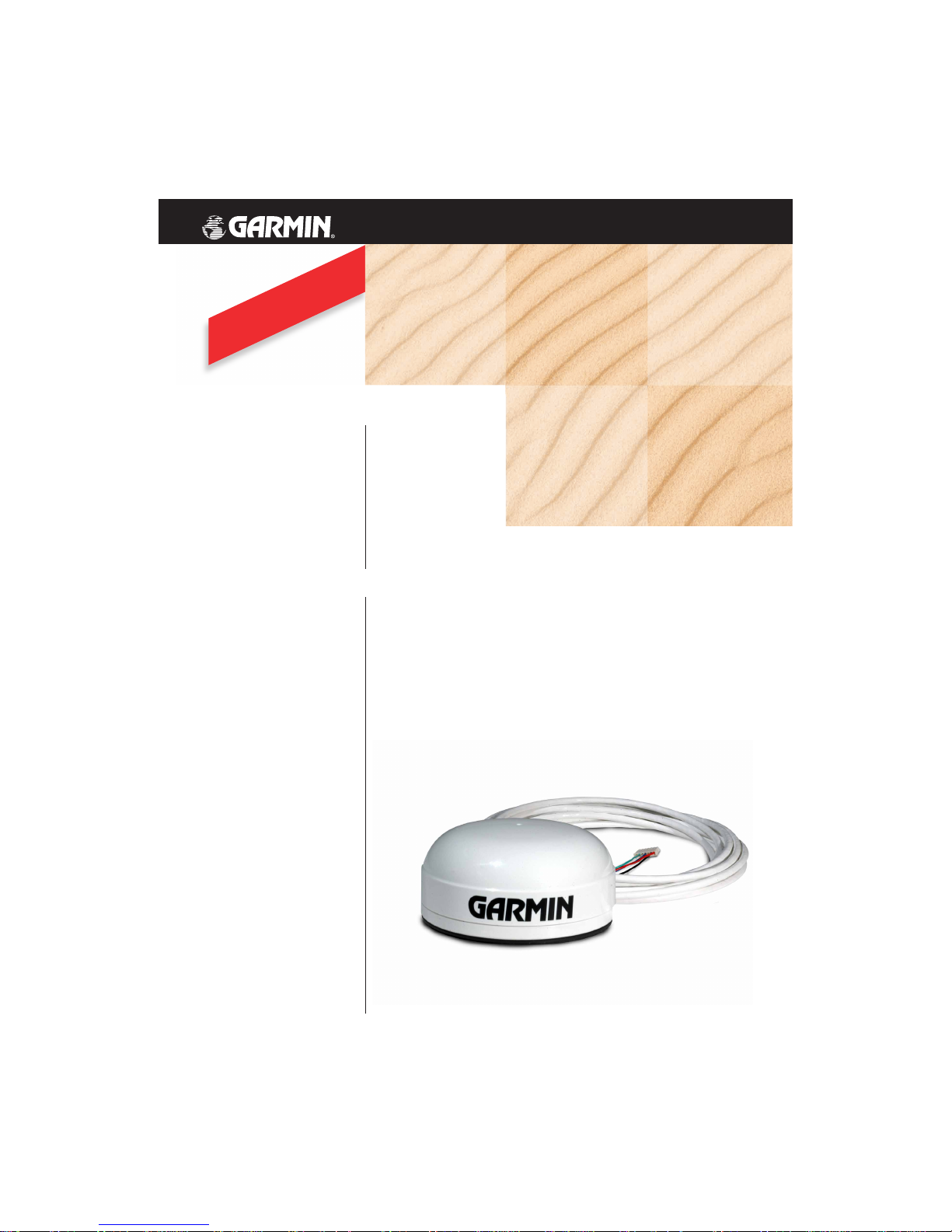
The Garmin GPS 16A delivers precise
position reporting for agricultural
applications such as yield monitoring
so you can you pinpoint areas in a field
that may require additional fertilizer
or other treatment. The 12-channel
receiver allows for continuous tracking
of all visible satellites. And it’s WAAS-
capable for better position accuracy.
This GPS sensor consists of an integrated
antenna housed in a rugged, waterproof
design. It includes a Teflon
™
-jacketed
cable for resistance to agricultural
chemicals, sun and the elements.
GPS 16A
Rugged GPS receiver for ag applications
GPS 16A
©
2003 Garmin Ltd. or its subsidiaries
Garmin International, Inc.
1200 East 151st Street
Olathe, Kansas 66062, U.S.A.
913/397.8200 fax 913/397.8282
Garmin (Europe) Ltd.
Unit 5, The Quadrangle
Abbey Park Industrial Estate
Romsey, SO51 9DL, U.K.
44/1794.519944 fax 44/1794.519222
Garmin (Asia) Ltd.
No. 68, Jangshu 2nd Rd.
Shijr, Taipei County, Taiwan
886/2.2642.9199 fax 886/2.2642.9099
www.garmin.com
For more information, please refer to our tech specs,
which are available on our Web site:
http://www.garmin.com/products/gps16a/manual.html
Specifications are preliminary and subject to change
without notice.
*
Warm = all data known.
Cold = position, time and almanac known.
AutoLocate
™
= almanac known, position and
time unknown.
SkySearch = no data known.
**
Subject to accuracy degradation to 100m 2DRMS
under the U.S. Department of Defense imposed
Selective Availability Program.
REV 0503 M01-10120-00
Electrical
Input voltage: Unregulated 8–40v
Input current: 65 mA @ 12v DC
28 mA @ 40v DC
Sensitivity: -165 dBW minimum
GPS performance
Receiver: WAAS-enabled, 12 parallel channel GPS
receiver continuously tracks and uses up
to 12 satellites to compute and update your
position
Acquisition times:*
Reacquisition: Less than 2 seconds
Warm: Approximately 15 seconds
Cold: Approximately 45 seconds
AutoLocate
™
: 2 minutes
SkySearch: 5 minutes
Update rate: 5Hz
GPS accuracy:
Position: < 15 meters, 95% typical**
Velocity: 0.1 knot RMS steady state
DGPS (USCG) accuracy:
Position: 3-5 meters, 95% typical
Velocity: 0.1 knot RMS steady state
DGPS (WAAS) accuracy:
Position: < 3 meters, 95% typical
Velocity: 0.1 knot RMS steady state
Dynamics: 999 knots, 6g’s
Map datums: 108 predefined, 1 user
Interfaces
Serial interface:
Port 1: Selectable between NMEA and Garmin.
NMEA 0183 v2.0 (ASCII), GPALM, GPGGA,
GPGSA, GPGSV, GPRMC, GPVTG, GPGLL,
PGRME, PGRMF, PGRMT and PGRMV output
Port 2: RTCM only. RTCM SC-104 differential input
message types 1, 2, 3, 7 and 9
Baud rates: 300/600/1200/2400/4800/9600/19200
Environmental
Temperature:
Operating: –30
˚
to 80˚C
Storage: –40˚to 80˚C
Physical
Size: 3.54" diameter (90 mm)
1.65" height (42 mm)
Weight: .46 lb. (0.209 kg) unit only
1.1 lb. (0.499 kg) with cable
Cable: Foil-shielded 5 conductor 22 AWG
Mount: Magnetic base included
specifications
 Loading...