

Garmin GPS 3 Plus Specification
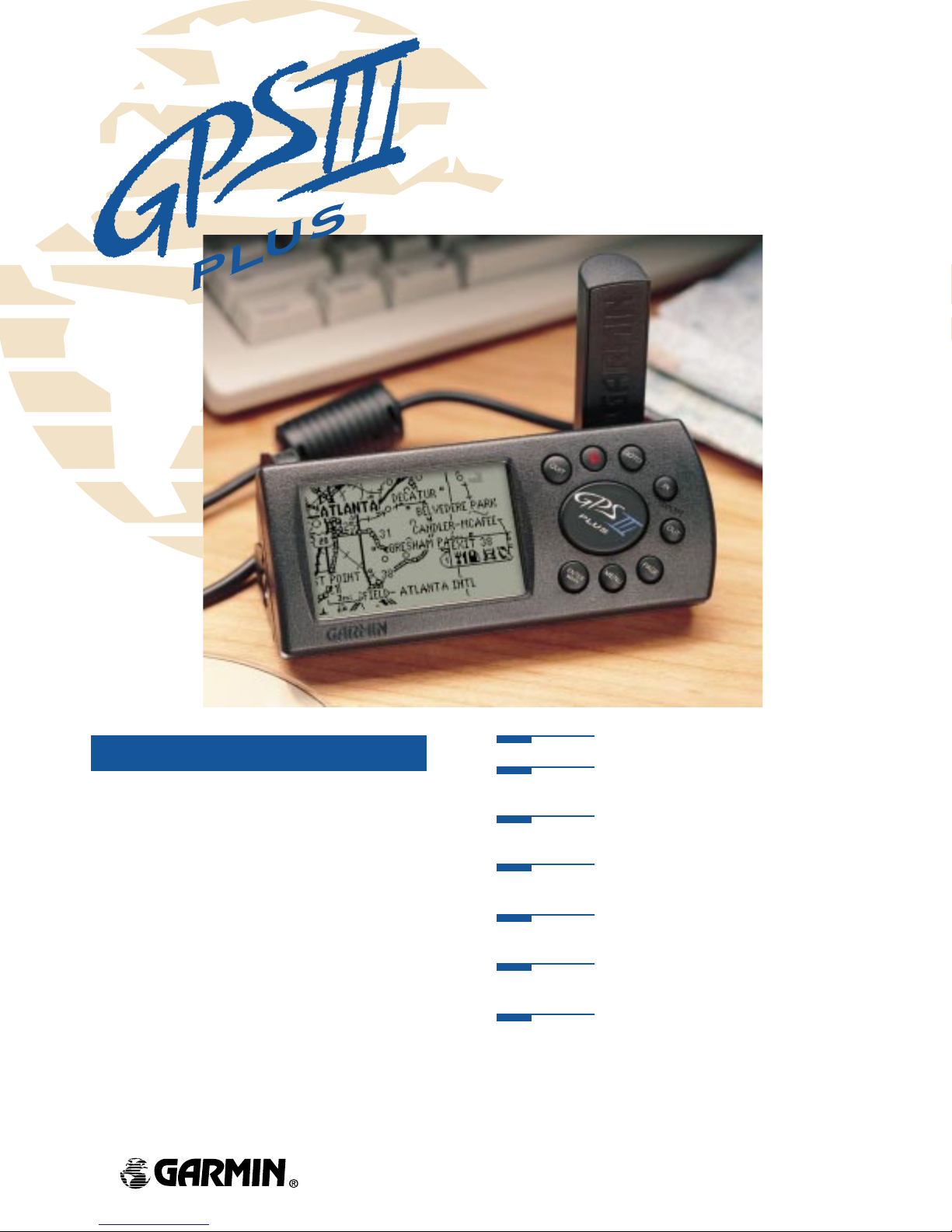
GARMIN’ s new GPS III Plus of fers cartographic capabilities formerly found only in high-end automotive navigation and marine
chartplotting units. Simply plug it into a PC and download data
from GARMIN’s line of MapSourceTMCD ROM’s and you’ll enjoy
detailed maps.
Whether you’re cruising the streets or pounding the waves,
GARMIN has the maps you need. Choose the “U.S. Road &
Recreation” CD for city street level detail and features such as lake
and river shore lines, boat ramp and marina locations. Other CD’s
give you worldwide coverage of coastlines, including an extensive
database of cities, navaids and inland roads.
Even without additional cartography, the basemap in the GPS
III Plus will get you where you’re going. More than 10,000 new
towns have been added to the basemap. Y ou also get airport locations, secondary roads in metro areas and even detailed exit information for the federal interstate highway system, including available lodging, food and service stations.
Accepts MapSourceTMCD ROMs for enhanced mapping detail.
Powerful PhaseTrac12,TMtwelve parallel channel receiver, tracks
and uses up to twelve satellites for fast, accurate positioning.
Versatile screen switches from horizontal to vertical orientation
(and back again) with the press of a button.
Adaptable navigation page with either compass or highway steer-
ing guidance, and user-selectable data fields.
Patented TracBackTMfeature lets you quickly navigate your track
log back home without manually storing waypoints.
Trip odometer, average and maximum speed, and auto start/stop
trip timer.
Rugged construction with locking rubber battery cover.
Street Level Mapping in a Compact Handheld

Moving Map Features
Basemap: Built-in Americas to 20 mi; includes
lakes, rivers, cities, railroads,
coastlines, interstates, national
and state highways with exit info
CD ROM: Uploadable, detailed map data
available from MapSource CDs
Map Scale: Screen-width scale:
500 feet to 3,000 miles
Navigation Features
Waypoints:
Total: 500 each with name, symbol and
map display option
Nearest: 9 (automatic) continuously updated
Routes:
20 reversible routes with
up to 30 waypoints each,
plus MOB and TracBack
TM
Track Log:
Approximately 1900 active log
points plus 10 saved logs
Map Datums:
Over 100
Coordinates:
Lat/Lon plus 10 grids, including
UTM/UPS, Maidenhead and a user-UTMgrid
Performance
Receiver: Differential-ready, 12 parallel
channel receiver continuously
tracks and uses up to 12 satellites
Acquisition Times
Warm: Approximately 15 seconds
Cold: Approximately 45 seconds
AutoLocate
TM
: Approximately 5 minutes
EZinit
TM
: Easy initialization, 45 seconds
Update Rate:
1-second, continuous
Accuracy
Position: 15 meters (49 feet) RMS*
1-5 meters (3-15 feet) RMS
with GARMIN GBR 21 DGPS receiver
(optional)
Velocity: 0.1 knot RMS steady state
Dynamics:
6g’s
Interfaces:
NMEA 0183 and RS-232 DGPS correction
Antenna:
Detachable with standard
BNC-type connector
Physical
Size: 2.32"H x 5"L x 1.62"W
(5.9 x 12.7 x 4.1 cm)
Weight: 9 ounces (255g) with batteries
Display: 2.2"W x 1.5"H (5.6 x 3.8 cm) high-
contrast electroluminescent backlit
FTN display (100x160 pixels);
switchable orientation
Memory: Internal lithium battery backup
lasts up to 10 years
Power
Source: 4 AA batteries or 10-32vDC
Usage: 0.75 watts
Battery Life: 36 hours
Accessories
Standard: Wrist Strap
User’s Manual
PCI Interface Cable
Velcro Mount
Quick Reference Card
Optional: MapSource CDs
Automotive Dash Bracket
Bicycle Handlebar Bracket
Cigarette Lighter Adapter
PC-Kit (with Data Cable)
Power/Data Cable
Carrying Case
Remote Antenna (GA26)
GBR21 Differential Beacon Receiver
for DGPS Corrections
Specifications are subject to change without notice.
* Subject to accuracy degradation to 100m 2DRMS under
the United States Department of Defense imposed
Selective Availability Program.
©
1998 GARMIN Corporation
GARMIN worldwide:
GARMIN (Europe) Ltd.
Unit 5, The Quadrangle
Abbey Park Industrial Estate
Romsey, SO51 9AQ, UK
44.1794.519944 FAX 44.1794.519222
GARMIN (Asia) Corporation
No. 68, Jangshu 2nd Rd.
Shijr, Taipei County, Taiwan
886/2.2642.9199 FAX 886/2.2642.9099
GARMIN’s GPS III Plus–
the CD compatible portable map.
GARMIN International
1200 East 151st Street
Olathe, Kansas 66062, U.S.A.
913.397.8200 FAX 913.397.8282
www.garmin.com
M01-10083-00 REV0299
 Loading...