

Page 1

User Guide
T430BT
2nd edition
www.binatonegps.com
Binatone Navigation software
Page 2

IMPORTANT
Satellite signals are required for this product to function in Navigation Mode.
There may be occasions within your home or surrounding area when the
signal strength is limited and Navigation Mode may not be possible.
This is quite normal for products of this type. If you experience difficulty in
receiving a signal in your car you may need to use an external antenna
(optional).
If you need help...
The Help Line is available from 9:00 am to 5:00 pm, Monday to Friday, on 0845 345
9677 Calls are charged at Local Call rate (for UK only).
Unpacking your the Binatone Carrera T430BT
In the box you will find
z GPS navigation device
z Car mounting kit
z In-car charger
z USB cable *
z Stylus pen
z User guide
Keep the packaging materials in a safe place in
case you later need to transport the unit.
Keep your sales (till) receipt, which is your
guarantee. Before you can use the unit, you'll
need to fully charge the battery as described on
page 6, please also read the notes on the page 3.
WARNING:
Your GPS device operates under open sky
conditions in order to receive a satellite signal.
Please ensure that you are not using the device
indoors or in areas where the satellite signal is
weak.
For the first time of use or after a few days of no
use, it may take up to 10 minutes to acquire a
satellite signal. It is recommended to be
stationary during the start up process.
* USB cable can be either used to charge your device with your computer or update
your system (latest map and software, latest safety camera information) via your
computer and the internet (updates are payable).
1
Page 3

Safety
The Global Positioning System
The Global Positioning System (GPS) is a satellite based system that provides
location and timing information around the globe. GPS is operated and controlled
under the sole responsibility of the Government of the United States of America, who
are responsible for its availability and accuracy. Any changes in GPS availability and
accuracy, or in environmental conditions, may impact the operation of your the
Binatone Carrera Personal Navigation Device (PND).
Using Your PND in the Car
When using your PND while driving it is essential that you drive with due care and
attention. Never modify the settings or program your PND while driving. Only look at
the PND map when it is safe to do so. Only follow the PND instructions when the
road regulations allow you to do so. When mounting the PND in your car make sure
that it does not obscure your view or impede the operation of any driving controls.
Prohibited Areas
Do not operate your PND in hospitals or near any electrical medical equipment.
Do not operate your PND in aircraft.
Do not operate your PND in a petrol station forecourt.
Battery
Your PND uses a Li-Polymer battery. Do not use it in humid, wet or corrosive
environments. Do not operate or store your PND in high temperatures (>60℃) or in
direct sun light. Do not pierce or break the battery casing.
Failure to follow these cautions will invalidate the warranty and may cause the
battery to leak acid, become hot, explode or ignite and cause injury or damage.
If you come into contact with leaked battery acid wash the contact area
thoroughly and seek medical attention.
The Li-Polymer battery contained in this unit must be recycled or disposed of
properly. Do not dispose of in household waste or burn.
2
Page 4

CONTENTS
Contents
Important ………………………………………………………………………… 1
Safety ……………………………………………………………………… 2
Contents ………………………………………………………………………... 3
Getting started ……………………………………………………………….... 6
Postion of the Controls ………………………………………………….. 6
Battery Information …………………………………..…………………… 7
Car Adaptor ……………………..………………………………………… 7
External Antenna …………………………………………………………. 8
Switching On/Off …………………………………………………………. 8
Sleep Mode ………………………………………………………………. 9
SD Card Installation ……………………………………………………… 9
Connecting to PC ………………………………………………………… 9
Connecting to Earphones ……………………………………………….. 10
General Setup ........................................................................................... 11
Settings menu ……………………………………………………………. 11
Language …………………………………………………………… 12
Date & Time ………………………………………………………… 12
Volume ………………………………………………………………. 12
Backlight ……………………………………………………………. 13
Info ………………………………………………………………….. 13
Calibrate ……………………………………………………………. 13
Power ……………………………………………………………….. 14
Photo Viewer …………………………………………………………………… 15
Bluetooth Function …………………………………………………………… 17
Pairing …………………………………………………………………….. 18
Paired List ………………………………………………………………… 20
Making Calls ……………………………………………………………… 21
Receiving Calls ………………………………………………………….. 22
Phonebook ………………………………………………………………. 22
Adding New Phonebook Entries ………………………………………. 22
Edit Phonebook Entries ………………………………………………… 23
Call Record ………………………………………………………………. 23
Saving a Call Record to the Phonebook ……………………………… 23
Last Call Redial ………………………………………………………….. 23
Use of the Mounting Kit …………………………………………………….. 24
3
Page 5

CONTENTS
Navigation …………………………………………………………………….. 25
Getting Started…………………………………………………………… 25
Navigate to .…………………………………………………………………… 27
Entering your Waypoints/destination ………………………………….. 28
Address ……………………………………………………………... 28
POI (Points of Interest).……………………………………………. 30
POI Near You ………………………………………………………. 30
POI in City …………………………………………………………... 31
Favourites …………………………………………………………… 32
Recent Destinations………………………………………………... 32
Map …………………………………………………………………... 33
Browse Map Options …………………………………………… 33
Zoom to Address ……………………………………………….. 33
View POI ………………………………………………………… 33
Zoom to Current Pos ………………………………………….. 33
Night/Day ………………………………………………………. 33
3D/2D Map View ………………………………………………. 33
Show Trace Record …………………………………………… 34
Coordinates…………………………………………………………. 35
Navi/Simulate …………………………………………………………….. 36
Navigation Screen…………………………………………………... 37
Navigation Options…………………………………………………. 38
View Route ……………………………………………………… 38
Navi Settings…………………………………………….……... 38
Save Map View………………………………………………… 39
Night/Day ……………………………………………………….. 40
3D/2D …………………………………………………………… 40
Brightness….…………………………………………………… 40
Volume …………………………………………………………. 40
Road Block……………………………………………………... 40
GPS Status ……………………………………………………. 40
Trace Record…………………………………………………… 40
Main Menu.……………………………………………………… 40
Simulation Screen…………………………………………………... 41
View Route ……………………………………………………... 41
Simulate.………………………………………………………… 41
Back …………………………………………………………….. 41
GO .……………………………………………………………… 41
Route Options………………………………………………….. 42
Driving Method………………………………………….. 42
Routing Style .…………………………………………. 42
Routing Parameters……………………………………. 42
Go Home……………………………………………………………………….. 43
Edit Favourites ………………………………………………………………. 43
Add………………………………………………………………………... 43
Edit………………………………………………………………………… 44
4
Page 6

CONTENTS
On Map.…………………………………………………………………… 44
Recent Destinations ……………………………………………………… 44
View Map …………………………………………………………………….. 45
Settings ……………………………………………………………………….. 46
Language…………………………………………………………………. 46
Set Home Address………………………………………………………. 46
Units ………………………………………………………………………. 46
Brightness………………………………………………………………… 46
Volume ……………………………………………………………………. 47
About ……………………………………………………………………… 47
GPS Status …………………………………………………………………… 47
Time Zone Setting ………………………………………………… 48
Safety Cameras …………………………………………………………… 48
Frequently asked questions ………………………………………… 49
Troubleshooting …………………………………………………………. 50
Technical Specifications ………………………………………………. 51
5
Page 7
SETUP
Getting Started
This device combines GPS functionality with a photo viewer and Bluetooth Handsfree. Before you begin to install and use this product, please read this manual
carefully for fully exploiting the functions of this product. If you experience any
problems, go through the user guide before contacting the customer helpline.
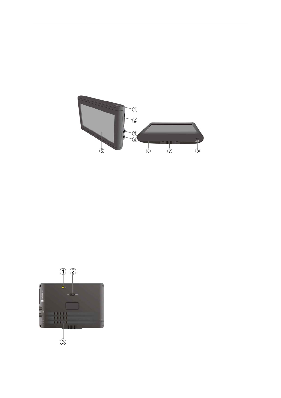
Position of the controls
Front and side
1. Sleep Button
Press and hold to switch the unit in or out of sleep mode.
2. SD Card Slot
Insert the SD card into this port.
3. Headphone Socket
Used to connect headphones to the unit. When the headphones are connected,
the speaker will turn off automatically.
4. DC 5V Car Adaptor Socket
Used to connect the car charger.
5. Touch Screen
6. Microphone hole
7. Grooves
Used to fix the unit to the mounting cradle.
8. USB Port
Used to connect the unit via USB cable.
Back
1. External GPS Antenna Jack
Connected to the external antenna (optional).
2. On/Off Power Switch
Used to switch power on or off.
3. Speaker
6
Page 8
SETUP
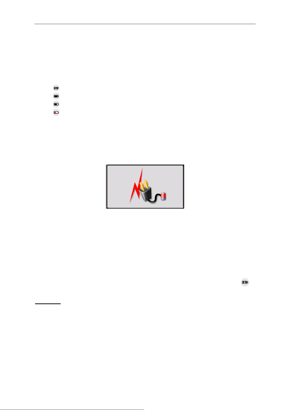
Battery Information
The device is integrated with a 1000mAH/ 3.7V Li-polymer battery. It allows the unit
to be used for approximately 2 hours, without being connected to a power source.
The battery icon which is shown at different points on the display during Navigation
mode.
The icon indicates the current battery status.
: The thunderbolt in the battery shows the battery is being charged.
: Battery is not charging, but it is at full capacity.
: Battery in not full, but there is sufficient reserve capacity.
: When the inside of the battery turns red, the battery needs recharging.
You can also go to the Main Menu / Settings / Power to view the actual percentage
of the remaining battery capacity.
The display shows the “Low Battery!” message automatically. When the battery
capacity drops below 18%, this message will begin to flash on the screen. However,
when battery capacity drops below 5%, the unit will shut down and will require
charging before it can be used again.
Charging the Battery
Before using your unit for the first time, we recommend you to charge the unit for
approximately 3 hours via the car charger in order to charge the battery.
Car Adapter
Plug the in-car charger into the DC 5V socket on the unit. Plug the other end of the
adapter into the car’s cigarette-lighter / 12V DC socket.
When using your unit in the car we recommend that you always use the in-car
charger to power the unit, especially on long journeys.
When the device is connected to the car charger the battery icon will change to .
Attention
¾ Place the unit in a position which allows a clear view of the screen viewing, but
which does not impede your view of the road.
¾ Disconnect the unit from the Car Adaptor when starting the vehicle.
¾ When connected via the adaptor, the LCD screen will be brighter than when it is
not charging.
7
Page 9
SETUP
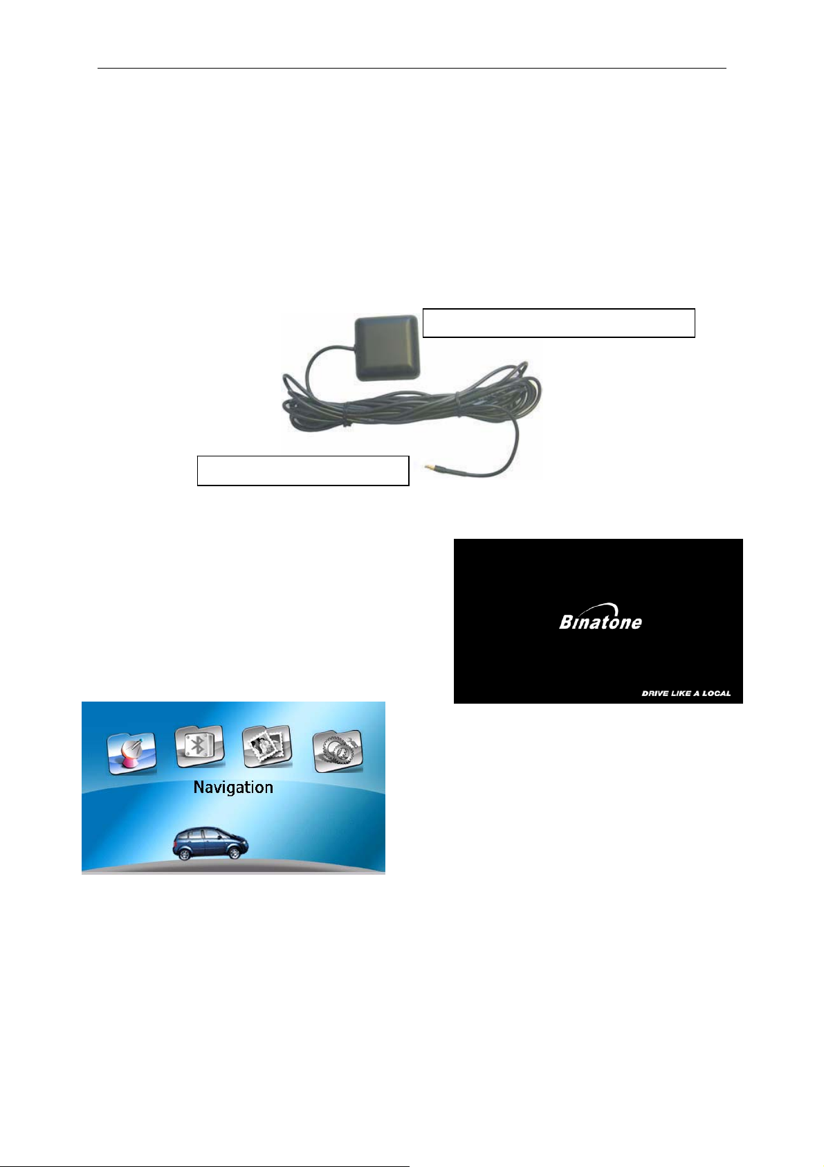
External Antenna (sold separately)
If the GPS receiver fails to acquire a valid signal when mounted in your car it may be
due to a heat reflecting coating or heating elements in your windscreen. In these
cases use an external antenna.
The antenna has a magnet and can be positioned in various locations in or outside
your car to obtain the best signal reception. Push the antenna into the socket on the
rear of the unit until it clicks into place. Then position the antenna so that you receive
a valid signal.
Position the antenna on the roof of your
Plugs into the back of the PND
*External Antenna Optional
Switching On/ Off
Use the stylus pen to switch the unit on by the
power switch on the back of the unit. You will
see the Binatone Carrera screen for a period
of time, while your Binatone Carrera powers
up.
The screen will then change to the Main
Menu screen shown here. This is the
starting point for using all of your T430BT
features.
8
Page 10
SETUP
Sleep Mode
You can use Sleep mode to conserve battery power if the unit is not going to be
used for a short while, for example if you have scheduled a stop at a service station.
NOTE: if the unit is not to be used for a few hours, the unit should be switched off by
the On/Off switch, to maximise battery power
Press the Sleep Button for 3 seconds to put the unit into Sleep Mode. You will briefly
see the Binatone Carrera screen again, before the unit enters Sleep Mode
Press the Sleep button for 3 seconds to wake up the device, the display will show
the same screen as when the unit was put into sleep mode.
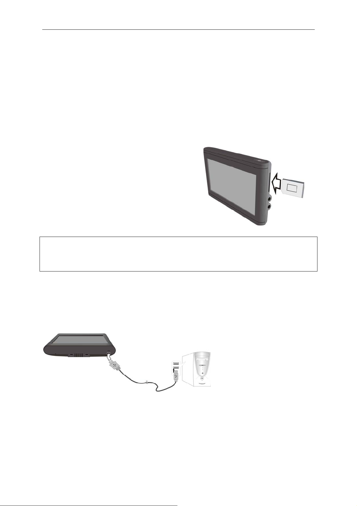
SD Card Installation
If you have a SD or MMC memory Card, you
may install it to extend the storage capacity of
the unit, to view photos, to play music or to play
movies saved on the SD card. When installing
the card it can only be fitted one way – the
wording side facing towards you and the cut-off
corner at the top as shown. Insert the card and
push it in so that it clicks into place.
NOTE: A SD Card Is Not Included.
NOTE: Never remove the SD card while it is use, other wise it could result in the loss
of data on the SD card or corruption to the software on your Binatone GPS. It is
therefore recommended that you always switch the unit off, before
inserting/removing a SD card.
Connecting to PC
The unit is designed with a USB port which allows you to connect the unit to a PC.
See the below figure for details:
9
Page 11

SETUP
Connecting to Earphones
Connect the earphones to the right side of the unit for private listening.
When the earphones are connected, the speaker will automatically turn off.
Note: Overly loud volume could damage your hearing. So turn down the volume
before you connect the earphones, and then raise the volume to a comfortable level.
10
Page 12
General Setup
System Main Menu
After powering up the unit, you will be
shown the main menu on the display (as
shown). This is the starting point for using
all of your Binatone Carrera features.
On this main menu tap the following icons
for the feature you wish activate.
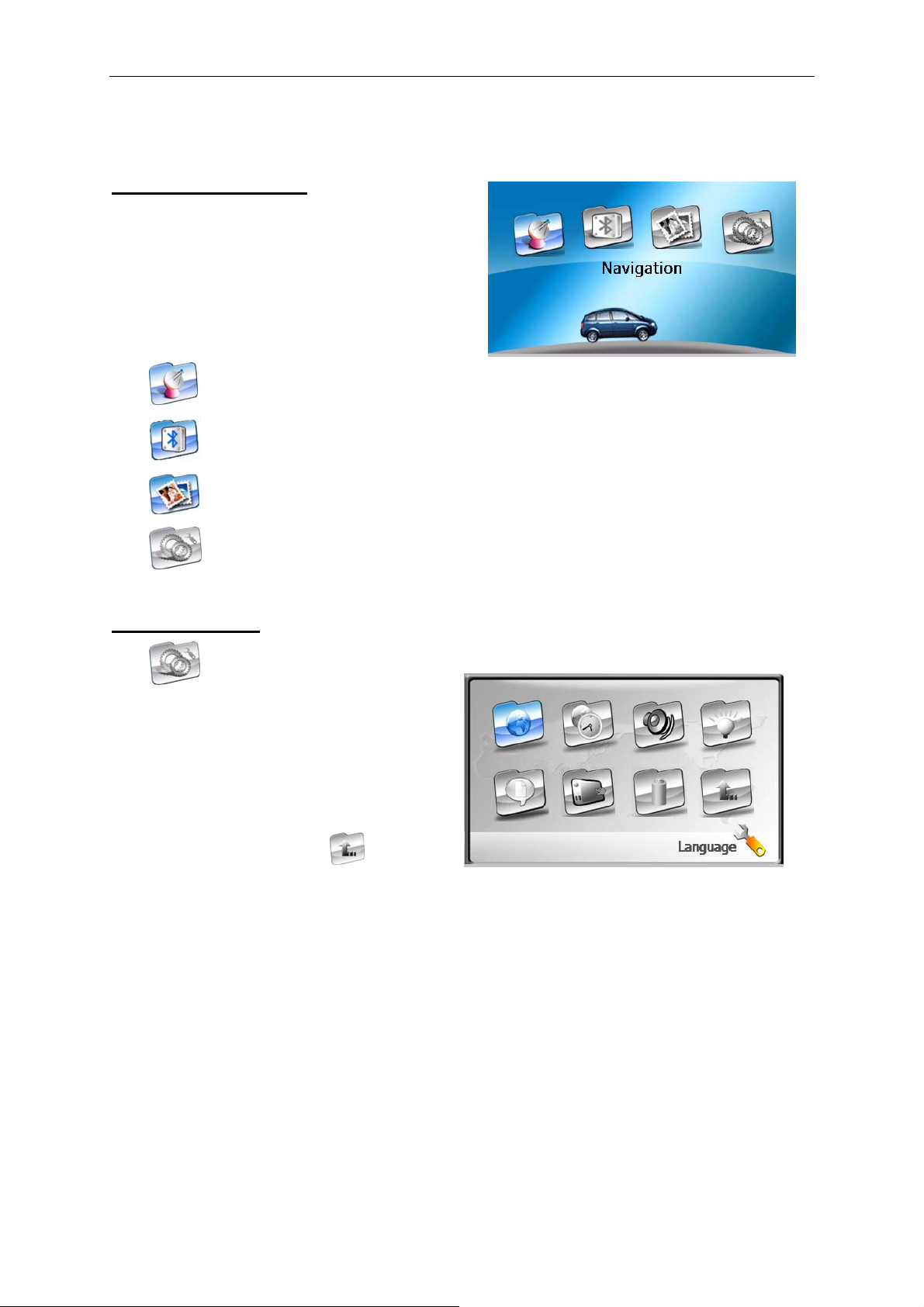
SETUP
Tap
Tap
Tap to enter the Photo Viewer.
Tap to enter the Settings menu.
to enter Navigation.
to enter the Bluetooth function.
Settings Menu
Tap to enter the settings menu,
the following screen is displayed.
NOTE: You do not need to enter the
Settings menu before you start to
navigate.
On the settings menu, tap to return
to the main menu.
11
Page 13
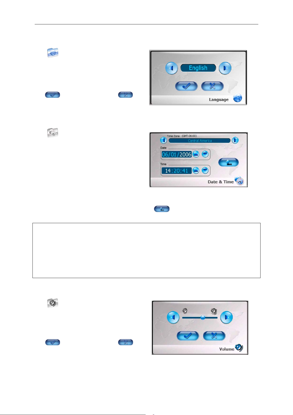
Language
Tap to enter the language settings
menu were you can set the language, the
screen will change as shown:
Tap the buttons to select language,
tap to confirm and exit or to
exit with out changing the language.
Date & Time
Tap to enter Date & Time settings
menu for changing the current time zone
as well as the time and date, the screen
will change as shown:
SETUP
Tap the buttons to select the proper
Time Zone.
Using the stylus select the either day, month, year, hour, minutes or seconds, the
selected item will turn white. Then tap the buttons for either the Date group or
Time group to change the selected item. Tap to return.
Note: When you obtain a valid GPS signal the date and time will be automatically
set, so you will only have to correctly set the time zone.
The unit does not allow for British Summer Time (BST) so during the summer
months it will be necessary to set the time zone 1 hour ahead.
Also note that this can be set via the Navigation software after selecting Navigate
from the main menu. Under the navigation software you will also need to set the
correct time zone, but BST can be selected from this software.
Volume
Tap to enter the Volume setting
menu which allows you to adjust the
volume, the screen will change as shown:
Tap the buttons to select volume level,
tap
to confirm and exit or to
exit with out changing the volume.
12
Page 14
SETUP
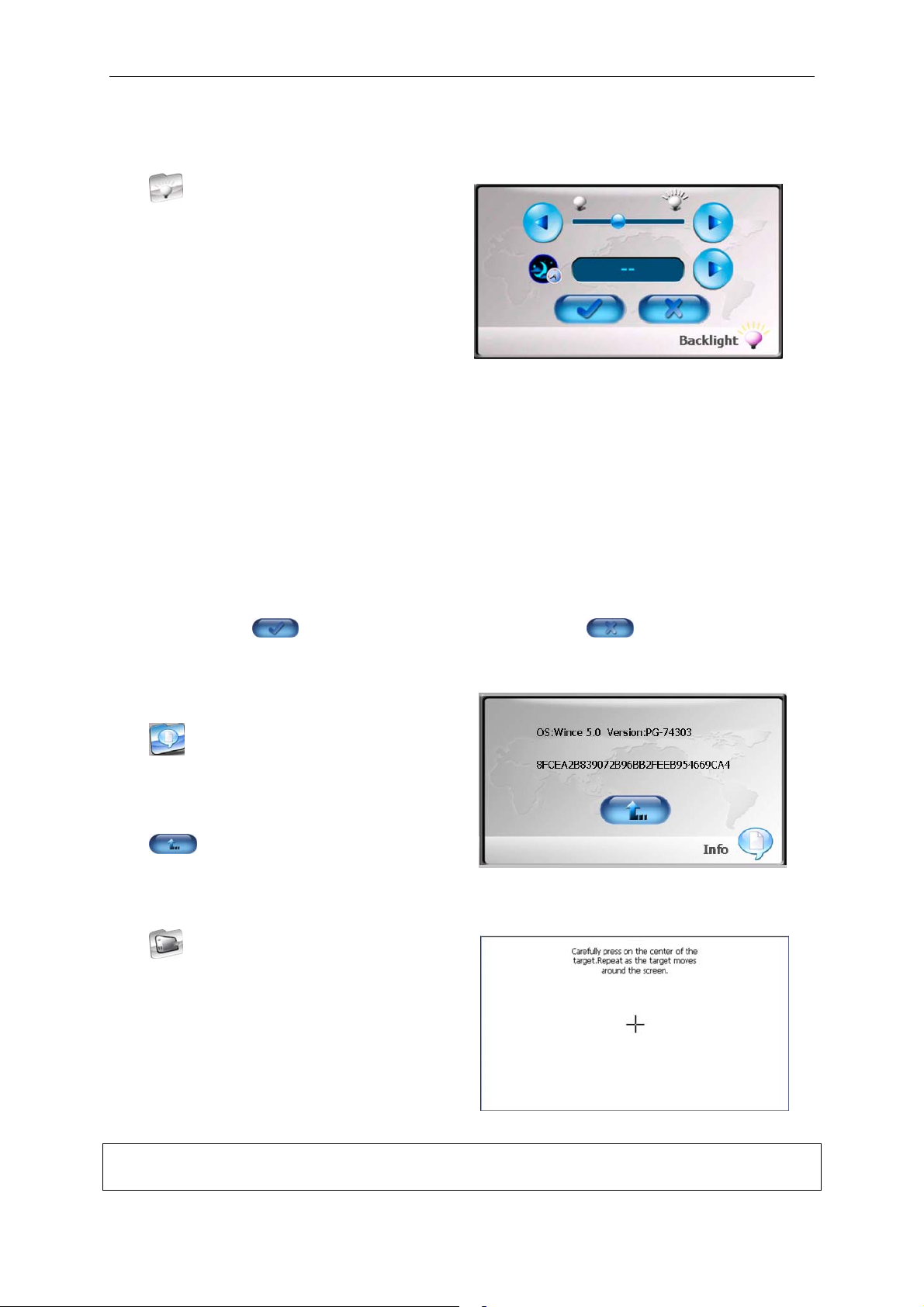
Backlight
Tap to enter the Backlight setting
menu which allows you to adjust the
backlight brightness, the screen will
change as shown:
Tap the top buttons to select the
backlight brightness level.
Tap the lower button to adjust the sleep time. There are 6 choices for sleep time
(--/5/10/30/60/120).
--: The backlight will always be on and the unit will not enter sleep mode.
5: The backlight will stay on for 5 minutes before entering sleep mode.
10: The backlight will stay on for 10 minutes before entering sleep mode.
30: The backlight will stay on for 30 minutes before entering sleep mode.
60: The backlight will stay on for 60 minutes before entering sleep mode.
120: The backlight will stay on for 120 minutes before entering sleep mode.
After setting, tap to confirm you settings and exit or to exit without
changing the settings.
Info
Tap to display the system information
screen, the screen will change as shown:
Tap to return.
Calibrate
Tap in the settings menu to calibrate
the screen to respond to your screen taps.
You will need to use this function only if
the unit begins to respond inconsistently to
your screen taps. The screen will display
as here:
Follow the on screen instructions to
complete the screen calibration.
NOTE: when pressing on the centre of the target hold the stylus in place for about 1
second, before removing it from the screen.
13
Page 15

Power
Tap to enter Power menu which
displays the current battery status, the
screen will change as shown:
The power menu will display the battery
status as a percentage. Tap the
button to return.
SETUP
14
Page 16
SETUP
Photo Viewer
The T430BT comes with a built in Photo/picture viewer, which is capable of
displaying BMP, GIF, JPG, JPEG files. Other photo/picture file formats are not
supported by the T430BT. In order to view these files on the T430BT, you will first
need to copy the files you want to play on to a separate SD card.
Note: Do not store photos in the Flash storage, for the flash storage is used to
store map data, any attempt to open the Flash storage may result in the map
data becoming lost or corrupt.
If the unit lags when reading JPEG files, try using lower resolution files. We
suggest 640 x 480 pixel resolution files.
In the main menu, tap to open the Photo Viewer screen, as shown here:
From here you can open and view the pictures saved on the SD card.
When opening the Photo Viewer for
the first time, there will be no
location set to look for photos so the
viewing screen will appear blank.
To select the SD card and to view
the photo’s it contains tap a
Picture list window will open which
shows all the folders on the T430BT.
The Window will then change to show
either thumbnails of the photos on the
SD card or a further list of folders, it is
also possible to have a mixture of
thumbnails and further folders. Once
you have a list of thumbnails you can
then select one to view. To open the
file the operation is the same as for
opening folders. If there are too many
Since the files are contained on the SD card,
double tap on MMC_Storage or select
MMC_Storage (a red box will appear around
the folder) then tap .
Photo’s to be shown on the one page you can use and to scroll to the
next/previous page.
15
Page 17

SETUP
If you make a mistake and enter the wrong folder you can use the button to go
back one level. If you have already selected photo’s to be viewed and you have used
the button to search for more photos. You can exit from this window by pressing
on the in the top right of the display.
Once your selected photo has been
loaded into the viewer, you have several
operations you can perform.
Tap to rotate the picture by 90°
anticlockwise.
Tap to go back to the previous
picture or tap to go to next picture
from the list.
Tap or to zoom in or out of the picture. When zoomed in it is possible to
move the picture around with the stylus, this allows you to view the part of the picture
you want.
Tap to view the picture in full screen mode; double tap the screen again to
return to the Photo Viewer main screen.
Tap to return to the pictures list.
Tap to Exit to the main menu.
16
Page 18

SETUP
Bluetooth Function
This device can be linked to a mobile phone as a Bluetooth Hands-free device. After
being linked to a mobile phone, you can use the T430BT to call and answer the
phone without holding your mobile phone.
The following functions are available via the Bluetooth feature:
- Making a call using the PND in hands-free mode.
- Answering a call using the PND in hands-free mode.
- Browse the phonebook of your mobile phone via the T430BT and then make
a call to a phonebook entry.
In the main menu, tap
the Bluetooth options screen, as
shown here:
From here you can control and setup
a Bluetooth link with your mobile
phone.
The current status of the Bluetooth
will be displayed along the top of the
window.
Tap
Tap to open the Phonebook.
Tap
Tap to redial the last call.
to enter the call menu (only available when connected to a mobile phone).
to open the Call Records.
to open
Tap to active the last connection.
Tap
Tap to return to the main menu.
to enter the Bluetooth Manager.
17
Page 19

SETUP
Pairing
To use the Bluetooth hands-free function, you have to pair the device with a mobile
phone first.
To pair a mobile phone with the Binatone Carrera follow the procedure below;
Switch on the Bluetooth feature on your mobile phone and on your T430BT.
Enter the Bluetooth manager by tapping
. The Bluetooth manager screen will
be shown; this is the starting point for all
pairing and connecting functions of the
Binatone Carrera.
Searching for Bluetooth devices
Use the stylus to select “Search BT Device” the T430BT will automatically begin
searching for all Bluetooth enabled devices near by. You can stop searching at any
point by tapping .
Once complete the T430BT will show a
list of all available devices. If a mobile
phone is found which has previously
been paired to, it will appear on the list
with a red semi circle on the phone
picture next to the mobile phone name.
Use the stylus to select your mobile
phone from the list, and then tap .
You will then be asked to enter a pass code;
you will need to enter this pass code into
your mobile phone. So it is suggested to
make it something which is easy to
remember and quick to enter, we
recommend using 0000. Use the stylus to
enter the pass code and confirm by tapping
or . To go back to the previous
screen tap .
You have now paired your mobile phone with the T430BT. You will be returned to
the List of found devices and you will see a red semi circle on the phone picture next
to your mobile name.
From this screen you also have the following options;
Delete device – you can delete a device from the list by simple selecting it from the
list and then tapping .
Search for devices – You can perform another search for devices, in case your
device was not found the first time round. Tap to begin a new search.
18
Page 20

SETUP
Pair/Un-pair a device – You can select more devices to pair to if you wish by
selecting a mobile phone which has not previously been paired to and tapping
again. If you select a mobile phone which has already been paired with, instead of
seeing the pair button you will see . Tap this button to un-pair the mobile
phone from the T430BT.
Connecting to the T430BT
Once you have successfully paired a phone with the T430BT, you need to setup a
connection between them in order to use the hands-free feature. It is only possible to
have 1 connection setup at anytime, but it is possible to be paired with several
mobile phones.
To connect the T430BT with your
mobile select a paired mobile phone
from the list, then tap . You will
be taken to the connection setup
screen. You will be shown a list of
available services. Select the service
“Handsfree Voice Gateway” and tap
the T430BT will connect to your
mobile phone, your phone may ask you to confirm the connection if this is the case
simply accept.
Note: During the pairing or connection process, you may get a window appear which
tells you that pairing or connection was not possible. If you do simply tap to
clear the window and try again after checking that; the Bluetooth on your phone is
switched on or that a connection is not already in progress.
It is also possible after connecting from the
same screen to disconnect the T430BT from
your mobile phone, simple tap
disconnect. Tapping will make the
T430BT re-search for available services, if a
connection was in place this connection will
be lost. You can go back at anytime by
tapping .
NOTE: It is also possible to pair and connect to a mobile phone via an alternative
way. For each screen the process is the same as above. Unless stated in the below
procedure.
After searching for devices, select the correct device from the list and double tap it.
You will then be taken straight to the connection window, select the service and tap
to
. You will than be asked for a pass code, enter the pass code and confirm.
You will then be asked to enter the pass code on your mobile phone and to accept a
connection. You have now successfully paired and connected the T430BT with your
mobile phone.
19
Page 21

SETUP
It is also possible once paired to connect to
the T430BT via your Mobile phone.
First make sure that the T430BT can be
found when searched for and that
connections from other devices can be
made. To check that these are possible tap
from the Bluetooth manager main
menu the Bluetooth settings window will
open. Using the stylus make sure that the yellow boxes next to both options are
ticked. To save the settings tap or to exit without saving tap . You will
be returned to the Bluetooth manager screen.
You will now be able to use your mobile phones Bluetooth options to select the
T430BT from your device list and connect to it, in this way it is also possible to
disconnect from the T430BT also. You may have to rename the T430BT device in
your phones device list so that it is easily identifiable.
You can also quickly connect to the last phone which was connected to the T430BT
from the Bluetooth main menu. Simply tap , the connection will be established
automatically.
Paired List
By selecting Shortcut from the Bluetooth
manager main menu, a paired list will be
opened.
This list shows all the phones which have
been paired with the T430BT. It can be
used to quickly connect to a paired phone
by simply selecting the mobile phone you
want and tapping or to disconnect by tapping . You can also delete
paired phones from the T430BT by selecting the phone you want to delete and
tapping .
From the Bluetooth manager main menu you also have the following buttons;
Tap , a new window will open which shows if there is an active connection.
Tap , this will disconnect any mobile phone and return you to the Bluetooth
main menu. This will also switch off the Bluetooth on the T430BT, making it
impossible to connect next time via your mobile phone. You will have to connect via
the T430BT; it is advised to never disconnect using this method.
20
Page 22

SETUP
Making calls
Once connected to your mobile phone you
can make calls from your T430BT. In the
Bluetooth main menu, tap to enter the
Telephone Keyboard menu, as shown:
Use the stylus to enter the number you wish to
dial by tapping on the required keys on the
keypad. If you make a mistake and need to
delete a digit tap on the ← at the end of the number screen. When you have entered
the correct number tap , the number will be dialled and the screen will change
to the to the Dialling screen. Alternatively tap
to enter the Phonebook see page 22; tap
to enter the Call Records see page 23. If
you wish not to make a call tap to exit back
to the Bluetooth main menu.
Once the call has been connected the screen
will change to the Talking screen and you will
be able to talk to the called party via the
T430BT built in microphone and loudspeaker.
In either the Dialling or Talking screen you
have the following options available to you.
Tap to adjust the volume level.
Tap
Tap
Tap to return to the Bluetooth main
menu, the call will be hung up.
Tap to switch the mobile phone; tap
Tap , a keyboard screen will appear, this allows for you to dial extra digits, for
example: an extension number. Simply tap again to remove the keyboard.
It is also possible to dial a number from your mobile phone, in this case during
dialling the call will automatically be transferred to the T430BT. The screen will
change to show the Dialling screen just as if you had dialled the number from the
T430BT, once started just treat the call in the same way as if it had been made from
the T430BT.
to toggle the loud speaker on/off.
to hang up the call.
to switch back to the T430BT.
21
Page 23

SETUP
Receiving Calls
Once connected to your mobile phone
you can receive calls to your mobile
phone on the T430BT. It does not matter
what mode the T430BT is in as long as it
is connected to a mobile phone calls can
be answered. When a call is received the
screen will change to the Incoming call
screen and the T430BT will sound with a
ringing tone. This screen is similar to the
Dialling screen, but has two different key functions.
Tap to reject the call, the call will be ignored. If you have Voicemail setup on
your mobile phone, then the call will be diverted to your answering service.
Tap to answer the call, the screen will change to the Talking screen. See the
above section for how to use the Talking screen.
Phonebook
The T430BT contains a useful Phonebook
which can be used to store contact names,
addresses and telephone numbers. To
enter the Phonebook tap from the
Bluetooth main menu. As shown here:
In the phone book, tap to move up
or down the list of phone numbers; select a phone number and tap to dial the
number directly, the number which is shown on the list under the name will be dialled.
Tap to delete the selected phone number.
Tap
Adding new Phonebook entries
Tap the screen will change to the
Address Entry screen, as shown. From here
you can enter all the details for your contact.
To enter details double tap on the required
field E.G. Name, Family Address. A keyboard
window will open allowing you to enter the
details.
Once you are happy with the entry confirm by tapping
enter the remaining details in the same way.
to return to the Bluetooth main menu.
or . You can then
NOTE; to enter a space tap , if you make mistake tap to delete the last
character/digit. To change between upper/lower case tap . If you wish to exit the
Keyboard screen without entering any details tap .
22
Page 24

SETUP
Once you have entered all the details for the contact tap to save the entry, you
will be returned to the Phonebook main screen and your new entry will be shown in
the list. You can also tap before you save in which case all the details will be
cleared from the screen. Tapping this key after you have already saved an item will
only clear any new details added.
Tap to return to the Phonebook without making any changes.
Edit Phonebook entries
To edit a Phonebook entry, from the phonebook main menu double tap an entry. The
Address Entry screen will open; you can make changes to the details in the same
way as for the Adding New Phonebook Entries.
Call Record
The Binatone Carrera contains keeps a record
of all the calls which are made or received,
just like your mobile phone. All the calls can
be easily accessed from the Call Record, to
enter the Call Record tap from the
Bluetooth main menu. As shown here:
Each entry in the Call Record contains the following information; telephone number,
time & date of the call and the duration of the call.
The Call Record contains 3 separate call lists, to enter one of these call lists tap on
one of the following buttons;
Tap to display your recent received calls.
Tap to display your recent dialled numbers.
Tap to display your recent missed calls.
From within each call list there are a number of functions available. All functions
require that you select an entry using the stylus; Tap to delete the selected
entry, tap to delete all entries in the call list. To call the number back tap
, the number will be dialled and the screen will change to the Dialling screen.
To exit back to the Bluetooth main menu tap
.
Saving a Call Record Entry to the Phonebook
It is also possible to save an entry from a call list into the Phonebook. Select the
entry you wish to save, the tap . A window will open saying “Item stored
successfully” tap to clear the window and to return to the Call Record screen.
The entry will be stored to the Phonebook, with the name and mobile telephone
fields as the number which was in the call list. You will have to enter the Phonebook
and edit the details of this entry.
Last Call Redial
You can easily redial the number of the last call you received, from the Bluetooth
main menu tap . The call will be automatically dialled out.
23
Page 25

SETUP
Use of the Mounting Kit
Take the following steps to mount the unit in the vehicle using the supplied mounting
kit (mount bracket, mount cradle, etc.):
Fig. 1 Fig. 2 Fig. 3
1. See Fig. 1. Fix the unit to mounting cradle.
2. See Fig. 2. Push the mounting cradle and the unit on to the mounting bracket.
3. See Fig. 3. Lift the suction lever, and place the unit on the desired location, then
press down and push the lever down to secure the suction cup. Rotate the
bracket arm to adjust the unit to obtain a good view of the display.
4. If you want to remove the unit, press the tab at the bottom of the mounting cradle
(see right figure).
Warning:
The device must not be mounted so that it impairs the driver’s view of the road.
Please take extra precaution to ensure that any airbags are not obstructed by the
device.
24
Page 26

NAVIGATION MENU
Navigation
Getting Started
Please make sure that the battery in your device is charged.
Switch on the unit and from the menu select Navigation. The navigational software
will start to load.
You will first see the warning statement screen tap on “I accept” to confirm that you
have read the statement and to continue. If you do not wish to be shown this screen
in the future check the box next to “Don’t show this statement again”. You will now
be shown the Binatone screen, which shows the progress of the loading software on
the yellow bar at the bottom.
Once the software has loaded you will be shown the navigation main menu, this is
the starting point for all your navigating needs.
25
Page 27

NAVIGATION MENU
Navigate to – Opens the destination page. From here you can select a
point to navigate to or you can select a start/destination point and then simulate the
route between them, just as if you were driving it. You can also gain access to the
route options so that you can set your driving preferences.
Go Home – This allows you to navigate to your home in one simple button
press. Note: you will have to first set your home address via the settings menu first.
Edit Favourites – Allows you to add and edit locations of interest to you, so
that they can be quickly used again for navigating to.
Recent Destinations – A list which keeps a record of all the destinations
you have recently entered, so that they can be quickly used again for navigating to.
View Map – allows you to view any part of the installed map, handy so that
you can have a detailed view of the area around your selected destination before
you set off.
Settings – allows access to the main setting of the unit, which you can set
to you personal preference.
Exit – Exits from navigation mode back to the unit’s main menu.
Satellite Signal Indicator – allows you to quickly view the status of the GPS
signal. Green means a GPS lock is obtained, Grey means that a GPS lock cannot be
currently achieved. Also allows for access to the GPS Status screen when tapped.
Time bar – Shows the current time and data as automatically
set by the received satellite signals. Also allows for access to the Time Zone setting
when tapped.
Bluetooth – the icon is located in the top right of the screen and allows direct
access to the Bluetooth menu.
26
Page 28

NAVIGATION MENU
Navigate to
Tap this option to begin any journey or if you
wish to set up a route simulate. The screen
will change to the Route Planning menu.
Navi – Used to navigate to a destination, via
a number of waypoints if also set.
Simulate – Used to plan a route which can
then be simulated.
Route options – Opens the route options
menu allowing you to set your preferred driving preferences.
Up/Down arrow – Used to scroll to view the list of waypoints/destination which are
currently not shown.
Move Up/Down – Use to shift the position of the waypoints/destination you have
entered.
On Map – Use to view the selected waypoint/destination on the map.
Delete – Used to delete a selected waypoint/destination from the list, you will be
asked to confirm the deletion. The currently selected item will be highlighted orange.
Back – Used to go back to the main menu.
Go – Use to switch to the Navigation screen and begin you journey/simulation.
Note: You can only enter a maximum of 10 waypoints/destination in the list,
when the list is full a message will be displayed informing you that you have
reached the maximum number.
In Navi the unit will display the list items in numerical order, when in Simulate
the first list item will be displayed with an S to indicate that it is your start point.
In order to navigate you need a valid GPS signal, for simulating a route this
can be done without a GPS signal.
27
Page 29

NAVIGATION MENU
Entering your Waypoints/destination
Tap on the next empty list slot, this is the list
item which says “Click here to add a new
destination”. This will always appear in the next
available list slot, when in simulate the first list
slot will have the text “Click here to set the
starting point”.
The Search From screen will appear allowing
you to choose your waypoint/destination from
several different methods.
Note: The unit will remember the last waypoints/destination used for the last
journey. It may be necessary to delete these Waypoints/Destination from the
list first, Before you can start a new journey. This happens if the actual
destination on the map was not reached. Select each Waypoint/Destination in
turn and tap delete, tap OK to confirm the deletion
Address
The most commonly used method for entering a
new waypoint/destination into the unit, when tapped
the Address Search screen will open. This screen
allows you to add information into several fields so
that you can accurately find the location you are
looking for. When a field is tapped a new screen will
be displayed showing a keypad, this is to allow you
to enter the desired address for your
waypoint/destination.
Firstly you will need to enter the city for which your waypoint/destination is located.
The current country for which the address will
be searched for will be shown in the top right of
the screen. If you wish to change the country
tap on the currently shown name, the screen
will change to show you a list of available
countries. Use the up/down arrows to scroll
through the list, when the desired country has
been found select the country be tapping on the
name in the list (you will see a blue bar
surround the name). Then tap OK to confirm
the selection, if you do not wish to change
countries tap Cancel.
When entering information into the search as well as just characters you have the
following special keys.
To enter a space in an entry tap the button which is blank shown on the bottom row.
To delete a character Tap the DEL button.
28
Page 30

NAVIGATION MENU
To Change between Characters/Digits and Special Characters. Tap the key to scroll
between the available options. The order of the options is ABC, ÄÖÜ, 123. The key
will always show the next selectable option.
Use the keypad to start to enter the desired
city, as you enter characters you will see a
list of possible matches appear as a list on
the screen. As you enter further characters
the list will narrow down until there are only
1 or 2 options available. This is handy if you
do not know how to spell the city you are
searching for, simple enter the first part of
the city name and let the unit do the rest. As
the list is populated by possible matches,
the matches will be white in colour. Wait
until the list items have turned dark blue,
then use the up/down arrows to scroll through the list to find the city you were
looking for. Select the correct entry from the list and tap OK to accept the selected
item.
The screen will return back to the Address search screen and the chosen city will
now appear in the City field.
Alternatively; if you know the postcode of the waypoint/destination, select the
Postcode field from the Address Search screen. Enter the full postcode, note that
you are not required to enter a space in the postcode. Again your selection will be
narrowed down as you enter more characters/digits. Select the correct entry from the
list and tap OK, you will be returned to the Address Search screen. The road field will
be automatically filled in by the unit. You will notice that some fields will now be
shown in grey these fields can no longer be altered.
Note : When the unit is searching, the matched Locations or Post Codes will be
shown in the results screen in white text. When the search has completed
the first search result will be shown with a blue highlighted bar, If you see
your location before the search has completed. You can select the correct
location make sure it is shown with a blue highlight before pressing the OK
button. In this way you do not have to wait for a full search to be carried out.
Secondly if you have not used the postcode to search for your waypoint/destination,
you will have to enter the road name. This is done in exactly the same way as for
entering a city.
Thirdly you have the option to enter a house number. If you do not know the house
number it is possible to specify the waypoint/destination by selecting an intersection
with another road. Tap crossroad, you will be shown a list of all the other roads
which either join or cross the selected road. Use the up/down arrows to scroll the list
until you find the correct road which intersects with your named road.
At any point while entering in an address you can tap the On Map button at the
bottom left of the screen to be shown the currently entered location on the map.
Once you are happy with the address that you have entered tap OK, the address will
be entered into the waypoint/destination list
29
Page 31

NAVIGATION MENU
POI (Points of Interest)
The POI search allows you to quickly find points of interest like petrol stations and
restaurants in a database of millions of POI. These places can be either close by or
at a distant location.
Tap POI to begin searching through the POI database.
There are 2 options available for searching for a POI; POI Near You and POI in City
POI Near You
Use this option to search for a POI from a
particular category or for all categories around
you current location (this will either be your
current GPS location or if there is no GPS lock,
then the area the map is currently showing will
be used for your location) up to a distance of
approximately 20 Miles. The screen will change
to the POI category Menu.
Select All POI to be shown all of the POI that
are located around your current location. Otherwise selecting a category will only
show you the POI for the chosen category. The screen will change to the Nearest
POI display; from here you can scroll through the list of available POI until you find
the POI you are looking for. With each POI you will be shown the type of POI it is by
the icon on the far left of the screen, you will then be shown the distance to the POI
from your current location and finally the name of the POI.
Scroll through the list by tapping on the Up/Down
arrows.
To view the POI on the map tap On Map.
To narrow down the list and search for a particular
POI tap Find.
To go back to the POI Category tap Cancel.
Once you have selected you chosen POI tap OK.
From the POI Category screen tap More to be shown a full list of the individual POI
categories. The screen will change to show the POI Category List. Scroll through the
list using the Up/Down arrows to view all of the categories. When you have found the
category you are looking for tap Next, the screen will change to the Nearest POI
screen. Navigate this menu as described above.
Tap Back and you will be taken back to the Search from screen.
30
Page 32

NAVIGATION MENU
Find
A new screen will be displayed requesting you to
enter a keyword, enter the name or the start of the
name for the POI you are looking for and press OK.
You will be returned to the Nearest POI screen, but
now only POI with the entered keyword will be
shown. Tap cancel to go back to the Nearest POI
screen without narrowing down the results.
Once the correct POI has been found tap OK it will
be entered into the waypoint/destination list.
POI in City
Use this option to search for POI in a city, which could be either close by or at a
distance from your current location. Again you will be shown the POI Category
screen, select a category for which you want to search for a POI.
Note: When in the POI In City option, if you search using the All POI option
you will only be shown a list of settlements near the town/city which is in the
city field. In order to search further you have to enter a name of road to narrow
the search down.
Select the category which you would like to
search for a POI. The screen will change to the
POI Search menu.
Tap on the city field to change the city for which
to look for POI, enter a new city using the same
method as for when searching via an address.
To narrow down the search even further you
can enter a name or part of the name in the
name field. The list will be re-populated to only show the matching POI.
You can also enter a road to search for POI along. The unit will search for the road in
the city stated and show POI which can be found on that road.
Tap On Map to see the POI location on the map.
Tap Cancel to go back to the POI Category screen.
Tap OK to select the POI and add it to the waypoint/destination list.
31
Page 33

NAVIGATION MENU
Favourites
Allows you select one of your favourite
locations as a waypoint/destination, in one
quick and easy step. The screen will change
to the Favourites List, use the Up/Down
arrows to view the list items which are
currently not shown.
Tap On Map to see the location of the
favourite on the map.
Tap cancel to be taken back to the Search For
screen.
Tap OK to select the currently highlighted list
item as your waypoint/destination.
Note: In order to use a location from the favourites list you will have to store
the address previously. This can be done via the Edit Favourites menu (see
page 43).
When you select a favourite from the list a blue window will appear below the
item, showing further information on the address, tap on the window to
remove it from the screen.
Recent Destinations
Allows you select one of your recently
selected locations and to use it again as a
waypoint/destination. All in one quick and
easy step. The screen will change to the
Recent Destinations list, use the Up/Down
arrows to view the list items which are
currently not shown.
Tap On Map to see the location of the Recent
Destination on the map.
Tap cancel to be taken back to the Search
For screen.
Tap OK to select the currently highlighted list item as your waypoint/destination.
Note: When you select a recent destination from the list a blue window will
appear below the item, showing further information on the address, tap on the
window to remove it from the screen.
32
Page 34

NAVIGATION MENU
Map
This option allows for you to scroll around the
map and to select a location which you want to
use as a waypoint/destination.
Use the stylus pen to drag the map around to
view the area as you move, tap on the + and –
symbols to zoom in/out of the map. Use the
stylus to select a point on the map you wish to
use as a waypoint/destination, if this is a POI
you will be shown information for that particular
POI.
¾ Tap Option the screen will change to show the Browse Map Options menu.
Zoom to Address
Allows you to enter an address in the
same way as for the address search (see
page 28). Once the address has been
entered, tap OK and the map will
automatically centre on the address
entered.
View POI
Allows for you to enter a POI in the same
way as for the POI In City search (see
page 31). Once the POI has been
selected, tap OK and the map will
automatically centre on that POI.
Zoom to Current Pos
Tap to have the map centre on your current GPS position.
Night/Day
Tap to change the map colour between daytime view and night time view. Once the
option has been selected the menu option will change to show the option which is
currently not selected.
3D/2D
Tap to change the map view between 2D view and 3D view. Once the option has
been selected the menu option will change to show the option which is currently not
selected.
33
Page 35

NAVIGATION MENU
Show Trace Record
The unit is capable of logging all positioning
information received from the GPS satellites
during navigation. It then uses this information
to draw a track of the route on the map. This
enables you to review the route information at a
later time.
If you have previously recorded any trace
records then these will be shown in the list, use
the Up/Down keys to scroll through the list. If
there are no trace records you will have to record a trace first.
Recording a trace record: use the Record Off/Record On button to activate and
deactivate this feature. The button will always show the option which is currently not
selected example display shows Record Off, but the actual recording feature is on
and visa versa for Record On. It is recommended that you start recording after your
route has been planned or you are in map tracking mode and that you stop recording
once you have reached your destination. This will prevent the unit from continually
recording while you are not driving, it will also divide each journey into a separate
trace record. After activating return back to the map/navigation screen.
Each recording will be logged with the following information.
Viewing the Trace Record on the map: Select the Trace record you want to view, the
currently selected trace record will be highlighted orange, then select the option
Show it. The screen will change to the View Map screen (see page 45) and the trace
will be shown as an orange line with green arrows. To remove the trace from the
map, re-enter the Trace Record feature again, but this time select Hide it.
To delete a trace record highlight the trace to delete and then tap the X located in
between the Up/Down arrows.
To Exit from the Trace Record screen tap Close.
Tap close from the Browse Map Options screen to return back to the map view.
¾ Tap Nearest, the screen will change to the POI Category. You can now search for
a POI in the same way as for the POI Near You search (see page 30). Once the POI
has been selected, tap OK and the map will automatically centre on that POI.
¾ Tap Cancel to go back to the Search from screen.
34
Page 36

NAVIGATION MENU
¾ Tap OK the selected location will be used as a waypoint/destination.
Coordinates
This option allows you to enter the
longitude and latitude co-ordinates of the
location you are looking for. The screen
will change to the Coordinates entry
screen.
You can enter the coordinates in 2 ways,
Degree:Minute or as a decimal. The unit
automatically defaults to Degree:Minute
format.
When entering the Longitude the letters
E, W are used to describe the hemisphere, ° is used to indicate the degrees and ‘ is
used to indicate the minutes. When entering the Latitude again the letters this time N,
S are used to indicate the hemisphere.
Alternatively you can tap Format this will change the N, S, E and W keys into + and –
were North and East are "+", and South and West are "-".
To delete an incorrect digit use the back arrow found at the bottom right of the
keypad.
To enter a decimal point use the. key.
Once the co-ordinates have been entered correctly tap OK to select the location as a
waypoint/destination or Cancel to exit back to the Search from screen.
35
Page 37

NAVIGATION MENU
Navi/Simulate
Now that you have successfully entered waypoints/destination into either the Navi
window or simulate window. You are now ready to navigate to those points or to
simulate the route.
Tap Go to begin, the screen will change to either the Navigation screen or to the
simulation screen and the unit will calculate the route. At this point you can press
Cancel to stop route calculation and return back to the previous screen.
36
Page 38

Navi
Navigation Screen
NAVIGATION MENU
Zoom in/out – Tap to either zoom in or out of the map, the map scale bar will
change accordingly.
Name of next road – Shows the name of the road which you will be on after the
next turn.
Planned route – Shows the route ahead which has been calculated by the unit.
GPS position indicator – Shows the vehicles location as the route is travelled.
Compass – Shows the direction of North.
GPS status – Gold means good, grey means poor and that navigation is not
possible. Tap to enter the GPS status screen. (See page 47)
Map scale bar – Indicates the scale for the currently selected zoom level.
Turn indicator – Shows the next manoeuvre/turn that is on the planned.
Distance bar – At 400m from the next turn the bar will begin to turn from orange to
blue, to give you a visual indication of the distance left to travel.
Name of current road – Shows the name of the road you are currently on.
Current speed – Shows the current speed of the vehicle. Note: that this is a general
indication of your speed, always observe you speedometer when checking the speed
of the vehicle.
Distance to destination – Shows the remaining distance to the selected destination.
Estimated arrival time – Shows the time for which you should reach your
destination. The time is constantly being adjusted to take into account the actual
driving/traffic conditions.
Bluetooth – The icon is located in the top left of the screen and allows direct access
to the Bluetooth menu.
37
Page 39

NAVIGATION MENU
Navigation Options
Tap anywhere on the map section of the screen to open the Navigation Option
screen. Not all the available options will be shown on the one screen tap on either
the Left or Right arrows to view the other available options. If no option is chosen
within 10 seconds the screen will automatically return to navigation.
View Route
This gives a summary of you planned route.
The screen shows the starting point for
your planned route. The final destination
for the planned route. The total length for
the route as well as the time it will take to
complete the route based on the speed
limits of the roads.
There is also a full list of all the turns that
you will be requested to make in order to
reach your destination. The list shows a
turn indicator, the name of the road you will be turning on to and the distance you will
travel on that road till the next turn is reached.
You can scroll through the list using the Up/Down arrows, select a point and tap On
Map to view that point on the map.
If you have a GPS lock, then when you begin moving the map will re-centre around
you current GPS position and begin following your movements. If you do not have a
GPS lock then you will have to re-select your start position.
Tap Close to go back to the navigation screen. Note: the screen will return to the last
point which was shown on the map.
Navi Settings
Opens the Navigation settings, which allows you to change the way the unit behaves
during navigation.
38
Page 40

NAVIGATION MENU
In driving direction/ North Orientated changing this option changes the way the map
is oriented when you are driving. In driving direction- It means the unit rotates the
map during navigation to always face the direction of your travel. North OrientatedNow the map is fixed to keep facing North, the map scrolls around your current
position.
Voice Guidance
Allows you to switch off the voice guidance if you wish, the green check box means
that voice guidance is switched on.
Auto Zoom
Allows you to activate/deactivate the auto zoom feature. With auto zoom activated
the unit will automatically zoom the map during navigation according to your speed,
the faster you go the more the map will zoom out to give you a better view of the
road ahead. The green check box means that voice guidance is switched on.
Re-calculate
Allows you to activate/deactivate the re-calculation feature. If switched on (check box
is green), then when you deviate from your planned route the unit will automatically
re-calculate the route to get you back on track. If switched off then the unit will let
you get back on route by your own navigation. It is recommended that you always
have Re-calculate turned on.
Speed Camera Alert Tone
Allow you to activate/deactivate the Alert tone of the speed camera warning during
navigation.
Simulation Speed
This allows you to set the speed, at which all of your simulations will be driven. Tap
on the Left/Right arrows to scroll through the available options until you have found
the required speed.
Tapping Default will reset all of the Navi settings back to their default state.
Tapping Cancel will exit without saving any of the changes you have made.
Tapping Done will save any changes and exit.
Save Map View
The unit will save a picture of the map as it appears on the screen. The picture will
be saved as a .bmp file on the SD Card. Note; you need to insert a SD Card in order
to save the pictures.
39
Page 41

NAVIGATION MENU
Night/Day
Tap to change the map colour between daytime view and night time view. Once the
option has been selected the menu option will change to show the option which is
currently not selected.
3D/2D
Tap to change the map view between 2D view and 3D view. Once the option has
been selected the menu option will change to show the option which is currently not
selected.
Brightness
Tap to change the brightness of the screen. Use the Left/Right arrows to change the
level, the current level will be indicated on the bar.
Tapping Default will reset the brightness back to the default state.
Tapping cancel will exit without saving any of the changes you have made.
Tapping Done will save any changes and exit.
Volume
Tap to change the volume of the unit. Use the Left/Right arrows to change the level,
the current level will be indicated on the bar.
Tapping Default will reset the volume back to the default state.
Tapping cancel will exit without saving any of the changes you have made.
Tapping Done will save any changes and exit.
Road Block
Whenever you encounter a traffic jam or a
closed road you can have the program
recalculate a route to circumnavigate this
situation as quickly as possible.
However, you must specify a minimum
distance after which you want to re-join the
original route. Choose a distance that is
suitable for the present traffic problem.
GPS Status
Brings up the GPS status screen for more information (see page 47).
Trace Record
Refer to Page 34, for how to use this feature.
Main Menu
Exits from navigation and takes you back to the main menu.
40
Page 42

NAVIGATION MENU
Simulate
Simulation Screen
When the screen appears you will 9
seconds before the simulation will
automatically start, if you do not wish to
start the simulation within this time tap
anywhere on the map or tap one of the
available buttons.
With the simulation halted you are able to
scroll around the map to view the route
just as if you were viewing the map
normally. Use the + and – buttons to change the zoom level of the map.
View Route
Works in the exact same way as for navigation see the Navigation Options (see
page 38)
Simulate
Tap to start simulating; you can use this
option if you have delayed the start of the
simulation or if you do not want to wait for the
start time to elapse. The simulation will start
and the unit will drive the route at the speed
stated in the Navi settings screen. The
screen will appear the same as for Navigation
and all the options are the same.
Back
Tap to go back to the Navigate To menu screen.
GO
Tap go to abort the simulation and to begin navigating.
41
Page 43

NAVIGATION MENU
Route options
The Route Option menu you be displayed, from
here you can set your travelling preferences and
influence the way in which your routes are
calculated.
Driving Method
Tap to change the speed and mode of transport
you will be using. The options available are;
- Car fast
- Car slow
- Bicycle
- Walker.
When selecting your mode of transport the unit will take this into account when
calculating the time it will take you to reach your destination. In addition Car fast
assumes fast driving on motorways, choosing this option will slightly favour
motorways in the route calculation. Car slow assumes slower driving on motorways,
choosing this option will reduce the preference for motorways in the route calculation.
Bicycle and Walker options disables the use of Motorways and Toll roads when the
calculating your route.
Routing Style
Tap to change how the route will be calculated to suit your driving needs. The
options available are;
- Quickest Route
- Shortest Route
Selecting Quickest Route will calculate a route which will result in the shortest time
between you and your destination, note this will not always be the shortest route.
Similarly Shortest route will calculate a route which has the shortest distance
between you and your destination, note this will not always be the quickest route.
Routing Parameters
There are 3 options to choose from Motorways, Ferries and Toll. By Tapping each
you can chose whether or not to allow that parameter during your route calculation,
choosing not to have motorways will cause the unit to calculate a route which does
not utilise motorways. The same is true for using Ferries or Toll roads. If the icon is
shown with a blue tick then it will be used during route calculation, a red cross
means it will be avoided.
Tapping Default will reset all of the Route Options back to their default state.
Tapping Cancel will exit without saving any of the changes you have made.
Tapping OK will save any changes and exit back to the Navigate to menu.
42
Page 44

NAVIGATION MENU
Go Home
Tapping this option will directly navigate you to your home address without having to
tap any other keys or enter an address. This is a very useful button as your home
address will be the destination which is navigated to the most.
Note; In order to use this feature you have to enter you home address first,
this can be done from the settings menu. Alternatively if you select the feature
without setting your home address, the unit will ask you if you wish to set it
now.
Edit Favourites
Opens the Favourites List, from here you
can add, edit, delete and view your
favourite locations on the map. A favourite
location is a location which you can enter
into the list, which can then be quickly
used for navigation purposes when
entering in a waypoint/destination. You
can add a total of 100 favourites to the list.
When you first open the Favourites List it
will be empty and you must first add an entry.
Add
Tap to add a new entry to the favourites list. You will be shown the Search from
screen as when entering a waypoint/destination to navigate to. The only difference is
that you will not be able to choose favourites from this list. Select the location of your
favourite in exactly the same way as described in the Navigate to section (see page
27). After confirming the location the display will change to the Edit Favourites
screen.
The address field will show the information
you have just selected.
Tap Name the screen will change to show
a keypad, you can now enter a name for
your favourite.
Tap Tel: the screen will change to show a
keypad, you can now enter a telephone
number for your favourite.
Tap Note the screen will change to show a
keypad, you can now enter a note for your
favourite.
It is not a requirement that you enter additional information for the favourite entry,
when it is saved the address will be used as the name automatically if it has not
been entered.
Location - This cannot be changed, but shows the location of your favourite as a
longitude and latitude co-ordinates.
43
Page 45

NAVIGATION MENU
Tap OK to save your favourite.
Tap Close to exit without saving.
Edit
Allows you to edit the information for an already stored favourite location, edit the
favourite in the same was as for entering a new entry. By selecting the field you want
to change and then delete and re-enter the correct information.
On Map
Allows you to view the location of the
favourite on the map. The map will centre
on the favourite, but it is still possible to
scroll the map as well as changing the zoom
level. At the bottom you will see a Left/Right
arrow, Tap the arrows to change the
information about the favourite which is
shown at the bottom of the map.
Tap Close to return back to the Favourite
Edit screen
To delete a favourite location from the list highlight the favourite to delete and then
tap the X located in between the Up/Down arrows.
To return back to the Main Menu tap Close.
Recent Destinations
Opens the Recent Destinations list, which
shows all of the locations you have
previously navigated to. You can view
there locations on the map. The Recent
Destinations list holds 50 recent
destinations.
The list shows the list number for the
location, the time and date the location
was last used as well as the address
information about the location. Use the
Up/Down arrows to scroll through the list, to delete a list entry select the entry you
wish to delete and tap the X in between the Up/Down arrows.
On Map - Allows you to view the location of the recent destination on the map. The
map will centre on the favourite, but it is still possible to scroll the map as well as
changing the zoom level.
Tap close to exit back to the Main Menu.
44
Page 46

NAVIGATION MENU
View Map
The Map View allows you to do 2 things,
firstly it can be used to view the map, you
can scroll around the map and change the
zoom level by using the + and – symbols.
In this mode you will be able to find POI
and select them to be shown more
information. Secondly if you have a valid
GPS signal then you can use the map in
map tracking mode.
Map Scrolling
If you have a GPS lock when you are scrolling around the map, the map will always
open on your current location. If you do not have a GPS lock then the map will show
the location where the map was last set. With A GPS lock when you move the map,
you will see appear on the screen at the right hand side. When you tap this icon
you will be automatically taken back to your current GPS position.
Map Tracking Mode
As you drive the map will move to follow your position just as if you were navigating,
the only difference being that you will not have set a destination to navigate to.
Menu
This brings up a simplified version of the
Navigation options page, as you are not
currently navigating not all of the options are
required.
The available options are;
Day/Night mode
2D/3D map mode
Save Map view
Trace Record
Navi Settings
Main Menu
All of these options work in exactly the same way as described under the Navigation
Options section (see page 38).
45
Page 47

NAVIGATION MENU
Settings
From the main menu tap to access the Change Preferences screen. There are 6
options available which you can set.
Language
Tap to open the Language setting screen;
here you can chose from 5 available
languages. When a language is selected
not only will it affect the text on the screen,
but it will also change the voice command
language to the chosen language. The
currently selected language choice is
indicated with a blue tick. Once the
language has been selected tap Done to
confirm.
Tap default to set the language back to the default setting, you will have to press
Done to confirm this setting.
Tap Cancel to exit without making any changes.
Set Home Address
Allows you to set your home address using the same methods as described under
the Navigate to section (see page 27). Once set allows you to use the option Go
Home from the Main Menu.
Units
This option allows you to choose if you want the distances shown on the map and in
the Voice commands to be in either miles or kilometres. The option which is
highlighted white is the option which is currently selected.
Brightness
Tap to change the brightness of the screen. Use the Left/Right arrows to change the
level, the current level will be indicated on the bar.
Tapping Default will reset the brightness back to the default state.
Tapping cancel will exit without saving any of the changes you have made.
Tapping Done will save any changes and exit.
46
Page 48

NAVIGATION MENU
Volume
Tap to change the volume of the unit. Use the Left/Right arrows to change the level,
the current level will be indicated on the bar.
Tapping Default will reset the volume back to the default state.
Tapping cancel will exit without saving any of the changes you have made.
Tapping Done will save any changes and exit.
About
Displays information about the software version which you are using. Tap Close to
return to the settings menu.
Note: In order for the changes to the settings to be saved, you must exit the
navigational software correctly by pressing on the exit icon shown on the main menu
screen. (See page 26)
GPS Status
This screen can be brought up from
several different points in the software, by
either tapping in the main menu or
from the map screen. It can also be
found as an option in the Navigation
Options menu.
The screen shows you information about the date/time, your current position in
longitude and latitude as well as your height above sea level. Your current speed
and the direction you are facing.
Along with this information you will find information about the satellites you are
receiving signals from. The green bars show signals which are locked, the orange
bars show the signals which have been found but are not locked to. Next to these
bars you will see a number this number relates to the number of the satellite for
which the signal is coming from.
Tap Close to return to the Main Menu.
Note; If you only have 3 locked satellite signals then you only have a 2D fix
and certain information will not be available. In order to navigate you need at
least 4 locked satellite signals which will give a 3D fix. This is clearly indicated
at the bottom of the screen by either the word Invalid or valid
47
Page 49

NAVIGATION MENU
Time Zone Setting
The time on the unit is automatically set by the satellite signals, but in order to
correct this time for your current location you will need to set the time zone. The
default time zone is GMT, but during the period of the last Sunday in March to the
last Sunday in October you will have to change this setting to BST. This only needs
to be done when located in the UK.
To change the time zone setting tap on the time and date in the main menu. The
display will change to the Time Zone setting screen, Use the + and – keys to scroll
through the available options. When you have selected the right option for your
current location tap Done, the setting will be saved and the unit will return to the
Main Menu.
To exit with out saving tap Cancel.
Safety Cameras
Your unit comes with hundreds of pre-installed
safety cameras locations. When approaching a
safety camera the unit will warn you of its
presence both visually and audibly.
The display will show the speed limit for the
camera as well as the distance to the camera.
Along with this the unit will emit a beep sound
to warn you of the camera.
48
Page 50

Frequently asked questions
Frequently asked questions
I can’t find an address.
Please make sure you have correctly spelt your entry. If you do not know how an
address is spelt correctly, simply enter the parts of the address, you know of sure
(e.g., “ond”, “Leic” for Leicester Square in London). Then browse the results list
and look for the address. Also make sure the the city in which you are looking for
an address is correct. Sometimes the official postal address differs from the
address you are looking for. In that case, search for a known address nearby and
browse the map.
If you find the address on the map but you cannot find it while searching for it,
please let us know via our help line 0845 345 9677.
The map contains an error / POls are missing.
If you detect an error in the map data (e.g., a street is missing completely), we
would like to inform our map data provider. Please let us know via our help line
0845 345 9677.
I am experiencing problems getting a GPS fix.
If you have problems getting a satellite fix with GPS(you can see how many
satellites are being received by going to the main menu and selecting GPS
receiver), please make sure you are outside and the GPS antenna has good
‘visibility’ to the open sky. Please consult the hardware manual of your device to
get further information on how to obtain a GPS fix.
Where can I get technical support?
Please contact our help line 0845 345 9677.
Where can I get software updates?
Please contact our helpline or your retail store for information about software
updates.
Where can I get additional maps and guides?
Please refer to www.binatonegps.com.
49
Page 51

Troubleshooting
Troubleshooting
Take steps described in the tables below to solve simple problems before contacting
customer service.
If you suspect something wrong with this unit, immediately turn the power off and
disconnect the power connector from the unit. Never try to repair the unit yourself
because it is dangerous to do so.
PROBLEM POSSIBLE CAUSE POSSIBLE SOLUTION
User can’t turn the
unit on.
There is no sound. The volume may be turned
Dark screen. The brightness may be
The unit can’t
receive satellite
signals or can’t
orient.
The unit can
receive signals now
but can’t then or
signals received
are not stable.
The adaptor is not correctly
connected.
The built-in rechargeable
battery is weak.
down or mute.
turned down.
The unit may be obstructed
by buildings or metal block.
The built-in rechargeable
battery is weak.
The unit may be obstructed
by veil, such as heat
insulation paper.
Connect the adaptor
correctly.
Use the adaptor to supply
power or charge the
battery.
Turn up the volume or turn
on the sound output.
Adjust the brightness of the
LCD.
Make sure to use the unit
out of room; if in the
vehicle, you can use the
external GPS antenna to
solve this problem.
Use the adaptor to supply
power or charge the
battery.
Remove the veil.
Swing of the unit is too
great.
System software of the unit
fails to function by change.
Other possibilities:
Static or other external interference may cause the unit to function abnormally. In
order to recover normal status, please unplug the power supply cord and then plug it
into the outlet again to reset the unit. If the problems still exist, please cut off the
power supply and consult your service centre or a qualified technician.
50
Avoid great swing of the
unit.
Turn the unit on again.
Page 52

Technical Specifications
Technical Specifications
TFT screen size 4.3 inches
Frequency Response
Audio Signal-to-noise Rate ≥65dB
Audio distortion or noise
Channel Separation ≥70dB (1kHz)
Dynamic Range ≥80dB (1kHz)
Power DC 5V
Power Consumption < 8W
Dimensions 117mmX80mmX20mm (L*W*D)
20Hz~20kHz
≤-20dB (1kHz)
Weight(GPS Unit) About 0.19kg
Design and specifications are subject to change without notice.
Waste electrical products should not be disposed of with household
waste. Please recycle where facilities exit. Check with your Local
Authority or retailer for recycling advice. (Waste Electrical and
Electronic Equipment Directive)
51
 Loading...