

Page 1

SENSUS NAVIGATION
Page 2
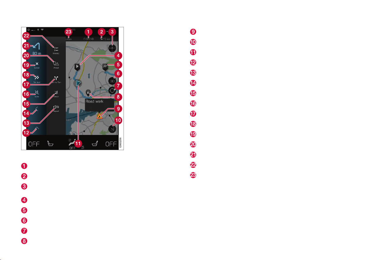
Text and symbols on the map
Estimated Time of Arrival (ETA) or Remaining Time to Arrival (RTA)
Distance to the destination
Compass and button for north at the top of the map/current direction at
the top of the map
Starting point
Destination
Toggle between 2D/3D map views
Button to reset the map to follow the vehicle
Points of Interest (POI): in this case, a service station
Traffic information
Minimize (expanded view) or maximize (full-screen map view)
Your vehicle on the planned route
Minimize the toolbar
Repeat the most recent voice guidance
Minimize the toolbar
Calculating a new route
Voice guidance on/off
Guidance points in the itinerary (turn-by-turn guidance)
Set a final/intermediate destination
Cancel guidance
Display the list of the itinerary's points of interest and traffic information
Next turn
Itinerary and alternative route
Destination
Page 3

SENSUS NAVIGATION
Sensus Navigation is a satellite-based system providing guidance/directions to a destination and in certain markets, also traffic information.
The system includes features that enable you to set itineraries, search
for certain types of points of interest (POIs) along your route, store special destinations, obtain traffic information en route, etc.
The system shows the vehicle's exact location and if at any time you
should decide to deviate from the route originally set, a new one will
automatically be calculated to your destination.
By enabling you to reach your destination quickly and by the most direct
route, Sensus Navigation also helps contribute to improving the environment.
To help you fully utilize the features and benefits offered by Sensus
Navigation, we suggest that you familiarize yourself with the information
provided in this owner's manual.
Page 4

2
INTRODUCTION
Getting started with Sensus Navigation
6
Navigation displays and controls
7
Common navigation system features
8
VOICE CONTROL
Voice control
12
Using voice commands
12
Navigation system voice commands
13
Voice control settings
14
SETTING A DESTINATION
Entering a destination
16
Setting a destination by pressing a
point on the map
16
Setting a destination by entering the
text of your choice
17
Setting a destination using Recent/
Favorites/Library
18
Using a point of interest (POI) as a
destination
19
Setting a destination by entering an
address
19
Saving a destination with Send to Car
20
TABLE OF CONTENTS
Page 5

3
ITINERARY AND ROUTE
Viewing the itinerary and alternate routes
22
Guidance points in the itinerary
23
POIs along the route
23
Traffic problems along the route
24
Information cards on the map
24
Choosing a detour
24
TRAFFIC INFORMATION
Traffic information
28
Real Time Traffic Information (RTTI)
28
SETTINGS
Navigation in the instrument panel
32
Sensus Navigation settings
32
Map settings
32
Guidance and route settings
33
Traffic information settings
34
Activating/deactivating RTTI
34
Page 6

4
MAP AND SYSTEM INFORMATION
Map updates with MapCare
36
Map updates with an Internet connection
37
Map updates from a computer with a
USB flash drive
38
Sensus Navigation troubleshooting
40
Navigation license agreements
41
Copyright
47
INDEX
Index 49
Page 7

INTRODUCTION
Page 8
INTRODUCTION
6
Getting started with Sensus Navigation
The navigation system is activated automatically
when the driver's door is opened.
Navigation On/Off
Navigation sub-view
Home button
Activating navigation
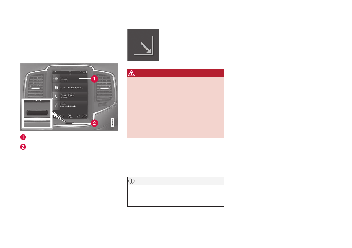
If the navigation system does not show a map on
the center display, tap the
Navigation sub-view
(1).
If the center display does not show the
Navigation sub-view, press the Home button (2)
and then tap Navigation sub-view (1).
This will display a map showing the area around
the vehicle and the vehicle's current location (a
blue triangle).
Tap this symbol for a fullscreen map display.
WARNING
Observe the following.
•
Direct all your attention to the road and
make sure that all your concentration is
on driving.
•
Follow applicable traffic legislation and
drive with good judgment.
•
Due to weather conditions or time of year
affecting the road conditions, some recommendations may be less reliable.
Deactivating navigation
While the ignition is switched on, the navigation
system is always active in the background. It
switches off automatically when the ignition is
switched off and the vehicle is locked.
NOTE
The system can be used even when the
engine is not running but will be switched off
automatically if the battery charge level is low.
Related information
•
Navigation displays and controls (p. 7)
Page 9
INTRODUCTION
}}
* Option/accessory.
7
Navigation displays and controls
Sensus Navigation is presented on the instrument panel and head-up display* and controlled
using center display on-screen buttons and
voice commands.
Center display
All settings in the navigation system, such as map
views and setting a destination, are made on the
center display.
If the map is not displayed, tap the Navigation
sub-view at the top of the center display.
Instrument panel
The map is only shown on the 12" instrument panel
During a trip, the driver receives visual guidance
on the instrument panel and voice guidance
through the infotainment system's speakers.
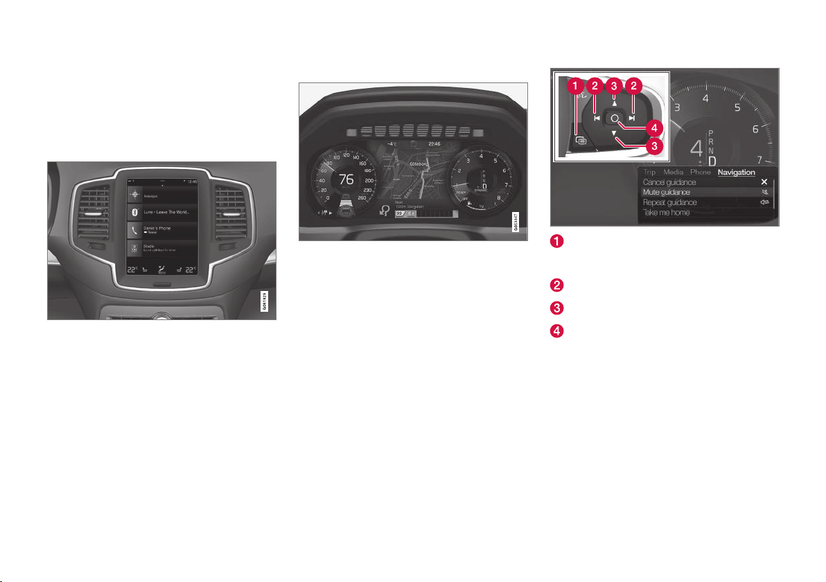
Right-side steering wheel keypad and instrument panel
Some of the navigation system's functions, such
as
Take me home and Cancel guidance, are
controlled from the right-side steering wheel keypad. If a message is displayed in the instrument
panel, it must be acknowledged before then
menu can be displayed.
Open/close the menu. In certain cases, the
menu will close automatically after a period
of inactivity
Scroll among the menus
Scroll in a menu
Confirm or mark a selection
Page 10

||
INTRODUCTION
* Option/accessory.
8
Head-up-display (HUD)*
Navigation guidance on the windshield
The driver can also get guidance and information
from the navigation system on the lower section
of the windshield.
Displaying navigation information can be turned
off and the position of the HUD can be adjusted
(see the article "Head-up display" for detailed
information).
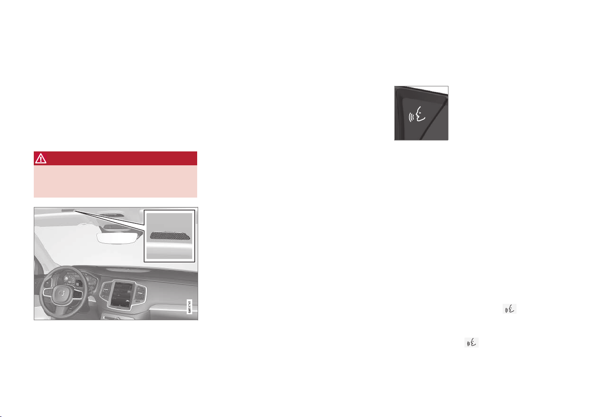
Voice control
Many settings can be controlled using voice commands.
Press the voice button on the
right-side steering wheel keypad, wait for the tone and then
say, e.g., "Drive
Home."
Using voice commands is explained in greater
detail in the articles "Navigation system voice
control," "Voice control," and "Voice control settings."
Related information
•
Setting a destination by entering the text of
your choice (p. 17)
•
Navigation system voice commands (p. 13)
•
Voice control (p. 12)
•
Using voice commands (p. 12)
•
Voice control settings (p. 14)
Common navigation system features
The most common features of the navigation
system are described here.
•
Where am I?
•
Finding the vehicle symbol on the map
•
Direction at the top of the map/North at the
top of the map
•
2D for 3D view
•
Zooming in
•
Zooming out
•
Scrolling
•
Changing the headers displayed
•
Exiting a menu
Where am I?
Where is the vehicle's current location?
•
Click the vehicle symbol (blue triangle) for
information directly on the map.
Finding the vehicle symbol on the map
After scrolling/zooming in/out, it may
be difficult to find the vehicle's location
on the map. To find it, tap the crosshairs; the map will be reset and will fol-
low the vehicle symbol.
Page 11
INTRODUCTION
}}
9
Direction at the top of the map/North at the top of the map
Tap the compass to change the way in
which the vehicle symbol moves on the
map. The driver can choose between
two views:
•
North will always be at the top of the map on
the center display and the vehicle symbol will
move in the current direction on the map (left
is west, right is east, etc.).
•
The vehicle symbol will always move toward
the top of the center display. The map will
rotate under the vehicle symbol according to
the direction in which the vehicle turns. The
compass symbol indicates north (N) on the
map and the vehicle's direction (NE in the
illustration).
Compass symbols Direction
N North
NE Northeast
E East
SE Southeast
S South
SW Southwest
Compass symbols Direction
W West
NW Northwest
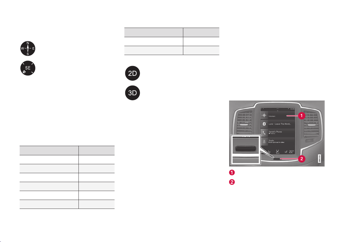
2D or 3D view
Tap the symbols to switch between 2D
and 3D views. In 3D, the vehicle's
direction is always upward on the center display. The map will rotate under
the vehicle symbol according to the
direction in which the vehicle turns. The
compass symbol indicates north (N) on
the map and the vehicle's direction is
shown at the center of the compass. The map
scale is not shown in 3D. 2D is described in the
previous section "Direction at the top of the
map/North at the top of the map."
Zooming
Zoom in
Tap the center display twice in quick succession
with one finger or "stretch" with two fingers on
the center display.
Zoom out
Tap the center display once with two fingers or
"pinch" with two fingers on the center display.
Scrolling
Place a finger on the map and swipe in the
desired direction. Scrolling is only possible with
the map in maximized view.
Changing the headers displayed
Maximize the map and tap the map header at the
top of the center display. Choose among the following:
•
Destination, Estimated Time of Arrival (ETA)
or Remaining Time to Arrival (RTA). To select
ETA or RTA, see the article "Route settings".
or
•
Position and the distance to the destination
(Dist).
Returning to the map view
Navigation sub-view
Home button
To return to the map view:
1. Press the Home button (2).
Page 12

||
INTRODUCTION
10
2. If the center display shows its Home view,
tap
Navigation in the navigation sub-view
(1).
Related information
•
Navigation in the instrument panel (p. 32)
•
Sensus Navigation settings (p. 32)
Page 13

VOICE CONTROL
Page 14
VOICE CONTROL
* Option/accessory.
12
Voice control
Voice commands make it possible for the driver
to voice-control certain functions in the media
player, a Bluetooth-connected cell phone, climate system and the Volvo navigation system*.
Voice control offers convenience and enables the
driver to keep his/her hands on the steering
wheel and concentrate on driving and the traffic
situation around the vehicle.
WARNING
As the driver, you have full responsibility for
operating the vehicle safely and adhering to
all applicable traffic regulations.
Input to the system is in dialog form and comprises commands from the driver and a verbal
response from the system.
The voice control system uses the same microphone as the Bluetooth hands-free system and
system responses come via the infotainment system's speakers.
In certain cases, text messages are also provided
in the instrument panel.
The functions are controlled using the right-side
steering wheel keypad and settings are made
from the center console.
System updates
The voice control system is being constantly
improved and updates should be downloaded for
optimal functionality. See the support site
support.volvocars.com.
Related information
•
Using voice commands (p. 12)
•
Voice control settings (p. 14)
•
Navigation system voice commands (p. 13)
Using voice commands
The following is an introduction for using voice
commands.
Press the button on the rightside steering wheel keypad to
activate the system and initiate
a voice command dialog.
Keep the following points in mind when using
voice commands:
•
When giving a command, speak at your usual
speed and in a normal tone of voice after
the tone.
•
Avoid speaking while the system is responding. Commands cannot be processed during
a response.
•
Avoid background noises in the cabin when
using the system by closing the vehicle's
doors, windows and panoramic roof* when
giving voice commands.
Voice command dialogs can be cancelled by:
•
Saying "Cancel".
•
By pressing and holding the
button on
the right-side steering wheel keypad.
To speed up a command dialog or to skip system
responses, press the
button on the rightside steering wheel keypad when the system is
responding and give your next command.
Page 15

VOICE CONTROL
}}
13
Voice command examples
Press , say "Call"-"[First-name]"-"[Lastname]"-"[number category]" to call a contact
in your phonebook if the person has more than
one phone number listed (i.e., home, mobile, work,
etc.).
For example, press
and say
"Call"-"Robin"-"Smith"-"mobile".
Commands/phrases
The following commands can always be used:
•
Repeat: the system will repeat the most
recent voice instruction.
•
Cancel: cancel the dialog.
•
Help: Initiates a help dialog. The system will
provide several alternative commands that
can be used in a given situation.
The commands for specific situations are described in the respective articles such as "Cell phone
commands", etc.
Numbers
Numbers can be spoken in different ways
depending on the context and function being
used:
•
Phone numbers and zip codes should be
spoken individually, number by number, e.g.,
five five five one two three four (5551234).
•
Addresses (house numbers) can be spoken individually or as a group, e.g., two two or
twenty-two (22). It is also possible to say a
sequence of numbers, e.g., twenty-two
twenty-two (22 22) and "double" or "triple"
can also be used, e.g., double zero (00) or triple zero (000). Numbers in the range
0-2300 can be used.
•
Frequencies can be spoken ninety-eight
point eight (98.8), one hundred four point
two (104.2) or hundred four point two
(104.2).
Related information
•
Voice control (p. 12)
Navigation system voice commands
Many of the navigation system's functions can
be activated using voice commands.
The procedure for using voice control is described in greater detail in the articles "Voice control," "Using voice control" and "Voice control
settings."
Voice commands
The following list contains examples of commands that are unique to navigation system.
To use the voice control system, press the
on the right-side steering wheel keypad and say
one of the following commands after the tone:
•
"
Navigation": Starts a navigation voice com-
mand dialog and displays available commands.
•
"
Take me home": Guidance will be given to
the location set as Home.
•
"
Go to [City]": Enter a city as a destination,
e.g., "Go to New York."
•
"
Go to [Address]": Enter an address as a
destination, e.g., Go to 125 43 St., New
York."
•
"
Go to Intersection": Starts a dialog where
two street names are entered. The destination will then be the intersection of the two
streets.
Page 16

||
VOICE CONTROL
14
•
"
Go to [Zip code]": Enter a zip code as a
destination, e.g., "Go to 07405."
•
"
Go to [Name]": Enter a name from a list of
contacts e.g., "Go to John Smith."
•
"
Search [POI category] in [City]": The list
of results will be sorted around the center of
the selected city/town, e.g., Search restaurants in Butler.
•
Search [POI category]": For example,
Search Yankee Stadium.
•
"
Change country/Change state":
Changes the country/state in which a search
is conducted.
•
"
Show favorites": Shows a list of Favorites
in the center display's Top view.
•
"
Clear itinerary": Deletes all intermediate
destinations in an itinerary.
•
"
Repeat voice guidance": Repeats the
most recent guidance instruction.
•
"
Turn off voice guidance": Turns voice
navigation guidance off.
•
"
Turn on voice guidance": Turns voice
navigation guidance on.
Related information
•
Navigation displays and controls (p. 7)
•
Voice control (p. 12)
•
Using voice commands (p. 12)
•
Voice control settings (p. 14)
Voice control settings
There are a number of settings that can be made
for the voice control system.
Open the center display's Top view and tap
Settings System Voice Control and
select settings.
•
Repeat Voice Command
•
Gender
•
Speech Rate
Sound settings
Open Top view and tap Settings Sound
System Volumes Voice Control.
Changing languages
The voice control system only understands the
languages marked by the
symbol in the list
of possible system languages.
Changing the language for this system also
affects menus, messages and help texts.
Open Top view and tap
Settings System
System Language.
Related information
•
Voice control (p. 12)
•
Using voice commands (p. 12)
•
Navigation system voice commands (p. 13)
Page 17

SETTING A DESTINATION
Page 18

SETTING A DESTINATION
16
Entering a destination
There are several different ways of choosing a
destination.
A destination can be chosen by:
•
Pressing on the map
•
Entering free text or coordinates
•
Selecting a recently set destination
•
Selecting a position marked as a favorite
from the library
•
Selecting a saved location from the library
•
Selecting a point of interest (POI)
•
Entering an address
Select one of the alternatives and follow the
instructions given.
Destinations and intermediate destinations (waypoints)
The first location selected will be the itinerary's
final destination.
Any other locations will be the itinerary's inter-
mediate destinations (waypoints).
An itinerary and its destinations can be edited at
any time, see also the section "Editing an itinerary" in the article "Itinerary and alternate routes."
Related information
•
Viewing the itinerary and alternate routes
(p. 22)
•
Setting a destination by pressing a point on
the map (p. 16)
•
Setting a destination by entering the text of
your choice (p. 17)
•
Setting a destination using Recent/Favorites/Library (p. 18)
•
Using a point of interest (POI) as a destination (p. 19)
•
Setting a destination by entering an address
(p. 19)
Setting a destination by pressing a point on the map
Pressing a point on the map is an easy way to
set a destination.
It may be easiest to scroll to an area on the map
and press a location to set a destination.
1. Be sure the map is in full-screen mode.
2. Scroll to the desired point on the map.
3. Press the point until an icon is created there
and a menu is displayed.
4.
Select
Go here to start guidance to that
point.
Deleting the icon
Tap Delete.
Changing the icon's location
Press the icon on the map, drag it to the desired
position and release it.
Related information
•
Entering a destination (p. 16)
Page 19

SETTING A DESTINATION
17
Setting a destination by entering the text of your choice
One way of setting a destination is by entering
the text of your choice, e.g., a phone number, zip
code, street name, city name, coordinates or a
point of interest.
1. Expand the toolbar with the down arrow to
the left and Tap
Set dest..
> The map will change to a screen for
entering text.
2. Enter the text of your choice.
> Possible destinations meeting your search
criteria will begin to appear on the screen.
3.
If the search provided the desired result:
tap one of the destinations to display its
information card and select to continue using
it.
If the search provided too many results:
tap
Filter search and select one of the fol-
lowing search alternatives:
•
Around vehicle
•
Around destination
•
Along route
•
Around point on map
Coordinates
A destination can also be set by entering its map
coordinates.
•
For example, enter: "N 58.1234 E 12.5678"
and tap
Search/.
Map coordinates can be written in different ways,
such as:
N 58.1234 E 12.5678 (with spaces)
N58.1234 E12.5678 (without spaces)
58.1234N 12.5678E (with the points on the
compass after the coordinates)
58.1234 -12.5678 (with a hyphen without the
points on the compass)
Related information
•
Entering a destination (p. 16)
•
Navigation displays and controls (p. 7)
•
Information cards on the map (p. 24)
Page 20

SETTING A DESTINATION
18
Setting a destination using Recent/ Favorites/Library
Selecting from a list is one way of setting a destination.
To display these lists:
1. Expand the toolbar with the down arrow to
the left and Tap
Set dest..
> The map will change to a screen for
entering text.
2. Continue by selecting one of the lists in the
upper margin:
•
Recent
•
Favorites
•
After marking an alternative, it will be
added as a destination by tapping the
Start navigation or Add as waypoint
buttons.
> After marking an alternative, it will be
added as a destination by tapping the
Start navigation or Add as waypoint
buttons.
Recent
This is a list of all searches that have been made.
Scroll through the list and select.
This menu alternative is also available in the
instrument panel and can be displayed using the
right-side steering wheel keypad (see also the
article "Navigation system displays and controls").
Use
Edit to edit destinations in the list.
Favorites
This is a list of locations that have been set as
favorites from the
Library. Scroll through the list
and select.
A deleted location in
Favorites always remains in
the Library but the "star" will not be highlighted.
To return it to the list of Favorites, go to the
Library and tap the location's star again.
Use Set home address to program a destination that is used often. A destination set as
Home will also be also available in the instru-
ment panel and can be displayed using the rightside steering wheel keypad (see also the article
"Navigation system displays and controls").
Use
Edit to edit destinations in the list.
Library
This is a list of saved destinations and itineraries.
The most recently saved one will be at the top of
the list. Scroll through the list and select.
Tap the destination's "star" to select/deselect it
as a favorite. A selected destination will also be
shown under the heading
Favorites.
A destination deleted from the Library will also
be deleted from Favorites.
The library can be sorted by:
•
Added: sort in chronological order
•
Name: sort in alphabetical order
•
Distance: sort according to distance from
the vehicle's current location
•
Received: destinations sent to the vehicle
using the Send to Car function will be sorted
in chronological order. New unread destinations have a BLUE marker that disappears
when they have been read. See the article
"Saving a destination with send-to-car" for
additional information.
Use
Edit to delete one of more destinations from
the list.
Related information
•
Saving a destination with Send to Car
(p. 20)
•
Navigation displays and controls (p. 7)
•
Entering a destination (p. 16)
Page 21

SETTING A DESTINATION
19
Using a point of interest (POI) as a destination
Selecting a point of interest (POI) is one way of
setting a destination.
1. Expand the toolbar with the down arrow to
the left and Tap
Set dest.. The map will
change to a screen for entering text.
2.
Tap
POI.
3. Tap the desired filter:
•
Near the vehicle
•
Near the destination
•
Near waypoint
•
Along route
•
Around point on map
4. Scroll to the desired POI and select it.
5.
Tap
Start navigation or Add as waypoint.
Many POIs (e.g., restaurants) have sub-categories
(e.g., Chinese restaurants).
See the article "Map settings" for information
about selecting the POIs to be displayed on the
map. This will show the selected POIs available in
the area. This setting does not affect searches
for POIs to be used as destinations (even ones
that have not been selected for display can be
used as a destination).
Certain POIs will only appear if the map scale is
greater than 1 mi. (1 km).
NOTE
•
The appearance, number and variations
of POIs vary from market to market.
•
Some symbols may be added/deleted
when the navigation system's software is
updated. The POIs available for the current map system can found in the menu
system.
Related information
•
Entering a destination (p. 16)
Setting a destination by entering an address
Entering an address is one way to set a destination.
Expand the toolbar with the
down arrow to the left and tap
Set dest.. The map will change
to a screen for entering text.
Tap Address.
The following search alternatives may vary somewhat from market to market. Only those available
for your market will be shown in the center display.
It is not necessary to fill in all of the information.
For example, for guidance to a city, fill in the
state/country (where applicable) and the city.
You will be guided to the center of the city.
Select any of the following alternatives and enter
text using the center display's keyboard:
•
Country/State/Province
•
City/Territory/Zip code
•
Address
•
Number
•
Junction
Related information
•
Entering a destination (p. 16)
Page 22

SETTING A DESTINATION
20
Saving a destination with Send to Car
Using the Send to Car feature is one way to
save a destination.
Sending a location to the vehicle
Send to Car is a function that makes it possible
to add a destination/location to the navigation
system from a computer.
Send to Car can also be done from a cell phone
using Volvo's Volvo On Call service.
Volvo On Call can also be used to send a destination from the Volvo On Call customer service
center to the vehicle.
Please note that the procedure shown here is an
example from one of several map service providers.
1. From the computer, go to the Internet site
here.com.
> A map service will open.
2. Search for the desired location.
3. Right-click the location and click the address.
> A side menu/information card will open.
4.
Tap Share in the side menu.
5.
Tap Send to car in the side menu.
6. Enter the vehicle's VIN number or the email
address registered with your Volvo ID. Tap
Send.
7.
Tap Finish.
> The location will be sent to the vehicle.
See the Volvo Cars support site
(support.volvocars.com) for more information
about the Send to Car function.
Receiving and using a location in the vehicle
In order to receive data, the vehicle must be connected to the Internet. See the section "Connecting to the Internet" in the owner's manual. If the
location was sent via Volvo On Call, the vehicle's
integrated modem will be used to receive that
data, i.e., no other Internet connection is necessary.
1. When the vehicle has received the data, notification will appear on the center display. Tap
the notification/symbol.
> An information card will open.
2. Select the desired use for the location.
Using a stored location
Locations that have been received are stored in
the navigation system's library for later use. See
also "Entering a destination using Recent/Favorites/Library" for additional information.
Related information
•
Setting a destination using Recent/Favorites/Library (p. 18)
•
Entering a destination (p. 16)
Page 23

ITINERARY AND ROUTE
Page 24

ITINERARY AND ROUTE
22
Viewing the itinerary and alternate routes
During guidance, it is possible to view the itinerary or see if alternate routes are available.
Viewing an itinerary
1. During guidance, expand the toolbar with the
down arrow to the left and tap the three
points.
2.
Tap the Itinerary symbol to open the itinerary.
Editing or clearing an itinerary
1. Display the itinerary (see the instructions
above).
2. Tap the recycling bin to delete a waypoint
(intermediate destination) in an itinerary or
tap
Clear itinerary to delete the entire itin-
erary.
Showing alternative routes
Display the itinerary (see the instructions above).
1. Display the itinerary.
2.
Tap
Alternative routes.
3. Select an alternative route:
•
Eco
•
Fast
•
Scenic
4. Tap the map.
> The updated route will be shown on the
map and guidance will resume.
Related information
•
Guidance points in the itinerary (p. 23)
•
Choosing a detour (p. 24)
•
Information cards on the map (p. 24)
•
Guidance and route settings (p. 33)
Page 25

ITINERARY AND ROUTE
23
Guidance points in the itinerary
A list of coming guidance points helps the driver
prepare for the next turn, etc. by e.g., getting into
the correct traffic lane.
To display a list of coming guidance points:
1. Expand the toolbar with the down arrow to
the left.
2. Expand the toolbar further with the three
points.
3.
Tap the
Turn-by-Turn symbol.
> A list of coming guidance points will
appear instead of the toolbar. It is possible
to scroll in the list. Tap the left arrow to
minimize the list.
The next guidance point is always at the top of
the list.
Tapping any of the guidance points will show
their positions on the map. Subsequently tapping
the map's crosshairs (below the 2D/3D button)
will return you to the map guidance view where
the map shows the vehicle's current location.
Related information
•
Choosing a detour (p. 24)
•
Viewing the itinerary and alternate routes
(p. 22)
•
Information cards on the map (p. 24)
POIs along the route
A list of points of interest (POIs) along the route
can be displayed.
1.
Tap
Ahead.
2.
Tap
POI.
> POIs along the route will be displayed
based on their distance from the vehicle.
3. If there are several POIs in the same location, they will be displayed as a group. Tap
the group for a list of the POIs.
4. Select a POI.
5. Select one of its information card's alternatives and follow the instructions.
Related information
•
Using a point of interest (POI) as a destination (p. 19)
Page 26

ITINERARY AND ROUTE
24
Traffic problems along the route
A list of traffic problems along your route can be
displayed.
1.
Tap
Ahead.
2.
Tap
Traffic. The traffic button will be gray if
there are no traffic problems along the route.
> If there are traffic problems along the
route, they will be displayed based on
their distance from the vehicle.
3. For additional information about a traffic
problem, tap it to open its information card.
Select one of the card's alternatives and follow the instructions.
4.
Tap
Avoid to avoid the traffic problem.
> The route will be recalculated and guid-
ance will resume.
Related information
•
Traffic information (p. 28)
•
Traffic information settings (p. 34)
Information cards on the map
All of the icons on the map for a destination,
intermediate destination (waypoint), favorite,
POI, traffic problem, etc., have information cards
that can be opened by tapping the icon.
Opening an icon's Info card gives the driver upto-date information about the respective icons.
Information and possible alternatives vary
depending on the type of icon.
With e.g., a POI highlighted, the driver can select:
•
Start navigation: save the POI's location as
a destination
•
Add as waypoint: save the POI's location as
an intermediate destination
•
Save: save the location in the Library. See
also the article "Entering a destination using
Recent/Favorites/Library."
Related information
•
Guidance and route settings (p. 33)
•
Viewing the itinerary and alternate routes
(p. 22)
•
Guidance points in the itinerary (p. 23)
•
Choosing a detour (p. 24)
•
Setting a destination using Recent/Favorites/Library (p. 18)
Choosing a detour
Select
Detour to avoid the next section of a
route if e.g., a road is closed.
1. Expand the toolbar with the down arrow to
the left and then with the three points.
2.
Tap
Detour to display an alternate route on
the map (the alternate route's distance, estimated travel time, etc.). Normally, only short
detours are proposed to take you quickly
back to your itinerary's original route if possible.
3.
To accept the proposed detour: tap the sign
with information about the detour or begin
driving on the proposed route. After a proposed detour has been accepted, guidance
will resume with the detour as the route. I
To reject the proposed detour: Expand the
toolbar with the down arrow and the three
points. Tap
Cancel to resume guidance on
the original route.
As an alternative to Detour, select another route
and leave your itinerary's current route. The sys-
Page 27

ITINERARY AND ROUTE
25
tem will update the route automatically and continue guidance to your destination along the most
suitable route.
See also the article "Viewing the itinerary and
alternate routes."
Related information
•
Viewing the itinerary and alternate routes
(p. 22)
•
Information cards on the map (p. 24)
Page 28

Page 29

TRAFFIC INFORMATION
Page 30

TRAFFIC INFORMATION
28
Traffic information
1
The navigation system constantly receives traffic
information that is broadcast by local radio stations. This information will be shown on the map.
NOTE
Traffic information is not available in all areas.
Traffic information coverage is being
increased continuously.
See the article "Traffic settings" for the trafficrelated settings available to the driver.
Traffic jams, road construction areas, accidents,
etc. are shown on the map in the form of various
symbols if the map is sufficiently zoomed in .
This symbol indicates road construction.
In cases of major traffic problems, their
extent is shown on the map as a RED
line along the side of the road (in e.g., road construction areas). This line will also indicate the
direction (there will be lines on both sides of the
road if both sides are affected).
Information about traffic problems
–
Tap the traffic problem's symbol.
> An information card will be displayed with
detailed information about the problem.
Avoiding a traffic problem
If the traffic problem affects your chosen route,
you can opt to select
Avoid to prompt the system
to find an alternate route.
See also the article "Traffic problems along the
route" for additional information.
Enhanced traffic information
When the vehicle is connected to the Internet,
Real Time Traffic Information (RTTI) may be available2.
Related information
•
Traffic information settings (p. 34)
•
Traffic problems along the route (p. 24)
•
Real Time Traffic Information (RTTI) (p. 28)
Real Time Traffic Information (RTTI)
When the vehicle is connected to the Internet,
Real Time Traffic Information (RTTI) may be
available3.
Information about current traffic situations is
gathered continuously from mobile apps, public
service sources and GPS data from the vehicle.
When a vehicle requests information about the
flow of traffic, anonymous data about the traffic
situation in the vicinity of the vehicle is provided,
which helps enable RTTI to function. This data is
only transmitted if RTTI is activated.
Current traffic information is shown for highways/
freeways, major roads, secondary roads and in
some cases for urban routes.
The amount of traffic information shown on the
map depends on the distance from the vehicle,
but not farther than approx. 75 miles (120 km)
from the vehicle's current location.
Text and symbols on the map are displayed in the
usual way and the traffic flow shows how fast
traffic is moving on a given road compared to the
posted speed limit. Traffic information is shown in
both directions on a road with a colored line in
each direction:
•
Green: traffic flowing smoothly
•
Yellow: shows the road section affected by a
traffic problem or disruption but does not
1
Not available in all markets.
2
Certain markets only.
Page 31

TRAFFIC INFORMATION
29
indicate the type of problem (accident, road
work, etc.)
•
Orange: slow-moving traffic
•
Red: traffic tie-up/accident
•
Black: road closed
NOTE
Traffic information is not available in all areas.
Traffic information coverage is being
increased continuously.
Activating/deactivating
The vehicle must be connected to the Internet in
order to use RTTI.
1.
Tap
Settings in the center display's Top
view.
2.
Tap Navigation Traffic and select a setting for connected traffic information:
Use
RTTI when an internet connection is
available/Real Time Traffic Information.
•
Check the box: RTTI is activated and
replaces the normal traffic information
function.
•
Deselect the box: RTTI will be deactivated
and the normal traffic information function
will be activated.
If the vehicle's Internet connection is lost while
RTTI is activated, the normal traffic information
will activate automatically. If the Internet connection is re-established, RTTI will reactivate.
Related information
•
Traffic information (p. 28)
•
Activating/deactivating RTTI (p. 34)
3
Certain markets only.
Page 32

Page 33

SETTINGS
Page 34

SETTINGS
32
Navigation in the instrument panel
An activated route will automatically be displayed
in the instrument panel (driver display). It can
also be displayed even if no route has been set.
1.
Tap
Settings in the center display's Top
view.
2.
Tap My Car Displays Driver Display
Information
.
3.
Tap
Show Map even if no route has been
activated.
Related information
•
Sensus Navigation settings (p. 32)
•
Navigation displays and controls (p. 7)
Sensus Navigation settings
These settings affect e.g., the way in which
routes are selected and how information is displayed.
Settings Navigation
The following types of settings are available:
•
Map: settings for the content and appear-
ance of the map
•
Route and Guidance: settings for guidance
and the way in which routes are calculated
and displayed
•
Traffic: settings for traffic information
Related information
•
Navigation in the instrument panel (p. 32)
•
Traffic information settings (p. 34)
•
Guidance and route settings (p. 33)
Map settings
These settings are used to determine how the
map will be displayed on the screen.
Settings Navigation Map
The following settings can be made:
•
Position Format
•
Map Display Format
•
POI
•
Show Favorites
•
Show Speed Cameras
1
Location format
Select to display the current location by address
or by coordinates:
•
Address
•
Coordinates and Altitude
Map design
Select map background lighting:
•
Day: bright colors
•
Night: Dark colors for better night vision
•
Auto: the system will shift between Day and
Night based on the ambient light in the pas-
senger compartment.
1
Not available in all markets.
Page 35

SETTINGS
33
Speed cameras
1
Use this setting to show the location of speed
cameras on the map.
POI
Select the POIs to be displayed on the map. Opt
to display all POIs in a category or open a category by tapping the ">" symbol and selecting the
sub-categories to be displayed. Mark the POI
sub-categories to be displayed on the map. Exit
the menu by tapping
Back or Close.
See also the article "POI as destination."
Favorites
Choose to display Favorites on the map:
See also the article "Entering a destination using
Recent/Favorites/Library."
Related information
•
Sensus Navigation settings (p. 32)
•
Setting a destination using Recent/Favorites/Library (p. 18)
•
Using a point of interest (POI) as a destination (p. 19)
Guidance and route settings
This section lists guidance settings.
Settings Navigation Guidance
The following settings can be made:
•
Arrival Time Format
•
Voice Guidance Level
•
Choose Default Route Type
•
Route Learning
•
Avoidance Settings
Arrival time format
•
ETA (Estimated Time of Arrival)
•
RTA (Remaining Time to Arrival)
The time shown reflects the time zone at your
destination.
Voice guidance level
Set the amount of guidance information provided:
•
None: no automatic guidance but guidance
can be requested manually once.
•
Low: one message per guidance point.
•
Medium: up to three messages per guid-
ance point, with limited information.
•
Full: up to four messages per guidance
point, with all available information provided.
Choose default routes type
Choose the standard type of route that the system will use whenever possible:
•
Fast
•
Eco
•
Scenic (highways will be avoided if possible,
which may make the route longer)
A route can also be selected during a trip. See
the article "Viewing the itinerary and alternate
routes".
Route learning
Tap Route Learning to allow the system to optimize the way in which routes are calculated.
Avoidance settings
Tap Avoidance Settings to open a menu with a
list of alternatives along the route that can be
avoided automatically if possible, e.g., tunnels, ferries, toll roads, etc.
Related information
•
Sensus Navigation settings (p. 32)
•
Viewing the itinerary and alternate routes
(p. 22)
1
Not available in all markets.
Page 36

SETTINGS
34
Traffic information settings
2
These options determine how traffic information
is presented.
Settings Navigation Traffic
The following settings are available:
•
Show & Handle Traffic Events
•
Show Free Flowing Traffic
•
Avoid Traffic Events
•
Use RTTI when an internet connection is
available
Traffic events
Filter the type of traffic events to be displayed on
the map and determine how a route is to be calculated.
•
None
•
Major
•
All
Free flowing traffic
Select if free-flowing traffic is to be displayed on
the map.
Avoid traffic events
Select to allow the system to avoid traffic problems along the route.
•
Never
•
Ask (any proposed route changes during the
trip will have to be confirmed)
•
Always
Real Time Traffic Information (RTTI)
2
When the vehicle is connected to the Internet,
RTTI can be used to receive traffic information.
Related information
•
Sensus Navigation settings (p. 32)
•
Traffic problems along the route (p. 24)
•
Traffic information (p. 28)
Activating/deactivating RTTI
3
When the vehicle is connected to the Internet,
Real Time Traffic Information (RTTI) may be
available4.
To activate RTTI:
1.
Tap
Settings in center display's Top view.
2.
Tap
Navigation Traffic.
3.
Tap the
Real Time Traffic Information box
to replace normal traffic information with
RTTI.
If the vehicle's Internet connection is broken,
while RTTI is activated, the normal traffic information function will be activated automatically. If the
vehicle's Internet connection is restored, RTTI will
reactivate.
Related information
•
Real Time Traffic Information (RTTI) (p. 28)
•
Traffic information (p. 28)
2
Not available in all markets.
3
Real Time Traffic Information
4
Certain markets only.
Page 37

MAP AND SYSTEM INFORMATION
Page 38

MAP AND SYSTEM INFORMATION
36
Map updates with MapCare
MapCare is a map update service for Volvos
equipped with Volvo Sensus Navigation. Map
information can be updated via the Internet.
General update information
Updates can be done directly to the vehicle
through a cell phone Internet connection or from
a computer with a USB flash drive.
The system's maps are divided into a number of
fixed regions. When updates are done, it is not
necessary to update all of the regions at the
same time but instead can be done for a specific
region or several regions.
One or several regions can be updated from the
vehicle's Internet connection. However, for major
updates, a computer and a USB flash drive are
recommended.
If an itinerary covers several regions, they should
all have the same version number to enable the
system to calculate the best route to the destination(s).
Updating the map structure
Changing the map structure may sometimes be
necessary, e.g., if a region is added or if a large
region is divided into smaller ones. If this is the
case, normal updates may not be possible and a
message will be displayed explaining what has
happened.
In this situation, the entire map must be reinstalled from a USB flash drive. For additional infor-
mation, go to support.volvocars.com or contact a
Volvo retailer.
Updating navigation system software
In addition to the maps, the system's software is
being steadily developed and has to be updated
occasionally. This may mean that newly downloaded map information may not be supported by
the navigation system's software. If this happens,
a message will be displayed indicating that the
software needs to be updated. This can be done
by a Volvo retailer or from a USB flash drive.
See the section "Software version" in the article
"System settings."
Updates from the vehicle's Internet connection or from a USB flash drive
For detailed information, see the articles "Map
updates with an Internet connection" and "Map
updates from the computer with a USB flash
drive."
FAQs
Question Answer
Can the
map database be
changed,
e.g., from
Europe to
North America?
Yes, with certain exceptions.
Contact a Volvo retailer for upto-date information.
How long
do map
updates
take?
This depends on the size of the
file(s) and the speed of the
Internet connection. Information about the size of the
update (in Mb) will be displayed.
How big is
an update?
This varies from market to market. Go to
support.volvocars.com or consult a Volvo retailer.
Updating
has not
worked.
What should
I do?
Try the Volvo Cars support site
(support.volvocars.com) or contact a Volvo retailer.
Page 39

MAP AND SYSTEM INFORMATION
}}
37
Related information
•
Map updates with an Internet connection
(p. 37)
•
Map updates from a computer with a USB
flash drive (p. 38)
•
Sensus Navigation troubleshooting (p. 40)
•
Copyright (p. 47)
•
Navigation license agreements (p. 41)
Map updates with an Internet connection
If the vehicle is connected to the Internet, this
connection can be used to update the navigation system's maps.
Remote update procedure
Internet connection
The vehicle has to be connected to the Internet.
See also the articles "Internet connected vehicle"
and "Connecting to the Internet" in your owner's
manual.
1.
Tap
Download Center in the center dis-
play's App view.
> The app will start and a number near
Maps will indicate the number of available
updates. This number will be visible until a
new search for updates has been performed or until the updates have been
installed.
2.
Tap
Maps.
3.
Tap
Install followed by Confirm.
> Installation of the map/update will begin.
For additional information, see the Volvo Cars
support site (support.volvocars.com) or contact a
Volvo retailer.
Page 40

||
MAP AND SYSTEM INFORMATION
38
Automatic map updates
Automatic updates can only be selected if Auto
Software Update is activated. See the article
"System updates" for detailed information.
1. Automatic map updates can only be selected
for your home region. If the home region is
not already selected, tap the DOWN arrow to
expand the region.
> Detailed map information will be dis-
played.
2.
Tap
Set as home region.
3.
Tap the
Auto update: box.
> When the vehicle is connected to the
Internet and map updates are available,
they will be downloaded automatically.
Related information
•
Map updates with MapCare (p. 36)
Map updates from a computer with a USB flash drive
Map information can be downloaded from the
Internet to a USB flash drive and then transferred from the flash drive to the vehicle.
Preparations
Computer/USB update procedure
USB flash drive
For use in updates, a USB flash drive has to meet
the following requirements:
Parameter Requirement
USB standard
(1.0/2.0/3.0):
At least 2.0
File system
(Ext2/NTFS/
FAT32):
FAT32
Capacity
(8/16/32/64
GB):
The file size varies from
market to market. See the
file size under "Detailed
information" for your market
at the Volvo Cars support
site (support.volvocars.com).
Determining the current map version
1.
Tap
Download Center in the center dis-
play's App view.
2. Tap the down arrow to expand the region.
> Detailed map information will be dis-
played.
3. Make note of the map information.
Page 41

MAP AND SYSTEM INFORMATION
39
Downloading maps from the Internet to a USB flash drive
A USB flash drive and the note of the map information are required.
1. From a computer connected to the Internet,
go to Volvo Cars support site at:
support.volvocars.com.
2. Select the maps, vehicle model and model
year.
3. Tap the region to be updated.
> A map with the most recent information
for the region will be displayed.
4. Verify that this information is newer than the
version in the vehicle.
5. Connect a USB flash drive to the computer
and download the update.
The amount of time for the download varies
according to the size of the file and the speed of
the Internet connection.
Transferring the updated maps from the USB drive to the vehicle
The amount of time for the data transfer varies
according to the file size. This must be done with
the navigation or infotainment systems activated.
If the engine is not running, it may be necessary
to connect a battery charger to avoid discharging
the start battery. An update can also be done
while driving. If the ignition is switched off before
the download is complete, it will continue automatically the next time the ignition is switched on.
Updating
1. Activate the navigation system.
2. Connect the USB drive to the vehicle's USB
socket in the tunnel console. If there are two
USB sockets, the other one cannot be in use
during the data transfer.
3. The navigation system will automatically
detect any available updates. The entire map
database update's progress will be displayed
on the screen as %.
> When individual regions are updated, the
update will start immediately.
To start an update of the entire map data-
base, tap
Confirm to start or Cancel to
stop the installation.
4.
Tap
Confirm. The update of the entire data-
base will begin and progress information will
be shown on the center display.
5. The center display will indicate when the
update has been completed. Remove the
USB drive from the socket.
6. Restart the navigation system.
7. Verify that the correct map information has
been transferred by repeating the procedure
in "Determining the current map version."
Interruptions
If an update is interrupted, an explanatory text will
always appear on the center display.
What happens if... Answer
...the infotainment
system is turned off
while an update is in
progress?
The process will pause
and will continue automatically when the
system is reactivated.
...the USB flash drive
is removed from the
USB socket while an
update is in progress?
The process will pause
and will continue automatically when the
USB drive is reconnected to the USB
socket.
For additional information, see the Volvo Cars
support site (support.volvocars.com) or contact a
Volvo retailer.
Related information
•
Map updates with MapCare (p. 36)
Page 42

MAP AND SYSTEM INFORMATION
40
Sensus Navigation troubleshooting
The following information provides answers to
frequently asked questions.
The vehicle's location on the map is not correct
The navigation system's accuracy is approx. 65 ft
(20 meters).
Accuracy may be reduced slightly when driving
on a road that is parallel with another road, winding roads, multi-level roads and long straightaways with no distinct curves.
High mountains, buildings, tunnels, viaducts,
multi-level roads, etc., may also affect GPS signal
reception, which may also reduce the system's
capacity to calculate the vehicle's location accurately.
The system does not always calculate the fastest/shortest route
Route calculation takes factors such as distance,
road width, type of road, number of right/left
turns, traffic circles, etc., into account to find the
theoretically best route. Familiarity with an area
may enable you to find a more efficient route to
your destination.
The system uses toll roads, highways or ferries even though I have chosen to avoid them
When calculating longer routes, the system may
have to choose major roads for technical reasons.
The types of roads that you have chosen to avoid
will not be used if there are viable alternatives.
After being transported, the vehicle's location on the map is not correct
If the vehicle has been transported (e.g., on a
ferry or train) where GPS signals have been
blocked, it may take up to 5 minutes before its
location will be shown correctly.
The car symbol moves erratically after new tires have been installed
In addition to GPS signals, the navigation system
also uses the speedometer and a gyroscopic
sensor to calculate the vehicle's current location
and speed. If e.g., a spare tire or snow tires have
been installed, the system has to "learn" the new
tire dimensions. To do so, drive for a short period
on a road with unobstructed GPS reception.
The map does not correspond to actual road conditions
Due to road changes/additions/rerouting/new
traffic regulations, the map database may not be
up-to-date. The database is continuously being
updated. Consult your Volvo retailer.
The car symbol jumps forward or spins
Before you begin to drive, the system may need
several seconds to determine the vehicle's location.
Switch off the navigation system and the ignition.
Restart but remain at a standstill for a minute or
so before driving.
The map information is not up-to-date
See the next heading.
Is the most recent map version installed?
Map information is continuously being updated.
To check if the currently installed version is upto-date or if updates are available:
•
Check while the vehicle is connected to the
Internet. See that article "Map updates with
an Internet connection".
•
Check the map version in the vehicle and
compare it to the map version available on
Volvo Cars' support site. See the article "Map
updates from a computer with a USB flash
drive".
1. From the center display's Home view, swipe
from right to left to display App view.
2.
Select the
Download Center app.
This contains information about the current map
version. See also "Updating map data with MapCare" for additional information or contact your
Volvo retailer.
Related information
•
Getting started with Sensus Navigation (p. 6)
•
Map updates with MapCare (p. 36)
Page 43

MAP AND SYSTEM INFORMATION
}}
41
•
Map updates from a computer with a USB
flash drive (p. 38)
•
Map updates with an Internet connection
(p. 37)
Navigation license agreements
The following is information for the end-user of
the Sensus Navigation system.
END USER LICENSE AGREEMENT FOR DISTRIBUTION BY HERE
FOR THE AMERICAS/ASIA PACIFIC
END-USER TERMS
The content provided (“Data”) is licensed, not
sold. By opening this package, or installing,
copying, or otherwise using the Data, you agree
to be bound by the terms of this agreement. If
you do not agree to the terms of this agreement,
you are not permitted to install, copy, use, resell
or transfer the Data. If you wish to reject the
terms of this agreement, and have not installed,
copied, or used the Data, you must contact your
retailer or HERE North America, LLC (as defined
below) within thirty (30) days of purchase for a
refund of your purchase price. To contact HERE,
please visit www.here.com. The Data is provided
for your personal, internal use only and may not
be resold. It is protected by copyright, and is
subject to the following terms (this “End User
License Agreement”) and conditions which are
agreed to by you, on the one hand, and HERE
and its licensors (including their licensors and
suppliers) on the other hand. For purposes of
these terms, “HERE” shall mean
(a) HERE North America, LLC with respect to
Data for the Americas and/or the Asia Pacific
region and (b) HERE Europe B.V. for Data for
Europe, the Middle East and/or Africa. The Data
includes certain information and related content
provided under license to HERE from third
parties and is subject to the applicable supplier
terms and copyright notices set forth at the
following URL:
here.com/supplierterms
Page 44

||
MAP AND SYSTEM INFORMATION
42
TERMS AND CONDITIONS
License Limitations on Use: You agree that
your li¬cense to use this Data is limited to and
conditioned on use for solely personal,
noncommercial purposes, and not for service
bureau, timesharing or other similar purposes.
Except as otherwise set forth herein, you agree
not to otherwise reproduce, copy, modify,
decompile, disassemble or reverse engineer any
portion of this Data, and may not transfer or
distribute it in any form, for any purpose, except
to the extent permitted by mandatory laws.
License Limitations on Transfer: Your limited
license does not allow transfer or resale of the
Data, except on the condition that you may
transfer the Data and all accompanying materials
on a permanent basis if: (a) you retain no copies
of the Data; (b) the recipient agrees to the terms
of this End User License Agreement; and (c) you
transfer the Data in the exact same form as you
purchased it by physically transferring the original
media (e.g., the CDROM or DVD you purchased),
all original packaging, all Manuals and other
documentation. Specifically, Multidisc sets may
only be transferred or sold as a complete set as
provided to you and not as a subset thereof.
Additional License Limitations: Except where
you have been specifically licensed to do so by
HERE in a separate written agreement, and
without limiting the preceding paragraph, your
license is conditioned on use of the Data as
prescribed in this agreement, and you may not (a)
use this Data with any products, systems, or
applications installed or otherwise connected to
or in communication with vehicles capable of
vehicle navigation, positioning, dispatch, real time
route guidance, fleet management or similar
applications; or (b) with, or in communication
with, including without limitation, cellular phones,
palmtop and handheld computers, pagers, and
personal digital assistants or PDAs.
Warning: This Data may contain inaccurate or
incom¬plete information due to the passage of
time, changing circumstances, sources used and
the nature of collecting comprehensive
geographic Data, any of which may lead to
incorrect results.
No Warranty: This Data is provided to you “as is”,
and you agree to use it at your own risk. HERE
and its licensors (and their licensors and
suppliers) make no guarantees, representations
or warranties of any kind, express or implied,
arising by law or otherwise, including but not
limited to, content, quality, accuracy,
completeness, effectiveness, reliability, fitness for
a particular purpose, usefulness, use or results to
be obtained from this Data, or that the Data or
server will be uninterrupted or error free.
Disclaimer of Warranty: HERE AND ITS
LICENSORS (INCLUDING THEIR LICENSORS
AND SUPPLIERS) DISCLAIM ANY
WARRANTIES, EXPRESS OR IMPLIED, OF
QUALITY, PERFORMANCE,
MERCHANTABILITY, FITNESS FOR A
PARTICULAR PURPOSE OR
NONINFRINGEMENT. Some States, Territories
and Countries do not allow certain warranty
exclusions, so to that extent the above exclusion
may not apply to you.
Disclaimer of Liability: HERE AND ITS
LICENSORS (INCLUDING THEIR LICENSORS
AND SUPPLIERS) SHALL NOT BE LIABLE TO
YOU IN RESPECT OF ANY CLAIM, DEMAND
OR ACTION, IRRESPECTIVE OF THE NATURE
OF THE CAUSE OF THE CLAIM, DEMAND OR
ACTION ALLEGING ANY LOSS, INJURY OR
DAMAGES, DIRECT OR INDIRECT, WHICH MAY
RESULT FROM THE USE OR POSSESSION OF
THIS DATA; OR FOR ANY LOSS OF PROFIT,
REVENUE, CONTRACTS OR SAVINGS, OR ANY
OTHER DIRECT, INDIRECT, INCIDENTAL,
SPECIAL OR CONSEQUENTIAL DAMAGES
ARISING OUT OF YOUR USE OF OR INABILITY
TO USE THIS DATA, ANY DEFECT IN THIS
DATA, OR THE BREACH OF THESE TERMS OR
CON¬DITIONS, WHETHER IN AN ACTION IN
CONTRACT OR TORT OR BASED ON A
WARRANTY, EVEN IF HERE OR ITS
LICENSORS HAVE BEEN ADVISED OF THE
POSSIBILITY OF SUCH DAMAGES. Some
States, Territories and Countries do not allow
certain liability exclusions or damages limitations,
so to that extent the above may not apply to you.
Export Control: You agree not to export from
any¬where any part of the Data or any direct
Page 45

MAP AND SYSTEM INFORMATION
}}
43
product thereof except in compliance with, and
with all licenses and ap¬provals required under,
applicable export laws, rules and regulations,
including but not limited to the laws, rules and
regulations administered by the Office of Foreign
Assets Control of the U.S. Department of
Commerce and the Bureau of Industry and
Security of the U.S. De¬partment of Commerce.
To the extent that any such export laws, rules or
regulations prohibit HERE from complying with
any of its obligations hereunder to deliver or
distribute Data, such failure shall be excused and
shall not constitute a breach of this Agreement.
Entire Agreement: These terms and conditions
constitute the entire agreement between HERE
(and its licensors, including their licensors and
suppliers) and you pertaining to the subject
matter hereof, and supersedes in their entirety
any and all written or oral agreements previously
existing between us with respect to such subject
matter.
Severability: You and HERE agree that if any
portion of this agreement is found illegal or
unenforceable, that portion shall be severed and
the remainder of the Agreement shall be given
full force and effect.
Governing Law: The above terms and conditions
shall be governed by the laws of the State of
Illinois (for Data for the Americas and/or the Asia
Pacific region) or The Netherlands (for Data for
Europe, the Middle East and Africa), without
giving effect to (i) its conflict of laws provisions,
or (ii) the United Nations Convention for
Contracts for the International Sale of Goods,
which is explicitly excluded. For any and all
disputes, claims and actions arising from or in
connection with the Data (“Claims”), you agree to
submit to the personal juris¬diction of (a) the
State of Illinois for Claims related to Data for the
Americas and/or the Asia Pacific region
pro¬vided to you hereunder, and (b) The
Netherlands for Data for Europe, the Middle East
and/or Africa provided to you hereunder.
Government End Users: If the Data is being
acquired by or on behalf of the United States
government or any other entity seeking or
applying rights similar to those customarily
claimed by the United States government, this
Data is a “commercial item” as that term is
defined at 48 C.F.R. (“FAR”) 2.101, is licensed in
accordance with this End User License
Agreement, and each copy of Data delivered or
otherwise furnished shall be marked and
embedded as appropriate with the following
“Notice of Use”, and be treated in accordance
with such Notice:
NOTICE OF USE
CONTRACTOR (MANUFACTURER/ SUPPLIER)
NAME:
HERE
CONTRACTOR (MANUFACTURER/SUPPLIER)
ADDRESS:
425 West Randolph Street, Chicago, IL 60606.
This Data is a commercial item as defined in FAR
2.101 and is subject to the End User License
Agreement under which this Data was provided.
© 1987-2015 HERE. All rights reserved.
If the Contracting Officer, federal government
agency, or any federal official refuses to use the
legend provided herein, the Contracting Officer,
federal government agency, or any federal official
must notify HERE prior to seeking additional or
alternative rights in the Data.
© 1987-2015 HERE. All rights reserved.
(Canadian models) ACCORD DE LICENCE D'UTILISATEUR FINAL DESTINÉ À LA DISTRIBUTION
PAR HERE EN LES AMÉRIQUES / ASIE
PACIFIQUE
Page 46

||
MAP AND SYSTEM INFORMATION
44
MODALITÉS D'UTILISATION FINALE
Le contenu (« Données ») est livré en mode
licence et non de vente. L’ouverture, l’installation,
la copie du produit ou autre emploi des Données
impliquent le consentement aux modalités de
licence. En cas de désaccord avec les modalités
de la licence, il est interdit d’installer, copier,
utiliser ou transférer les Données. S’il n’y a pas
consentement à certaines des modalités de la
licence et que les Données ne sont pas déjà
installées, copiées ou utilisées le titulaire peut
obtenir le rem¬boursement du prix d’achat, en en
faisant part dans les trente (30) jours au
détaillant HERE North America, LLC (« HERE »)
où l’achat a été fait. Pour les coorDonnées de
HERE, consulter www.here.com Le disque de
Données cartographiques (« Données »), est
prévu pour une utilisation personnelle, un usage
uniquement interne et ne peut en aucun cas être
revendu. Il est protégé par les droits d'auteurs et
assujetti aux modalités suivantes du présent
« Accord de licence d’utilisateur final », ainsi
qu'aux conditions convenues entre l’acquéreur du
produit et HERE North America, LLC (« HERE »)
ou ses concédants (comprenant concédants et
fournisseurs). Aux fins des présentes, “Here”
signifie
(a) Here North America, LLC pour ce qui
concerne des Données pour les régions
Amériques et/ou Asie Pacifique et (b) Here
Europe B.V. pour ce qui concerne des Données
pour l’Europe, le Moyen¬Orient et/ou l’Afrique.
Les Données incluent certaines informations et
contenus concédés sous licence à HERE par des
tiers. Les Données font l’objet des conditions de
fourniture applicables ainsi que des mentions de
copyright indiquées sous l’URL suivant:
here.com/supplierterms
MODALITÉS
Restrictions de la licence d’utilisation : Le
titulaire de la licence consent à utiliser les
Données en question à des fins exclusivement
personnelles, non commer¬ciales pour lesquelles
la licence a été accordée et non à des fins d’offre
de services informatiques, d'exploitation partagée
ou autres fins du même type. Le titulaire de la
licence consent également à ne reproduire, ne
copier, ne modifier, ne décompiler, ne
désassembler ou ne concevoir à rebours aucune
partie de ces Données et à ne les transférer ni
les distribuer sous quelque forme ni à aucune
autre fin, sauf dans la mesure permise par les lois
prescrites en cette matière.
Restrictions du transfert de la licence : Cette
licence restreinte ne permet pas de transférer ou
de revendre les Données, sauf à la condition où
le transfert des Données et de tous les outils
associés est permis sur une base définitive
lorsque : (a) aucune copie des Données n’est
conservée par le titulaire de la licence; (b) le
bénéficiaire accepte les modalités de l’accord de
licence de l’utilisateur final; (c) les Données sont
transférées sous strictement la même forme qu’à
l’achat par cession physique du média original
(par ex. le CD-ROM ou DVD d'origine), de
l’emballage d’origine, de tous les manuels et
autres documents. Les séries multidisques ne
peu¬vent être transférées ou vendues que sous
leur forme intégrale d’origine et non comme une
partie de celle-ci.
Restrictions additionnelles de la licence :
Sous réserve des consignes particulières
d'utilisation transmises par HERE dans la licence
et sans limiter la portée du paragraphe
précédent, l’utilisation des Données de la licence
est sujette aux conditions du présent accord qui
prévoit que l’utilisateur ne peut en aucun cas (a)
utiliser les Données avec les produits, les
systèmes ou les applications faisant l'objet d'une
installation sur des véhicules dotés d'un système
de navigation, de positionnement, de répartition,
de radioguidage routier en temps réel, de gestion
de parcs automobiles et d'applications
semblables ou (b) les utiliser avec des dispositifs
de positionnement et des appareils électroniques
ou informatiques mobiles ou sans fil, y compris
les téléphones cellulaires, les ordinateurs de
poche ou portables, les téléavertisseurs et les
assistants numériques personnels ou PDA.
MISE EN GARDE : Ces Données peuvent
comporter des informations inexactes ou
incomplètes en raison du passage du temps, de
l'évolution des circonstances, des sources
utilisées et des difficultés par nature de la
collecte exhaustive de Données géographiques,
Page 47

MAP AND SYSTEM INFORMATION
}}
45
de tout ce qui peut conduire à des résultats
incorrects.
No Warranty: This Data is provided to you “as is”,
and you agree to use it at your own risk. HERE
and its licensors (and their licensors and
suppliers) make no guarantees, representations
or warranties of any kind, express or implied,
arising by law or otherwise, including but not
limited to, content, quality, accuracy,
completeness, effectiveness, reliability, fitness for
a particular purpose, usefulness, use or results to
be obtained from this Data, or that the Data or
server will be uninterrupted or error free.
Non-garantie : Ces Données sont fournies
« telles quelles», l’acquéreur de cette licence
accepte de l’u¬tiliser à ses risques et périls.
HERE et ses titulaires de licences (et leurs
concédants et fournisseurs) n'offrent aucune
garantie ou déclaration de quelque nature que ce
soit, expresse ou implicite, issue du droit ou
autrement, quant au contenu, à la qualité, à
l'utilité, à l'exactitude, à l'intégralité, à l'efficacité,
à la fiabilité, à l'aptitude à l'emploi, à l'usage ou
aux résultats découlant de l'emploi des Données,
et ne garantissent pas non plus que ces
dernières ou le serveur en assurant la
transmission fonctionneront sans interruption et
sans erreur.
Exonération de garantie : HERE ET SES
TITULAIRES DE LICENCES (Y COMPRIS LEURS
PROPRES CONCÉDANTS ET FOURNISSEURS)
DÉCLINENT TOUTE GARANTIE, EXPRESSE OU
IMPLICITE, DE QUALITÉ, DE PERFORMANCE,
DE VALEUR MARCHANDE, D'ADÉQUATION À
UN USAGE PARTICULIER OU DE NONCONTREFAÇON. Certains États, territoires et
pays n'autorisent pas certaines exclusions de
garantie, et, dans cette mesure, les exclusions cidessus pourraient ne pas s’appliquer.
Exonération de responsabilité : HERE ET SES
CONCÉDANTS (Y COMPRIS LEURS PROPRES
CONCÉDANTS ET FOURNISSEURS) NE
PEUVENT ÊTRE TENUS RESPONSABLES PAR
LE TITULAIRE DE LA LICENCE À L'ÉGARD DE
TOUTE RÉCLAMATION, DEMANDE OU ACTION,
QUELLE QUE SOIT LA NATURE DE LA CAUSE
DE LA REVENDICATION, DEMANDE OU
ACTION ALLÉGUANT TOUTE PERTE,
BLESSURE OU DES DOMMAGES, DIRECTS OU
INDIRECTS, QUI POURRAIENT RÉSULTER DE
L'UTILISATION OU LA POSSESSION DE CES
DONNÉES, OU DE TOUTE PERTE DE
BÉNÉFICES, REVENUS, CONTRATS OU
ÉCONOMIE ATTENDUE OU DE TOUT AUTRE
DOMMAGE DIRECT, INDIRECT, ACCESSOIRE,
PARTICULIER OU CONSÉCUTIF, DÉCOULANT
DE L’UTILISATION DU TITULAIRE OU DE
L'IMPOSSIBILITÉ D'UTILISER CES DONNÉES,
DE TOUT DÉFAUT DE CES DONNÉES, OU DE
LA VIOLATION DE CES MODALITÉS OU
CONDITIONS, QUE CE SOIT DANS UNE
ACTION EN RESPONSABILITÉ
CONTRACTUELLE OU DÉLICTUELLE OU
FONDÉE SUR UNE GARANTIE, MÊME SI HERE
OU SES CONCÉDANTS DE LICENCE ONT ÉTÉ
AVISÉS DE LA POSSIBILITÉ D’UN TEL
DOMMAGE. Certains États, territoires et pays
n'autorisent pas certaines exclusions de
responsabilité ou limitations des dommages-intérêts, dans cette mesure, la disposition cidessus pourrait ne pas s’appliquer.
Contrôle des exportations : Le titulaire de la
licence accepte, où qu’il soit, de n’exporter
aucune partie des Données de tout produit direct
des présentes sauf en conformité, ainsi qu’à
toutes les licences et autorisations requises ciaprès, aux lois applicables relatives à
l’exportation, aux règles et règlements, y compris,
mais pas uniquement aux lois, règles et
règlements administrés par le Bureau du contrôle
des avoirs étrangers du département du
Commerce des États-Unis et le Bureau de
l’industrie et de la sécurité du département du
Com¬merce des États¬Unis. HERE est
dispensée de ses ob¬ligations en vertu des
présentes dans la mesure ou de telles lois, règles
ou règlements relatifs à l’exportation de cette
nature l’empêcheraient de s’y conformer.
Intégralité de l’accord : Ces modalités
constituent l’intégralité de la licence entre HERE
(et ses concédants, y compris leurs concédants
et fournisseurs) et le titulaire de la licence eu
égard à l’objet des présentes et remplace la
totalité de toutes les ententes écrites ou orales
Page 48

||
MAP AND SYSTEM INFORMATION
46
antérieures conclues entre les parties concernant
l’objet des présentes.
Divisibilité : Le titulaire de la licence et HERE
reconnaissent que toute partie de l’accord jugée
illégale ou inexécutable devra être enlevée et que
le reliquat de l’accord restera entièrement en
vigueur.
Droit Applicable : les termes et conditions cidessus sont assujetties aux lois de l’Etat du
Illinois (pour les Données pour les régions
Amériques et/ou Asie Pacifique) ou au droit
néerlandais (pour les Données pour l’Europe, le
Moyen-Orient et/ou l’Afrique), à l’exclusion
(i) des dispositions de conflit des lois, (ii) de la
Conven¬tion des Nations Unies sur les Contrats
de Vente Internationale de Marchandises, qui est
expressément exclue.
Tout litige, réclamation, ou action découlant ou
survenant en relation avec les Données
(« Réclamations ») sera soumis à la compétence
exclusive (a) des tribunaux de l’Etat de l’Illinois
pour toutes Réclamations concernant les
Données qui vous sont fournies au titre des
présentes pour les régions Amériques et/ou Asie
Pacifique et, (b) des tribunaux néerlandais pour
les Données qui vous sont fournies au titre des
présentes pour l’Europe, le Moyen-Orient et/ou
l’Afrique.
Utilisateurs finaux du gouvernement : Si les
Don¬nées sont en cours d'acquisition par ou
pour le compte du gouvernement des États-Unis
ou toute autre personne qui cherche à obtenir ou
à appliquer des droits similaires à ceux
habituellement réclamés par le gouvernement
des États-Unis, ces Données sont considérées
comme « article commercial » tel que ce terme
est défini dans la réglementation 48 CFR
( « FAR ») 2,101, dont l’usage est autorisé
conformément à la présente licence de
l'utilisateur final. Chaque copie de Données livrée
ou fournie par d’autres moyens doit être marquée
et inscrite, le cas échéant, avec le texte suivant
« Avis d'utilisation » et devra être traitée
conformément aux Avis de ce type:
AVIS D'UTILISATION
NOM DE L‘ENTREPRENEUR (FABRICANT/
FOURNISSEUR) :
HERE
ADRESSE :
425 West Randolph Street, Chicago, IL 60606.
Ces Données commerciales sont des éléments
tels que définis dans la FAR 2.101 qui sont
soumis à la licence de l'utilisateur final en vertu
de laquelle ces Données ont été fournies.
© 1987 – 2015 HERE. Tous droits réservés.
Si l'agent de négociation des contrats, un
organisme du gouvernement fédéral, ou tout
autre fonctionnaire fédéral refuse d'utiliser la
légende fournie dans les présentes, le
responsable des marchés, l’organisme du
gouvernement fédéral, ou tout autre fonctionnaire
fédéral doit en aviser HERE avant de rechercher
des moyens supplémentaires ou autres droits
dans les Données.
© 1987 – 2015 HERE. Tous droits réservés.
Related information
•
Map updates with MapCare (p. 36)
•
Copyright (p. 47)
Page 49

MAP AND SYSTEM INFORMATION
47
Copyright
For © Copyright information, see the article
"Licence agreements for map navigation."
Related information
•
Map updates with MapCare (p. 36)
•
Navigation license agreements (p. 41)
Page 50

Page 51

INDEX
49
A
Audio system
voice control 12
C
copyright 47
D
Destination
by pressing a point on the map 16
entering (general information) 16
free-text 17
save 20
E
Entering a destination
POI 19
Entering destination
recent options 18
using an address 19
I
Infotainment system
voice control 12
Itinerary
Guidance points 23
L
Licence
copyright 41
M
Map
Information cards 24
Map updates
computer with USB flash drive 38
MapCare 36
Remote 37
N
Navigation
enhanced traffic information 28, 34
instrument panel 32
Sensus Navigation 6
Navigation displays
controls 7
Navigation system
features 8
voice commands 7, 13
R
Rout
Detour 24
S
Settings
guidance 33
Map 32
Route 33
Sensus Navigation 32
Traffic information 34
INDEX
Page 52

INDEX
50
T
Traffic information 28
Troubleshooting
Sensus Navigation 40
V
Voice control
giving commands 12
introduction 12
settings 14
Page 53

Page 54

TP 24443 (English - USA & Canada), AT 1717, MY18, Copyright © 2000-2017 Volvo Car Corporation
 Loading...