

Page 1
EPOCH 50 GNSS Receiver
Day after day, rugged and reliable
Page 2

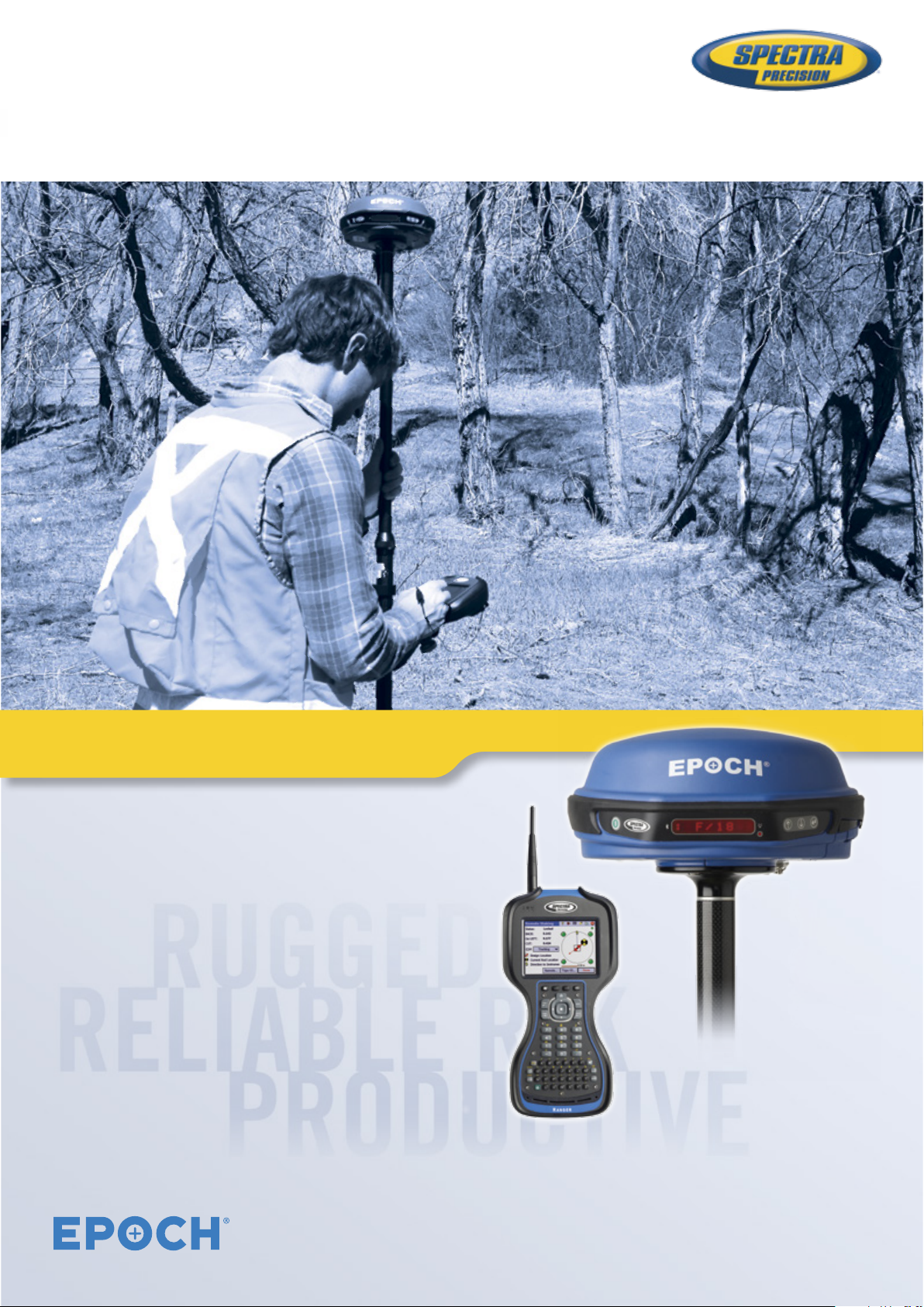
EPOCH 50 GNSS
Receiver
Spectra Precision® EPOCH® 50 GNSS,
Survey Pro, and Survey Ofce make a
complete, integrated system for precision
eldwork including cadastral, control,
location, and construction stakeout.
Multi-Constellation
GNSS Support
The Spectra Precision EPOCH 50 GNSS
system, with its 220 channels, makes
effective use of the GPS L1/L2/L2C/
L5, GLONASS L1/L2 and BeiDou B1/B2
signals for outstanding satellite coverage
and precise positioning. The EPOCH
50 GNSS receiver and antenna use
proven technologies to provide both an
extremely stable phase center and the
tracking of the new stronger L2C and
L5 signals. The overall combination of
these new signals, multi-constellation
support, and receiver processing power
provides consistent accuracy and
condence in results.
EPOCH 50
O
H
I
C
C
T
S
R
I
F
S
U
R
V
E
O
F
S
R
O
E
Y
Page 3

Integrated transmit/
receive UHF radio
The EPOCH 50 GNSS receiver has an
internal Transmit and Receive radio
modem so that any receiver may be used
as a base or rover. Use the internal radio
on a construction site for a quick and
easy setup. Plug in an external battery for
all-day operations. The EPOCH 50 GNSS
also supports external radio and cellular
modems for added exibility and range.
All receivers include Bluetooth
to communicate cable free with your
choice of world class Spectra Precision
data collectors.
®
capability
Proven Technology
Designed with greater than 99.9%
reliability initializations, the EPOCH 50
GNSS provides fast, high quality results
in all supported survey modes including
RTK, Postprocessed Kinematic and
Static. Consistent accurate results, quality
construction, and affordable pricing make
the EPOCH 50 GNSS the ideal choice for a
productive business.
Survey Pro Field Software
The key to getting the most out of your
crews and your equipment is your eld
software. Spectra Precision Survey Pro
eld software is specically tailored for
your new EPOCH 50 GNSS, as well as all
other Spectra Precision survey equipment.
Choose from three different data collectors,
add the level of Survey Pro you need, and
go to work. Survey Pro is easy to use, yet
it still unlocks the full power of EPOCH 50
GNSS so you can concentrate on getting
the work done.
™
Manage Your Data
Spectra Precision Survey Ofce software
provides a complete ofce solution for
postprocessing GNSS data and adjusting
terrestrial survey data. Download or import
eld and reference data from a variety
of sources including the entire family
of EPOCH GNSS receivers, Survey Pro
and permanent reference stations via
the internet. Export your processed and
completed results directly back to the
eld or design software packages using a
variety of le formats.
Network Rover Capable
The EPOCH 50 GNSS rover solution
supports the numerous real time GNSS
reference networks now installed all over
the world. A real time network improves
productivity while at the same time
reduces costs, by eliminating the need
to set up a base station. The networking
process supported by Survey Pro eld
software and GSM/GPRS capable
Spectra Precision data collectors
ensures the best quality, location
independent correction data.
EPOCH 50 GNSS system is best
described as Simply Reliable.
The lightweight, ergonomic and
cable-free system combines the
ease of use of a rugged integrated
Designed for Maximum
Performance
The EPOCH 50 GNSS with Survey Pro
provides eld crews with the tools and
capabilities to get the job done. With
maximum stability, precision, quality
and easy to use work ows, the EPOCH
50 GNSS is packed full of proven
technologies that you can rely on day to
day. Pair it with the most advanced and
rugged eld data collectors from Spectra
Precision to provide maximum productivity
and reliability for your everyday eldwork.
Features
220 Channels for Multi-Constellation
GNSS support
Integrated transmit/receive UHF radio
Compact and lightweight design
RTK, Postprocessed Kinematic and
Static
Network RTK positioning
Spectra Precision Survey Pro application
eld software
Support for all GNSS data with Spectra
Precision Survey Ofce software
GNSS receiver with the popular
Survey Pro eld software and
a choice of reliable of Spectra
Precision data collectors.
Page 4

EPOCH 50 GNSS System
GENERAL
When connected to the data collector:
•
220 Channels for multi-constellation GNSS support
•
Integrated transmit/receive UHF radio
•
Compact and lightweight design
•
RTK, Postprocessed, Kinematic, and Static
•
Network RTK positioning
•
Integrated wireless Bluetooth® 2.0 technology
TECHNICAL SPECIFICATIONS
Static GNSS surveying
High-accuracy static
Horizontal ................... 3 mm + 0.1 ppm RMS
Vertical ....................3.5 mm + 0.4 ppm RMS
Static & Fast Static
Horizontal ................... 3 mm + 0.5 ppm RMS
Vertical ..................... 5 mm + 0.5 ppm RMS
Real-Time Kinematic GNSS surveying
Horizontal ....................10 mm + 1 ppm RMS
Vertical ......................20 mm + 1 ppm RMS
Initialization ....Automatic OTF (on-the-fly) while moving
Initialization time ..............Typically <10 seconds
Initialization reliability
Start-up ..... <60 seconds from power on to positioning
Code differential GPS positioning
Horizontal ....................0.25 m + 1 ppm RMS
Vertical ......................0.50 m + 1 ppm RMS
SBAS (WAAS/EGNOS/GAGAN/MSAS) differential
positioning accuracy. . . . . . . . .Typically <5 m 3DRMS
Physical
Dimensions (W×HxD) ....19.0 cm x 10.7 cm x 20.0 cm
Weight (with battery) ...............1.34 kg (2.95 lb)
Ports
I/O .....................Two 7-pin Lemo, RS-232
Data Link (UHF radio) antenna ...............TNC
Measurements
•
Advanced, sixth generation, custom survey
GNSStechnology
•
High-precision multiple correlator for GNSS
pseudorange measurements
•
Unfiltered, unsmoothed pseudorange measurement
data for low noise, low multipath error, low time domain
correlation and high dynamic response
•
Very low noise GNSS carrier phase measurements with
<1 mm precision in a 1 Hz bandwidth
•
Proven Spectra Precision low-elevation
trackingtechnology
•
Satellite signals tracked simultaneously:
– GPS: L1/L2/L2C/L5
– GLONASS L1/L2
– BeiDou: B1/B2
– SBAS (WAAS/EGNOS/GAGAN/MSAS): L1C/A, L5
– Galileo: E1/E5A/E5B
1
1
2
..............Typically >99.9%
<30 seconds with recent ephemeris
1
(7.48 in x 4.21 in x 7.87 in)
Bluetooth
ENVIRONMENTAL
Operating temperature ..............–40 °C to +60 °C
–40 °C to +55 °C (–40 °F to +131 °F)
Storage temperature. . . . . . . . . . . . . . . . –40 °C to +75 °C
(–40 °F to +167 °F)
Dust/Water .................................IP66
Vibration ...........................MIL-STD-810F
Shock/Drop ............MIL-STD-810F Method 516.5
(–40 °F to +140 °F)
with internal radio transmitting
ELECTRICAL
•
Power 10 V DC to 20 V DC external power input with
over-voltage protection on Port 1 and Port 2 (7-pin)
•
Rechargeable, 7.4 V 2400 mAh Li-Ion internal battery
•
Average operating times on internal battery:
– RTK/Static: 4.0 hours
5
COMMUNICATIONS AND DATA STORAGE
•
Internal post process data storage 64 MB (9 MB
reserved)
•
Supports external GSM/GPRS/CDMA modems for point
to point RTK and NTRIP operations
•
Internal UHF Transceiver. 1 W or 0.5 W transmit power.
•
Supports external UHF transmit data link for RTK base
station operation.
•
1 Hz, 2 Hz, 5 Hz, 10 Hz, and 20 Hz positioning when
configured
3
Correction formats
•
sCMRx, CMR, CMR+, RTCM 2.1, RTCM 2.2, RTCM
6
.
7
:
2.3, RTCM 3.0, RTCM 3.1
– 25 KHz and 12.5 KHz channel spacing
•
NMEA-0183 output support on COM2 during Network
RTK or autonomous operations
RECYCLING INFORMATION
For product recycling instructions and more information,
please go to: www.spectraprecision.com/ev.shtml.
4
4
1 Accuracy and reliability may be subject to anomalies due to
multipath, obstructions, satellite geometry, and atmospheric
conditions. The specifications stated recommend the use of stable
mounts in an open sky view, EMI and multipath clean environment,
optimal GNSS constellation configurations, along with the use of
survey practices that are generally accepted for performing the
highest-order surveys for the applicable application including
occupation times appropriate for baseline length. Baselines longer
than 30 km require precise ephemeris and occupations up to 24 hr
may be required to achieve the high accuracy static specification.
2 May be affected by atmospheric conditions, signal
multimath,obstruction, and satellite geometry.Initialization reliabilityis
continuously monitored to ensure the highest quality.
3 Depends on SBAS (WAAS/EGNOS) system performance.
4 Below –20°C, external power must be used.
5 Three batteries supplied standard.
6 When used with Survey Pro, only 1 Hz and 5 Hz modes are
supported.
7 Not all protocols will work with all radio baud rates and channel
spacing.
Contact Information:
AMERICAS
Spectra Precision Division
10368 Westmoor Drive
Westminster, CO 80021 • USA
+1-720-587-4700 Phone
888-477-7516 (Toll Free in USA)
Please visit www.spectraprecision.com for the latest product information and to locate your nearest distributor. Specifications and descriptions are subject to change without notice.
© 2011–2014, Trimble Navigation Limited. All rights reserved. Spectra Precision is a Division of Trimble Navigation Limited. Spectra Precision and the Spectra Precision logo are
trademarks of Trimble Navigation Limited or its subsidiaries. EPOCH is a trademark of Spectra Precision. The Bluetooth word mark and logos are owned by the Bluetooth SIG, Inc. and any
use of such marks by Spectra Precision is under license. All other trademarks are the property of their respective owners. PN 022487-170C-CHINA (01/14)
EUROPE, MIDDLE EAST AND AFRICA
Spectra Precision Division
Rue Thomas Edison
ZAC de la Fleuriaye – CS 60433
44474 Carquefou (Nantes) • FRANCE
+33-(0)2-28-09-38-00 Phone
ASIA-PACIFIC
Spectra Precision Division
80 Marine Parade Road
#22-06, Parkway Parade
Singapore 449269 • SINGAPORE
+65-6348-2212 Phone
www.spectraprecision.com
SCAN THIS CODE FOR
MORE INFORMATION
 Loading...