

Page 1
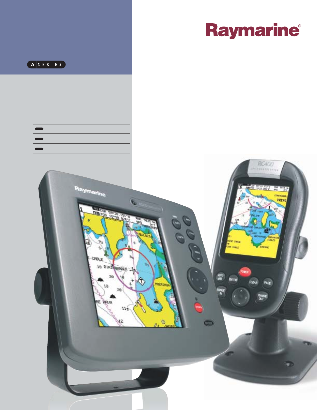
GPS
Chartplotters
new
RC400
RC435
RC435i
Page 2
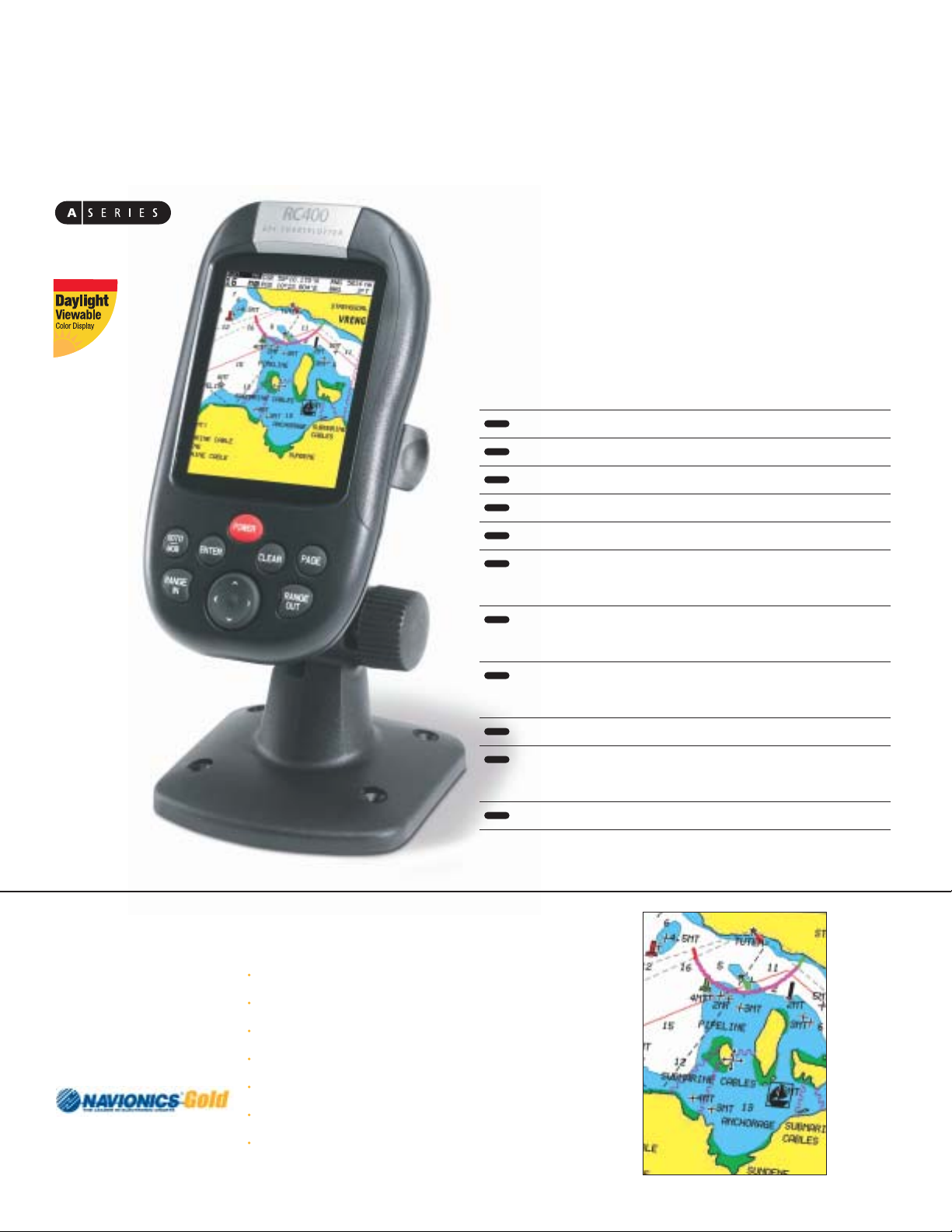
3.5” Daylight viewable transflective color LCD
Submersible to IPX7 Standard: Submersible to 1 meter for at least 30min.
12 Channel Satellite Differential GPS with WAAS
Built in world map and Navionics Gold chart support on compact flash cards
Unlimited waypoint,route and track storage using compact flash cards
Raymarine SmartRoute™ automatically builds routes and waypoints from
previous tracks
Autozoom Mode intelligently maintains your vessel and your waypoint on
the best chart scale while underway
Screen Amplifier automatically offsets your vessel position for maximum
“look ahead” on the chart display
Chart rotation modes: North Up; Course Up and Head Up
Accepts 4 AA NiMH rechargeable (included) or alkaline batteries for
handheld operation
Supplied with Cradle/Charger and NMEA/Power cable
Submersible
The RC400 packs big navigation features into a compact and portable GPS that
harness’s the power of Navionics Gold cartography for paper chart like clarity, and
fast screen updates. Both fixed mount and portable,the RC400 comes standard
with a mounting bracket and cables for 12-volt power and NMEA 0183 interfacing.
The battery compartment holds 4 AA rechargeable Nickel metal hydride (NiMH)
batteries and also accepts alkaline batteries for added convenience.
RC400
Portable GPS Chartplotter
GPS Chartplo
To learn more about Navionics Gold charts and to browse the complete Navionics chart catalog go to www.navionics.com
Familiar appearance of a paper charts
A clear uncluttered chart display on every range scale
Shaded Depth Contours
Real-world shapes and colors of buoys and navaids.
Spot Soundings
Tides and Currents
Port Plans and Port Service Guides
About
Navionics
Gold Charts
Page 3

RC435
RC435i
Bold 5.7” Daylight Viewable color display
Paper like color chart display using Navionics Gold Chart cartography
Compact Flash support for cartography and unlimited waypoint,
route and track storage
Raymarine SmartRoute™ automatically builds routes and waypoints
from previous tracks
Autozoom Mode intelligently maintains your vessel and your waypoint on
the best chart scale while underway
Screen Amplifier automatically offsets your vessel position for maximum
“look ahead” on the chart display
Standard 12 channel Satellite Differential GPS receiver for extreme
accuracy using WAAS
Rugged waterproof (CFR46 standard) display and Raymarine reliability
backed by a two-year limited warranty
The RC435 and 435i are full-featured compact chartplotters designed for fast performance and uncomplicated navigation. Featuring high-resolution color displays,
professional quality vector cartography,and “point and shoot” navigation RC435
is the clear and simple choice for advanced electronic charting.This compact charting powerhouse is available in two versions,the RC435 with external antenna or
the easy-to-install RC435i with a built in antenna.
Full screen CDI (Course Deviation
Indicator) graphics guide you to
your waypoint.
BDI (Bearing Distance Indicator)
combines digital and graphic
"steer to waypoint" information
on a full screen display
Essential navigation data is clearly
displayed in one of three information pages.
Page 4

RC400 Specifications
Display Size and Type 3.5”Advanced Transflective TFT Color LCD
Dimensions (H x W x D) 6.48” x 3.57”x 1.75”
(164.6mm x 90.6mm x 44.5mm)
Weight 15.2 oz (431g), including batteries
Operating Temp Range -10 deg C to 50 deg C
Storage Temp Range -20 deg C to 70 deg C
Humidity up to 95% RH
Controls 7 defined keys and trackpad
Interface NMEA 0183 - receive and transmit,
waypoint upload and download
Cartography Navionics Gold Charts on compact flash
Chartplotter Specifications
Waypoints 500
Waypoint Names 8 character
Routes 20 routes with up to 50 waypoints each
Route Names 8 character
Alarms Arrival / XTE / Anchor / No Fix
Tides/Current Predictions Via chart
Sunrise/Sunset Predictions Via chart
External Memory Store Waypoints / Routes / Tracks on
Compact Flash cards up to 128MB
GPS Specifications
Signal Acquisition 12-channel parallel (C / A Code)
Satellite Differential Type WAAS / EGNOS / MSAS ready
Differential Acquisition: Automatic
Position Accuracy (RMS) < 15 m
Position Accuracy (SD GPS) < 5 m
Time to First Fix (from cold start )
Typically < 3 min,4 minutes max
Display type 5.7" 1/4 VGA 16 Color TFT Display
Nominal Voltage 10-18 Volts
Power Consumption 10 Watts (backlights on full)
Interface NMEA 0183 output (GGA, GLL, RMC,VTG, GSA,
GSV, ECXTE, ECBWR,ECRMB, ECAPB)
Cartography Navionics Gold Chart
Chartplotter Specifications
Waypoints 500
Waypoint Names 8 character
Routes 20 routes with up to 50 waypoints each
Route Names 8 character
Alarms Arrival / XTE / Anchor / Fix
Tides/Current Predictions Via chart
Sunrise/Sunset Predictions Via chart
GPS Specifications
Signal Acquisition 12-channel parallel (C / A Code)
Antenna RC435i: Internal passive
RC435: External passive with 10m cable
Satellite Differential Type WAAS / EGNOS / MSAS ready
Differential Acquisition Automatic
Position Accuracy (RMS) < 15 m
Position Accuracy (SD GPS) < 5 m
Time to First Fix
(from cold start)
Typical < 2.5 min (< 40 sec)
Time to First Fix
(after initial cold start)
Typically < 8 seconds
RC435/RC435i Specifications
Submersible
www.raymarine.com Specifications subject to change without notice
Raymarine Incorporated
22 Cotton Road, Unit D
Nashua, NH
03063-4219 USA
Tel: 603.881.5200
Fax: 603.864.4756
Raymarine Limited
Robinson Way
Anchorage Park Portsmouth
Hampshire PO3 5TD England
Tel: +44 (0)23 9269 3611
Fax: +44 (0)23 9269 4642
Raymarine develops and manufactures an extensive range of marine electronics.
Please visit our website at www.raymarine.com to learn more about our complete
line of radar, GPS, chartplotters, instruments, fishfinders, VHF radios, software and
integrated systems.
 Loading...