

Page 1
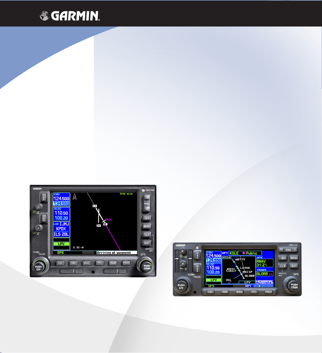
What’s New with the
400W / 500W Series
New Operational Characteristics of the
WAAS GNS 400W/500W Series Units
versus
the Classic 400/500 Series Units
Page 2

This document is written for:
• Garmin GPS 400W, GNC 420W/420AW, and GNS 430W/430AW Main System Software Version 2.00
• Garmin GPS 500W & GNS 530W/530AW Main System Software Version 2.00
© 2006 Garmin Ltd. or its subsidiaries. All Rights Reserved.
Garmin International, Inc., 1200 East 151st Street, Olathe, KS 66062, U.S.A.
Tel. 913/397.8200 or 800/800.1020 Fax 913/397.8282
Garmin AT, Inc., 2345 Turner Rd., S.E., Salem, Oregon 97302, U.S.A.
Tel: 503/581.8101 Fax: 503/364.2138
Garmin (Europe) Ltd., Unit 5, The Quadrangle, Abbey Park, Romsey, Hampshire S051 9DL, U.K.
Tel: 44/0870.851241 (Europe) Fax: 44/1794.519222
Tel: 0808.2380000 (UK)
Garmin Corporation, No. 68, Jangshu 2
Tel. 886/2.2642.9199 Fax 886/2.2642.9099
Except as expressly provided herein, no part of this addendum may be reproduced, copied, transmitted, disseminated,
downloaded or stored in any storage medium, for any purpose without the express prior written consent of Garmin.
Garmin hereby grants permission to download a single copy of this manual and of any revision to this manual onto
a hard drive or other electronic storage medium to be viewed and to print one copy of this manual or of any revision
hereto, provided that such electronic or printed copy of this manual or revision must contain the complete text of this
copyright notice and provided further that any unauthorized commercial distribution of this manual or any revision
hereto is strictly prohibited.
Information in this document is subject to change without notice. Garmin reserves the right to change or improve its
products and to make changes in the content without obligation to notify any person or organization of such changes or
improvements.
nd
Road, Shijr, Taipei County, Taiwan
The complete set of 400W/500W series Pilot Guides is available on-line at www.garmin.com.
190-00356-06 Rev A
December 2006 Printed in U.S.A.
Page 3

The 400W/500W series of navigators with WAAS now offer many enhancements over the previous non-WAAS
models. Advancements include new WAAS-enabled GPS antenna, receiver, and associated software. The 400W/500W
series system complies with WAAS TSO C146a and also includes a significant hardware upgrade with a new and much
faster micro-processor. A terrain database for terrain awareness is included as a standard feature and now provides
even greater detail. The WAAS GPS receiver now allows you to use the 400W/500W series unit for primary navigation
and use GPS with vertical guidance for LPV, L/VNAV, and LNAV+V approaches. Non-precision approaches are annunciated as LNAV approaches. The Comparison of Features Summary table provides a quick view of the differences and
is followed by a more detailed description of feature changes.
Comparison of Features Summary
Feature Classic 400/500 New 400W/500W
1 TSO C129a – Supplemental navigation WAAS TSO C146a – Primary navigation
2 WAAS Capable No Yes
3 Approach Annunciations C129a non-precision annuncia-
tions
4 SBAS Selection No Yes for WAAS
5 GPS Position Calculation Rate Once per second Five times per second
6 GPS Software Level-C Level-B. More robust
7 Vectors-To-Final Yes Auto-Suspend (SUSP) is active for Vectors To Final
8 GPS/WAAS-Based Vertical Guid-
ance
9 Holding Patterns Yes Holding pattern depiction on the Nav mode
10 Autopilot Roll Steering Yes Includes active guidance during holding patterns
11 OBS Operation Yes OBS/SUSP behavior around the MAP is different
12 Hold to Altitude Yes Hold to Altitude legs will now use baro-corrected
13 Parallel Track No Yes
14 Magnetic Variation Options True, Magnetic, or User True or Magnetic
No GPS WAAS provides vertical guidance on the
C146a precision annunciations of LPV, L/VNAV,
LNAV+V, LNAV, and MAPR
(VTF) until on the “TO” side of the FAF and the
aircraft ground track is within a 45° course of the
published in bound course. At this point, the SUSP
annunciation will automatically extinguish.
available GPS approaches
moving map shows aircraft position and provides
active guidance
and procedure turns
altitude if it is available
1
Page 4

Feature Classic 400/500 New 400W/500W
15 Terrain Database Optional Standard. Increased resolution.
16 Dead Reckoning (DR) No Yes
17 Satellite Status Page Yes Enhanced with new colors and 3D differential fix
notation.
18 Graphics Speed Good Much better
19 Crossfill Yes 12x faster
20 XM Radio Audio and Weather Limited, NEXRAD, METARs, no
audio control
21 KAP140/KFC225 Autopilot
Yes Annunciation added
Yes - Adds TAFs, TFRs, NEXRAD Coverage, and
audio controls
Operation-Compatible
22 GDL Configuration No GDL 69/69A
23 GDL 69/69A Data Link Diag-
No Yes
nostics
24 Traffic Range Rings Yes The numeric values for Traffic Range rings vary
with the installed traffic source.
25 Installation Individual aircraft field approval. Approved Model List for more than 900 aircraft
when installed per the STC.
26 How Can I Tell If I Have A WAAS
Unit
N/A View the first screen in the start-up routine.
Check other features.
2
Page 5

Detailed Description of Feature Changes
1. TSO
satellite are wrong and removing that satellite from the
navigation solution.
TSO C-129/C-129a allowed the use of GPS for
supplemental navigation for non-precision approaches.
An installation meeting TSO-146a requirements allows
the use of your 400W/500W navigators as the primary
navigation device for precision approaches.
See your dealer for detailed information about how the
new TSO affects the operation of your aircraft.
2. WAAS Capable
Department of Transportation (DOT) are developing
the WAAS program for use in precision IFR approaches.
Without WAAS, GPS alone does not meet the FAA’s
navigation requirements for accuracy, integrity, and
availability. WAAS corrects for GPS signal errors caused
by ionospheric disturbances, timing, and satellite orbit
errors, and it provides vital near real-time integrity information regarding the health of each GPS satellite.
WAAS (Wide Area Augmentation System) is a
system to provide improved integrity and accuracy of
GPS signals used for navigation. “Wide Area” refers to
a network of ground reference stations that cover the
entire U.S. and some of Canada and Mexico. Implemented by the FAA (Federal Aviation Administration)
for aviation users, these reference stations are located
at precisely surveyed spots and compare GPS distance
measurements to known values. Each reference station is
linked to a master station, which puts together a correction message and broadcasts it via satellite. The corrected
differential message is then broadcast through one of two
geostationary satellites. The information is compatible
with the basic GPS signal structure, which means any
in North America. There are no ground reference stations in South America, so even though GPS users there
can receive WAAS, the signal has not been corrected
and thus would not improve the accuracy of their unit.
For some users in the U.S., the position of the WAAS
satellites over the equator makes it difficult to receive
the signals when trees or mountains obstruct the view of
the horizon. WAAS signal reception is ideal for aviation
applications. Your Garmin 400W/500W series system
provides for primary GPS navigation in areas where no
WAAS coverage is available using a Fault Detection and
Exclusion (FDE) RAIM algorithm.
WAAS-enabled GPS receiver can read the signal. WAAS
capable receivers typically have accuracies of one meter
horizontally and 2 meters vertically.
Basically, it’s a system of satellites and ground stations that provide GPS signal corrections, giving you
even better position accuracy. How much better? Try
an average of up to five times better. A WAAS-capable
Based Augmentation Systems (SBAS). In Asia, it’s the
Japanese Multi-Functional Satellite Augmentation System
(MSAS), while Europe has the Euro Geostationary Navigation Overlay Service (EGNOS). Once these systems
are fully tested and operational, your 400W/500W series
system will be capable of using these systems.
receiver can give you a position accuracy of better than
two meters 95 percent of the time. And you don’t have to
purchase additional receiving equipment or pay service
fees to utilize WAAS. WAAS also provides the capability of quickly determining when signals from a given
The Federal Aviation Administration (FAA) and the
Currently, WAAS satellite coverage is only available
Other governments are developing similar Satellite-
3
Page 6

GPS Accuracy
3. Approach Annunciations
GPS Condition Accuracy Level
Accuracy of the original GPS system,
100 meters
which was subject to accuracy
degradation under the governmentimposed Selective Availability (SA)
program.
Typical GPS position accuracy
15 meters
without SA.
Typical differential GPS (DGPS) posi-
3-5 meters
tion accuracy.
Typical WAAS position accuracy. < 1.25 meters
WAAS Channels
WAAS channel numbers are shown on Airport
Approach pages in the Waypoint page group. The WAAS
approach reference ID is displayed in the top left corner
of the map. The approach service level is shown in the
lower right corner of the map. Service level annunciations available are: LPV, L/VNAV, LNAV+V, or LNAV.
LPV, L/VNAV, LNAV+V, LNAV, and MAPR will appear
in the flight phase annunciation window.
Annunciation Description
LPV Follow lateral and vertical guidance to LPV
minimums.
L/VNAV GPS approach identified in the database as
LNAV/VNAV. Fly to LNAV/VNAV minimums.
LNAV+V Non-precision GPS approach with advisory
vertical guidance. Note that some LNAV/
VNAV approaches are not yet marked in
the database as such and will show up as
LNAV+V. If the chart shows the approach
as LNAV/VNAV, it can be flown to LNAV/
VNAV minimums.
LNAV Non-precision GPS approach or non-GPS
approach, such as ILS or Localizer.
MAPR Missed Approach, indicates the system is
providing missed approach integrity and
CDI full-scale deflection ±0.3 NM. This also
shows that the pilot has initiated a Missed
Approach by pressing the OBS key after
crossing the MAP.
4. SBAS selection
The SBAS (Space-Based Augmentation System) menu
option allows you to enable or disable the use of WAAS
satellites. If WAAS is disabled, the unit will not be able
to fly vertically guided GPS approaches (LPV, LNAV/
VNAV, or LNAV+V). If WAAS was previously disabled,
it may take several minutes to achieve a 3D-Diff fix after
re-enabling WAAS.
See the section on SBAS Selection of the Setup 2 Page in
the Aux Pages chapter of the Pilot’s Guide for more details.
4
Page 7

5. GPS Position Calculation Rate
MAP
FAF
45°
45°
SUSP
On
SUSP
Off
Vector-To-Final
SUSP
On
SUSP
Off
8. GPS/WAAS-Based Vertical Guidance
The WAAS GPS receiver calculates its position five
times per second rather than once per second like the
Classic C-129/C-129a GPS systems. This, together with
the enhanced vertical accuracy and other system enhancements, allows for vertical approach guidance.
6. GPS Software
The GPS software of the Classic 400/500 series met
the requirements for Level-C. The new 400W/500W
meets the more rigorous requirements of Level-B, where
400W/500W series unit for primary navigation and
use GPS with vertical guidance for LPV, L/VNAV, and
LNAV+V approaches.
9. Holding Patterns
moving map shows the aircraft position and provides
active guidance, with roll steering autopilot-equipped
aircraft.
required.
7. Vectors-To-Final
Auto-Suspend (SUSP) is active for Vectors To Final
(VTF) until on the “TO” side of the FAF and the aircraft
ground track is within a 45° course of the published in
bound course. At this point, the suspend annunciator
will automatically extinguish.
The WAAS GPS receiver now allows you to use the
The Holding pattern depiction on the Nav mode
Guidance provided along the holding pattern
Vector-To-Final Suspend Operation
Remember, don’t press OBS or you will have to
reload the approach, unless you desire to sequence to the
final approach segment in the active flight plan.
See the section on Vectors to Final in the Procedures
chapter of the Pilot’s Guide for more details.
See the section on Flying an Approach with a Hold in the
Procedures chapter of the Pilot’s Guide for more details.
10. Autopilot Roll Steering
Roll steering guidance is now provided for procedure
turns and holding patterns. The holding pattern now depicts the actual location and shape of the holding pattern
while providing real-time display of your position.
See the Procedures chapter of the Pilot’s Guide for more
details.
5
Page 8

11. OBS Operation
13. Parallel Track
SUSP after canceling OBS when on From side of OBS
path – The change in behavior is this: When you put the
400W/500W-series unit into OBS mode and the course
selected places the aircraft onto the from side and then
you cancel OBS, the OBS course is retained but the unit
indicates that sequencing is suspended by annunciating
SUSP. Note that you can still change the course to the
OBS waypoint as long as you haven’t cancelled OBS, but
once you have it will annunciate SUSP. The WAAS TSO
requires the unit to annunciate when leg sequencing is
suspended, so this is the reason the SUSP annunciation
Parallel Track allows you to create a parallel course
offset of 1 to 99 NM to the left or right of your current
flight plan. After setting a parallel track to your current
flight plan, a magenta parallel track active leg line will be
drawn offset from the original by the selected distance.
The original course line will appear in white. The aircraft
will navigate to the parallel track course line.
Points to remember with Parallel Track:
1. You must have an active flight plan.
2. The current leg must support parallel track.
3. Parallel track is not allowed for the active leg of an
is active. The classic product behaved the same way but
did not indicate that sequencing was suspended and
4. Parallel track is not allowed if the active leg is not a
when pressing the OBS key, it would return to OBS
mode on the same waypoint. With the 400W/500W-se-
5. Parallel track may be allowed but not the selected offset
ries unit, pressing the OBS key when the SUSP annunciation is above it will allow leg sequencing to occur
6. Parallel Track offset waypoint is indicated with a “-p”
immediately.
See the Q & A comments about using the OBS key in
Appendix C - Troubleshooting Q&A of the Pilot’s Guide for
more details.
approach.
track-to-fix or direct-to-fix leg.
distance.
suffix.
Original waypoint
Parallel Track offset waypoint
12. Hold to Altitude
The Hold to Altitude legs now use baro-corrected
altitude if it is available (similar to Fix to Altitude legs).
This means that if baro-corrected altitude is available
and the required altitude is reached for the hold, the
400W/500W-series unit will automatically unsuspend
and then sequence to the next leg after the hold fix is
crossed. If baro-corrected altitude is not available, then
the behavior is the same as the Classic – the user needs
to press OBS to sequence past the hold.
See the section on Flying an Approach with a Hold in the
Procedures chapter of the Pilot’s Guide for more details.
6
ter of the Pilot’s Guide for more details.
Original flight
plan course
line
Present
Position
After setting a parallel track to your current flight plan, a
magenta parallel track line will be drawn offset from the
original by the selected distance. The original course line
will be drawn in white. The aircraft will navigate to the
parallel track course line.
Navigating Along A Parallel Track
See the section on Parallel Track in the Flight Plan chap-
Page 9

14. Magnetic Variation Options
Magnetic variation has been simplified to the choices
of Magnetic and True.
See the section on Units/Position of the Setup 1 Page in
the Aux Pages chapter of the Pilot’s Guide for more details.
15. Terrain Database
The Terrain function in Nav mode is now a standard
feature. The extensive database aids in terrain awareness.
TAWS remains as an option in the 500W series.
17. Satellite Status Page
The Satellite Status page has been redesigned to
provide WAAS GPS information.
Signal Strength
Bars
Sky View
of satellite
positions
Current
UTC Time
GPS Receiver
Status
Horizontal Figure of
Merit and Vertical
Figure of Merit
Estimated Position
Uncertainty
See the section on Terrain Operation in the Nav Pages
chapter of the Pilot’s Guide for more details.
16. Dead Reckoning (DR)
Dead reckoning is the process of continuing navigation based on your last known position using your
current heading, speed, time, and distance to be traveled
after a loss of GPS navigation on an active flight plan.
Navigation using dead reckoning is therefore only an
estimate and requires that you maintain the course and
speed shown on your 400W/500W unit. Dead reckoning
Annunciator
shown when the required
level of integrity is not
should not be used if any other means of navigation is
available, such as a VOR or pilotage.
Dead reckoning becomes active after a loss of GPS
position while you are navigating using an active flight
plan. A pop-up message will appear and requires pilot
input to clear the message. Dead reckoning is not available if you are in terminal or approach modes.
When Dead Reckoning is active, the ownship icon
color is changed to yellow and the To/From flag is
removed from the CDI. The Dead Reckoning annunciator (DR) appears on the left side of the map display
when GPS position is unavailable and the unit is in Dead
Reckoning mode. All external outputs dependent on
GPS position are flagged.
See the section on the Satellite Status Page in the Nav
Pages chapter of the Pilot’s Guide for more details.
18. Graphics Speed
The graphics speed for redrawing the display is much
improved. This is especially evident on the Map and Terrain displays.
19. Crossfill
Crossfill operation in the 400W/500W series units is
now 12x faster than in the Classic units. The databases
of the 400/500 series and the 400W/500W series are
incompatible, so you may not mix systems.
Excluded
Satellite
“INTEG”
available
Satellite acquired
but not used for
Acquiring
Satellite, not
ready for
use
Satellite Status Page Description
Satellite
acquired, used
for position
fix, and has
differential
corrections
Current Page in NAV
(page position
depends on options;
see 400W/500W Series
Display Interfaces Pilot's
Guide Addendum)
position fix
Satellite
Numbers
Group
See the section on Dead Reckoning in the Nav Pages
chapter of the Pilot’s Guide for more details.
77
Page 10

20. XM Radio Audio and Weather
XM Weather is available through the XM Satellite
Radio Service when activated in the optional installation of the GDL 69 or 69A. Textual and graphic weather
products such as NEXRAD graphic weather with precipitation type, radar coverage, TFRs, TAFs, and METARs
symbols are displayed in the NAV function. The types
of products available depend on the subscription service
with XM Satellite Radio.
XM NEXRAD Weather
Textual METARs
Audio entertainment is available through the XM
Satellite Radio Service when activated in the optional
installation of the GDL 69A. The 400W and 500W series
units serve as the display and control head for your
remotely mounted GDL 69A. XM Satellite Radio allows
you to enjoy a variety of radio programming over long
distances without having to constantly search for new
stations. Based on signals from satellites, coverage far
exceeds land-based transmissions. When enabled, the
XM Satellite Radio audio entertainment is accessible in
the AUX function.
Graphic METARs
XM Satellite Radio Audio
See the section on XM Radio in the 400W/500W Series
Garmin Optional Displays Pilot’s Guide Addendum - p/n
190-00356-30 for more details.
88
Page 11

21. KAP140/KFC225 Autopilot Operation-Compatible
24. Traffic Range Rings
Autopilot outputs for the King KAP140/KFC225
autopilots are activated manually by the pilot after
the installed traffic source.
being prompted during the approach procedure. Since
these autopilots revert to roll mode-wings level when
transitioning to approach mode, it is important for
the pilot to be part of the decision process of when to
make this control change. After enabling outputs, the
400W/500W-series unit will provide guidance information to the autopilot.
The 400W/500W-series unit must be configured
during installation to interface with these autopilots.
Guidance to the FAF is active as indicated by Approach
mode annunciation (LPV, L/VNAV, LNAV+V, or LNAV).
See the section on Enabling Autopilot Outputs in the
Procedures chapter of the Pilot’s Guide for more details.
22. GDL Configuration
Garmin Optional Displays Pilot’s Guide Addendum - p/n
190-00356-30 and the 400W/500W Series Display Interfaces Pilot’s Guide Addendum - p/n 190-00356-31 for more
details.
25. Installation
an AML (Approved Model List) STC. There are more
than 900 aircraft on the approved list. This allows the
aircraft on the AML to be installed via the STC, that may
result in cost and time savings in the installation process
for the aircraft owner. See your dealer for details about
your aircraft installation.
26. How Can I Tell If I Have A WAAS Unit
The GDL 69/69A receives broadcast weather data
from a service of XM Satellite Radio, Inc. The GDL 69A
also can receive audio entertainment broadcasts.
number of the unit will have a “W” at the end of the
number.
See the section on XM Radio in the 400W/500W Series
Garmin Optional Displays Pilot’s Guide Addendum - p/n
190-00356-30 for more details.
The numeric values for Traffic Range rings vary with
See the section on Traffic in the 400W/500W Series
The 400W/500W series products are certified with
At the beginning of the start-up screens, the model
23. GDL 69/69A Data Link Diagnostics
Diagnostics for the GDL 69/69A are available for
viewing in the Aux pages of the 400W/500W series
units.
See the section on XM Radio in the 400W/500W Series
Garmin Optional Displays Pilot’s Guide Addendum - p/n
190-00356-30 for more details.
There are a couple of screens you can check quickly.
The Satellite Status page has changed. Under Status,
the WAAS units will show values for HFOM, VFOM,
and EPU. The SBAS Selection page is only available for
WAAS units; see item 4.
99
Page 12

© 2006 Garmin Ltd. or its subsidiaries
Garmin International, Inc.
1200 East 151
st
Street, Olathe, Kansas 66062, U.S.A.
Garmin AT, Inc.
2345 Turner Rd., S.E., Salem, Oregon 97302, U.S.A.
Garmin (Europe) Ltd.
Unit 5, The Quadrangle, Abbey Park Industrial Estate, Romsey, SO51 9DL, U.K.
Garmin Corporation
No. 68, Jangshu 2nd Road, Shijr, Taipei County, Taiwan
190-00356-06 Rev A
www.garmin.com
 Loading...