

Page 1
WhereTag III ST HO
User’s Guide
Revision B, July 2005
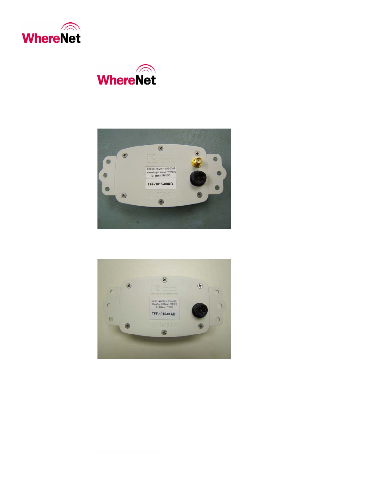
Model Number: TFF-1015 with external antenna connection
Model Number: TFF-1015 with internal antenna connection
WhereNet Corp.
2858 De La Cruz Blvd.
Santa Clara, CA 95050
408-845-8500
WWW.WhereNet.COM
©WhereNet Corp. June 2001 TFF-1015-000-4589_UserMan_rev_08_30_05 Page 1
Page 2

_
_
_
_
FCC Requirements
This device must operate in compliance with Federal Communications Commission (FCC) Rules and Regulations Parts
15. See FCC registration label, located on the bottom of the equipment for the FCC, registration.
This equipment has been tested and found to comply with the limits for both Class A and Class B devices, pursuant to Part
15 of the FCC Rules.
This ISM device complies with Canadian ICES-001.
Cet appareil ISM est conforme à la norme NMB-001 du Canada.
Radio Equipment Authorization: FCC ID: NSQTFF-1015S
IC: 3586A-TFF1015S
RF Notice
This device must be professionally installed. The internal and external antenna used for this transmitter must be installed
to provide a separation distance of at least 20 cm from all persons and must not be co-located or operating in conjunction
with any other antenna or transmitter.
Any changes or modifications to WhereNet Corp. equipment not expressly approved by WhereNet Corp. could void the
user’s authority to operate the equipment.
__________
__________
There are no user-serviceable parts inside. Do not attempt to open the unit to change batteries.
©WhereNet Corp. June 2003 TFF-1015-000-4589_UserMan_rev_08_30_05 Page 2
Page 3

Contents
Introduction........................................................................................................................4
Installation and Activation................................................................................................7
Tag Mounting Options.......................................................................................................7
Specifications ......................................................................................................................8
©WhereNet Corp. June 2003 TFF-1015-000-4589_UserMan_rev_08_30_05 Page 3
Page 4

Introduction
This User Guide describes the features, communication formats, configuration, and operation of the WhereTag. It includes
everything needed to be able to configure the tag and the communications between the tag and a host system.
Appendix A is a complete description of all the WhereTag commands together with examples of how they are
used to set up and operate the WhereTag. Appendix B is a physical description of the tag.
This chapter briefly describes the major features and components of the Real Time Location System.
The Real Time Location System
The WhereNet system tracks and locates items tagged with a WhereTag. Each tag emits short, low power bursts of widely
spread spectrum radio energy. These bursts are received by the system infrastructure. The infrastructure calculates the
location of the tagged item based on the different arrival times of the burst.
The WhereTag III HO or ST is a compact battery operated radio frequency device. It is a component of the
WhereNet Real Time Location System.
The WhereNet Real Time Locating System (RTLS) is a precise local locating system with robust wireless
telemetry capabilities. Its integrated architecture meets all the requirements for an enterprise-wide wireless infrastructure
including locating, telemetry, and high-speed wireless communications.
WhereTags
WhereTags are attached to assets whose status must be quickly and accurately monitored. Examples are the
movement of a shipping container through a loading yard or a trailer through a warehousing facility.
RTLS uses DSSS RF technology to determine the location of WhereTag transmitting beacons. These
transmissions are extremely low power, about
2 mW (high output options increase this to 54 mW). The transmissions can be received at distances in excess of
1,000 meters outdoors (high output tags operate at up to 3,000 meters).
Because the transmissions are low power and spread across 60 MHz they add almost no RF pollution to
the environment. They can be readily used with wireless LANs and Blue Tooth devices without adversely
affecting the throughput of those systems.
The transmissions from the WhereTags are very resistant to interference because of the large amount of
processing gain. The system is able to receive signals that are below the RF noise floor of the surrounding
environment.
WhereTags are located by measuring the difference in the arrival time of a signal at a minimum of three
fixed-position Location Sensors (the reliability increases if more than three sensors receive the signal). The
WhereTags transmit their keep alive signal at a programmable interval. The Location Sensors are in a grid
formation that ensures that at least three antennas can receive a blink from any place within the site. By
comparing the difference in the arrival time of the beacon signal at each of the receiving antennas the system can
determine the location of the transmitting WhereTag. This type of location determination is called TDOA (Time
Difference Of Arrival). Tags are located to an accuracy of less than ten feet in virtually all environments, indoors
and out. The accuracy can be affected by environmental factors such as concentrations of large metal objects.
Location Sensors
The Location Sensors are interconnected using standard Ethernet or connected wirelessly using 802.11b/g WiFi
compliant communications. One type of Location Sensor, called a Locating Access Point, (LAP) includes a full
802.11b/g Access Point (AP). These integrated APs are from manufacturers such as Cisco, Symbol, and Intermec.
©WhereNet Corp. June 2001 TFF-1015-000-4589_UserMan_rev_08_30_05 Page 4
Page 5

Integration of these standard APs allows complete compatibility with wireless LAN infrastructure. All the
wireless services required within an enterprise are then available on a single infrastructure.
WherePorts
The WherePort transmits a short range, adjustable from 5 to 20 feet, 127 kHz electro-magnetic signal. This signal
defines a field. The field may indicate an entry gate or transition point. Each WherePort is programmed with its
own ID. When a tag receive a WherePort trigger it transmits the WherePort ID along with its own ID to the
location server. The server then knows that the tagged object has entered the gate or completed a transition.
Because the location of the WherePorts is known, the server can locate the tag according to the
WherePort field even if the tag can not be located on the full X-Y coordinate grid of the location sensors.
Communication
The WhereTag has multiple types of transmissions, keep alive blinks, switch blinks, and WherePort/data blinks.
The keep alive blink is controlled by the WhereTag and blinks at the programmed interval. Switch blinks and
WherePort/data blinks are triggered by activity on a switch, a WherePort field, or a telemetry request from the
host.
There are three formats for messages, short, medium, and long. The shortest one identifies the WhereTag
and is used for location processing. The longest transmission can include 88 bits of telemetry information. When
connected to a host microprocessor, additional information about the tagged item and its status can be transmitted.
The WhereNet system is scalable. A single Location Sensor and server can detect the presence of a
WhereTag within its 1,000 meter outdoor range. In addition, it can receive telemetry data, such as vehicle VINs,
fuel status, and mileage from WhereTag equipped vehicles. Or hundreds of Location Sensors can be
interconnected to cover a site of hundreds of acres and provide accurate X-Y coordinates for tracked assets on a
map of the site.
©WhereNet Corp June 2001 TFF-1015-000-4589_UserMan_rev_08_30_05 Page 5
Page 6

Location
Antenna
1-way spread
spectrum RF
(Blink S/N &
telemetry)
Figure 1. WhereNet Real Time
Locating System Block Diagram
Location
Antenna
1-way spread
spectrum RF for
sending tag ID
association with
bar code read
WhereTag III ST HO
2-way
communication
Location
Processor
GUI
Client
GUI
Client
RF
Client
and
Indigenous
Network(s)
WhereNet
Server
Laser bar code
WhereNet
DBMS
Indigenous
MIS
DBMS
Location
Antenna
1-way FSK
Magnetic Field
WherePort
Bar
WhereWand
PCMCIA
Location
Antenna
Dimensions:
* Location Antenna – Location Antenna = 1000 ft indoor
* WhereTag III ST HO – Location Antenna = 1000 ft indoor
* WhereTag III ST HO - WhereWand = 1-2 ft
* WherePort- WhereTag III ST HO = 20 ft
HPC
Code
Scanner
©WhereNet Corp. June 2001 TFF-1015-000-4589_UserMan_rev_08_30_05 Page 6
Page 7

Tag Mounting Options
Introduction
The WhereTag III device has a variety of ways to be mounted depending on the user’s needs. The following mounting
methods can be used:
With external antenna as seen in photo.
Tie wrap
Poly-lock
Adhesive tape
Trailer and ISO container mounts
©WhereNet Corp June 2001 TFF-1015-000-4589_UserMan_rev_08_30_05 Page 7
Page 8

Specifications (Subject to change without notice)
WhereTag III ST HO (Model #: TFF-1015-00AA)
CAPABILITIES
Frequency Range 2.4 to 2.483 GHz
Typical Locate Range, Indoors 175 m (600 ft)
Typical Locate Range, Outdoors 1,500 m (4,500 ft)
Typical Read Range, Indoors 400 m (1,300 ft)
Typical Read Range, Outdoors 2,500 m (8,000 ft)
User Configurable Blink Rate 5 sec to 9 hr
WherePort Activation Up to 6 m
(20 ft) (With WherePort set for maximum power and optimum orientation.)
WIRED COMMUNICATION INTERFACE
Protocols RS-232c
RS-422/RS-485
TAG MOUNTING OPTONS
Tie wrap
Poly-lock
Adhesive tape
ELECTRICAL
Power............................................................ AA 3.6V Lithium Thionyl Chloride cell (The battery is not replaceable.)
Typical Battery Life ...................................... 6.5 years (dependent on blink rate and operating temperature)
ENVIRONMENTAL / PHYSICAL
Operating Temperature Range......................-30º C to +65º C (-40º F to +149º F)
Storage Temperature Range.......................... -40º C to +70º C (-40º F to +158º F)
Durability......................................................1.8 m (6 ft) drop to concrete
Height ...........................................................2.1 cm (0.9 in)
Length, without mounting tabs .....................6.6 cm (2.6 in)
Length, with mounting tabs .......................... 10.5 cm (4.1 in)
Width ............................................................ 4.4 cm (1.7 in)
Weight...........................................................53 g (1.9 oz)
Environmental Sealing.................................. IP54
Case Material................................................ Molded Plastic (polyester)
REGULATORY APPROVALS
- FCC Part 15 Class B, EN 55022 Class B, R&TTE Directive
- ANCI/ISTIS 371.1
©WhereNet Corp June 2001 TFF-1015-000-4589_UserMan_rev_08_30_05 Page 8
 Loading...