

Page 1
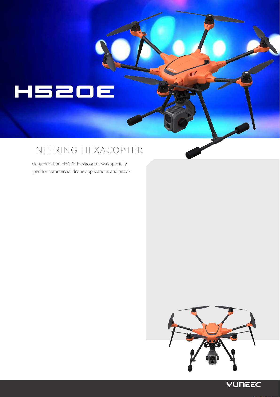
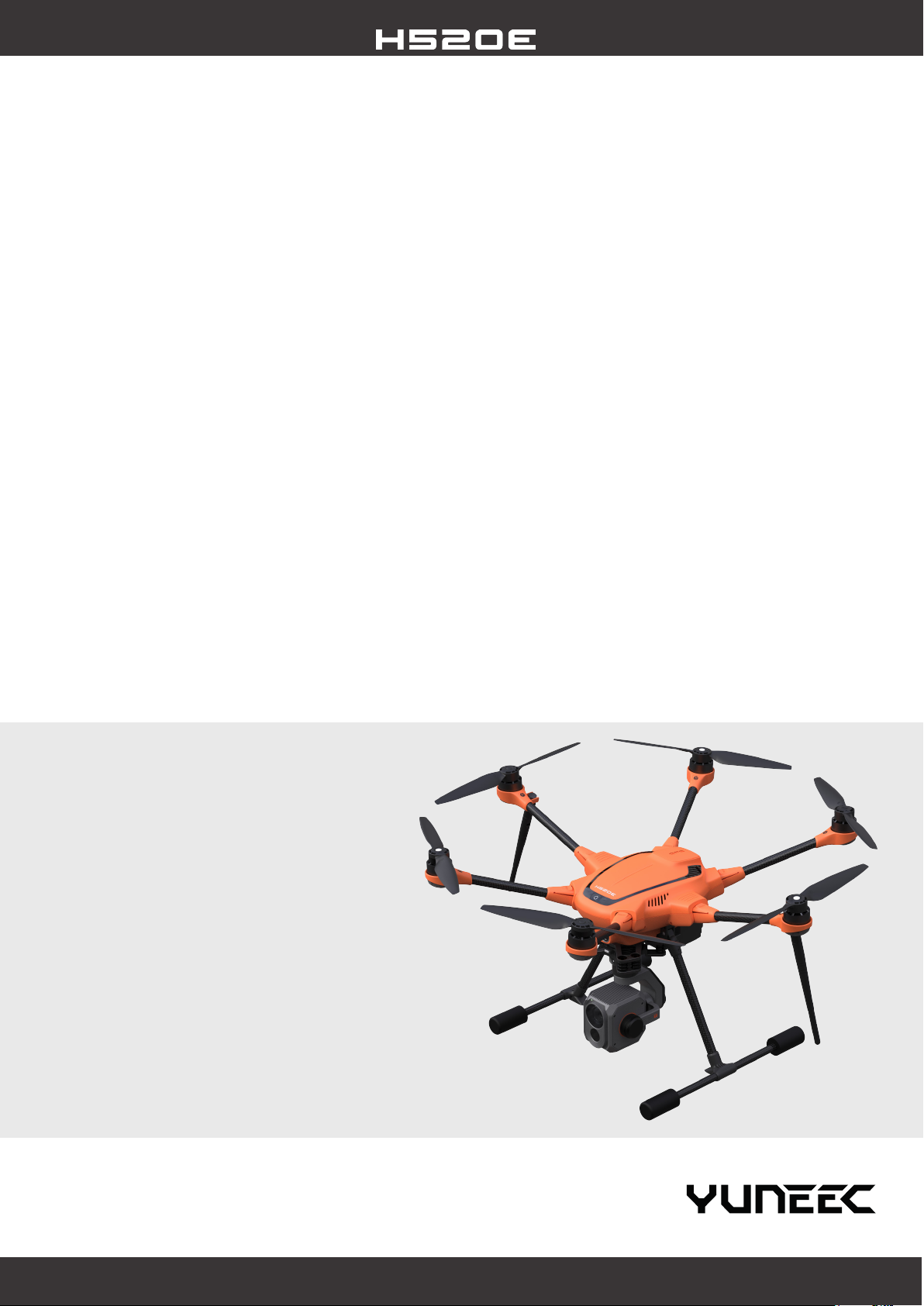
PIONEERING HEXACOPTER
This next generation H520E Hexacopter was specially
developed for commercial drone applications and provi-
des SAR ground teams, inspectors, police, re brigades
and surveying teams with a versatile tool. The H520E
is a robust, powerful and exible UAV platform that
can be ideally adapted to individual requirements and
thus enables a variety of industry-specic applications.
Long ight times and high-quality camera systems with
embedded GPS data allow an area to be recorded qui-
ckly and precisely, while the interference-free precision
compass enables ying even in previously difcult-to-y
environments.
SECURITY CONCEPT
The H520E was developed with the highest demands
on safety and functionality. The 6-rotor system enables
a stable and safe ight by ensuring that the H520E can
continue to y safely even if a rotor fails. Built-in
ultrasonic sensors allow the drone to detect obstacles
and avoid collisions, while the battery issues battery
warnings when the voltage is too low and nally changes
to a fail-safe function. In addition, the H520E is
equipped with a redundant control signal, a return home
and a geo fence function, which ensures that the drone
does not move beyond a radius specied by the user.
FEATURES
/ New Powerful ight control processor
/ New battery connector with fail safe design
/ New 3.5-7 km* long range OFDM module
/ Designed for professional, commercial and
governmental requirements
/ High-precision, low-interference compass
/ New 30 pin payload interface
/ No data transfer to external servers
/ Stable and safe 6 rotor system
/ Energy efcient and quiet operation
/ ST16E with integrated 7” touch display, voice output
and comprehensive DataPilot™ software
/ HDMI signal directly from the ST16E to output the
drone’s live image onto larger monitors
/ Mission planning on the computer or ST16E
Page 2
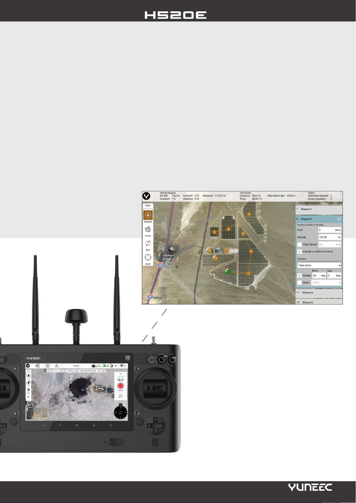
DATAPILOT™ SOFTWARE
DATA SECURITY
Yuneec DataPilot™ is a comprehensive software
solution for planning waypoint and survey missions, that
is fully integrated into the hardware and software of the
H520E. The DataPilot™ software system enables users
to efciently and consistently create orthomaps, 3D
scans, crop data imagery, in the eld or on the desktop
for repeatable, recallable aerial ight paths, without
requiring expensive third party software. DataPilot also
allows for storage of maps from many map providers for
access in areas with no connectivity, and provides tools
for precise waypoint placement even in areas where no
updated maps are available.
The H520E has been developed as a closed system, its
technical design prevents communication with third-
party servers. Communication only takes place between
the drone, the payload and the ST16E remote control.
Log les are stored locally in the drone and are only
required by Yuneec for service purposes in the event of
a guarantee. There is no involuntary data transfer to
servers. Neither ight data nor images, videos or log
les are forwarded to external servers and remain in
your possession. Thus, your data is optimally protected.
ST16E CONTROLLER
The Android-based ST16E is equipped with a fast Intel
quad-core processor and OFDM support. Thanks to
the OFDM support, the live image transmission can be
expanded up to 3.5-7 kilometers. The integrated 7 inch
display with touchscreen ensures precise and intuitive
operation of the H520E and shows all ight information
as well as the live image from the camera. The live image
can also be transferred to a larger monitor via the HDMI
output of the ST16E.
Page 3
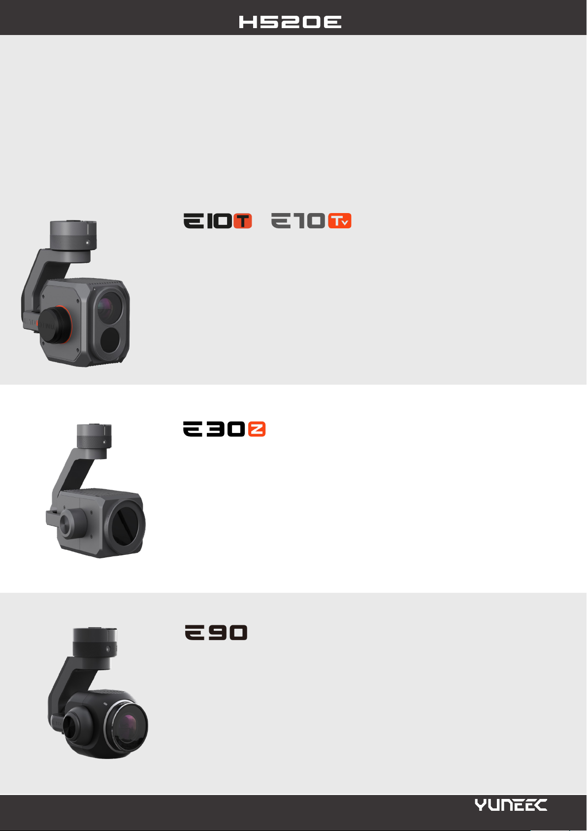
VERSATILE PAYLOAD OPTIONS WITH X CONNECTOR
Thanks to its multiple load options, the H520E can be easily adapted to different areas of application. Replace sensors in a
matter of seconds, downtime is minimized and productivity is improved. This means that one gimbal-
camera combination can be exchanged for another without power cycling the airframe.
X
X
/ Thermal imaging and residual light camera with FLIR® Boson sensor
/ 320 x 256 (E10TX) or 640 x 512 (E10TvX) thermal resolution
/ Supports DataPilot and mission planning
/ Dual video stream
/ 30 pin X-connector
/ 320° rotation of the gimbal for perfect image stabilization
/ High-value for inspection, law enforcement, fire fighting, search & rescue and
construction tasks
X
/ 30x optical zoom + 6x digital zoom
/ Autofocus
/ Defogging
/ 1080p video resolution
/ 30 pin X-connector
/ 2.55 s zoom speed (from wide to tele)
/ Ideal for law enforcement and inspection tasks
X
/ 20 megapixel / 4K resolution at 60 frames per second
/ 1“ CMOS sensor
/ Digital zoom up to 8x
/ 23 mm lens with low distortion
/ 30 pin X-connector
/ 320° rotation of the gimbal for perfect image stabilization
/ Ideally suitable for professional lm applications, 3D mapping / modeling
and search and rescue
Page 4
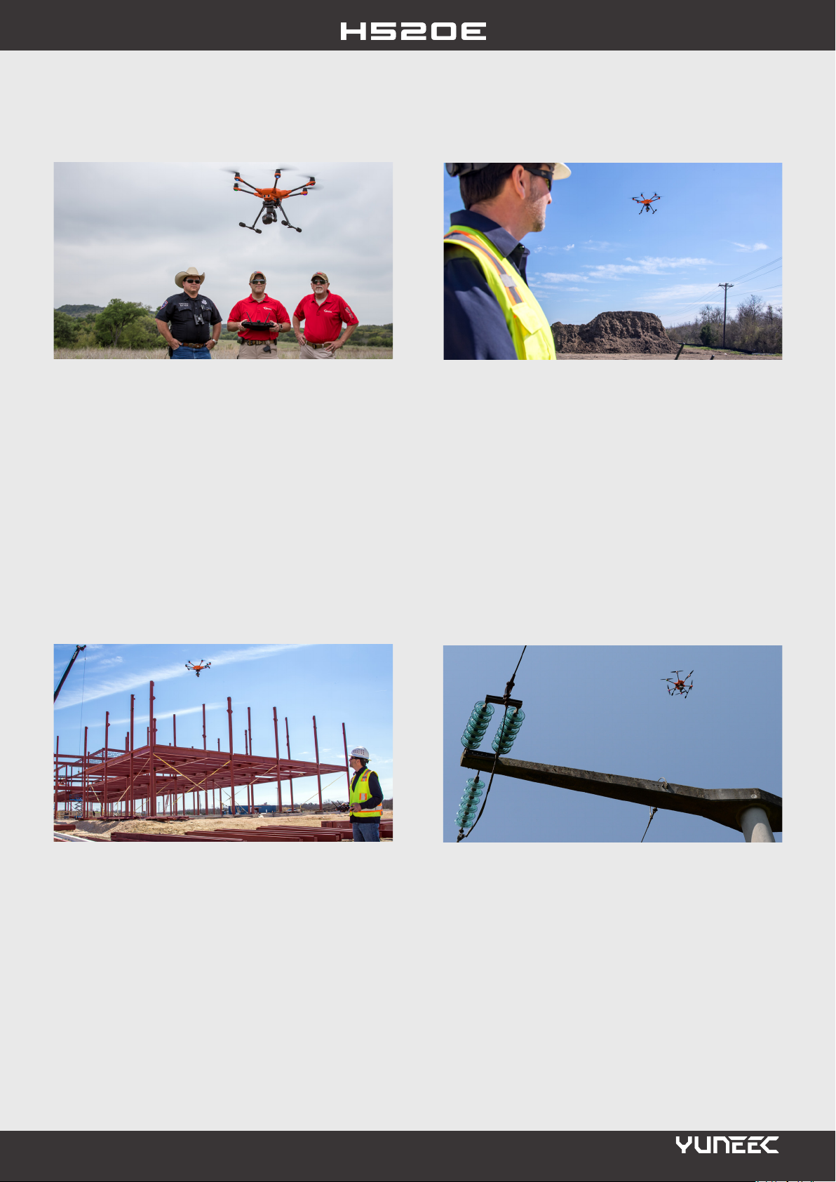
APPLICATION AREAS
/ Law Enforcement
Accident scene reconstruction, crime scene mapping, as
“eye in the sky” for crowd control, intelligence-
gathering, or monitoring of targeted areas - The H520E
empowers Law Enforcement ofcers to quickly record
an accident scene in 2D or 3D, for later assembly of data
for court appearances, reporting, or archiving. Camera
systems with embedded GPS data enables evidence-
gathering to be captured and examined before re
investigators or rst-responders have entered the area.
/ Search & Rescue
The Yuneec H520E enhances safety at a contaminated
scene, speeds rescue and recovery. Fireghters
appreciate the ability to “see” through smoke and rapidly
identify hotspots using thermal imaging, and the ability
to gain a birdseye view of operations on a large scene. In
addition, the drone can be used for scouting the route
ahead for obstacles, nding victims, photographing
remote crash sites, terrain mapping, crash site
monitoring or for improving communication
/ Site Mapping
Preconstruction survey, topographical measurements,
and project progress - The Yuneec H520E is
designed to y repeatable, perfect-placement ight over
construction sites, providing not only measurable and
demonstrable project data, but also helping to identify
shrink points, at-risk areas, or security breach points.
Autonomous ight allows for repeated ights that may
be layered to determine changes in the work site and
provide comparisons over time.
/ Inspecon
Vertical structures can be inspected safely and
efciently with the precise ight behavior of the H520E.
Long focal lengths allow users to y further back from
the object being viewed, without compromising image
quality or depth. DataPilot™ can store missions that
require weekly or monthy re-ight for purposes of
comparison, failure evaluation, or deterioration studies.
The safety improvement and cost reduction with sUAS
inspection are staggering in comparison.
Page 5
TECHNICAL SPECIFICATIONS
DRONE
Take Off Weight: 1860 g (excl. camera)
Diagonal Length: 520 mm (w/o rotor blades)
Dimensions: 551x482x309 mm
Fligth Time: 25-30 min
Max. Speed: 20 m/s
Max. Ascent Speed: 5 m/s
Max. Descent Speed: 3 m/s
Max. Flight Height: 500 m
Max. Angular Velocity: 120°/s
Battery: 4S-6200mAh Li-Ion
Motors: 720kV
Charger: SC4000-4H
Operating Temperature: 0°C - 40°C
Storage Temperature: -10°C - 50°C
OBSTACLE AVOIDANCE
Sensor: Ultrasonic
Flight Speed: 4 m/s
Operating Environment: Height > 1.5m
Distance to obstacles < 5 m
REMOTE CONTROL
Operating System: Android ™
Channels: 16
*Transmission Distance: Up to 3.5-7 km (3.5 km Europe)
Battery: 3.6V 8700mAh 31.32Wh Li-Ion
Frequency: 2.4 GHz
Videolink Frequency: 2.4 GHz
Videolink Resolution: 720 p
Screen: 7“
Operating Temperature: 0°C - 40°C
Video Outputs: HDMI
COMPATIBLE CAMERAS
E90x (YUNE90XEU)
CGOETx (YUNETXEU)
E30Zx (YUNE30ZXEU)
E10Tx (YUNE10TXEU
E10Tvx (YUNE10TVXEU)
RELEASE DATE
14-10-2020
H520E
YUNH520EEU / YUNH520EUK
YUNH520EUS
/H520E Hexacopter
/ OFDM module
/ST16E Remote Control
/2 Batteries 4S-6200mAh
/Charger
/SD Card
Yuneec Europe GmbH, Nikolaus-Otto-Straße 4, D- 24568 Kaltenkirchen, Germany
All pictures shown are for illustration purpose only. Actual products may vary due to product enhancement.
Camera not included.
Phone: +49 4191 93260, E-Mail: [email protected], www.yuneec.com
 Loading...