


User Manual
NavNGo iGO 8
Navigation software for mobile devices
UK English
December 2008, ver. 1.1
Copyright note
The product and the information contained herein is subject to change without prior notification.
This manual may not, in whole or in part, be reproduced or transmitted in any form either electronically or mechanically, including photocopying and recording, without the express written consent of Nav N Go Kft..
© 2008 - Nav N Go Kft.
Whereis® map data is © 2006 Telstra Corporation Limited and its licensors Data Source © 2006 Tele Atlas N.V.
Austria: |
© BEV, GZ 1368/2003 |
Denmark: |
© DAV |
France: |
© IGN France |
Great Britain: |
Ordnance Survey data with permission of Her Majesty’s Stationery Office © Crown |
|
Copyright |
Italy: |
© Geonext/DeAgostini |
Northern |
© Ordnance Survey of Northern Ireland |
Ireland: |
|
Norway: |
© Norwegian Mapping Authority, Public Roads Administration / Mapsolutions |
Switzerland: |
© Swisstopo |
The |
Topografische ondergrond |
|
Netherlands: |
||
Copyright © dienst voor het kadaster en de openbare registers, Apeldorn |
||
|
||
All rights reserved. |
||
2
Thank you for choosing NavNGo iGO 8 as your in-car navigator. Read the Quick Start Guide first and start using NavNGo iGO 8 right away. This document is the detailed description of the software. You can easily discover NavNGo iGO 8 while you are using it; however, we still recommend that you read this manual to understand the screens and the features of NavNGo iGO 8.
3
Table of contents |
|
1 Warnings and Safety information .................................................................................. |
7 |
2 Getting started with NavNGo iGO 8 .............................................................................. |
8 |
2.1 Simple and Advanced modes .................................................................................................. |
10 |
2.2 Buttons and other controls on the screen ............................................................................... |
12 |
2.2.1 Using keyboards............................................................................................................................. |
13 |
2.3 Using the map......................................................................................................................... |
14 |
2.3.1 Checking the details of a map location .......................................................................................... |
14 |
2.3.2 Manipulating the map .................................................................................................................... |
15 |
2.3.3 Lane information and Signposts..................................................................................................... |
17 |
2.3.4 Status information and hidden controls on the map....................................................................... |
18 |
2.3.5 Using the Cursor (the selected map location) ................................................................................ |
21 |
2.4 NavNGo iGO 8 concepts ........................................................................................................ |
22 |
2.4.1 Smart Zoom ................................................................................................................................... |
22 |
2.4.2 Position markers............................................................................................................................. |
23 |
2.4.2.1 Current GPS position and Lock-on-Road ............................................................................................... |
23 |
2.4.2.2 Returning to normal navigation.............................................................................................................. |
23 |
2.4.2.3 Selected location (Cursor) ...................................................................................................................... |
24 |
2.4.2.4 Original position in the Cursor menu ..................................................................................................... |
24 |
2.4.3 Daytime and night colour profiles.................................................................................................. |
24 |
2.4.4 Colour scheme in tunnels............................................................................................................... |
25 |
2.4.5 Route calculation and recalculation ............................................................................................... |
25 |
2.4.6 Itinerary.......................................................................................................................................... |
26 |
2.4.7 Track Logs ..................................................................................................................................... |
27 |
2.4.8 Route demonstration ...................................................................................................................... |
27 |
2.4.9 POI (Points of Interest) .................................................................................................................. |
27 |
2.4.10 Road Safety Cameras................................................................................................................... |
28 |
2.4.10.1 Camera types ........................................................................................................................................ |
29 |
2.4.10.2 Camera directions................................................................................................................................. |
29 |
2.4.11 Speed limit warning ..................................................................................................................... |
30 |
2.4.12 TMC (Traffic Message Channel)................................................................................................. |
30 |
3 Navigating with NavNGo iGO 8 ................................................................................... |
31 |
3.1 Selecting the destination of a route ........................................................................................ |
31 |
3.1.1 Selecting the Cursor as the destination .......................................................................................... |
31 |
3.1.2 Entering an address or part of an address....................................................................................... |
32 |
3.1.2.1 Entering an address ................................................................................................................................ |
32 |
3.1.2.2 Entering an address if house numbering is restarted.............................................................................. |
34 |
3.1.2.3 Entering an address without knowing the district/suburb....................................................................... |
35 |
3.1.2.4 Selecting an intersection as the destination ............................................................................................ |
36 |
3.1.2.5 Selecting a city centre as the destination ................................................................................................ |
37 |
4
|
3.1.2.6 Entering an address with a postal code .................................................................................................. |
38 |
|
3.1.2.7 Tips on entering addresses quickly ......................................................................................................... |
39 |
3.1.3 Selecting the destination from your Favourites.............................................................................. |
40 |
|
3.1.4 Selecting the destination from the POIs......................................................................................... |
40 |
|
3.1.5 Selecting the destination with saved POI search criteria ............................................................... |
41 |
|
3.1.6 Selecting the destination from the History..................................................................................... |
42 |
|
3.1.7 Selecting the destination by entering its coordinates ..................................................................... |
42 |
|
3.2 |
Creating a multi-point route (inserting a via point)............................................................... |
43 |
3.3 |
Creating a multi-point route (appending a new destination) ................................................. |
43 |
3.4 |
Editing the route ..................................................................................................................... |
44 |
3.5 |
Viewing the entire route on the map (Fit-to-Screen).............................................................. |
45 |
3.6 |
Watching the simulation of the route...................................................................................... |
45 |
3.7 |
Enabling Safety Mode............................................................................................................. |
46 |
3.8 |
Pausing the active route ......................................................................................................... |
46 |
3.9 |
Deleting the next via point from the route.............................................................................. |
46 |
3.10 Deleting the active route....................................................................................................... |
47 |
|
3.11 Using Track Logs ................................................................................................................. |
47 |
|
3.12 Saving the active route ......................................................................................................... |
48 |
|
3.13 Loading a saved route .......................................................................................................... |
49 |
|
4 Reference Guide (Advanced mode) .............................................................................. |
50 |
|
4.1 |
Map screen ............................................................................................................................. |
50 |
4.1.1 Icons on the map ............................................................................................................................ |
53 |
|
|
4.1.1.1 Battery, GPS position quality and Vehicle type indicator....................................................................... |
54 |
|
4.1.1.2 Status indicator strip............................................................................................................................... |
55 |
|
4.1.1.3 Next two route events (Turn Preview fields) ........................................................................................... |
56 |
4.1.2 Objects on the map......................................................................................................................... |
57 |
|
|
4.1.2.1 Streets and roads .................................................................................................................................... |
57 |
|
4.1.2.2 3D object types ....................................................................................................................................... |
57 |
|
4.1.2.3 Elements of the active route.................................................................................................................... |
58 |
4.1.3 Detour menu .................................................................................................................................. |
59 |
|
4.1.4 Cursor menu................................................................................................................................... |
59 |
|
4.1.5 Position menu ................................................................................................................................ |
61 |
|
4.1.6 Route Information screen............................................................................................................... |
61 |
|
4.1.7 Trip Information screen ................................................................................................................. |
62 |
|
|
4.1.7.1 Trip Computer screen ............................................................................................................................. |
64 |
4.1.8 Quick menu.................................................................................................................................... |
64 |
|
4.1.9 TMC Events screen........................................................................................................................ |
66 |
|
4.1.10 GPS Data screen .......................................................................................................................... |
67 |
|
4.2 |
Find menu............................................................................................................................... |
68 |
4.3 |
Route menu ............................................................................................................................. |
68 |
4.4 Manage menu ......................................................................................................................... |
70 |
|
5
4.4.1 Manage Saved Routes.................................................................................................................... |
70 |
4.4.2 Manage History.............................................................................................................................. |
71 |
4.4.3 Manage Track Logs ....................................................................................................................... |
71 |
4.4.4 Manage Favourites......................................................................................................................... |
72 |
4.4.5 Manage POIs.................................................................................................................................. |
72 |
4.4.6 Manage Saved Search Criteria....................................................................................................... |
73 |
4.4.7 User Data Management.................................................................................................................. |
74 |
4.5 Settings menu.......................................................................................................................... |
74 |
4.5.1 Map Screen settings ....................................................................................................................... |
76 |
4.5.2 Sound settings ................................................................................................................................ |
77 |
4.5.3 Route Planning options .................................................................................................................. |
78 |
4.5.4 Regional settings............................................................................................................................ |
80 |
4.5.5 Navigation settings......................................................................................................................... |
81 |
4.5.6 Warning settings ............................................................................................................................ |
82 |
4.5.7 GPS settings................................................................................................................................... |
83 |
4.5.8 TMC settings.................................................................................................................................. |
83 |
4.5.9 Menu settings................................................................................................................................. |
84 |
4.5.10 Device settings............................................................................................................................. |
85 |
4.5.11 Track Log settings........................................................................................................................ |
86 |
5 Glossary........................................................................................................................... |
87 |
6 End User Licence Agreement........................................................................................ |
89 |
6
1 Warnings and Safety information
NavNGo iGO 8 is a navigation system that helps you find your way to your destination with a connected GPS receiver. NavNGo iGO 8 does not transmit your GPS position; others cannot track you.
It is important that you look at the display only when it is safe to do so. If you are the driver of the vehicle, we recommend that you operate NavNGo iGO 8 before you start your journey. Plan the route before your departure and stop if you need to change something in the route.
NavNGo iGO 8 has a Safety Mode: if you turn on Safety Mode, you cannot change anything in NavNGo iGO 8 while the vehicle is moving at a speed of 10 km/h (6 mph) or higher. Unless only passengers operate NavNGo iGO 8, we strongly encourage you to turn on Safety Mode.
You must obey the traffic signs and follow the road geometry. If you deviate from the route that NavNGo iGO 8 recommended, NavNGo iGO 8 changes the instructions accordingly.
Never place mobile devices where it obstructs the driver's view, where it is in the deployment zone of an airbag or where it might cause injuries in an accident.
For more information, consult the End User Licence Agreement (page 89).
7
2 Getting started with NavNGo iGO 8
NavNGo iGO 8 is optimised for in-car use. You can use it easily by tapping the screen buttons and the map with your fingertips.
NavNGo iGO 8 can plan routes throughout the whole installed map set; you do not need to change maps or switch to a poorly detailed general map to navigate between map segments or countries.
|
Tasks |
|
|
|
Instructions |
|
|
|
|
|
|
|
|
|
|
|
|||
|
Using the retractable |
You do not need a stylus to use NavNGo iGO 8. Tap the buttons and the |
|||||||
|
stylus |
map with your fingertips. |
|
|
|
|
|
|
|
|
Double tapping the |
You do not need to tap the screen twice for any action. With buttons and |
|||||||
|
screen |
controls, a single tap is enough. |
|
|
|
|
|||
|
Tapping and holding |
You do not need this to access the basic navigation functions. Tap and keep |
|||||||
|
the screen |
||||||||
|
pressing the following buttons to reach extra functions: |
|
|
||||||
|
|
|
|
||||||
|
|
• |
Tap and hold |
on the Map screen: you can set the minimum and |
|||||
|
|
|
maximum zoom level of Smart Zoom. |
|
|
|
|
||
|
|
• |
Tap and hold any of the |
|
|
|
buttons on the |
||
|
|
|
Map screen: you can set or reset the zoom value of the button (2D |
||||||
|
|
|
map). |
|
|
|
|
|
|
|
|
• |
Tap and hold any of the |
|
|
|
buttons on the |
||
|
|
|
Map screen: you can set or reset the tilt and zoom values of the button |
||||||
|
|
|
(3D map). |
|
|
|
|
|
|
|
|
• |
Tap and hold |
|
on list and menu screens: the Navigation |
||||
|
|
|
menu appears. |
|
|
|
|
|
|
|
|
• |
Tap and hold any of the |
, |
, |
, |
, |
, and |
|
|
|
|
buttons on the Map screen: you can rotate, tilt or scale the map |
||||||
|
|
|
continuously. |
|
|
|
|
|
|
|
|
• |
Tap and hold |
|
on keyboard screens: you can delete |
||||
|
|
|
several characters quickly. |
|
|
|
|
||
|
|
• |
Tap and hold |
or |
in long lists: you can scroll pages |
||||
|
|
|
continuously. |
|
|
|
|
|
|
|
|
• Tap and hold the buttons in the Quick menu to open screens related |
|||||||
|
|
|
with the function of the button from the Manage menu or the Settings |
||||||
|
|
|
menu. |
|
|
|
|
|
|
|
|
• In portrait screen orientation there are symbols (instead of labels) on |
|||||||
|
|
|
the buttons at the bottom of the screen. Tap and hold any of these |
||||||
|
|
|
buttons, and its name pops up at the centre of the screen. |
|
|||||
|
|
|
|
|
|
|
|
|
|
|
Gestures (drag&drop) |
You do not need gestures to access the basic navigation features. You need |
|||||||
|
|
||||||||
|
|
to drag and drop the screen only in cases like: |
|
|
|
||||
|
|
• Moving the handle on a slider. |
|
|
|
|
|||
|
|
|
|
|
|
|
|
|
|
8
|
Tasks |
Instructions |
|
|
|
||
|
|
• Moving the map: grab the map, and move it in the desired direction. |
|
|
|
• Shortcut to open the Map screen: slide your finger from the bottom |
|
|
|
right corner to the bottom left corner on any screen. |
|
|
|
• Shortcut to open the Navigation menu: slide your finger from the top |
|
|
|
left corner to the bottom left corner on any screen. |
|
|
|
|
|
Start using NavNGo iGO 8
When NavNGo iGO 8 is started the first time, you need to do the following:
1.Select the written language of the application interface. Later you can change it in Settings (page 80).
2.Select the language and speaker used for voice guidance messages. Later you can change it in Settings (page 80).
3.Read and accept the End User Licence Agreement (page 89).
4.Select whether to start the program in Simple mode or in Advanced mode. Later you can switch between the two operating modes in Settings.
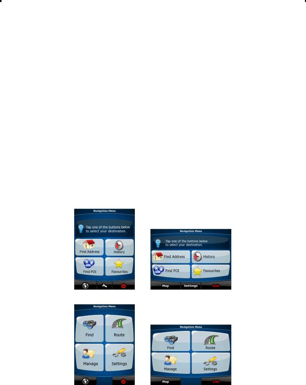
After this, the Navigation menu appears and you can start using NavNGo iGO 8. The Navigation menu in Simple mode:
The Navigation menu in Advanced mode:
The typical way of using NavNGo iGO 8 is to select a destination, and start navigating. You can select your destination in the following ways (not all of them are available in Simple mode):
•Use the selected location on the map (the Cursor) (page 31).
•Enter a full address or a part of an address, for example a street name without a house number or the names of two intersecting streets (page 32).
•Enter an address with postal code (page 38). This way you do not need to select the name of the settlement and the search for street names might be faster as well.
•Use a coordinate (page 42)
9

•Use a saved location:
•a Favourite (page 40)
•a POI (page 40)
•the History of previously set destinations and waypoints (page 42)
2.1 Simple and Advanced modes
The two operating modes of NavNGo iGO 8 mainly differ in the menu structure and the number of available features. The controls and screen layouts are the same.
•Simple mode: you have easy access to the most important navigation functions and the basic settings only. The rest of the settings are set to values that are optimal for typical use.
•Advanced mode: you have access to the full functionality of NavNGo iGO 8.
In portrait screen orientation:
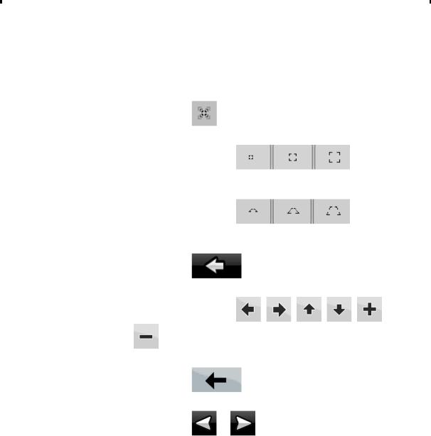
To switch from Simple mode to Advanced mode: on the startup screen (Navigation Menu), tap  ,
,  .
.
To switch from Advanced mode to Simple mode: on the startup screen (Navigation Menu), tap  ,
,
 .
.
In landscape screen orientation:
To switch from Simple mode to Advanced mode: on the startup screen (Navigation Menu), tap  ,
,  .
.
To switch from Advanced mode to Simple mode: on the startup screen (Navigation Menu), tap  ,
,
 .
.
The features and settings available in each mode are as follows:
|
Type of action |
Available in |
Available in |
Explanation |
|
|
|
||||
|
|
Simple mode |
Advanced |
|
|
|
|
|
mode |
|
|
|
|
|
|
|
|
|
Navigating to a selected map point |
Yes |
Yes |
See page 31 |
|
|
|
|
|
|
|
|
Navigating to a street address |
Yes |
Yes |
See page 32 |
|
|
Navigating to an incomplete address |
Yes |
Yes |
See page 32 |
|
|
Navigating to an intersection |
Yes |
Yes |
See page 36 |
|
|
Navigating to recent destinations (History) |
Yes |
Yes |
See page 42 |
|
|
Navigating to Favourites |
Yes |
Yes |
See page 40 |
|
|
Navigating to a POI |
Yes |
Yes |
See page 40 |
|
|
Navigating to coordinates |
No |
Yes |
See page 42 |
|
|
Creating a multi-point route |
No |
Yes |
See page 43 |
|
10
|
Type of action |
Available in |
Available in |
Explanation |
|
|
|
||||
|
|
Simple mode |
Advanced |
|
|
|
|
|
mode |
|
|
|
|
|
|
|
|
|
Saving a map point as a Favourite |
Yes |
Yes |
See page 59 |
|
|
destination |
|
|
|
|
|
Saving a map point as a POI |
No |
Yes |
See page 59 |
|
|
Saving a map point as a location of a Road |
No |
Yes |
See page 59 |
|
|
Safety Camera |
|
|
|
|
|
Mark a map point with a Pin |
No |
Yes |
See page 59 |
|
|
Saving the active route |
No |
Yes |
See page 48 |
|
|
Saving Track Logs |
No |
Yes |
See page 27 |
|
|
Map Screen settings |
Only colour |
Yes |
See page 76 |
|
|
|
profiles (from |
|
|
|
|
|
Quick Menu) |
|
|
|
|
Menu settings |
Only |
Yes |
See page 84 |
|
|
|
background |
|
|
|
|
|
picture |
|
|
|
|
Sound settings |
Yes (from Quick |
Yes |
See page 77 |
|
|
|
Menu) |
|
|
|
|
Route Planning options |
Yes |
Yes |
See page 78 |
|
|
Regional settings |
Only language |
Yes |
See page 80 |
|
|
|
selection |
|
|
|
|
Warnings |
No |
Yes |
See page 82 |
|
11

2.2 Buttons and other controls on the screen
When you are using NavNGo iGO 8, you usually tap buttons on the touch screen.
You only need to confirm selections or changes in NavNGo iGO 8 if the application needs to restart, it needs to perform a major reconfiguration, or you are about to lose some of your data or settings. Otherwise, NavNGo iGO 8 saves your selections and applies the new settings without confirmation as soon as you use the controls.
|
Type |
Example |
Description |
|
How to use it |
|
|
|
|
||||
|
Button |
|
Tap it to initiate a function, |
Tap it once. |
|
|
|
|
|
to open a new screen, or |
|
|
|
|
|
|
to set a parameter. |
|
|
|
|
|
|
|
|
|
|
|
Icon |
|
Shows status information. |
Some icons also function as a button. |
|
|
|
|
|
|
Tap them once. |
|
|
|
|
|
|
|
|
|
|
List |
|
When you need to select |
|
|
|
|
|
|
from several options, they |
Move between pages with the |
|
|
|
|
|
appear in a list. |
|
|
|
|
|
|
|
and |
buttons and tap the value |
|
|
|
|
|
that you want. |
|
|
|
|
|
|
|
|
|
|
Slider |
|
When a feature has |
• Drag the handle to move the |
|
|
|
|
|
several different unnamed |
|
slider to its new position. |
|
|
|
|
values, NavNGo iGO 8 |
• Tap the slider where you want |
|
|
|
|
|
shows an indicator on a |
|
||
|
|
|
gauge that displays and |
|
the handle to appear; the |
|
|
|
|
sets a value from a range. |
|
thumb jumps there. |
|
|
|
|
|
|
|
|
|
Switch |
|
When there are only two |
Tap it to turn the switch on or off. |
|
|
|
|
|
choices, a checkmark |
|
|
|
|
|
|
shows whether the feature |
|
|
|
|
|
|
is enabled. |
|
|
|
|
|
|
|
|
|
|
12
|
Type |
Example |
Description |
How to use it |
|
|
|
||||
|
Virtual |
|
Alphabetic and |
Each key is a touch screen button. |
|
|
|
|
|
||
|
keyboard |
|
alphanumeric keyboards |
|
|
|
|
|
to enter text and numbers. |
|
|
|
|
|
|
|
|
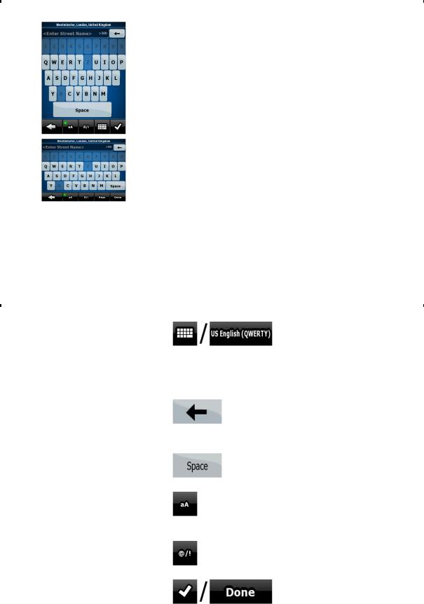
2.2.1 Using keyboards
You only need to enter letters or numbers in NavNGo iGO 8 when you cannot avoid it. You can type with your fingertips on the full-screen keyboards and you can switch between various keyboard layouts, for example ABC, QWERTY, or numerical.
|
Task |
|
Details |
|
|
|
|
||
|
Switching to another keyboard |
|
|
|
|
layout, for example from an English |
Tap |
, and select from the list of available |
|
|
QWERTY keyboard to a Greek |
keyboard types. |
|
|
|
keyboard |
|
||
|
NavNGo iGO 8 remembers your last keyboard choice and offers |
|
||
|
|
|
||
|
|
it the next time you need to enter data. |
|
|
|
|
|
|
|
|
Correcting your entry on the |
|
|
|
|
keyboard |
Tap |
to remove the unneeded character(s). |
|
|
|
|
||
|
|
Tap and hold the button to delete the entire input string. |
|
|
|
|
|
|
|
|
Entering a space, for example |
|
|
|
|
between a first name and a family |
Tap |
. |
|
|
name or in multi-word street names |
|
||
|
|
|
|
|
|
Entering lowercase or capital letters |
|
|
|
|
|
Tap |
to cycle through entering lowercase letters, initial |
|
|
|
capitals or all capitals. |
|
|
|
|
|
|
|
|
Entering symbols |
|
|
|
|
|
Tap |
to switch to a keyboard offering symbol characters. |
|
|
|
|
|
|
|
Finalising the keyboard entry |
|
|
|
|
|
Tap |
. |
|
|
|
|
|
|
13
2.3 Using the map
The map screen is the most frequently used screen of NavNGo iGO 8. It can be accessed from the Navigation menu by tapping 
 .
.
For further information about the map screen, see page 50.
2.3.1 Checking the details of a map location
•If you are interested in the details of your current position during navigation:
1.Check the bottom line of the map. It shows the current street and house number information.
2.For further details, tap  to open the Position menu.
3.Tap 
 . The address, the coordinate and the list of nearby POIs will be displayed.
•You can check the details of any other location by selecting it on the map:
1.Tap the map anywhere to open the map control buttons.
2.Tap the desired location on the map. The Cursor ( ) appears there. The address of the location is displayed at the bottom of the map.
3.For further details, tap  to open the Cursor menu.
4.Tap 
 . The address, the coordinate and the list of nearby POIs will be displayed.
•It is even easier if you select the desired point in the Find menu. Then the Cursor menu opens automatically. You only need to tap the 
 button.
14

2.3.2 Manipulating the map
Position markers on the map:
•Current GPS position:  (page 23)
•Selected location (Cursor):  (page 24)
The following controls help you modify the map view to suit your actual needs the best. Most of these controls appear only if you tap the map once, and disappear after a few seconds of inactivity.
|
Action |
Button(s) |
|
Description |
|
|
|
|
|
||||
|
Moving the map with |
No buttons |
You can move the map into any direction: |
|
||
|
drag&drop |
|
|
|||
|
|
tap and hold the map, and move your |
|
|||
|
|
|
|
|||
|
|
|
finger to the direction in which you want to |
|
||
|
|
|
move the map. |
|
|
|
|
|
|
If GPS position is available and you have |
|
||
|
|
|
moved the map, the |
button |
|
|
|
|
|
appears. Tap this button to return to the |
|
||
|
|
|
GPS position. |
|
|
|
|
|
|
|
|
|
|
|
Opening/closing map |
|
Tap this button to show or hide the |
|
||
|
control buttons |
|
|
|||
|
|
following map control buttons: |
|
|||
|
|
|
|
|||
|
|
|
• |
Zoom in/out |
|
|
|
|
|
• Rotate left/right (3D map only) |
|
||
|
|
|
• Tilt up/down (3D map only) |
|
||
|
|
|
• Zoom preset buttons (2D map only) |
|
||
|
|
|
• Tilt and zoom preset buttons (3D |
|
||
|
|
|
|
map only) |
|
|
|
|
|
• Return to GPS position button |
|
||
|
|
|
• |
Smart Zoom button |
|
|
|
|
|
|
|
|
|
|
Zooming in and out |
|
Changes how much of the map is |
|
||
|
|
|
|
|||
|
|
, |
displayed on the screen. |
|
|
|
|
|
NavNGo iGO 8 uses high-quality vector |
|
|||
|
|
|
|
|||
|
|
|
maps that let you see the map at various |
|
||
|
|
|
zoom levels, always with optimised |
|
||
|
|
|
content. It always displays street names |
|
||
|
|
|
and other text with the same font size, |
|
||
|
|
|
never upside-down, and you only see the |
|
||
|
|
|
streets and objects that you need. |
|
||
|
|
|
Map scaling has different limits in 2D and |
|
||
|
|
|
in 3D map view modes. |
|
|
|
|
|
|
|
|
|
|
|
Tilting up and down |
|
Changes the vertical view angle of the |
|
||
|
|
|
|
|||
|
|
, |
map in 3D mode. |
|
|
|
|
|
|
|
|
|
|
15

|
Action |
|
Button(s) |
Description |
|
|
|
|
|
||||
|
Rotating left and right |
|
|
Changes the horizontal view angle of the |
|
|
|
|
|
|
|
||
|
|
, |
|
map in 3D mode or in rotated 2D mode. |
|
|
|
|
|
When GPS position is available, NavNGo |
|
||
|
|
|
|
|
||
|
|
|
|
iGO 8 always rotates the map so its top |
|
|
|
|
|
|
faces your direction of travel (Track-Up |
|
|
|
|
|
|
orientation). You can turn away from |
|
|
|
|
|
|
Track-Up with these buttons. |
|
|
|
|
|
|
If GPS position is available and you have |
|
|
|
|
|
|
rotated the map, the |
button |
|
|
|
|
|
appears. Tap this button to re-enable the |
|
|
|
|
|
|
automatic map rotation. |
|
|
|
|
|
|
|
|
|
|
Viewing modes |
|
|
Gives you the following map perspectives |
|
|
|
|
|
|
|
||
|
|
, |
, |
in NavNGo iGO 8: |
|
|
|
|
• classic top-down view (2D), the top |
|
|||
|
|
|
|
|
||
|
|
|
|
of the map always faces North |
|
|
|
|
|
|
• top-down view (2D), the top of the |
|
|
|
|
|
|
map always points in the current |
|
|
|
|
|
|
driving direction |
|
|
|
|
|
|
• perspective view (3D) the top of the |
|
|
|
|
|
|
map always points in the current |
|
|
|
|
|
|
driving direction |
|
|
|
|
|
|
The icon always shows the mode the |
|
|
|
|
|
|
button switches to: If you are in 3D mode, |
|
|
|
|
|
|
you can see the |
button and you |
|
|
|
|
|
need to tap it to switch to 2D mode. |
|
|
|
|
|
|
|
|
|
|
Smart Zoom |
|
|
NavNGo iGO 8 can automatically rotate, |
|
|
|
|
|
|
|
||
|
|
|
|
scale and tilt the map and give you the |
|
|
|
|
|
|
optimal view: |
|
|
|
|
|
|
• When you are approaching a turn, |
|
|
|
|
|
|
NavNGo iGO 8 zooms in and |
|
|
|
|
|
|
raises the view angle to let you |
|
|
|
|
|
|
easily recognise your manoeuvre at |
|
|
|
|
|
|
the next junction. |
|
|
|
|
|
|
• If the next turn is at a distance, |
|
|
|
|
|
|
NavNGo iGO 8 zooms out and |
|
|
|
|
|
|
lowers the view angle to show you |
|
|
|
|
|
|
the road in front of you. |
|
|
|
|
|
|
Tap this button once to enable Smart |
|
|
|
|
|
|
Zoom. |
|
|
|
|
|
|
Tap&hold the button to set the zoom limits |
|
|
|
|
|
|
of Smart Zoom. |
|
|
|
|
|
|
|
|
|
|
Returning to normal |
|
|
Tap this button to move the map back to |
|
|
|
navigation (back to the GPS |
|
|
|
||
|
|
|
the current GPS position. If the map has |
|
||
|
position with automatic map |
|
|
|
||
|
|
|
been rotated, automatic map rotation is |
|
||
|
rotation) |
|
|
|
||
|
|
|
also re-enabled. |
|
|
|
|
|
|
|
|
|
|
|
|
|
|
|
|
|
16

|
Action |
Button(s) |
Description |
|
|
|
|||
|
Zoom preset buttons |
|
Tap one of the preset buttons to set the |
|
|
(available in Advanced |
|
|
|
|
|
zoom level to a fix, predefined value. |
|
|
|
mode only) |
|
|
|
|
|
Smart Zoom is disabled. These buttons |
|
|
|
|
|
|
|
|
|
|
are available in 2D mode. |
|
|
|
|
Tap&hold any of the buttons to set its |
|
|
|
|
value to the current zoom level, or to reset |
|
|
|
|
it to its original value. |
|
|
|
|
|
|
|
Tilt and zoom preset |
|
Tap one of the preset buttons to set the tilt |
|
|
buttons (available in |
|
|
|
|
|
and zoom levels to fix, predefined values. |
|
|
|
Advanced mode only) |
|
|
|
|
|
Smart Zoom is disabled. These buttons |
|
|
|
|
|
|
|
|
|
|
are available in 3D mode. |
|
|
|
|
Tap&hold any of the buttons to set its |
|
|
|
|
value to the current tilt and zoom levels, or |
|
|
|
|
to reset it to its original value. |
|
|
|
|
|
|
|
Map scale |
|
NavNGo iGO 8 shows the scale of the |
|
|
|
|
|
|
|
|
|
map in 2D mode. |
|
|
|
|
|
|
|
Fit-to-screen |
|
This button does not appear on the Map |
|
|
|
|
|
|
|
|
|
screen. It is available on the following |
|
|
|
|
screens: |
|
|
|
|
• Plan on Map screen: When you |
|
|
|
|
have an active route, you can |
|
|
|
|
display it in its full length on the |
|
|
|
|
map. |
|
|
|
|
• Track Information screen: A track |
|
|
|
|
log can be displayed in its full |
|
|
|
|
length on the map. |
|
|
|
|
|
|
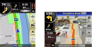
2.3.3 Lane information and Signposts
When navigating on multilane roads, it is important to take the appropriate lane in order to follow the recommended route. If lane information is available in the map data, NavNGo iGO 8 displays the lanes and their directions using small arrows either at the bottom or at the top of the map (the position of these arrows can be modified in Map Screen settings). Arrows in yellow represent the lanes you need to take.
Where there is additional information available, signposts substitute arrows. Signposts are always displayed at the top of the map. The colour and style of the signposts are similar to the real ones you can see above road or by the roadside. They show the available destinations and the number of the road the lane leads to.
All signposts look similar when cruising (when there is no recommended route). When navigating a route, only that signpost is displayed in vivid colours that points to the lane(s) to be taken; all others are darkened out.
17

2.3.4 Status information and hidden controls on the map
The following information appears in the rounded field in the top left corner, the Turn Preview field. When tapping this area, the result depends on the information currently shown.
|
Icon |
Information |
Details |
Action |
|
|
|
||||
|
|
There is no active |
If there is no route to be navigated in |
Tap this area to open |
|
|
|
route in Simple mode |
|
||
|
|
Simple mode, this icon appears in the |
Find Address. |
|
|
|
|
|
|
||
|
|
|
Turn Preview field. |
|
|
|
|
|
|
|
|
|
|
There is no active |
If there is no route to be navigated in |
Tap this area to open |
|
|
|
route in Advanced |
Advanced mode, this icon appears in |
Find. |
|
|
|
mode |
the Turn Preview field. |
|
|
|
|
There is no valid GPS |
If an active route exists, and there is |
Tap this area to open |
|
|
, |
position. |
no valid GPS position, the view of the |
the Route Information |
|
|
|
|
sky above you is shown with coloured |
screen. |
|
|
|
|
dots for each satellite. Some dots |
|
|
|
|
|
need to turn green to be able to |
|
|
|
|
|
navigate. |
|
|
|
|
|
|
|
|
|
|
If the icon is a static |
GPS position and an active route are |
Tap this area to make |
|
|
|
picture, route |
available, but automatic off-route |
NavNGo iGO 8 |
|
|
|
calculation is needed |
recalculation is switched off, and you |
recalculate the |
|
|
|
|
deviated from the route. |
recommended route. |
|
|
|
|
|
Automatic off-route |
|
|
|
|
|
recalculation is also re- |
|
|
|
|
|
enabled. |
|
|
|
If the icon is animated, |
NavNGo iGO 8 is calculating or |
Nothing happens if you |
|
|
|
route calculation is in |
recalculating the route. |
tap this area of the |
|
|
|
progress |
|
screen. |
|
|
|
Next route event (next |
GPS position and an active route are |
Tap this area to open |
|
|
, |
manoeuvre) |
available, and you navigate the |
the Route Information |
|
|
|
screen. |
|
||
|
|
|
recommended route. This area gives |
|
|
|
|
|
you information about the type and |
|
|
|
|
|
distance of the next route event. |
|
|
|
|
|
|
|
|
18
The following area appears next to the above described rounded area. When tapping this area, the result depends on the information currently shown.
|
Icon |
Information |
Details |
Action |
|
|
|
||||
|
|
There is no valid |
If there is no valid GPS |
Tap this area to open |
|
|
|
GPS position |
the GPS Data screen to |
|
|
|
|
position, this symbol appears |
|
||
|
|
|
here. |
check the signal status |
|
|
|
|
or the connection |
|
|
|
|
|
|
|
|
|
|
|
|
settings. |
|
|
|
Traffic restriction |
When GPS position is |
Nothing happens if you |
|
|
|
|
available but there is no route |
tap this area of the |
|
|
|
|
to be navigated, the traffic |
screen. |
|
|
|
|
restriction of the upcoming |
|
|
|
|
|
intersection is shown here if |
|
|
|
|
|
there is any. |
|
|
|
|
Second route event |
When GPS position and an |
Tap this area to open |
|
|
, |
(manoeuvre after |
active route are both |
the Itinerary screen with |
|
|
the next |
the turn by turn |
|
||
|
|
available, this field shows the |
|
||
|
|
manoeuvre) |
route event that follows the |
guidance instructions. |
|
|
|
|
|
|
|
|
|
|
next route event shown in the |
|
|
|
|
|
above described area. |
|
|
|
|
|
|
|
|
|
|
Approaching a |
This icon appears when you |
Tap this area to |
|
|
|
Road Safety |
|
||
|
|
are approaching a Road |
suppress the audible |
|
|
|
|
Camera |
|
||
|
|
Safety Camera, and the |
camera warning. |
|
|
|
|
|
|
||
|
|
|
warning for cameras is |
Tap again to display the |
|
|
|
|
enabled in Settings. |
|
|
|
|
|
second route event with |
|
|
|
|
|
|
|
|
|
|
|
|
the possibility to open |
|
|
|
|
|
the Itinerary. |
|
|
|
|
|
|
|
|
|
Stops the running |
This icon appears during |
Tap this area to stop the |
|
|
|
simulation |
simulation. |
|
|
|
|
Route Fly Over, Route |
|
||
|
|
|
|
|
|
|
|
|
Simulation, and Track Log |
|
|
|
|
|
playback. |
|
|
|
|
|
|
|
|
|
|
Route recalculation |
During route recalculation, |
Nothing happens if you |
|
|
|
progress |
this field shows the |
tap this area of the |
|
|
|
|
screen. |
|
|
|
|
|
recalculation progress |
|
|
|
|
|
|
|
|
|
|
|
between 0% and 100%. |
|
|
|
|
|
|
|
|
|
|
Indicator strip |
- sounds muted/enabled |
Tap this area to open |
|
|
|
the Itinerary screen with |
|
||
|
|
|
- Track Log recording |
the turn by turn |
|
|
|
|
guidance instructions. |
|
|
|
|
|
- TMC status |
|
|
|
|
|
|
|
|
|
|
|
|
|
|
19
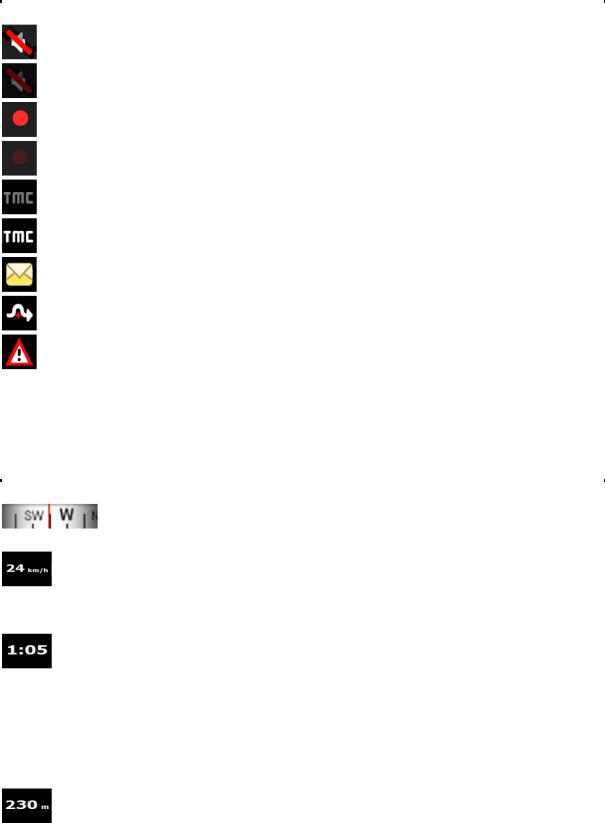
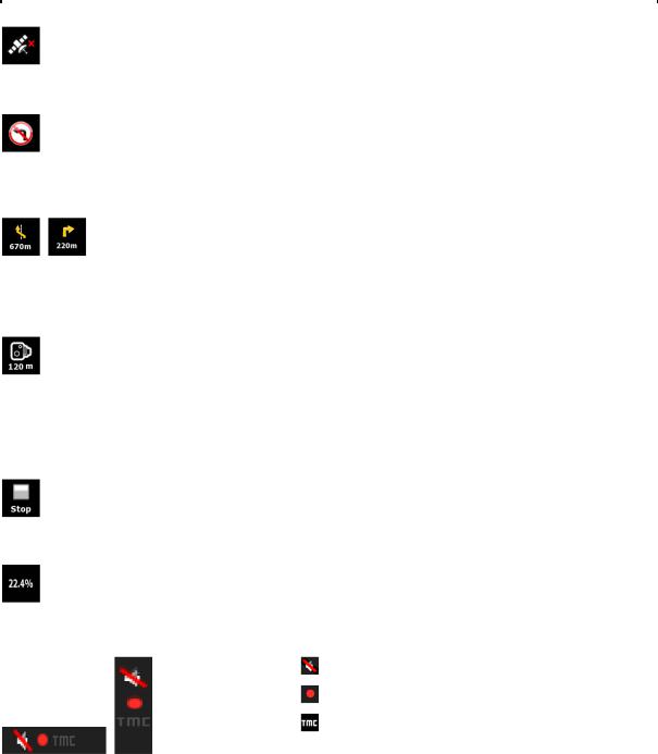
The following symbols appear in the Indicator strip:
|
Icon |
Description |
|
|
|
||
|
|
The sound output of NavNGo iGO 8 is muted. |
|
|
|
|
|
|
|
The sound output of NavNGo iGO 8 is enabled. |
|
|
|
|
|
|
|
NavNGo iGO 8 records a Track log when GPS position is available. |
|
|
|
|
|
|
|
Track log recording is disabled. |
|
|
|
|
|
|
|
No TMC receiver is connected or TMC is turned off. |
|
|
|
|
|
|
|
A TMC receiver is connected and a radio station with TMC broadcast is received. |
|
|
|
|
|
|
|
There are new, unread Traffic events. |
|
|
|
|
|
|
|
A part of the route is bypassed based on Traffic events. |
|
|
|
|
|
|
|
A part of the route is mentioned in Traffic events but it has not been bypassed (for |
|
|
|
example, even the best detour would be too long) or it could not be bypassed (for |
|
|
|
example, the destination is on a congested street). |
|
The following information can be seen in the three data fields shown on the map screen. Tap this area to open the Trip Information screen where you can select which values to be shown in these three fields.
When there is no active route, these fields show the following information: current speed, compass and the current time of day.
|
Icon |
Type |
|
More information |
|
|
|
|
|||
|
|
Compass |
Shows the direction of your heading both when the map is |
|
|
|
|
|
|
||
|
|
|
automatically rotated and when the map is always facing North. |
|
|
|
|
|
|
|
|
|
|
Speed information |
There are speed values that can be shown: |
|
|
|
|
|
|
||
|
|
|
• |
Current speed |
|
|
|
|
• Speed limit on the current road |
|
|
|
|
|
|
|
|
|
|
Time information |
There are time values that can be shown: |
|
|
|
|
|
|
||
|
|
|
• |
Current GPS time |
|
|
|
|
• Time remaining to reach the destination |
|
|
|
|
|
• Time remaining to reach the next via point |
|
|
|
|
|
• Estimated arrival time at the destination |
|
|
|
|
|
• Estimated arrival time at the next via point |
|
|
|
|
|
|
|
|
|
|
Distance |
There are distance type values that can be shown: |
|
|
|
|
information |
|
||
|
|
• Distance remaining to reach the destination |
|
||
|
|
|
|
||
|
|
|
• Distance remaining to reach the next via point |
|
|
|
|
|
• |
Current altitude |
|
|
|
|
|
|
|
20
The next area is a combined status indicator field. Tap this area to open the Quick menu (page 64).
|
Icon |
Status for |
More information |
|
|
|
|||
|
|
GPS position |
A higher number of lit bars indicates better GPS position |
|
|
|
quality |
|
|
|
|
accuracy. |
|
|
|
|
|
|
|
|
|
|
|
|
|
|
Battery status |
The device is running on battery power. The number of |
|
|
|
|
lit bars represent the remaining capacity. |
|
|
|
|
|
|
|
|
The battery is |
The device is running on external power. The battery is |
|
|
|
being charged. |
|
|
|
|
being charged |
|
|
|
|
|
|
|
|
|
|
|
|
|
|
Vehicle type |
The symbol displays the vehicle type used for route |
|
|
|
|
|
|
|
|
|
calculation. |
|
|
|
|
|
|
2.3.5 Using the Cursor (the selected map location)
First, place the Cursor at the desired map location with one of the following options:
•Use the Find menu to select a location. The map returns with the selected point (the Cursor) in the middle, and the Cursor menu appears with the available options.
•Tap the screen and tap again to place the Cursor at the desired location. Now tap  to open the Cursor menu.
You can perform the following actions in Simple mode:
Button |
Action |
|
Creates a new route with the Cursor as the destination. The previous route |
|
(if exists) is deleted. |
|
|
|
Saves the Cursor as a Favourite destination |
|
|
|
Opens a screen with the name, address and coordinate information of the |
|
Cursor, and the list of POIs near it |
|
|
21
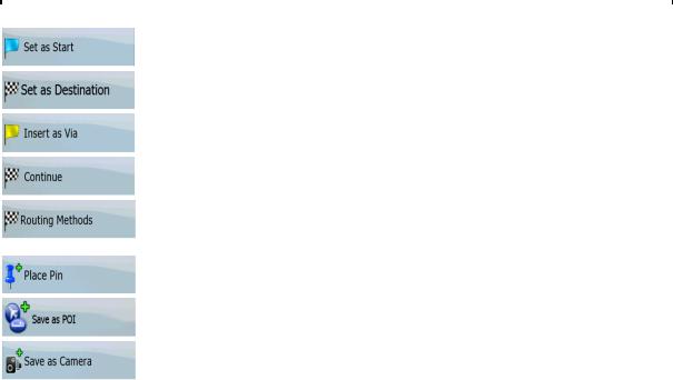
The following options are available in Advanced mode only:
|
Button |
Action |
|
|
|
||
|
|
In the active route, uses the Cursor as the start point by replacing the |
|
|
|
current GPS position (available in Advanced mode only) |
|
|
|
|
|
|
|
Creates a new route with the Cursor as the destination. The previous route |
|
|
|
(if exists) is deleted. |
|
|
|
|
|
|
|
In the active route, uses the Cursor as a via point (an intermediate |
|
|
|
destination) preceding the destination (available in Advanced mode only) |
|
|
|
|
|
|
|
In the active route, uses the Cursor as the destination while keeping the |
|
|
|
previous destination as a via point (available in Advanced mode only) |
|
|
|
|
|
|
|
Shows the different routes calculated by the available routing methods. |
|
|
|
Choose the one that suits your needs the best (available in Advanced mode |
|
|
|
only) |
|
|
|
Marks the map with a Pin at the Cursor (available in Advanced mode only) |
|
|
|
|
|
|
|
Saves the Cursor as a POI (available in Advanced mode only) |
|
|
|
|
|
|
|
Saves the Cursor as a Road Safety Camera location (available in Advanced |
|
|
|
mode only) |
|
|
|
This button is not displayed when GPS position is not available or if you are |
|
|
|
in certain countries where Road Safety Camera warning is prohibited. Even |
|
|
|
if the button is available, you are responsible for checking whether it is legal |
|
|
|
to use this feature at your location. |
|
|
|
|
|
2.4NavNGo iGO 8 concepts
2.4.1Smart Zoom
Smart Zoom provides much more than just a usual automatic zoom feature:
•While following a route calculated by NavNGo iGO 8: when approaching a turn, it will zoom in and raise the view angle to let you easily recognise your manoeuvre at the next junction. If the next turn is at a distance, it will zoom out and lower the view angle to be flat so you can see the road in front of you.
•While driving without an active route in NavNGo iGO 8: Smart Zoom will zoom in if you drive slowly and zoom out when you drive at high speed.
Enabling Smart Zoom
Tap the map to let the map control buttons appear, and then tap  to enable Smart Zoom.
22

Fine-tuning Smart Zoom
Tap the map to let the map control buttons appear, and then tap and hold  to open the Smart Zoom Settings window. Modify the zoom limits of Smart Zoom if necessary.
2.4.2Position markers
2.4.2.1Current GPS position and Lock-on-Road
When your GPS position is available, NavNGo iGO 8 marks your current position with the  icon on the map.
The exact location of the position marker depends on the vehicle type used for route calculation. The vehicle type can be selected in Route settings (page 78) or in the Quick Menu (page 64).
•If you choose pedestrian: The  icon is at your exact GPS position. The direction of the icon shows your actual heading.
•If you choose any of the vehicles: The  icon may not show your exact GPS position and heading. If roads are near, it is aligned to the nearest road to suppress GPS position errors, and the direction of the icon is aligned to the direction of the road.
To use the current GPS position, tap  . The Position menu appears and you can save the GPS position as one of the following:
•a Favourite
•a Road Safety Camera
•a POI
•a map marker Pin
2.4.2.2 Returning to normal navigation
When GPS position is available, and you have moved the map (the  icon is moving or is not
even visible), or you have rotated the map, the  button appears. Tap it to move the map back to the GPS position and re-enable automatic map rotation.
 Note! Even if you move the map while you are driving, NavNGo iGO 8 continues navigating if there is an active route: it plays the voice instructions and displays the turn preview
icons according to your current GPS position.
23
2.4.2.3 Selected location (Cursor)
If you select a location in the Find menu, or you tap the map when the map control buttons are visible, the Cursor appears at the selected point on the map. NavNGo iGO 8 displays the Cursor with a
radiating red dot ( ) to make it visible at all zoom levels, even when it is in the background of a 3D map view.
When the Cursor is set, tap  . The Cursor menu appears and you can use the Cursor as one of the following:
•the start point of a route
•a via point in a route
•the destination of a route
You can also search for POIs around the Cursor.
Or you can save the location of the Cursor as:
•a Favourite
•a Road Safety Camera
•a POI
•a map marker Pin
2.4.2.4 Original position in the Cursor menu
When the Cursor menu is open, a special icon ( ) shows the Cursor position the menu was opened with.
You can move and zoom the map, and you can set the Cursor to a different place. The usual Cursor ( ) appears, and the buttons of the Cursor menu initiate actions for this new location.
To return to the original Cursor position, tap  . The map jumps back to the position with which the Cursor menu was opened, and the
  icon appears again.
2.4.3 Daytime and night colour profiles
NavNGo iGO 8 uses different colour profiles during the day and during the night.
•Daytime colours are similar to paper road maps.
•The night colour profiles use dark colours for large objects to keep the average brightness of the screen low.
NavNGo iGO 8 offers different daytime and night colour profiles. It can also switch automatically between the daytime and the night schemes based on the current time and GPS position a few minutes before sunrise, when the sky has already turned bright, and a few minutes after sunset, before it becomes dark.
24
2.4.4 Colour scheme in tunnels
When entering a tunnel, the colours of the map change. All buildings disappear, large objects (such as surface waters or forests) and empty areas between roads become black.
However, roads and streets keep their original colours from the daytime or night colour scheme currently used.
After leaving the tunnel, the original colours return.
2.4.5 Route calculation and recalculation
NavNGo iGO 8 calculates the route based on your preferences:
•Route calculation method:
•Fast
•Short
•Economical
•Easy
•Vehicle types :
•Car
•Taxi
•Bus
•Emergency vehicles
•Bicycle
•Pedestrian
•Road types
•Unpaved Roads
•Permit Needed
•Motorways
•Per-use Toll
•Period Charge
•Ferries
•Cross-border Planning
NavNGo iGO 8 automatically recalculates the route if you deviate from the proposed itinerary.
Depending on the type of the TMC event, NavNGo iGO 8 also recalculates the route if a TMC event concerns a part of the recommended route.
For further information about Route Planning options, see page 78.
25
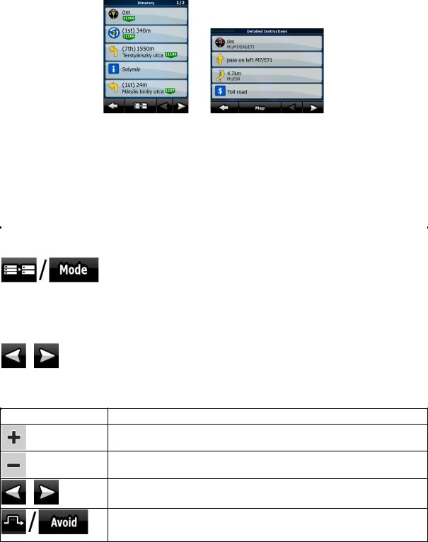
2.4.6 Itinerary
The Itinerary is the list of the route events, that is, the driving instructions.
When you are on the Map screen, you can display the Itinerary in one of the following ways:
•Tap the area between the Turn preview and the Travel data fields where the symbol of the second next manoeuvre is displayed (for example  ).
).
•In Advanced mode, tap the following buttons:  ,
,  ,
,  .
.
You have the following options on the Itinerary screen:
|
Button |
Description |
|
|
|
||
|
Any of the list items |
Opens the map with the selected manoeuvre in the middle. |
|
|
|
Changes the detail level of the Itinerary. The levels are as follows: |
|
|
|
• Detailed Instructions: all intersections are listed |
|
|
|
• Itinerary: only significant intersections (the ones announced in voice |
|
|
|
guidance) are listed |
|
|
|
• Road list: the list of the roads used while navigating the route |
|
|
|
|
|
|
, |
Moves between pages for additional list items. |
|
|
|
|
When the map is open with a manoeuvre in the middle:
Button |
Description |
Zooms in the map.
Zooms out the map.
Moves the map to show the previous or next manoeuvre.
,
Opens a screen where you can avoid a part of the route starting from the selected manoeuvre.
26
2.4.7 Track Logs
NavNGo iGO 8 can log the track that you drive (page 47).
A Track Log is a recording of how your GPS position changed and it is independent of the route NavNGo iGO 8 calculated.
Track Logs can be recorded, renamed, replayed, shown on the map, exported to a memory card in GPX format, and deleted. See page 71.
Independently of the normal track log, you can instruct NavNGo iGO 8 to record the native GPS data received from the GPS device. These logs are saved as separate text files on the memory card, and they cannot be shown or replayed in NavNGo iGO 8.
To turn on NMEA/SIRF log saving, tap the following buttons: |
, |
, |
, |
. |
|
|
|
2.4.8 Route demonstration
A simulation drives you through the route, following the driving instructions (page 45). You can choose from a simulation at high speed or at normal driving speed.
You can use it, for example, to see which bridge NavNGo iGO 8 planned for the route; if you do not want to take that bridge, you can avoid it.
Route demonstrations can be started from the Route menu by tapping the 
 (high speed simulation) or the
 (simulation at normal speed) button.
2.4.9 POI (Points of Interest)
A point of interest (POI) is a location that someone might find useful or interesting. NavNGo iGO 8 is delivered with thousands of POIs and you can also create your own POIs in the application.
POI locations are marked on the map with special icons. POI icons are quite large so you can easily recognise the symbol. The icons are semi-transparent: they do not cover the streets and intersections behind them.
POIs are grouped into several levels of categories and subcategories. The icon of a POI that comes with the map shows the symbol of the POI category. If you save your own POI, you can select an icon for it independently of the POI category you have put it in.
Saving POIs
To save a POI, place the Cursor ( ) at the desired location, then tap the following buttons:
  ,
,  ,
,  .
.
27

Managing POIs
You can select which POI groups to show and which ones to hide on the map, and from which zoom levels POI icons are visible. At the same place you can manage your saved POIs. A saved POI can be renamed, moved to a different POI group, its icon can be changed, or a phone number and
additional information can be added to it. Tap the following buttons:  ,
,  ,
,  .
.
2.4.10 Road Safety Cameras
The location of a Road Safety Camera is a special POI. These cannot be searched like other POIs, and there is a special proximity warning only for cameras.
Is the device shipped with a built-in database of Road Safety Cameras? |
No |
|
|
|
|
Can Road Safety Camera locations be uploaded in a text file? |
Yes |
|
|
|
|
Can you save the Cursor as the location of a Road Safety Camera? |
Yes |
Saving Road Safety Cameras
To save the location of a Road Safety Camera, place the Cursor ( ) at the desired location, then tap the following buttons:
  ,
,  ,
,  .
.
 Note! This button is not displayed when GPS position is not available or if you are in certain countries where Road Safety Camera warning is prohibited. Even if the button is available, you are responsible for checking whether it is legal to use this feature at your location.
Camera warning
The warning for Road Safety Cameras can be turned on in Warning Settings. Tap the following
buttons:  ,
,  ,
,  ,
,  .
.
When you approach a Road Safety Camera with the warning enabled, the following happens:
•Visible Warning: The type and distance of the camera is displayed in the secondary Turn Preview field (for example  ).
).
•Audible Warning: If there is no speed limit specified for the camera, or your speed is under the specified speed limit, single beeps warn you about the camera.
•If you exceed the speed limit of the camera, the following also happens:
•Visible Warning: A symbol with the speed limit appears in the corner of the map (for example:  ),
),
28
 Loading...