

Page 1

NAVIGATION SYSTEM
Page 2
Marked Point
Direct De
After Rou
Route Ch
Prod
Setup
Precautions/S
Troubleshoot
Maintenance
Destin
Charac
POI Ico
Accessories
Laser Produc
Contents
. . .
Safety Inform
Introduction
Names and F
Before U
Contents, Accessories, and Laser
Before Use
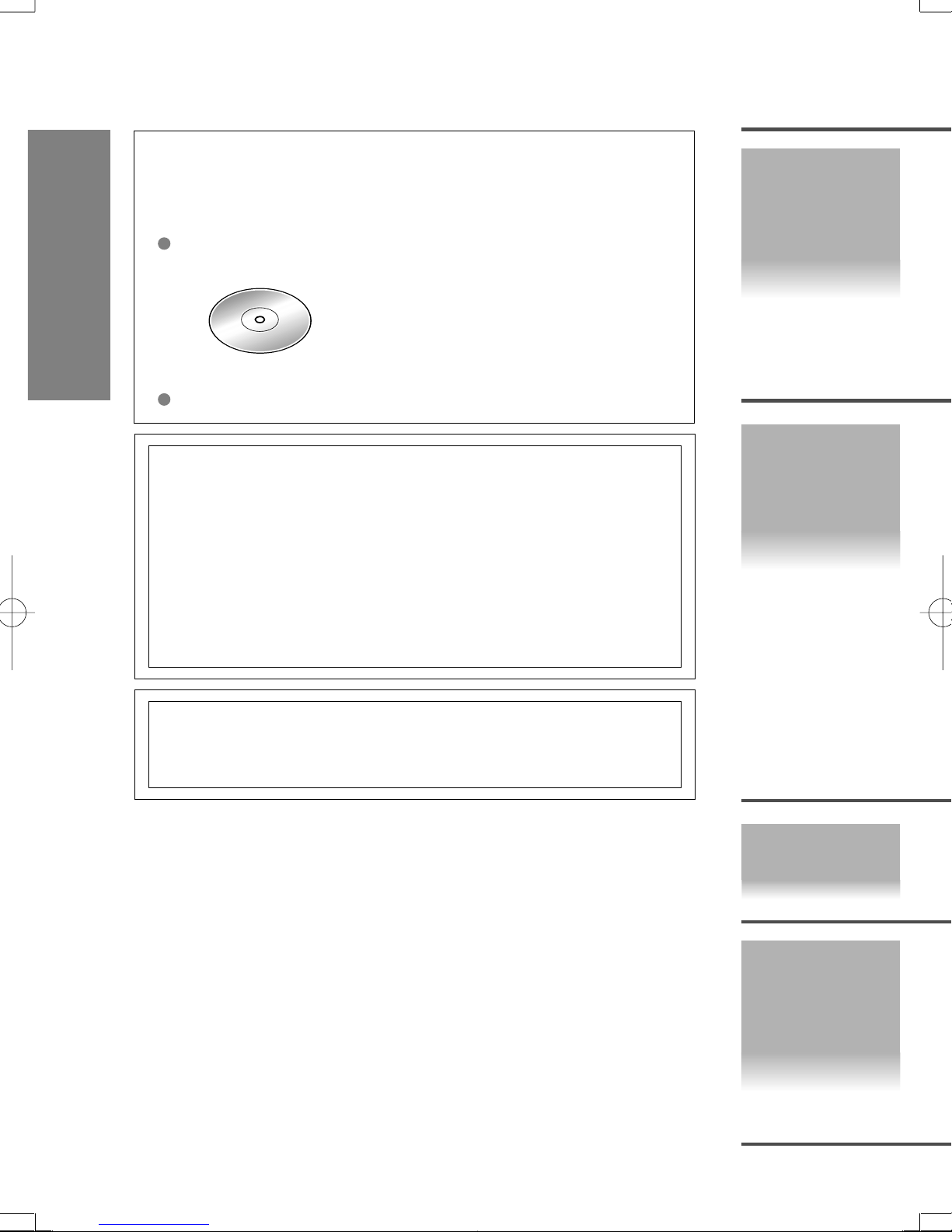
Accessories
Please contact an Authorized Mazda Dealer if you are
missing any of the following accessories.
CAUTION:
THIS PRODUCT IS A CLASS LASER PRODUCT .
HOWEVER THIS PRODUCT USES A VISIBLE/INVISIBLE LASER BEAM
WHICH COULD CAUSE HAZARDOUS RADIATION EXPOSURE IF DIRECTED.
BE SURE TO OPERATE THIS PRODUCT CORRECTLY AS INSTRUCTED.
USE OF CONTROLS OR ADJUSTMENTS OR PERFORMANCE OF
PROCEDURES OTHER THAN THOSE SPECIFIED HEREIN MAY RESULT IN
HAZARDOUS RADIATION EXPOSURE. DO NOT OPEN COVERS AND DO
NOT REPAIR YOURSELF. REFER SERVICING TO QUALIFIED PERSONNEL.
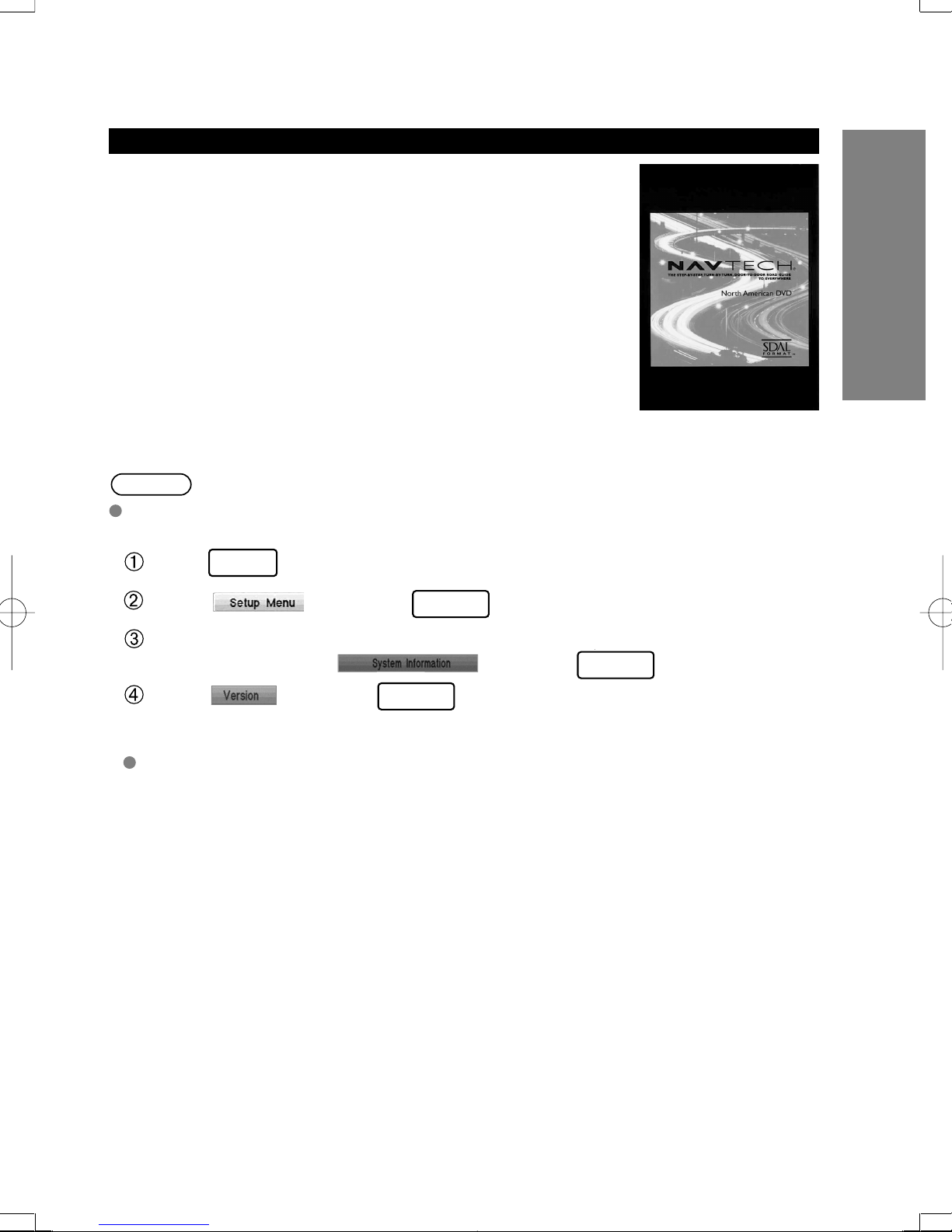
Map Disc
Owner's Manual
Preparation
Imme-
I
diate
use
Laser products:
Wave length: 650 nm
Laser power: No hazardous radiation is emitted with safety protection.
Advanced
use
If
necessary
2
Page 3

Product
Accessories
Laser Product
Contents
Safety Information
Introduction
Names and Functions
Before Use
. . . . . . . . . . . . . . . . . . . . . . . . . . . . . . . . . . . . . . . . . . . . . . . . . . . . . . . . . . . . . . . . .
. . . . . . . . . . . . . . . . . . . . . . . . . . . . . . . . . . . . . . . . . . . . . . . . . . . . . . . . . . . . . . .
. . . . . . . . . . . . . . . . . . . . . . . . . . . . . . . . . . . . . . . . . . . . . . . . . . . . . . . . . . . . . . . . . . . .
. . . . . . . . . . . . . . . . . . . . . . . . . . . . . . . . . . . . . . . . . . . . . . . . . . . . . . . . . . .
. . . . . . . . . . . . . . . . . . . . . . . . . . . . . . . . . . . . . . . . . . . . . . . . . . . . . . . . . . . . . . . . .
. . . . . . . . . . . . . . . . . . . . . . . . . . . . . . . . . . . . . . . . . . . . . . . . . . . . . .
●
Activation
●
Pop Up Menu
●
System Operation Verification
●
Screen Quality Adjustment
●
Map Display
●
Changing the map Orientation/Scale
. . . . . . . . . . . . . . . . . . . . . . . . . . . . . . . . . . . . . . . . . .
. . . . . . . . . . . . . . . . . . . . . . . . . . . . . . . . . . . . . .
. . . . . . . . . . . . . . . . . . . . .
. . . . . . . . . . . . . . . . . . . . . . . .
. . . . . . . . . . . . . . . . . . . . . . . . . . . . . . . . . . . . . . .
. . . . . . . . . . . . .
Destination Entry and Route Search
●
Destination by address
●
Destination by intersection
●
Destination by Point of Interest (POI) categories
●
Destination by history
●
Destination by a marked point
●
Destination by the map
Character Entry
10
12
14
15
16
18
19
20
22
2
2
3
4
8
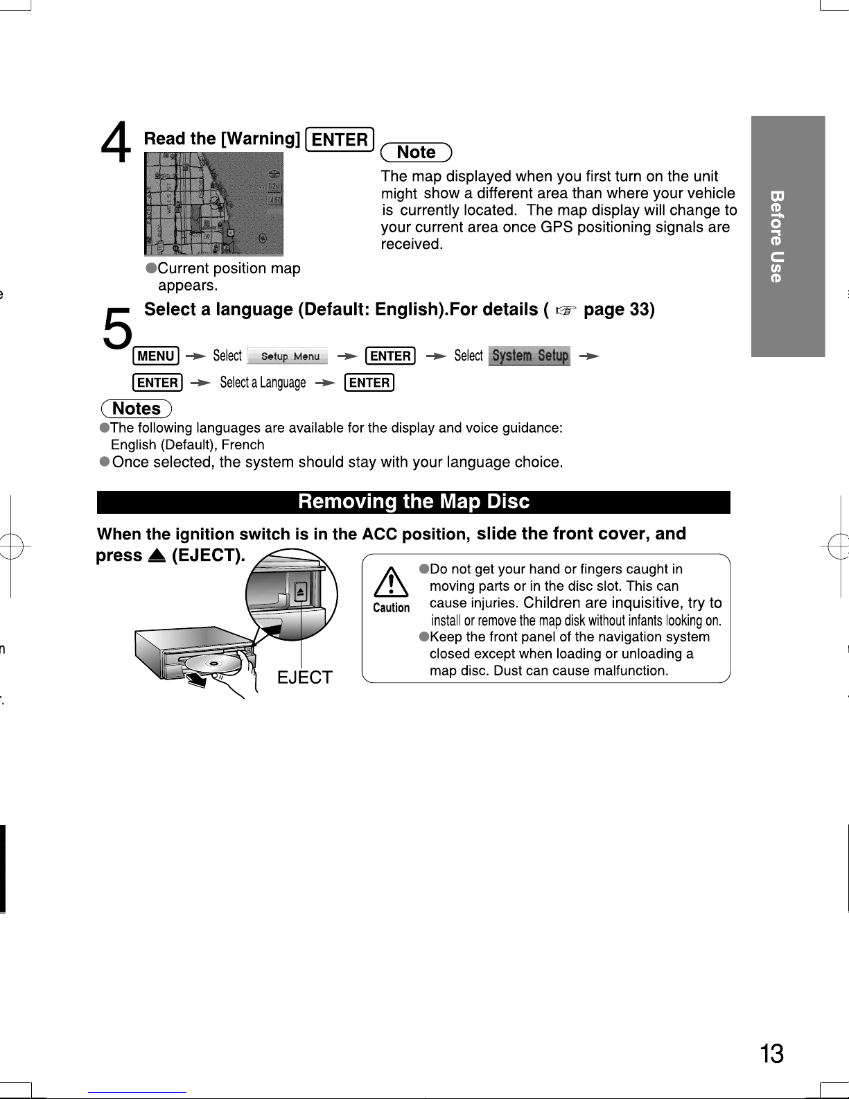
Before Use
Routing
POI Icons on Maps / Zipcode Entry
Direct Destination Input
●
After Routing
Route Changes
Marked Point
Setup
Precautions/System Performance
Troubleshooting
Maintenance
. . . . . . . . . . . . . . . . . . . . . . . . . . . . . . . . . . . . . . . . . . . . . . . . . . . . . . . . . . . . . .
Route Search Cancellation, Whole Route display,,
Route guidance cancellation
●Voice Guidance . . . . . . . . . . . . . . . . . . . . . . . . . . . . . . . . . . . . . . .
●Automatic Distance Correction . . . . . . . . . . . . . . . . . . . . . . . . . . .
●GPS . . . . . . . . . . . . . . . . . . . . . . . . . . . . . . . . . . . . . . . . . . . . . . . . .
●Map Matching . . . . . . . . . . . . . . . . . . . . . . . . . . . . . . . . . . . . . . . . .
●Positioning Accuracy . . . . . . . . . . . . . . . . . . . . . . . . . . . . . . . . . . .
●Route Guide . . . . . . . . . . . . . . . . . . . . . . . . . . . . . . . . . . . . . . . . . .
●Route Search . . . . . . . . . . . . . . . . . . . . . . . . . . . . . . . . . . . . . . . . .
●Verification First . . . . . . . . . . . . . . . . . . . . . . . . . . . . . . . . . . . . . . .
●Error Messages . . . . . . . . . . . . . . . . . . . . . . . . . . . . . . . . . . . . . . . .
23
24
25
26
28
30
34
34
35
35
36
36
37
38
40
41
Marking
User setting
As
necessary
3
Page 4

Safety Information
W
Warning
■
D
Do
be
■
N
Do
pr
Warnings
■Read this owner's manual for your Navigation System carefully before using the system.
They contain instructions about how to use the system in a safe and effective manner.
Mazda assumes no responsibility for any problems resulting from failure to observe the instructions
given in this manual.
Before Use
■This manual uses pictographs to show you how to use the product safely and to alert you to potential
dangers resulting from improper connections and operation. The meanings of the pictographs are
explained below. It is important that you fully understand the pictographs and explanations in order to
use this manual and the system properly.
Warning
Warnings
Warning
■
Do not keep your eyes fixed on the monitor screen or operate the system
while driving.
Do not change the settings and destination locations while driving. Minimize the time
spent on viewing the monitor screen and listening to the voice guidance while driving.
Operating the system will distract the driver from looking ahead of the vehicle and can
cause accidents. Always stop the vehicle in a safe location and use the parking brake
before operating the system.
■
Always obey local traffic regulations.
Your guided route may include roads that are not open to vehicles or are closed due to
traffic regulations. Comply with the local traffic regulations and take another route.
■
Do not use the unit when it is out of order
If the unit is out of order (no image, no sound) or in an abnormal state (has foreign
matter in it, is exposed to water, is smoking, or smells), then turn it off immediately and
consult with an Authorized Mazda Dealer. Using the unit in out-of-order condition
may lead to accidents, fires, or electric shocks.
■
Use the proper power supply.
This product is designed for operation with a negative grounded 12 V DC battery
system.
The presence of this Warning symbol in the text is intended to
alert you to the importance of heeding the operation instructions.
Failure to heed the instructions may result in severe injury or death.
.
■
Leaving children in a vehicle with the ignition key is dangerous.
This could result in someone being badly injured or even killed. They could play with
power windows or other controls, or even make the vehicle move. Don’t leave the keys
in your vehicle with children.
4
Page 5
Warning
Warnings
The presence of this Warning symbol in the text is intended
Warning
■
Do not disassemble.
Do not disassemble the product or attempt to repair it yourself. If the product needs to
be repaired, take it to an Authorized Mazda Dealer.
Never attempt to play the map disc on an audio player.
■
Do not attempt to play the map disc on other CD (DVD) player. The loud sound
produced may damage your hearing and your speakers.
to alert you to the importance of heeding the operation instructions.
Failure to heed the instructions may result in severe injury or death.
Before Use
5
Page 6
Safety Information
PLEASE READ
This software and
protect it.
By using this Soft
You agree to use
not for service bu
reproduce this So
or otherwise reve
Further Restrictio
GPS receivers, c
applications insta
positioning, dispa
devices, cell phon
No warranty
. Thi
suppliers and lice
or otherwise, incl
particular purpose
Disclaimer of Wa
OR IMPLIED, OF
NON-INFRINGEM
extent the above
Disclaimer of Liab
RESPECT OF AN
CLAIM, DEMAND
RESULT FROM T
CONTRACTS OR
DAMAGES ARIS
SOFTWARE, OR
TORT OR BASE
POSSIBILITY OF
damages limitatio
Indemnity
. You a
of any kind arisin
Export Control
. Y
thereof except in
Governing Law
.
to (i) its conflict o
Before Use
Cautions
The presence of this Caution symbol in the text is intended to
Caution
Caution
alert you to the importance of heeding the operation instructions.
Failure to heed the instructions may result in injury or material damage.
■ Do not use the product where it is exposed to water, moisture, or dust.
Exposure to water, moisture, or dust may lead to smoke, fire, or other damage to the unit.
Make especially sure that the unit does not get wet in car washes or on rainy days.
■ Keep the voice guidance volume at an appropriate level.
Keep the volume level low enough to be aware of road and traffic conditions while driving.
■ Protect the Deck Mechanism.
Do not insert any foreign objects into the slot of this unit.
■ This navigation system is designed use for exclusively in automobiles.
This navigation system should only be installed in an automobile. Do not install it in a
ship, aircraft, or any other vehicles except an automobile. Do not use it detached from
the vehicle.
■
Do not insert or allow your hand or fingers to be caught in the unit.
To prevent injury, do not get your hand or fingers caught in moving parts or in the disc
slot. Especially watch out for infants.
6
Page 7

SOFTWARE (MAP DISC) LICENCE AGREEMENT
PLEASE READ THIS AGREEMENT CAREFULLY BEFORE USING NAVTECH PRODUCT
This software and data (“Software”) is provided for your personal, non-commercial use only. Copyright and other Laws
protect it.
By using this Software you agree to the following terms and conditions.
You agree to use this Software for solely personal use or, if applicable, for use in your business‘ internal operations, and
not for service bureau, time-sharing or other similar purposes. Except to save it on your hard drive, you may not copy or
reproduce this Software, and may not distribute it in any form, for any purpose. You agree not to disassemble, decompile
or otherwise reverse engineer the Software, except to the extent expressly permitted by mandatory laws.
Further Restrictions
GPS receivers, compasses, wheel sensors, or any other distance or direction sensors; or (ii) any products, systems or
applications installed in or otherwise connected to or in communication with vehicles, or capable of vehicle navigation,
positioning, dispatch, real time route guidance, fleet management or similar applications; or (iii) any hand-held computer
devices, cell phones or similar mobile devices.
No warranty
suppliers and licencers make no guarantees, representations or warranties of any kind, express or implied, arising by law
or otherwise, including but not limited to, content, quality, accuracy, completeness, effectiveness, reliability, fitness for a
particular purpose, usefulness, use or results to be obtained from this Software will be uninterrupted or error-free.
Disclaimer of Warranty
OR IMPLIED, OF QUALITY, PERFORMANCE, MERCHANTABILITY, FITNESS FOR A PARTICULAR PURPOSE OR
NON-INFRINGEMENT. Some States, Territories and Countries do not allow certain warranty exclusions, so to that
extent the above exclusion may not apply to you.
Disclaimer of Liability
RESPECT OF ANY CLAIM, DEMAND OR ACTION, IRRESPECTIVE OF THE NATURE OF THE CAUSE OF THE
CLAIM, DEMAND OR ACTION ALLEGING ANY LOSS, INJURY OR DAMAGES, DIRECT OR INDIRECT, WHICH MAY
RESULT FROM THE USE OR POSSESSION OF THE SOFTWARE; OR FOR ANY LOSS OF PROFIT, REVENUE,
CONTRACTS OR SAVINGS, OR ANY OTHER DIRECT, INDIRECT, INCIDENTAL, SPECIAL OR CONSEQUENTIAL
DAMAGES ARISING OUT OF YOUR USE OF OR INABILITY TO USE THIS SOFTWARE, ANY DEFECT IN THE
SOFTWARE, OR THE BREACH OF THESE TERMS OR CONDITIONS, WHETHER IN AN ACTION IN CONTRACT OR
TORT OR BASED ON A WARRANTY, EVEN IF Panasonic OR ITS LICENSORS HAVE BEEN ADVISED OF THE
POSSIBILITY OF SUCH DAMAGES. Some states, Territories and Countries do not allow certain liability exclusions or
damages limitations, so to that extent the above may not apply to you.
Indemnity
of any kind arising out of or in connection with any use by you of this Software.
Export Control
thereof except in compliance with applicable export laws, rules and regulations.
Governing Law
to (i) its conflict of laws provisions, or (ii) the United Nations Convention for contracts for the international Sale of Goods.
. You agree to indemnify and hold Mazda and its suppliers and licensors harmless from any liability or loss
. You may not use this Software with: (i) any positioning devices, including without limitation, any
. This Software is provided to you “as is,” and you agree to use it at your own risk. Mazda and its
: Mazda AND ITS SUPPLIERS AND LICENSORS DISCLAIM ANY WARRANTIES, EXPRESS
: Mazda AND ITS SUPPLIERS AND LICENSORS SHALL NOT BE LIABLE TO YOU: IN
. You agree not to export from anywhere any part of the Software provided to you or any direct product
. The above terms and conditions shall be governed by the laws of the Netherlands, without giving effect
Before Use
7
Page 8
Introduction
e
h
r
D
p
h
o
M
v
m
e
o
n
e
n
This DVD Navigation System combined with the NAVTECH's MAP Disc
Before Use
has following special features:
●Detailed maps are used.
Selected destinations will be displayed for easy viewing.
●Desired places or facilities can be stored in the memory.
Notes
●DVD audio and video will not work by this unit.
●This unit does not support all Video CD and CD formats.
Caution
Features
Map Disc
This unit supports only DVD-SDAL-formatted map disc (SEAMLESS) that NAVTECH has
specifically designed for this unit. Mazda shall not be liable for any damages caused by
using other formatted discs. Make sure to use only the discs specified for this product.
Use This Product Safety
■ Avoid excessive moisture
Do not expose the product to water or excessive moisture.
This could cause electrical shorts, fire or other damage.
■ Extremely low or high temperatures may interfere with normal operation
The inside of the vehicle can become very hot or cold when it is parked for extended
periods in direct sunlight or in cold places with the engine turned off. The navigation
system may not operate normally under such circumstances. Turn off the navigation
system until the inside of the vehicle has cooled down or warmed up. If the system does
not operate thereafter, consult an Authorized Mazda Dealer.
This navigation system utilizes GPS* satellite signals, Speed sensor and
Gyrosensor to track and display your vehicle's current position, and to guide you from
your starting point to your destination along a calculated route.
GPS (Global Positioning System) is a position detecting system utilizing the signals from GPS satellites
* :
deployed by the U.S. Defense Department.
Navigation System
8
Page 9
Map Related Issues
Customer Service
If you need help with the operation your Mazda navigation system,
want to report a map database error or wish to obtain a new map
DVD, please call 1-888-NAV-MAPS (1-888-628-6277).
Latest map DVD
Map content is constantly changing due to the addition of new roads,
points of interest, traffic restrictions, etc. While every effort is made
to supply the most accurate DVD map, it is not always possible for
the DVD map to match the current roadways. Not all map areas are
covered to the same level of detail. Some areas that include private
roads may not be included on the database. Map DVD's are updated
on a regular basis to check availability, please call
1-888-NAV-MAPS (1-888-628-6277).
Notes
Please have the map and software version numbers available in advance.
This information can be found by using the following procedure:
Before Use
Press on the remote control.
Select and press
MENU
ENTER
Use the remote control joystick to scroll through the
menu options, select and press
Select and press
ENTER
ENTER
Map and software versions are now displayed.
For further assistance please refer to pages 30 in the
instruction book.
9
Page 10
Names and Functions
w
h
e
Before Use
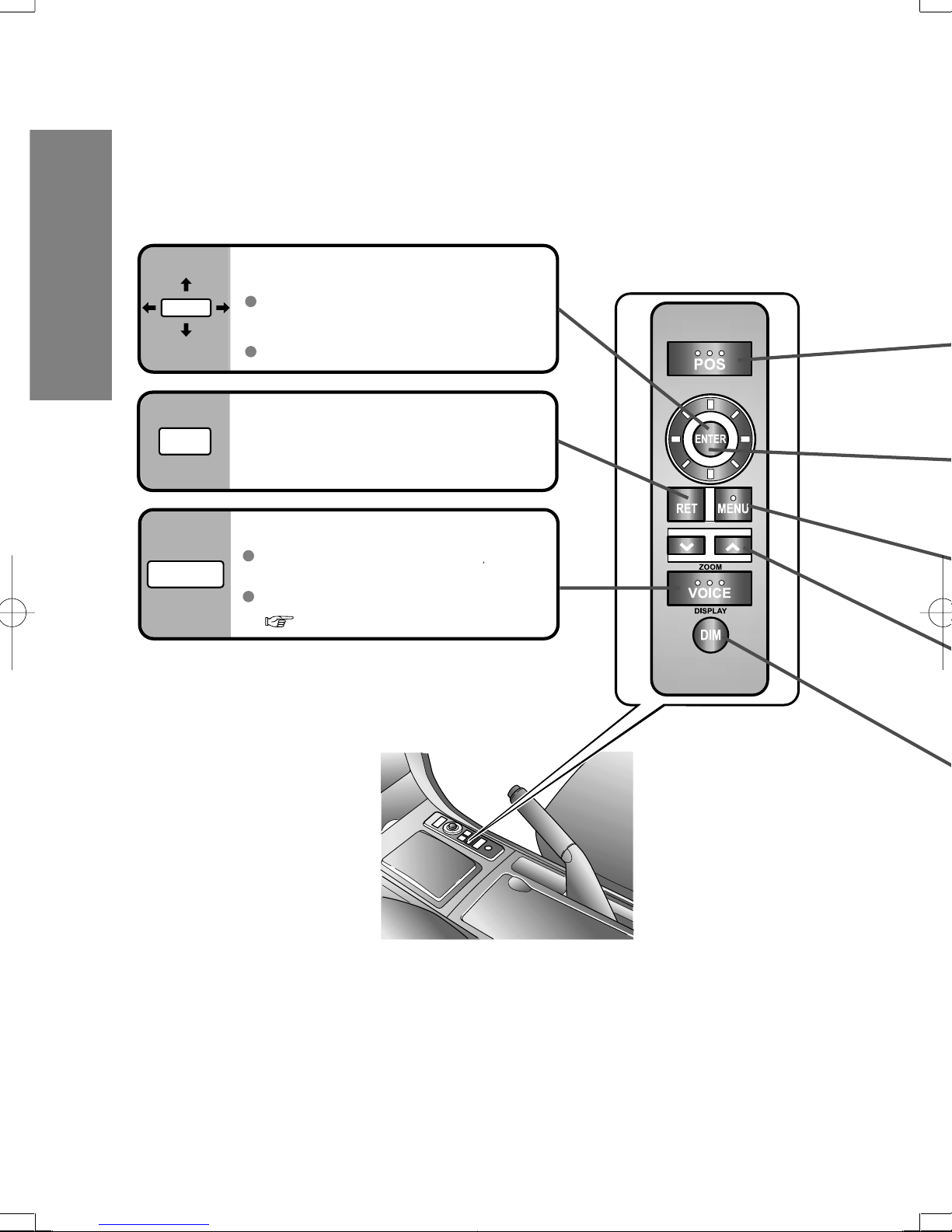
Joystick
ENTER
RET
VOICE
Selects items
by tilting it up, down, right, and left.
Scrolls map.
RET key
Returns to the previous screen.
VOICE key
Initiates vocal guidance
for route maneuvers.
Adjusts screen quality.
( page 16)
10
Page 11
POS
ENTER
Before Use
POS (Position) key
Displays your current position.
( page 18)
ENTER key
Executes a selected item.
Displays pop up menu.
( page 14)
MENU key
MENU
Displays menu.
ZOOM key
ZOOM
Changes the map scale.
( page 19)
DIM key
DIM
Switching the Display Mode
When the headlight switch is in the or position, the display
switches to night mode.
Press the DIM key to switch to day mode.
To return to night mode, press the DIM key again.
Switches the display to day mode
or night mode.
11
Page 12
OPEN
TILT
TILT
OPEN
12
Page 13
Page 14

●Start the d
to start dur
●The vehicle
depending
is calculati
The mobile n
properly calib
1. When usin
2. When the
3. When the
wheel dia
4. When del
Notes
t
h
w
o
g
Pop Up Menu
Before Use
This function is mainly used during route searches.
■
Pop Up menu appears when pressing .
■
When route has
been set or route
in operation
When scroll map
is displayed
ENTER
Route change ( page 26)
Route display ( page 25)
Route list display
Marked point registration ( page 28)
Map orientation change ( page 19)
Stop route Search ( page 25)
Rerouting
Note
Change of routing Search method ( page 21)
Change volume
Delete Destination ( page 25)
Direct destination input
with the joystick ( page 24)
Appears only when the auto reroute
function
( page 32)
is inactivated.
Near POI (Point of Interest) search
(within a radius of about 6 mile) ( page 24)
●Example : When is selected.
Highlighted
Detour submenu
Note
This function is not available on intersection zoom maps.
14
Page 15

Before Use
System Operation Verification
Automatic distance correction
The mobile navigation system uses GPS data for distance correction automatically. It must be
properly calibrated for accurate operation. Perform calibration in any of the following circumstances:
1. When using the navigation system for the very first time after installing the system.
2. When the navigation system is transferred to another vehicle.
3. When the tire pressure is changed, tires are rotated, the spare tire is used, tire size, or
wheel diameter is changed.
4. When deleting the position correction learning results.
Notes
●Start the driving after closing the opening screen as much as possible. The system is ready
to start during opening screen.
●The vehicle position indicator may disappear temporarily after the speed is increased
depending on the vehicle model. This is a normal phenomenon indicating that the system
is calculating the distance correction.
■
Resetting automatic distance correction
Drive the vehicle in an open area for approximately 30-minutes at a speed over 20 kph
(12.5 MPH) while receiving GPS signals.
Before Use
Notes
Make sure the GPS reception indicator is illuminated on the map screen.
GPS reception indicator
15
Page 16

Before Use
3
Screen Quality Adjustment
1
Before Use
Screen quality
adjustment
Screen off
VOICE
Press and hold
Open [Display
Menu]
2
Select
Select
ENTER
ENTER
Screen display turns off.
Press any button to return
to screen display.
Day / Night
mode selector
16
Select /
headlights OFF - DAY MODE
headlights ON - NIGHT MODE
When the headlights are on,
daytime mode can also be
selected (if extra screen
brightness is required under
certain nighttime conditions).
This selection can only be done
when the headlights are on.
Press to switch
ENTER
between day and night modes.
Page 17

3
ENTER
Before Use
ENTER
Adjust screen
brightness.
ENTER
Adjust screen
contrast.
ENTER ENTER
Returns screen to
initial settings.
17
Page 18

g
n
o
m
a
c
a
Page 19

Changing the Map Orientation/Scale
Do not keep your eyes fixed on the monitor screen or operate the system while driving
Do not change the settings and destination locations while driving. Minimize the time spent viewing
Warning
the monitor screen and listening to the voice guidance while driving. Operating the system will
distract the driver from looking ahead of the vehicle and may cause an accident. Always stop the
vehicle in a safe location and use the parking brake before operating the system.
Before Use
Map
orientation
1
2
ENTER
ENTER
Open the pop up menu
(while in current position map)
Select or
and
press
ENTER
North Up :
Geographic north is up.
Head Up
The direction you are
heading is up.
:
1
Map scale
ZOOM OUT: Enlarges the map.
ZOOM
The map can be displayed in
twelve steps with scales from
to .
ZOOM
ZOOM IN: Reduces the map.
(more detail.)
19
Page 20

m
r
e
d
r
s
p
c
*
c
e
a
a
n
n
w
p
u
r
h
s
e
h
R
Destination Entry and Route Search
If you would like to go back to your start point, select the [History] in the [Select
●
Destination] Menu, after that, select a green flag icon as a destination.
Routing
MENU
1
Destination by
address
Destination by
intersection
Destination by
intersection
Destination
by POI
Destination
by POI
ENTER
select
Open the [Select
Destination] Menu
Select
Default: North Central USA
Character entry
( page 22)
To enter the street
name, city name,
zip code, and other.
ENTER
2
Select
Select
Select
Select a
destination from
the POI categories.
●POI icon chart
( page 23)
ENTERENTER
Destination by
history
Destination by
Destination by
a marked point
history
Destination by
a marked point
Destination by
Open the [Select
Destination] Menu
the map
Destination by
the map
20
Select
Select
●Refer to page 28 for information about
marked points.
Select
Page 21

Warnings
Do not keep your eyes fixed on the monitor screen or operate the system while driving.
●
Do not change the settings and destination locations while driving. Minimize the time spent
viewing the monitor screen and listening to the voice guidance while driving. Operating the
system will distract the driver from looking ahead of the vehicle and may cause an accident. Always
stop the vehicle in a safe location before operating the system.
●
Route searches with the navigation system can include roads that you can not drive on and roads
that you are prohibited from driving on due to traffic regulations. Please comply with the traffic regulations.
ENTER
3
Enter/Select the
street name.
Enter/Select the
city name.*
Enter the
Zipcode.
*1 The memory stores up to 10 cities visited recently, and these city names can be selected.
*2 Depending on the area,zipcode search may not be possible.
Enter the name of
the city where your
target intersection is.
Enter the target
city name.
2
*
Character entry or selection
( page 22)
Select the
city name.
1
Enter/Select
the street
name.
Enter the
name of a
street that is
part of the
intersection.
Enter the
target name.
ENTER
Select the
house
number
.
Enter the
other street
name that
makes up the
intersection.
Select a
4
desired
Enter the target name.
destination
from the list.
(The 20 closest destinations to the current
position appear (within a radius of about 30 mile.).)
ENTER
Search method
This is the route that
reaches the destination
in the shortest time.
This route reduces the
use of highways (if there
are highways on the way).
You can designate a
destination on the map.
(Move the crosshair
cursor to the destination.)
The following menus will be
displayed when is
pressed on the map display.
[Marked Point]
[Destination]
[Nearest POI]
( page 24)
ENTER
Routing
ENTER
Select a destination from the list of recent destinations.
(Up to 50 points including the latest starting point are in the system memory.)
Select a destination from the list of Marked points
(Up to 100 points).
Move the crosshair
cursor to the destination and press .
Select
ENTER
Marks the destination
r
esulting from the search.
Note
The results from the route
search are not always the
shortest routes. You cannot
always avoid the highways
even if the highway is set
to [Avoid Highway].
For example, you will be
on the highway when your
vehicle is on the highway
or when your destination
exists on the highway.
21
Page 22

Character Entry
POI I
■
POI (Poin
The followi
AUTO SE
PA
PA
PA
AU
GA
RE
FA
RE
AU
AS
BORDE
CROSS
BUSINE
FACILIT
EMERG
HO
HOTEL
MOTEL
N
T
ENTER
ENTERENTER
ENTER
12
Select the first several
characters on the screen.
Select your target
in the list, and press
ENTER
Routing
To enter the
street name,
city name,
and other.
:
Move the cursor to
the previous position and
delete a character.
: The list appears.
●Up to 10 characters can be
entered.
■ Entry of a street name
Do not enter the type of street such as ST, AVE, PL, LN,
Caution
●Examples
Street : 33RD ST
Enter by selecting characters:
or RD as the search may not perform successfully.
DR33
Names of which spelling starts
with the entered character
appear.
●If a desired name is not in the
list, go back to the step 1,
and try fewer characters.
12
To enter the
zip code,
house
number,
and other.
22
Select the characters
on the screen.
ENTER ENTER
ENTER
Select and press
: Move the cursor to the previous position
and delete a character.
: Space
ENTER
ENTER
Page 23

POI Icons on Maps / Zipcode Entry
SHOPPING CENTER
POI (Point of Interest) Icons
■
The following are POI icons shown on maps.
AUTO SERVICES
AUTO REPAIR
AUTOMOBILE
ASSOCIATION
GAS STATION
PARK & RIDE
PARKING GARAGE
PARKING LOT
RENTAL CAR
FACILITY
REST AREA
BANKING
ATM
BANK
BORDER
CROSSING
LEISURE/
RECREATION
AMUSEMENT PARK
CASINO
GOLF COURSE
HISTORICAL
MONUMENT
MARINA
MUSEUM
PARKS AND
RECREATION
SKI RESORT
STADIUM / ARENA
THEATER
TOURIST
ATTRACTION
TOURIST INFORMATI0N
WINERY
NAMED PLACE
PUBLIC
FACILITY
CITY HALL
COMMUNITY CENTER
COURT HOUSE
EXHIBITION OR
CONFERENCE CENTER
LIBRARY
SCHOOL
UNIVERSITY OR
COLLEGE
RESTAURANT
SHOPPING
GROCERY STORE
Routing
BUSINESS
FACILITY
EMERGENCY
HOSPITAL
POLICE STATION
HOTEL OR
MOTEL
TRANS PORTATION
AIRPORT
BUS STATION
FERRY TERMINAL
LIGHT RAIL
STATION
TRAIN STATION
23
Page 24

n
n
t
e
Direct destination input
Routing
Direct
destination
input
ENTER
Position the cursor on your
destination on the map
Scroll the map and change the map scale if necessary.
ENTER ENTER
ENTER
Select a route search method
●
You can determine whether or not to use a highway if there is a
highway within a radius of about 300ft from the crosshair cursor position.
[Choose Highway]
: Highway is used.
: Highway is not used.
Select
( page 21)
Driving to
the nearest
POI
(within a
radius of
about 6 mile)
ENTER
Notes
●A point near the crosshair cursor position can be a
destination if there is not a destination point at the
specified point.
●A POI icon will be a destination if there is a POI icon close to
the crosshair cursor.
ENTER
Select
ENTER
Select the POI category
●Icon list ( page 23)
Select an icon from the list that you would
like to go to.
●
The 20 closest destinations to your current position appear.
Select a route search method
( page21)
24
Note
When there is no POI that you would like to go to, then
[POI Not Found] will appear.
Page 25

After routing
During route search
Route
search
cancellation
Whole
route
display
(while on
current
position
map)
ENTER
ENTER
After route search
ENTER
ENTER
Select
Select
ENTER
ENTER
Routing
Delete
destination
(while on
current
position
map)
ENTER
ENTER
Select
ENTER
25
Page 26

Select a r
●Maximum 3
Select str
●Streets to a
Select a point t
●
Refer to pag
●The detour
●You can set
opens. It wi
●If you add a
may not be
Notes
■
Select the se
and followin
points
■
Delete a v
Do n
Do no
the m
distra
vehic
Warning
Route Changes
This function allows you to search
for alternative routes to the same
destination.
Routing
Alternative
route
search
Avoid
streets
ENTER
ENTER
12
Open Pop up Menu
(while on current position map)
Select the first point that
you would like to go by on
the way to your destination.
ENTER
Via point
Detour
distance
26
Page 27

Do not keep your eyes fixed on the monitor screen or operate the system while driving
Do not change the settings and destination locations while driving. Minimize the time spent viewing
Warning
the monitor screen and listening to the voice guidance while driving. Operating the system will
distract the driver from looking ahead of the vehicle and may cause an accident. Always stop the
vehicle in a safe location and use the parking brake before operating the system.
Select a route
●Maximum 3 routes (including the current one) appear.
Select streets to avoid
●Streets to avoid become gray
Select the second
■
and following via
points
When adding a new point between the
current position and the first point
Delete a via point
■
Select a point that you would like to delete.
●
Refer to page 32 for designating the detour distance.
When adding a new point between the
first point and the destination
Routing
Use the point search
and entry by
following the same
steps in"Destination
Entry and Route
Search"
( page 20, 21)
Notes
●The detour may be longer than the distance you specified.
●You can set up to five Via points. If you try to add a sixth point, then the [Delete] menu
opens. It will prompt you to delete a currently selected point.
●If you add a Via point near your current position when adding points, then Avoid Highway
may not be selected with the route search method in some cases.
27
Page 28

3
Select a m
point from
●
Information
the marked
appears.
ENTE
Marked Point
●Up to 100 points can be stored.
●Each stored point is memorized with its
name and icon, and shown on the map.
Marking
your
current
position
Marking
any point
on the map
12
POS
Press to display
the current position
Move to
position the crosshair
cursor on a point to be marked
POS
ENTER
/
ENTER
ENTER
Marking
Changing
a marked
point icon
Renaming
a marked
point (User
POI)
Deleting
a marked
point
1
MENU
ENTER ENTER
select
ENTER
2
Open [Setup Menu]
Select
Select
ENTER
28
Page 29

3
ENTER
ENTER
Warning
■
Stop your vehicle before doing the following operations:
Do not change the settings and destination locations while driving.
Minimize the time spent viewing the monitor screen and listening
to the voice guidance while driving.
Operating the system will distract the driver from looking ahead of
the vehicle and may cause an accident. Always stop the vehicle in
a safe location and use the parking brake before operating the
system.
Note
If the same point is stored in “Marking Your Current
Position”, then it is registered with one local name on the
list. If the same point is stored in different processes, for
example, as in “Marking Your Current Position” and
“Marking Any Point on the Map”, then two local names,
identical to each other, will be shown on the list.
Select a marked
point from the list
●
Information about
the marked point
appears.
ENTER
3
Select an icon
Enter a name
ENTER
Marking
29
Page 30

u
Open th
screen
■ How to
: D
E
T
T
Setup
Warning
■ Stop your vehicle before the following operations
Do not change the settings and destination locations while driving. Minimize the time spent viewing the
monitor screen and listening to the voice guidance while driving. Operating the system will
distract the driver from looking ahead of the vehicle and may cause an accident.
Always stop the vehicle in a safe location and put the parking brake on before operating the system.
●The setting is a variable to suit your preferences.
1
MENU
: Default
ENTER ENTER
Open
[Setup Menu]
select
ENTER
2
Map setting ( page 31)
Route setting ( page 32)
System setting ( page 33)
( page 9)
Map area, Map disc (DVD) version and software
version appear.
You can check your route from the starting point to the
destination.
This function is available after route setup is performed.
ENTER
User setting
30
Restoring
■
defaults
ENTER
( page 28)
( page 28)
You can change and delete marked points.
●
On : Icons on a map.
●
Off : No icon on a map.
When the actual position of your
vehicle is different from the vehicle
position on a map
ENTER
ENTER
Change the vehicle position.
Change the vehicle direction.
: Rotation in a clockwise direction by 11.25°.
: Rotation in a counterclockwise direction
by 11.25°.
Page 31

Setup
Map
MENU
1
ENTER
select
2
: Default
Open the [Map]
screen
ENTER
ENTER
select
ENTER
ENTER
ENTER
3
■ Color (daytime)
■ Color (nighttime)
■ Map Direction
●
North Up : Geographic north is always up on the map.
●
Head Up : The direction you are going is always up on the
map.
ENTER
■ How to exit
ENTER
■ Vehicle Position
●
Center : The current vehicle position indicator is displayed
in the center of the screen.
●
Off Ctr : The current vehicle position indicator is displayed
at the bottom of the screen.
■ POI Icon
●
On : POI icons appear in their marked positions.
●
Off : POI icons do not appear in their marked positions.
■ Trace Mark
●
On : The traced route is marked.
●
Off : The traced route is not marked.
User setting
31
Page 32

Open th
[System
screen
: D
■ How to
Setu
E
N
Setup
Route
MENU
ENTER
1
ENTER
select
2
: Default
Open the [Route]
screen
select
ENTER
ENTER
ENTER
3
■ Detour (mile/km)
The detouring distance is specified.
●
1 : 1 mile/km
●
2 : 2 mile/km
●
5 : 5 mile/km
■ Auto Re-route
●
On : Searching for another route is activated to go back
to the original route when you drive away from it.
●
Off : No search takes place.
Usually, this function should be set to [ON].
■ System Mode
●
10 : 10 mile/km
●
20 : 20 mile/km
ENTER
User setting
■ How to exit
●
Map : The map mode
●
Guide : The guide mode map
■ Zoom
●
On : The intersection zoom map appears automatically
when approaching an intersection.
●
Off : The zoom function is not activated when approaching
an intersection.
■ Estimated Travel Time
●
On : The estimated travel time is announced by
voice guidance, and displayed on the current
vehicle map.
●
Off : No announce
ENTER
32
Page 33

Setup
System
MENU
1
ENTER
select
2
: Default
Open the
[System Setup]
screen
ENTER
ENTER
select
ENTER
ENTER
ENTER
ENTER
3
■ Volume control for voice guidance (5 levels)
Adjust the volume control at the monitor as well.
■ Beep
●
On : Beep activated when pressing buttons in the
remote control.
●
Off : Beep inactivated when pressing buttons in the
remote control.
■ Voice repetition
●
On : Initiates vocal guidance.
●
Off : Initiates no vocal guidance.
■ How to exit
ENTER
■ Clock
■ Language
■ Changeover meter/mile
●
Metric : Meters
●
English : Miles
■ Daylight Saving Time(Summer Time)
●
On : Daylight saving time mode is enabled.
(The navigation internal clock gains 1 hour).
●
Off : Daylight saving time mode is disabled.
User setting
33
Page 34

●If you are u
takes about
position.
●The GPS sa
lower positi
●There may
turning on t
■ GPS sign
In tunnels
This functio
disc, applies
and displays
●Intelligent m
in vehicle p
●Using a spa
●Any differen
on the map
Precautions/System Performance
Second branching point
First branching point
150m
100m
Route
In 700m left turn.
Left turn ahead,
then right turn.
Roundabout.
Take the second
exit.
● The navigation system is just a support system for the driver. The driver should always
Warnings
● Your route may sometimes include roads that are not open to vehicles or are closed
● Do not change the settings and destination locations while driving. Minimize the time
Voice Guidance
pay attention to the traffic situation to safely make decisions. You may be unable at
times to arrive at your destination due to out-of-date information on a map disc. You
should be especially careful when selecting an urgent destination such as a hospital or
a police station.
due to traffic regulations. Please comply with the local traffic regulations.
spent viewing the monitor screen and listening to the voice guidance while driving.
Operating the system will distract the driver from looking ahead of the vehicle and may
cause an accident. Always stop the vehicle in a safe location and use the parking brake
before operating the system.
Voice guidance has the following functions:
■ Intersection guidance
●The system voice announces the distance to an upcoming turn and the turning direction.
a This guidance function is automatic. Therefore, you do not have to set it, and it cannot
●The system vocally announces the distance to an upcoming highway
branching point or junction.
a This guidance function can be set in the [Setup menu]. For details, see page 32.
be disabled.
When two intersections are close together,
the voice guidance may be late.
As necessary
Automatic Distance Correction
●The mobile navigation system calculates and indicates the vehicle position on the map by
●Using a spare tire in place of the regular one may cause vehicle position deviations.
multiplying the speed pulse emitted by the vehicle with a correction coefficient.
The speed pulse emitted varies with the type of vehicle and with differences in tire
pressure and wear.
A different correction coefficient might even be required for the same type of vehicle.
34
When two roundabouts are close together,
the voice guidance for the second may be late.
Page 35

GPS
GPS is a position detecting system utilizing the signals from
GPS satellites deployed by the U.S. Department of Defense.
The Mobile Navigation System uses input from three or more
satellites and calculates the vehicle position based on the
principle of triangulation.
The positioning accuracy of the system corresponds to the
error display of the GPS which is from about 30 to 200 meters.
●If you are using the system for the first time, or if you have not used it for some time, it
takes about 5 minutes (or about 2 minutes in open areas) to calculate your vehicle's
position.
■ GPS signal reception is poor in the following places
In tunnels
●The GPS satellites are controlled by the U.S. Defense Department, which may intentionally
lower positioning accuracy. In such cases, there may be vehicle position deviations.
●There may be vehicle position deviations for some time until GPS signals are received after
turning on the ignition.
Among high-rise buildings
Under elevated roads In wooded areas
Map Matching
This function compares your vehicle's tracking data with the road data on the map
disc, applies dead reckoning to determine the road you are driving on,
and displays your vehicle on that road on the map.
●Intelligent map matching addresses the following problems to achieve high accuracy
in vehicle positioning.
Position Correction for Elevated Roads
Position accuracy is improved by detecting if
the vehicle is running on or under an elevated road.
Position Correction for Parking Garages
Position accuracy is improved by detecting if the vehicle
is driving in an elevated or underground parking garage.
High-precision Gyrosensor
A gyro detects turns with an accuracy of 0.05˚ per second.
Combined with a speed sensor, it enables the system to display
the current vehicle position even where GPS signals may be
blocked.
As necessary
●Using a spare tire in place of the regular one may cause vehicle position deviations.
●Any difference between the direction which your vehicle actually travels and that shown
on the map is automatically eliminated by azimuth correction.
35
Page 36

Although yo
wrong with t
?
The ro
reach
your d
destin
direct
the ro
The
sho
pas
in w
reas
Warning
The n
atten
destin
when
In 300 m
right turn
Left turn
ahead
3
0
0
m
0
m
Precautions/System Performance
In the following situations, your vehicle position may not be displayed correctly on the map. But, as you
keep driving, your vehicle position will be automatically corrected utilizing map matching and GPS data.
Positioning Accuracy
Running on an
elevated road
Running on gridiron
layout of roads
Making a turn after
driving on a long
straight road
Running on a
slippery road with
tire chains
Running on a steep
mountain road
Snaking on a
wide road
Running on a spiral
road
STOPSTOP
When your vehicle
is on a turntable
with the ignition
turned off
Entering an intersection
where a road branches
off at a small angle
CAR FERRY
After getting off a
ferryboat or
vehicle train
Route Guide
Although you may encounter the following problems in route guide, there is nothing wrong
with the system.
For certain intersection shapes, the
upcoming turn or the name of the
intersection may not be announced.
As necessary
Some points where the road divides
36
on highways or toll roads may not
be displayed or announced.
For certain intersection shapes, you
may be prompted to turn right or left
When you should actually stay on the
same road.
The Intersection Zoom Map may not
always agree with the actual shape
of the intersection.
Voice guidance for the planned route
may continue even after you have
deviated from that route such as
having turned too early.
The announced distance to an
upcoming turn may differ slightly
from reality.
In 300 m
right turn
Page 37

?
?
?
?
?
?
?
?
It may also show roads
that are out of use due
to the opening of a new
road or for other
reasons.
The route shown only
reaches a point near
your destination if your
destination has no
direct access road or
the road is too narrow.
It may show a route
where you'll have to
make a U-turn.
The guide map may
show roads that are not
passable due to closure
in winter or for other
reasons.
It may show a
common road under
or over an elevated
road.
Destination
Road
out of
use
which
exit?
Destination
Destination
Destination
Depending upon the shape of
roundabout (rotary), the guide
map may show a wrong exit.
where the route remains
unchanged after another
search.
• There may be cases
• A congested route may
be shown.
It may also show
roads that only permit
one-way traffic.
The navigation system is just a support system for the driver. The driver should always pay
attention to the traffic situation to safely make decisions. You may be unable to arrive at your
Warning
destination due to out-of-date information on a map disc. You should be especially careful
when selecting an urgent destination such as a hospital or a police station.
Route Search
Although you may encounter the following problems in a route search, there is nothing
wrong with the system.
As necessary
37
Page 38

Sympto
No GPS sy
are display
The vehicle
position is
displayed
No voice gu
Buttons in
remote con
do not bee
No map disp
(blank scre
Troubleshooting
There may be some problems due to operational errors or mistakes. Please read this
manual again and verify that there really is a problem before calling an Authorized Mazda
Dealer to ask for repair services.
No picture
Verification First
Note
Symptom Check point
●
Check if a fuse has been blown.
a
Consult an Authorized Mazda Dealer.
●
Check if the voltage level of the vehicle battery is low.
a
Recharge the battery or change batteries.
The vehicle
As necessary
position is not
correct
●
Check if the vehicle position changed when ACC was set to
OFF.
When, for example,
●
The vehicle was transported by a ferry boat.
●
The vehicle was rotated on a turn table in a parking lot.
●
The vehicle was transported by a tow track or other such
vehicle.
a
Drive the vehicle for a while where you are receiving
GPS signals.
38
Page 39

Symptom Check point
● GPS signals may not be received because of obstructions.
After moving the vehicle away from obstructions, the GPS
No GPS symbols
are displayed
signals can be received.
The vehicle
position is not
displayed
No voice guidance
Buttons in the
remote control
do not beep
● Check if the mode is set to the map mode.
a
Press
● Check if the volume control for the voice guidance is
adjusted to zero.
● Check if the vehicle is off the route.
a
Repeat the route search while checking the route guide
screen.
● Check if you are driving the vehicle in the wrong direction on
the route.
a
Repeat the route search checking the direction of the
destination.
● Check if [Beep] is set to [Off] ( page 33).
POS
As necessary
No map displayed
(blank screen)
● Check if the disc is wet, scratched, or dewy.
39
Page 40

Main
Use a dry,
■
Cleaning
Never use so
■
Cautions
If you require
please refer
■
Map disc
●
Do not to
●
Do not m
●
Do not be
●
When not
■
How to h
●
●
Near car
Direct su
●
In dirty, d
●
On seats
■
Do not le
●
Use a dry
■
Disc Clea
■ Ma
This
spe
by u
use
Caution
Troubleshooting
Error message Solution
Error Messages
Route
Calculation failed
Cannot Read Disc
Accessing Data
Please wait....
Please Select
another point.
* When entering
your destination
Unable to select
Destination.
● Change your destination and route, and repeat the route
search.
● The disc is wet, dirty, scratched, or upside down, or the disc
cannot be played with this unit.
a
Eject the disc and check it.
● When the message appears in the opening screen:
a
Check if the map disc is wet from condensation,
scratched, or dirty. If the same message is displayed
when this operation is repeated after checking, then
consult an Authorized Mazda Dealer.
● When the message appears during operation:
a
If the same message appears after repeating the
operation, then consult an Authorized Mazda Dealer.
● Change your destination and route, and repeat the route
search.
As necessary
40
Page 41

Maintenance
Caution
As necessary
Cleaning this product
■
Use a dry, soft cloth to wipe it.
Cautions for cleaning
■
Never use solvents such as benzene and thinners they may mar the surface of the unit.
Map disc
■
If you require the latest map disc, consult an Authorized Mazda Dealer. For latest map disc information,
please refer to "Map Related Issues" on page 9.
Handling and Care of Map Discs
■ Map Disc
This unit supports only DVD-SDAL-formatted map disc (SEAMLESS) that NAVTECH has
■
How to hold the disc
●
●
●
●
specifically designed for this unit. Mazda shall not be liable for any damages caused
by using other formatted discs. Make sure to specify that a disc should be exclusively
used for this product when you purchase it.
Do not touch the underside of the disc.
Do not make scratches on the disc.
Do not bend the disc.
When not in use, keep the disc in the case.
Care of the Product
Label side
Disc Cleaning
■
●
Use a dry, soft cloth to wipe from the center outward.
Do not leave discs in the following places:
■
●
Direct sunlight
●
Near car heaters
●
In dirty, dusty and damp areas
●
On seats and dashboards
< >
Right Wrong
< >
41
Page 42

 Loading...