

Lowrance 6.3, MapCreate USA 6.3 Topo Instruction Manual

1
Pub. 988-0154-201
Addendum I For
MapCreate USA 6.3 Topo
Thank you for buying the USA topo version of MapCreate. This addendum describes features and functions that differ from the basic version
of MapCreate.
MapCreate Topo is ideal for aviation, backpacking and related outdoor
activities, but it was specially designed for hunters. Maps made with
MapCreate Topo will work in other Lowrance
GPS units, but this pro-
gram was developed to complement the iFINDER
HUNT hand-held
GPS receiver. MapCreate Topo is the first GPS mapping software to
offer such extensive boundary data for several types of public hunting
lands, game management units and related areas.
NOTE:
MapCreate Topo and its companion iFINDER HUNT GPS were introduced in the summer of 2004, but their development is continuing. More free features and enhancements are planned for release
as the fall hunting season approaches. We strongly recommend
you check the Lowrance web site, www.lowrance.com, for free
downloads of updated software and instruction manuals.
The high detail map data provided with this program is organized into
six regions. To install MapCreate, follow the instructions in the manual
but refer to the map on page 3 of this addendum to find out which region is recorded on which CD.
Material covered in this addendum includes:
New Mapping Data
• Topographic elevations, public hunting areas and game management
units are discussed along with other new data on page 3. Be sure to
read the map data disclaimer following the data descriptions.
Additional Symbols
• New hunting-specific symbols make it easier to scout ahead of the
hunt and mark important spots. Described on page 4.
Searching
• MapCreate Topo lets you search for POIs, land features and more,
just as you can in a Lowrance GPS unit. The details are on page 5.
Aviation Searching
• Load a card containing a Jeppesen Aviation Database into the card

2
reader and MapCreate Topo lets you search for items such as airports
and VORs. On page 6.
Find Nearest Waypoint or Nearest Highway Exit
• It's easier to find these items with the new right-click shortcut. See
page 6.
Map Category Options Toolbar
• A drop-down menu lets you select pre-set or customizable category
settings for activities ranging from hunting to aviation. On page 7.
Routing
• MapCreate Topo lets you accurately add POIs, land features and avia-
tion navaids to routes with a click of the mouse. Read more about it on
page 7.
Dynamic Pan Arrows
• The permanent pan arrows that were located along the sides of the
Master Map window have been replaced with pop-up pan arrows.
You can even pan diagonally! See page 7.
Pop-up Boxes
• Pop-up information boxes for POIs, land features and interstate
highway exits now include elevations. Exit pop-up boxes also list
nearby exit services. See page 8.
Color Legend
• A legend describing the colors of different areas is at the end of this
document. This printed document is in black and white, but the
version in the Help File is in color. See page 8.
Map Coverage by CD
The program's map data is provided on six CDs. The installation disc is
CD 1. If you choose to use Full Install, all of the high detail map data
will be available from your hard drive. This requires 3.3 GB of space.
A Custom Install lets you select only the region(s) you want to be installed on the hard drive. If you want to view high-detail maps in a region you did not install, you must place that regional CD in the disc
drive to see maximum detail.
The Compact Install loads your hard drive with the basic program,
along with navigational aid data and a medium-detail world map. This
requires approximately 300 MB of space. If you want to view highdetail maps, you must place the desired regional CD in the disc drive to
see maximum detail.
3
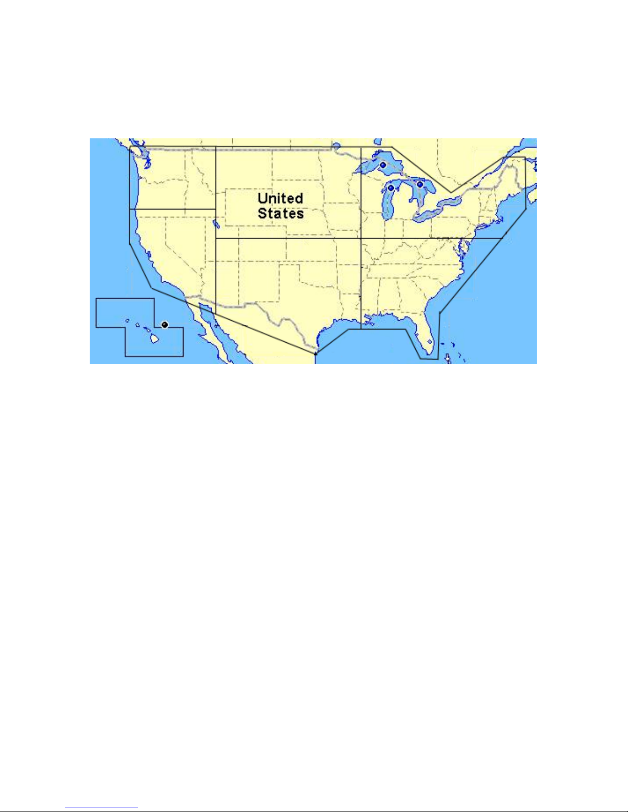
In this package, northwest United States and Alaska are on CD 1;
southwest U.S. and Hawaii are on CD 2; north central U.S. is on CD 3;
south central U.S. is on CD 4; northeast U.S. is on CD 5 and southeast
U.S. is on CD 6. To view the high-detail data boundaries, see the following figure.
Continental United States and Hawaii showing approximately where
data is divided on the six CDs.
New Mapping Data Types:
Elevation Contour Lines
MapCreate Topo includes topographic elevations for 49 states (excluding Alaska). These are shown as major and minor contour lines, with
numbers showing the elevation above sea level. Contour lines begin to
appear at about the 56 mile zoom range (depending on your monitor
size and resolution). At that zoom level and closer, the mouse pointer
also triggers a pop-up box showing elevation at that point. Read more
about pop-up boxes on page 8.
Hunting
Public Hunting Area boundaries and their names from 47 states are
included. Alaska, Hawaii and Washington state are not included.
Game Management Unit boundaries for 22 states are included, in the
following categories: antelope, bear, deer, elk goat, moose, mule deer,
sheep, turkey (spring and fall) and whitetail deer.
The GMU states include: Arizona, Colorado, Iowa, Idaho, Kansas, Kentucky, Massachusetts, Minnesota, Missouri, Montana, North Dakota,
Nebraska, New Mexico, Nevada, New York, Ohio, Oregon, Pennsylvania, South Dakota, Utah, Wisconsin and Wyoming.
CD 1
(Northwest)
plus Alaska
CD 3
(North Central)
CD 2
(Southwest)
CD 5
(Northeast)
CD 6
(Southeast)
CD 4
(South Central)
CD 2
 Loading...