

Page 1
DGPS NAVIGATOR
JLR-7700MK
12-Channel Parallel for simultaneous
reception of 12 satellites.
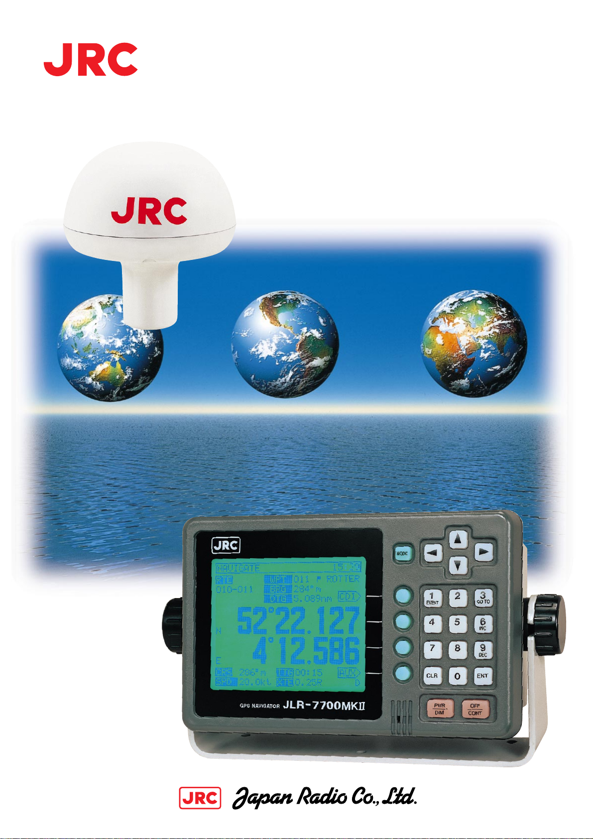
The DGPS Navigator composed of a
DGPS receiver and a LCD display unit
ensures very accurate position fixing.
22
Page 2
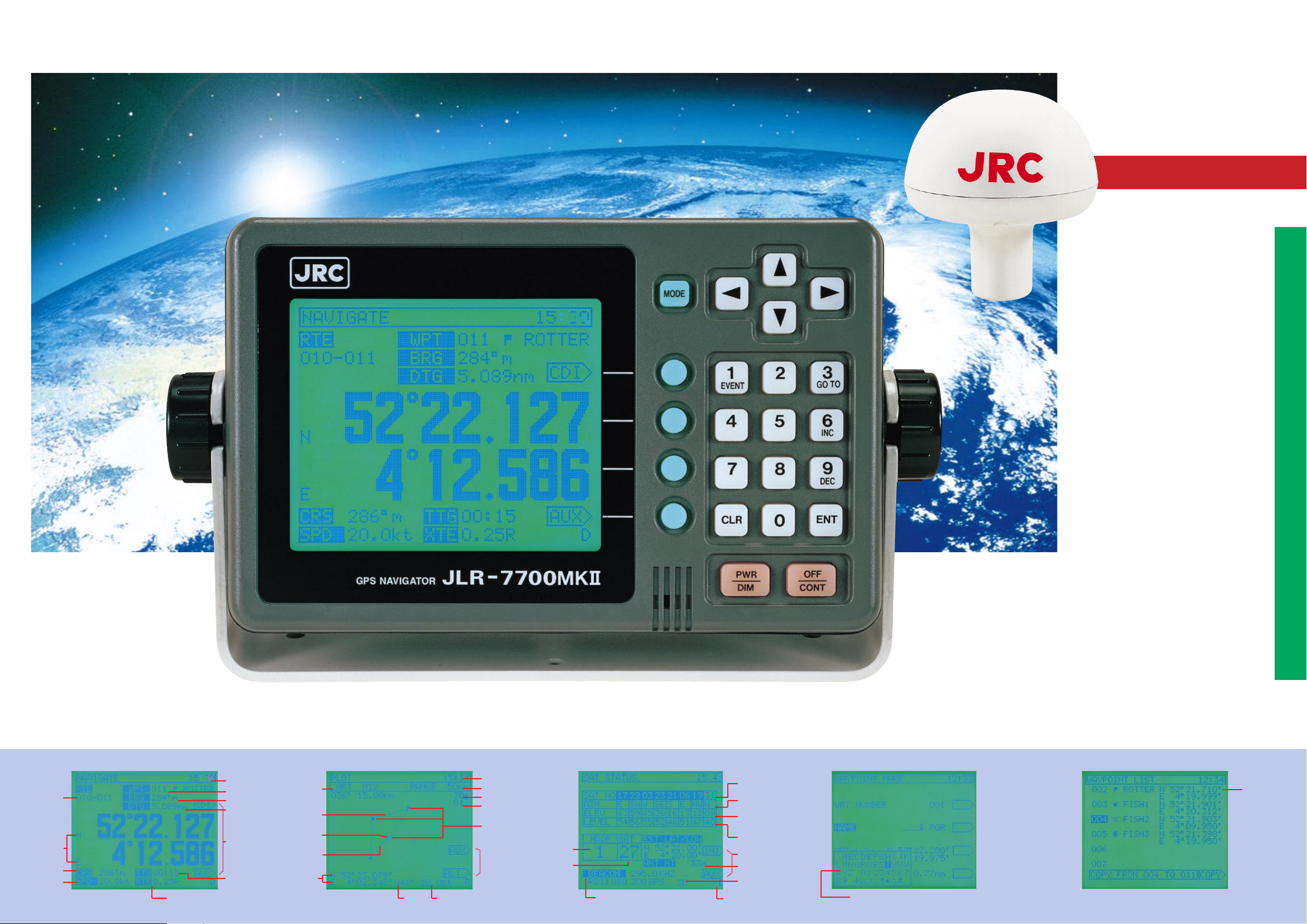
Very accurate DGPS position fixing, large LCD graphics and simple operation
NNN-4331
DGPS Receiver
DGPS NAVIGATOR
DISPLAY EXAMPLES
Actual size
The DGPS Navigator offers position fixing with high accuracy anywhere in the world.
Own ship's position, course, speed, planned route, bearing and distance are displayed on the large LCD screen.
JLR-7700MK
22
●Large LCD Display
Necessary navigational information can
be displayed on a large LCD screen at a
glance, ensuring simple operation without
troublesome switchover of displays.
●
More Accurate DGPS Positioning
Differential GPS position data is
automatically received in DGPS service
areas, and own ship's position fixes are
displayed with very high accuracy.
●Waypoint Memory
Up to 499 waypoints can be stored in the
internal memory with their place names in
8 alphanumeric characters.
●Data Outputs
Two data ports are provided: one is an
RS-422 port, and the format is selectable from NMEA0180, NMEA0183
(version 1.5 or 2.1) and a JRC.
●Navigational Calculations
Navigational calculations are made in the
Great Circle or Rhumb Line mode.
●Loran C/A TD Display
The GPS position fixes can be converted
into Loran C or A time difference values
and displayed on the LCD screen.
●Relay Contact Output
A log pulse or external buzzer alarm
signal is available from the relay contact
output.
●Weather information display
Local weather and sea conditions in
coastal sea areas of Japan can be
displayed.
Selected route
Current
position
(lat/Lon)
Course
Speed
Local time
Waypoint No.
Bearing
Distance
Display
select menu
Time to go
Couse deviation value
and direction to steer
Waypoints No.
Present route
(dotted line)
Own ship's mark
(+mark flicker)
Ship's track
(solid line)
Current position
PLOT WAYPOINT MAKE WAYPOINT LISTNAVIGATE SAT STATUS
Local time
Display range
Track memory intervals
Number of tracked
memory
Waypoint marks
Positioning accuracy
(HDOP)
Number of orbiting
satellites
Beacon parameters
Frequency, RSSI baud rate
Course Speed
Display
select menu
Satellite No.
Sat azimuth angle
Sat elevation angle
Receiving signal level
Display select menu
Antenna height
3D fix display
Differential GPS fixing
Waypoint list
List of characters
Page 3

SPECIFICATIONS
212
94
50
224
252
134
135
150
φ40
φ126
Fittingscrewdiameter
1inch14UNS-28
For further information, contact:
Since 1915
PrintedinJapan2001.1 '01.1 CAT.No.Y3-129(No.442-1-3)D
Main Office: Akasaka Twin Tower(Main), 17-22,
Akasaka 2-chome, Minato-ku, Tokyo 107-8432, JAPAN
Telephone: Tokyo(03)3584-8788
Facsimile: Tokyo(03)3584-8795
Telex: 2425420 JRCTOK J Cable: JAPANRADIO TOKYO
Overseas Branches : Seattle, London
Liaison Offices : Kaohsiung, Manila, Bangkok,
Singapore, Jakarta, New Delhi, New York, Amsterdam,
Piraeus, Las Palmas
19EM
ISO
9001
,
ISO
14001 Certified
URL
■Position Accuracy
GPS position fix: 15 m 2DRMS (HDOP≦4)
DGPS position fix: 5 m 2DRMS (HDOP≦4)
■Beacon Receiving
Receiving frequency:283.5KHz to 325KHz
Frequency step: 500Hz
Beacon station selection:Automatic or manual setting
of a frequency and baud rate.
Demodulation: Minimum shift keying(MSK)
RF bit rate: 50/100/200 bps
COMPONENTS
Component
Display unit
DGPS Receiver
DC Power cable
Screw mount
Fitting belt
DGPS connection cable
Junction box
Pole mounting kid
Instruction parts
Spare parts
Instruction manual
Extension cable
(Standard)
Model
NWZ-4570B
NNN-4331
CFQ-3598B
MTV302007
MPBP02520
CFQ-8919
NQE-7700
MPBP30608
Copper tape, Connector
2A Fuses
250V-MPYCYS-5
Q'ty
1set
1kit
1set
1copy
Option
■General Functions
Display type: 5-inch STN LCD, 160×128 dots
Back-lighting: EL (LCD), lamps (keyboard)
Waypoint memory: Up to 499 waypoints including 100 event
marks (WPT No. 400 to 499), each point with
a place name in 8 alphanumeric characters
Route plan: One route with up to 499 waypoints
Alarms:
Position correction:
Display language: English or Japanese
Operating temperature:DGPS Receiver: -25 to +55:
Power requirements: 12/24 VDC, 10W or less
Waypoint arrival, cross track error, anchor watch, boundary and no-fix
Selectable from 46 geodetic datum, and manual lat./lon. entry
Display Unit:
100/220 VAC with AC power supply unit (option)
-15 to+55:
DIMENSION
1
1
1
1
1
2
3
DGPSReceiver(NNN-4331) DisplayUnit(NWZ-4570B)
Weight:Approx.1.7kg
Weight:Approx.1.8kg
Unit:mm
SCHEMATIC DIAGRAM
DGPS Receiver
NNN-4331
Junction Box
NQE-7700
Junction Box
NQE-7700
*Option
* The equipment appearance and specifications may be subject to change without notice.
with Pole mounting kit
MPBP 30608
*250V-MPYCYS-5
50 m max.
CFQ-8919
5 m
Display Unit
NWZ-4570B
Data output
Log pulse or
external buzzer
 Loading...