

Page 1
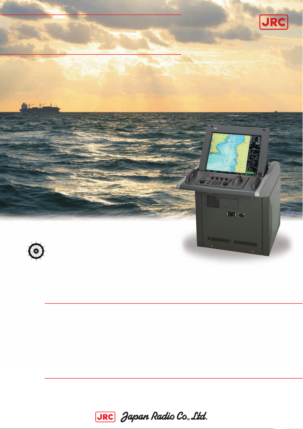
JAN-901B
ECDIS
Complies with new SOLAS regulations
MSC 232(82) performance standard for
ECDIS, e ective from 1 January 2009.
– introducing a new high performance ECDIS, integrating the latest technologies and innovative features
23” high visibility LCD screen
Simultaneous real-time radar & AIS overlay
Advanced route planning
Multiple and wide screen viewing
High-speed graphic processor
Page 2
JAN-901B
u
– performance features
Unique features
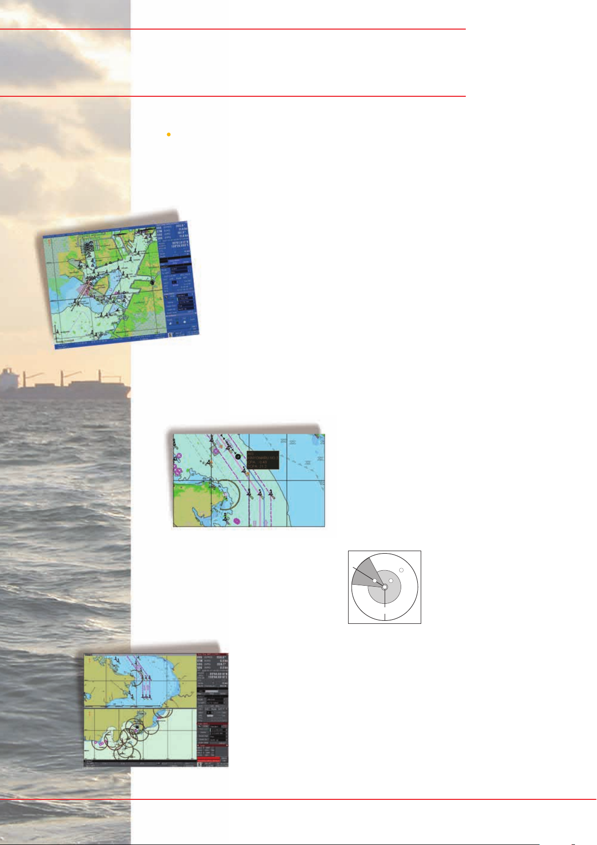
The JAN-901B is a newly developed multi-functional ECDIS.
It is ergonomically designed to enhance the working
environment and man/machine interfaces, providing
continuous position and navigational safety information.
Radar overlay
The JRC JAN-901B o ers practical radar usage with ECDIS,
more than just overlaying a rough radar image. The radar
image has a high resolution when interfaced with JRC radars.
The radar image does not hide the priority objects of vector
charts, but overlays them on the radar image. At the same
time, brilliance and clutter controls of the radar images
continues to be operable.
AIS targets
The AIS is an important key device used to indicate AIS target symbol and information
on the ECDIS. These targets are very useful, as it provides the maneuvering conditions
of other ships at a glance, allowing for safe and e ective navigation. The name of
the vessels, and bearing, range, speed,
length, heading and much more AIS target
speci cs from other ships are received and
displayed. The AIS symbols are continuously
displayed on-screen without the in uence
of the radar characteristics. The AIS targets
are never shielded by ground, rain or cloud
re ections, nor are they eliminated by
adjustments of anti-sea or anti-rain clutter.
Also, it is easy to activate, deactivate
and switch between AIS target
symbols. This simply can be done
with an integrated AIS lter,
prioritising the targets within a
dedicated area.
120nm
3
24
1
1. vessels’ position
2. ring area
3. sector area
4. heading area
Multi-view
Multiple and wide screen viewing is possible with the new
JAN-901B. You can divide the chart screen into two sections,
in which the same or di erent charts can be displayed, in a
mixture of ways. In this eld of view, it provides a ‘look-ahead’
capability, especially useful in coastal areas. With the wide
screen view function, an additional screen in the display area,
showing a segment of the chart, allows viewing at a glance.
JAN-901B ECDIS – a newly developed multi-f
Page 3
JAN-901B
– developed for maximum ease of use
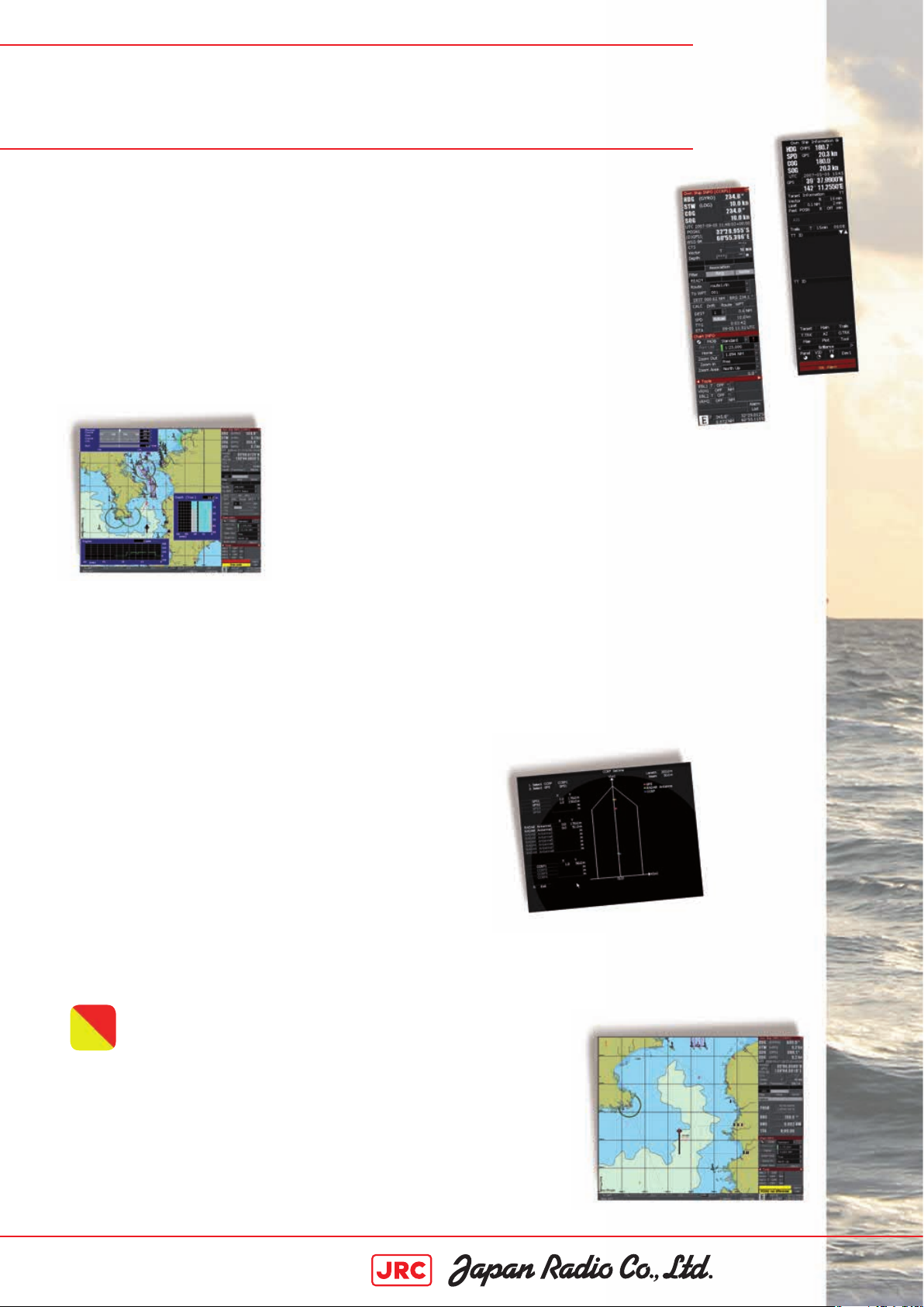
Flexible black box configuration
The ECDIS system is available in stand alone and desktop versions to suit
your type of vessel. In the desktop version, the processor unit is the heart of
the JAN-901B, allowing for exible installation approach in con ned spaces.
User interface
With its simpli ed menu structure, the new JAN-901B shares the same insightful user
interface as found in JRC’s new radar series. The consistent visual appeal and intuitive
usage is of great importance on the vessels bridge, especially being a working and living
environment for thousands of vessels’ o cers on a day to day base.
Conning and external sensors
You can easily connect a wide range of navigation equipment
to acquire more information. The ECDIS will display exactly the
info you need in a clear, uncluttered format, reducing the risk of
accidents. This results in a more relaxing and secure operation. Even
equipment from di erent manufacturers can be incorporated.
RADAR
ECDIS
More powerful than ever
The JAN-901B incorporates two Tornado™ processors, which are exclusively developed and designed by JRC,
bringing a new level of performance and reliability to ECDIS operation. The new Tornado™ processors, which
equal the power of eight conventional processors, allow radar overlay processing within a few milliseconds
before displayed. This generates a smooth and fast image update. The advanced system architecture, make
the JAN-901B series probably the most sophisticated ECDIS available today.
CCRP
As set by IMO regulations, a Consistent Common Reference
Point (CCRP) is a location on own ship, to which all horizontal
measurements, such as target range, bearing, relative course/
speed, closest point of approach, or time to closest point of
approach are referenced.
Where multiple antennas are installed, di erent position o sets for each antenna in the radar system
should be applied with respect to the CCRP. If you switch between scanners (up to 8 possible - option),
the information displayed is generated, which allow for consistency and uniform output.
Man OverBoard
Some items could strike you on the vessel, a slippery deck or
unexpected movement of the vessel are situations in which a person
may possibly fall of the vessel. The JAN-901B integrates a single-press
Man OverBoard (MOB) operation. Instantly, a dedicated symbol arises on
the screen, providing a range detailed info such as positioning, bearing,
range and time till arriving at MOB. This emergency system enables
immediate and accurate search and rescue e orts.
nctional system
Page 4

JAN-901B
JRC one-call™
One number to call
With JRC you can go anywhere and
if you need our support, simply call us
at +81 3 3492 9201, anytime.
– easy user interface
New keyboard design
The new keyboard design of the JAN-901B allows you to carry out all
operations simply by using the keyboard or on-screen by use of the trackball.
The responsive feel keys allow logical and
precise operation and also integrate function
keys for one-touch access to VIDEO, RAIN, SEA
and GAIN. This makes is seamlessly to navigate
through all commonly used tasks.
Optimised viewing
The JAN-901B 23-inch colour
display is able to show bright, highresolution imagery. With a press of
a button, the screens’ brightness
can automatically be adjusted to
the most optimal condition.
North arrow mark
Menu title bar
You can also select from multiple
background modes e.g. day/dusk/
night, a practical feature which
Display panel
Chart display area
facilitates a clear sight, this in view
of the ever changing lightening
TCS bar
conditions on the bridge.
JRC StarNetwork™
JRC has been providing sales and support of products since 1915. Today, JRC o ers comprehensive assistance
through its organisation, in partnership with a worldwide StarNetwork™ of over 270 fully trained and quali ed
partners and agents, assisting you 24 hours a day, 7 days a week and 365 days a year.
Reykjavik
San Francisco
Honolulu
Vancouver
Seattle
Los Angeles
San Diego
Toronto
Chicago
Houston
Panama
Guayaquil
Lima
Talchuano
Miami
Havana
New York
St. John’s
Rio de Janeiro
Buenos Aires
Torshavn
Lisbon
Las Palmas
Dakar
Belfast
London
Le Havre
Abidjan
Egersund
Antwerp
Madrid
Cape Town
Rotterdam
Tuni s
Lund
Amsterdam
Rome
Athens
Limassol
Helsinki
Tallinn
Istanbul
Alexandria
Richards Bay
Durban
Haifa
Dubai
Mumbai
Columbo
Hong Kong
Hanoi
Bangkok
Kuala Lumpur
Singapore
Jakarta
Pusan
Vladivostok
Shanghai
Taipei
Manila
Melbourne
Tok yo
Sydney
Suva
Brisbane
Auckland
Page 5

JAN-901B
– routing exibility
Advanced route planning
The advanced nature of JRC’s new ECDIS system allows route planning
in di erent ways. Either plan your route by using the table editor, while
displaying current waypoint or graphically draw your next waypoint on the
chart. Editing the route is just as simple as inserting. Dedicated menus are
readily available to assist the mariner in e ective route planning. Not only can
you save the routes, but import favourite or commonly used les, even from
previously ECDIS models, using industry-standard CSV format.
Route planning with
table editor while
displaying waypoints
Editing the user maps
The JAN-901B provides a rich
suite of objects which you
single-handedly can enter, move,
insert and add on user maps.
The objects consist of symbols,
lines, areas and texts. From buoys
to buildings and harbour to seabed signals, JRC’s new ECDIS has a total of over 40 categories and 30 sub-categories,
which include more than 250 graphics readily available for endless possibilities.
The user map is linked to the chart, and even if there are multiple user maps, you can easily select or merge.
During the voyage, you can add an alternative route, which can be displayed
simultaneously. You can move, insert, add and delete waypoints instantly
and easily exchange the alternative route with route in progress, at your own
convenience.
user map 2user map 1
merge
chart chart
A few examples
warning shing harbour dangerous wreck - unknown depth sand waves
jurisdiction border warning area large font
Track and time label
The vessels’ primary position is saved with a minimum interval of three seconds, and the tracking period on
the chart is displayed up to 24 hours. Conveniently mark your past track, choosing out of seven colours, eight
tracking periods, ten time intervals and eight nautical mile presets.
Vessels’ position Time interval
Tracking period
Past tracking dots
Page 6

JAN-901B
– version comparison
What’s standard in the box?
With our new JAN-901B ECDIS series you have four system choices to select from.
All are available in desktop or stand alone version, making it more than ideal for your
preferred installation approach.
JAN-901B stand alone•desktop
Versions SOO•FOO SOR•FOR SCR•FCR
Stand alone unit o o o o
Display o o o o
Keyboard o o o o
Processor o o o o
ECDIS software o o o o
Radar overlay o o
Analogue interface o o
Conning software o o
Accessories o o o o
Installation kit o o o o
Operation manual o o o o
SOO ECDIS SOR ECDIS/radar SCR ECDIS/radar/conning SCO ECDIS/conning
FOO ECDIS FOR ECDIS/radar FCR ECDIS/radar/conning FCO ECDIS/conning
SCO•FCO
Version comparison
Below a speci cation comparison between the di erent versions available.
Versions SOO•FOO SOR•FOR SCR•FCR
Console design
Tilting display o o o o
Hardware design
Vibration absorber o o o o
CD/DVD ROM drive o o o o
Dual hard disk o o o o
Silicon disk o o o o
Battery for auto shut down o o o o
Network adapter (LAN) oooo
Radar interface
Radar video input o o
Serial interface
Gyro oooo
Doppler log (VBW) oooo
GPS (GGA, VTG, ZDA, DTM, GNS) oooo
NAVTEX (JRC format) oooo
Echo sounder (DPT) oooo
ARPA (TTM) oooo
AIS (VDM) oooo
Auto pilot (HTC, HTD) oooo
Anemometer (MWV) oo
Atmospheric pressure (MTA, XDR) oo
Air temperature (MMB, XDR) oo
Water temperature (MTW, XDR) oo
Humidity (MHU, XDR) oo
Rudder angle (RSA) oo
Rate of turn (ROT) oo
Engine RPM (RPM, PJM07) oo
Other serial input (option) oo
Analogue interface
Gyro (synchro or step) o
Log (200P/NM) o
Anemometer (synchro or 4-20mmA) oo
Rudder angle (synchro or 4-20mmA) oo
Bow thruster pitch (4-20mmA) oo
Bow thruster RPM (4-20mmA) oo
Stern thruster pitch (4-20mmA) oo
Stern thruster RPM (4-20mmA) oo
Propeller pitch (4-20mmA) oo
Propeller RPM (4-20mmA) oo
Dry contact
Original (6 points) oooo
Option (6 points) o
o1 needs optional MPXP34120 gyro I/F unit o2 needs optional MPXP34118 SRB unit
1
1
2
1
o
1
o
2
o
1
o
1
o
oo
SCO•FCO
1
o
1
o
Page 7

JAN-901B
– dimensions and mass
Dimension drawings - Stand alone version
NCD-2096 MASS 150 kg
325 mm
200 mm
575 mm
700 mm
335 mm
Dimension drawings - Display in desktop version
NWZ-170-E MASS 25 kg
485 mm
606 mm
463 mm
Dimension drawings - Keyboard in desktop version
1145 mm
515 mm
505 mm
NCE-5163-E MASS 3,5 kg
210 mm
Dimension drawings - Processor in desktop version
NDC-1444 MASS 85 kg
575 mm
576 mm
52 mm
400 mm
515 mm
Page 8
JAN-901B
– speci cations
Model JAN-901B
IMO compliant
General
OS Windows XP embedded
Power supply AC 100-115, 200-230 V ±10%, 60/50Hz ±5%
Power consumption 300VA or less
Display
Size 23” colour LCD display
Resolution 1600x1200 dot (UXGA)
EBL 2 (EBL1/EBL2)
VRM 2 (VRM1/VRM2)
Bearing indication north-up / course-up (simultaneously in multi view)
Presentation mode true / relative / free motion
Multi display areas 2 (longitudinal, transverse, picture in picture)
Scale 1:1.000 up to 1:75.000.000
Range 0.125 - 96nm
Route planning
Input graphical or numerical
Safety check grounding, obstruction, dangerous areas
Import/export format CSV
Limit check
Monitoring
Plotting Own vessel position and track
ARPA tracking 200 (100 from No.1 Radar + 100 from No.2 Radar)
AIS tracking 300 (sleeping + activated)
AIS class class A + class B
AIS/ARPA alarm CPA/TCPA
Chart management
Updating semi-auto / manual (available via ChartCo)
Data correction available
Conning display
Navigation screen date/time, speed, route planning info, engine data, rudder data, weather/sea conditions
Harbour/docking screen speed, docking/sway speed, thruster data
Alarm management screen complete and detailed alarm status, acknowledge
Interfaces
Gyro input
Log input
Remote maintenance possible
Copying route FD / USB
Network LAN (10/100Mbps)
Optional items
HUB (for multiple radars/RPS connector) 7EZNA4008
Junction box route HUB CQD-10
Gyro interface unit MPXP34120
Mini keyboard 5EZKT00022
Route planning system (RPS) JAN-1186-19
Display cover MPXP33089
Display hood MPOL30345A
1) JAN-901B is compliant with TCS, speci ed in IEC62065 - Category B/C 2) Gyro I/F unit is needed
1) TCS only: turn radius, route width
2) IEC61162-2 or synchro/step
2) IEC61162-1 or 200 pulse
v
●
Specifications may be subject to change without notice.
For further information, contact:
Since 1915
URL eng
Main Office: Nittochi Nishi-Shinjuku bldg.
10-1, Nishi-Shinjuku 6-chome
Shinjuku-ku, Tokyo 160-8328, Japan
Telephone: +81-3-3348-4099
Facsimile: +81-3-3348-4139
Overseas Branches : Seattle, Amsterdam, Athens
Liaison Offices : Taipei, Manila, Jakarta, Singapore,
Hanoi, Shanghai, Hamburg, New York
27EM
2008.10
ISO
9001
,
ISO
14001 Certified
PrintedinJapan2008.10 CAT.No.Y14-208(No.808-1-3)D
 Loading...