

AvMap Motivo User Manual
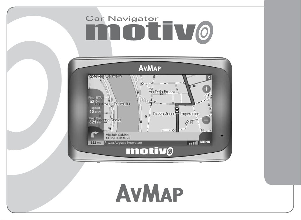
SATELLITE NAVIGATION
User Manual

English

User Manual
Warning:
The manufacturer and the distribution chain disclaim any liability
deriving from an improper use of the device in a way that may cause
accidents or damages to things or persons.
Using this navigator implies that the user accepts and follows all
these warnings and all the instructions contained on this manual. The
driver is held responsible for using the navigator in the correct way
(passenger or non passenger mode).
The User should ignore the indications suggested by the navigator in
situations that appear to be in contrast with the Highway Code. The
Manufacturer and the distribution chain disclaim any liability deriving
from an improper use of the device in a way that may violate the
Highway Code.
The Tele Atlas cartographic data loaded in the navigator may present
some discrepancies from the realit y. This is due to the continuous
changes in the street networ k. Some areas have a better coverage
than other s.
Impor tant:
Do not plac e the navigator in positions that may obstruct the
•
driver’s view.
Do not plac e the navigator in positions that may inter fere with the
•
correct functioning of the secur ity/safety equipment of the vehicle
(e.g. airbags).
Make sure that the navigator is cor rectly attached to the bracket
•
before driving.
Do not rely exclusively on vocal instructions. Depending on a
•
variety of factors, (speed, weather, GPS reception etc) these
instructions may not be correct or timely. Always take the
information provided as indicative, and always respect the
Highway Code. Satellite navigators should be considered merely
as aids. The driver is held responsible for safe driving and the
choice of the best route to take.
Do not consult the navigator whilst driving if this represents a
•
danger for you and other people.
Do not program the navigator while driving .
•
The precision of the GPS signal, in the best possible conditions is
•
guaranteed with a deviation of 15 meters.
N.B.: The information contained in this manual is updated to April
2007. Any subsequent changes in the system, in the func tions, in the
tools bar or maps introduced after this date will not be present in this
manual.
3
4
1. Introduction
1.1 Battery disposal
This product is equipped with a built-in Li-Ion battery. Do not use the
product in damp or corrosive environments. In order to lengthen the
life of the battery, do not recharge it at temperatures higher than 60°C.
THE LI-ION BATTERY PROVIDED WITH THE PRODUCT
MUST BE RECYCLED OR DISPOSED IN THE CORRECT
WAY.
1.2 Maintenance
Do not leave the navigator in direct sunlight for extended periods.
•
This could compromise the correct running of your navigator. If you
suspect that the navigator has been over heated because of sunlight
exposure, let the temperature of the car cool down, and wait for the
device temperature to go down to normal values before switching
it on.
Avoid knocking against the display.
•
Do not use oil based products to clean the LCD surface.
•
Keep away from water.
•
WEEE: Waste of Electric and Electronic Equipment
The symbol shown here and on the box indicates the
conformity to the WEEE directive. Do not dispose
of this WEEE product as domestic waste; some
substances contained in electronic equipment can
damage the environment and harm human health if
misused or if they are not disposed of in the correct
way. Return the device to the distributor when
purchasing a new one. The unlawful disposal of
these wastes is punished with sanctions.
R&TTE DL2 Directive: this device is in conformity with the UE
directive 99/5/CE
1.3 Content of the box
• Motivo Portable satellite navigator
• User Manual
• Mounting bracket with suction cup
• Car power supply
• USB cable
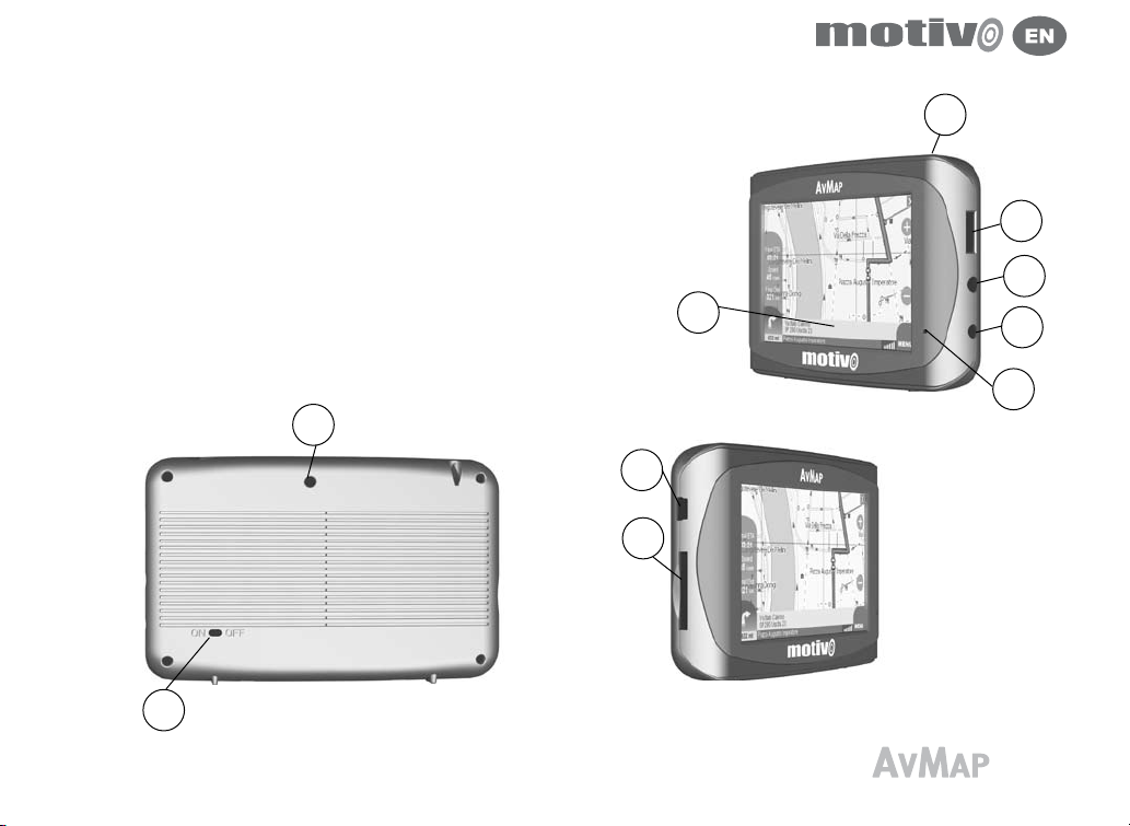
1.4 Hardware description
Looking at the navigator you can see the following components:
1. Power key
2. Volume control
3. Audio output for earphones
4. Power supply plug DC 5v
5. Batter y status led
6. 4.3” LCD display
7. USB por t
8. Slot for Secure Digital memory cards
9. Serial port for external GPS antenna
10. On/ Of f selector
9
10
1
2
3
6
7
8
4
5
5
6
2. Starting
To power on the navigator, position the ON/OFF selector on ON and
1.
then push the Power Key.
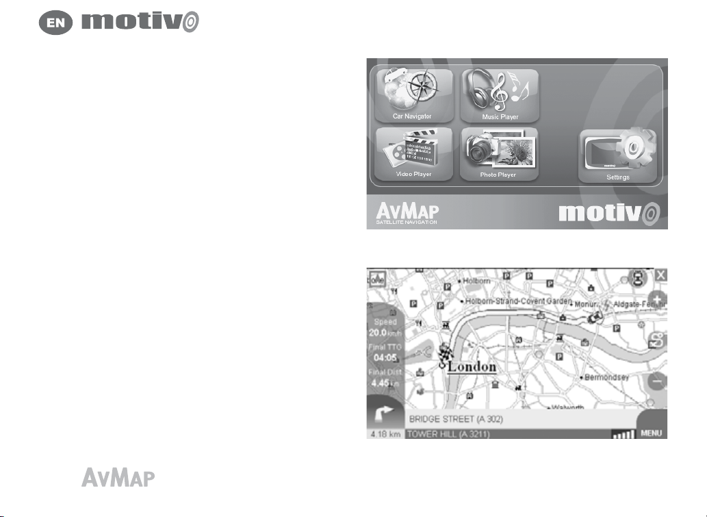
In the first screen choose among navigator, video player, mp3
2.
player and picture viewer. The first page of the satellite navigation
software displays some important warnings.
If the warnings are not in the language required, it is possible to set
3.
immediately the text language by touching the Language setting
button in the lower left corner. Select the desired language for the
text, and then touch the upper right arrow button to select the voice
language (for vocal instructions)
Touch the OK button to close the language setting window and go
4.
back to the warning page
Touch the Accept button to accept the warning and display the Map
5.
If a route was set before switching off the navigator, the navigation
6.
will continue toward the previously selected destination.
2.1 The Map
If the GPS signal is active, the position of the vehicle on the map is
shown with an Icon (e.g. a blue car).
On the right part of the map the zoom in and zoom out button are
displayed.
In the lower right corner of the screen the GPS icon shows the status
and quality of the GPS signal. Next to the GPS icon, The Menu button
allows opening the main menu.
In the lower part of the screen the information bar is displayed.
The information bar displays the name of the street you are travelling
 Loading...