

Page 1
XRX connection addendum booklet
EKPIV / EKPIV PRO / GeoPilot 2 Plus
AvMap/Navigation
133 Falmouth Rd Suite E Mashpee MA 02649
800.363.2627 Fax 508.539.4383
www.avmap.us / info@avmap.us
1
Page 2

XRX connection addendum booklet
EKPIV / EKPIV PRO / GeoPilot 2 Plus
1.LOCATE THE XRX CONNECTION FEATURE ........................................................................... 3
2.DISPLAY THE XRX FEATURE ON THE MAP ............................................................................ 4
NOTE:
XRX connection feature is mutually exclusive with the WX WEATHER Interface.
The two systems cannot operate at the same time on AvMap navigators. For receiver
information and purchase, please contact AvMap Navigation at 1-800-363-2627.
Your unit may require a Software update. You will need to have V2.15.175R or
higher.
If you do need an update, please got to www.avmap.us – You must be a registered
User to download.
1.Download the Software from the Website. You will then have to load the new SW file(s) ending
ins .SWX
EKPIV / EKPIV Pro will have 2 SW Files / GP II Plus will only have 1 SW Files
2.Insert your CF or SD Carde into a card reader on your computer and open it.
3.You will see a "Charts" folder, 2 files that end in .SWX and a CMap2.cer file (and maybe a
CMap.cer file too).
4.You will want to replace the older .swx file(s) with the new ones you have downloaded from the
Website. Delete the older .SWX file(s) from the Card
5. Copy the NEW downloaded .SWX files onto Card.
2
Page 3

1. LOCATE THE XRX CONNECTION FEATURE
The XRX connection feature is located in the SYSTEM SETUP MENU. This enables the user to
activate the connection and select the Range Alert radius setting to be applied (see XRX manual).
NOTE. To reach System Setup, hit MENU 3x from the map page.
3
Page 4

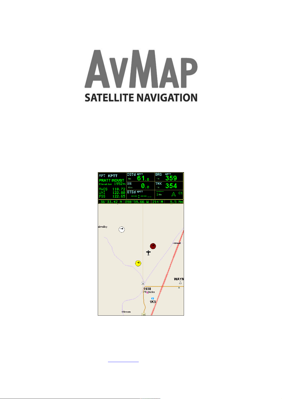
2. DISPLAY THE XRX FEATURE ON THE MAP
Set the XRX in communication PROFILE 2 mode in order to enable the device to send data through
the serial port.
As soon as “PROFILE 2 appears on the main page of the XRX LCD, turn DATA RECEPTION to
ON in the PCS XRX setup menu of the navigator, then select the Range Alert Radius (6Nm, 3 Nm
or 1 Nm). The logic applied to Range Alert Radius is the same as is used in the XRX.
Once the function is turned ON and the devices are correctly connected, when the XRX detects
traffic, one to three circles relative to the nearest aircraft will appear on the screen. Colors are
related to Range Alert Radius rating : White (No Threat), Yellow (Advisory) and Red (alert).
Each circle includes the aircraft’s relative altitude information in hundreds of feet, with a “+”
symbol if above and a “-“ if below. In case the aircraft is Ascending or descending an “A” or “D”
letter will be showed as well. For example :
NOTE. Circles are shown on the screen only in case of GPS reception.
4
 Loading...