

Page 1
Powerful Transportation Design
CAiCE™Visual Roads® 10 software helps you create design models for all
types of transportation projects,including simple roads,complex highways
and interchanges,airport runways,canals, and dikes.User-defined
restraints for roadway design make CAiCE Visual Roads software completely
customizable to any level of detail.Used by government agencies and civil
engineering companies across North America,CAiCE Visual Roads software
provides robust engineering capabilities that support every phase of the
transportation design process.
Adaptable
You can completely customize CAiCE Visual Roads
to support your local design standards.Userdefined restraints lend flexibility to both simple
and complex road designs,so you can modify
alignment design constraints,superelevation
specifications,profile constraints,and cross section
details more efficiently.You can even plug in
CAiCE fragments,which are ready-made components such as raised or depressed medians,travel
lanes,and catch slopes.Plus you can develop or
change alignments and profiles quickly,so it’s easy
to try out alternative designs.
Interactive
Creating alignments,profiles,superelevation specifications,and design models is a completely interactive process.The design utilities provided by
CAiCE Visual Roads include built-in,user-definable
design tools that automate the process of meeting
design requirements,such as minimum radius and
spiral length,superelevation application, and sight
distance on vertical curves.
Intelligent
Robust and easy-to-use earthwork computation
capabilities help you classify and compute volumes for different material types. You can use the
Horizontal Alignment Editor to create or modify
alignments using any combination of numerical
input and onscreen graphical digitizing. You can
access user-definable tables that define minimum
curve radii,spirals, and vertical curve lengths
based on the design speed. The features combined in CAiCE Visual Roads help you meet all the
challenges of roadway design.
www.autodesk.com/caice
CAiCE
™
Visual®Transportation
CAiCE™Visual Roads®10
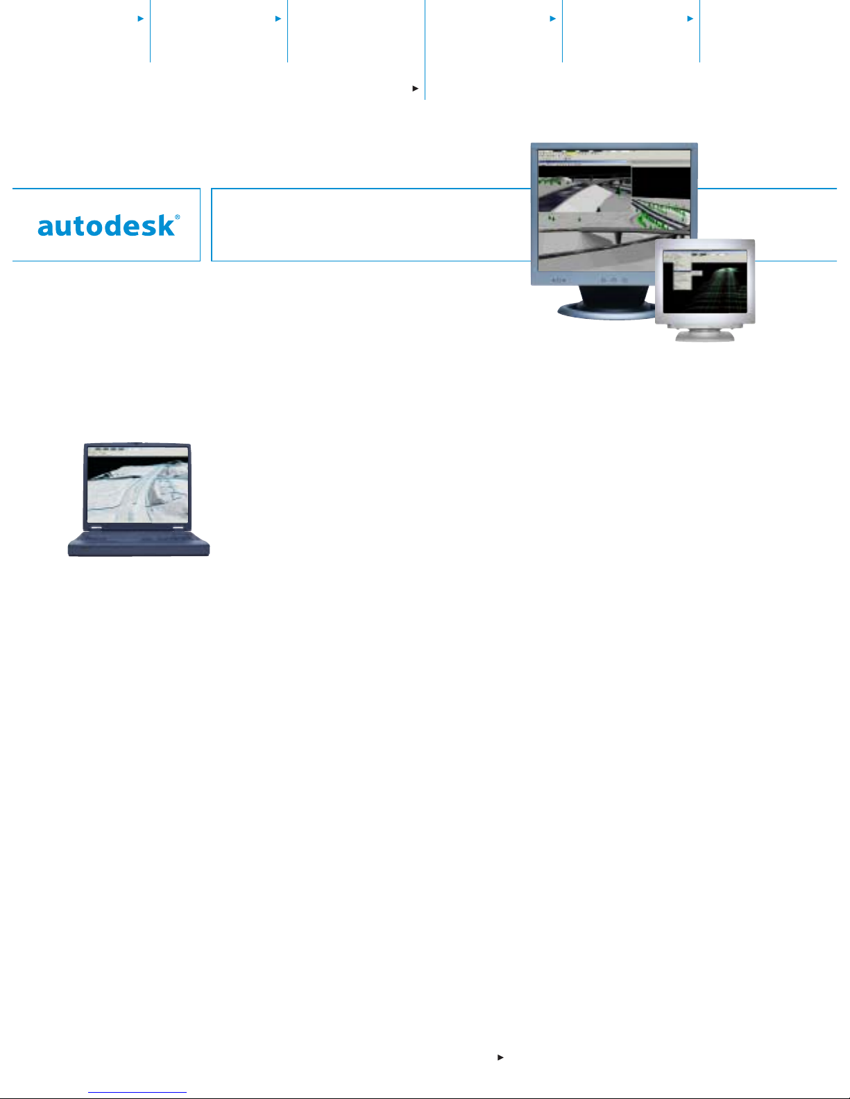
The powerf ul CAiCE Visual
Roads visualization tools
make problem areas and conflicts easy to spot,and you
can instantly see the results
of modifications.
Page 2
CAiCE Visual Roads 10
Autodesk,Inc.
410 Ware Blvd.,Suite 1200
Tampa, FL 33619
USA
Autodesk, AutoCAD,CAiCE,DXF,Visual,and Visual Roads
are either registered trademarks or trademarks of
Autodesk, Inc.,in the USA and/or other countries.All other
brand names,product names,or trademarks belong to
their respective holders.
© 2003 Autodesk,Inc.All rights reserved.
000000000000113357
Digital Terrain Modeling (DTM)
•
Work wi t h larg e d ata sets.
•
Construct cross sections.
•
Tag obscured areas.
•
Detect and resolve breakline crossings.
•
Compute f reehand cross sec tions and
profiles.
•
Perform 3D site design,including building pads,retention basins,and interchanges.
•
Display surface slopes,water flow directions,and catchment areas.
Geometric Layout
•
Create interactive horizontal and vertical
alignment.
•
Define edges of pavements, intersection
geometry,compound curves,and spirals.
•
Automate de s ign checks.
•
Compute b e st - fit alignment to sur veyed
points.
Profile Definition
•
Define profiles with graphical and numerical input.
•
Check sight distance criteria and overlaps.
•
Compute best-fit profile to surveyed points.
Cross Section Design
•
Define proposed cross sections with
customizable fragment libraries.
•
Define rehabilitation criteria and methodology.
•
Design multiple alignments and roadways
simultaneously.
Superelevation Definition
•
Calculate multiple slope and shoulder
superelevation.
•
Work wi t h auto matic overlap resolution.
•
Use customizable ASCII superelevation
table files.
Earthwork Analysis
•
Calculate volumes and generate reports.
•
Define material exceptions.
Data Format Compatibility
Compatible with most data formats,such
as AutoCAD
®
DWG (including 2004),DGN
(including V8),DXF
™
,and LandXML.
Quantity Estimating
•
Calculate pay-item quantities.
•
Create reports and pay item tables.
Redesign
•
Modify and rerun design files and run in
batch mode.
•
Use interactive template editor for design
modifications.
Customization and Report Generation
•
Integrated Microsoft®Visual Basic®for
Applications (VBA) for customized macros.
•
Use VBA to link your project database to
other databases.
Visualization,Graphics,and Imaging
•
Display realistic,real-time project renditions.
•
Drape images onto surfaces,and view
background files.
•
Map images to real-world coordinates.
•
Create AVI files for drivethroughs,design
reviews,and client presentations.
Drafting/Plans Production
•
Manipulate and label text.
•
Annotate and plot plans,profiles,and
cross sections.
•
Draw line segments,line strings,and cells.
System Requirements
For s y stem requirements,visit
www.caice.com.
Compan io n Pro d ucts and Services
Autodesk pr ovi des integrated consulting,
training,and support to help you get the
best return on your investment in
Autodesk® technology.
The CAiCE Maintenance Program gives
you complete technical support and
access to the latest CAiCE software releases
and enhancements,simplifying your
software management and budgeting
process. To learn more,contact your
Autodesk Au th or ized Reseller.
Purchase or Le ar n M o re
To le arn more about CAiCE Visual Roads,
visit www.autodesk.com/caice.Purchase
CAiCE Visual Roads through your
Autodesk Au th orized Reseller.To locate
the reseller nearest you,visit
www.autodesk.com/reseller.
www.autodesk.com/caice
 Loading...