

Page 1
LEO
Earth Science/
Remote Sensing
Landsat 8
Continuing the Landsat Mission
FACTS AT A GLANCE
Mission Description
Landsat 8 is a joint mission formulated, implemented, and operated by the National Aeronautics and
Space Administration (NASA) and the Department of Interior (DOI) United States Geological Survey
(USGS) that builds upon previous Landsat missions. Landsat 8 is a remote sensing satellite mission
providing coverage of the Earth’s land surfaces, collecting multi-spectral land images, including
infrared. Landsat 8 continues the more than 40 years of global data collection and distribution of the
Earth’s continental surfaces by the Landsat series of satellites to support global change research and
applications. This data constitutes the longest continuous record of the Earth’s surface as seen from
space.
Spacecraft
Orbital was responsible for the design and manufacture of the Landsat 8 spacecraft bus, the integration
of the customer-furnished payload instruments, and full observatory testing, including environmental
and EMI/EMC. To meet the performance and schedule challenges, a simple, robust design was utilized
based on Orbital's ight-proven LEOStar-3 standard bus. This ensures that Landsat 8 will continue the
Landsat heritage, obtaining unique and valuable data and imagery to be used in agriculture, education,
business, science, and government.
• Landsat 8 provides data continuity
following Landsat 5 and 7
• 705 km Low Earth Orbit mission
• Simple, easily integrated design based
on Orbital's ight-proven LEOStar™-3
standard modular spacecraft
architecture that reduces assembly
and test cycle times
• Moving mechanisms were eliminated
to improve reliability, simplify
operations, and ensure service to the
international cooperators
• Landsat data products are available
for free to the general public from
the USGS, enabling a broad scope
of scientic research and land
management applications. Go to:
http://landsat.usgs.gov/index.php
Customer:
NASA Goddard Space Flight Center
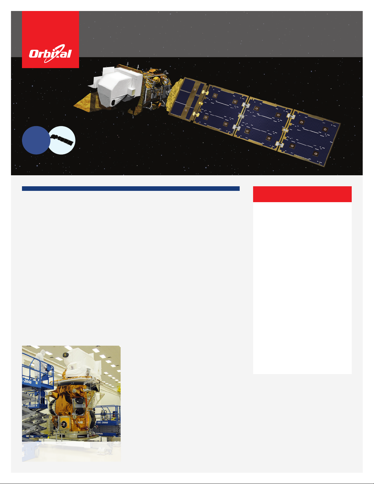
Scientic instruments being integrated with
the Landsat 8 satellite bus in Gilbert, Arizona
Page 2
Landsat 8
Specications
Spacecraft
Launch Mass: NTE 3,085 kg (6,801 lb.)
Solar Arrays: Triple-junction GaAs cells, 3750 W EOL
Orbit: 705 km circular @ 98.2
°
Stabilization: 3-axis, zero momentum bias, nadir pointing
Pointing Stability: 6.02 microradians
Data Storage: 4,000 Gbits BOL
Data Downlink: X-band, 384 Mbps (over two channels)
Propulsion: 395 kg (870 lb.) of blowdown monopropellant
hydrazine with eight (8) 22N thrusters
Design Life: 5.25 years, 10 year goal
Launch
Launch Vehicle: Atlas V – 401
Launch Site: Vandenberg Air Force Base, California
Date: February 11, 2013
Instruments
Operational Land Imager (OLI)
The OLI collects land-surface data in the visible and near-infrared spectra, and
features two additional spectral channels: one for coastal and aerosol studies, and
another for cirrus cloud detection.
Thermal InfraRed Sensor (TIRS)
TIRS coincidently collects data for two longwave (thermal) spectral bands not
imaged by the OLI.
Mission Partners
Orbital Sciences Corporation
Spacecraft design, integration and test, launch mission
operations
NASA Goddard Space Flight Center
Project management, TIRS instrument, OLI instrument
management
United States Geological Survey
Data processing and archiving, ground systems
management, mission operations
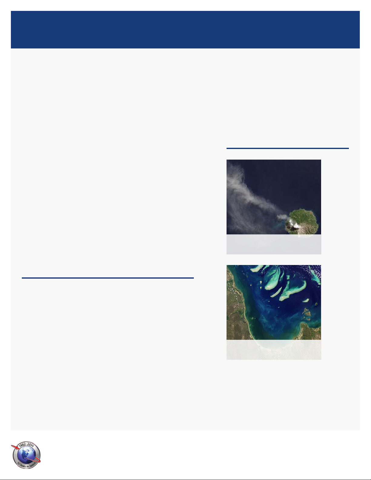
Landsat 8 image of Paluweh volcano ash
plume, Indonesia
Landsat 8: Continuing the Landsat Legacy
Because of Landsat's long history and unparalleled data record, data continuity
with prior Landsat missions is paramount because the two most recent Landsat
observatories, Landsat 5 and 7, far exceeded their design. NASA chose Orbital
as their Landsat 8 spacecraft partner in consideration of Orbital's legacy of
exceptional performance and short delivery times.
The Landsat 8 mission is charged with collecting data sufciently consistent with
data from early Landsat satellites to allow comparisons for regional and global
change detection. Landsat 8 has two new spectral bands, one tailored especially
for detecting cirrus clouds and the other for coastal zone observation. Additionally,
Landsat 8 will return more than twice as many scenes per day than Landsat 7,
increasing the probability of capturing cloud-free scenes of the global landmass.
Orbital Sciences Corporation
45101 Warp Drive
©2014 Orbital Sciences Corporation FS009_10_2998
•
Dulles, Virginia 20166
•
www.orbital.com
Landsat 8 image of Princess Charlotte Bay,
Australia
 Loading...