

Page 1
LEO
Earth Science/
Remote Sensing
Coriolis
A Low Earth Orbit Meteorological Science Satellite
FACTS AT A GLANCE
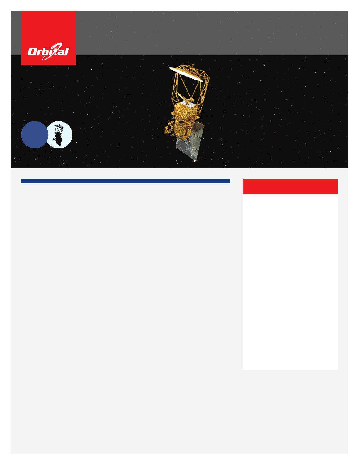
Mission Description
Coriolis is a USAF/SMC and Space and Naval Warfare Systems Command meteorological science
mission to demonstrate the viability of using polarimetric radiometry to measure ocean surface wind
speed and direction from space, and to demonstrate predictions of geomagnetic disturbances through
continuous observation of Coronal Mass Ejections. Two government furnished payload instruments are
utilized: WindSat and the Solar Mass Ejection Imager (SMEI). These instruments gather science data
that is stored onboard the spacecraft and, upon ground command, is subsequently downlinked on
X-band to a ground station.
Spacecraft
Orbital was the space system integrator as well as the designer and manufacturer of the spacecraft
bus. Orbital also developed backup ground station elements, supported launch vehicle integration, and
continues to provide on-orbit support.
Key performance features include extremely low levels of Electromagnetic Interference (EMI) emissions
that could impair the operation of WindSat's passive radiometers; physical accommodation of WindSat,
with its 125 kilograms spinning platform, that ensures an unobstructed science eld of view while
providing the necessary power, pointing knowledge, control, and stability; and full redundancy with
robust fault management and sang capabilities. Orbital built robustness into Coriolis' control and
sang algorithms including satellite recovery and placement in a thermally safe, power safe attitude in
response to disruption of the WindSat spin rate or failure of its momentum compensation system.
Coriolis was launched in January 2003 from Vandenberg Air Force Base aboard a Titan II rocket.
Designed for a three year mission, Coriolis remains operational after more than nine years in orbit with a
cumulative bus availability of 98 percent. Orbital continues to provide Sustaining Engineering support to
the mission.
• Joint Air Force and Navy program
• Launched January 6, 2003 on a Titan
II rocket from Vandenberg AFB
• 830 x 830 km, 98.7° inclination
• Coriolis continues to perform on-orbit
after more than three times its design life
• The WindSat instrument measures
ocean surface wind speed and
direction and the SMEI images coronal
mass ejections
• Spacecraft maintains extremely low
electromagnetic emissions to prevent
interference with WindSat's passive
radiometers
• Simple, easily integrated design based
on Orbital's ight-proven LEOStar-3
modular spacecraft architecture
Customers:
USAF SMC/SDTW – Kirtland Air Force
Base, New Mexico
Naval Research Laboratory
Page 2
Coriolis
Specications
Spacecraft
Launch Mass: 816 kg (1,799 lb.)
Solar Arrays: Fixed, 3-panel, 2-jct GaAs, 1174 W EOL
Orbit: 830 x 830 km @ 98.7
°
inclination
Stabilization: 3-axis, pitch momentum bias
Pointing Knowledge: 194 arcsec (3s)
Data Storage: 30.0 Gbits
Data Downlink: 25.6 or 51.2 Mbps (selectable), X-band
Propulsion: Four 4.48 Newton (1 lb.) thrusters (204 mps DV)
Mission Life: 3 years; 5 year goal
Current Status: Operational
Launch
Launch Vehicle: Titan II
Launch Site: Vandenberg Air Force Base, California
Date: January 6, 2003
Instruments
Windsat, Passive Polarimetric Microwave Radiometer
A highly sensitive 6.8 to 37 GHz receiver for measuring ocean surface wind
speed and direction. Provides risk reduction data for the National Polar-orbiting
Operational Environmental Satellite System (NPOESS) development of the Conical
Microwave Imager Sounder (CMIS). WindSat is 3.3 meters high with a mass of
305 kg, and it includes a 125 kg rotating platform that spins about the Earth-
pointing yaw axis at 29.6 RPM.
Solar Mass Ejection Imager (SMEI)
A 35 kg all-sky camera experiment for imaging Coronal Mass Ejections (CME)
propagating from the sun through the solar wind. 4π steradians of sky coverage is
provided per orbit.
Mission Partners
USAF SMC/SDTW (Kirtland Air Force Base, New
Mexico)
Procuring agency, provided customer program
management
Orbital Sciences Corporation
Prime contractor and system integrator responsible for
spacecraft design and manufacture, payload integration,
and system test; launch support; on-orbit operations support
Naval Research Laboratory
On-orbit operator, led the WindSat instrument
development
NPOESS Integrated Program Ofce (Silver
Spring, Maryland) and the Naval Center for Space
Technology (Washington, D.C.)
Developed the WindSat instrument
Air Force Research Laboratory
Led the SMEI instrument development
University of Birmingham (Birmingham, U.K.),
University of California (San Diego), Rutherford
Appleton Laboratories (Oxfordshire, U.K.), and
Boston College
Developed the SMEI instrument
Orbital Sciences Corporation
45101 Warp Drive
©2014 Orbital Sciences Corporation FS001_11_2998
•
Dulles, Virginia 20166
•
www.orbital.com
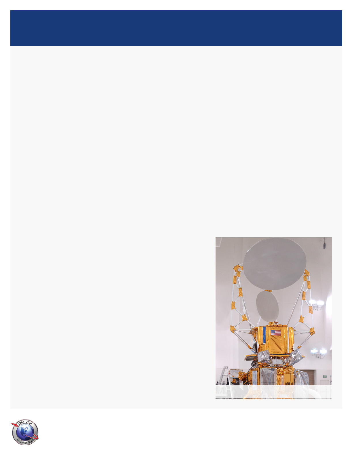
Coriolis in nal checkout
 Loading...