

Page 1
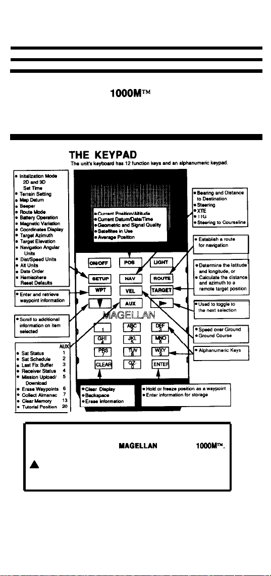
Magellan GPS NAV
Field Card
READ USER GUIDE COMPLETELY TO INSURE PROPER
AND SAFE USE OF THE
THIS
SYMBOL IS USED FOR IMPORTANT SAFETY
INFORMATION. WHEN YOU SEE THIS SAFETY SYMBOL,
CAREFULLY READ AND FOLLOW THE MESSAGE.
GPS NAV
Page 2
THE UNIT
Use the SETUP key to
position.
Enter your approximate position
the time in Universal Coordinated Time (UTC),
also called GMT.
The recommended mode for land use is 3D. In 2D mode, best
accuracies are obtained when the correct attitude is entered
5 meters).
NOTE: ff you
have moved
last position fix,
SETUP key.
the unit before attempting to take a
300 miles).
than
miles since
using the
COLLECTING AN ALMANAC
If during the start up the NAV
Almanac, connect the unit to external power (if possible) and press
the POS key. An Almanac contains information which locates GPS
satellites in the sky; the NAV
looking for the GPS satellites it will use for the position fix. The
information can be collected from any one satellite in the GPS
constellation. Once the NAV
will take about 13 minutes.
AUX 7 can also be used to collect an Almanac or to refresh an old
one.
NOTE: To
conserve the alkaline batteries, external power
Is recommended for
instructs you to collect an
consults its Almanac before
locates a satellite, this process
this function.
OBTAINING A POSITION FIX
1.
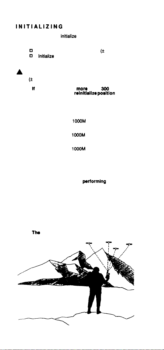
In hand-held operation, turn the antenna directly upward, hold the
unit at eye-level, with an unobstructed view of the sky in all
directions.
2.
Press the ON key and watt until you see the ready indicator.
NOTE: The
antenna must have an unobstructed vlew
the sky.
your
of
Page 3

3.
Press the POS key. The time to obtain your first fix will be
roughly 2
on the distance and time from the last position fix, and other
factors.
4.
When using the exterior antenna, make certain the units attached
antenna is folded downward within the shield of the quick-release
Averaged Positions
You may obtain averaged positions by pressing the RIGHT ARROW key
when you are on the position
NOTE: You must be taking
Press the clear key while on the averaging screen to restart the
averaging process.
minutes in 2D and 3
and that the unit is connected to power.
averaged together, the unit will start the process
over.
WARNING:
warning symbol appears and the GQ
Do not use the position fix if this
minutes in 3D depending
screen.
fixes. After 999 fixes are
3.
WAYPOINTS
To view, press WPT and RIGHT ARROW.
To save a position fix, press ENTER while viewing any position.
To enter a waypoint, press WPT and ENTER to begin data entry.
To rename, select waypoint and press ENTER.
To
erase,
To era88 all waypoints. press AUX 6.
NOTE: Keep a written record of all waypoints.
select waypoint and press CLEAR.
TARGET
The target function will let you calculate the coordinates for a remote
target position (given an azimuth and distance), or the azimuth and
distance to a target (given a position). Press the
screen will let you select between calculating a position or a range and
azimuth. Select by pressing the RIGHT ARROW key. Press the
DOWN ARROW
enter the pertinent information.
For Position . . .
If you select position, the unit will ask where you would like to calculate
from. You may select from your waypoints or last fix or averaged position.
Most likely you will use your lastfx position. Enter your range, azimuth,
and elevation angle to your target. The unit will calculate the targets
position.
For Range and Azimuth
If you select range and azimuth, the NAV
want to calculate from (lastfx, avg, and waypoints) and where you want to
calculate to (waypoints). The unit will then calculate the distance and
azimuth to the target.
key when you are done; the unit will then ask you to
TARGET
unit will ask where you
key, the first
SINGLE FIX OPERATION
You may run the unit in single fix operation to help conserve battery
power.
In single fix operation the NAV
if you press no key for 120 seconds, only take one fix when you push
the POS key and no velocity related information is available. You
may access single fix operation under battery operation under the
SETUP key.
is designed to cycle off
Page 4

LOW BATTERY WARNINGS
In hand-held battery operation, the Magellan GPS NAV
When you see the battery symbol on the display, have a
loaded battery clip ready. When you see the second warning
“Replace Batteries or Lose Data”
change the battery clip.
OPENING THE BATTERY DOOR
Remove the back cover by pulling
downward on the compartment
door. After removing the battery clip,
you have two minutes to exchange
clips before losing waypoints and
other stored information. Place the
clip in the holder with the open side
(batteries showing) facing up.
Before replacing the cover, use a
soft cloth to remove all dirt and sand
from the sealing gasket. Slide the
cover back into place, applying
pressure the last
inch.
TROUBLE SHOOTING
Found
Make sure the antenna (on unit or exterior) is vertical and has a
clear view of the sky.
q
Check the initialization. The unit should be initialized within 300
miles of your position with the correct date and time in Universal
Time (UTC).
q
Wait 10 minutes and try again. Under some conditions, the unit
may not “see” satellites which are very close to the horizon.
More Satellites Needed
Check for satellite availability by pressing the AUX 1, Sat Status
key, and resetting any satellites you may have turned off with this
function.
Try 2D mode if three satellites are available, and if you know your
altitude.
Searching the Sky
q
For hand-held, battery operation, make sure the unit is free from
obstructions.
Press SETUP to check the initialization position, date and time.
n
NO of this
means. electronic or mechanical, including photocopying and recording, for any
purpose other than the
Magellan Systems Corporation.
Copyright Magellan Systems Corporation. 1991. All rights reserved.
Corporation.
No
Card may be reproduced or
and GPS NAV
in any
or by any
personal use without the written permission
are the trademarks
Magellan Systems
 Loading...