

Page 1
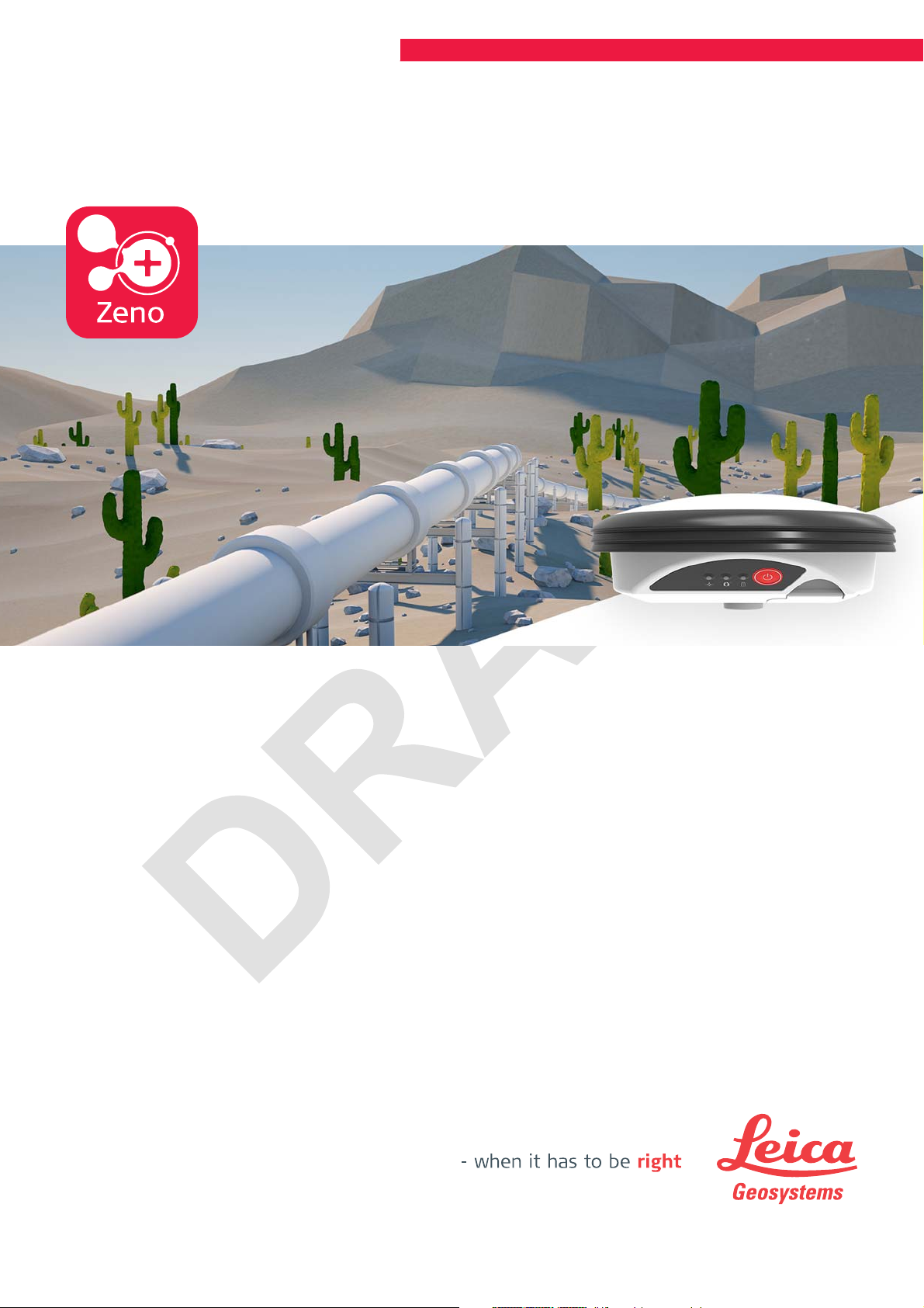
Leica Zeno GG04 plus
User Manual
Version 1.0
English
Page 2
Introduction
Purchase
Product Identification
Trademarks
Congratulations on the purchase of a Leica GG04 plus GNSS instrument.
This manual contains important safety directions as well as instructions for setting up the product and operating it. Refer to "2 Description of the System" for
further information.
Read carefully through the User Manual before you switch on the product.
The model and serial number of your product are indicated on the type plate.
Always refer to this information when you need to contact your agency or
Leica Geosystems authorised service centre.
•
Windows is a registered trademark of Microsoft Corporation in the United
States and other countries
•
Bluetooth
•
The operating system is using the Android Open Source Project (AOSP).
The license associated with it is available at https://source.android.com/
source/licenses.html#android-open-source-project-license.
•
iPad and iPhone are trademarks of Apple Inc., registered in the U.S. and
other countries. iPad Air, iPad pro and iPad mini are trademarks of Apple
Inc
Refer to the Apple Trademark List at www.apple.com/legal/intellectualproperty/trademark/appletmlist.html for the correct trademark symbol.
®
is a registered trademark of Bluetooth SIG, Inc.
Validity of this manual
Available documentation
All other trademarks are the property of their respective owners.
This manual applies to all models of the Leica GG04 plusGNSS instrument.
Where there are differences between the various instruments they are clearly
described.
Name Description/Format
LeicaGG04
plus Quick
Guide
LeicaGG04
plus User
Manual
Refer to the myWorld web page for all GG04 plus documentation/software:
•
https://myworld.leica-geosystems.com
Provides an overview of the product together with
technical data and safety directions. Intended as a
quick reference guide.
All instructions required in order to operate the
product to a basic level are contained in the User
Manual. Provides an overview of the product
together with technical data and safety directions.
-
2
Page 3

myWorld@Leica Geosystems (https://myworld.leica-geosystems.com) offers
a wide range of services, information and training material.
With direct access to myWorld, you are able to access all relevant services
whenever it is convenient for you.
Service Description
myProducts Add all products that you and your company own
and explore your world of Leica Geosystems: View
detailed information on your products and update
your products with the latest software and keep upto-date with the latest documentation.
myService View the current service status and full service his-
tory of your products in Leica Geosystems service
centres. Access detailed information on the services
performed and download your latest calibration certificates and service reports.
mySupport View the current service status and full service his-
tory of your products in Leica Geosystems service
centres. Access detailed information on the services
performed and download your latest calibration certificates and service reports.
myTraining Enhance your product knowledge with Leica Geosys-
tems Campus - Information, Knowledge, Training.
Study the latest online training material on your
products and register for seminars or courses in your
country.
myTrustedServices Add your subscriptions and manage users for Leica
Geosystems Trusted Services, the secure software
services, that assist you to optimise your workflow
and increase your efficiency.
3
Page 4

Table of Contents
1 Safety Directions 5
1.1 General Introduction 5
1.2 Definition of Use 6
1.3 Limits of Use 6
1.4 Responsibilities 6
1.5 Hazards of Use 7
1.6 Electromagnetic Compatibility EMC 11
1.7 FCC Statement, Applicable in U.S. 13
2 Description of the System 15
2.1 General Information 15
2.2 System Components 16
2.3 Data Collection 17
2.4 Power Concept 17
2.5 Leica Zeno GIS Software 18
2.6 Accessories 18
3 Operation 19
3.1 Guidelines for Correct Results with GNSS Surveys 19
3.2 Batteries 19
3.2.1 Operating Principles 19
3.2.2 Battery for GG04 plus 19
3.3 Equipment Setup as a Real-Time Rover 20
3.3.1 Setup with Leica Zeno GIS Hardware and Software 20
3.3.2 Setup with Third-Party Mobile Devices 21
3.4 Connection with Leica Zeno GIS Software 23
3.5 Correction Service Spot Lite and Spot Prime (PPP) 26
4 Care and Transport 27
4.1 Transport 27
4.2 Storage 27
4.3 Cleaning and Drying 27
5 Technical Data 29
5.1 Tracking Characteristics GG04 plus 29
5.2 Accuracy 29
5.3 Technical Data 30
5.4 Conformity to National Regulations 32
5.4.1 Dangerous Goods Regulations 33
6 Software Licence Agreement 34
Appendix A Firmware Upgrade 35
Appendix B Pin Assignments and Sockets 36
4 Table of Contents
Page 5
1 Safety Directions
1.1 General Introduction
Description
About Warning Messages
The following directions enable the person responsible for the product, and the
person who actually uses the equipment, to anticipate and avoid operational
hazards.
The person responsible for the product must ensure that all users understand
these directions and adhere to them.
Warning messages are an essential part of the safety concept of the instrument. They appear wherever hazards or hazardous situations can occur.
Warning messages...
•
make the user alert about direct and indirect hazards concerning the use
of the product.
•
contain general rules of behaviour.
For the users‘ safety, all safety instructions and safety messages shall be
strictly observed and followed! Therefore, the manual must always be available
to all persons performing any tasks described here.
DANGER, WARNING, CAUTION and NOTICE are standardised signal words for
identifying levels of hazards and risks related to personal injury and property
damage. For your safety, it is important to read and fully understand the following table with the different signal words and their definitions! Supplementary safety information symbols may be placed within a warning message as
well as supplementary text.
Type Description
Indicates an imminently hazardous situation
DANGER
WARNING
CAUTION
NOTICE
☞
which, if not avoided, will result in death or
serious injury.
Indicates a potentially hazardous situation or
an unintended use which, if not avoided,
could result in death or serious injury.
Indicates a potentially hazardous situation or
an unintended use which, if not avoided,
may result in minor or moderate injury.
Indicates a potentially hazardous situation or
an unintended use which, if not avoided,
may result in appreciable material, financial
and environmental damage.
Important paragraphs which must be adhered
to in practice as they enable the product to
be used in a technically correct and efficient
manner.
Safety Directions 5
Page 6
1.2 Definition of Use
Intended use
•
Measuring raw data using carrier phase and code signal from GNSS satellites.
•
Computing with software.
•
Recording measurements.
•
Recording GNSS and point related data.
•
Carrying out measurement tasks using various GNSS measuring techniques.
•
Data communication with external appliances.
Reasonably foreseeable misuse
•
Use of the product without instruction.
•
Use outside of the intended use and limits.
•
Disabling safety systems.
•
Removal of hazard notices.
•
Opening the product using tools, for example screwdriver, unless this is
permitted for certain functions.
•
Modification or conversion of the product.
•
Use after misappropriation.
•
Use of products with recognizable damages or defects.
•
Use with accessories from other manufacturers without the prior explicit
approval of Leica Geosystems.
•
Inadequate safeguards at the working site.
•
Controlling of machines, moving objects or similar monitoring application
without additional control and safety installations.
1.3 Limits of Use
Environment
Suitable for use in an atmosphere appropriate for permanent human habitation: not suitable for use in aggressive or explosive environments.
DANGER
▶
Local safety authorities and safety experts must be contacted before working in hazardous areas, or close to electrical installations or similar situations by the person in charge of the product.
1.4 Responsibilities
Manufacturer of the
product
Leica Geosystems AG, CH-9435 Heerbrugg, hereinafter referred to as Leica
Geosystems, is responsible for supplying the product, including the user manual and original accessories, in a safe condition.
6 Safety Directions
Page 7
Person responsible
for the product
The person responsible for the product has the following duties:
•
To understand the safety instructions on the product and the instructions
in the user manual.
•
To ensure that it is used in accordance with the instructions.
•
To be familiar with local regulations relating to safety and accident prevention.
•
To inform Leica Geosystems immediately if the product and the application
becomes unsafe.
•
To ensure that the national laws, regulations and conditions for the operation of the product are respected.
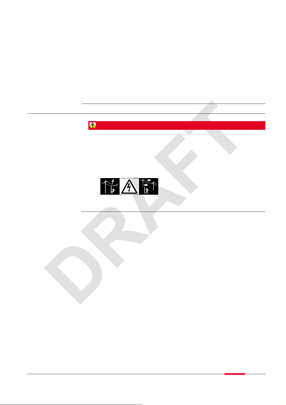
1.5 Hazards of Use
DANGER
Because of the risk of electrocution, it is dangerous to use poles, levelling
staffs and extensions in the vicinity of electrical installations such as power
cables or electrical railways.
Precautions:
▶
Keep at a safe distance from electrical installations. If it is essential to
work in this environment, first contact the safety authorities responsible
for the electrical installations and follow their instructions.
Safety Directions 7
Page 8
DANGER
If the product is used with accessories, for example on masts, staffs, poles,
you may increase the risk of being struck by lightning. Danger from high voltages also exists near power lines. Lightning, voltage peaks, or the touching of
power lines can cause damage, injury and death.
Precautions:
▶
Do not use the product in a thunderstorm as you can increase the risk of
being struck by lightning.
▶
Be sure to remain at a safe distance from electrical installations. Do not
use the product directly under or close to power lines. If it is essential to
work in such an environment contact the safety authorities responsible for
electrical installations and follow their instructions.
▶
If the product has to be permanently mounted in an exposed location, it is
advisable to provide a lightning conductor system. A suggestion on how to
design a lightning conductor for the product is given below. Always follow
the regulations in force in your country regarding grounding antennas and
masts. These installations must be carried out by an authorised specialist.
▶
To prevent damages due to indirect lightning strikes (voltage spikes)
cables, for example for antenna, power source or modem should be protected with appropriate protection elements, like a lightning arrester. These
installations must be carried out by an authorised specialist.
▶
If there is a risk of a thunderstorm, or if the equipment is to remain
unused and unattended for a long period, protect your product additionally
by unplugging all systems components and disconnecting all connecting
cables and supply cables, for example, instrument - antenna.
WARNING
During dynamic applications, for example stakeout procedures there is a danger of accidents occurring if the user does not pay attention to the environmental conditions around, for example obstacles, excavations or traffic.
Precautions:
▶
The person responsible for the product must make all users fully aware of
the existing dangers.
WARNING
Inadequate securing of the working site can lead to dangerous situations, for
example in traffic, on building sites and at industrial installations.
Precautions:
▶
Always ensure that the working site is adequately secured. Adhere to the
regulations governing safety, accident prevention and road traffic.
8 Safety Directions
Page 9
WARNING
If the product is used with accessories, for example masts, staffs, poles, you
may increase the risk of being struck by lightning.
Precautions:
▶
Do not use the product in a thunderstorm.
WARNING
High mechanical stress, high ambient temperatures or immersion into fluids
can cause leakage, fire or explosions of the batteries.
Precautions:
▶
Protect the batteries from mechanical influences and high ambient temperatures. Do not drop or immerse batteries into fluids.
WARNING
If battery terminals are short circuited e.g. by coming in contact with jewellery,
keys, metallised paper or other metals, the battery can overheat and cause
injury or fire, for example by storing or transporting in pockets.
Precautions:
▶
Make sure that the battery terminals do not come into contact with metallic objects.
WARNING
Incorrect fastening of the external antenna to vehicles or transporters poses
the risk of the equipment being broken by mechanical influence, vibration or
airstream. This may result in accident and physical injury.
Precautions:
▶
Attach the external antenna professionally. The external antenna must be
secured additionally, for example by use of a safety cord. Ensure that the
mounting device is correctly mounted and able to carry the weight of the
external antenna (>1 kg) safely.
Safety Directions 9
Page 10
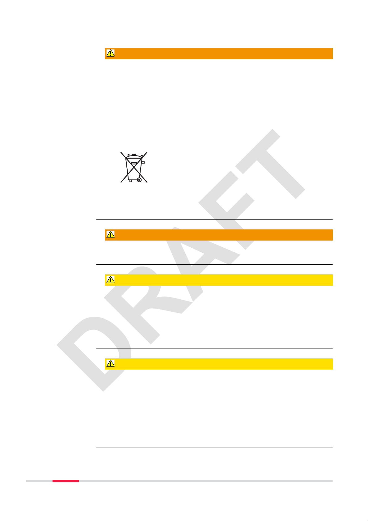
WARNING
If the product is improperly disposed of, the following can happen:
•
If polymer parts are burnt, poisonous gases are produced which may
impair health.
•
If batteries are damaged or are heated strongly, they can explode and
cause poisoning, burning, corrosion or environmental contamination.
•
By disposing of the product irresponsibly you may enable unauthorised
persons to use it in contravention of the regulations, exposing themselves
and third parties to the risk of severe injury and rendering the environment
liable to contamination.
Precautions:
▶
Product-specific treatment and waste management information can be
received from your Leica Geosystems distributor.
The product must not be disposed with household waste.
Dispose of the product appropriately in accordance with
the national regulations in force in your country.
Always prevent access to the product by unauthorised personnel.
WARNING
Only Leica Geosystems authorised service centres are entitled to repair these
products.
CAUTION
If the accessories used with the product are not properly secured and the
product is subjected to mechanical shock, for example blows or falling, the
product may be damaged or people can sustain injury.
Precautions:
▶
When setting up the product, make sure that the accessories are correctly
adapted, fitted, secured, and locked in position.
Avoid subjecting the product to mechanical stress.
CAUTION
During the transport, shipping or disposal of batteries it is possible for inappropriate mechanical influences to constitute a fire hazard.
Precautions:
▶
Before shipping the product or disposing of it, discharge the batteries by
running the product until they are flat.
When transporting or shipping batteries, the person in charge of the product must ensure that the applicable national and international rules and
regulations are observed. Before transportation or shipping contact your
local passenger or freight transport company.
10 Safety Directions
Page 11
Lightning conductors
Suggestion for design of a lightning conductor for a GNSS system:
1. On non-metallic structures
Protection by air terminals is recommended. An air terminal is a pointed
solid or tubular rod of conducting material with proper mounting and connection to a conductor. The position of four air terminals can be uniformly
distributed around the antenna at a distance equal to the height of the air
terminal.
The air terminal diameter should be 12 mm for copper or 15 mm for aluminium. The height of the air terminals should be 25 cm to 50 cm. All air terminals should be connected to the down conductors. The diameter of the
air terminal should be kept to a minimum to reduce GNSS signal shading.
2. On metallic structures
Protection is as described for non-metallic structures, but the air terminals
can be connected directly to the conducting structure without the need for
down conductors.
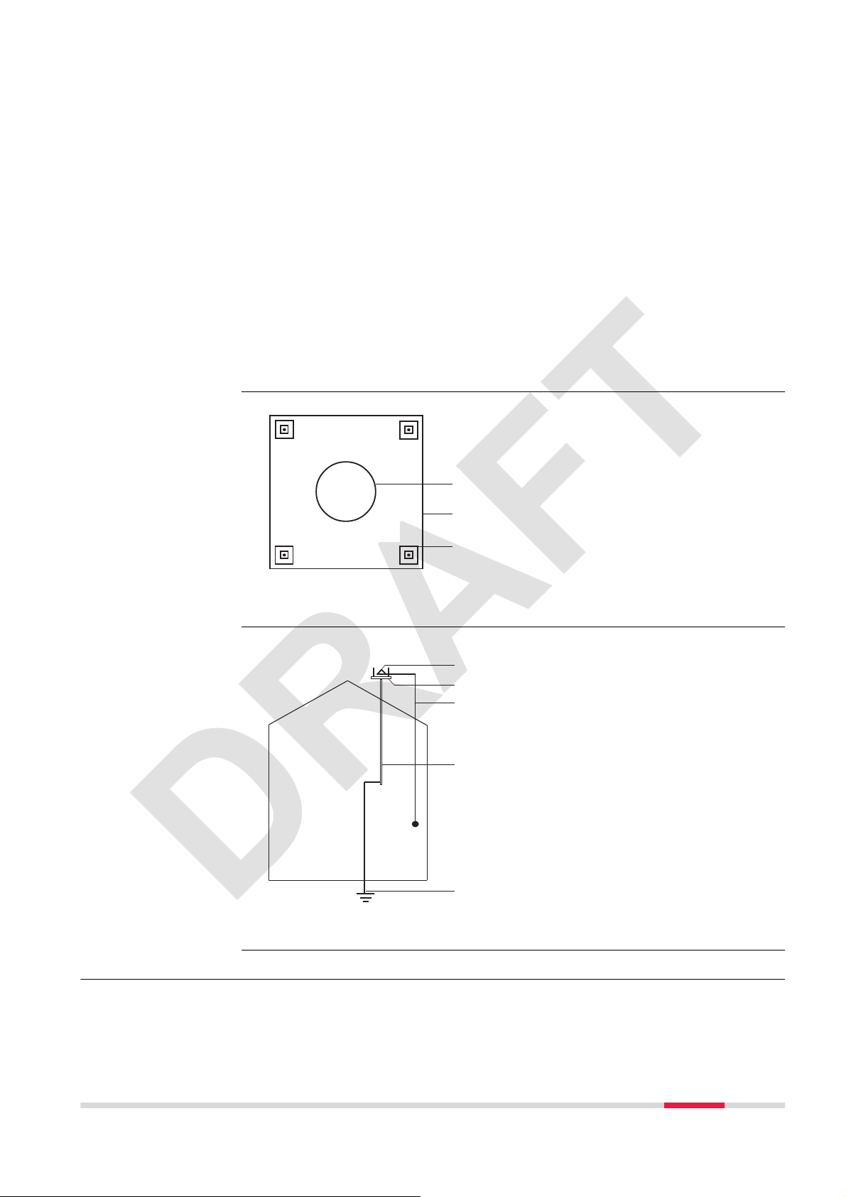
Air terminal arrangement, plan view
Grounding the instrument/antenna
GS_039
GS_040
a
b
c
a
a Antenna
b Support structure
c Air terminal
b
c
d
a Antenna
b Lightning conductor array
c Antenna/instrument connec-
tion
e
d Metallic mast
e Connection to earth
1.6 Electromagnetic Compatibility EMC
Description
The term Electromagnetic Compatibility is taken to mean the capability of the
product to function smoothly in an environment where electromagnetic radia-
Safety Directions 11
Page 12
tion and electrostatic discharges are present, and without causing electromagnetic disturbances to other equipment.
WARNING
Electromagnetic radiation can cause disturbances in other equipment.
Although the product meets the strict regulations and standards which are in
force in this respect, Leica Geosystems cannot completely exclude the possibility that other equipment may be disturbed.
CAUTION
There is a risk that disturbances may be caused in other equipment if the product is used with accessories from other manufacturers, for example field computers, personal computers or other electronic equipment, non-standard cables
or external batteries.
Precautions:
▶
Use only the equipment and accessories recommended by Leica Geosystems. When combined with the product, they meet the strict requirements
stipulated by the guidelines and standards. When using computers or other
electronic equipment, pay attention to the information about electromagnetic compatibility provided by the manufacturer.
CAUTION
Disturbances caused by electromagnetic radiation can result in erroneous
measurements.
Although the product meets the strict regulations and standards which are in
force in this respect, Leica Geosystems cannot completely exclude the possibility that the product may be disturbed by intense electromagnetic radiation, for
example, near radio transmitters, two-way radios or diesel generators.
Precautions:
▶
Check the plausibility of results obtained under these conditions.
CAUTION
If the product is operated with connecting cables attached at only one of their
two ends, for example external supply cables, interface cables, the permitted
level of electromagnetic radiation may be exceeded and the correct functioning
of other products may be impaired.
Precautions:
▶
While the product is in use, connecting cables, for example product to
external battery, product to computer, must be connected at both ends.
12 Safety Directions
Page 13
Bluetooth
Use of product with Bluetooth:
WARNING
Electromagnetic radiation can cause disturbances in other equipment, in installations, in medical devices, for example pacemakers or hearing aids and in aircraft. It can also affect humans and animals.
Precautions:
▶
Although the product meets in combination with radio or digital cellular
phone devices recommended by Leica Geosystems the strict regulations
and standards which are in force in this respect, Leica Geosystems cannot
completely exclude the possibility that other equipment may be disturbed
or that humans or animals may be affected.
•
Do not operate the product with radio or digital cellular phone devices
in the vicinity of filling stations or chemical installations, or in other
areas where an explosion hazard exists.
•
Do not operate the product with radio or digital cellular phone devices
near to medical equipment.
•
Do not operate the product with radio or digital cellular phone devices
in aircraft.
1.7 FCC Statement, Applicable in U.S.
WARNING
This equipment has been tested and found to comply with
the limits for a Class B digital device, pursuant to part 15 of
the FCC rules.
These limits are designed to provide reasonable protection
against harmful interference in a residential installation.
This equipment generates, uses and can radiate radio frequency energy and, if not installed and used in accordance
with the instructions, may cause harmful interference to
radio communications. However, there is no guarantee that
interference will not occur in a particular installation.
If this equipment does cause harmful interference to radio or
television reception, which can be determined by turning the
equipment off and on, the user is encouraged to try to correct the interference by one or more of the following measures:
•
Reorient or relocate the receiving antenna.
•
Increase the separation between the equipment and the
receiver.
•
Connect the equipment into an outlet on a circuit different from that to which the receiver is connected.
•
Consult the dealer or an experienced radio/TV technician
for help.
Safety Directions 13
Page 14

0
1
_003
Labelling GG04 plus
WARNING
This Class (B) digital apparatus complies with Canadian ICES-003.
Cet appareil numérique de la classe (B) est conforme à la norme NMB-003 du
Canada.
WARNING
Changes or modifications not expressly approved by Leica Geosystems for
compliance could void the user's authority to operate the equipment.
Art.No.:
Model: GG04
Equip. No.: 123456 7 S.No.: 1234567
Power: 12V --- nominal / 0.3 A max.
Leica Geosystems AG
CH-9435 Heerbrugg
Manufactured: 20XX
Made in Switzerland
123456
Labelling internal battery GEB212
0015185_001
015185_00
005044_003005044
This device contains
a transmitter:
R 204-210003
IC: 5325A-0946
FCC-ID: PVH0946
14 Safety Directions
Page 15

2 Description of the System
2.1 General Information
Design
The instrument
•
is designed to be used on a pole. It calculates a position from the computed ranges to all visible and activated GNSS (Global Navigation Satellite
System) satellites.
•
can be used with any existing Leica Zeno GIS hardware, like the CS25,
CS25 plus, CS25 GNSS, CS25 LRBT, Zeno 5, Zeno 10, Zeno 15 or with the
following third-party hardware in combination with Zeno Connect:
•
Selected Android phones with Android version > 4.1,
•
Selected Android tablets with Android version > 4.1,
•
Windows 7/Windows 8/Windows 10 PC/Laptop,
•
on selected iOS tablets,
•
on selected iOS phones.
•
can communicate with Leica Zeno GIS software:
•
Zeno Mobile,
•
Zeno Connect (on Windows 7/Windows 8/Windows 10, Android version > 4.1 or iOS), or
•
Zeno Field
•
can be configured to track all currently available satellite systems with all
included signals (multi-frequency and multi-satellite system).
•
can be used for high accuracy data collection with real-time corrections
coming by L-band satellites (Precise Point Positioning - PPP).
•
can increase positioning accuracy through various correction services, like
SBAS, RTCM corrections or Spot options (Precise Point Positioning - PPP).
Special features
Firmware concept
The instrument contains several special features:
•
Robust instrument with integrated antenna and built-in ground plane.
•
Low power consumption.
•
Simple mounting.
•
Seamless integration with all available Leica Zeno GIS software.
•
LED indicators for power, Bluetooth and signal reception.
•
Multiple upgrade options.
•
Provide NMEA messages output on different Bluetooth ports.
The instrument has two different firmware types where the GNSS calculation is
done:
•
the system engine firmware,
•
the measurement engine firmware.
The instrument is delivered with the latest firmware versions installed. If new
firmware versions are released at a later point in time, refer to "A Firmware
Upgrade" on how to upgrade the instrument.
Description of the System 15
Page 16

☞
To ensure best tracking performance, verify to have the most recent
Leica Zeno GIS measurement engine firmware installed on the instrument.
2.2 System Components
Main components
Interface
The GG04 plus represents the so called instrument.
Component Description
Integrated antenna Receiving signals from a GNSS (Global Navigation
Satellite System).
Bluetooth To wireless pair with Leica Zeno GIS hardware or
third-party hardware.
Battery The battery compartment holds the GEB212 battery
for power supply.
LEDs Indication of power, Bluetooth and signal reception.
LEMO-1 connector Serial by RS232 or USB communication.
5/8" Whitworth
thread
a
b
012209_001
Mounting the instrument for observation.
c
d
e
f
g
a LEMO-1 connector,
RS232 and USB port
b Whitworth thread, for
instrument mounting
c Tracking LED
d Bluetooth LED
e Power LED
f ON/OFF key
g Battery compartment
☞
LED Indicators
16 Description of the System
Do not open the instrument or remove any connector as this action impairs the
protection against water, dust and sand. Open the instrument for battery handling without exception in dry and clean conditions only.
The GG04 plus has Light Emitting Diode indicators. They indicate the basic
instrument status.
Page 17

abc
012264_001
Description of the LEDs
LED LED Status Status of the Instrument
Tracking LED Green Enough satellites tracked to compute position.
Dark No position computed.
Bluetooth LED Green The antenna is ready to be connected to.
Blue Connection established to a Bluetooth device.
Power LED Off Power is off.
Green Power is 100%…20%.
Red Power is 20%…5%.
Flashing red Power is low (<5%).
a Tracking LED
b Bluetooth LED
c Power LED
2.3 Data Collection
Live and raw data collection
The instrument can be connected with Leica Zeno GIS software and Leica Zeno
hardware or selected Android, iOS or Windows devices to collect or verify
assets in the field and to collect raw data. Our office software fully supports
the collected GG04 plus data either to review and adapt or to post-process collected raw data. The setting for the GG04 plus smart antenna can be adjusted
with different provided tools.
2.4 Power Concept
General
Power options
Use the batteries, chargers and accessories recommended by Leica Geosystems
to ensure the correct functionality of the instrument.
Power for the instrument can be supplied internally only.
Internal power supply: One battery (GEB212) fits into the instrument.
Description of the System 17
Page 18

On/Off behaviour
•
On: The instrument turns on as soon as the power supply is connected
and the power key is pressed.
•
Off: To turn off the instrument push either the power key or disconnect
the power supply.
Total discharge
If an instrument connected to a low powered external battery continues to
operate, total discharge of the battery can occur.
2.5 Leica Zeno GIS Software
Description
Leica Zeno Connect
on third-party devices
All Leica Zeno GIS hardware and software can utilise the GG04 plus with a survey pole. The compatible hardware includes the Zeno 5, Zeno 10, Zeno 15,
CS25, CS25 plus, CS25 GNSS, CS25 LRBT and selected Android, iOS or Windows
devices.
With the Leica Zeno GIS software you can do different things:
•
Seamlessly connect to the GG04 plus smart antenna through Bluetooth.
•
Compute positions.
•
Configure the smart antenna.
•
Collect raw data from the smart antenna.
•
Collect live data.
•
Configure RTK connections to improve positioning accuracy.
•
Export collected data in different formats.
Refer to the respective software documentation for further information.
A Leica
Zeno Connect license is already included with the GG04 plus in order to use the
antenna on Android/iOS moblile devices (smartphones/tablets) by Zeno Connect from the Google Play Store or Apple App Store (iOS).
For third-party devices, only Zeno Connect is available through the App Store.
2.6 Accessories
Description
Extra equipment such as cables and universal pole holders are listed in the
setup sections. Any further description of accessories is not part of this manual.
Refer to the Leica Zeno GIS Equipment List.
18 Description of the System
Page 19

3 Operation
1
3.1 Guidelines for Correct Results with GNSS Surveys
Undisturbed satellite
signal reception
Successful GNSS measurements require undisturbed satellite signal reception,
especially at the instrument which serves as a base. For kinematic use, be sure
to select measurement positions with best satellite reception possible. Use the
instrument in location which is free of obstructions such as trees, buildings or
mountains for best measurement results.
Centred instrument
Centre the instrument precisely over the target positions.
3.2 Batteries
3.2.1 Operating Principles
First-time Use/Charging Batteries
•
The battery must be charged before using it for the first time because it is
delivered with an energy content as low as possible.
•
The permissible temperature range for charging is from 0 °C to +40 °C/
+32 °F to +104 °F. For optimal charging, we recommend charging the batteries at a low ambient temperature of +10 °C to +20 °C/+50 °F to +68 °F
if possible.
•
It is normal for the battery to become warm during charging. Using the
chargers recommended by Leica Geosystems, it is not possible to charge
the battery once the temperature is too high.
•
For new batteries or batteries that have been stored for a long time
(> three months), it is effectual to make only one charge/discharge cycle.
•
For Li-Ion batteries, a single discharging and charging cycle is sufficient. We
recommend carrying out the process when the battery capacity indicated
on the charger or on a Leica Geosystems product deviates significantly
from the actual battery capacity available.
Operation / Discharging
•
The batteries can be operated from −20 °C to +55 °C/−4 °F to +131 °F.
•
Low operating temperatures reduce the capacity that can be drawn; high
operating temperatures reduce the service life of the battery.
3.2.2 Battery for GG04 plus
Change Qattery btepby-step
1
012536_001012536_00
2
7
3
5
4
6
Operation 19
Page 20

Step Description
☞
1. Push the slide fastener in the direction of the arrow with the open-
2. Open the battery compartment.
3. Pull the battery from the battery compartment.
4. A pictogram of the battery is displayed inside the battery compart-
5. Place the battery into the battery compartment, ensuring that the
6. Close the battery compartment.
7. Lock the battery compartment by pushing the slide fastener in the
Turn the GG04 plus over to gain access to the battery compartment.
lock symbol.
ment. It is a visual aid to help in placing the battery correctly.
contacts are facing outward. Click the battery into position.
direction of the arrow with the close-lock symbol.
3.3 Equipment Setup as a Real-Time Rover
3.3.1 Setup with Leica Zeno GIS Hardware and Software
Use
Description
☞
The equipment setup is used for real-time rover with extended periods of use
in the field.
This chapter shows a possible pole setup with Leica Zeno GIS hardware and
software.
Connection between the GG04 plus instrument and the field controller is made
through Bluetooth. All hardware is fixed on a Leica carbon pole in this example.
•
The antenna is mounted directly using screw fitting.
•
Carbon fibre poles are used. They can be replaced with their aluminium
equivalent without any change to these instructions.
20 Operation
Page 21

Equipment setup
a
b
d
Equipment setup
step-by-step
c
e
f
a GG04 plus
b GEB212 battery
c Pole
d CS25 plus or Zeno 5 field
controller
e AZ204, GHT55 or GHT72
012566_001
pole holder
f GHT63 pole clamp
Step Description
1. Attach the GHT63 pole clamp to the pole.
2. Attach the correct pole holder to the clamp, according to the field
controller:
•
the GHT72 pole holder for the CS25 plus controller
•
the GHT55 pole holder for the Zeno 5 controller
3. Clip the field controller into the holder and lock it by pushing the
locking pin into the locked position.
4. Insert the battery into the field controller.
5. Press the ON/OFF key on the field controller to switch on.
6. Insert the battery into the GG04 plus.
7. Press the ON/OFF key on the GG04 plus to switch on.
8. Screw the GG04 plus to the top of the pole.
9. Start the Zeno GIS software on the controller and select the GG04
plus instrument to be connected through Bluetooth.
3.3.2 Setup with Third-Party Mobile Devices
Use
The equipment setup is used for real-time rover with extended periods of use
in the field with a third-party Android, iOS or Windows mobile device.
Operation 21
Page 22

Description
☞
This chapter shows a possible pole setup of the GG04 plus with a third-party
hardware and Zeno Connect to utilise the position in a third-party software.
Connection between the GG04 plus instrument and the mobile device is made
through Bluetooth. All hardware is fixed on a Leica carbon pole in this example.
•
The antenna is mounted directly using screw fitting.
•
Carbon fibre poles are used. They can be replaced with their aluminium
equivalent without any change to these instructions.
Equipment setup
a
b
c
0015189_001
d
e
f
a GG04 plus
b GEB212 battery
c Pole
d Mobile device
e UVPMLPH Universal Pole
Mount large Smartphones
Equipment setup
step-by-step
22 Operation
Step Description
1. Attach the correct pole holder, depending on the mobile device, to
the pole clamp.
2. Clip the mobile device into the pole holder.
3. Switch on the mobile device.
4. Download and install Zeno Connect from the repective app store or
from myWorld.
5. Start the Zeno Connect app.
6. Insert the battery into the GG04 plus.
7. Press the ON/OFF key on the GG04 plus to switch on.
8. Screw the GG04 plus to the top of the pole.
9. On the mobile device, select the GG04 plus in the Zeno Connect app
and connect to the GG04 plus through Bluetooth.
Page 23

3.4 Connection with Leica Zeno GIS Software
Description
Principle of
Zeno Connect
The GG04 plus is fully supported from:
•
Zeno Field V3.6 onwards
•
Zeno Mobile V2.0 onwards
•
Zeno Connect V3.0 onwards
Consult the corresponding documentation for detailed help with software
installation and instructions. Here only the basic idea behind and the connection to Zeno Connect on third-party devices is explained.
☞
Zeno Connect is the configuration software for your Leica GG04 plus smart
antenna. With Zeno Connect the highly accurate position achievable with the
GG04 plus antenna can be utilized by location aware applications running on
iOS, Android or Windows.
On Windows 7 devices, the first initial pairing might take up to
seven minutes.
015190_001
Different versions
available for Zeno
Connect
There are three different versions of Zeno Connect available. One for iOS, one
for Android and one for Windows.
Zeno Connect for iOS and Android is available for download from the respective
app stores. A valid internet connection is necessary. Unlike the Windows Zeno
Connect version, a license for Zeno Connect on Android and iOS smartphones
and tablets is included with the GG04 plus antenna purchase.
Zeno Connect for Windows can be downloaded from myWorld, including installation instructions and user manual.
Operation 23
Page 24

015191_001
fo
Using Zeno Connect
on Android devices
(third-party)
Zeno Connect on Android utilizes the so-called Android Location Manager. It
allows every location aware app installed on your device to utilize the highly
accurate GNSS position.
Install Zeno Connect
Install Zeno Connect from the Google Play Store.
On the first startup Zeno Connect checks if the GPS is switched on. If this is
not the case you are guided for the correct setting.
r
Furthermore, Zeno Connect verifies that it is set as the mock-location app. This
setting has to be enabled only once. It can be achieved by following these
steps:
Enable Mock Location
Activate the Developer options first in order to enable mock locations.
1. Tap OK to enter the Android settings page, when Zeno Connect is
asking for it.
2. Scroll to and tap About phone in the Settings page.
3. Scroll to and tap Build number seven times.
A message saying that Developer options have been activated is displayed.
4. Go back to the Settings page. Tap on Developer options and turn
them on.
24 Operation
Page 25

5. Scroll to the mock location section and turn it on. Depending on
a
are
messages directly from
eta information. Consult the
.
e
t
o
-
vi
.
the device manufacturer, it is also possible that you can define which
app should be used as the mock-location app. If this is the case,
select Zeno Connect.
6. A device restart is recommended to ensure that the settings are enabled.
Connect the GG04 plus antenna
Once the setup is correct, connect the GG04 plus antenna within the Zeno
Connect settings.
Enter the pairing code “0000” when requested.
As soon as connection is established, the position information from the GG04
plus is automatically used by any location aware app running on your device.
For more detailed information about Zeno Connect settings and antenna configuration, refer to the respective documentation.
In case further GNSS metadata are required, some apps allow to establish a
direct connection to the GG04 plus antenna by a Bluetooth connection. It
allows reading NMEA messages directly from the antenna in order to obtain
additional GNSS meta information. Consult the respective app documentation
on how to do this. Zeno Connect is still required to configure and to provide
correction data to the antenna.
t
Using Zeno Connect
on Apple devices
The GG04 plus can be connected by Bluetooth settings to an Apple device. Any
location aware app can immediately use the uncorrected, navigated position
coming from the antenna. For a more accurate position, utilise Zeno Connect.
After pairing the antenna with your Apple device using the iOS Bluetooth settings, enter the pairing code “0000” once requested. In case, Zeno Connect is
not yet installed on the Apple device, a pop up is displayed. It guides you automatically to the Zeno Connect installation from the Apple App Store (iOS).
Start Zeno Connect to configure and to provide correction data to the antenna.
The high accuracy position is then automatically used by any location aware
app running on the Apple device.
For more detailed information about Zeno Connect settings and antenna configuration, refer to the respective documentation.
In case further GNSS metadata are required, some apps allow you to establish
a direct connection to the GG04 plus antenna by a SPP Bluetooth connection. It
allows reading NMEA messages coming directly from the antenna in order to
llows reading NMEA messages coming directly from the antenna in order t
obtain additional GNSS meta information. Consult the respective app documentation on how to do this. Zeno Connect is still required to configure and to pro-
ation on how to do this. Zeno Connect is still required to configure and to pro
vide correction data to the antenna.
de correction data to the antenna
r
utilise Zeno Connect
I
Operation 25
Page 26

☞
The GG04 plus GNSS metadata feature is restricted and it might not
yet be possible in your app to connect to the additional SPP Bluetooth
port of the antenna. If this feature is needed, ask the app developer
to contact the Leica Zeno team for approval and integration guidance
(zeno.support@leica-geosystems.com).
3.5 Correction Service Spot Lite and Spot Prime (PPP)
Description
Service activation
Spot Lite and Spot Prime are correction services supported by the GG04 plus
antenna.
Both are subscription services with the correction data being received from a
satellite. Therefore, this service is an ideal solution for precise applications in
areas where mobile data connection is unavailable or unreliable and real-time
high accuracy is necessary.
With the correction service, the position accuracy will be enhanced autonomously after a necessary convergence time.
•
10 cm and better level for Spot Prime.
•
60 cm and better level with the Spot Lite service.
The convergence phase can take up to 30 minutes to have a converged solution with the Spot Prime option and up to seven minutes for Spot Lite.
☞
After ordering the subscription service, activate the respective Spot option once
within 30 days of the order date. To complete the activation process, switch on
the antenna and leave it running in very good GNSS conditions for up to
three hours. A stable tracking of one of the PPP satellites is necessary for the
initial activation. Once the activation is completed, a corrected position by the
Spot option is possible.
An L1/L2 option is necessary to use the different Spot options.
Service usage
26 Operation
After the initial activation, the Spot option can be activated like any other correction service. After activation, the convergence period begins, where the
position accuracy is gradually improving over time until the best possible position accuracy is achieved.
The tracking of at least one correction satellite is necessary to receive a corrected GNSS position, during both the convergence period and spot usage.
Page 27

4 Care and Transport
4.1 Transport
Transport in a road
vehicle
Shipping
Shipping, transport of
batteries
Never carry the product loose in a road vehicle, as it can be affected by shock
and vibration. Always carry the product in its container, original packaging or
equivalent and secure it.
When transporting the product by rail, air or sea, always use the complete original Leica Geosystems packaging, container and cardboard box, or its equivalent, to protect against shock and vibration.
When transporting or shipping batteries, the person responsible for the product must ensure that the applicable national and international rules and regulations are observed. Before transportation or shipping, contact your local passenger or freight transport company.
4.2 Storage
Product
Li-Ion batteries
Respect the temperature limits when storing the equipment, particularly in
summer if the equipment is inside a vehicle. Refer to "5 Technical Data" for
information about temperature limits.
•
Refer to "5 Technical Data" for information about storage temperature
range.
•
Remove batteries from the product and the charger before storing.
•
After storage recharge batteries before using.
•
Protect batteries from damp and wetness. Wet or damp batteries must be
dried before storing or use.
•
A storage temperature range of 0 °C to +30 °C / +32 °F to +86 °F in a dry
environment is recommended to minimize self-discharging of the battery.
•
At the recommended storage temperature range, batteries containing a
40% to 50% charge can be stored for up to one year. After this storage
period the batteries must be recharged.
4.3 Cleaning and Drying
Product and accessories
Damp products
•
Use only a clean, soft, lint-free cloth for cleaning. If necessary, moisten the
cloth with water or pure alcohol. Do not use other liquids; these may
attack the polymer components.
Dry the product, the container, the foam inserts and the accessories at a temperature not greater than 40 °C/104 °F and clean them. Remove the battery
Care and Transport 27
Page 28

cover and dry the battery compartment. Do not repack until everything is dry.
Always close the container when using in the field.
12542_002
Cables and plugs
Keep plugs clean and dry. Blow away any dirt lodged in the plugs of the connecting cables.
28 Care and Transport
Page 29

5 Technical Data
5.1 Tracking Characteristics GG04 plus
Satellite reception
Instrument channels
Supported signals
Multi-frequency
☞
System Signal
GPS L1 C/A, L2P, L2C, L5
GLONASS L1, L2
Galileo
BeiDou
QZSS L1, L2C, L5
L-Band for PPP corrections by satellite
SBAS EGNOS, WAAS, MSAS, GAGAN
*
Believe to comply, but subject to availability of BeiDou ICD and Galileo commercial service definition. BeiDou B3 and Galileo E6 will be provided through
future firmware upgrade.
Depending on the satellite systems and signals configured, a maximum number of 555 channels is allocated.
E1, E5a, E5b, E6
B1, B2, B3
*
*
Initialisation time
(typical)
Signal reacquisition
time (typical)
Cold start [s] Warm start [s]
< 40 < 30
< 1 s
5.2 Accuracy
Accuracy is dependent upon various factors including the number of satellites
☞
tracked, constellation geometry, observation time, ephemeris accuracy, ionospheric disturbance, multipath and resolved ambiguities.
The following accuracies, given as root mean square, are based on measure-
ments processed using Zeno Office and on real-time measurements.
The use of multiple GNSS systems can increase accuracy by up to 30% relative
to GPS only.
Technical Data 29
Page 30

Post-processed
accuracy
Type Accuracy
Baseline mode L1 Phase
*
Measurement precision, accuracy and reliability depend upon various factors
10 mm + 1 ppm RMS
*
including number of available satellites, geometry proximity to base station,
multipath effects or ionospheric conditions.
Horizontalreal-time
accuracy
Vertical real-time
accuracy
SBAS, PPP or external source.
Type Accuracy
SBAS, L1 only
Spot Lite,PPP (L1/L2 option
needed)
DGNSS, L1 only
Spot Prime,PPP (L1/L2 option
needed)
RTK, L1/L2
*
Measurement precision, accuracy and reliability depend upon various factors
< 0.9 m
< 60 cm
of converging
< 40 cm
< 10 cm
converging
< 1 cm + 1 ppm
*
*
, after approximately seven minutes
*
*
, after approximately 30 minutes of
*
including number of available satellites, geometry proximity to base station,
multipath effects or ionospheric conditions.
Type Accuracy
RTK, L1/L2
*
Measurement precision, accuracy and reliability depend upon various factors
< 2 cm + 1 ppm
*
including number of available satellites, geometry proximity to base station,
multipath effects or ionospheric conditions.
5.3 Technical Data
Dimensions
Weight
Connector
Mounting
Height: 0.071 m
Diameter: 0.186 m
0.8 kg including internal battery
LEMO-1: female, 8 pin
5/8" Whitworth
30 Technical Data
Page 31

Power
Power consumption: 2.0 W typically
Internal battery
Bluetooth
GNSS antenna
Type: Li-Ion
Voltage: 7.4 V
Capacity: GEB212 - 2.6 Ah
Typical operating time*: GNSS only - 10 hRTK - 7.5 h
* May vary with temperature, battery age or usage.
Type: Bluetooth 4.1
Type GG04 plus
Frequency
For Frequency, refer to the "Frequency band" in chapter "5.4 Conformity to
National Regulations"
Gain (LNA) Typically 28 dB
Noise Figure Typically < 2 dB
Environmental
specifications
Serial ports
Operating temperature [°C] Storage temperature [°C]
−40 … +65
Bluetooth: −30 … +65
External influences Protection
Water, dust and sand IP68 (IEC60529)
Humidity Up to 100%.
Description Default setting
Baud rates 4800–230400 baud, without
RTS/CTS
−40 … +80
Protected against continuous
immersion in water.
Tested for 2 hours in 1.40 m
depth.
Dust tight.
Periodically drying out the
instrument effectively counteracts the effects of condensation.
115200/N/8/1/N
Technical Data 31
Page 32

5.4 Conformity to National Regulations
Conformity to
national regulations
•
FCC Part 15 (applicable in US)
•
Hereby, Leica Geosystems AG, declares that the product GG04 plus is in
compliance with the essential requirements and other relevant provisions of Directive 1999/5/EC and other applicable European Directives.
The declaration of conformity can be consulted at http://www.leica-geosystems.com/ce.
Class 1 equipment according European Directive 1999/5/EC (R&TTE)
can be placed on the market and be put into service without
restrictions in any EEA member state.
•
The conformity for countries with other national regulations not covered
by the FCC part 15 or European directive 1999/5/EC has to be approved
prior to use and operation.
•
Japanese Radio Law and Japanese Telecommunications Business Law
Compliance.
•
This device is granted pursuant to the Japanese Radio Law (
and the Japanese Telecommunications Business Law (
•
This device should not be modified (otherwise the granted designation number will become invalid).
電気通信事業法
電波法
)
).
Frequency band
Output power
Type Frequency band [MHz]
GG04 plus GPS, QZSS L1: 1575.42
GPS, QZSS L2: 1227.60
GPS, QZSS L5: 1176.45
GLONASS L1: 1602.5625-1611.5
GLONASS L2: 1246.4375-1254.3
Galileo E1: 1575.42
Galileo E5a: 1176.45
Galileo E5b: 1207.14
Galileo E6: 1191.795
BeiDou B1: 1561.098
BeiDou B2: 1207.14
Bluetooth 2402…2480
Type Output power [mW]
GNSS Receive only
Bluetooth max. 10 (Class 1)
32 Technical Data
Page 33

Antenna
5.4.1 Dangerous Goods Regulations
Type Antenna Gain
GNSS Internal GNSS
antenna element
(receive only)
Bluetooth Internal Microstrip
antenna
Connector Frequency band
[dBi]
-- -
1.0 - -
[MHz]
Dangerous Goods
Regulations
Many products of Leica Geosystems are powered by Lithium batteries.
Lithium batteries can be dangerous under certain conditions and can pose a
safety hazard. In certain conditions, Lithium batteries can overheat and ignite.
☞
☞
☞
When carrying or shipping your Leica product with Lithium batteries
onboard a commercial aircraft, you must do so in accordance with the
IATA Dangerous Goods Regulations.
Leica Geosystems has developed Guidelines on “How to carry Leica
products” and “How to ship Leica products” with Lithium batteries.
Before any transportation of a Leica product, we ask you to consult
these guidelines on our web page (http://www.leica-geosystems.com/
dgr) to ensure that you are in accordance with the IATA Dangerous Goods Regulations and that the Leica products can be transported correctly.
Damaged or defective batteries are prohibited from being carried or
transported onboard any aircraft. Therefore, ensure that the condition
of any battery is safe for transportation.
Technical Data 33
Page 34

6 Software Licence Agreement
Software Licence
Agreement
This product contains software that is preinstalled on the product, or that is
supplied to you on a data carrier medium, or that can be downloaded by you
online according to prior authorisation from Leica Geosystems. Such software is
protected by copyright and other laws and its use is defined and regulated by
the Leica Geosystems Software Licence Agreement, which covers aspects such
as, but not limited to, Scope of the Licence, Warranty, Intellectual Property
Rights, Limitation of Liability, Exclusion of other Assurances, Governing Law
and Place of Jurisdiction. Please make sure, that at any time you fully comply
with the terms and conditions of the Leica Geosystems Software Licence
Agreement.
Such agreement is provided together with all products and can also be referred
to and downloaded at the Leica Geosystems home page at
http://leica-geosystems.com/about-us/compliance-standards/legal-documents
or collected from your Leica Geosystems distributor.
You must not install or use the software unless you have read and accepted
the terms and conditions of the Leica Geosystems Software Licence Agreement. Installation or use of the software or any part thereof, is deemed to be
an acceptance of all the terms and conditions of such Licence Agreement. If
you do not agree to all or some of the terms of such Licence Agreement, you
must not download, install or use the software and you must return the
unused software together with its accompanying documentation and the purchase receipt to the distributor from whom you purchased the product within
ten (10) days of purchase to obtain a full refund of the purchase price.
34 Software Licence Agreement
Page 35

Appendix A Firmware Upgrade
Upgrading measurement engine firmware
☞
Upgrading measurement engine firmware can take some time. Do not
interrupt the power of the device during firmware upgrade! Ensure
that the battery is at least 75% full before beginning the upgrade.
Upgrading system
firmware
☞
Step Description
1. Download the most recent GG04 plus firmware from https://
2. Download the Leica Zeno FW loader from https://myworld.leicageo-
3. Connect the GG04 plus to your computer by Bluetooth.
4. Use Leica Zeno Firmware Upload Tool to upgrade the latest firmware
☞
☞
GG04 plus firmware can only be uploaded from a Windows computer
or laptop.
myworld.leica-geosystems.com.
systems.com.
version. Refer to the corresponding software documentation on how
to connect the instrument to your device and how to use Leica Zeno
GIS Tools.
Upgrading system firmware ...
GG04 plus firmware can only be uploaded from a Windows computer
or laptop.
Step Description
1. Download the most recent GG04 plus firmware from https://
myworld.leica-geosystems.com.
2. Download the Leica Zeno FW loader from https://myworld.leicageosystems.com.
3. Connect the GG04 plus to your computer by Bluetooth.
4. Use Leica Zeno Firmware Upload Tool to upgrade the latest firmware
version. Refer to the corresponding software documentation on how
to connect the instrument to your device and how to use Leica Zeno
GIS Tools.
Firmware Upgrade 35
Page 36

Appendix B Pin Assignments and Sockets
Description
Port at the instrument underside
Pin assignments for
8 pin LEMO-1
1
7
2
8
6
3
4
5
PIN_001
Some applications require knowledge of the pin assignments for the instrument ports.
In this chapter, the pin assignments and sockets for the instrument ports are
explained.
a
a Lemo port (USB and
012547_001
Pin Signal Name Function Direction
1 USB_D+ USB data line In or out
2 USB_D− USB data line In or out
3 GND Signal ground -
4 RxD RS232, receive data In
5 TxD RS232, transmit data Out
6 ID Identification pin In or out
7 PWR Power input, 10.5 V–28 V In
8 TRM_ON/USB_ID RS232, general purpose signal In or out
serial)
Sockets
8 pin LEMO-1: LEMO-1, 8 pin, LEMO EGI.1B.308.CLN
36 Pin Assignments and Sockets
Page 37

Page 38

Leica Geosystems AG
Heinrich-Wild-Strasse
CH-9435 Heerbrugg
Switzerland
Phone +41 71 727 31 31
www.leica-geosystems.com
123456-1.0.0en
Original text
Published in Switzerland
© 2017 Leica Geosystems AG, Heerbrugg, Switzerland
 Loading...