

Page 1
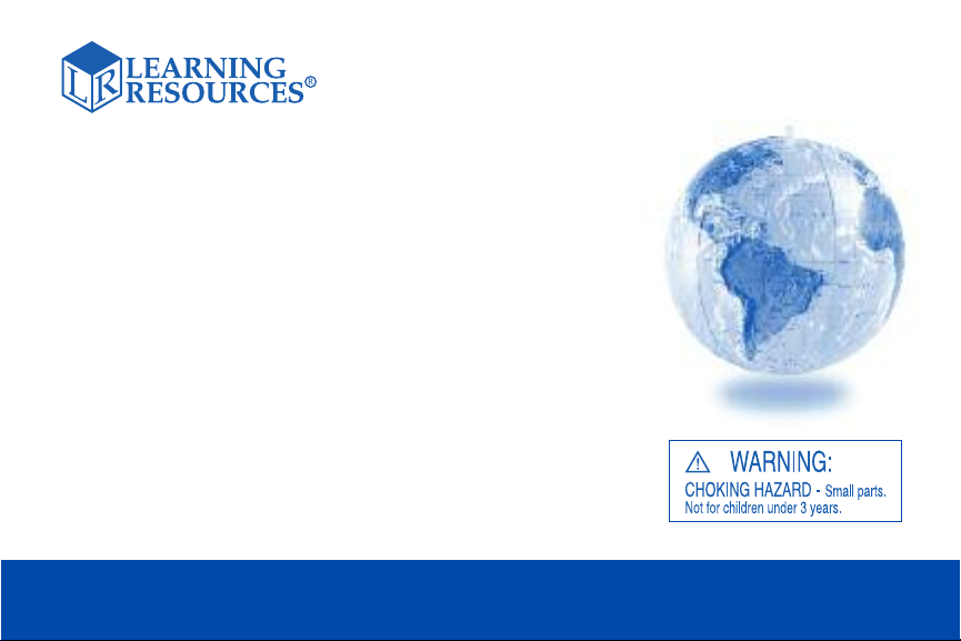
Inflatable
Topographical
Globe
Using an inflatable topographical globe in the classroom is a great way for
students to learn about the geographical characteristics of our world. Use
the globe for demonstration; teaching facts about the world, landforms,
regions; and as a classroom decoration.
Includes a repair kit: Please follow the directions found in the repair kit for
details on how to repair the inflatable globe if damage occurs.
For Demonstration & Explorati on
LER 1811
Page 2

If you plan to hang the inflatable globe from the ceiling,
you can tie a piece of string to the air-hole closure and
attach it to the ceiling. Do not tie the string too tight as it
may tear the hang tab.
The globe is color-coded to identify different regions:
a. Green – primarily forest and grasslands regions
b. Orange-yellow – desert regions
c. Pale Purple – snow covered mountain regions
d. Dark purple – polar regions
(above North America and Russia)
e. White – Antarctica and Iceland
f. Blue – bodies of water
The following activities will help students learn about
continents, landforms, and other great facts about the
world. However, since there is so much to learn and teach
about our world, the possibilities are endless!
Activity 1: Country Toss
1. Have all the students stand in a group.
2. Explain that you are going to toss the globe into
the air.
3. The student who catches the globe must name a
country that begins with the letter “A.”
4. After that student correctly names a country with the
letter “A,” that student then tosses the globe to
another student.
5. The next student who catches the globe should
name a country that begins with the letter “B.”
6. Play continues until all the letters of alphabet are
used, with the exception of the letter “x.” However, if
you want, you may run through the alphabet again,
using different country names.
Variation: Try this game with major cities, both in the U.S.
and around the world! The student should name the city
and the state and/or the country where the city is located.
Activity 2: Country Regions
1. Hold up the globe and explain the different regions
that are shown in color on the globe. These regions
are listed in the beginning of this guide.
2. Have the students sit in a circle and pass around the
globe.
3. After 30 seconds tell the students to stop and then
name a country for the student to find.
4. The student who is holding the globe must find the
country that was named and then name what type of
region the country is in. (forest, grassland, desert,
mountain, polar, etc.)
Page 3

5. Continue playing until all the students have had
a chance.
Variation: Play this game with music and stop the music
to indicate when the students should stop passing the
globe.
Activity 3: SwimmingTime
1. List the names of the major oceans on the board.
2. Ask the students if they have ever heard of any of
these before, and which ones they have heard of.
3. Show the globe and explain that all bodies of water
are somehow connected.
4. Divide the class into 5 groups and assign each group
one ocean to study.
5. Give the groups ten minutes to find where their
ocean is located, what continents and countries are
touching that ocean, and what are some of the rivers
and other bodies of water that flow into that ocean.
6. After the ten minutes are up, each group should give
a quick presentation of their findings.
Activity 4: Where in the world am I?
Separate students into small groups of 3-4.
Give each group a stack of index cards with clues about a
specific location on the globe, such as:
1. I am a country in the Southern Hemisphere.
2. I am to the west of the International Date Line.
3. I am made up of two main islands.
4. I am near Australia.
5. Where am I?
Answer: New Zealand.
Have the small groups use the globe to try and figure out
the clues.
Once all of the groups have figured out what they are
looking for, have them share the clues with the rest of the
class and explain how they found the answer.
The cards can contain clues for counties, continents,
states, cities, or whatever you would like to have the
students learn about.
Variation:
Have students write out the clues and give them to other
students. The other students can then use the clues to
discover new locations.
This is also an activity that students could do.
Activity 5: Geo-Quiz
Have the students sit at their desks and divide the room in
two groups. Explain that you are going to play a quiz
show game about the world and each side of the room is
a team.
Page 4

Ask a question about a country, continent, body of water,
etc.
If students think they know the answer, they should raise
their hand.
Toss the globe to whoever raises their hand first and give
them 10 seconds to answer.
If they answer incorrectly, give the team 20 seconds to
come up with an answer.
If the team or the student answers correctly, then that
team receives 1 point. If both the student and the team
answer incorrectly, then the other team receives the point.
Play continues until all the questions have been
answered, or until one team reaches a specified point
total.
Visit our website to write a product review
or to find a store near you.
Variation:
This game can also be played with a minimum
of two students. Write the questions on cards and have
the students take turns reading the questions to each
other. The only difference in scoring is that points are not
awarded to the other player if an incorrect answer is
given. The player with the most points at the end wins.
Also from Learning Resources®:
• LER 1170 World Treasure Hunt™Map
• LER 2434 Inflatable Solar System
• LER 2437 Cross Section Earth Model
© Learning Resources, Inc., Vernon Hills, IL (U.S.A.)
Learning Resources Ltd., King’s Lynn, Norfolk (U.K.)
Please retain our address for future reference.
Made in China. LRM1811-TG
Fabriqué en Chine. Informations à conserver.
Made in China. Bitte bewahren Sie unsere
Hecho en China. Conservar estos datos.
Adresse für spätere
Nachfragen auf.
 Loading...