

Page 1
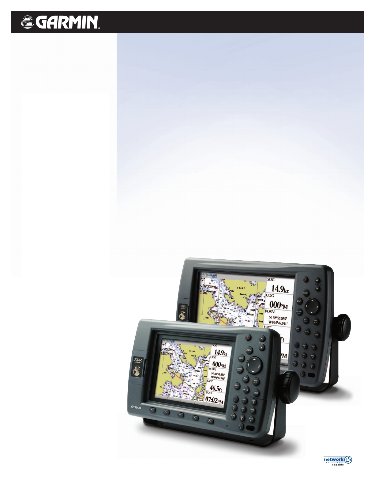
GPSMAP®3000 series
Garmin’s GPSMAP 3000 series
chartplotters deliver top-of-the-line
navigation and interface options along
with exceptional display quality.
Whether you choose the 6-inch
display or step up to the 10-inch,
you’ll get bold, sunlight-readable color.
These plotters also have configurable
display windows, 1 PC monitor output
and 2 video inputs, so you can keep an
eye on the stern or the engine room.
Both have an optional remote control.
For advanced capabilities, these plotters
have a built-in high-speed marine
network that can link additional displays
and remote sensors for weather, radar
and sonar data overlays.
Full-featured plotters show you the big picture
Page 2
©
2004 Garmin Ltd. and its subsidiaries
Garmin International, Inc.
1200 East 151st Street
Olathe, Kansas 66062, U.S.A.
913/397.8200 fax 913/397.8282
Garmin (Europe) Ltd.
Unit 5, The Quadrangle
Abbey Park Industrial Estate
Romsey, SO51 9DL, U.K.
44/1794.519944 fax 44/1794.519222
Garmin Corporation
No. 68, Jangshu 2nd Rd.
Shijr, Taipei County, Taiwan
886/2.2642.9199 fax 886/2.2642.9099
www.garmin.com
Specifications are preliminary and subject to
change without notice.
*
Subject to accuracy degradation to100m
2DRMS under the U.S. Department of
Defense Selective Availability Program.
REV1104 M01-10173-00
Navigation features
Waypoints/icons: 4000 with name, symbol and comment,
with support for proximity waypoints
Routes: 50 reversible routes with up to 300 points
each, plus MOB and TracBack®modes
Track log: 10,000 point automatic track log, with
15 saved tracks, 700 points per saved
track, lets you retrace your path in
both directions
Alarms: Anchor drag, arrival, off course, shallow
water, proximity waypoint, deep water,
clock and battery
Tables: Built-in celestial tables, with sun
and moon rise, set and location;
tide tables for the U.S.
Map datums: More than 100, plus user datum
Position format: Lat/Lon, UTM/UPS, Loran TDs and
other grids, including user grid
Languages: 10 (with software update)
GPS performance (with GPS 17HVS)
Receiver: WAAS enabled, 12 parallel channel GPS
receiver continuously tracks and uses up
to 12 satellites to compute and update
your position
Acquisition times:
Warm: Approximately 15 seconds
Cold: Approximately 45 seconds
AutoLocate™: Approximately 5 minutes
Update rate: 1/second, continuous
GPS accuracy:
Position: < 15 meters, 95% typical*
Velocity: 0.05 meter/sec steady state
DGPS (WAAS) accuracy:
Position: < 3 meters, 95% typical
Velocity: 0.05 meter/sec steady state
Dynamics: 6 g’s
Interfaces: 3 data ports allow for NMEA 0183
and proprietary Garmin
2 composite video inputs
1 VGA PC monitor output
Moving map features
Basemap: Built-in worldwide marine basemap with
coastlines, rivers, lakes, political
boundaries, tide data for the U.S.,
cities and interstates
Data cartridges: User-programmable or preprogrammed
data card containing detailed
BlueChart
™
marine cartography
Plotting scales: 20 ft. to 800 nm with dedicated
push-button zoom control
Power
Source: 10-35v DC
Usage: 3006C = 25 watts max. at 10v DC
3010C = 25 watts max. at 10v DC
Physical
Size: 3006C = 10.25"W x 6.5"H x 3.25"D
3010C = 13.1"W x 8.8"H x 3.25"D
Weight: 3006C = 3.2 lbs. (1.5 kg)
3010C = 4.5 lbs. (2.1 kg)
Display: 3006C = 6.4" diagonal (16.3 cm)
high-resolution, 256 colors with
backlighting (640 x 480 pixels)
3010C = 10.4" diagonal (26.4 cm)
high-resolution, 256 colors with
backlighting (640 x 480 pixels)
Case: Fully gasketed, high-impact plastic alloy,
waterproof to IEC 60529 IPX7 standards
Temperature range: 5˚ F to 122˚ F (-15˚ C to 50˚ C)
Accessories Infra red remote control
Standard: GPS 17 external remote sensor
Power/data cable
Bail mount
Template for flush mounting
Protective front cover
Owner’s manual
Quick reference guide
Audio/video cable
Optional: Blank or preprogrammed data cards
with BlueChart™marine cartography
USB data card programmer
Second mounting station
MapSource
™
CDs:
NEXRAD Radar with precipitation
type (animated, high resolution)
Wind speed and direction
GPSMAP®3000 series
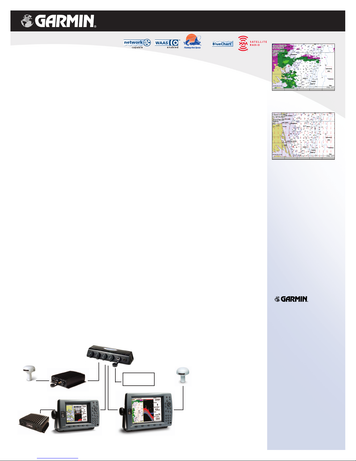
Garmin Marine Network
GA 31 GPS 17GDL 30/30A
GMS 10
GPSMAP 3010GPSMAP 3006GSD 20
Garmin Radar
available 2005
compatible
 Loading...