


 delorme.com/earthmate
 Earthmate
A Guide to the Complete GPS Navigation Solution for Smartphones and Tablets.
E
A
|
H |
M |
A |
|
|
||
T |
|
|
|
T |
|
||
|
|
|
|
E |
|||
R |
|
|
|
|
|
||
|
|
|
|
|
|
|
|
I |
|
|
|
|
E |
D |
|
|
|
|
|
|
|||
|
N |
|
|
|
D |
|
|
|
|
CLU |
|
|
|||
A guide to Earthmate Hunt Edition is included in this document. Earthmate Hunt Edition is designed
specifically for hunters and includes additional maps and data layers.
WARNING: Messaging, tracking and SOS functions require an active Iridium satellite subscription. Always test your device before you go.
This manual is provided as a convenience.
GARMIN IS NOT RESPONSIBLE FOR THE ACCURACY OF THIS MANUAL AND
DISCLAIMS ANY LIABILITY ARISING FROM THE RELIANCE THEREON.

Introduction
You take your smartphone everywhere. Now it can take you anywhere and back.
Earthmate is a mobile, full-featured GPS navigation app that’s as unlimited as your adventures! As the best value in mobile GPS apps, Earthmate comes complete with unlimited access to all North America topographic maps for storage on your device, cloud storage of all your data, online routes and waypoint planning, and much more!
With a Hunt Edition subscription, you have access to an additional set of maps and layers. This includes Game Management Units (GMU’s), parcel data, and Public Land Survey System (PLSS) maps. For more information on the map types, please see the Description of Map Types & Layers section on page 11 of the guide.
View routes, waypoints, or |
Track and share your location, |
Create waypoints and direct |
Digital compass includes |
tracks with detailed topo maps |
along with trip details, such as |
routes in the app or online and |
detailed trip information such |
or NOAA charts downloaded to |
waypoints and tracks while in |
sync over WiFi or cellular. |
as speed, bearing, elevation |
your device. |
cellular range. |
|
and more. |
ACCESSTO USEFUL MAPS AND U.S. NOAA CHARTS
North America Topo Maps North America Public Lands |
U.S. NOAA Charts |
Detailed World Base Map |
2
Set Up
You’ll be navigating in no time when you complete these simple set up steps.
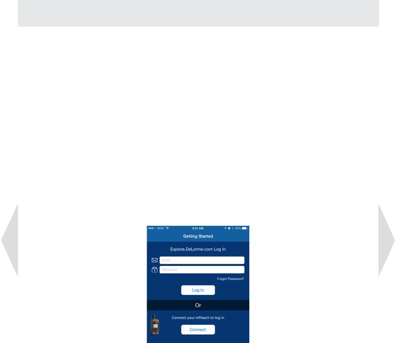
1.Start by visiting our Explore online portal at explore.delorme.com to create a user account. Having an online user account allows you to plan routes and waypoints ahead of time and sync them to the Earthmate app on your mobile device. Under the Create Account section, choose “Earthmate for Mobile Only” and follow the instructions. Have your subscription key code handy, which is printed in your package underneath the tear-off strip at the bottom right.
2.Next, download the Earthmate app in either the App StoreTM or the Google Play store, depending on your mobile device’s operating system. (Note: You can find it by simply searching for Earthmate.)
3.Enter your Explore account information into the Earthmate app to log in. Once Earthmate is registered, your data will seamlessly sync. To plan routes, waypoints and more, visit the Explore portal at explore.delorme.com and choose the Map tab.
4.Click Allow to give the Earthmate app to access your location data when you are not using the app. Then, click Download Maps to download the High Detailed and World Reference Data for your area.
5.Watch the Earthmate Quick Start video to see step-by-step instructions for the most common tasks, such as tracking, waypoint creation, and using the Explore portal.
delorme.com/earthmate-how-to
3
App Navigation
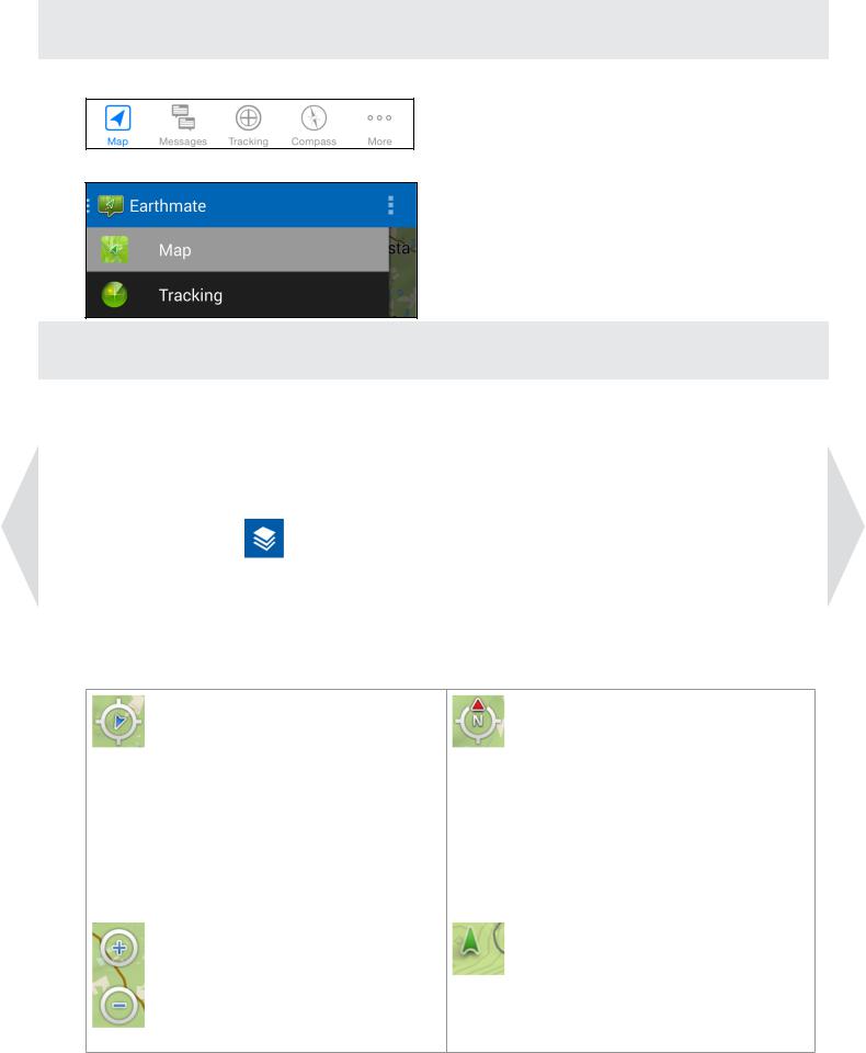
•To navigate through the app on an iOS device use the Tab Bar:
•To navigate through the app on an Android device use the Navigation Drawer:
Map
1.Downloading Maps
Note: A data connection is required for downloading maps. Due to the size of the downloads, DeLorme highly recommends using a high-speed WiFi connection.
• To download highly detailed DeLorme topographic maps and U.S. NOAA charts, tap the Layers icon on the Map page then choose Download Maps. Use the onscreen instructions to select and download maps.
•Choose Manage Maps to view a list of downloaded maps. Use the checkmark to show and hide the maps, swipe or use the Details button to delete them.
2.Map Controls
After you pan to a new location, |
The Map Rotation/North Arrow |
the Locate Me/Pan control |
allows you to control map rotation. |
appears on the map. Tap the |
The arrow on the outer ring is |
control to quickly center the map |
fixed and points up to the top of |
on your current GPS location. |
the screen in north up mode. In |
|
direction of travel mode, the arrow |
|
rotates to point north. Tap the |
|
control to toggle between north up |
|
and direction of travel map view. |
Zoom the map in and out using |
The GPS Location Arrow shows |
multi-touch on the screen or tap |
your current location. |
the Zoom in and Zoom out controls |
Green–Good GPS signal, 3-D |
that appear after you have touched |
Yellow–Acceptable GPS signal, 2-D |
the map. |
Red–No fix or very low GPS signal |
4
 Loading...